
Steiermark
Description
Largely mountainous Bundesland in the eastern part of Austria.
Trails in this state
Links
Facts
Reports
Guides and maps
Lodging
Organisations
Tour operators
GPS
Other
Books

Stanfords
United Kingdom
United Kingdom
- Graz Highland - Schöckl - Almenland-Teichalm - Stubenbergsee F&B WK131
- Graz Highlighands - Schöckl – Teichalm- Stubenbergsee area of south-eastern Austria presented at 1:50,000 in a series of contoured and GPS compatible outdoor leisure map from Freytag & Berndt with hiking and cycling routes, mountain huts, campsites and youth hostels, local bus stops, plus other tourist information.To see the list of currently... Read more

Stanfords
United Kingdom
United Kingdom
- Istria Kompass 238
- Istria at 1:75,000 on a double-sided, waterproof and tear-resistant, detailed contoured map from Kompass, with hiking and cycling routes, street plans of 10 main towns, plus tourist information. Coverage extends north beyond the Croatian border to include Trieste and the coast of Slovenia. Contours at 50m intervals and spot heights present the... Read more

The Book Depository
United Kingdom
2018
United Kingdom
2018
- The Karnischer Hohenweg
- A 1-2 week trek on the Carnic Peace Trail: Austria and Italy Read more
- Also available from:
- De Zwerver, Netherlands

De Zwerver
Netherlands
2018
Netherlands
2018
- Wandelgids Trekking the Karnischer Höhenweg | Cicerone
- English-language guidebook to the Karnischer Höhenweg, a 206km waymarked hut-to-hut trek along the border between Italy and Austria. Also known as the Carnic Peace Trail, it runs west to east along the Ridge of the Carnic Alps, the site of the WW1 front line. With information on planning your trip, accommodation and the history of the area. Read more

Bol.com
Netherlands
Netherlands
- Hiking in Switzerland
- This is the official guidebook to the Swiss section of the Via Alpina (National Route 1), published by the Swiss Hiking Federation. The Via Alpina is a network of five long-distance hiking routes which cross eight Alpine countries from Trieste to Monaco - over 5,000 kilometres of hiking trails in total. On Swiss soil, National Route 1 Via... Read more
- Also available from:
- Bol.com, Belgium
Bol.com
Belgium
Belgium
- Hiking in Switzerland
- This is the official guidebook to the Swiss section of the Via Alpina (National Route 1), published by the Swiss Hiking Federation. The Via Alpina is a network of five long-distance hiking routes which cross eight Alpine countries from Trieste to Monaco - over 5,000 kilometres of hiking trails in total. On Swiss soil, National Route 1 Via... Read more

Bol.com
Netherlands
Netherlands
- Over the Top & Back Again
- Book of the Year Bronze Award 2010 (travel essays category), ForeWord Magazine After hiking some of the world's great trails, Brandon Wilson was excited to hear about the Via Alpina, paths running across eight countries on the backbone of the Alps. Besides promising immersion into Alpine life and wilderness, it was the ultimate adventure. It... Read more
- Also available from:
- Bol.com, Belgium
Bol.com
Belgium
Belgium
- Over the Top & Back Again
- Book of the Year Bronze Award 2010 (travel essays category), ForeWord Magazine After hiking some of the world's great trails, Brandon Wilson was excited to hear about the Via Alpina, paths running across eight countries on the backbone of the Alps. Besides promising immersion into Alpine life and wilderness, it was the ultimate adventure. It... Read more

Bol.com
Netherlands
2014
Netherlands
2014
- Walking in the Bavarian Alps
- Guidebook describing a both valley and mountain walks and treks in the Bavarian Alps. 85 walks are covered, including graded mountain routes, gentler valley walks, hut-to-hut routes and two multi-day tours, arranged by region with practical information on transport, accommodation and the like. Since the last edition of this guide many of the... Read more
- Also available from:
- Bol.com, Belgium
Bol.com
Belgium
2014
Belgium
2014
- Walking in the Bavarian Alps
- Guidebook describing a both valley and mountain walks and treks in the Bavarian Alps. 85 walks are covered, including graded mountain routes, gentler valley walks, hut-to-hut routes and two multi-day tours, arranged by region with practical information on transport, accommodation and the like. Since the last edition of this guide many of the... Read more

Bol.com
Netherlands
Netherlands
- Over the Top & Back Again
- Book of the Year Bronze Award 2010 (travel essays category), ForeWord Magazine After hiking some of the world's great trails, Brandon Wilson was excited to hear about the Via Alpina, paths running across eight countries on the backbone of the Alps. Besides promising immersion into Alpine life and wilderness, it was the ultimate adventure. It... Read more
- Also available from:
- Bol.com, Belgium
Bol.com
Belgium
Belgium
- Over the Top & Back Again
- Book of the Year Bronze Award 2010 (travel essays category), ForeWord Magazine After hiking some of the world's great trails, Brandon Wilson was excited to hear about the Via Alpina, paths running across eight countries on the backbone of the Alps. Besides promising immersion into Alpine life and wilderness, it was the ultimate adventure. It... Read more

Bol.com
Netherlands
Netherlands
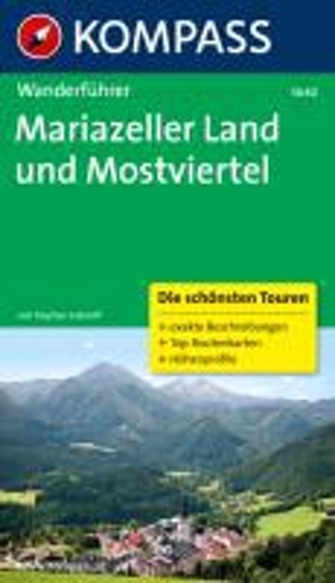
- WF5640 Mariazeller Land und Mostviertel Kompass
- zahlr. Touren mit Top-Routenkarten und HöhenprofilenDe Kompass wandelgids + kaart geeft een overzicht van alle wandelroutes in het gebied met nauwkeurige routeaanwijzingen en hoogteaanduidingen, De extra grote kaart, schaal 1:35 000, is ideaal om van te voren uw route uit te stippelen en om onderweg te gebruiken • naast de bekende bestemmingen,... Read more
- Also available from:
- Bol.com, Belgium
Bol.com
Belgium
Belgium
- WF5640 Mariazeller Land und Mostviertel Kompass
- zahlr. Touren mit Top-Routenkarten und HöhenprofilenDe Kompass wandelgids + kaart geeft een overzicht van alle wandelroutes in het gebied met nauwkeurige routeaanwijzingen en hoogteaanduidingen, De extra grote kaart, schaal 1:35 000, is ideaal om van te voren uw route uit te stippelen en om onderweg te gebruiken • naast de bekende bestemmingen,... Read more

Bol.com
Netherlands
2019
Netherlands
2019
- WF5966 Julische Alpen mit Karte Kompass
- De Kompass wandelgids + kaart geeft een overzicht van alle wandelroutes in het gebied met nauwkeurige routeaanwijzingen en hoogteaanduidingen, De extra grote kaart, schaal 1:35 000, is ideaal om van te voren uw route uit te stippelen en om onderweg te gebruiken; naast de bekende bestemmingen, worden ook de minder bekende vermeld; openbaar... Read more
- Also available from:
- Bol.com, Belgium
Bol.com
Belgium
2019
Belgium
2019
- WF5966 Julische Alpen mit Karte Kompass
- De Kompass wandelgids + kaart geeft een overzicht van alle wandelroutes in het gebied met nauwkeurige routeaanwijzingen en hoogteaanduidingen, De extra grote kaart, schaal 1:35 000, is ideaal om van te voren uw route uit te stippelen en om onderweg te gebruiken; naast de bekende bestemmingen, worden ook de minder bekende vermeld; openbaar... Read more
De Zwerver
Netherlands
2024
Netherlands
2024
Bol.com
Netherlands
2021
Netherlands
2021
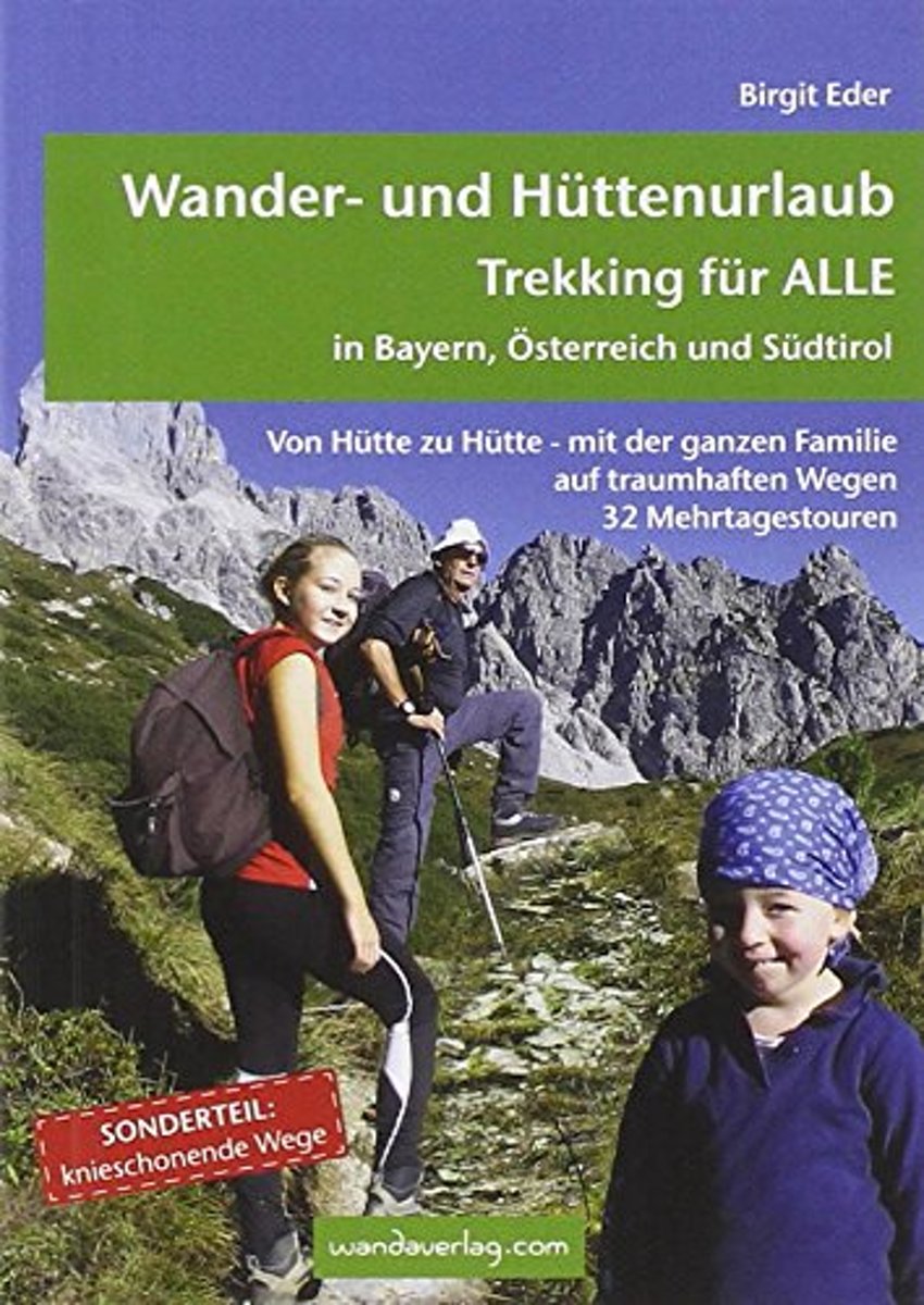
- Wander- und H ttenurlaub. Trekking f r ALLE in Bayern, Österreich und S dtirol
- Von H tte zu H tte mit leichtem Gep ck zu wandern, ist eine wunderbare Art, dem Alltag zu entfliehen. Die spannenden Mehrtagestouren sind in leicht zu bew ltigende Etappen unterteilt, die nach Kondition oder Laune zusammengefasst werden k nnen. Darum ist dieser Trekkingf hrer f r EinsteigerInnen wie f r Versierte gleicherma en eine Fundgrube.... Read more
- Also available from:
- Bol.com, Belgium
- De Zwerver, Netherlands
Bol.com
Belgium
2021
Belgium
2021
- Wander- und H ttenurlaub. Trekking f r ALLE in Bayern, Österreich und S dtirol
- Von H tte zu H tte mit leichtem Gep ck zu wandern, ist eine wunderbare Art, dem Alltag zu entfliehen. Die spannenden Mehrtagestouren sind in leicht zu bew ltigende Etappen unterteilt, die nach Kondition oder Laune zusammengefasst werden k nnen. Darum ist dieser Trekkingf hrer f r EinsteigerInnen wie f r Versierte gleicherma en eine Fundgrube.... Read more
De Zwerver
Netherlands
2021
Netherlands
2021
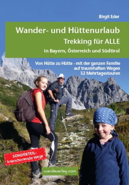
- Wandelgids Wander- und Hüttenurlaub. Trekking für alle in Bayern, Österreich und Südtirol | Wandaverlag
- Von Hütte zu Hütte mit leichtem Gepäck zu wandern, ist eine wunderbare Art, dem Alltag zu entfliehen. Die spannenden Mehrtagestouren sind in leicht zu bewältigende Etappen unterteilt, die nach Kondition oder Laune zusammengefasst werden können. Darum ist dieser Trekkingführer für EinsteigerInnen wie für Versierte gleichermaßen eine Fundgrube.... Read more
Bol.com
Netherlands
Netherlands
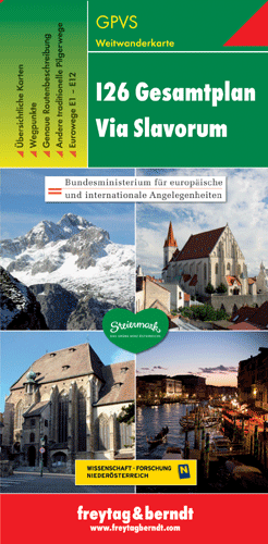
- FB GPVS Via Slavorum
- Dubbelzijdige wandel- en vrijetijdskaart toeristische tips stadsplattegronden overzichtskaart van de pelgrimsroute Via Slavorum, de internationale pelgrimsweg I26 die dwars door Midden- en Zuid-Europa voert GPS-punten Read more
- Also available from:
- Bol.com, Belgium
- De Zwerver, Netherlands
Bol.com
Belgium
Belgium
- FB GPVS Via Slavorum
- Dubbelzijdige wandel- en vrijetijdskaart toeristische tips stadsplattegronden overzichtskaart van de pelgrimsroute Via Slavorum, de internationale pelgrimsweg I26 die dwars door Midden- en Zuid-Europa voert GPS-punten Read more
De Zwerver
Netherlands
Netherlands
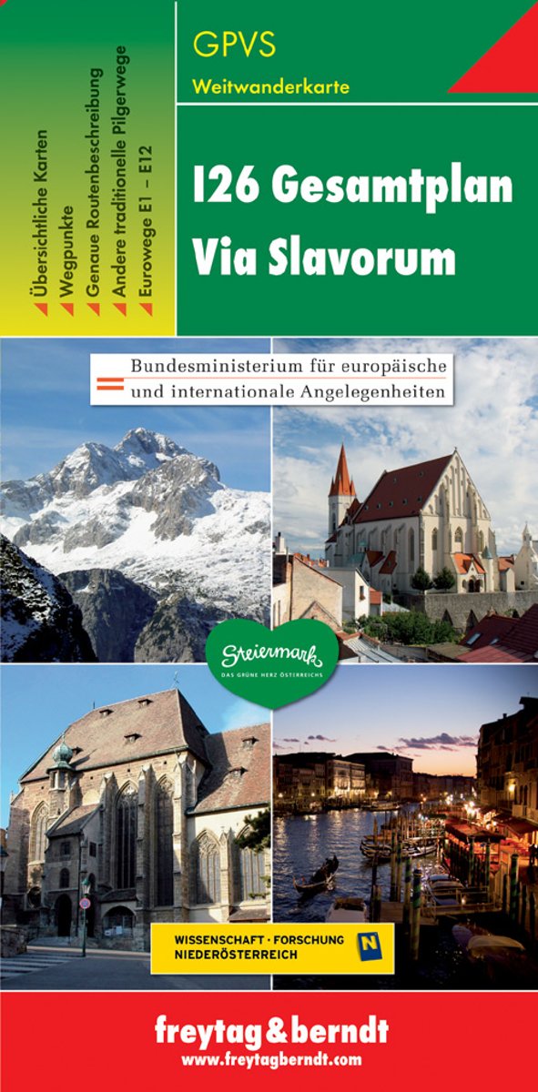
- Wandelkaart - Pelgrimsroute (kaart) - Wegenkaart - landkaart Via Slavorum I26 Gesamtplan Steiermark | Freytag & Berndt
- Dit is een overzichtskaart van de wandelkaart en/of pelgrimskaart voor de Via Slavorum, de internationale pelgrimsweg I26 die dwars door Midden-en Zuid-Europa voert: Van Krakau in Polen - Brno / Brünn in Tsjechië - Wenen, Mariazell, Graz, Klagefurt in Oostenrijk (Neder-Oostenrijk, Steiermark en Karinthie) - door het Save en Isonzodal in... Read more
Maps

Stanfords
United Kingdom
United Kingdom
- Gesäuse - Ennstaler Alpen - Schoberpass F&B WK062
- Gesäuse - Ennstaler Alpen - Schoberpass area of eastern Austria presented at 1:50,000 in a series of contoured and GPS compatible outdoor leisure map from Freytag & Berndt with hiking and cycling routes, mountain huts, campsites and youth hostels, local bus stops, plus other tourist information.To see the list of currently available titles in... Read more

Stanfords
United Kingdom
United Kingdom
- Hochschwab - Aflenz - Wildalpen - Salzatal F&B WK5041
- Hochschwab - Aflenz - Wildalpen - Salzatal area of eastern Austria presented at 1:35,000 in a series of contoured and GPS compatible outdoor leisure map from Freytag & Berndt with hiking and cycling routes, mountain huts, campsites and youth hostels, local bus stops, plus other tourist information. Cartography is an enlargement of the... Read more

Stanfords
United Kingdom
United Kingdom
- Semmering - Rax - Schneeberg - Schneealpe F&B WK022
- Semmering - Rax - Schneeberg – Schneealpe area of eastern Austria presented at 1:50,000 in a series of contoured and GPS compatible outdoor leisure map from Freytag & Berndt with hiking and cycling routes, mountain huts, campsites and youth hostels, local bus stops, plus other tourist information.To see the list of currently available titles in... Read more

Stanfords
United Kingdom
United Kingdom
- Goms - Aletsch
- Goms - Aletsch area of the Bernese Oberland at 1:50,000 in a series from Hallwag covering Switzerland’s popular hiking regions on light, waterproof and tear-resistant maps highlighting long-distance paths: the nine national routes plus special regional routes, as well as other local hiking trails.Cartography is similar to that used both in... Read more

Stanfords
United Kingdom
United Kingdom
- Graz and Surroundings - Region Hügelland-Schöcklland – Gleisdorf – Weiz – Raabklamm F&B WK133
- Graz and Environs area of south-eastern Austria presented at 1:50,000 in a series of contoured and GPS compatible outdoor leisure map from Freytag & Berndt with hiking and cycling routes, mountain huts, campsites and youth hostels, local bus stops, plus other tourist information.To see the list of currently available titles in this series... Read more

Stanfords
United Kingdom
United Kingdom
- Central Rhodopes / Rodopi Geopsis 132
- Central Rhodopes Mountains on the border of north-eastern Greece and Bulgaria on a waterproof and tear-resistant, contoured and GPS compatible map from Geopsis highlighting nine recommended hiking trails and the local section of the E6 cross-Europe long-distance route. All place names are in both Greek and Latin alphabet, with several villages... Read more

Stanfords
United Kingdom
United Kingdom
- Zirbitzkogel-Grebenzen Nature Park – Murau – Sölkpass F&B WK211
- Zirbitzkogel NP - Grebenzen - Murau - Solkpass area of the Austrian Alps presented at 1:50,000 in a series of contoured and GPS compatible outdoor leisure map from Freytag & Berndt with hiking and cycling routes, mountain huts, campsites and youth hostels, local bus stops, plus other tourist information.To see the list of currently available... Read more

Stanfords
United Kingdom
United Kingdom
- Styrian Winelands - Southwest Styria F&B WK411
- Styrian Winelands area south-eastern Austria presented at 1:50,000 in a series of contoured and GPS compatible outdoor leisure map from Freytag & Berndt with hiking and cycling routes, mountain huts, campsites and youth hostels, local bus stops, plus other tourist information. To see the list of currently available titles in this series please... Read more
Stanfords
United Kingdom
United Kingdom
- Pyhrn-Priel - Grünau - Almtal - Steyral - Kalkalpen National Park - Bad Aussee F&B WK081
- Pyhrn - Priel - Eisenwurzen - Grünau - Almtal - Steyral - Kalkalpen NP area of central Austria presented at 1:50,000 in a series of contoured and GPS compatible outdoor leisure map from Freytag & Berndt with hiking and cycling routes, mountain huts, campsites and youth hostels, local bus stops, plus other tourist information.To see the list of... Read more

Stanfords
United Kingdom
United Kingdom
- Eastern Rhodopes / Rodopi Geopsis 131
- Eastern Rhodopes Mountains on the border of north-eastern Greece and Bulgaria on a waterproof and tear-resistant, contoured and GPS compatible map from Geopsis highlighting nine recommended hiking trails and the local section of the E6 cross-Europe long-distance route. All place names are in both Greek and Latin alphabet, with several villages... Read more

Stanfords
United Kingdom
United Kingdom
- Hochschwab - Veitschalpe - Eisenerz - Bruck an der Mur F&B WK041
- Hochschwab - Veitschalpe - Eisenerz - Bruck an der Mur area of eastern Austria presented at 1:50,000 in a series of contoured and GPS compatible outdoor leisure map from Freytag & Berndt with hiking and cycling routes, mountain huts, campsites and youth hostels, local bus stops, plus other tourist information.To see the list of currently... Read more

Stanfords
United Kingdom
United Kingdom
- Seetaler Alpen - Seckauer Alpen - Judenburg - Knittelfeld F&B WK212
- Seetaler Alpen - Seckauer Alpen - Judenburg - Knittelfeld area of the Austrian Alps presented at 1:50,000 in a series of contoured and GPS compatible outdoor leisure map from Freytag & Berndt with hiking and cycling routes, mountain huts, campsites and youth hostels, local bus stops, plus other tourist information.To see the list of currently... Read more

Stanfords
United Kingdom
United Kingdom
- Western Rhodopes / Rodopi - Falakro Geopsis 133
- Central Rhodopes Mountains on the border of north-eastern Greece and Bulgaria on a waterproof and tear-resistant, contoured and GPS compatible map from Geopsis highlighting nine recommended hiking trails and the local section of the E6 cross-Europe long-distance route. All place names are in both Greek and Latin alphabet, with several villages... Read more

Stanfords
United Kingdom
United Kingdom
- South-East Styrian Hills - Vulkanland - Bad Gleichenberg - Bad Radkersburg F&B WK412
- Southern Styrian Hills - Vulkanland - Bad Gleichenberg - Bad Radkersburg area of south-eastern Austria presented at 1:50,000 in a series of contoured and GPS compatible outdoor leisure map from Freytag & Berndt with hiking and cycling routes, mountain huts, campsites and youth hostels, local bus stops, plus other tourist information. To see the... Read more

Stanfords
United Kingdom
United Kingdom
- Vienna Woods
- Vienna Woods on a detailed, GPS compatible map at 1:50,000 from Kompass with local and long-distance footpaths, cycling routes, accommodation, etc, printed on durable, waterproof and tear-resistant synthetic paper.KOMPASS HIKING & RECREATIONAL MAPS: this title is part of an extensive series covering Austria, much of Germany and the Slovenian... Read more