
Czech Republic
Description
 Although by nature Czechs are bikers rather than hikers, the Czech Tourist Club has set out 40.000km of hiking trails across the country. Enough to keep any globetrotter occupied.
The Czech Republic is a friendly country, covered in forested hills, undulating meadows and roads lined with apple trees. Most famous is Bohemia, Sumava for the Czechs, bordering on Germany and Austria. This region of high hills, forests and marshes is the most touristic. But there are other beautiful mountain regions on the border with Poland. Starting from Karlovy Vary in the west there are the Ore Mountains (Krušné hory), followed by the Izera Mountains (Jizerské hory) with their spectacular rock formations north of Liberec. Next are the Giant Mountains (Krkonoše), and the Eagle Mountains (Orlické hory) northeast of Hradec Králové. Further east are the High Ash Mountains (Hrubý Jeseník), and all the way on the border with Slovakia, the Beskids (Beskydy).
KCT publishes excellent 1:50.000 maps carrying descriptions of all hiking trails. These are for sale in regular bookshops. Hiking trails don't normally carry a name or number, just follow your heart. In the landscape the trails are marked using an ingeneous system of stripes. Possibilities for lodging are marked on the maps, there is a campsite in every village, and beer flows more profusely than in Germany.
If you are intent on walking a fully-fledged long distance hiking trail, then follow one of the European long distance trails passing through the Czech Republic. The E3 runs back and forth across the border with Germany and Poland, and includes the aforementioned mountain regions. The E6 passes through the Bohemian forest. The E10 leads straight from north to south right through the capital of Prague. A new project is the Prague-Vienna Greenways, a 400km hiking and biking trail between Prague and Vienna.
Trails
Regions


Links
Facts
Reports
Guides and maps
Lodging
Organisations
Tour operators
GPS
Other
Books
Netherlands
2017
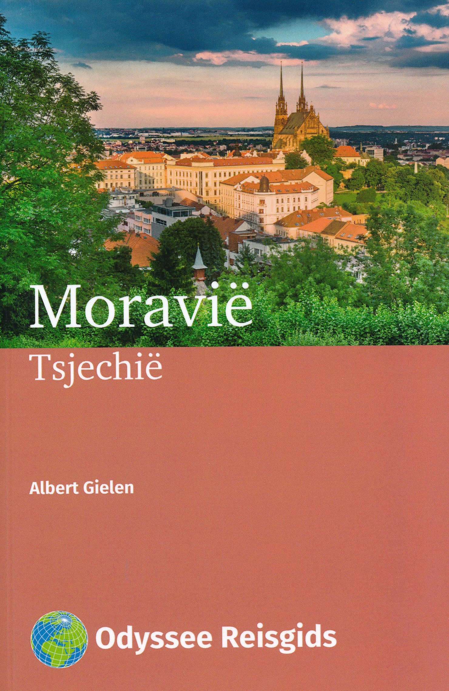
- Reisgids Moravië - Tsjechië | Odyssee Reisgidsen
- Moravië: hier is het goede leven Het in het oosten van Tsjechië gelegen Moravië is overwegend landelijk van karakter met een paar grote steden. Zoals het levendige en veelzijdige Brno en Olomouc, dat na Praag de meeste officiële monumenten in Tsjechië bezit. Telč en Nový Jičín hebben ieder een betoverend stadsplein. Het verder dunbevolkte... Read more

Netherlands
2016
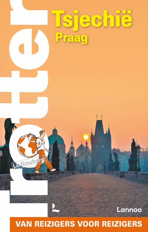
- Reisgids Trotter 48 Praag | Lannoo
- De beroemde en terecht gewaardeerde reisgidsenuitgever Trotter heeft nu een mooie serie stadsgidsen op de markt gebracht. Uitgevoerd in harde kaft staan deze zoals gebruikelijk vol met informatie. Niet alleen de bezienswaardigheden maar ook de info hoe je er moet komen, wat je er niet mag missen etc. Het beproefde Trotter-recept in een trendy... Read more
Netherlands
2018
- Reisgids Eyewitness Travel Czech & Slovak Republics - Tsjechië en Slowakije | Dorling Kindersley
- History & Politics Continent - Europe More Europe International Books Read more
Netherlands
2022
Netherlands
2015
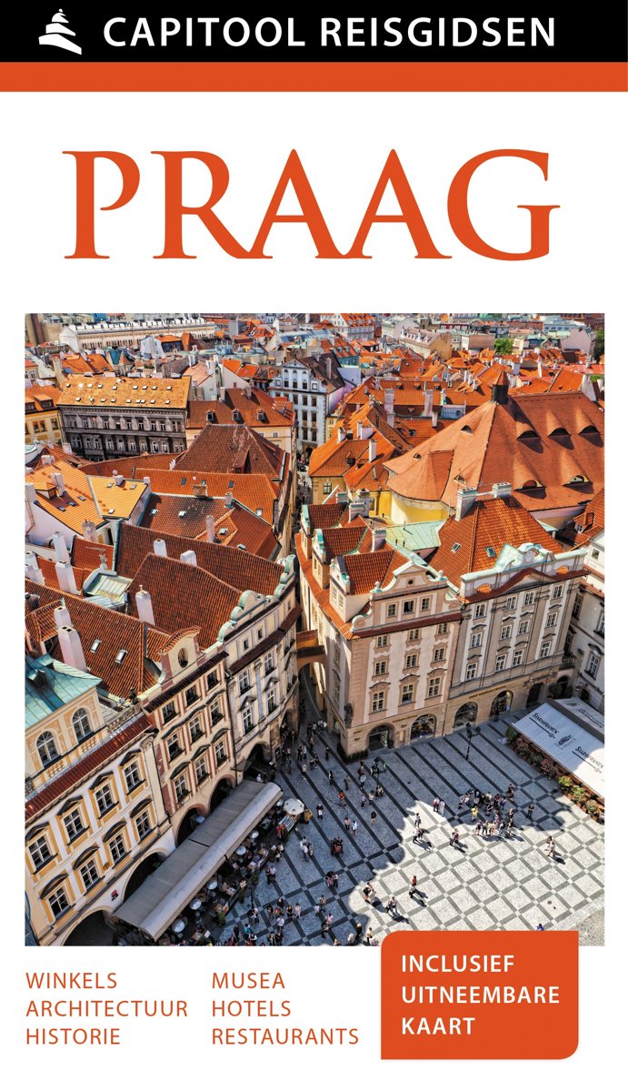
- Capitool reisgids Praag + uitneembare kaart
- Capitool Praag: de ideale reisgids voor jouw reis naar PraagHet is de luxe reisgids voor levensgenietersMet een zorgvuldig samengestelde inhoud van zeer hoge kwaliteitMet vele schitterende foto's en illustratiesBestand tegen intensief gebruik, voor, tijdens en na je reisEn de gids die je nog lang zult bewaren samen met je herinneringen"Een... Read more
- Also available from:
- Bol.com, Belgium
Belgium
2015
- Capitool reisgids Praag + uitneembare kaart
- Capitool Praag: de ideale reisgids voor jouw reis naar PraagHet is de luxe reisgids voor levensgenietersMet een zorgvuldig samengestelde inhoud van zeer hoge kwaliteitMet vele schitterende foto's en illustratiesBestand tegen intensief gebruik, voor, tijdens en na je reisEn de gids die je nog lang zult bewaren samen met je herinneringen"Een... Read more
Netherlands
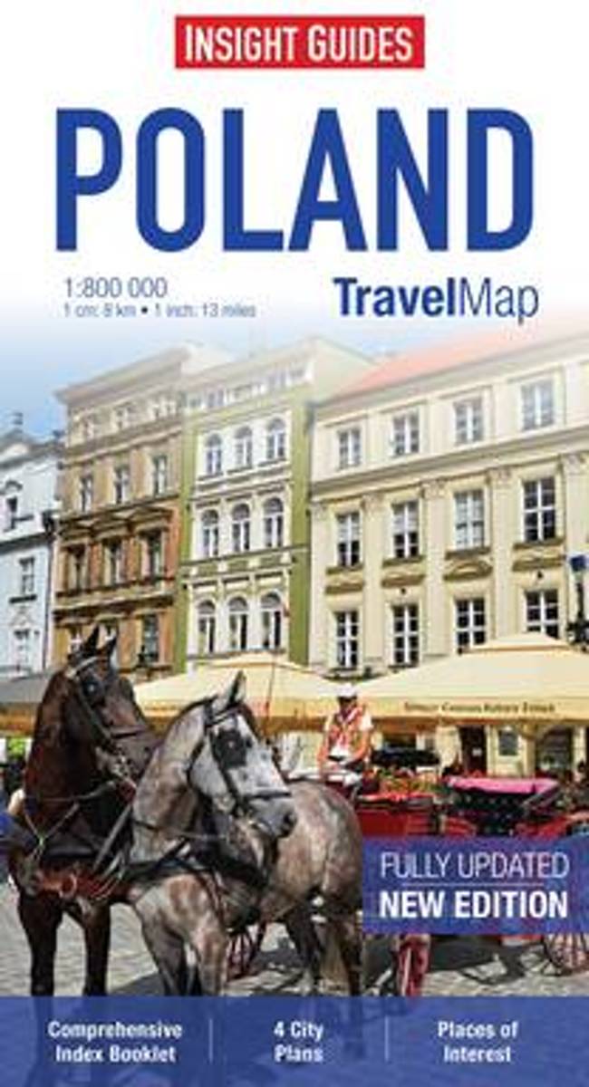
- Insight Guides Travel Map Poland
- Travel Map Poland is a double-sided, indexed, road map at 1:800 000. It includes detailed city plans of Krakow and Warsaw together with plans of Prague in the Czech Republic and Bratislava in Slovakia, each city has its own separate listing in the attached index. Places of interest including nature reserves, national parks, museums, monuments... Read more
- Also available from:
- Bol.com, Belgium
Belgium
- Insight Guides Travel Map Poland
- Travel Map Poland is a double-sided, indexed, road map at 1:800 000. It includes detailed city plans of Krakow and Warsaw together with plans of Prague in the Czech Republic and Bratislava in Slovakia, each city has its own separate listing in the attached index. Places of interest including nature reserves, national parks, museums, monuments... Read more
Netherlands
2017
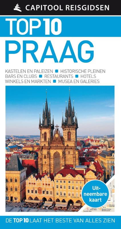
- Reisgids Capitool Top 10 Praag | Unieboek
- De naam zegt het al: een compacte versie van de veel geprezen Capitool serie. Eigenlijk vergelijkbaar met veel illustraties, veel aandacht voor cultuur en bevolking en hier en daar praktische informatie. Kleine versie, handig in de binnenzak. - Top 10 van onder andere de beste restaurants, de mooiste bezienswaardigheden en de leukste winkels -... Read more
Netherlands
- Finding Henry
- No reservations, no money, no problem!Directionless and depressed after leaving the blissful cocoon of college, Rebecca Patrick was finding herself at a loss in the “real world.” Her friends had scattered to the winds, jobs were hard to come by in her mountain town, and her difficult relationship with her boyfriend was disillusioning.... Read more
- Also available from:
- Bol.com, Belgium
Belgium
- Finding Henry
- No reservations, no money, no problem!Directionless and depressed after leaving the blissful cocoon of college, Rebecca Patrick was finding herself at a loss in the “real world.” Her friends had scattered to the winds, jobs were hard to come by in her mountain town, and her difficult relationship with her boyfriend was disillusioning.... Read more
Netherlands
2017
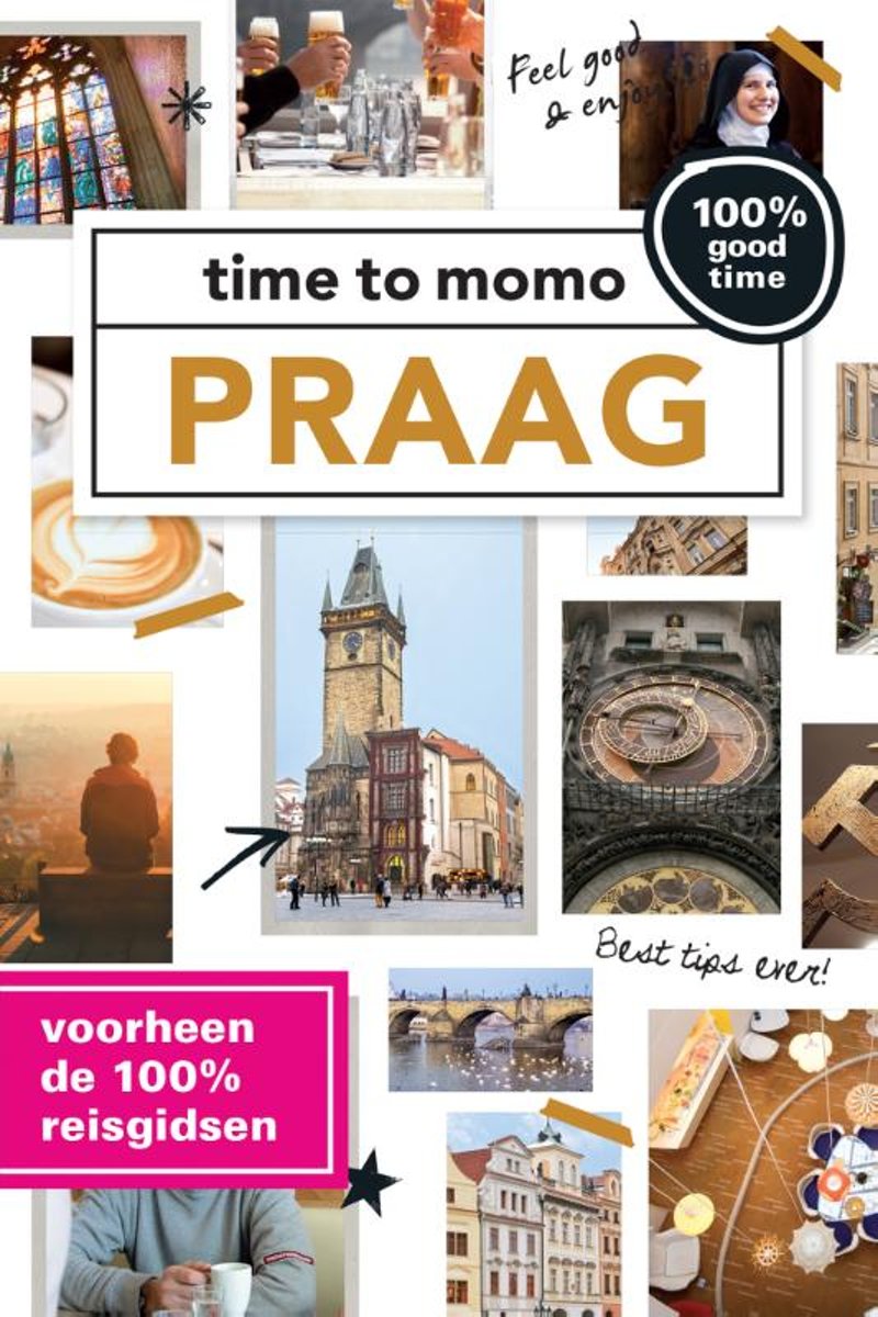
- Time to momo - Praag
- Dit is de vernieuwde versie van de 100% Praag-gids! Jij gaat Praag ontdekken! De stad barst van de historische bezienswaardigheden en musea. Je kunt er eindeloos ronddwalen door leuke wijken zoals Malá Strana en de Oude Stad. Rondneuzen in exclusieve boetiekjes, een boottocht op de Moldau, picknicken in een mooi park, een klassiek concert... Read more
- Also available from:
- Bol.com, Belgium
Belgium
2017
- Time to momo - Praag
- Dit is de vernieuwde versie van de 100% Praag-gids! Jij gaat Praag ontdekken! De stad barst van de historische bezienswaardigheden en musea. Je kunt er eindeloos ronddwalen door leuke wijken zoals Malá Strana en de Oude Stad. Rondneuzen in exclusieve boetiekjes, een boottocht op de Moldau, picknicken in een mooi park, een klassiek concert... Read more
Netherlands
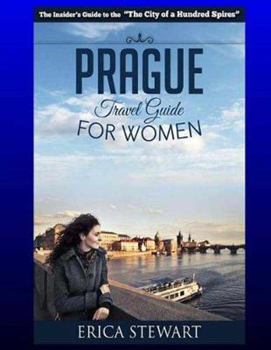
- Prague
- Travel Czech Republic Eastern Europe Guidebook. Eastern Europe Czech Republic General Short Reads Women Travel.Learn the Ins and Outs of Traveling to Prague from an Expert - Erica StewartThe Insider´s Guide for Women Traveling to this Amazing City! Brimming with insider knowledge, helpful tips and recommendations to off-the-beaten path... Read more
- Also available from:
- Bol.com, Belgium
Belgium
- Prague
- Travel Czech Republic Eastern Europe Guidebook. Eastern Europe Czech Republic General Short Reads Women Travel.Learn the Ins and Outs of Traveling to Prague from an Expert - Erica StewartThe Insider´s Guide for Women Traveling to this Amazing City! Brimming with insider knowledge, helpful tips and recommendations to off-the-beaten path... Read more
Netherlands
2023
Netherlands
2010
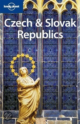
- Lonely Planet Czech & Slovak Republics
- Experience the best of the Czech and Slovak Republics with Lonely Planet. With our 6th edition you'll discover atmospheric castles on green hilltops, marvel at centuries of architectural majesty in Prague, ski down pristine slopes in the Tatras and relax with a glass of crips, golden beer in historic Plzen.Lonely Planet guides are written by... Read more
- Also available from:
- Bol.com, Belgium
Belgium
2010
- Lonely Planet Czech & Slovak Republics
- Experience the best of the Czech and Slovak Republics with Lonely Planet. With our 6th edition you'll discover atmospheric castles on green hilltops, marvel at centuries of architectural majesty in Prague, ski down pristine slopes in the Tatras and relax with a glass of crips, golden beer in historic Plzen.Lonely Planet guides are written by... Read more
Maps

United Kingdom
- Bohemian Forest - Mühlviertel - Lipno Dam F&B WK262
- Bohemian Forest - Mühlviertel - Moldau/Vltava Reservoir area straddling the border of Austria, Czech Republic and Germany presented at 1:50,000 in a series of contoured and GPS compatible outdoor leisure map from Freytag & Berndt with hiking and cycling routes, mountain huts, campsites and youth hostels, local bus stops, plus other tourist... Read more

United Kingdom
- Czech Republic Marco Polo Road Atlas
- Czech Republic Road Atlas from MairDumont in an A4 spiral-bound format, with 18 street plans and the publisher’s innovative system of providing peel-on/peel-off stickers for making selected locations more prominent when navigating.MairDumont’s distinctive cartography boldly stresses main roads and motorways in strong colours and selected towns... Read more

United Kingdom
- Czech - Slovak Republics F&B Superatlas
- Road Atlas of the Czech Republic and Slovakia at 1:150,000 from Freytag & Berndt, presenting each county separately and accompanied by street plans and enlargements for main urban areas, plus mapping of the whole of Europe for route planning.The atlas, published in an A4 spiral-bound format, presents each country on a separate set of maps, with... Read more

United Kingdom
- Czechia Shocart-F&B Road Map
- Indexed road map of Czech Republic at 1:250,000, with 1:100,000 scale enlargements of Prague, Ústí nad Labem, Karlovy Vary, Ceské Budejovice, and Plzen. The main map shows the major road network and some minor roads, with road distances marked in kilometres; filling stations are shown. Railway lines and airports are clearly displayed.Topography... Read more

United Kingdom
- EuroVelo 9 Cycle Route: Brno - Vienna - Maribor (550km) Bikeline Map/Guide
- A 550km section of the EuroVelo 9 from Brno in the Czech Republic, across eastern Austria including Vienna, to Maribor in north-eastern Slovenia presented by the Verlag Esterbauer in guide with maps at 1:75,000 showing the route and its variants. Extensive information is conveyed by symbols, indicating road surface, campsites and other... Read more

United Kingdom
- Czech Republic 100K Cycling Atlas
- Czech Republic Cycling Atlas at 1:100,000 from Shocart in an A4 ring-binder format with removable pages, including additional more detailed mapping of 231 specially selected routes, each with elevation profiles, etc. The whole volume comes in a protective presentation case.The 170-page atlas section has detailed, GPS compatible mapping covering... Read more

United Kingdom
2017
- Czechia Shocart 75K Cycling Atlas
- Czech Republic Cycling Atlas at 1:75,000 from Shocart in an A4 spiral-bound format, providing a detailed picture of the country’s extensive network of waymarked cycling paths, including routes in the adjoining areas of the neighbouring countries.Topography is shown by contours at 20m intervals with spot heights and relief shading, complemented... Read more

United Kingdom
- Czech Republic Road Atlas
- Czech Republic Road Atlas from Shocart in an A4, paperback format with enlargements showing access to 13 main cities, illustrated notes on the country’s UNESCO heritage sites, plus an extensive index.Road and rail networks are shown on a base map with relief shading to present the topography. National parks and other protected areas are marked.... Read more

United Kingdom
- Oder-Neisse Cycle Route Bikeline Map-Guide
- Oder-Neisse Cycle Route, a 630-km long cycle route from the source of the Neisse in the Czech Republic to the Baltic with variants on both the German and the Polish side of the two rivers, presented by the Verlag Esterbauer in a guide with maps at 1:75,000 showing the route and its variants. Extensive information is conveyed by symbols,... Read more

United Kingdom
- Karkonosze
- Karkonosze Mountains in Poland and the Czech Republic on a detailed hiking map at 1:50,000 from EKO-GRAF, with on the reverse on overview map of hiking trails with timings, seven street plans and a sightseeing map of the region highlighting locations of palaces and other historic buildings in Poland.On one side is a detailed map at 1:50,000... Read more
Netherlands
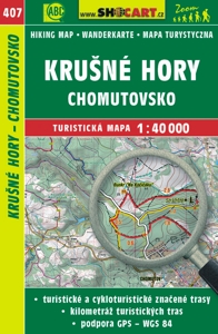
- Wandelkaart 407 Krušné hory - Chomutovsko - Erzgebirge | Shocart
- Gedetailleerde deelkaart van Tsjechie met daarop naast vele topografische details ook ingetekende wandelroutes, hutten en andere toeristische bezienswaardigheden. Voor de wandelaar zijn de routes en bijvoorbeeld hoogtelijnen van belang. Goed kleurgebruik en legenda in meerdere talen. Als wandelkaart of fietskaart dan ook prima te gebruiken Read more
Netherlands
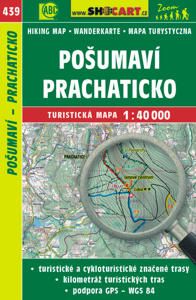
- Wandelkaart 439 Pošumaví, Prachaticko - Böhmerwald-Vorgebirge - Prachatitz | Shocart
- Gedetailleerde deelkaart van Tsjechie met daarop naast vele topografische details ook ingetekende wandelroutes, hutten en andere toeristische bezienswaardigheden. Voor de wandelaar zijn de routes en bijvoorbeeld hoogtelijnen van belang. Goed kleurgebruik en legenda in meerdere talen. Als wandelkaart of fietskaart dan ook prima te gebruiken Read more
Netherlands
2017
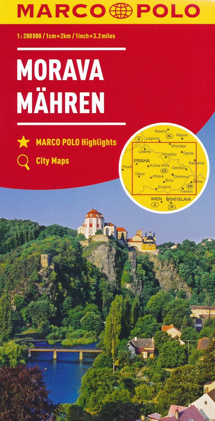
- Wegenkaart - landkaart Moravia - Tsjechie | Marco Polo
- MARCO POLO Karte Tschechien 02 Mähren 1:200 000 ab 9.99 EURO MARCO POLO Highlights, City Maps Marco Polo Karte Tschechien. 3. Auflage Read more
Netherlands
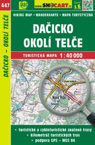
- Wandelkaart 447 Da?icko, okolí Tel?e | Shocart
- Gedetailleerde deelkaart van Tsjechie met daarop naast vele topografische details ook ingetekende wandelroutes, hutten en andere toeristische bezienswaardigheden. Voor de wandelaar zijn de routes en bijvoorbeeld hoogtelijnen van belang. Goed kleurgebruik en legenda in meerdere talen. Als wandelkaart of fietskaart dan ook prima te gebruiken Read more
Netherlands
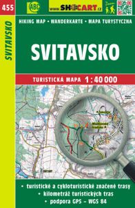
- Wandelkaart 455 Svitavsko | Shocart
- Gedetailleerde deelkaart van Tsjechie met daarop naast vele topografische details ook ingetekende wandelroutes, hutten en andere toeristische bezienswaardigheden. Voor de wandelaar zijn de routes en bijvoorbeeld hoogtelijnen van belang. Goed kleurgebruik en legenda in meerdere talen. Als wandelkaart of fietskaart dan ook prima te gebruiken Read more