
Massif Central
Description
Links
Facts
Reports
Guides and maps
Lodging
Organisations
Tour operators
GPS
Other
Books

Stanfords
United Kingdom
2014
United Kingdom
2014
- Le Val de Sioule à pied FFRP Topo-guide No. P032
- Le Val de Sioule à pied, FFRP topo-guide Ref. No.P032, with 44 day walks of varying length and difficulty in the Massif Central between Vichy and Montluçon. Each walk is presented on a separate colour extract from IGN’s topographic survey of France at 1:25,000, with its description cross-referenced to the map. Current edition of this title was... Read more
Stanfords
United Kingdom
2018
United Kingdom
2018
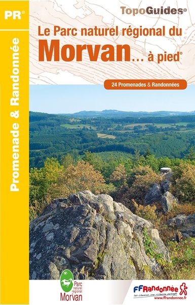
- Le Parc naturel regional du Morvan... a pied
- The Morvan regional nature park on foot.In the center of Burgundy, the Morvan and its granite mountain at the northern end of the Massif Central, reserves its most beautiful secrets for those who walk its paths.Spread over the entire territory of the Parc du Morvan, from Vézelay to Bibracte, the twenty-four walks offered in this guide will... Read more

Stanfords
United Kingdom
2006
United Kingdom
2006
- GR46/GRP: Au pays du George Sand FFRP Topo-guide No. 361
- GR46/GRP: Au pays du George Sand, FFRP topo-guide ref. no. 361, one of the titles from an extensive series of light, high quality, A5 paperback guides to the Sentiers de Grande Randonnée, the GR routes, a dense network of long-distance footpaths across the French countryside. Each topo-guide covers either a circular route, or part of a longer... Read more

Stanfords
United Kingdom
2014
United Kingdom
2014
- Pays de Lauragais à pied FFRP Topo-guide No. P115
- Pays de Lauragais à pied, FFRP topo-guide Ref. No. P115, with 39 day walks of varying length and difficulty in the countryside north-west of Carcassonne, on both sides of the Canal du Midi. Each walk is presented on a separate colour extract from IGN’s topographic survey of France at 1:25,000, with its description cross-referenced to the map.... Read more

Stanfords
United Kingdom
2019
United Kingdom
2019
- Volcan du Cantal - Pays de Saint-Flour - Haute-Auvergne GR400/4
- Volcan du Cantal: Pays de Saint-Flour et de Ruynes-en-Margeride, FFRP topoguide, Ref. No. 400, covering 600kms of long-distance paths in the Cantal region of the Massif Central, which can also be walked as shorter circuits. Current edition of this title was published in July 2013.To see other titles in this series please click on the series... Read more
Stanfords
United Kingdom
2020
United Kingdom
2020
- Le Chemin de Saint-Guilhem-le-Desert - Lozere - Aveyron - Gard - Herault
- Le chemin de Saint-Guilhem-le Désert, FFRP topoguide Ref. No. 4834, covering the 340kms of hiking routes between Aumont-Aubrac in the Massif Central, across the Cevennes, to Saint-Guilhem-le-Désert near Montpellier. Current edition of this title was published in July 2018ABOUT THE FFRP (Fédération française de la randonnée pédestre) TOPOGUIDES:... Read more

Stanfords
United Kingdom
2011
United Kingdom
2011
- GRP: Monts et Lacs du Lévézou FFRP Topo-guide No. 1201
- Monts et Lacs du Lévézou, FFRP topo-guide ref. no. 1201, covering two hiking circuits in the Massif Central near Rodez and Millau; in all 214kms of routes. Current edition of this title was published in March 2011.ABOUT THE FFRP (Fédération française de la randonnée pédestre) TOPOGUIDES: published in a handy A5 paperback format, the guides are... Read more
Stanfords
United Kingdom
2018
United Kingdom
2018
- Sentiers de St-Jacques via le Puy - Le Puy to Figeac GR65
- Chemins de St-Jacques: Le Puy - Figeac, FFRP topoguide Ref. no. 651, covering a 252km section of the Way of St. James across the Massif Central from Le Puy-en-Velay to Figeac along the GR 65. Current edition of this title was published in August 2014.ABOUT THE FFRP (Fédération française de la randonnée pédestre) TOPOGUIDES: published in a handy... Read more
Stanfords
United Kingdom
2021
United Kingdom
2021
- Tour des Monts d`Aubrac GRP/GR60/GR6
- Tour des Monts d`Aubrac, FFRP topoguide Ref. No. 616, covering 259kms of hiking circuits in the Massif Central along the GR6, GR60 and GR65. Current edition of this title was published in May 2016.ABOUT THE FFRP (Fédération française de la randonnée pédestre) TOPOGUIDES: published in a handy A5 paperback format, the guides are the best... Read more
- Also available from:
- The Book Depository, United Kingdom

Stanfords
United Kingdom
2021
United Kingdom
2021
- Volcan du Cantal et Pays de Saint-Flour - Haute-Auvergne GR400/4
- Volcan du Cantal: Pays de Saint-Flour et de Ruynes-en-Margeride, FFRP topoguide, Ref. No. 400, covering 600kms of long-distance paths in the Cantal region of the Massif Central, which can also be walked as shorter circuits. Current edition of this title was published in July 2013.To see other titles in this series please click on the series... Read more
- Also available from:
- The Book Depository, United Kingdom

Bol.com
Netherlands
Netherlands
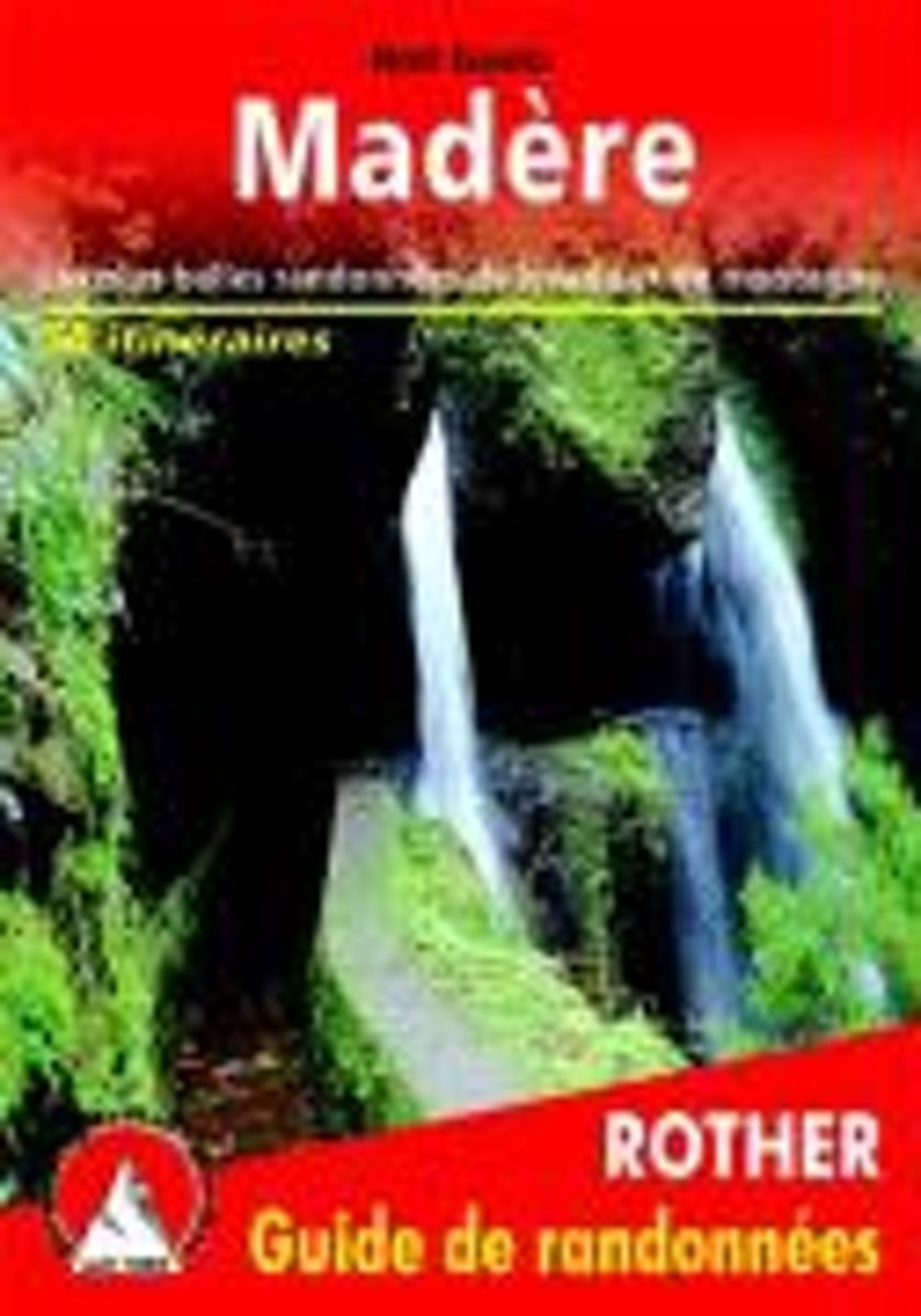
- Mad re (Madeira - franz sische Ausgabe)
- Les plus belles randonnées de levada et de montagne Read more
- Also available from:
- Bol.com, Belgium
Bol.com
Belgium
Belgium
- Mad re (Madeira - franz sische Ausgabe)
- Les plus belles randonnées de levada et de montagne Read more

Stanfords
United Kingdom
2013
United Kingdom
2013
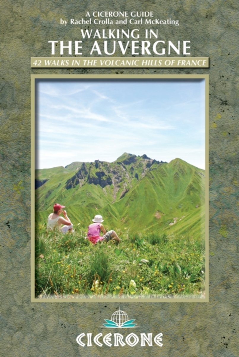
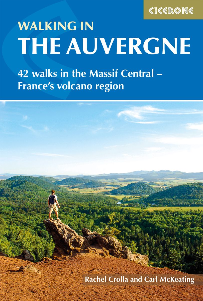
- Auvergne Walking Guide
- Rachel Crolla and Carl McKeating’s Cicerone guide to Walking in the Auvergne illustrates 42 walks in the volcanic hills of France covering the Puy de Dôme, Cantal and Haute-Loire regions and featuring detailed instructions, clear sketch maps and colour photographs.The book covers the area from Vichy in the north to Le Puy-en-Velay in the... Read more
- Also available from:
- The Book Depository, United Kingdom
- Bol.com, Netherlands
- Bol.com, Belgium
- De Zwerver, Netherlands

The Book Depository
United Kingdom
2013
United Kingdom
2013
- Walking in the Auvergne
- 42 Walks in the Massif Central - France's volcano region Read more
Bol.com
Netherlands
2013
Netherlands
2013
- Walking in the Auvergne
- This walking guidebook describes 42 day routes exploring the stunning Auvergne region in central France. The walks are ideal for day walkers and hikers, with routes ranging from easy 5km outings to more challenging 20km hikes. All are illustrated with clear mapping and colour photographs. The guide focuses on the best routes in five different... Read more
Bol.com
Belgium
2013
Belgium
2013
- Walking in the Auvergne
- This walking guidebook describes 42 day routes exploring the stunning Auvergne region in central France. The walks are ideal for day walkers and hikers, with routes ranging from easy 5km outings to more challenging 20km hikes. All are illustrated with clear mapping and colour photographs. The guide focuses on the best routes in five different... Read more
De Zwerver
Netherlands
2020
Netherlands
2020
- Wandelgids Walking in the Auvergne | Cicerone
- Guidebook to the Auvergne describing 42 walks between 5 and 20km in the quiet volcanic hills of central France. Five areas are covered: Cantal, Chaine des Puys, Mont Dores, Haute-Loire and Montagne Bourbonnaise. The volcanic geography provides a stunning backdrop to routes suitable for all walkers. Bases in Vichy, Clermont-Ferrand and Puy-en-Velay. Read more
De Zwerver
Netherlands
2022
Netherlands
2022
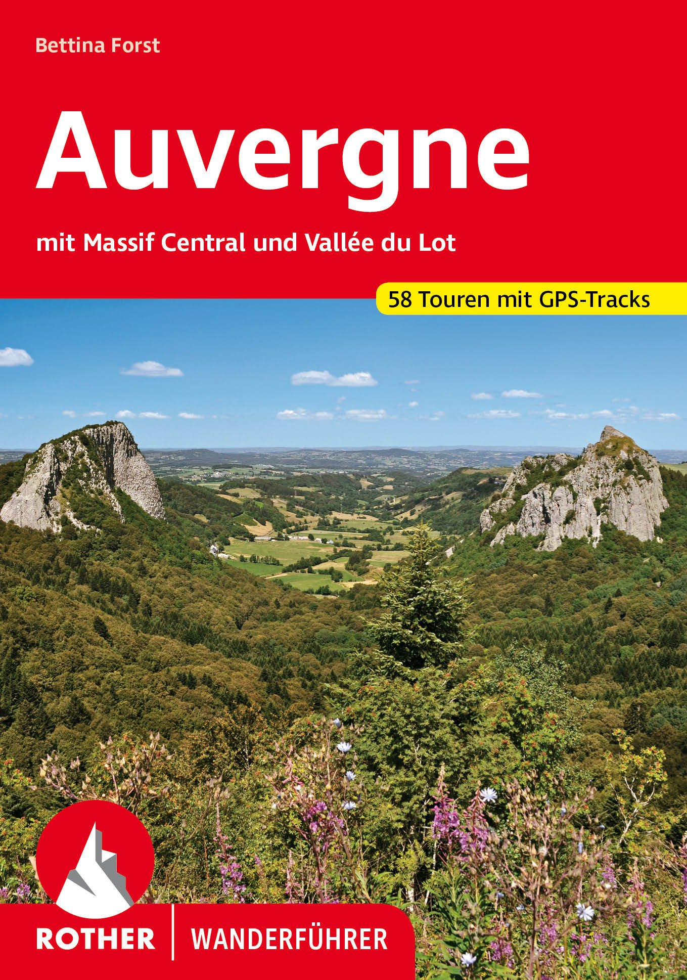
- Wandelgids 246 Auvergne en Massif Central - Vallée du Lot | Rother Bergverlag
- Uitstekende wandelgids met een groot aantal dagtochten in dal en hooggebergte. Met praktische informatie en beperkt kaartmateriaal! Wandelingen in verschillende zwaarte weergegeven in rood/blauw/zwart. Die Auvergne mit dem Massif Central bildet das wilde, grüne Herz Frankreichs. Abseits von Touristenströmen und Autorouten konnte diese... Read more

Stanfords
United Kingdom
2015
United Kingdom
2015
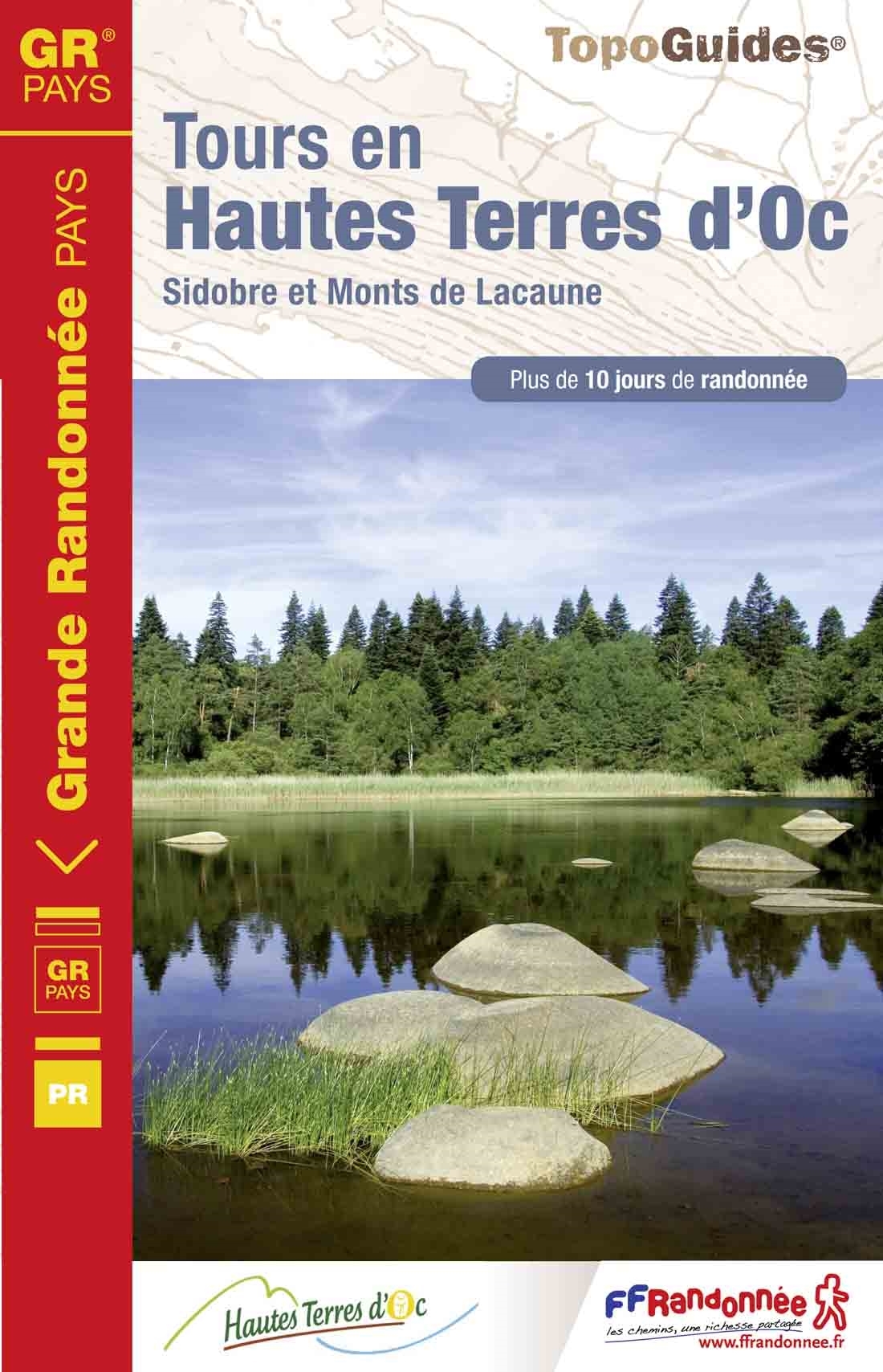
- GR de Pays: Tours en Hautes Terres d`Oc FFRP Topo-guide No. 811
- Tours en Hautes Terres d`Oc, FFRP topoguide Ref. No. 811, covering a 230km circular route in the Parc Naturel Régional du Haut-Languedoc, with additional descriptions of 14 day walks in the region. Current edition of this title was published in July 2015.ABOUT THE FFRP (Fédération française de la randonnée pédestre) TOPOGUIDES: published in a... Read more
- Also available from:
- De Zwerver, Netherlands
De Zwerver
Netherlands
2015
Netherlands
2015
- Wandelgids 811 Tours en Hautes Terres d'Oc | FFRP
- Uitstekende routegids met gedetailleerde kaarten en een routebeschrijving. Fout lopen wordt op deze manier wel erg moeilijk. Met symbolen is weergegeven welke voorzieningen (openbaar vervoer / winkels / overnachtingen) er zijn langs of bij de route. Een nadeel is dat de daadwerkelijke adressen dan weer niet altijd genoemd worden. Alle gidsen... Read more
Maps
Stanfords
United Kingdom
United Kingdom
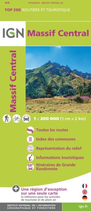
- Massif Central IGN Top200 204
- Pyrénées Ouest map from the IGN at 1:200,000, with excellent presentation of the terrain through contours and vivid relief shading, plenty of names of topographic features, long-distance GR hiking routes, places of interest, etc. The map is designed to provide convenient coverage of the western and central part of the Pyrenees, extending across... Read more

Stanfords
United Kingdom
United Kingdom
- Auvergne-Rhone-Alpes - Massif Central IGN Regional NR14 DOUBLE-SIDED
- IGN publishes its new collection of regional maps including the official division of the 13 new regions. The largest regions are well represented on a single map. These maps are double sided and in 6 languages. Read more

Stanfords
United Kingdom
United Kingdom
- Mgoun Massif, Central High Atlas Mountains
- Mgoun Massif in the Central High Atlas Mountains of Morocco on a ridge-type map at 1:100,000 from West Col Publications. The map is centred on the peak of Oumsoud and covers an area measuring approximately 80 km east/west and 50 km north south. An inset extends the coverage north-eastwards to include the Jbel Aroudan peak.Ridge maps do not... Read more