
GR8
Description
- Name GR8 (GR8)
- Start of trail Saint Brévin les Pins
- End of trail Sare
 Atlantic Trail
The GR8 is not finished yet. Parts are there: from the harbour of Urt to the village of Sare in Basque country, 65 km, 3 days; a part in the Médoc, and a piece in the Vendée.
The Basque part of this Grande Randonnée runs some distance from the Basque Atlantic Coast, joins the GR10 - the trail in the Pyrenees - and ends at the frontier village Handaye.
When finished (?), the GR8 is in fact the course of the E9, the coastal European Long Distance Trail.
Select some tracks
☐GR 8 Puertos de Beceite - Javalambre, 43km
Map

Links
Facts
Reports
Guides and maps
Lodging
Organisations
Tour operators
GPS
Other
Books

Stanfords
United Kingdom
United Kingdom
- Purbeck & South Dorset - Poole, Dorchester - Weymouth & Swanage OS Explorer Active Map OL15 (waterproof)
- Purbeck and the southern part of Dorset on a detailed topographic and GPS compatible map OL15, waterproof version, from the Ordnance Survey’s 1:25,000 Explorer series. Coverage extends from Poole and Swanage in the east to Bridport in the west, and includes Dorchester, Tolpuddle, Bere Regis, Wareham, Weymouth, Chesil Beach, Portland Bill, the... Read more
- Also available from:
- The Book Depository, United Kingdom

The Book Depository
United Kingdom
United Kingdom

Stanfords
United Kingdom
United Kingdom
- Purbeck & South Dorset - Poole, Dorchester - Weymouth & Swanage OS Explorer Map OL15 (paper)
- Purbeck and the southern part of Dorset on a detailed topographic and GPS compatible map OL15, paper version, from the Ordnance Survey’s 1:25,000 Explorer series. Coverage extends from Poole and Swanage in the east to Bridport in the west, and includes Dorchester, Tolpuddle, Bere Regis, Wareham, Weymouth, Chesil Beach, Portland Bill, the final... Read more
- Also available from:
- The Book Depository, United Kingdom
- Bol.com, Netherlands
- Bol.com, Belgium
- De Zwerver, Netherlands

The Book Depository
United Kingdom
United Kingdom

Bol.com
Netherlands
Netherlands
- Purbeck & South Dorset, Poole, Dorchester, Weymouth & Swanage
- OS Explorer is the Ordnance Survey's most detailed map and is recommended for anyone enjoying outdoor activities like walking, horse riding and off-road cycling. The OS Explorer range of OL maps now includes a digital version of the paper map, accessed through the OS smartphone app, OS Maps. Providing complete GB coverage the series details... Read more
Bol.com
Belgium
Belgium
- Purbeck & South Dorset, Poole, Dorchester, Weymouth & Swanage
- OS Explorer is the Ordnance Survey's most detailed map and is recommended for anyone enjoying outdoor activities like walking, horse riding and off-road cycling. The OS Explorer range of OL maps now includes a digital version of the paper map, accessed through the OS smartphone app, OS Maps. Providing complete GB coverage the series details... Read more

De Zwerver
Netherlands
Netherlands
Bol.com
Netherlands
2013
Netherlands
2013
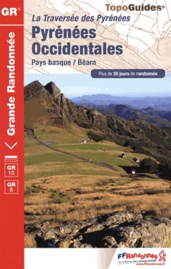
- Pyrenees Occidentales GR10/GR8 PNR Pays Basque Bearn
- Du col de Tende vers Colmars ou Grasse, les GR® 52 et 52A cheminent en lisière du Parc national du Mercantour et passent en revue l'enfilade de sommets qui composent le massif le plus méridional des Alpes. Ne nécessitant pas l'intensité physique de la randonnée en haute-montagne, ce sentier conduit le marcheur à la découverte du Haut-Pays,... Read more
- Also available from:
- Bol.com, Belgium
Bol.com
Belgium
2013
Belgium
2013
- Pyrenees Occidentales GR10/GR8 PNR Pays Basque Bearn
- Du col de Tende vers Colmars ou Grasse, les GR® 52 et 52A cheminent en lisière du Parc national du Mercantour et passent en revue l'enfilade de sommets qui composent le massif le plus méridional des Alpes. Ne nécessitant pas l'intensité physique de la randonnée en haute-montagne, ce sentier conduit le marcheur à la découverte du Haut-Pays,... Read more

De Zwerver
Netherlands
2023
Netherlands
2023
Maps
De Zwerver
Netherlands
Netherlands
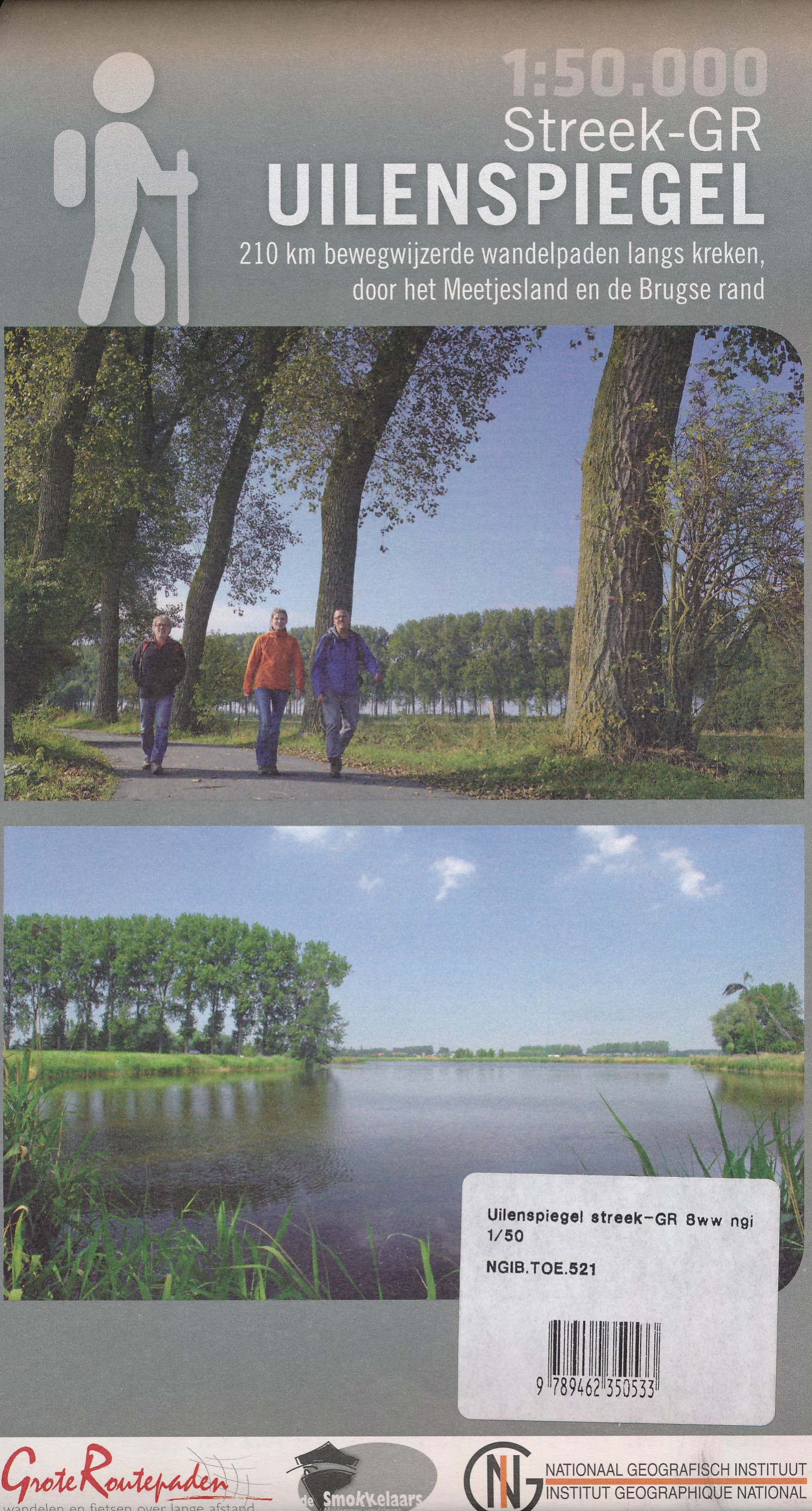
- Wandelkaart 521 Streek GR Uilenspiegel GR 8 | NGI - Nationaal Geografisch Instituut
- Omvat: de gemeentes Damme, Het Zwin, Sluis, Oostburg en Terneuzen, Meetjesland, de Lembeekse bossen, provinciaal domein Het Leen & het Drongengoedbos Productomschrijving: Het Nationaal Geografisch Instituut publiceert ook toeristische kaarten, in samenwerking met lokale overheden, VVV-kantoren en andere verenigingen. Deze kaarten zijn ontworpen... Read more