
Galicia
Description
Autonomous region in the northwest of Spain.
Trails in this state
Links
Facts
Reports
Guides and maps
Lodging
Organisations
Tour operators
GPS
Other
Books
Stanfords
United Kingdom
United Kingdom
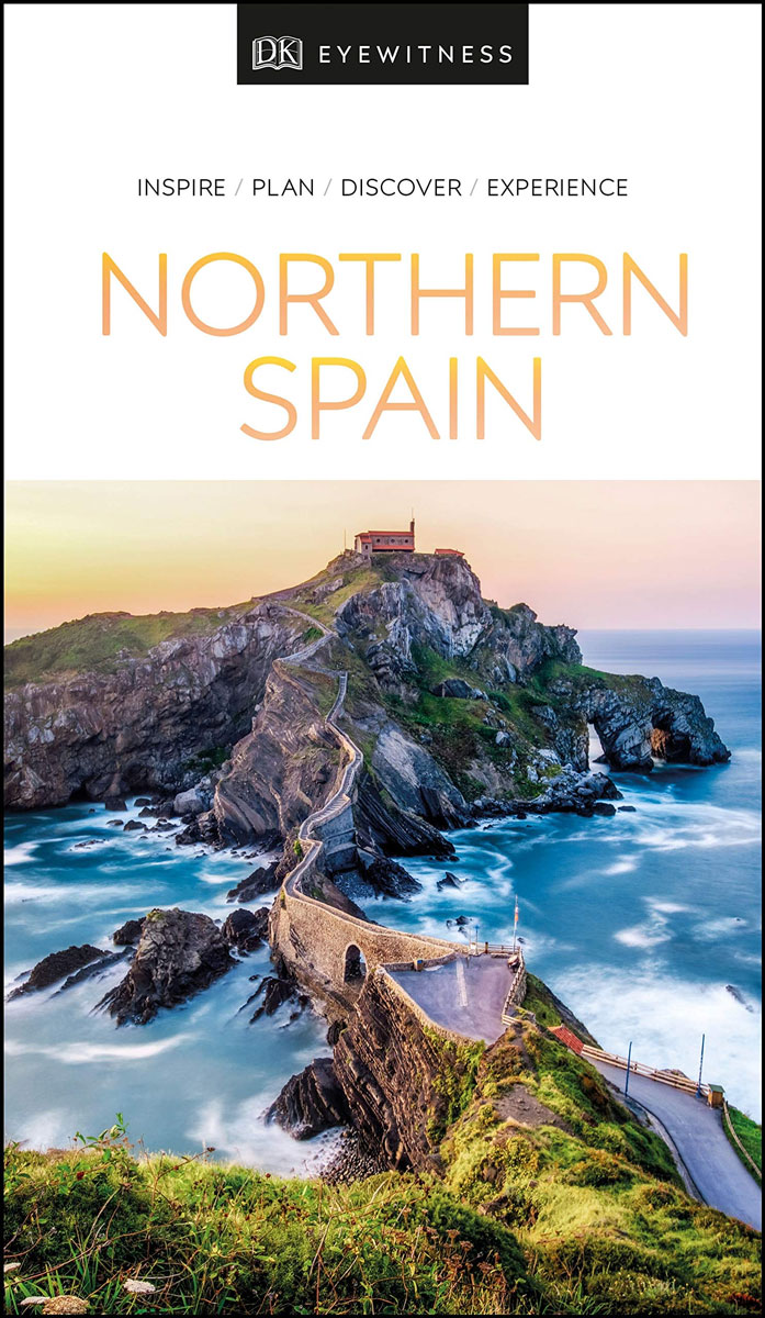
- DK Eyewitness Northern Spain
- Your journey starts here. Featuring DK`s much-loved maps and illustrations, walks and information, plus all new, full-colour photography, this 100% updated guide to Northern Spain brings you the best of this stunning Spanish region in a brand-new, lightweight format. What`s inside? - full-colour photography, hand-drawn illustrations, and maps... Read more

Stanfords
United Kingdom
United Kingdom
- DK Eyewitness Northern Spain
- Explore wild mountain terrain, vibrant cities and romantic coastline.Whether you want to trek the dramatic peaks of the Picos de Europa, appreciate contemporary art at Museo Guggenheim or hop from bar to bar in the side streets of San Sebastian, your DK Eyewitness travel guide makes sure you experience all that Northern Spain has to offer.Our... Read more

Stanfords
United Kingdom
United Kingdom
- Call of the Camino
- The experiences of an ordinary man on the pilgrim`s path are charted in this narrative that walks along the Camino Frances to the shrine of Saint James at Santiago de Compostela and then on to Finisterre, the westernmost point of Spain. The history of the Camino is recounted, as well as several of the myths, legends, and miracle stories that... Read more

Stanfords
United Kingdom
United Kingdom
- DK Eyewitness Road Trips Spain
- With its idyllic hilltop villages, historic cities, coastal towns, and stunning natural landscapes, Spain is the perfect destination for a leisurely road trip. It`s yours to explore with Road Trips Spain, our redesigned and newly updated guide containing 25 drives across the country, from the spectacular rocky coastline of Mallorca to the... Read more

Stanfords
United Kingdom
United Kingdom
- Islands of the Galician Coast National Park CNIG Map-Guide SPANISH
- Islands of the Galician Coast National Park (PN Marítimo-Terrestre de las Islas Atlánticas de Galicia) at 1:25,000 on a contoured and GPS compatible map from IGN/CNIG with cartography from their topographic survey of Spain. The four groups of islands which form this national park are presented as a separate panel: Illa de Cortagada with the... Read more

The Book Depository
United Kingdom
United Kingdom
- Caminhando Com as Estrelas
- Vivendo entre histórias, lendas e um turbilhão de emoções no Caminho de Santiago. Read more


The Book Depository
United Kingdom
United Kingdom
- 400 Kilometer rückwärts auf dem Camino del Norte
- Allein & off-season von Ribadeo nach Bilbao Read more

The Book Depository
United Kingdom
United Kingdom
- Walking Notes Camino Frances
- Day to day from St. Jean Pied de Port to Santiago de Compostela Read more

The Book Depository
United Kingdom
2023
United Kingdom
2023
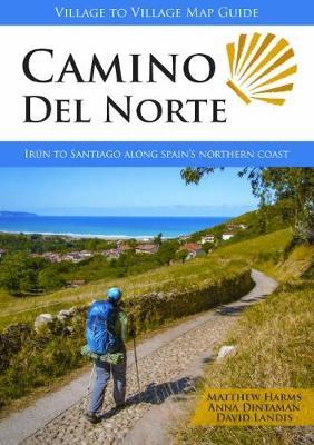
- Camino del Norte
- Irun to Santiago along Spain's Northern Coast Read more
- Also available from:
- De Zwerver, Netherlands
De Zwerver
Netherlands
2023
Netherlands
2023
- Wandelgids Camino Del Norte | Village to Village Press
- Irun to Santiago along Spain's Northern Coast Read more


Stanfords
United Kingdom
United Kingdom
- Purbeck & South Dorset - Poole, Dorchester - Weymouth & Swanage OS Explorer Active Map OL15 (waterproof)
- Purbeck and the southern part of Dorset on a detailed topographic and GPS compatible map OL15, waterproof version, from the Ordnance Survey’s 1:25,000 Explorer series. Coverage extends from Poole and Swanage in the east to Bridport in the west, and includes Dorchester, Tolpuddle, Bere Regis, Wareham, Weymouth, Chesil Beach, Portland Bill, the... Read more
- Also available from:
- The Book Depository, United Kingdom

The Book Depository
United Kingdom
United Kingdom
- Also available from:
- De Zwerver, Netherlands

The Book Depository
United Kingdom
United Kingdom
- Walk Together and Take Care of One Another
- Our Time on the Camino Frances Read more
More books…

Maps

Stanfords
United Kingdom
United Kingdom
- Benidorm CNIG Topo 848
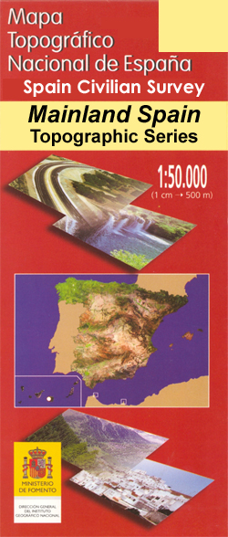
- Topographic coverage of mainland Spain at 1:50,000 in the MTN50 (Mapa Topográfico Nacional) series from the Centro Nacional de Información Geografica, the country’s civilian survey organization. The maps have contours at 20m intervals, enhanced by relief shading, plus colouring and/or graphics to show different types of terrain, vegetation or... Read more

Stanfords
United Kingdom
United Kingdom
- Quintana Redonda CNIG Topo 378
- Topographic coverage of mainland Spain at 1:50,000 in the MTN50 (Mapa Topográfico Nacional) series from the Centro Nacional de Información Geografica, the country’s civilian survey organization. The maps have contours at 20m intervals, enhanced by relief shading, plus colouring and/or graphics to show different types of terrain, vegetation or... Read more

Stanfords
United Kingdom
United Kingdom
- Ubrique CNIG Topo 1050
- Topographic coverage of mainland Spain at 1:50,000 in the MTN50 (Mapa Topográfico Nacional) series from the Centro Nacional de Información Geografica, the country’s civilian survey organization. The maps have contours at 20m intervals, enhanced by relief shading, plus colouring and/or graphics to show different types of terrain, vegetation or... Read more

Stanfords
United Kingdom
United Kingdom
- Agüero CNIG Topo 209
- Topographic coverage of mainland Spain at 1:50,000 in the MTN50 (Mapa Topográfico Nacional) series from the Centro Nacional de Información Geografica, the country’s civilian survey organization. The maps have contours at 20m intervals, enhanced by relief shading, plus colouring and/or graphics to show different types of terrain, vegetation or... Read more

Stanfords
United Kingdom
United Kingdom
- Palomares del Campo CNIG Topo 633
- Topographic coverage of mainland Spain at 1:50,000 in the MTN50 (Mapa Topográfico Nacional) series from the Centro Nacional de Información Geografica, the country’s civilian survey organization. The maps have contours at 20m intervals, enhanced by relief shading, plus colouring and/or graphics to show different types of terrain, vegetation or... Read more

Stanfords
United Kingdom
United Kingdom
- Ardales CNIG Topo 1038
- Topographic coverage of mainland Spain at 1:50,000 in the MTN50 (Mapa Topográfico Nacional) series from the Centro Nacional de Información Geografica, the country’s civilian survey organization. The maps have contours at 20m intervals, enhanced by relief shading, plus colouring and/or graphics to show different types of terrain, vegetation or... Read more
Stanfords
United Kingdom
United Kingdom
- Puerto Lumbreras CNIG Topo 975
- Topographic coverage of mainland Spain at 1:50,000 in the MTN50 (Mapa Topográfico Nacional) series from the Centro Nacional de Información Geografica, the country’s civilian survey organization. The maps have contours at 20m intervals, enhanced by relief shading, plus colouring and/or graphics to show different types of terrain, vegetation or... Read more

Stanfords
United Kingdom
United Kingdom
- Membrio CNIG Topo 676
- Topographic coverage of mainland Spain at 1:50,000 in the MTN50 (Mapa Topográfico Nacional) series from the Centro Nacional de Información Geografica, the country’s civilian survey organization. The maps have contours at 20m intervals, enhanced by relief shading, plus colouring and/or graphics to show different types of terrain, vegetation or... Read more

Stanfords
United Kingdom
United Kingdom
- Albatera CNIG Topo 892
- Topographic coverage of mainland Spain at 1:50,000 in the MTN50 (Mapa Topográfico Nacional) series from the Centro Nacional de Información Geografica, the country’s civilian survey organization. The maps have contours at 20m intervals, enhanced by relief shading, plus colouring and/or graphics to show different types of terrain, vegetation or... Read more

Stanfords
United Kingdom
United Kingdom
- Huesca CNIG Topo 286
- Topographic coverage of mainland Spain at 1:50,000 in the MTN50 (Mapa Topográfico Nacional) series from the Centro Nacional de Información Geografica, the country’s civilian survey organization. The maps have contours at 20m intervals, enhanced by relief shading, plus colouring and/or graphics to show different types of terrain, vegetation or... Read more

Stanfords
United Kingdom
United Kingdom
- Vinuesa CNIG Topo 317
- Topographic coverage of mainland Spain at 1:50,000 in the MTN50 (Mapa Topográfico Nacional) series from the Centro Nacional de Información Geografica, the country’s civilian survey organization. The maps have contours at 20m intervals, enhanced by relief shading, plus colouring and/or graphics to show different types of terrain, vegetation or... Read more

Stanfords
United Kingdom
United Kingdom
- Guntin CNIG Topo 97
- Topographic coverage of mainland Spain at 1:50,000 in the MTN50 (Mapa Topográfico Nacional) series from the Centro Nacional de Información Geografica, the country’s civilian survey organization. The maps have contours at 20m intervals, enhanced by relief shading, plus colouring and/or graphics to show different types of terrain, vegetation or... Read more

Stanfords
United Kingdom
United Kingdom
- Lastres CNIG Topo 15
- Topographic coverage of mainland Spain at 1:50,000 in the MTN50 (Mapa Topográfico Nacional) series from the Centro Nacional de Información Geografica, the country’s civilian survey organization. The maps have contours at 20m intervals, enhanced by relief shading, plus colouring and/or graphics to show different types of terrain, vegetation or... Read more

Stanfords
United Kingdom
United Kingdom
- Villalpando CNIG Topo 309
- Topographic coverage of mainland Spain at 1:50,000 in the MTN50 (Mapa Topográfico Nacional) series from the Centro Nacional de Información Geografica, the country’s civilian survey organization. The maps have contours at 20m intervals, enhanced by relief shading, plus colouring and/or graphics to show different types of terrain, vegetation or... Read more

Stanfords
United Kingdom
United Kingdom
- Marchena CNIG Topo 1004
- Topographic coverage of mainland Spain at 1:50,000 in the MTN50 (Mapa Topográfico Nacional) series from the Centro Nacional de Información Geografica, the country’s civilian survey organization. The maps have contours at 20m intervals, enhanced by relief shading, plus colouring and/or graphics to show different types of terrain, vegetation or... Read more