
Alabama
Description
State in the South, bordering on the Gulf of Mexico. Mainly plains, with mountains in the north. Two main trails: The 250 mile Pinhoti Trail (also in Georgia) and the 1600 mile Great Eastern Trail. Several National Forests with good hiking opportunities.
Map

Trails in this state
Links
Facts
Reports
Guides and maps
Lodging
Organisations
Tour operators
GPS
Other
Books

Stanfords
United Kingdom
2016
United Kingdom
2016
- Lonely Planet Bilbao and San Sebastian Pocket Guide
- The Lonely Planet Pocket Guide to Bilbao and San Sebastian offers frank and informal advice on an extensive range of sights, activities, accommodation, restaurants and nightlife. Gawk at the Museo Guggenheim in Bilbao, soak in the history at Guernica and explore the perfect city beach.Written and researched by a team of experts, this book is... Read more

Stanfords
United Kingdom
United Kingdom
- DK Eyewitness Europe
- Your journey starts here. Featuring DK`s much-loved maps and illustrations, walks and information, plus all new, full-colour photography, this 100% updated guide to Europe brings you the best of this diverse continent in a brand-new, lightweight format.- full-colour photography, hand-drawn illustrations, and maps throughout - easy-to-follow... Read more

Stanfords
United Kingdom
United Kingdom
- DK Eyewitness Berlin
- Discover Berlin - a cosmopolitan capital with a vibrant spirit.Whether you want to get cultural on Museum Island, explore Berlin`s complex history at Checkpoint Charlie, walk in the footsteps of royalty at Schloss Charlottenburg, or sample a tantalizing array of street food from around the globe, your DK Eyewitness travel guide makes it easy to... Read more

Stanfords
United Kingdom
United Kingdom
- Rural London
- London is a wonderful city, but sometimes the hustle and bustle, noise and grime, can get too much and you feel the need for some peace and quiet, clean air and nature. But there`s no need to flee to the countryside, as London has so many surprisingly `rural` areas and activities to offer. With everything from beautiful gardens and country... Read more

Stanfords
United Kingdom
2013
United Kingdom
2013
- Sicily: Car Tours and Walks
- Sicily is the Sunflower Landscapes guide to exploring the best walking and touring possibilities on the island. The guide covers a range of routes including walks around Mount Etna, Mount Soro, Cefalù, Mount Pellegrino and the Gran Cratere on Vulcano. A double-sided, fold-out touring map at the back of the book shows the whole island, with the... Read more

Stanfords
United Kingdom
United Kingdom
- DK Eyewitness Great Britain
- Three unique nations interwoven into a rich cultural tapestry, this small island has huge character.Whether you want to tour elegant stately homes, marvel at prehistoric wonders or take a windswept walk along cliff-top paths, your DK Eyewitness travel guide makes sure you experience all that Great Britain has to offer.From the jagged peaks of... Read more

Stanfords
United Kingdom
2015
United Kingdom
2015
- Sorrento, Amalfi Coast and Capri: Car Tours and Walks
- Sorrento, Amalfi and Capri is the Sunflower Landscapes guide to exploring the best walking and touring possibilities in the region. The guide covers a range of routes including walks in Amalfi/Ravello, Positano/Praiano, Conca dei Marini, Maiori/Minori, Sorrento and Capri. A double-sided, fold-out touring map at the back of the book shows the... Read more

Stanfords
United Kingdom
2021
United Kingdom
2021
- DK Eyewitness Japan
- Konnichiwa from one of the most fascinating countries on earth.Whether you want to see cherry blossoms in Kyoto, speed through the countryside aboard a shinkansen, or shop til you drop in futuristic Shibuya, your DK Eyewitness travel guide makes sure you experience all Japan has to offer.Japan is a land of contrast - think tranquil zen gardens... Read more

Stanfords
United Kingdom
United Kingdom
- Frommer`s New Orleans Day by Day
- Packed with color photos, this bestselling guide offers itineraries that show you how to see the best of the New Orleans in a short time--with bulleted maps that lead the way from sight to sight. Featuring a full range of area and thematic tours, plus dining, lodging, shopping, nightlife, and practical visitor info, Frommer`s New Orleans day by... Read more

Stanfords
United Kingdom
2016
United Kingdom
2016
- Pyrenees: Car Tours and Walks
- Pyrenees is the Sunflower Landscapes guide to exploring the best walking and touring possibilities in the mountain range. The guide covers a range of routes including walks in Vilajuiga, Pedraforca, the Anisclo Canyon and Roncesvalles. A double-sided, fold-out touring map at the back of the book gives an overview of the region and the locations... Read more

Stanfords
United Kingdom
United Kingdom
- Walking Prague: The Best of the City
- See the best of Prague with this streamlined walking guide, complete with step-by-step itineraries and maps, to help you explore the city like a pro and navigate like a local. Created in a handy, take-along format, this guide is written by a seasoned travel writer to help conjure the spirit of the place in elegant text enhanced by National... Read more

Stanfords
United Kingdom
United Kingdom
- DK Eyewitness Sardinia 14/5/20
- An atmospheric island bursting with history, culture and natural beauty.Whether you want to hike across rugged mountains, spot flamingoes near Cagliari or simply sip a glass of Cannonau overlooking the sparkling turquoise waters of the mediterranean, your DK Eyewitness travel guide makes sure you experience all that Sardinia has to offer.... Read more

Stanfords
United Kingdom
United Kingdom
- DK Eyewitness Travel Guide Venice & the Veneto
- Your journey starts here. Featuring DK`s much-loved maps and illustrations, walks and information, plus all new, full-colour photography, this 100% updated guide to Venice and the Veneto brings you the best of this Italian hot spot in a brand-new, lightweight format.What`s inside?- full-colour photography, hand-drawnillustrations, and maps... Read more

Stanfords
United Kingdom
2012
United Kingdom
2012
- Algarve Car Tours and Walks - 6th ed.
- Algarve in the Sunflower Landscapes guide series; exploring the best walking and touring possibilities in the region or area. Detailed information about touring by hired car or public transport, as well as on foot is provided, helping walkers to navigate and plan day-trips. Shorter strolls are also included as an alternative for each main route... Read more

Stanfords
United Kingdom
United Kingdom
- DK Eyewitness San Francisco and the Bay Area
- Discover San Francisco and the Bay Area - a region renowned for its culture, history, natural beauty, and incredible food.Whether you want to get inspired by contemporary art at SFMOMA, weekend in the Wine Country, or hike through Muir Woods National Monument, your DK Eyewitness travel guide makes sure you experience all that San Francisco and... Read more
Maps

Stanfords
United Kingdom
United Kingdom
- Cycling the Canal de la Garonne: From Bordeaux to Toulouse
- This guidebook presents a cycle ride along the Canal de la Garonne in the south of France. The 290km route is covered in 7 stages from bustling Bordeaux to the splendid rose city of Toulouse, with a 135km excursion from to Lacanau on the Atlantic coast. Optional side trips explore the countryside and historical towns and villages, including... Read more

Stanfords
United Kingdom
2018
United Kingdom
2018
- Ben Nevis & Glen Coe Harvey British Mountain Map XT40
- Waterproof mountain map of Ben Nevis & Glen Coe from Harvey at 1:40,000, with a geological map of the region on the reverse, an enlargement of Ben Nevis` summit, and advice on navigating the region safely.*MAIN MAP:* Topography is shown through clear altitude shading, spot heights, contours at 15m intervals, and index contours at 75m intervals.... Read more
- Also available from:
- The Book Depository, United Kingdom
- De Zwerver, Netherlands

The Book Depository
United Kingdom
2018
United Kingdom
2018
- Ben Nevis and Glen Coe
- Waterproof mountain map of Ben Nevis & Glen Coe from Harvey at 1:40,000, with a geological map of the region on the reverse, an enlargement of Ben Nevis' summit, and advice on navigating the region safely.MAIN MAP: Topography is shown through clear altitude shading, spot heights, contours at 15m intervals, and index contours at 75m intervals. A... Read more

De Zwerver
Netherlands
2018
Netherlands
2018
- Wandelkaart Ben Nevis & Glen Coe | Harvey Maps
- Waterproof mountain map of Ben Nevis & Glen Coe from Harvey at 1:40,000, with a geological map of the region on the reverse, an enlargement of Ben Nevis' summit, and advice on navigating the region safely.MAIN MAP: Topography is shown through clear altitude shading, spot heights, contours at 15m intervals, and index contours at 75m intervals. A... Read more

- Also available from:
- De Zwerver, Netherlands


Stanfords
United Kingdom
United Kingdom
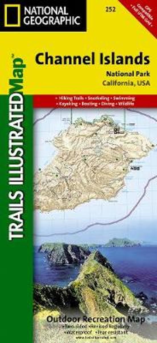
- Channel Islands National Park CA NGS Trails Illustrated Map 252
- Map No. 252, Channel Islands National Parkin California, at 1:25,000/1:50,000 in an extensive series of GPS compatible, contoured hiking maps of USA’s national and state parks or forests and other popular recreational areas. Cartography based on the national topographic survey, with additional tourist information.The maps, with most titles now... Read more
- Also available from:
- Bol.com, Netherlands
- Bol.com, Belgium
Bol.com
Netherlands
Netherlands
- Channel Islands National Park
- Waterproof Tear-Resistant Topographic MapThis two-sided map includes San Miguel Island, Santa Rosa Island, Santa Cruz Island, Santa Barbara Island, and Anacapa Island. The map combines beautiful cartography that shows the topology and natural features of each island, along with hiking trails, camping spots, rest areas, notable ship... Read more
Bol.com
Belgium
Belgium
- Channel Islands National Park
- Waterproof Tear-Resistant Topographic MapThis two-sided map includes San Miguel Island, Santa Rosa Island, Santa Cruz Island, Santa Barbara Island, and Anacapa Island. The map combines beautiful cartography that shows the topology and natural features of each island, along with hiking trails, camping spots, rest areas, notable ship... Read more

Ordnance Survey
United Kingdom
United Kingdom
- Ordnance Survey OS Wireless Heart Rate Monitor
- Measure and record your fitness with our wearable heart rate monitor. Whether you are a competitive athlete or need to consider your heart rate while working out for health reasons our wireless heart rate monitor can help you keep on track. Simple to pair with many compatible GPS devices you can get a recording when you want to track your... Read more
Bol.com
Netherlands
Netherlands
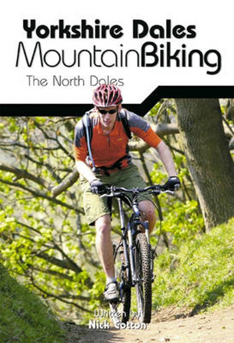
- Yorkshire Dales Mountain Biking
- This is a mountain biking guidebook to the Yorkshire Dales. Yorkshire Dales Mountain Biking - The North Dales is a user-friendly guide to the best riding in one of the country's most MTB-friendly national parks. The Yorkshire Dales have the lot: short riverside cruises on good trails, epic rides taking in big views, moorland singletrack and... Read more
- Also available from:
- Bol.com, Belgium
Bol.com
Belgium
Belgium
- Yorkshire Dales Mountain Biking
- This is a mountain biking guidebook to the Yorkshire Dales. Yorkshire Dales Mountain Biking - The North Dales is a user-friendly guide to the best riding in one of the country's most MTB-friendly national parks. The Yorkshire Dales have the lot: short riverside cruises on good trails, epic rides taking in big views, moorland singletrack and... Read more

Stanfords
United Kingdom
United Kingdom
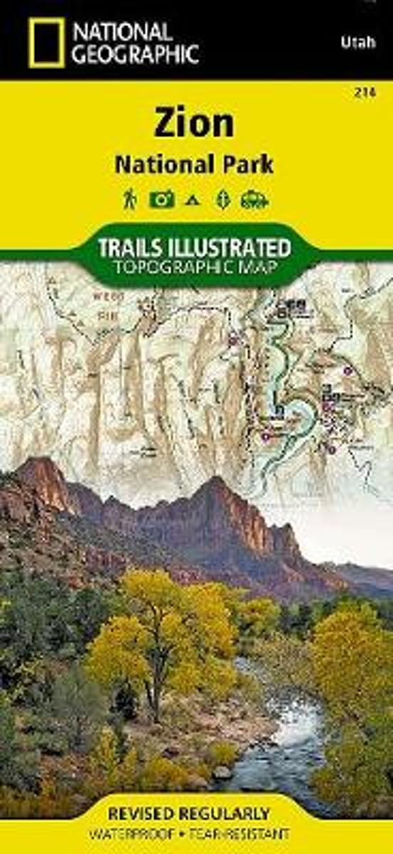
- Zion National Park UT NGS Trails Illustrated Map 214
- Map No. 214, Zion National Park, UT, in an extensive series of GPS compatible, contoured hiking maps of USA’s national and state parks or forests and other popular recreational areas. Cartography based on the national topographic survey, with additional tourist information.The maps, with most titles now printed on light, waterproof and... Read more
- Also available from:
- The Book Depository, United Kingdom
- Bol.com, Netherlands
- Bol.com, Belgium
- De Zwerver, Netherlands

Bol.com
Netherlands
Netherlands
- Zion National Park
- Waterproof Tear-Resistant Topographic MapExplore the beauty and geological wonder of Utah's first national park with National Geographic's Trails Illustrated map of Zion National Park. Created in partnership with local land management agencies, this expertly researched map combines unmatched detail with useful information to help you get... Read more
Bol.com
Belgium
Belgium
- Zion National Park
- Waterproof Tear-Resistant Topographic MapExplore the beauty and geological wonder of Utah's first national park with National Geographic's Trails Illustrated map of Zion National Park. Created in partnership with local land management agencies, this expertly researched map combines unmatched detail with useful information to help you get... Read more
.jpg)
De Zwerver
Netherlands
Netherlands
- Wandelkaart - Topografische kaart 214 Zion National Park | National Geographic
- Prachtige geplastificeerde kaart van het bekende nationaal park. Met alle recreatieve voorzieningen als campsites, maar ook met topografische details en wandelroutes ed. Door uitgekiend kleurgebruik zeer prettig in gebruik. Scheur en watervast! This National Geographic Trails Illustrated folded map offers comprehensive coverage of Zion National... Read more

Ordnance Survey
United Kingdom
United Kingdom
- ST&G's ST&G's Ludicrously Moreish Great British Food Map
- The Cheesiest map of Great Britain, brought to you by ST&G. Bursting full of over 2,000 food and drink locations, with a generous taste of trivia, this map will have you lusting after the variety of cuisine the Isles have to offer. Between Paddington's famous marmalade sandwiches to sandy seaside picnics, Britain has had a strange love affair... Read more
- Also available from:
- Ordnance Survey , United Kingdom

Ordnance Survey
United Kingdom
United Kingdom
- ST&G's ST&G's Ludicrously Moreish Great British Food Map
- The Cheesiest map of Great Britain, brought to you by ST&G. Bursting full of over 2,000 food and drink locations, with a generous taste of trivia, this map will have you lusting after the variety of cuisine the Isles have to offer. Between Paddington's famous marmalade sandwiches to sandy seaside picnics, Britain has had a strange love affair... Read more

Bol.com
Netherlands
Netherlands
- Tenerife Hikers Maps
- Our latest hiking research on Tenerife has resulted in new editions of Walk! Tenerife and Tenerife Hikers' Super-Durable Maps being published in 2017. Thanks to Jan Kostura's 2016 research we have several new hiking adventures described in detail in Walk! Tenerife. Jan's gps records of his research for new routes and updating of current routes... Read more
- Also available from:
- Bol.com, Belgium
Bol.com
Belgium
Belgium
- Tenerife Hikers Maps
- Our latest hiking research on Tenerife has resulted in new editions of Walk! Tenerife and Tenerife Hikers' Super-Durable Maps being published in 2017. Thanks to Jan Kostura's 2016 research we have several new hiking adventures described in detail in Walk! Tenerife. Jan's gps records of his research for new routes and updating of current routes... Read more
Ordnance Survey
United Kingdom
United Kingdom
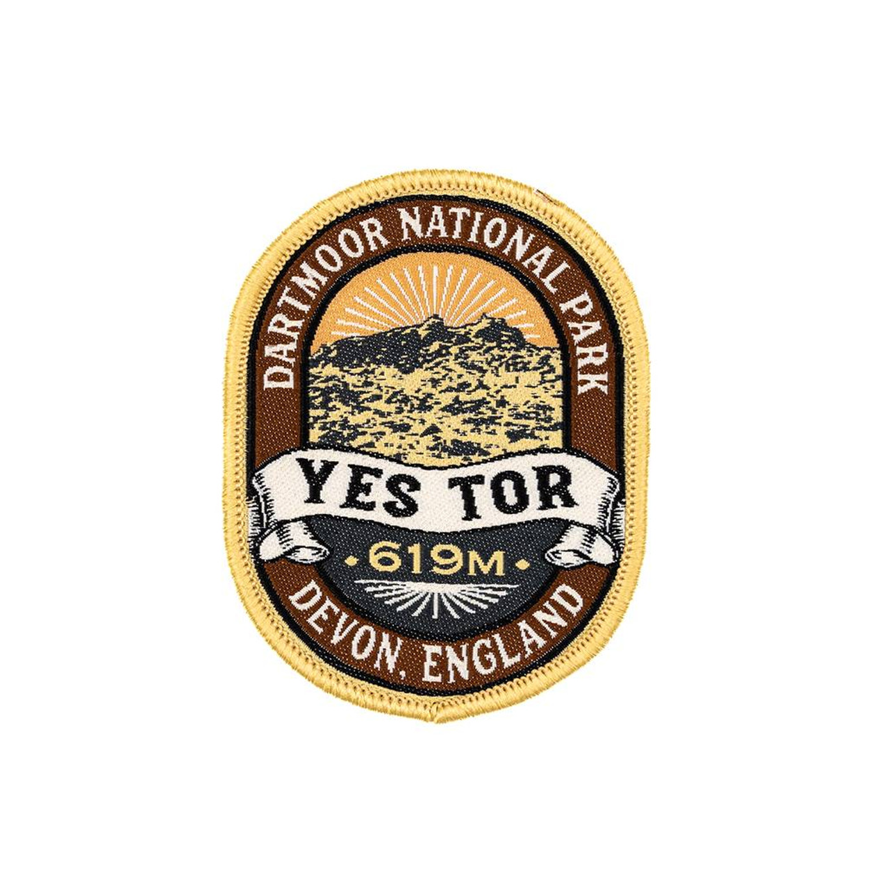
- The Adventure Patch Company Yes Tor Patch
- Woven patch celebrating one Dartmoor's second highest tor. Read more

Bol.com
Netherlands
Netherlands
- Wales Mountain Biking
- Wales Mountain Biking is the 12th title in Vertebrate Publishing's bestselling series of UK mountain biking guidebooks. This book showcases 20 routes in Wales, between 12km and 50km in length, suitable for all levels of mountain bikers. Split into three sections, South Wales, Mid Wales and North Wales, this book includes classic loops in the... Read more
- Also available from:
- Bol.com, Belgium
Bol.com
Belgium
Belgium
- Wales Mountain Biking
- Wales Mountain Biking is the 12th title in Vertebrate Publishing's bestselling series of UK mountain biking guidebooks. This book showcases 20 routes in Wales, between 12km and 50km in length, suitable for all levels of mountain bikers. Split into three sections, South Wales, Mid Wales and North Wales, this book includes classic loops in the... Read more

Stanfords
United Kingdom
2014
United Kingdom
2014
- Cape Wrath Trail South - Fort William to Strathcarron Harvey National Trail XT40
- The southern section of the Cape Wrath Trail, from Fort William to Strathcarron presented at 1:40,000 on a light, waterproof and tear-resistant map from Harvey Map Services. The map covers this section of the trail on eight panels, showing both the western variant via Inverie and Shiel Bridge, and inland route along Loch Lochy and Invegarry.... Read more
- Also available from:
- The Book Depository, United Kingdom
- Bol.com, Netherlands
- Bol.com, Belgium
- De Zwerver, Netherlands


Bol.com
Netherlands
2014
Netherlands
2014
- Cape Wrath Trail South XT40
- Cape Wrath Trail is a challenging route from Fort William to Cape Wrath. It is around 200 miles long and passes through some of Scotland's wildest and most spectacular scenery. The trail has evolved from use and is not an officially recognised National Trail. There is no single definitive route. There are various ways of tackling the traverse... Read more
Bol.com
Belgium
2014
Belgium
2014
- Cape Wrath Trail South XT40
- Cape Wrath Trail is a challenging route from Fort William to Cape Wrath. It is around 200 miles long and passes through some of Scotland's wildest and most spectacular scenery. The trail has evolved from use and is not an officially recognised National Trail. There is no single definitive route. There are various ways of tackling the traverse... Read more

De Zwerver
Netherlands
2014
Netherlands
2014
- Wandelkaart Cape Wrath Trail South | Harvey Maps
- The southern section of the Cape Wrath Trail, from Fort William to Strathcarron presented at 1:40,000 on a light, waterproof and tear-resistant map from Harvey Map Services. The map covers this section of the trail on eight panels, showing both the western variant via Inverie and Shiel Bridge, and inland route along Loch Lochy and Invegarry.... Read more
Ordnance Survey
United Kingdom
United Kingdom
- Ordnance Survey OS Maps Premium Annual Subscription
- Get unlimited access to detailed topographic mapping for the whole of Great Britain, Northern Ireland, USA, Australia and New Zealand with OS Maps Premium. OS Maps makes it easy to discover, plan and follow and explore routes in the great outdoors. Premium features include: Instant access to hundreds of maps That’s digital access to 607 OS... Read more
Bol.com
Netherlands
Netherlands
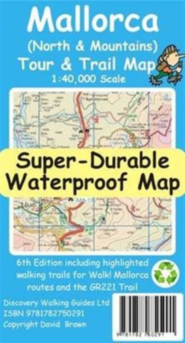
- Mallorca North & Mountains Tour & Trail Super-Durable Map
- Fully detailed Mallorca adventures with our new Mallorca North & Mountains Tour & Trail Super-Durable Map 6th edition by David Brawn and Walk! Mallorca guide book by Charles Davis. Our new 6th edition gives you a super detailed, up to date, map of the Tramuntana region stretching from Peguera-Costa Calma- Santa Ponca in the west then running... Read more
- Also available from:
- Bol.com, Belgium
Bol.com
Belgium
Belgium
- Mallorca North & Mountains Tour & Trail Super-Durable Map
- Fully detailed Mallorca adventures with our new Mallorca North & Mountains Tour & Trail Super-Durable Map 6th edition by David Brawn and Walk! Mallorca guide book by Charles Davis. Our new 6th edition gives you a super detailed, up to date, map of the Tramuntana region stretching from Peguera-Costa Calma- Santa Ponca in the west then running... Read more

Stanfords
United Kingdom
United Kingdom
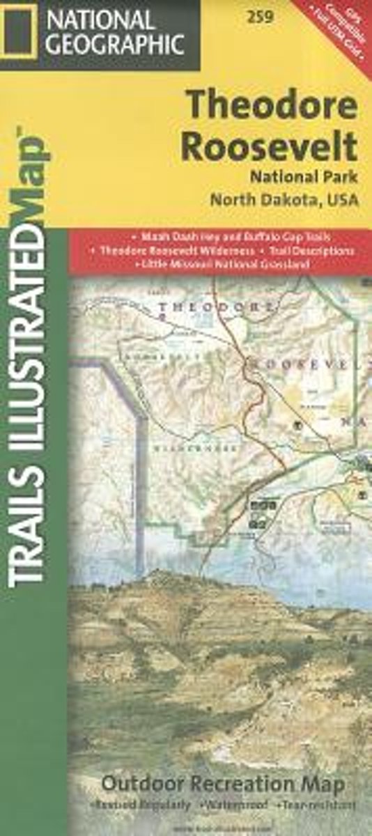
- Theodore Roosevelt National Park / Maah Daah Hey Trail ND
- Map No. 259, Theodore Roosevelt National Park/ Maah Daah Hey Trail in North Dakota, at 1:40,000 in an extensive series of GPS compatible, contoured hiking maps of USA’s national and state parks or forests and other popular recreational areas. Cartography based on the national topographic survey, with additional tourist information.The maps,... Read more
- Also available from:
- Bol.com, Netherlands
- Bol.com, Belgium
Bol.com
Netherlands
Netherlands
- Theodore Roosevelt National Park/maah Daah Hey Trail
- Get the most trusted and popular recreation maps available. Each map is crafted in conjunction with local land managers and undergoes rigorous review and enhancement before being printed on waterproof, tear-resistant material. The maps are updated regularly to include detailed topographic information, clearly marked/named trails, recreational... Read more
Bol.com
Belgium
Belgium
- Theodore Roosevelt National Park/maah Daah Hey Trail
- Get the most trusted and popular recreation maps available. Each map is crafted in conjunction with local land managers and undergoes rigorous review and enhancement before being printed on waterproof, tear-resistant material. The maps are updated regularly to include detailed topographic information, clearly marked/named trails, recreational... Read more