
Wellington
Description
Trails in this region
Links
Facts
Reports
Guides and maps
Lodging
Organisations
Tour operators
GPS
Other
Books

Stanfords
United Kingdom
United Kingdom
- New Zealand Traveler Guide
- This newly revised edition of National Geographic`s comprehensive New Zealand guide brings the visitor attractions, museums, hotels, restaurants, and ski resorts of this dynamic country right up to the moment. The Christchurch chapter has been fully updated to reflect the recovery and rebuilding after the earthquakes of 2010 and 2011, and a new... Read more

Stanfords
United Kingdom
United Kingdom
- DK Eyewitness Travel Guide New Zealand
- Discover New Zealand with this essential travel guide, designed to help you create your own unique trip and to transport you to this beautiful country before you`ve even packed your case. Hike up mountains and glaciers, taste world-class wines, go whale-watching or enjoy spectacular coastal drives - DK Eyewitness Travel Guide New Zealand covers... Read more

Stanfords
United Kingdom
United Kingdom
- On a Pedestal: A Trip around Britain`s Statues
- This is a book for people who are interested in statues... and for people who aren`t. It explores those immortalised in marble and bronze - and what the rest of us think about them. As Roger Lytollis travels Britain he encounters a man at Liverpool`s Beatles statue convinced that Rod Stewart was in the Fab Four. In Edinburgh he walks into a row... Read more

Stanfords
United Kingdom
2015
United Kingdom
2015
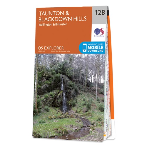
- Taunton & Blackdown Hills - Wellington & Ilminster OS Explorer Map 128 (paper)
- Taunton, Blackdown Hills, Wellington and Ilminster area on a detailed topographic and GPS compatible map No. 128, paper version, from the Ordnance Survey’s 1:25,000 Explorer series.MOBILE DOWNLOADS: this title and all the other OS Explorer maps include a code for downloading after purchase the digital version onto your smartphone or tablet for... Read more
- Also available from:
- The Book Depository, United Kingdom
- De Zwerver, Netherlands

De Zwerver
Netherlands
2015
Netherlands
2015

Stanfords
United Kingdom
United Kingdom
- Taunton & Blackdown Hills - Wellington & Ilminster OS Explorer Active Map 128 (waterproof)
- Taunton, Blackdown Hills, Wellington and Ilminster area on a detailed topographic and GPS compatible map No. 128, waterproof version, from the Ordnance Survey’s 1:25,000 Explorer series.MOBILE DOWNLOADS: this title and all the other OS Explorer maps include a code for downloading after purchase the digital version onto your smartphone or tablet... Read more
- Also available from:
- The Book Depository, United Kingdom


Bol.com
Netherlands
2016
Netherlands
2016
- Lonely Planet New Zealand's North Island dr 4
- Lonely Planet New Zealand's North Island is your passport to the most relevant, up-to-date advice on what to see and skip, and what hidden discoveries await you. Explore still-seething volcanos and bubbling mud pools, pull on your boots to tramp or kayak a Great Walk (yes, you can!) and learn how Maori culture is so much more than just rugby... Read more
- Also available from:
- Bol.com, Belgium
Bol.com
Belgium
2016
Belgium
2016
- Lonely Planet New Zealand's North Island dr 4
- Lonely Planet New Zealand's North Island is your passport to the most relevant, up-to-date advice on what to see and skip, and what hidden discoveries await you. Explore still-seething volcanos and bubbling mud pools, pull on your boots to tramp or kayak a Great Walk (yes, you can!) and learn how Maori culture is so much more than just rugby... Read more
Bol.com
Netherlands
Netherlands
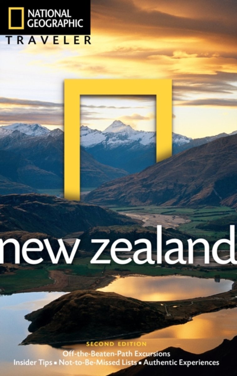
- National Geographic Traveler New Zealand
- Active travelers trust National Geographic to deliver what they want in a guidebook: expert advice, insider tips, and the cultural feel of each destination not easily found online. These guides are pitch-perfect for today's experiential travel enthusiasts who want an authentic, enriching immersion. From the heart of Auckland and Christchurch to... Read more
- Also available from:
- Bol.com, Belgium
Bol.com
Belgium
Belgium
- National Geographic Traveler New Zealand
- Active travelers trust National Geographic to deliver what they want in a guidebook: expert advice, insider tips, and the cultural feel of each destination not easily found online. These guides are pitch-perfect for today's experiential travel enthusiasts who want an authentic, enriching immersion. From the heart of Auckland and Christchurch to... Read more
Bol.com
Netherlands
2014
Netherlands
2014
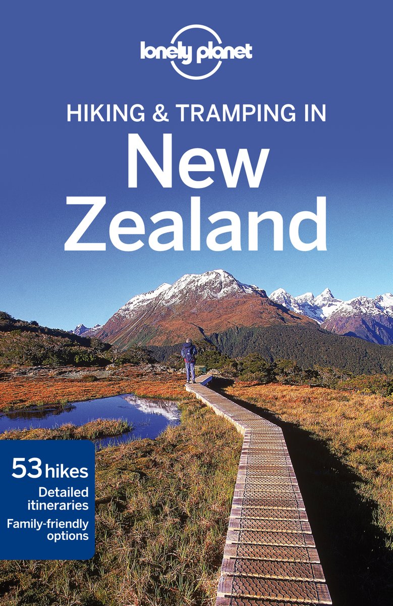
- Lonely Planet Tramping in New Zealand 7e Lonely Planet
- Lonely Planet: The world's leading travel guide publisher Lonely Planet Hiking & Tramping in New Zealand is your passport to all the most relevant and up-to-date advice on what to see, what to skip, and what hidden discoveries await you. Admire the dramatic peaks and valleys of Fiordland National Park, stroll past bays and beaches of the Abel... Read more
- Also available from:
- Bol.com, Belgium
Bol.com
Belgium
2014
Belgium
2014
- Lonely Planet Tramping in New Zealand 7e Lonely Planet
- Lonely Planet: The world's leading travel guide publisher Lonely Planet Hiking & Tramping in New Zealand is your passport to all the most relevant and up-to-date advice on what to see, what to skip, and what hidden discoveries await you. Admire the dramatic peaks and valleys of Fiordland National Park, stroll past bays and beaches of the Abel... Read more

Bol.com
Netherlands
2016
Netherlands
2016
- Lonely Planet New Zealand dr 18
- Lonely Planet: The world's leading travel guide publisher Lonely Planet New Zealand is your passport to the most relevant, up-to-date advice on what to see and skip, and what hidden discoveries await you. Experience Maori culture, be wowed by beautiful glaciers or hike through gorgeous scenery; all with your trusted travel companion. Get to the... Read more
- Also available from:
- Bol.com, Belgium
Bol.com
Belgium
2016
Belgium
2016
- Lonely Planet New Zealand dr 18
- Lonely Planet: The world's leading travel guide publisher Lonely Planet New Zealand is your passport to the most relevant, up-to-date advice on what to see and skip, and what hidden discoveries await you. Experience Maori culture, be wowed by beautiful glaciers or hike through gorgeous scenery; all with your trusted travel companion. Get to the... Read more
Bol.com
Netherlands
Netherlands
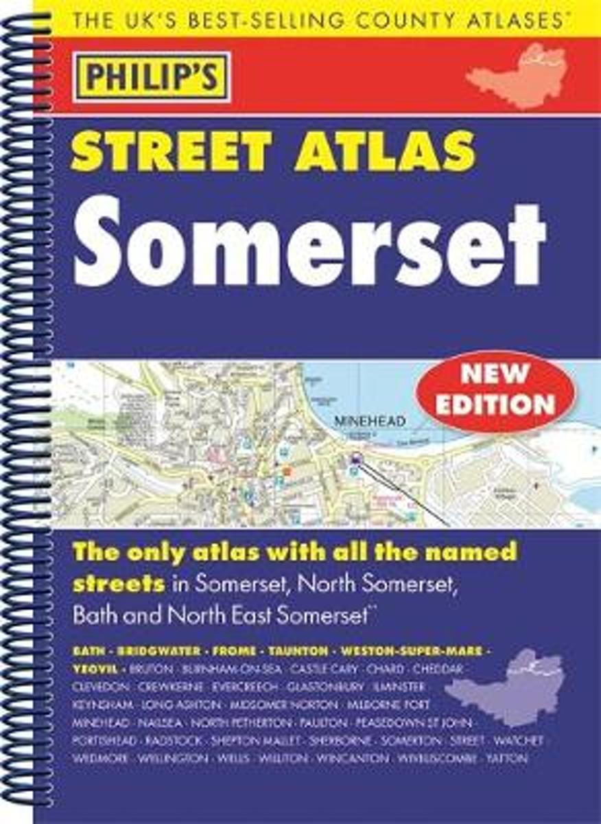
- Philip's Street Atlas Somerset
- THE ONLY COUNTY STREET ATLAS WITH ALL THE NAMED STREETS OF SOMERSET.The UK's best-selling county street atlasesMore than 24,000 named streets, roads, lanes and alleysThe essential map book for residents and visitors - and if you're moving to SomersetIncludes all the streets in BATH, BRIDGWATER, FROME, TAUNTON, WESTON-SUPER-MARE, YEOVIL, Bruton,... Read more
- Also available from:
- Bol.com, Belgium
Bol.com
Belgium
Belgium
- Philip's Street Atlas Somerset
- THE ONLY COUNTY STREET ATLAS WITH ALL THE NAMED STREETS OF SOMERSET.The UK's best-selling county street atlasesMore than 24,000 named streets, roads, lanes and alleysThe essential map book for residents and visitors - and if you're moving to SomersetIncludes all the streets in BATH, BRIDGWATER, FROME, TAUNTON, WESTON-SUPER-MARE, YEOVIL, Bruton,... Read more
Bol.com
Netherlands
Netherlands
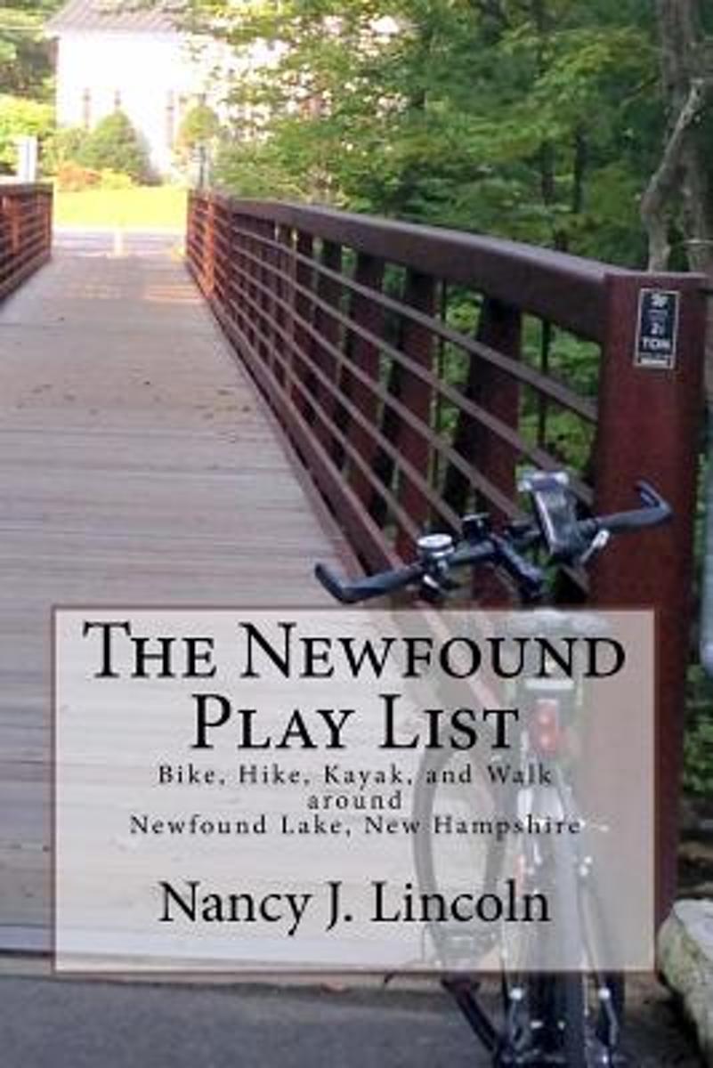
- The Newfound Play List
- Using the award-winning Wellington State Park on Newfound Lake in New Hampshire as home base, the author guides you around the Newfound Lake region encouraging you to "Come Play!" in her backyard.There are great descriptions with turn-by-turn directions for some of the best bike and kayak rides, hikes and walks. Great travel tips and local... Read more
- Also available from:
- Bol.com, Belgium
Bol.com
Belgium
Belgium
- The Newfound Play List
- Using the award-winning Wellington State Park on Newfound Lake in New Hampshire as home base, the author guides you around the Newfound Lake region encouraging you to "Come Play!" in her backyard.There are great descriptions with turn-by-turn directions for some of the best bike and kayak rides, hikes and walks. Great travel tips and local... Read more
Bol.com
Netherlands
Netherlands
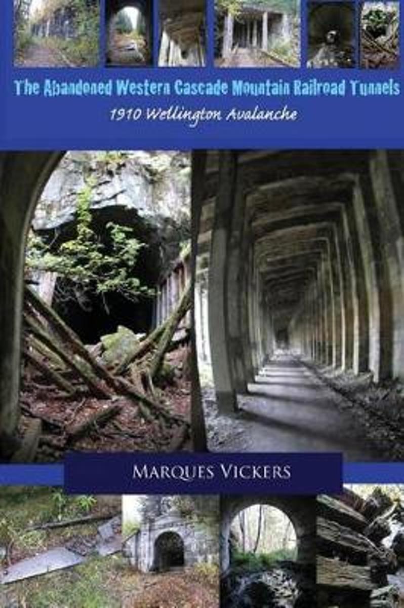
- The Abandoned Western Cascade Mountain Railroad Tunnels
- The creation of the train routes through the Western Washington Cascade Mountains proved a monumental challenge. The conflict arose between the engineering capabilities of man and the treacherous topography and inclimate weather of the region. The nine miles of track connecting the towns of Stevens Pass, Wellington and Scenic, Washington... Read more
- Also available from:
- Bol.com, Belgium
Bol.com
Belgium
Belgium
- The Abandoned Western Cascade Mountain Railroad Tunnels
- The creation of the train routes through the Western Washington Cascade Mountains proved a monumental challenge. The conflict arose between the engineering capabilities of man and the treacherous topography and inclimate weather of the region. The nine miles of track connecting the towns of Stevens Pass, Wellington and Scenic, Washington... Read more

Bol.com
Netherlands
Netherlands
- Lonely Planet New Zealand
- Lonely Planet: The world's leading travel guide publisher Lonely Planet New Zealand is your passport to the most relevant, up-to-date advice on what to see and skip, and what hidden discoveries await you. Experience Maori culture, be wowed by beautiful glaciers or hike through gorgeous scenery; all with your trusted travel companion. Get to the... Read more
- Also available from:
- Bol.com, Belgium
Bol.com
Belgium
Belgium
- Lonely Planet New Zealand
- Lonely Planet: The world's leading travel guide publisher Lonely Planet New Zealand is your passport to the most relevant, up-to-date advice on what to see and skip, and what hidden discoveries await you. Experience Maori culture, be wowed by beautiful glaciers or hike through gorgeous scenery; all with your trusted travel companion. Get to the... Read more
Bol.com
Netherlands
Netherlands
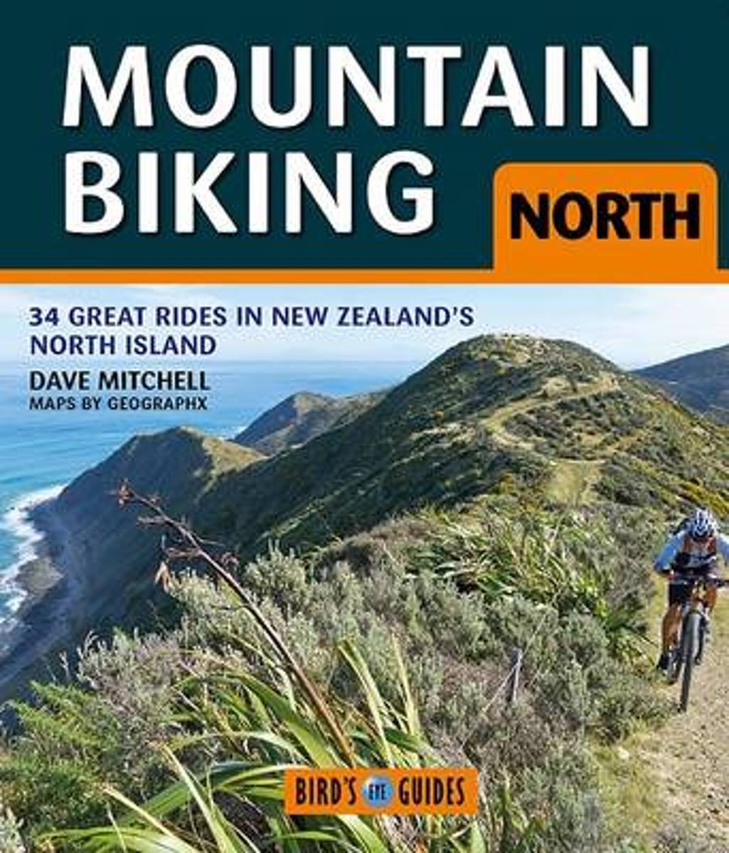
- Mountain Biking North
- New Zealand's North Island has a wide range of world-class mountain biking tracks and Mountain Biking North is a guide to 34 of the best of these rides. Selected by expert mountain biker and photographer Dave Mitchell, they range from straightforward and easy rides close to our urban areas, through to hard and challenging trips deep into the... Read more
- Also available from:
- Bol.com, Belgium
Bol.com
Belgium
Belgium
- Mountain Biking North
- New Zealand's North Island has a wide range of world-class mountain biking tracks and Mountain Biking North is a guide to 34 of the best of these rides. Selected by expert mountain biker and photographer Dave Mitchell, they range from straightforward and easy rides close to our urban areas, through to hard and challenging trips deep into the... Read more
Bol.com
Netherlands
Netherlands
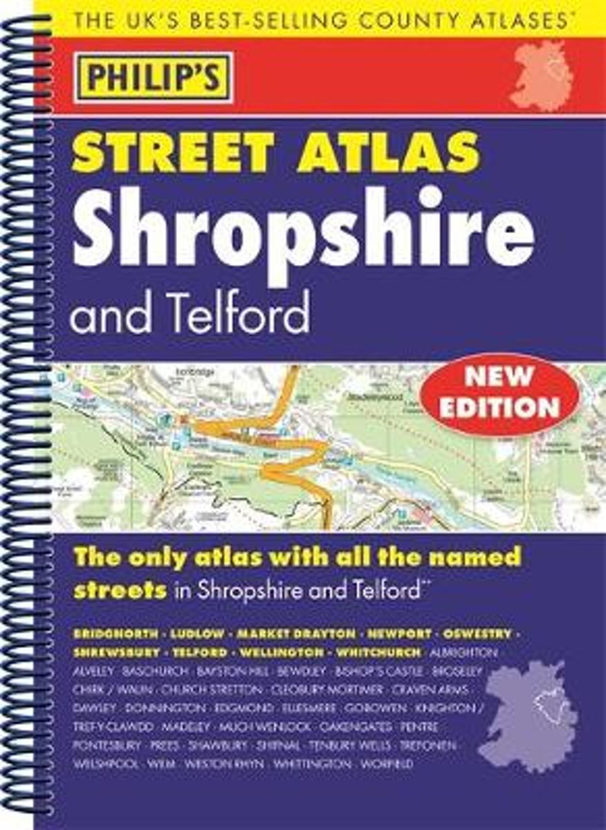
- Philip's Street Atlas Shropshire and Telford
- THE ONLY COUNTY STREET ATLAS WITH ALL THE NAMED STREETS OF SHROPSHIREThe UK's best-selling county street atlasesMore than 24,000 named streets, roads, lanes and alleysThe essential map book for residents and visitors - and if you're moving to ShropshireIncludes all the streets in BRIDGNORTH, LUDLOW, MARKET DRAYTON, NEWPORT, OSWESTRY,... Read more
- Also available from:
- Bol.com, Belgium
Bol.com
Belgium
Belgium
- Philip's Street Atlas Shropshire and Telford
- THE ONLY COUNTY STREET ATLAS WITH ALL THE NAMED STREETS OF SHROPSHIREThe UK's best-selling county street atlasesMore than 24,000 named streets, roads, lanes and alleysThe essential map book for residents and visitors - and if you're moving to ShropshireIncludes all the streets in BRIDGNORTH, LUDLOW, MARKET DRAYTON, NEWPORT, OSWESTRY,... Read more
Maps

Stanfords
United Kingdom
United Kingdom
- Minehead and Brendon Hills 1898-1900
- Map No. 181, Minehead and Brendon Hills 1898-1900, in the Cassini Historical Series of old Ordnance Survey mapping of England and Wales at 1:50,000 in a format designed to offer a convenient comparison with the present day coverage from the OS, and most locations in three different editions. Old historical maps have been combined so that the... Read more

Stanfords
United Kingdom
United Kingdom
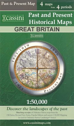
- Taunton and Wellington Past and Present
- Taunton and Wellington in the Cassini Past and Present map series which covers town and cities of England and Wales and offers a unique way of tracing their history and expansion by showing four different periods of their development using Ordnance Survey mapping from the mid-19th century, the late 19th century, the 1920s and the present day.... Read more
Stanfords
United Kingdom
United Kingdom
- Hereford and Leominster 1831-1833
- Map No. 149, Hereford and Leominster 1831-1833, in the Cassini Historical Series of old Ordnance Survey mapping of England and Wales at 1:50,000 in a format designed to offer a convenient comparison with the present day coverage from the OS, and most locations in three different editions. Old historical maps have been combined so that the sheet... Read more

Stanfords
United Kingdom
United Kingdom
- Exmoor & Taunton Cycling Map 84
- Exmoor and Taunton area of Devon and Somerset at 1:100,000 on a handy size, 50x35cm, double-sided contoured map from Croydecycle, printed on waterproof and tear-resistant synthetic paper and showing National Cycle routes and numerous local facilities, including campsites, pubs, etc. Coverage extends from Combe Martin, Barnstaple and South... Read more
Stanfords
United Kingdom
United Kingdom
- Stafford and Telford 1902
- Map No. 127, Stafford and Telford 1902, in the Cassini Historical Series of old Ordnance Survey mapping of England and Wales at 1:50,000 in a format designed to offer a convenient comparison with the present day coverage from the OS, and most locations in three different editions. Old historical maps have been combined so that the sheet lines... Read more
Stanfords
United Kingdom
United Kingdom
- Hereford and Leominster 1919-1920
- Map No. 149, Hereford and Leominster 1919-1920, in the Cassini Historical Series of old Ordnance Survey mapping of England and Wales at 1:50,000 in a format designed to offer a convenient comparison with the present day coverage from the OS, and most locations in three different editions. Old historical maps have been combined so that the sheet... Read more

Stanfords
United Kingdom
United Kingdom
- Cape Town - Western Cape Towns Map Studio Street Atlas
- Cape Town and Western Cape Towns Street Atlas from Map Studio at 1:20,000, in an A4 spiral-bound format, with coverage extending well beyond the city’s outer suburbs to the towns of the Cape Winelands and South-Western Cape. The atlas includes an enlargement of central Cape Town and a route-planning map of main roads across the region with... Read more
Stanfords
United Kingdom
United Kingdom
- Taunton and Lyme Regis 1809-1811
- Map No. 193, Taunton and Lyme Regis 1809-1811, in the Cassini Historical Series of old Ordnance Survey mapping of England and Wales at 1:50,000 in a format designed to offer a convenient comparison with the present day coverage from the OS, and most locations in three different editions. Old historical maps have been combined so that the sheet... Read more
Stanfords
United Kingdom
United Kingdom
- Stafford and Telford 1833-1921 (3-map set)
- Map No. 127, Stafford and Telford 1833-1921 (3-map set), in the Cassini Historical Series of old Ordnance Survey mapping of England and Wales at 1:50,000 in a format designed to offer a convenient comparison with the present day coverage from the OS, and most locations in three different editions. Old historical maps have been combined so that... Read more
Stanfords
United Kingdom
United Kingdom
- Presteigne and Hay-on-Wye / Llanandras a’r Gelli Gandryll 1919-1920
- Map No. 148, Presteigne and Hay-on-Wye / Llanandras a’r Gelli Gandryll 1819-1920, in the Cassini Historical Series of old Ordnance Survey mapping of England and Wales at 1:50,000 in a format designed to offer a convenient comparison with the present day coverage from the OS, and most locations in three different editions. Old historical maps... Read more

Stanfords
United Kingdom
United Kingdom
- New Zealand Kiwimaps Travel & Touring Map
- New Zealand at 1:1,700,000 from Kiwimaps on a handy size, double-sided map with street plans of city centres in main towns. North and South Island are presented separately and accompanied by a distance table, a map showing driving times between various locations, plus the relevant street plans.The road network highlights state highways and... Read more
Stanfords
United Kingdom
United Kingdom
- Minehead and Brendon Hills 1809
- Map No. 181, Minehead and Brendon Hills 1809, in the Cassini Historical Series of old Ordnance Survey mapping of England and Wales at 1:50,000 in a format designed to offer a convenient comparison with the present day coverage from the OS, and most locations in three different editions. Old historical maps have been combined so that the sheet... Read more
Stanfords
United Kingdom
United Kingdom
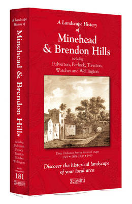
- Minehead and Brendon Hills 1809- 1919 (3-map set)
- Map No. 181, Minehead and Brendon Hills 1919, in the Cassini Historical Series of old Ordnance Survey mapping of England and Wales at 1:50,000 in a format designed to offer a convenient comparison with the present day coverage from the OS, and most locations in three different editions. Old historical maps have been combined so that the sheet... Read more
Stanfords
United Kingdom
United Kingdom
- Telford Past and Present
- Telford in the Cassini Past and Present map series which covers town and cities of England and Wales and offers a unique way of tracing their history and expansion by showing four different periods of their development using Ordnance Survey mapping from the mid-19th century, the late 19th century, the 1920s and the present day. Coverage... Read more
Stanfords
United Kingdom
United Kingdom
- Taunton and Lyme Regis 1919
- Map No. 193, Taunton and Lyme Regis 1919, in the Cassini Historical Series of old Ordnance Survey mapping of England and Wales at 1:50,000 in a format designed to offer a convenient comparison with the present day coverage from the OS, and most locations in three different editions. Old historical maps have been combined so that the sheet lines... Read more