
Stanfords
United Kingdom
- Tenby and Pembroke / Dinbych-y-pysgod & Penfro 1901-1902
- Map No. 158, Tenby and Pembroke / Dinbych-y-pysgod & Penfro 1901-1902, in the Cassini Historical Series of old Ordnance Survey mapping of England and Wales at 1:50,000 in a format designed to offer a convenient comparison with the present day coverage from the OS, and most locations in three different editions. Old historical maps have been... Read more
Stanfords
United Kingdom
- Gloucester and the Forest of Dean 1899-1900
- Map No. 162, Gloucester and the Forest of Dean 1899-1900, in the Cassini Historical Series of old Ordnance Survey mapping of England and Wales at 1:50,000 in a format designed to offer a convenient comparison with the present day coverage from the OS, and most locations in three different editions. Old historical maps have been combined so that... Read more
Stanfords
United Kingdom
- Kidderminster & Wyre Forest 1901-1902
- Map No. 138, Kidderminster and Wyre Forest 1901-1902, in the Cassini Historical Series of old Ordnance Survey mapping of England and Wales at 1:50,000 in a format designed to offer a convenient comparison with the present day coverage from the OS, and most locations in three different editions. Old historical maps have been combined so that the... Read more
Stanfords
United Kingdom
- Lleyn Peninsula / Pen Llyn 1922
- Map No. 123, Lleyn Peninsula / Pen Llyn 1922, in the Cassini Historical Series of old Ordnance Survey mapping of England and Wales at 1:50,000 in a format designed to offer a convenient comparison with the present day coverage from the OS, and most locations in three different editions. Old historical maps have been combined so that the sheet... Read more

Stanfords
United Kingdom
- Central Coast Suburban Streets NSW UBD Gregory`s 289
- Central Coast of New South Wales Suburban Streets map from UBD Gregory’s at 1:25,000 with coverage including Chain Valley Bay, Ourimbah, Kariong, Patonga, Terrigal, The Entrance and Wyee. The map is indexed and highlight various facilities and places of interest.To see a list of other street plans and directories from UBD Gregory`s please click... Read more
Stanfords
United Kingdom
- Reading and Windsor 1816-1830
- Map No. 175, Reading and Windsor 1818-1830, in the Cassini Historical Series of old Ordnance Survey mapping of England and Wales at 1:50,000 in a format designed to offer a convenient comparison with the present day coverage from the OS, and most locations in three different editions. Old historical maps have been combined so that the sheet... Read more
Stanfords
United Kingdom
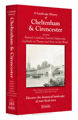
- Cheltenham and Cirencester 1828-1919 (3-map set)
- Map No. 163, Cheltenham and Cirencester 1828-1919 (3-map set), in the Cassini Historical Series of old Ordnance Survey mapping of England and Wales at 1:50,000 in a format designed to offer a convenient comparison with the present day coverage from the OS, and most locations in three different editions. Old historical maps have been combined so... Read more
Stanfords
United Kingdom
- Market Weighton 1824-1858
- Map No. 106, Market Weighton 1824-1858, in the Cassini Historical Series of old Ordnance Survey mapping of England and Wales at 1:50,000 in a format designed to offer a convenient comparison with the present day coverage from the OS, and most locations in three different editions. Old historical maps have been combined so that the sheet lines... Read more
Stanfords
United Kingdom
- Lleyn Peninsula / Pen Llyn 1903
- Map No. 123, Lleyn Peninsula / Pen Llyn 1903, in the Cassini Historical Series of old Ordnance Survey mapping of England and Wales at 1:50,000 in a format designed to offer a convenient comparison with the present day coverage from the OS, and most locations in three different editions. Old historical maps have been combined so that the sheet... Read more
Stanfords
United Kingdom
- Malton and Pickering 1903-1904
- Map No. 100, Malton and Pickering 1903-1904, in the Cassini Historical Series of old Ordnance Survey mapping of England and Wales at 1:50,000 in a format designed to offer a convenient comparison with the present day coverage from the OS, and most locations in three different editions. Old historical maps have been combined so that the sheet... Read more
Stanfords
United Kingdom
- Peterborough 1824-1836
- Map No. 142, Peterborough 1824-1836, in the Cassini Historical Series of old Ordnance Survey mapping of England and Wales at 1:50,000 in a format designed to offer a convenient comparison with the present day coverage from the OS, and most locations in three different editions. Old historical maps have been combined so that the sheet lines... Read more
Stanfords
United Kingdom
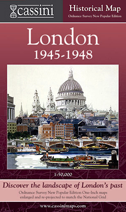
- London 1945-1948
- London in 1945-1948 in the Cassini Historical Series reproducing old Ordnance Survey mapping of England and Wales at 1:50,000. The four London maps cover roughly the area of the present day Greater London rather than following the format of rest of the series which is designed to correspond to the current Landranger maps. Mapping is identical... Read more
Stanfords
United Kingdom
- Canterbury and East Kent 1816-1819
- Map No. 179, Canterbury and East Kent 1816-1819, in the Cassini Historical Series of old Ordnance Survey mapping of England and Wales at 1:50,000 in a format designed to offer a convenient comparison with the present day coverage from the OS, and most locations in three different editions. Old historical maps have been combined so that the... Read more
Stanfords
United Kingdom
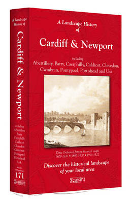
- Cardiff and Newport / Caerdydd & Casnewydd 1813-1922 (3-map set)
- Map No. 171, Cardiff and Newport / Caerdydd & Casnewydd 1813-1922 (3-map set), in the Cassini Historical Series of old Ordnance Survey mapping of England and Wales at 1:50,000 in a format designed to offer a convenient comparison with the present day coverage from the OS, and most locations in three different editions. Old historical maps have... Read more
Stanfords
United Kingdom
- Manchester 1923-1925
- Map No. 109, Manchester 1923-1925, in the Cassini Historical Series of old Ordnance Survey mapping of England and Wales at 1:50,000 in a format designed to offer a convenient comparison with the present day coverage from the OS, and most locations in three different editions. Old historical maps have been combined so that the sheet lines... Read more