
Stanfords
United Kingdom
- Canterbury and East Kent 1816-1819
- Map No. 179, Canterbury and East Kent 1816-1819, in the Cassini Historical Series of old Ordnance Survey mapping of England and Wales at 1:50,000 in a format designed to offer a convenient comparison with the present day coverage from the OS, and most locations in three different editions. Old historical maps have been combined so that the... Read more
Stanfords
United Kingdom
- Canterbury and East Kent 1920-1921
- Map No. 179, Canterbury and East Kent 1920-1921, in the Cassini Historical Series of old Ordnance Survey mapping of England and Wales at 1:50,000 in a format designed to offer a convenient comparison with the present day coverage from the OS, and most locations in three different editions. Old historical maps have been combined so that the... Read more
Stanfords
United Kingdom
- Canterbury and East Kent 1898-1899
- Map No. 179, Canterbury and East Kent 1898-1899, in the Cassini Historical Series of old Ordnance Survey mapping of England and Wales at 1:50,000 in a format designed to offer a convenient comparison with the present day coverage from the OS, and most locations in three different editions. Old historical maps have been combined so that the... Read more

Stanfords
United Kingdom
- Canterbury and East Kent 1816-1921 (3-map set)
- Map No. 179, Canterbury and East Kent 1816-1921 (3-map set), in the Cassini Historical Series of old Ordnance Survey mapping of England and Wales at 1:50,000 in a format designed to offer a convenient comparison with the present day coverage from the OS, and most locations in three different editions. Old historical maps have been combined so... Read more
Stanfords
United Kingdom
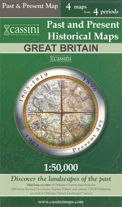
- Canterbury, Herne Bay and Whitstable Past and Present
- Canterbury, Herne Bay and Whitstable in the Cassini Past and Present map series which covers town and cities of England and Wales and offers a unique way of tracing their history and expansion by showing four different periods of their development using Ordnance Survey mapping from the mid-19th century, the late 19th century, the 1920s and the... Read more

Stanfords
United Kingdom
- North Downs Way A-Z Adventure Atlas
- North Downs Way Adventure Atlas at 1:25,000 in a series of handy A5 size Adventure Atlases from Geographers` A-Z Map Company with cartography from the Ordnance Survey’s Explorer series. The route from Farnham to Dover is presented with the alternative final sections, either via Canterbury or via Folkestone. To see other titles in this series... Read more

De Zwerver
Netherlands