
Glocknergruppe
Description

The Glocknergruppe forms the central part of the Hohe Tauern. The Grossglockner is Austria's highest mountain, 3,797 m. It is beautifully situated in one of Austria's wildest areas. This, of course, attracts many tourists, not only hikers and climbers, but also many day-trippers who pass through the Hochalpenstrasse. You've been warned.
The Grossglockner itself is not exactly a walkers mountain. For those who are fairly trained in ice and rock, it is still a challenging summit. If you do choose to go up, and reconciles oneself to line up under the summit, it would be just as nice to start in Heiligenblut. This is where, more than 200 years ago, the first successful climbers gathered.
The area, allthough it is not particularly large, lends itself to a fine trek. The most obvious route would be to start in Kaprun, walk south, and combine both the Glocknergruppe and Schobergruppe into a hut-hopping tour lasting for a week. This tough walk can be made without any dangerous glacier crossings.
Map

Trails in this region
Links
Facts
Reports
Guides and maps
Lodging
Organisations
Tour operators
GPS
Other
Books

Netherlands
2008
- Wandelgids Arnoweg - Der Salzburger Rundwanderweg | Rother Bergverlag
- Dieser gemeinsam mit dem Tourismusverband SalzburgerLand herausgegebene Wanderführer beschreibt detailliert alle Etappen des erst 1999 aus der Taufe gehobenen Arnowegs. Anlaß für die Errichtung dieses Weitwanderwegs war das 1200jährige Jubiläum der Erzdiözese Salzburg, 798 nämlich wurde Bischof Arno zum Erzbischof dieser großen Kirchenprovinz... Read more
Netherlands
- Glockner- Und Granatspitzgruppe
- Der Großglockner, Primus inter pares im Land der Berge, übt seit jeher auf Alpinisten aller Herren Länder eine ungebrochen magische Anziehungskraft aus. Und in der Tat bieten seine Grate, Flanken und Wände immer noch Traumziele und Höhepunkte eines Bergsteigerlebens und brauchen einen Vergleich mit westalpinen Größen wie Jungfrau, Matterhorn... Read more
- Also available from:
- Bol.com, Belgium
Belgium
- Glockner- Und Granatspitzgruppe
- Der Großglockner, Primus inter pares im Land der Berge, übt seit jeher auf Alpinisten aller Herren Länder eine ungebrochen magische Anziehungskraft aus. Und in der Tat bieten seine Grate, Flanken und Wände immer noch Traumziele und Höhepunkte eines Bergsteigerlebens und brauchen einen Vergleich mit westalpinen Größen wie Jungfrau, Matterhorn... Read more
Netherlands
2016
- WF5620 Oost-Tirol Kompass
- De Kompass wandelgids + kaart geeft een overzicht van alle wandelroutes in het gebied met nauwkeurige routeaanwijzingen en hoogteaanduidingen, De extra grote kaart, schaal 1:35 000, is ideaal om van te voren uw route uit te stippelen en om onderweg te gebruiken • naast de bekende bestemmingen, worden ook de minder bekende vermeld • openbaar... Read more
- Also available from:
- Bol.com, Belgium
Belgium
2016
- WF5620 Oost-Tirol Kompass
- De Kompass wandelgids + kaart geeft een overzicht van alle wandelroutes in het gebied met nauwkeurige routeaanwijzingen en hoogteaanduidingen, De extra grote kaart, schaal 1:35 000, is ideaal om van te voren uw route uit te stippelen en om onderweg te gebruiken • naast de bekende bestemmingen, worden ook de minder bekende vermeld • openbaar... Read more
Netherlands
2019
- Wandelgids Kärnten - Karinthië | Rother Bergverlag
- Kärnten, am südöstlichen Rand des weiten Alpenbogens gelegen, wartet mit einer Vielzahl an spannenden Tourenmöglichkeiten auf. Von den Firngipfeln der Hohen Tauern über die runden, grasbewachsenen Nockberge bis zu den schroffen Kalkfelsen der Karnischen Alpen und der Karawanken warten vielfältige landschaftliche Höhepunkte darauf entdeckt zu... Read more
Netherlands
2024
- Wandelgids Glockner-Region | Rother Bergverlag
- Uitstekende wandelgids met een groot aantal dagtochten in dal en hooggebergte. Met praktische informatie en beperkt kaartmateriaal! Wandelingen in verschillende zwaarte weergegeven in rood/blauw/zwart. Der höchste und wohl schönste Berg Österreichs, der Großglockner, bildet die spektakuläre Kulisse für ein außergewöhnlich reizvolles... Read more
Netherlands
2015
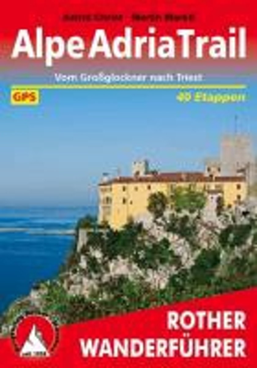
- Alpe-Adria-Trail
- Lange afstandswandelpad van 700km, onderverdeeld in 40 etappes van de Grossglockner in Karinthië door Slovenië en Friuli-Venezia Giulia naar Trieste. Deze handzame wandelgids bevat de routebeschrijving met wandelroutekaarten, hoogteprofielen en praktische informatie.Duitstalig 40 Höhenprofile, 40 Wanderkärtchen im Maßstab 1:75.000, eine... Read more
- Also available from:
- Bol.com, Belgium
Belgium
2015
- Alpe-Adria-Trail
- Lange afstandswandelpad van 700km, onderverdeeld in 40 etappes van de Grossglockner in Karinthië door Slovenië en Friuli-Venezia Giulia naar Trieste. Deze handzame wandelgids bevat de routebeschrijving met wandelroutekaarten, hoogteprofielen en praktische informatie.Duitstalig 40 Höhenprofile, 40 Wanderkärtchen im Maßstab 1:75.000, eine... Read more
Netherlands
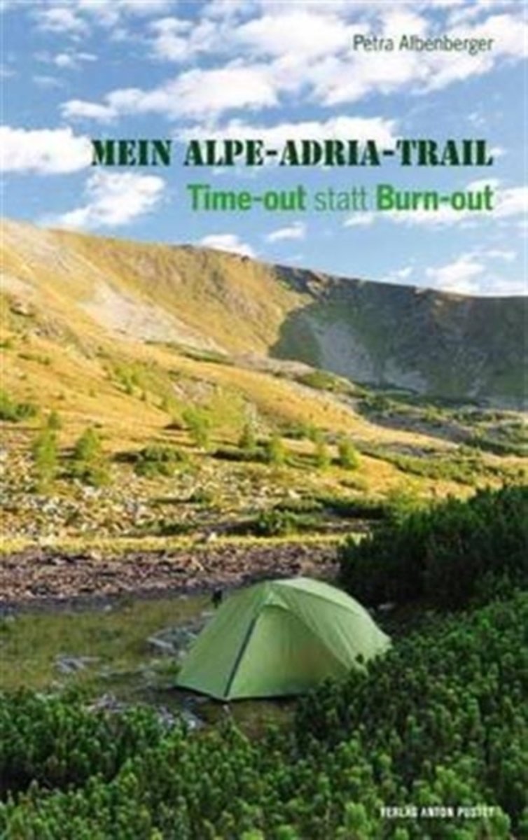
- Mein Alpe-Adria-Trail [Alpe Adria - Trail]
- In einer Welt voll Geschwindigkeit und Leistungsdruck zerbrechen immer mehr Menschen an ihrer Lebenssituation. Depression und Burn-out sind die Folgen. ''Wie komme ich da wieder raus?'' Petra Albenberger hat sich getraut, einfach ihre sieben Sachen zu packen, sich eine Auszeit zu nehmen und von zu Hause in Wals ber die Alpen und den Gro... Read more
- Also available from:
- Bol.com, Belgium
Belgium
- Mein Alpe-Adria-Trail [Alpe Adria - Trail]
- In einer Welt voll Geschwindigkeit und Leistungsdruck zerbrechen immer mehr Menschen an ihrer Lebenssituation. Depression und Burn-out sind die Folgen. ''Wie komme ich da wieder raus?'' Petra Albenberger hat sich getraut, einfach ihre sieben Sachen zu packen, sich eine Auszeit zu nehmen und von zu Hause in Wals ber die Alpen und den Gro... Read more

United Kingdom
2010
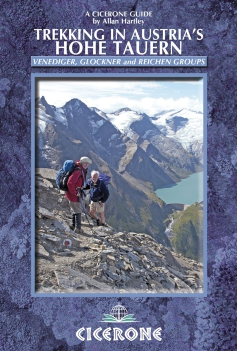
- Austria Hohe Tauern Trekking
- Trekking in Austria’s Hohe Tauern is Allan Hartley’s Cicerone guide to walks in the Venediger, Glockner and Reichen mountain groups. The book describes five longer distance routes; four separate multi-day treks and a ten day traverse of the region. Detailed introductory information and preparation tips are included, whilst the options in the... Read more
- Also available from:
- The Book Depository, United Kingdom
- Bol.com, Netherlands
- Bol.com, Belgium

United Kingdom
2010
- Trekking in Austria's Hohe Tauern
- Venediger, Glockner and Reichen Groups Read more
Netherlands
2010
- Trekking in Austria's Hohe Tauern
- Situated in the heart of Austria and the Eastern Alps, the Hohe Tauern National Park is the largest in Europe and a World Conservation Area, taking in the Tyrol, Salzburg and Karnten. The area boasts dramatic valleys headed by scores of peaks and hikers are well supported by some of the best huts in the Alps. The Park is centered on the Gross... Read more
Belgium
2010
- Trekking in Austria's Hohe Tauern
- Situated in the heart of Austria and the Eastern Alps, the Hohe Tauern National Park is the largest in Europe and a World Conservation Area, taking in the Tyrol, Salzburg and Karnten. The area boasts dramatic valleys headed by scores of peaks and hikers are well supported by some of the best huts in the Alps. The Park is centered on the Gross... Read more

Netherlands
2016
- Wandelgids Tauern-Höhenweg | Rother Bergverlag
- Uitstekende beschrijvingen van deze steeds populairder wordende bergtocht! Met alle noodzakelijke info. Zie voor beschrijving de duitse tekst hieronder ..... Nicht nur im Bann von Großglockner und Großvenediger erstreckt sich auf einer Gesamtlänge von etwa 200 Kilometern der Tauern-Höhenweg, der alle Gebirgsgruppen der Niederen und Hohen Tauern... Read more
Maps

United Kingdom
- Grossglockner - Sonnblick - Kaprun - Zell am See F&B WK120
- Grossglockner - Sonnblick - Kaprun - Zell am See area of the Austrian Alps presented at 1:50,000 in a series of contoured and GPS compatible outdoor leisure map from Freytag & Berndt with hiking and cycling routes, mountain huts, campsites and youth hostels, local bus stops, plus other tourist information.To see the list of currently available... Read more

United Kingdom
- Glocknergruppe - Matrei - Kals - Heiligenblut Tabacco 076
- This Tabacco topographic map at 1:25,000 (1cm = 250m) covers the Alta Via routes, as well as the Via Ferrata where you get further than the ordinary walker with the help of steel ladders. Additional information includes: symbols to indicate 6 different types of accommodation from mountain hut, hotel to camping site. As well as information on... Read more
- Also available from:
- The Book Depository, United Kingdom
- De Zwerver, Netherlands


United Kingdom
- Lienz Dolomites - Lesachtal - Villgratner Berge F&B WK182
- Lienz Dolomites - Lesachtal area of Carinthia presented at 1:50,000 in a series of contoured and GPS compatible outdoor leisure map from Freytag & Berndt with hiking and cycling routes, mountain huts, campsites and youth hostels, local bus stops, plus other tourist information.To see the list of currently available titles in this series please... Read more
- Also available from:
- The Book Depository, United Kingdom

United Kingdom
- Lienz Dolomites - Lesachtal - Villgratner Mountains Hiking + Leisure Map 1:50 000
- Lienz Dolomites - Lesachtal area of Carinthia presented at 1:50,000 in a series of contoured and GPS compatible outdoor leisure map from Freytag & Berndt with hiking and cycling routes, mountain huts, campsites and youth hostels, local bus stops, plus other tourist information.To see the list of currently available titles in this series please... Read more

United Kingdom
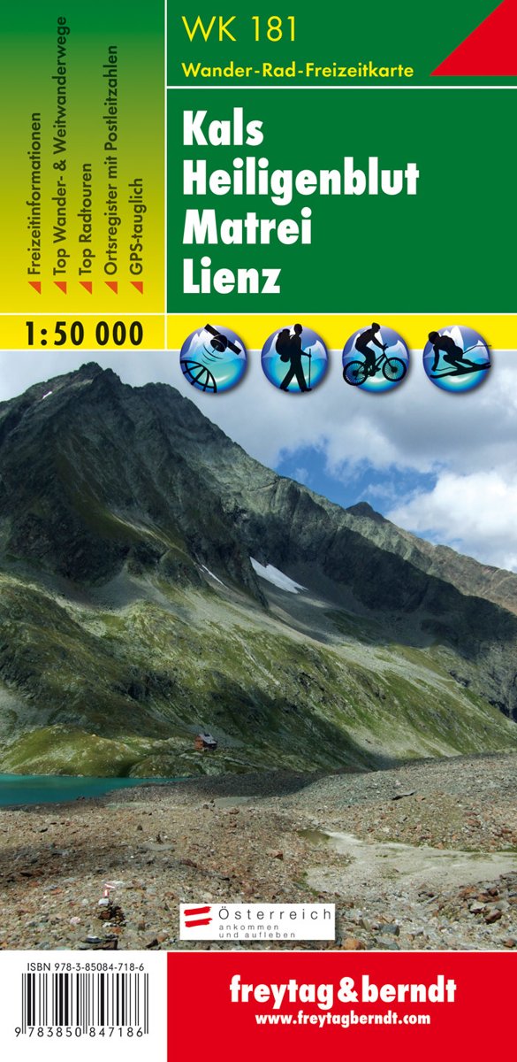
- Kals - Heiligenblut - Matrei - Lienz F&B WK181
- Kals - Heiligenblut - Matrei - Lienz area of the Austrian Alps presented at 1:50,000 in a series of contoured and GPS compatible outdoor leisure map from Freytag & Berndt with hiking and cycling routes, mountain huts, campsites and youth hostels, local bus stops, plus other tourist information.To see the list of currently available titles in... Read more
- Also available from:
- The Book Depository, United Kingdom
- Bol.com, Netherlands
- Bol.com, Belgium

United Kingdom
- Kals - Heiligenblut - Matrei - Lienz Hiking + Leisure Map 1:50 000
- Kals - Heiligenblut - Matrei - Lienz area of the Austrian Alps presented at 1:50,000 in a series of contoured and GPS compatible outdoor leisure map from Freytag & Berndt with hiking and cycling routes, mountain huts, campsites and youth hostels, local bus stops, plus other tourist information.To see the list of currently available titles in... Read more
Netherlands
- FB WK181 Kals • Heiligenblut • Matrei • Lienz
- Fiets- en wandelkaart • schaal 1:50 000 • activiteiten gids • plaatsnamenregister met postcodes • fietspaden en mountainbikeroutes • vermelding GPS-punten • met ski- en langlaufroutes Read more
Belgium
- FB WK181 Kals • Heiligenblut • Matrei • Lienz
- Fiets- en wandelkaart • schaal 1:50 000 • activiteiten gids • plaatsnamenregister met postcodes • fietspaden en mountainbikeroutes • vermelding GPS-punten • met ski- en langlaufroutes Read more

United Kingdom
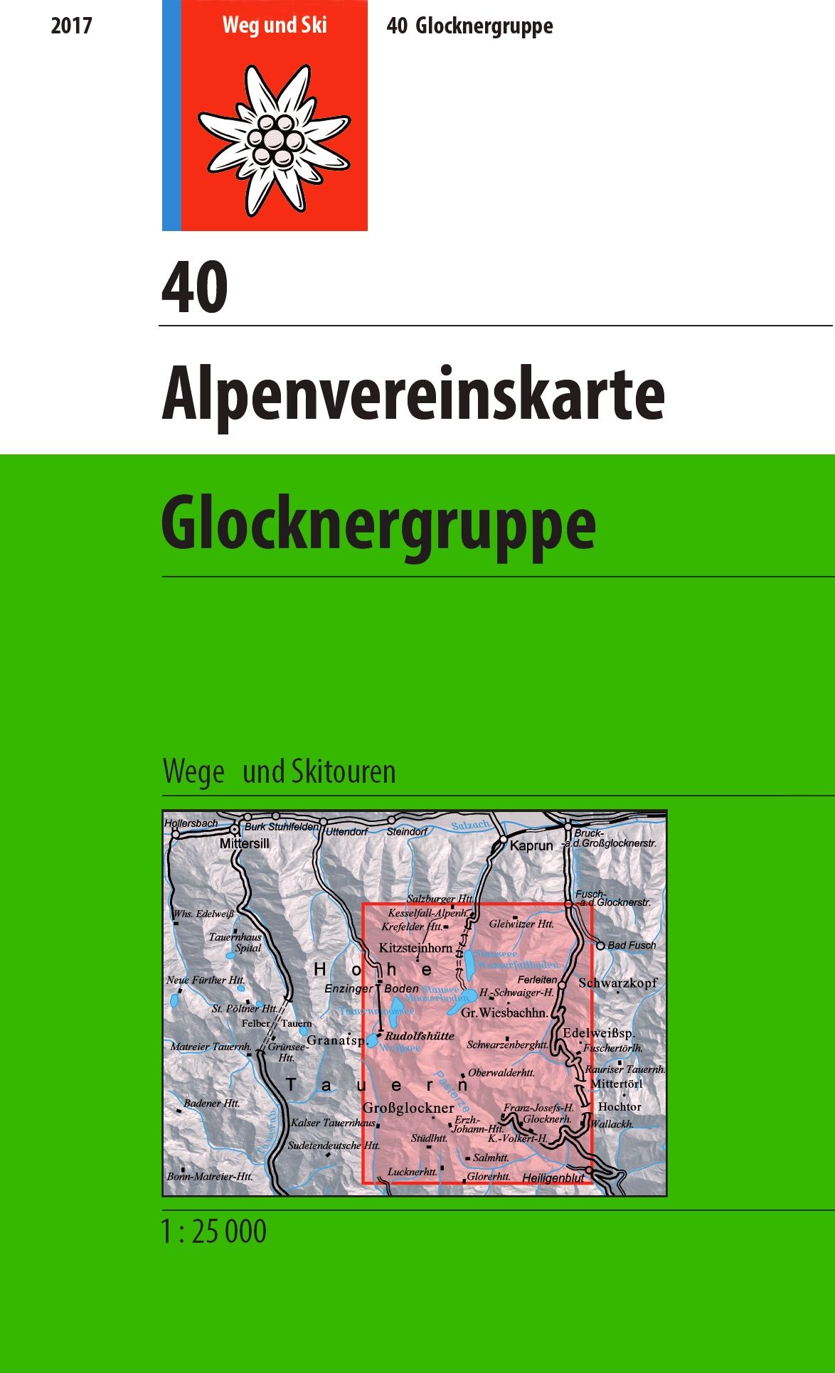
- Glocknergruppe Alpenverein KOMBI Map 40
- Glocknergruppe area of the Alps in a hiking edition at 1:25,000 from a series of detailed, GPS compatible maps published by the DAV - Deutscher Alpenverein and produced by the German and Austrian Alpine Clubs using cartography from their respective survey organizations. Maps in this series have topography vividly presented by contours at 20... Read more
- Also available from:
- De Zwerver, Netherlands
Netherlands
- Wandelkaart 40 Alpenvereinskarte Glocknergruppe | Alpenverein
- Glocknergruppe area of the Alps in a hiking edition at 1:25,000 from a series of detailed, GPS compatible maps published by the DAV - Deutscher Alpenverein and produced by the German and Austrian Alpine Clubs using cartography from their respective survey organizations. Maps in this series have topography vividly presented by contours at 20... Read more

United Kingdom
- Bregenz Forest F&B WK364
- Bregenz - Bregenzerwald area of the Austrian Alps presented at 1:50,000 in a series of contoured and GPS compatible outdoor leisure map from Freytag & Berndt with hiking and cycling routes, mountain huts, campsites and youth hostels, local bus stops, plus other tourist information. To see the list of currently available titles in this series... Read more
- Also available from:
- The Book Depository, United Kingdom
- Bol.com, Netherlands
- Bol.com, Belgium

United Kingdom
- Bregenz Forest Hiking + Leisure Map 1:50 000
- Bregenz - Bregenzerwald area of the Austrian Alps presented at 1:50,000 in a series of contoured and GPS compatible outdoor leisure map from Freytag & Berndt with hiking and cycling routes, mountain huts, campsites and youth hostels, local bus stops, plus other tourist information. To see the list of currently available titles in this series... Read more

Netherlands
- FB WK364 Bregenzerwald
- Aufgrund der übersichtlichen und detailgetreuen, digitalen Kartographie sowie der ideal gewählten Maßstäbe sind freytag & berndt Wanderkarten der perfekte Begleiter beim Wandern und Bergsteigen. Sie werden regelmäßig überarbeitet und enthalten aktualisierte Informationen zu Wanderwegen, Rad- und Mountainbikestrecken, Hütten, Naturdenkmälern,... Read more
Belgium
- FB WK364 Bregenzerwald
- Aufgrund der übersichtlichen und detailgetreuen, digitalen Kartographie sowie der ideal gewählten Maßstäbe sind freytag & berndt Wanderkarten der perfekte Begleiter beim Wandern und Bergsteigen. Sie werden regelmäßig überarbeitet und enthalten aktualisierte Informationen zu Wanderwegen, Rad- und Mountainbikestrecken, Hütten, Naturdenkmälern,... Read more
Netherlands
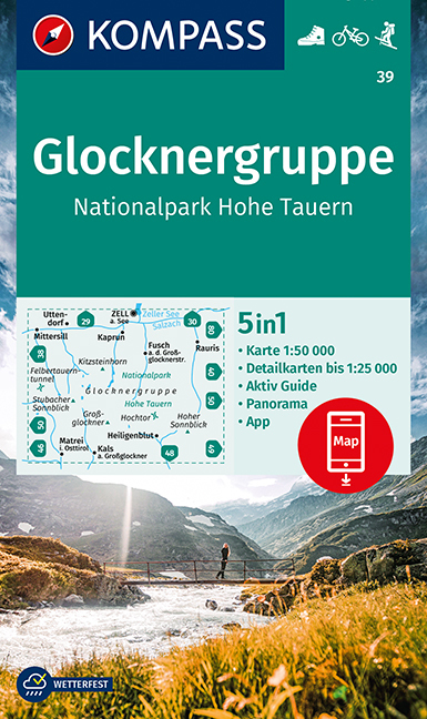
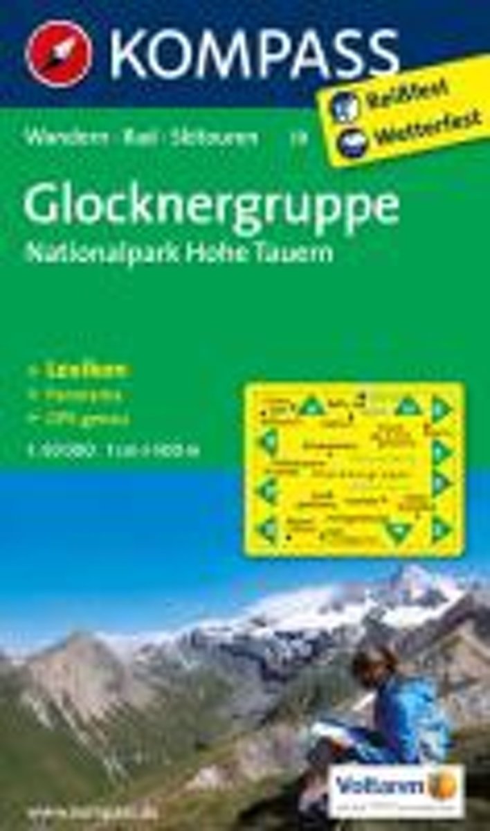
- Kompass WK39 Glocknergruppe, Nationalpark Hohe Tauern
- Deze Kompass wandelkaart, schaal 1:50 000, is ideaal om uw route uit te stippelen en om onderweg te gebruiken • naast de bekende bestemmingen, worden ook de minder bekende vermeld • openbaar vervoer bij begin- of eindpunt van een route aangegeven • eenvoudige wandelingen tot pittige (berg)tochten, voor getrainde en ongetrainde wandelaars • met... Read more
- Also available from:
- Bol.com, Belgium
Belgium
- Kompass WK39 Glocknergruppe, Nationalpark Hohe Tauern
- Deze Kompass wandelkaart, schaal 1:50 000, is ideaal om uw route uit te stippelen en om onderweg te gebruiken • naast de bekende bestemmingen, worden ook de minder bekende vermeld • openbaar vervoer bij begin- of eindpunt van een route aangegeven • eenvoudige wandelingen tot pittige (berg)tochten, voor getrainde en ongetrainde wandelaars • met... Read more