
GR65 - Via Podiensis
Description
- Name GR65 - Via Podiensis (GR65)
- Length of trail 740 km, 460 miles
- Length in days 30 days
- Start of trail Le Puy-en-Velay
- End of trail Ostabat
- Traildino grading MW, Moderate walk, backpacking trail
- Hut tour grading T1, Walk


 Via Podiensis, Le Puy-en-Velay - Ostabat, 740 km, 30 days
GR65, Geneva - Le Puy-en-Velay - Ostabat, 1090 km, 44 days
The Via Podiensis is one of the main pilgrim ways in France. The start is in Le Puy-en-Velay, and for about a month, pilgrims walk southwest till they hit the Pyrenees in Ostabat, Basque Country. The trail is very attractive, taking in some of the best parts of France, like the Causse, the Aubrac plateau, the volcanoes of Velay. The trail is also dotted with many churches, old towns and other monuments. Not surprisingly, this route is one of the most popular and busy pilgrim ways in France.
The walking association FFRP did a great job to mark the whole way white-red, and describe it in a topoguide. As a bonus, an extra itinerary between Geneva and Le Puy - the Via Gebennensis - has been added to the GR65. The GR65 continues into Spain, where it is better known as Camino Francés.
Did you know that the European Long Distance Trail E3 follows practically the same itinerary between Santiago de Compostela and Le Puy? It diverges in Le Puy from the GR65 and heads north.
Visit Traildino's overview page for the Way of Saint James / Camino de Santiago.
Map


Links
Facts
Reports
Guides and maps
Lodging
Organisations
Tour operators
GPS
Other
Books

United Kingdom
- Le Chemin du Vézelay: de la Bourgogne aux Pyrénéees
- Le Chemin du Vézelay: de la Bourgogne aux Pyrénéees covers the one of most popular routes of the Way of St. James in France, from the cathedral in Vézelay, across the La Charité-sur-Loire, Bourges, La Souterraine, Limoges, Périgueux, Ste-Foy-la-Grande, Bazas, Mont-de-Marsan and Orthez to Saint-Jean-Pied-de-Port.This title is part of a series of... Read more

United Kingdom
2015
- GR654 Chemins de St-Jacques: Vézelay - Périgueux FFRP Topo-guide No. 6542
- Chemins de St-Jacques: Vézelay - Périgueux, FFRP topoguide Ref. no. 6542, covering the 744km route along the GR654 the Way of St. Jamezs from Vézelay via Limoges to Périgueux. Current edition of this title was published in March 2015.ABOUT THE FFRP (Fédération française de la randonnée pédestre) TOPOGUIDES: published in a handy A5 paperback... Read more

United Kingdom
2019
- Sentiers de Saint-Jacques-de-Compostelle - Via Le Puy - Geneve - Le Puy GR65
- Chemins de St-Jacques: Geneva - Le Puy-en-Velay, FFRP topoguide Ref. No. 650, covering a 360km section of the GR65 along one of the routes of the Way of St. James across France. Current edition of this title was published in March 2016.ABOUT THE FFRP (Fédération française de la randonnée pédestre) TOPOGUIDES: published in a handy A5 paperback... Read more

United Kingdom
2016
- St-Jacques-de-Compostelle - Puy-en-Velay to Moissac GR65-1 IGN 89020
- Chemin de St-Jacques - the Way of St James in France along the GR65 between Le Puy-en-Velay and Moissac presented at 1:100,000 on a double-sided, waterproof and tear-resistant map from IGN with cartography from their highly popular TOP100 series. The route is prominently highlighted on contoured mapping and annotated with hiking distances.... Read more

United Kingdom
2016
- St-Jacques-de-Compostelle - Moissac to Roncevaux / Roncesvalles GR65-2 IGN 89021
- Chemin de St-Jacques - the Way of St James in France along the GR65 between Moissac and Roncevaux/Roncesvalles in the Spanish Pyrenees presented at 1:100,000 on a double-sided, waterproof and tear-resistant map from IGN with cartography from their highly popular TOP100 series. The route is prominently highlighted on contoured mapping and... Read more

United Kingdom
- Chemins de St.Jacques: Cluny/Lyon - Le Puy à pied
- Chemins de St.Jacques: Cluny/Lyon-Le Puy à pied from Chamina presents the route overprinted on IGN’s 1:50,000 topographic survey with details of accommodation, local services and other tourist information.Each stage is shown on extracts from IGN`s 1:50,000 topographic survey cross-referenced to the descriptions of the route. Symbols indicate... Read more

United Kingdom
2017
- Sentiers de St- Jacques via le Puy - Moissac to Roncevaux GR65
- Continuation and end of the Puy road, through Quercy, Béarn and Basque Country. More than 15 days of hiking.Chemins de St- Jacques: Moissac - Roncevaux (Roncesvalles), FFRP topoguide Ref. no. 653, covering the last, 345-km long section of the Way of St. James in France along the GR65 between Le Puy-en-Velay to the Spanish border. Current... Read more

United Kingdom
2012
- GR62B/GR36/GR46 Le Chemin de Conques à Toulouse FFRP Topo-guide No. 3646
- Le Chemin de Conques à Toulouse, FFRP topoguide Ref. no. 3646, covering 563kms of various GR routes in the region of Quercy and the Gorges of the Aveyron between Conques and Cahors in the north and Toulouse and Albi in the south: le Chemin de Conques à Toulouse along the GR62B, 36 and 46; GR 36 from Cahors to Albi; GR46 along the Gorges of the... Read more
United Kingdom
2018
- Sentiers de St-Jacques via le Puy - Le Puy to Figeac GR65
- Chemins de St-Jacques: Le Puy - Figeac, FFRP topoguide Ref. no. 651, covering a 252km section of the Way of St. James across the Massif Central from Le Puy-en-Velay to Figeac along the GR 65. Current edition of this title was published in August 2014.ABOUT THE FFRP (Fédération française de la randonnée pédestre) TOPOGUIDES: published in a handy... Read more
United Kingdom
2021
- Tour des Monts d`Aubrac GRP/GR60/GR6
- Tour des Monts d`Aubrac, FFRP topoguide Ref. No. 616, covering 259kms of hiking circuits in the Massif Central along the GR6, GR60 and GR65. Current edition of this title was published in May 2016.ABOUT THE FFRP (Fédération française de la randonnée pédestre) TOPOGUIDES: published in a handy A5 paperback format, the guides are the best... Read more
- Also available from:
- The Book Depository, United Kingdom


United Kingdom
2022
- Camino de Santiago - Via Podiensis
- Le Puy to the Pyrenees on the GR65 Read more
- Also available from:
- De Zwerver, Netherlands

Netherlands
2022
- Wandelgids Camino de Santiago - Via Podiensis GR65 | Cicerone
- Le Puy to the Pyrenees on the GR65 Read more

Netherlands
2023
Netherlands
2013
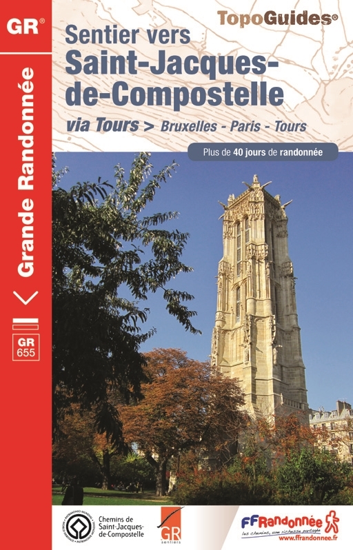
- Wandelgids 6551 Sentier vers Saint-Jacques-de-Compostela: Brussel - Parijs -Tours GR655 | FFRP
- Guide FFRandonnée Sentier vers Saint-Jacques-de-Compostelle : Bruxelles-Paris-Tours - 6551.La via Turonensis (ou voie de Tours/voie de Paris) est l'un des quatre chemins de France du pèlerinage de Saint-Jacques-de-Compostelle, le plus au nord. Voie la plus sereine et la plus ancienne, elle était historiquement la plus fréquentée.Au départ de... Read more

United Kingdom
2014
- GR653D Chemins de St-Jacques: Montgenèvre - Arles FFRP Topo-guide No. 6531
- Chemins de St-Jacques: Montgenèvre - Arles, FFRP topoguide Ref. no. 6531, covering a 459km route along the GR653D from Montgenèvre in the French Alps on the Italian border, across Gap, Sisteron, Apt and Cavaillon, to Arles. Current edition of this title was published in June 2014.ABOUT THE FFRP (Fédération française de la randonnée pédestre)... Read more
- Also available from:
- De Zwerver, Netherlands

Netherlands
2014
- Wandelgids - Pelgrimsroute 6531 Sentier vers Saint-Jacques-de-Compostelle : Montgenèvre - Arles GR653D | FFRP
- Guide FFRandonnée Sentier vers Saint-Jacques-de-Compostelle : Montgenèvre - Arles - GR 653D - 459 km de sentiers GR. La Voie d'Arles. Un chemin incontournable, à la fois itinéraire jacquaire et ancienne voie romaine, qui vous fera découvrir 4 départements aux paysages contrastés et au... Read more

Maps

United Kingdom
- Massif de la Vanoise IGN Wall Map
- Massif de la Vanoise presented on an encapsulated waterproof wall map, size 100 x 132cm (39.5” x 52” approx), with cartography of IGN’s excellent TOP25 series reduced slightly to 1:28,000. The map combines sections of TOP25 maps 3532ET, 3532OT, 3534OT, 3633ET and 3634OT to extend from Mâcot-la-Plagne and Aiguille Rouge in the north to Lac du... Read more

United Kingdom
2017
- Le Chemin du Piemont Pyreneen - vers Saint-Jacques-de-Compostell
- Le Chemin du Piémont Pyrénéen, FFRP topoguide, Ref. No. 780, covering the GR78 - the Way of St. James along the northern side of the Pyrenees from Carcassonne to Roncesvalles on the Spanish side, with an alternative variant to cross the mountains along the Col du Somport. Current edition of this title was published in May 2017.The route, the... Read more

Netherlands
2020
- Wandelatlas - Pelgrimsroute (kaart) 161 Chemins de Compostelle GR65 | Michelin
- Véritable petit atlas détaillant chaque étape avec indications précises concernant les villes de départ et d'arrivée ainsi que pour les localités traversées (auberges, refuges, restaurants, pharmacies, gare, épiceries, Km parcourus, Km restants....).Ce petit atlas suit le chemin du... Read more