
Lanzarote, Canarias
Description

Lanzarote is not a well-known hiking destination. Most people land on this Canary Island to enjoy sun and sea.
With a good map and some time you will find nice niches on this island. For instance the string of volcanic pimples in the black sea of solidified lava in the Parque Nacional de Timanfaya. Or the naked and arid hill ridges in the south. Also, the coastline has some nice corners, but for the endless string of holiday resorts.
Check the complete list of Canary Islands.
Map

Links
Facts
Reports
Guides and maps
Lodging
Organisations
Tour operators
GPS
Other
Books

Stanfords
United Kingdom
2013
United Kingdom
2013
- Lanzarote: Car Tours and Walks
- Lanzarote is the Sunflower Landscapes guide to exploring the best walking and touring possibilities on the island. The guide covers a range of routes including walks in La Graciosa, Maguez, Mancha Blanca, Yaiza and Lobos. A double-sided, fold-out touring map of Lanzarote gives an overview of the island and the locations of each walk. Detailed... Read more

Stanfords
United Kingdom
2015
United Kingdom
2015
- La Palma GERMAN
- This Rother Walking Guide to La Palma (ALL TEXT IS IN GERMAN), presents the hiker with 64 varied and entertaining tour suggestions incorporating every region on the island - the guide includes 112 colour photos and colour hiking maps at 1:50.000 or 1:100,000 scale, and an overview map for general planning at 1:250,000. From physically demanding... Read more

Stanfords
United Kingdom
United Kingdom
- Timanfaya National Park - Lanzarote CNIG Map-Guide SPANISH
- Timanfaya National Park on Lanzarote at 1:25,000 on a contoured and GPS compatible map from IGN/CNIG with cartography from their topographic survey of Spain. The map is accompanied by a SPANISH language guide with descriptions of walks, contact details for recommended accommodation, etc. The map has contours at 10m intervals enhanced by relief... Read more

Stanfords
United Kingdom
United Kingdom
- Timanfaya National Park - Lanzarote CNIG Map-Guide ENGLISH
- Timanfaya National Park on Lanzarote at 1:25,000 on a contoured and GPS compatible map from IGN/CNIG with cartography from their topographic survey of Spain. The map is accompanied by a 54-page English language guide with descriptions of walks, contact details for recommended accommodation, etc. The map has contours at 10m intervals enhanced by... Read more

Stanfords
United Kingdom
United Kingdom
- Lanzarote
- Realising that his New Year is probably going to be a disaster, as usual, our narrator, on impulse, walks into a travel agency to book a week in the sun. Sensitive to his limited means and dislike of Muslim countries, the travel agent suggests an island full of 21st century hedonism, set in a bizarre lunar landscape - Lanzarote. On Lanzarote,... Read more

Stanfords
United Kingdom
2019
United Kingdom
2019
- Trekking in the Canary Islands: The GR131 island-hopping route
- This guidebook provides a comprehensive and detailed description of the GR131, an island-hopping trail across the seven Canary Islands. The 560km (348 mile) route begins on Lanzarote and finishes on El Hierro and is presented in 32 daily stages. The route is well waymarked but some navigational skills are required, and the remote and occasional... Read more
- Also available from:
- The Book Depository, United Kingdom
- De Zwerver, Netherlands

The Book Depository
United Kingdom
2019
United Kingdom
2019
- Trekking in the Canary Islands
- The GR131 island-hopping route Read more

De Zwerver
Netherlands
2019
Netherlands
2019
- Wandelgids Trekking in the Canary Islands: The GR131 Island Hopping Route | Cicerone
- Guidebook to the GR131, an island-hopping trail that runs coast to coast across each of the 7 Canary Islands, a sub-tropical Spanish archipelago. Described over 32 stages, the route begins on Lanzarote, finishes on El Hierro, measures 560km (348 miles) and would take an average trekker about 1 month to complete. Read more

Stanfords
United Kingdom
2022
United Kingdom
2022
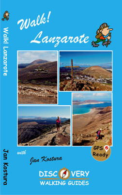
- Walk! Lanzarote
- Lanzarote`s most popular walking guide book just got even better. Walk! Lanzarote 5th edition builds on the reputation of our earlier editions with comprehensive updating so that it caters for the needs of the increasing number of people who would like to combine some walking with a holiday on the Fire island. Walk Lanzarote explodes the myth... Read more
- Also available from:
- The Book Depository, United Kingdom
- De Zwerver, Netherlands


Stanfords
United Kingdom
2022
United Kingdom
2022
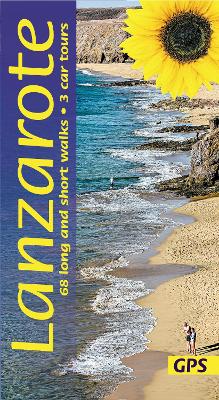
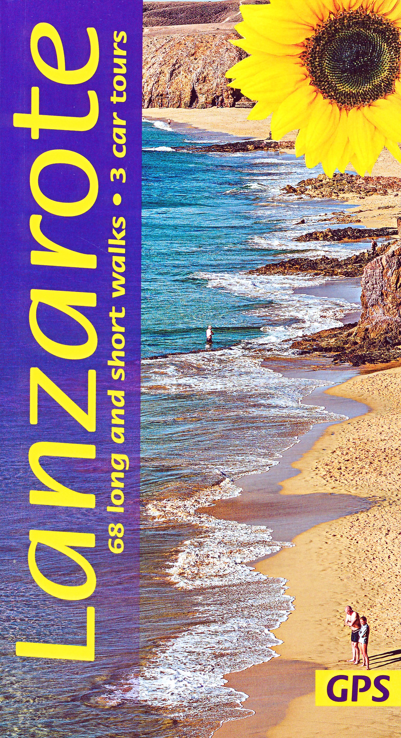
- Lanzarote Guide: 68 long and short walks with detailed maps and GPS; 3 car tours with pull-out map
- The go-to Lanzarote travel guide for discovering the best walks and car tours. Strap on your boots and discover Lanzarote on foot with the Sunflower Lanzarote travel guide. And on the days when your feet may have had enough, enjoy some spectacular scenery on one of our legendary car tours. The Sunflower Lanzarote guide is indispensable for... Read more
- Also available from:
- The Book Depository, United Kingdom
- De Zwerver, Netherlands
The Book Depository
United Kingdom
2022
United Kingdom
2022
- Lanzarote Guide: 68 long and short walks with detailed maps and GPS; 3 car tours with pull-out map
- The go-to Lanzarote travel guide for discovering the best walks and car tours. Strap on your boots and discover Lanzarote on foot with the Sunflower Lanzarote travel guide. And on the days when your feet may have had enough, enjoy some spectacular scenery on one of our legendary car tours. The Sunflower Lanzarote guide is indispensable for... Read more
De Zwerver
Netherlands
2022
Netherlands
2022
- Wandelgids Lanzarote | Sunflower books
- The go-to Lanzarote travel guide for discovering the best walks and car tours. Strap on your boots and discover Lanzarote on foot with the Sunflower Lanzarote travel guide. And on the days when your feet may have had enough, enjoy some spectacular scenery on one of our legendary car tours. The Sunflower Lanzarote guide is indispensable for... Read more

Stanfords
United Kingdom
2022
United Kingdom
2022
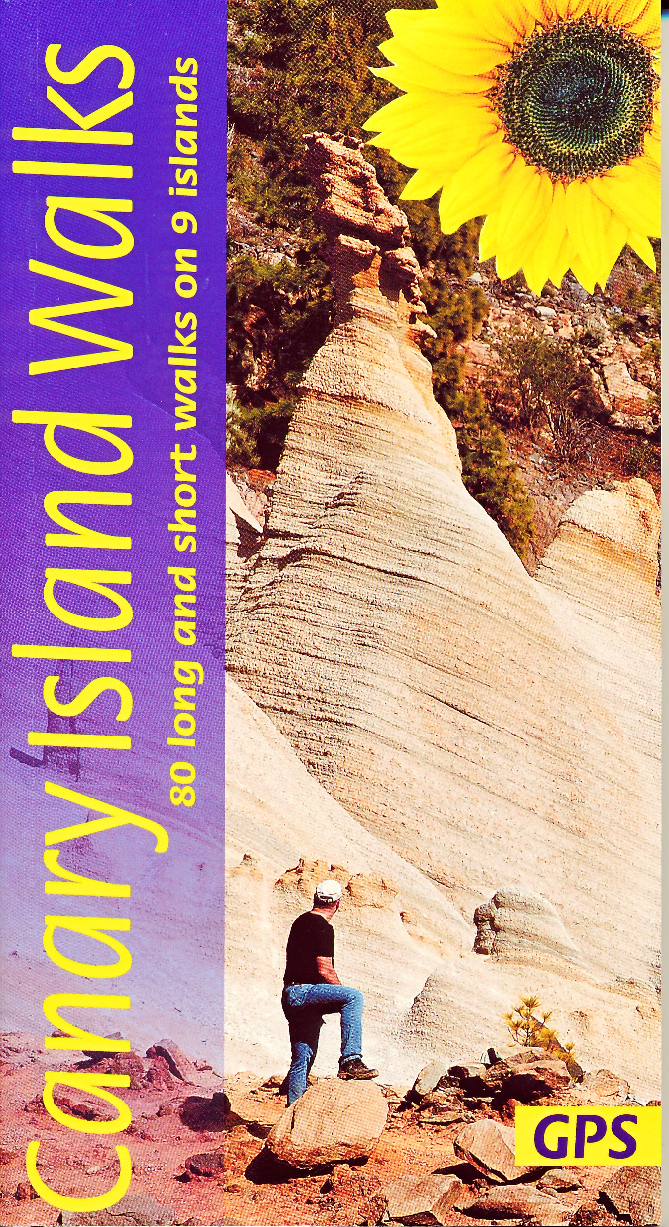
- Canary Islands Walks Sunflower Guide: 90 long and short walks on the Canary Islands
- The go-to travel guide for discovering the best walks on the Canary Islands; Strap on your boots and discover the Canary Islands on foot with the Sunflower Canary Islands Walks travel guide. The Sunflower Canary Islands Walks guide is indispensable for walking and hiking on all 7 Canary Islands - Tenerife, Gran Canaria, Lanzarote,... Read more
- Also available from:
- The Book Depository, United Kingdom
- De Zwerver, Netherlands

The Book Depository
United Kingdom
2022
United Kingdom
2022
- Canary Islands Walks Sunflower Guide
- 80 long and short walks on the Canary Islands Read more
De Zwerver
Netherlands
2022
Netherlands
2022
- Wandelgids Canary Islands Walks | Sunflower books
- The go-to travel guide for discovering the best walks on the Canary Islands; Strap on your boots and discover the Canary Islands on foot with the Sunflower Canary Islands Walks travel guide. The Sunflower Canary Islands Walks guide is indispensable for walking and hiking on all 7 Canary Islands - Tenerife, Gran Canaria, Lanzarote,... Read more

The Book Depository
United Kingdom
United Kingdom
Bol.com
Netherlands
Netherlands
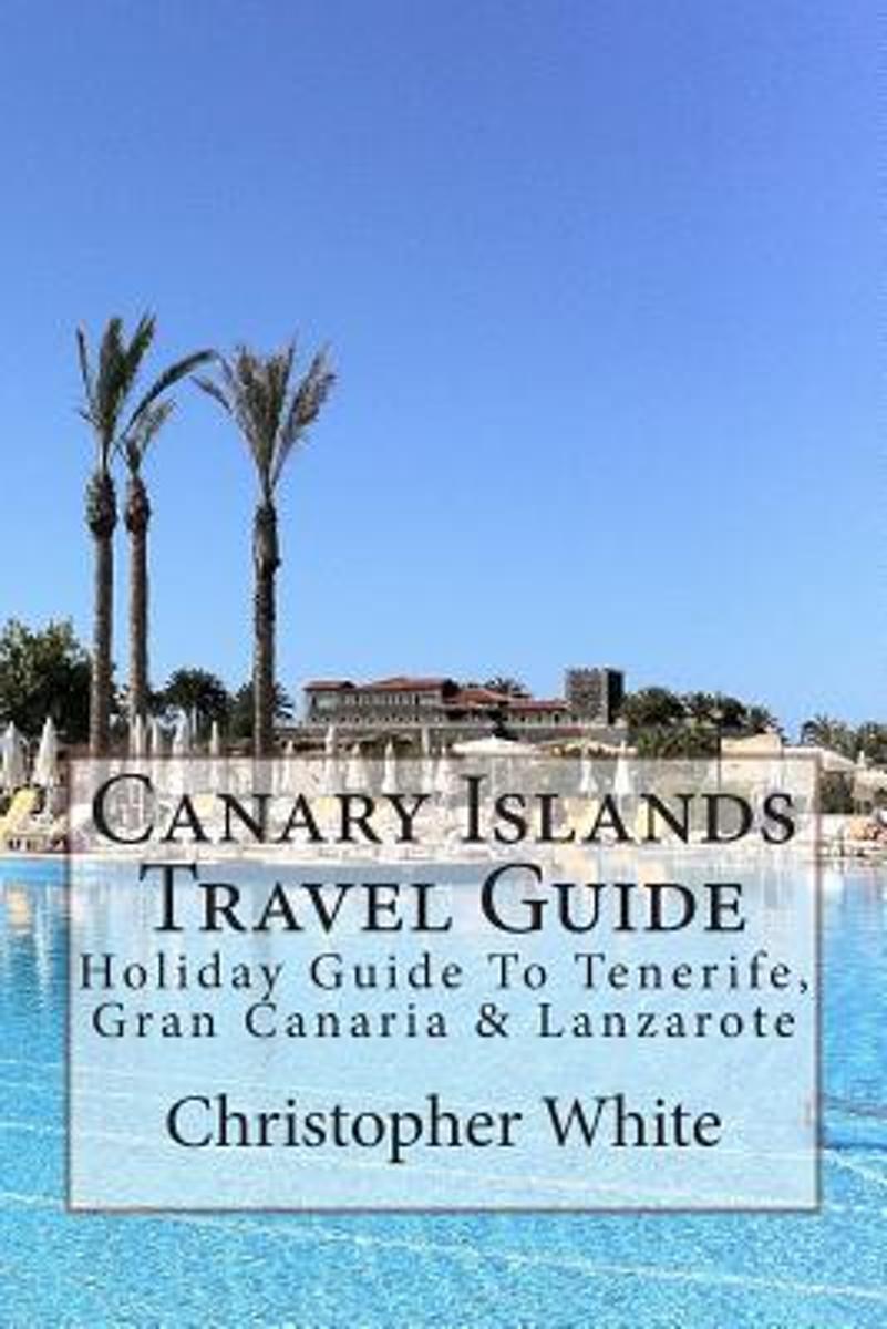
- Canary Islands Travel Guide
- The Canary Islands (Spanish: Islas Canarias) are an Atlantic territory of Spain on the west coast of Africa, near to Morocco, Cape Verde and the archipelagos of the Azores Islands and Madeira Islands.Gran Canaria The largest island by population, its capital city (Las Palmas de Gran Canaria) has the shared title of capital of the Canaries.... Read more
- Also available from:
- Bol.com, Belgium
Bol.com
Belgium
Belgium
- Canary Islands Travel Guide
- The Canary Islands (Spanish: Islas Canarias) are an Atlantic territory of Spain on the west coast of Africa, near to Morocco, Cape Verde and the archipelagos of the Azores Islands and Madeira Islands.Gran Canaria The largest island by population, its capital city (Las Palmas de Gran Canaria) has the shared title of capital of the Canaries.... Read more
Bol.com
Netherlands
2016
Netherlands
2016
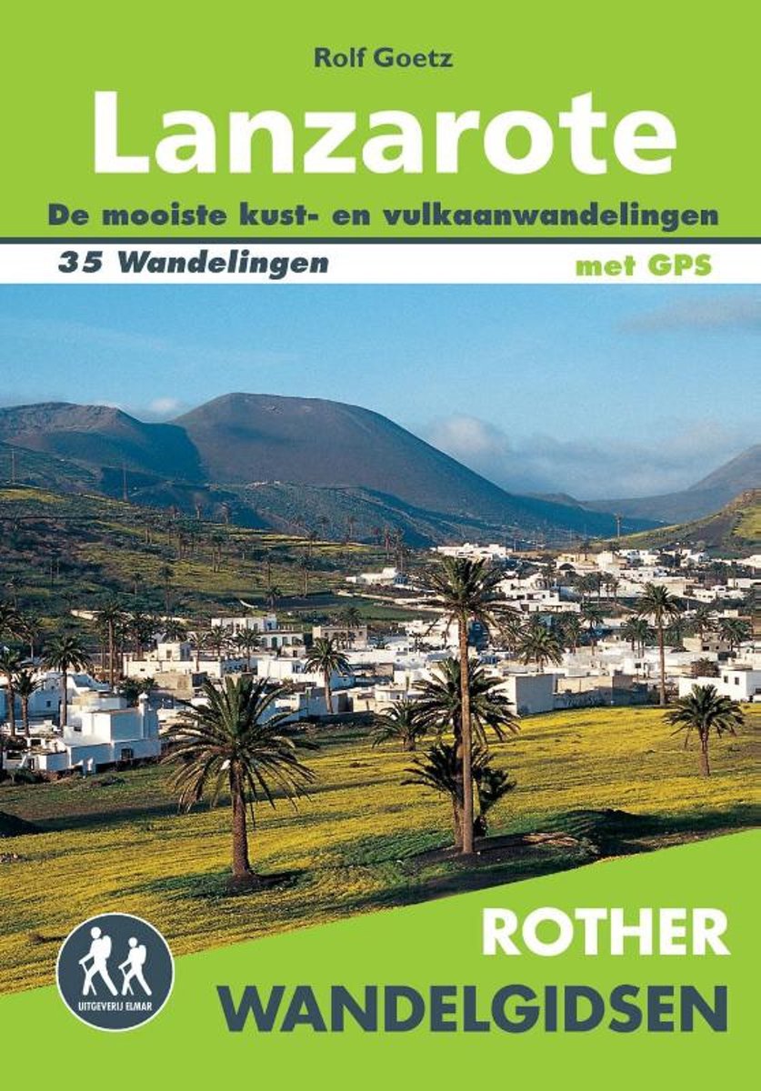
- Rother Wandelgidsen - Lanzarote
- De Rother wandelgids Lanzarote beschrijft 35 fantastische wandelingen over dit vulkaneneiland. Natuurliefhebbers en wandelaars kijken hun ogen uit tijdens de wandelingen tussen de kraters en langs de onvoorspelbare kuststroken. De vulkanen hebben hun sporen achtergelaten en zorgen voor spectaculaire uitzichten tijdens uw wandelvakantie op... Read more
- Also available from:
- Bol.com, Belgium
- De Zwerver, Netherlands
Bol.com
Belgium
2016
Belgium
2016
- Rother Wandelgidsen - Lanzarote
- De Rother wandelgids Lanzarote beschrijft 35 fantastische wandelingen over dit vulkaneneiland. Natuurliefhebbers en wandelaars kijken hun ogen uit tijdens de wandelingen tussen de kraters en langs de onvoorspelbare kuststroken. De vulkanen hebben hun sporen achtergelaten en zorgen voor spectaculaire uitzichten tijdens uw wandelvakantie op... Read more

De Zwerver
Netherlands
2016
Netherlands
2016
- Wandelgids Lanzarote | Uitgeverij Elmar
- de mooiste kust- en vulkaanwandelingen Read more
De Zwerver
Netherlands
2018
Netherlands
2018
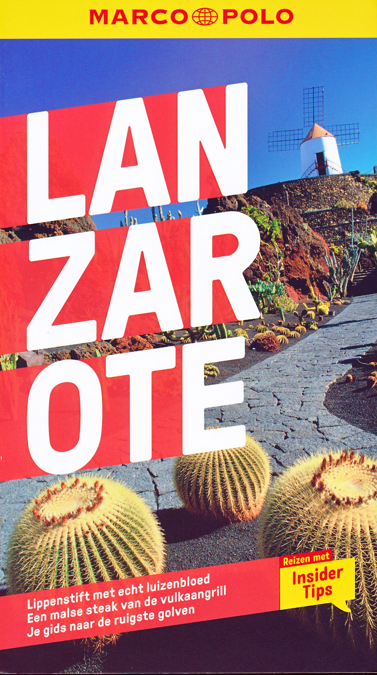
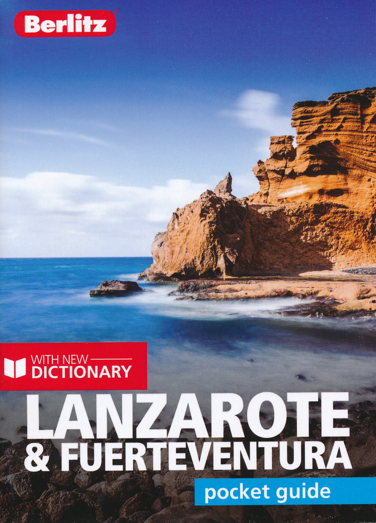
- Reisgids Pocket Guide Lanzarote - Fuertaventura | Berlitz
- Pocket Guide Berlitz is een handzaam engelstalige reisgids met bezienswaardigheden, kaartjes, hotels en restaurants. Past makkelijk in de binnenzak. Berlitz Pocket Guide Lanzarote & Fuerteventura combines informative text with vivid colour photography to uncover two of the most popular islands to visit in the Canary Islands archipelago. It... Read more
De Zwerver
Netherlands
2022
Netherlands
2022
Maps

Stanfords
United Kingdom
United Kingdom
- Tinajo 25K Lanzarote CNIG Topographic Survey Map No. 1082-I
- Topographic coverage of the Canary Islands at 1:25,000 published by the Instituto Geográfico Nacional – Centro Nacional de Información Geografica, the country’s civilian survey organization. The maps have contours at 10m intervals and colouring and/or graphics to show different types of vegetation or land use. Boundaries of national parks and... Read more
Stanfords
United Kingdom
United Kingdom
- Haria 25K Lanzarote CNIG Topographic Survey Map No. 1080-IV
- Topographic coverage of the Canary Islands at 1:25,000 published by the Instituto Geográfico Nacional – Centro Nacional de Información Geografica, the country’s civilian survey organization. The maps have contours at 10m intervals and colouring and/or graphics to show different types of vegetation or land use. Boundaries of national parks and... Read more
Stanfords
United Kingdom
United Kingdom
- Teguise CNIG Topo 1082-2
- Topographic coverage of the Canary Islands at 1:25,000 published by the Instituto Geográfico Nacional – Centro Nacional de Información Geografica, the country’s civilian survey organization. The maps have contours at 10m intervals and colouring and/or graphics to show different types of vegetation or land use. Boundaries of national parks and... Read more
Stanfords
United Kingdom
United Kingdom
- Tias 25K Lanzarote CNIG Topographic Survey Map No. 1082-III
- Topographic coverage of the Canary Islands at 1:25,000 published by the Instituto Geográfico Nacional – Centro Nacional de Información Geografica, the country’s civilian survey organization. The maps have contours at 10m intervals and colouring and/or graphics to show different types of vegetation or land use. Boundaries of national parks and... Read more

Stanfords
United Kingdom
United Kingdom
- Yaiza CNIG Topo 1081
- Yaiza area of Lanzarote, map No. 1081 in the topographic coverage of the Canary Islands at 1:50,000 from the Instituto Geográfico Nacional - Centro Nacional de Información Geograficá, Spain’s civilian survey organization. Maps in the MTN50 (Mapa Topográfico Nacional) series begun in late 1990s have contours at 20m intervals enhanced by relief... Read more
Stanfords
United Kingdom
United Kingdom
- Timanfaya 25K Lanzarote CNIG Topographic Survey Map No. 1081-III
- Topographic coverage of the Canary Islands at 1:25,000 published by the Instituto Geográfico Nacional – Centro Nacional de Información Geografica, the country’s civilian survey organization. The maps have contours at 10m intervals and colouring and/or graphics to show different types of vegetation or land use. Boundaries of national parks and... Read more
Stanfords
United Kingdom
United Kingdom
- Arrecife 25K Lanzarote CNIG Topographic Survey Map No. 1082-IV
- Topographic coverage of the Canary Islands at 1:25,000 published by the Instituto Geográfico Nacional – Centro Nacional de Información Geografica, the country’s civilian survey organization. The maps have contours at 10m intervals and colouring and/or graphics to show different types of vegetation or land use. Boundaries of national parks and... Read more
Stanfords
United Kingdom
United Kingdom
- Arrecife CNIG Topo 1082
- Arrecife area of Lanzarote, map No. 1082 in the topographic coverage of the Canary Islands at 1:50,000 from the Instituto Geográfico Nacional - Centro Nacional de Información Geograficá, Spain’s civilian survey organization. Maps in the MTN50 (Mapa Topográfico Nacional) series begun in late 1990s have contours at 20m intervals enhanced by... Read more
Stanfords
United Kingdom
United Kingdom
- Yaiza 25K Lanzarote CNIG Topographic Survey Map No. 1081-IV
- Topographic coverage of the Canary Islands at 1:25,000 published by the Instituto Geográfico Nacional – Centro Nacional de Información Geografica, the country’s civilian survey organization. The maps have contours at 10m intervals and colouring and/or graphics to show different types of vegetation or land use. Boundaries of national parks and... Read more

Stanfords
United Kingdom
United Kingdom
- Gran Canaria
- Gran Canaria, Las Palmas and the island’s main resorts on a clear and informative, waterproof and tear-resistant map from Berndtson, with both the road map and the street plans indexed and highlighting the island’s 15 top rated sites and other places of interest, as well as providing general tourist information. On one side a map at 1:100,000... Read more
Stanfords
United Kingdom
United Kingdom
- Playa Blanca CNIG Topo 1084
- Playa Blanca area of Lanzarote, map No. 1084 in the topographic coverage of the Canary Islands at 1:50,000 from the Instituto Geográfico Nacional - Centro Nacional de Información Geograficá, Spain’s civilian survey organization. Maps in the MTN50 (Mapa Topográfico Nacional) series begun in late 1990s have contours at 20m intervals enhanced by... Read more
Stanfords
United Kingdom
United Kingdom
- Playa Blanca CNIG Topo 1084-1/2
- Topographic coverage of the Canary Islands at 1:25,000 published by the Instituto Geográfico Nacional – Centro Nacional de Información Geografica, the country’s civilian survey organization. The maps have contours at 10m intervals and colouring and/or graphics to show different types of vegetation or land use. Boundaries of national parks and... Read more
Stanfords
United Kingdom
United Kingdom
- Isla de Montana Clara 25K Lanzarote CNIG Topographic Survey Map No. 1079-IV
- Topographic coverage of the Canary Islands at 1:25,000 published by the Instituto Geográfico Nacional – Centro Nacional de Información Geografica, the country’s civilian survey organization. The maps have contours at 10m intervals and colouring and/or graphics to show different types of vegetation or land use. Boundaries of national parks and... Read more
Stanfords
United Kingdom
United Kingdom
- Haria CNIG Topo 1080
- Haria area of Lanzarote, map No. 1080 in the topographic coverage of the Canary Islands at 1:50,000 from the Instituto Geográfico Nacional - Centro Nacional de Información Geograficá, Spain’s civilian survey organization. Maps in the MTN50 (Mapa Topográfico Nacional) series begun in late 1990s have contours at 20m intervals enhanced by relief... Read more
Stanfords
United Kingdom
United Kingdom
- Caleta del Sebo 25K Lanzarote CNIG Topographic Survey Map No. 1080-II
- Topographic coverage of the Canary Islands at 1:25,000 published by the Instituto Geográfico Nacional – Centro Nacional de Información Geografica, the country’s civilian survey organization. The maps have contours at 10m intervals and colouring and/or graphics to show different types of vegetation or land use. Boundaries of national parks and... Read more