
Nantahala National Forest
Description
Trails in this region
Links
Facts
Reports
Guides and maps
Lodging
Organisations
Tour operators
GPS
Other
Books

Stanfords
United Kingdom
United Kingdom
- Blur Ridge Parkway: Northern Section
- The northern section of the Blue Ridge Parkway and the surrounding area of the Appalachian Mountains on a double-sided map at 1:135,000 approx. from Outdoor Paths Publishing highlighting facilities along the route. The map covers the first part of the Parkway, from Milepost 0 to 123.Topography of the area is shown by relief shading based on the... Read more

Stanfords
United Kingdom
United Kingdom
- World Awesome Maps Hiking Wall Map
- Illustrated world map with the best hiking trails across the globe. Over 300 trails, from short glacier walks like the Perito Moreno Glacier Walk in Argentina to long-distance treks like the Appalachian Trail and Bibbulmun Track in Australia to lesser known remote trails like the Huahuash Circuit in Peru.- High quality offset print on... Read more
Stanfords
United Kingdom
United Kingdom
- Blur Ridge Parkway Southern Section
- The northern section of the Blue Ridge Parkway and the surrounding area of the Appalachian Mountains on a double-sided map at 1:135,000 approx. from Outdoor Paths Publishing highlighting facilities along the route. The map covers the first part of the Parkway, from Milepost 0 to 123.Topography of the area is shown by relief shading based on the... Read more

Stanfords
United Kingdom
United Kingdom
- The Blue Ridge and Smoky Mountains
- Professional travel writer and photographer Jim Hargan, a longtime resident of western North Carolina, is your guide to the hills and backroads of the Blue Ridge and Smoky Mountains region of North Carolina and Tennessee. Hargan reveals where to find local produce, crafts and music and leads travelers to the region`s many historic homes and... Read more


The Book Depository
United Kingdom
United Kingdom
- One Day At A Time
- A thru-hiker's journey on Appalachian Trail Read more


The Book Depository
United Kingdom
United Kingdom
- Love at First Hike
- A Memoir about Love and Triumph on the Appalachian Trail Read more

The Book Depository
United Kingdom
United Kingdom
- Hiking Through - One Man`s Journey to Peace and Freedom on the Appalachian Trail
- One Man's Journey to Peace and Freedom on the Appalachian Trail Read more

The Book Depository
United Kingdom
United Kingdom
- Appalachian Sojourner
- Transformed on the Appalachian Trail and Other Byways Read more


The Book Depository
United Kingdom
United Kingdom
- A Child's Walk in the Wilderness
- An 8-Year-Old Boy and His Father Take on the Appalachian Trail Read more
More books…

Maps

Stanfords
United Kingdom
United Kingdom
- Green Mountain National Forest - Moosalamoo NRA - Rutland VT
- Map No. 747, Green Mountain National Forest: Moosalamoo NRA - Rutland area in Vermont, in an extensive series of GPS compatible, contoured hiking maps of USA’s national and state parks or forests and other popular recreational areas. Cartography based on the national topographic survey, with additional tourist information.The maps, with most... Read more
- Also available from:
- The Book Depository, United Kingdom
- Bol.com, Netherlands
- Bol.com, Belgium
- De Zwerver, Netherlands

The Book Depository
United Kingdom
United Kingdom
- Green Mountains N.f., Moosalamoo Nra/rutland
- Trails Illustrated Other Rec. Areas Read more

Bol.com
Netherlands
Netherlands
- Green Mountains N.F., Moosalamoo NRA/Rutland
- Waterproof Tear-Resistant Topographic MapNational Geographic's Green Mountain National Forest North Trails Illustrated topographic map is the most comprehensive available for outdoor enthusiasts of all types. Designed to be easy-to-read, yet highly detailed this map includes a comprehensive road and trail network distinguishing between... Read more
Bol.com
Belgium
Belgium
- Green Mountains N.F., Moosalamoo NRA/Rutland
- Waterproof Tear-Resistant Topographic MapNational Geographic's Green Mountain National Forest North Trails Illustrated topographic map is the most comprehensive available for outdoor enthusiasts of all types. Designed to be easy-to-read, yet highly detailed this map includes a comprehensive road and trail network distinguishing between... Read more

De Zwerver
Netherlands
Netherlands
- Wandelkaart - Topografische kaart 747 Green Mountain National Forest North - Moosalamoo NRA - Rutland | National Geographic
- Prachtige geplastificeerde kaart van het bekende nationaal park. Met alle recreatieve voorzieningen als campsites, maar ook met topografische details en wandelroutes ed. Door uitgekiend kleurgebruik zeer prettig in gebruik. Scheur en watervast! National Geographic's Green Mountain National Forest North Trails Illustrated topographic map is... Read more

Stanfords
United Kingdom
United Kingdom
- Cades Cove - Elkmont - Great Smoky Mountains National Park NC/TN
- Map No. 316, Great Smoky Mountains National Park: Cades Cove - Elkmont, NC/TN, in an extensive series of GPS compatible, contoured hiking maps of USA’s national and state parks or forests and other popular recreational areas. Cartography based on the national topographic survey, with additional tourist information.The maps, with most titles now... Read more
- Also available from:
- Bol.com, Netherlands
- Bol.com, Belgium
- De Zwerver, Netherlands

Bol.com
Netherlands
Netherlands
- Cades Cove/elkmont, Great Smoky Mountains National Park
- Waterproof Tear-Resistant Topographic MapThis title provides an increased scale of one of the most visited National Parks in the US, and one of our more popular map titles. This increased scale will provide greater detail to the backcountry users and Appalachian Trail through-hikers.Park Introduction:Great Smoky Mountains National Park is... Read more
Bol.com
Belgium
Belgium
- Cades Cove/elkmont, Great Smoky Mountains National Park
- Waterproof Tear-Resistant Topographic MapThis title provides an increased scale of one of the most visited National Parks in the US, and one of our more popular map titles. This increased scale will provide greater detail to the backcountry users and Appalachian Trail through-hikers.Park Introduction:Great Smoky Mountains National Park is... Read more

De Zwerver
Netherlands
Netherlands
- Wandelkaart - Topografische kaart 316 Cades Cove - Elkmont - Great Smoky Mountains National Park | National Geographic
- Prachtige geplastificeerde kaart van het bekende nationaal park. Met alle recreatieve voorzieningen als campsites, maar ook met topografische details en wandelroutes ed. Door uitgekiend kleurgebruik zeer prettig in gebruik. Scheur en watervast! This title provides an increased scale of one of the most visited National Parks in the US, and one... Read more

Stanfords
United Kingdom
United Kingdom
- Chattahoochee National Forest - Springer and Cohutta Mountains GA/SC 777
- Map No. 777, Chattahoochee National Forest: Springer and Cohutta Mountains, GA/SC, in an extensive series of GPS compatible, contoured hiking maps of USA’s national and state parks or forests and other popular recreational areas. Cartography based on the national topographic survey, with additional tourist information.The maps, with most titles... Read more
- Also available from:
- Bol.com, Netherlands
- Bol.com, Belgium

Bol.com
Netherlands
Netherlands
- Springer & Cohutta Mountains, Chattahoochee National Forest
- Waterproof Tear-Resistant Topographic MapLocated just north of Atlanta, the Chattahoochee National Forest contains the southern terminus of the Appalachian Trail along with an abundance of recreational opportunities for outdoor enthusiasts of all interests.This detailed recreation map contains carefully researched trails, campsites,... Read more
Bol.com
Belgium
Belgium
- Springer & Cohutta Mountains, Chattahoochee National Forest
- Waterproof Tear-Resistant Topographic MapLocated just north of Atlanta, the Chattahoochee National Forest contains the southern terminus of the Appalachian Trail along with an abundance of recreational opportunities for outdoor enthusiasts of all interests.This detailed recreation map contains carefully researched trails, campsites,... Read more

Stanfords
United Kingdom
United Kingdom
- Mount Rogers High Country VA
- Map No. 318 - Mount Rogers High Country in Virginia in an extensive series of GPS compatible, contoured hiking maps of USA’s national and state parks or forests and other popular recreational areas. Cartography based on the national topographic survey, with additional tourist information.The maps, with most titles now printed on light,... Read more
- Also available from:
- The Book Depository, United Kingdom
- Bol.com, Netherlands
- Bol.com, Belgium
- De Zwerver, Netherlands

The Book Depository
United Kingdom
United Kingdom
- Mount Rogers High Country
- Trails Illustrated Other Rec. Areas Read more

Bol.com
Netherlands
Netherlands
- Mount Rogers High Country
- Waterproof Tear-Resistant Topographic MapNational Geographic's Trails Illustrated map of Mount Rogers High Country and Grayson Highlands State Park, Southwest Virginia, is a two-sided, waterproof, topographic trail map designed to meet the needs of outdoor enthusiasts with unmatched durability and detail. This map was created in... Read more
Bol.com
Belgium
Belgium
- Mount Rogers High Country
- Waterproof Tear-Resistant Topographic MapNational Geographic's Trails Illustrated map of Mount Rogers High Country and Grayson Highlands State Park, Southwest Virginia, is a two-sided, waterproof, topographic trail map designed to meet the needs of outdoor enthusiasts with unmatched durability and detail. This map was created in... Read more

De Zwerver
Netherlands
Netherlands
- Wandelkaart - Topografische kaart 318 Mount Rogers High Country - Grayson Highlands State Park | National Geographic
- Prachtige geplastificeerde kaart van het bekende nationaal park. Met alle recreatieve voorzieningen als campsites, maar ook met topografische details en wandelroutes ed. Door uitgekiend kleurgebruik zeer prettig in gebruik. Scheur en watervast! National Geographic's Trails Illustrated map of Mount Rogers High Country and Grayson Highlands... Read more

Stanfords
United Kingdom
United Kingdom
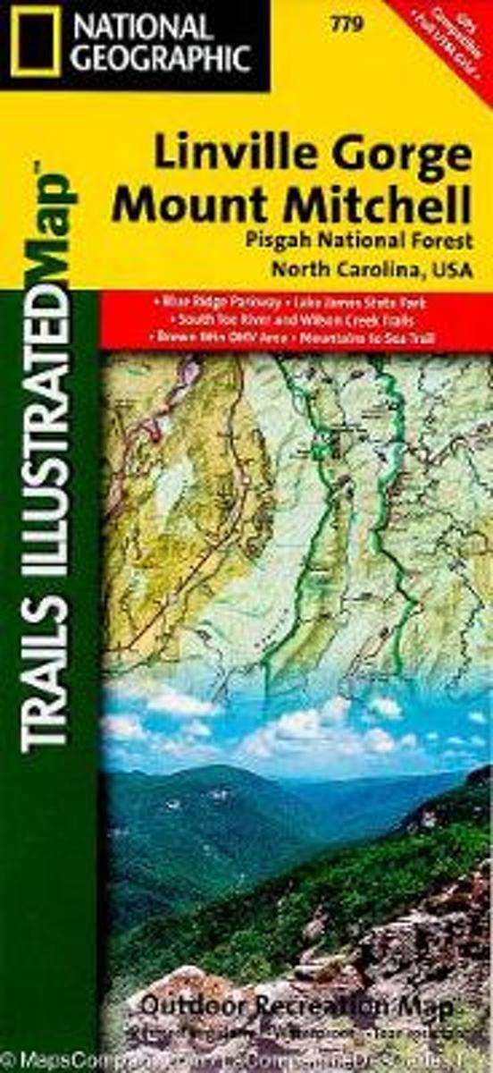
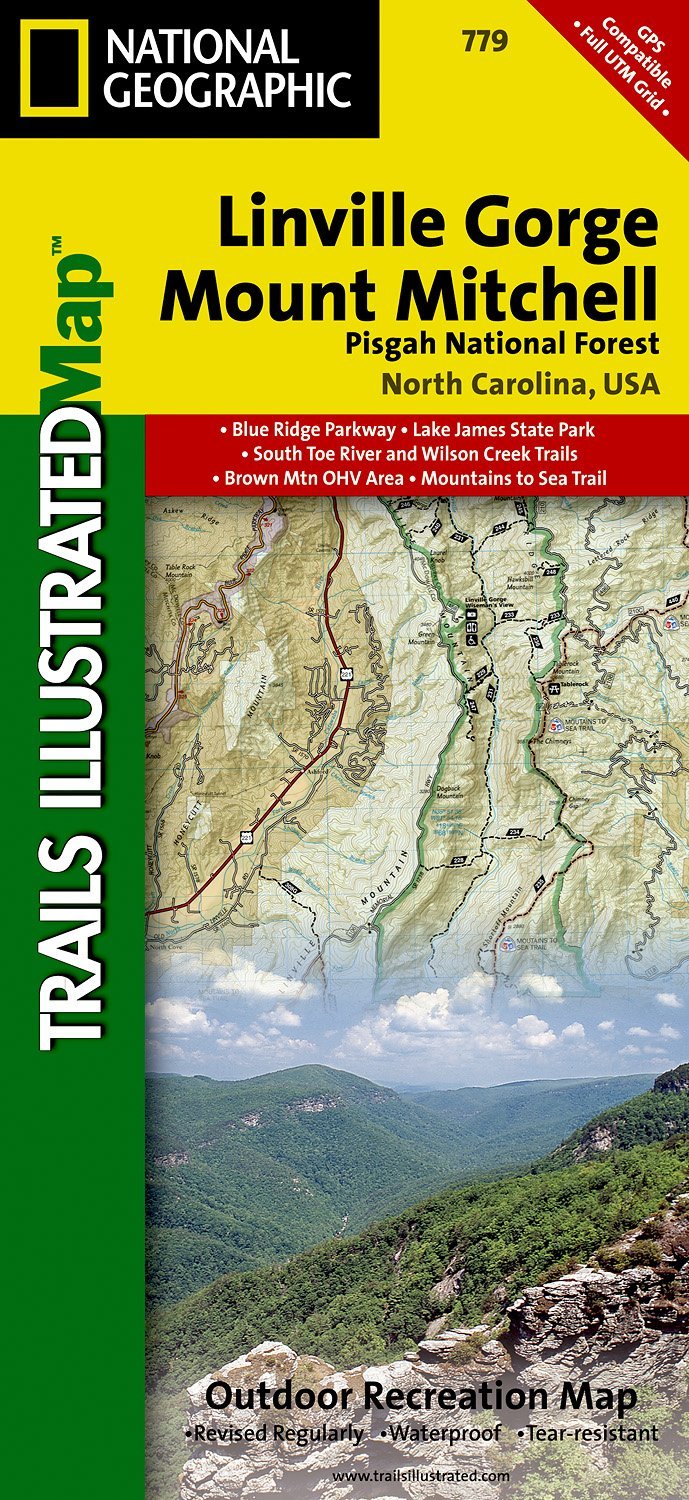
- Pisgah National Forest - Linville Gorge - Mt. Mitchell NC
- Map No. 779, Pisgah National Forest: Linville Gorge - Mt. Mitchell, NC, in an extensive series of GPS compatible, contoured hiking maps of USA’s national and state parks or forests and other popular recreational areas. Cartography based on the national topographic survey, with additional tourist information.The maps, with most titles now... Read more
- Also available from:
- The Book Depository, United Kingdom
- Bol.com, Netherlands
- Bol.com, Belgium
- De Zwerver, Netherlands

The Book Depository
United Kingdom
United Kingdom
- Linville Gorge/mount Mitchell, Pisgah National Forest
- Trails Illustrated Other Rec. Areas Read more
Bol.com
Netherlands
Netherlands
- Linville Gorge/mount Mitchell, Pisgah National Forest
- Waterproof Tear-Resistant Topographic MapExpertly researched and created in partnership with local land management agencies, National Geographic's Trails Illustrated map of Linville Gorge and Mount Mitchell provides an unparalleled tool for exploring these remarkable features within Pisgah National Forest. This map includes such key areas... Read more
Bol.com
Belgium
Belgium
- Linville Gorge/mount Mitchell, Pisgah National Forest
- Waterproof Tear-Resistant Topographic MapExpertly researched and created in partnership with local land management agencies, National Geographic's Trails Illustrated map of Linville Gorge and Mount Mitchell provides an unparalleled tool for exploring these remarkable features within Pisgah National Forest. This map includes such key areas... Read more
De Zwerver
Netherlands
Netherlands
- Wandelkaart - Topografische kaart 779 Linville Gorge - Mount Mitchell - Pisgah National Forest | National Geographic
- Prachtige geplastificeerde kaart van het bekende nationaal park. Met alle recreatieve voorzieningen als campsites, maar ook met topografische details en wandelroutes ed. Door uitgekiend kleurgebruik zeer prettig in gebruik. Scheur en watervast! Coverage includes Pisgah National Forest, Grandfather Ranger District (complete) and Appalachian... Read more