
Georgia
Description
The north of Georgia is mountainous. The Appalachian Trail starts here. Also, the Benton Mackaye Trail has 75 miles in the Chattahooche National Forest in the north, before it enters the state of Tennessee.
Georgia shares the 250 mile Pinhote Trail with Alabama.
Three long distance trails (will) run through Georgia. The Eastern Continental Trail, The East Coast Greenway and the Great Eastern Trail.
Map

Trails in this state
Links
Facts
Reports
Guides and maps
Lodging
Organisations
Tour operators
GPS
Other
Books

Stanfords
United Kingdom
2020
United Kingdom
2020
- DK Eyewitness Pacific Northwest: Oregon, Washington and British Columbia
- Follow the call of the wild to the pristine Pacific NorthwestWhether you want to hike through the spellbinding landscape of the Rockies, unwind with homebrewed beer in Portland or venture to Vancouver for immersive galleries and innovative dining, your DK Eyewitness travel guide makes sure you experience all that the Pacific Northwest has to... Read more

Stanfords
United Kingdom
United Kingdom
- DK Eyewitness Travel Guide Washington DC
- Whether you want to stroll beneath the cherry blossoms, visit the iconic domed Capitol, or tour the magnificent White House, your DK Eyewitness travel guide makes sure you experience all that Washington, DC has to offer.Washington, DC delights at every turn. Wherever you go, there is a marvel of architecture to be discovered, a scenic view to... Read more

Stanfords
United Kingdom
2015
United Kingdom
2015
- Algarve Sunflower Landscape Guide
- Algarve in the Sunflower Landscapes guide series; exploring the best walking and touring possibilities in the region or area. Detailed information about touring by hired car or public transport, as well as on foot is provided, helping walkers to navigate and plan day-trips. Shorter strolls are also included as an alternative for each main route... Read more

Stanfords
United Kingdom
United Kingdom
- The Wild Atlantic Way Route Atlas - Ireland West
- The Wild Atlantic Way is a 25,000 kilometre coastal route along Ireland’s Atlantic coast that stretches between the southerly point of Kinsale, County Cork up to Derry. This route is favoured by many in its entirety or broken down into more manageable, day trip sections. This Xploreit handy sized spiral bound route atlas contains 30 easy-to-use... Read more

Stanfords
United Kingdom
United Kingdom
- Rick Steves Pocket London (Fourth Edition)
- Make the most of every day and every dollar with Rick Steves! This colorful, compact guidebook is perfect for spending a week or less in London: City walks and tours: Six detailed tours and walks showcase London`s essential sights, including the National Gallery, the Tower of London, and Westminster Abbey, plus handy neighborhood breakdowns... Read more

Stanfords
United Kingdom
United Kingdom
- The Broon`s Days Oot!
- The much-acclaimed The Broons Days Oot! is a cracking guide to Scotland. Now expanded with new information throughout, the new book includes new sections on the Scottish islands, Scotland`s whisky trails, cycling in Scotland, walking, arts and other festivals, and gala days. Ideal for the glovebox, the backpack, and the holiday cottage, this... Read more

Stanfords
United Kingdom
2019
United Kingdom
2019
- Insight Guides Explore Fiji
- Discover the best of Fiji with this indispensably practical Insight Explore Guide. From making sure you don`t miss out on must-see attractions like Viseisei Village, the sand dunes in Sigatoka, Mamanuca Islands, Levuka and the Hibiscus Highway, to discovering hidden gems, including Navala, the easy-to-follow, ready-made walking routes will save... Read more

Stanfords
United Kingdom
United Kingdom
- New York Theatre Walks
- This outstanding volume provides readers with seven self-guided tours, not just of New York`s theatre district, but also the East and West Village, the Lower East Side, and the Upper West Side. ”New York Theatre Walks” abounds in amusing, and insightful Broadway anecdotes, as well as giving the reader a sense of the city`s own complex, rich... Read more

Stanfords
United Kingdom
United Kingdom
- Athens: The Monocle Travel Guide Series
- Get to know the most atmospheric open-air cinemas and drawn up walks around Athens` neighborhoods -- one a leafy suburb, another by the sea. Think of Athens and the first things that spring to mind are ancient ruins and camera-toting crowds (before they hotfoot it to the island-bound ferries at the port of Piraeus, that is). It`s true, the... Read more

Stanfords
United Kingdom
United Kingdom
- Coast - The Walks
- Accompanying BBC2`s BAFTA award-winning television series, ”Coast: The Walks” will inspire you to explore the best that the coastline of the British Isles has to offer. With more than 50 fantastic walks around Great Britain and Ireland, this practical guidebook features a variety of town and rural routes that are designed to suit both... Read more
Stanfords
United Kingdom
United Kingdom
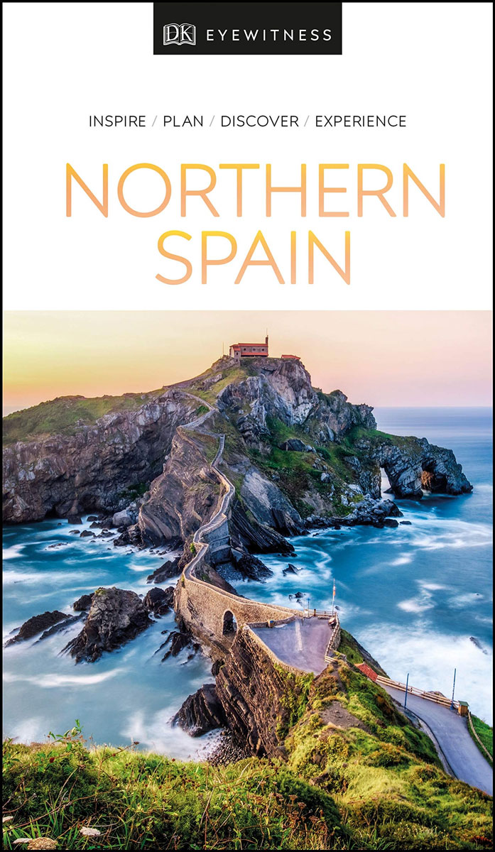
- DK Eyewitness Northern Spain
- Your journey starts here. Featuring DK`s much-loved maps and illustrations, walks and information, plus all new, full-colour photography, this 100% updated guide to Northern Spain brings you the best of this stunning Spanish region in a brand-new, lightweight format. What`s inside? - full-colour photography, hand-drawn illustrations, and maps... Read more

Stanfords
United Kingdom
2015
United Kingdom
2015
- Madeira: Car Tours and Walks
- Madeira in the Sunflower Landscapes guide series; exploring the best walking and touring possibilities in the region or area. Detailed information about touring by hired car or public transport, as well as on foot, is provided, helping walkers to navigate and plan day-trips. Shorter strolls are also included as an alternative for each main... Read more

Stanfords
United Kingdom
United Kingdom
- Fodor`s Inside Berlin
- One of the world`s coolest cities, Berlin has grabbed the world`s attention with its cutting-edge arts scene. Cosmopolitan and affordable, Berlin will delight foodies, scenesters, and fashionistas. Fodor`s brand new guidebook, Inside Berlin, touches on top tourist sights, including Museum Island, Schloss Charlottenburg, and Brandenburg Gate,... Read more

Stanfords
United Kingdom
2021
United Kingdom
2021
- DK Eyewitness Top 10 Amsterdam
- With its cafes and canals, modern art galleries and colossal museums, Amsterdam is at once a historic cultural powerhouse and a laidback cosmopolitan city. Your DK Eyewitness Top 10 travel guide ensures you`ll find your way around Amsterdam with absolute ease.Our updated Top 10 travel guide breaks down the best of Amsterdam into helpful lists... Read more

Stanfords
United Kingdom
United Kingdom
- Middlesex and West London - Waterside Walks
- Waterside Walks in Middlesex and West London by David and Rosemary Hall presents a selection of twenty circular walks that take in some part of a local waterway. These include the rivers Thames and Colne, the Staines Reservoirs, Dollis Brook and the Grand Union Canal. The twenty routes in this book are all between 3 to 7 miles. Each walk is... Read more
Maps

Stanfords
United Kingdom
United Kingdom
- Busen Region - South Georgia BAS Wall Map
- South Georgia and its offshore islands in the South Atlantic presented by the British Antarctic Survey on a double-sided map combining topographic mapping of the whole island at 1:200,000 scale and detailed topographic mapping of the route of Shackleton’s crossing in May 1916 at 1:40,000 scale.On one side is a map presenting the topography by... Read more

Stanfords
United Kingdom
United Kingdom
- Khalanga Baja (Darchula)
- Khalanga Baja (Darchula), sheet no. 2980-03 / 3080-15, in the topographic survey of Nepal at 1:50,000 published by the Nepali Government in the late 1990s and early 2000s and produced from remote sensing data by Finnish cartographers as part of that country’s international aid program. The maps cover 15’ x 15’ quadrangles.IMPORTANT – PLEASE... Read more
Stanfords
United Kingdom
United Kingdom
- Gamgadhi
- Gamgadji, sheet no. 2982-05, in the topographic survey of Nepal at 1:50,000 published by the Nepali Government in the late 1990s and early 2000s and produced from remote sensing data by Finnish cartographers as part of that country’s international aid program. The maps cover 15’ x 15’ quadrangles.IMPORTANT – PLEASE NOTE BEFORE ORDERING:... Read more
Stanfords
United Kingdom
United Kingdom
- Langtang Lirung
- Langtang Lirung, sheet no. 2885-11, in the topographic survey of Nepal at 1:50,000 published by the Nepali Government in the late 1990s and early 2000s and produced from remote sensing data by Finnish cartographers as part of that country’s international aid program. The maps cover 15’ x 15’ quadrangles.IMPORTANT – PLEASE NOTE BEFORE ORDERING:... Read more
Stanfords
United Kingdom
United Kingdom
- Mt. Pumori
- Mt Pumori, sheet no. 2886-16, in the topographic survey of Nepal at 1:50,000 published by the Nepali Government in the late 1990s and early 2000s and produced from remote sensing data by Finnish cartographers as part of that country’s international aid program. The maps cover 15’ x 15’ quadrangles.IMPORTANT – PLEASE NOTE BEFORE ORDERING:... Read more

Stanfords
United Kingdom
United Kingdom
- Omalo - Pass Abano - Mt. Diklosmta Geoland 1 WATERPROOF
- Omalo - Pass Abano - Mt. Diklosmta area of the Caucasus Mountains in Georgia at 1:50,000 on a double-sided, contoured and GPS compatible map from Geoplan, with an overprint providing tourist information including local accommodation and sights. This is the WATERPROOF & TEAR-RESISTANT edition of the map, which is also available in a paper... Read more
Stanfords
United Kingdom
United Kingdom
- Phugau Ghomion
- Phugau Ghomion, sheet no. 2884-02, in the topographic survey of Nepal at 1:50,000 published by the Nepali Government in the late 1990s and early 2000s and produced from remote sensing data by Finnish cartographers as part of that country’s international aid program. The maps cover 15’ x 15’ quadrangles.IMPORTANT – PLEASE NOTE BEFORE ORDERING:... Read more
Stanfords
United Kingdom
United Kingdom
- Muktinath
- Koban, sheet no. 2883-07, in the topographic survey of Nepal at 1:50,000 published by the Nepali Government in the late 1990s and early 2000s and produced from remote sensing data by Finnish cartographers as part of that country’s international aid program. The maps cover 15’ x 15’ quadrangles.IMPORTANT – PLEASE NOTE BEFORE ORDERING:... Read more
Stanfords
United Kingdom
United Kingdom
- Ghandruk
- Ghandruk, sheet no. 2883-12, in the topographic survey of Nepal at 1:50,000 published by the Nepali Government in the late 1990s and early 2000s and produced from remote sensing data by Finnish cartographers as part of that country’s international aid program. The maps cover 15’ x 15’ quadrangles.IMPORTANT – PLEASE NOTE BEFORE ORDERING:... Read more
Stanfords
United Kingdom
United Kingdom
- Apsuwa Khoka - Bala
- Apsuwa Khoka – Bala, sheet no. 2787-05, in the topographic survey of Nepal at 1:50,000 published by the Nepali Government in the late 1990s and early 2000s and produced from remote sensing data by Finnish cartographers as part of that country’s international aid program. The maps cover 15’ x 15’ quadrangles.IMPORTANT – PLEASE NOTE BEFORE... Read more
Stanfords
United Kingdom
United Kingdom
- Dho
- Dho, sheet no. 2983-13, in the topographic survey of Nepal at 1:50,000 published by the Nepali Government in the late 1990s and early 2000s and produced from remote sensing data by Finnish cartographers as part of that country’s international aid program. The maps cover 15’ x 15’ quadrangles.IMPORTANT – PLEASE NOTE BEFORE ORDERING:... Read more
Stanfords
United Kingdom
United Kingdom
- Lamabagar
- Lamabagar, sheet no. 2786-01, in the topographic survey of Nepal at 1:50,000 published by the Nepali Government in the late 1990s and early 2000s and produced from remote sensing data by Finnish cartographers as part of that country’s international aid program. The maps cover 15’ x 15’ quadrangles.IMPORTANT – PLEASE NOTE BEFORE ORDERING:... Read more

Stanfords
United Kingdom
United Kingdom
- Barcelona High 5 Edition Street Plan
- The first water-resistant “Comfort Map“ with direct access to useful additional information from the InternetBarcelona in a scale of 1:20,000 including detailed presentation of the old town in a scale of 1:11,000 presented on a practical map; inclusive of the High 5 Edition app technology for calling up additional travel information and many... Read more

Stanfords
United Kingdom
United Kingdom
- Europe High 5 Edition Camping Atlas
- The first physical atlas with direct access to useful additional information from the InternetThe entirety of Europe on 432 pages in a scale of 1:800,000 clearly presented, including lots more travel information:- Road Companion (roadmaps) in a scale of 1:800,000, inclusive of the High 5 - Edition app technology for calling up additional travel... Read more
Stanfords
United Kingdom
United Kingdom
- Dattu
- Dattu, sheet no. 2980-02, in the topographic survey of Nepal at 1:50,000 published by the Nepali Government in the late 1990s and early 2000s and produced from remote sensing data by Finnish cartographers as part of that country’s international aid program. The maps cover 15’ x 15’ quadrangles.IMPORTANT – PLEASE NOTE BEFORE ORDERING:... Read more