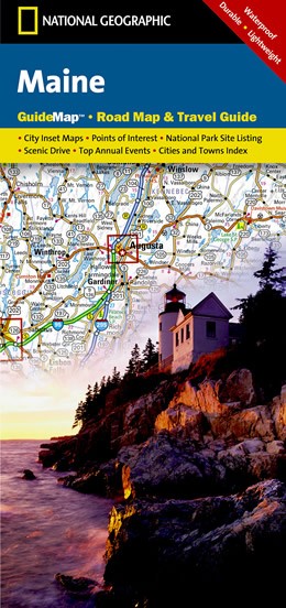
Maine
Description
Maine borders on Canada and the Atlantic Ocean. A substantial portion of this New England state remains relatively wild and undeveloped.
Maine hosts 274 miles of the Appalachian Trail, and also parts of the East Coast Greenway and the Eastern Continental Trail.
The coastal region is represented in the Acadia National Park. The Baxter State Park up north, trailhead of the Appalachian Trail, is a true wilderness area.
Map

Trails in this state
Links
Facts
Reports
Guides and maps
Lodging
Organisations
Tour operators
GPS
Other
Books

Stanfords
United Kingdom
United Kingdom
- Blur Ridge Parkway: Northern Section
- The northern section of the Blue Ridge Parkway and the surrounding area of the Appalachian Mountains on a double-sided map at 1:135,000 approx. from Outdoor Paths Publishing highlighting facilities along the route. The map covers the first part of the Parkway, from Milepost 0 to 123.Topography of the area is shown by relief shading based on the... Read more

Stanfords
United Kingdom
United Kingdom
- The Blue Ridge and Smoky Mountains
- Professional travel writer and photographer Jim Hargan, a longtime resident of western North Carolina, is your guide to the hills and backroads of the Blue Ridge and Smoky Mountains region of North Carolina and Tennessee. Hargan reveals where to find local produce, crafts and music and leads travelers to the region`s many historic homes and... Read more
Stanfords
United Kingdom
United Kingdom
- Blur Ridge Parkway Southern Section
- The northern section of the Blue Ridge Parkway and the surrounding area of the Appalachian Mountains on a double-sided map at 1:135,000 approx. from Outdoor Paths Publishing highlighting facilities along the route. The map covers the first part of the Parkway, from Milepost 0 to 123.Topography of the area is shown by relief shading based on the... Read more

Stanfords
United Kingdom
United Kingdom
- DK Eyewitness New England
- Discover New England - a region synonymous with fall foliage, seafood and historic sitesWhether you want to explore the rugged natural beauty of the Appalachian Mountains, follow the fascinating Freedom Trail through Boston, or indulge in fresh lobster from the coast of Cape Cod, your DK Eyewitness travel guide makes sure you experience all New... Read more

Stanfords
United Kingdom
United Kingdom
- World Awesome Maps Hiking Wall Map
- Illustrated world map with the best hiking trails across the globe. Over 300 trails, from short glacier walks like the Perito Moreno Glacier Walk in Argentina to long-distance treks like the Appalachian Trail and Bibbulmun Track in Australia to lesser known remote trails like the Huahuash Circuit in Peru.- High quality offset print on... Read more

The Book Depository
United Kingdom
United Kingdom
- A Child's Walk in the Wilderness
- An 8-Year-Old Boy and His Father Take on the Appalachian Trail Read more

The Book Depository
United Kingdom
United Kingdom
- Just Passin' Thru
- A Vintage Store, the Appalachian Trail, and a Cast of Unforgettable Characters Read more

The Book Depository
United Kingdom
United Kingdom
- Explorer's Guide 50 Hikes in Eastern Pennsylvania
- From the Mason-Dixon Line to the Poconos and North Mountain Read more

The Book Depository
United Kingdom
United Kingdom
- Blind Man Walking
- Views of the American Landscape from the Appalachian Trail Read more

The Book Depository
United Kingdom
United Kingdom
- A Walk for Sunshine
- A 2,160-mile Expedition for Charity on the Appalachian Trail Read more

The Book Depository
United Kingdom
United Kingdom
- Amc's Best Sea Kayaking in New England
- 50 Coastal Paddling Adventures from Maine to Connecticut Read more

The Book Depository
United Kingdom
United Kingdom
- Chicas on the Appalachian Trail
- Women-Specific Tips for Thru-Hiking the Appalachian Trail and Conversations with Badass Women Hikers Read more

The Book Depository
United Kingdom
United Kingdom
- Maine Day Hikes
- A Folding Pocket Guide to Gear, Planning & Useful Tips Read more

The Book Depository
United Kingdom
United Kingdom
- Footprints on the Mountains
- Hiking the Appalachian Trail from Georgia to Maine Read more

The Book Depository
United Kingdom
United Kingdom
- Appalachian Sojourner
- Transformed on the Appalachian Trail and Other Byways Read more
Maps

The Book Depository
United Kingdom
United Kingdom
- Caen / Evreux 2014
- Map No. 117, Caen - Evreux at 1:100,000, part of the TOP100 series from the Institut G Read more

De Zwerver
Netherlands
Netherlands

Stanfords
United Kingdom
United Kingdom
- Chattahoochee National Forest - Springer and Cohutta Mountains GA/SC 777
- Map No. 777, Chattahoochee National Forest: Springer and Cohutta Mountains, GA/SC, in an extensive series of GPS compatible, contoured hiking maps of USA’s national and state parks or forests and other popular recreational areas. Cartography based on the national topographic survey, with additional tourist information.The maps, with most titles... Read more
- Also available from:
- Bol.com, Netherlands
- Bol.com, Belgium

Bol.com
Netherlands
Netherlands
- Springer & Cohutta Mountains, Chattahoochee National Forest
- Waterproof Tear-Resistant Topographic MapLocated just north of Atlanta, the Chattahoochee National Forest contains the southern terminus of the Appalachian Trail along with an abundance of recreational opportunities for outdoor enthusiasts of all interests.This detailed recreation map contains carefully researched trails, campsites,... Read more
Bol.com
Belgium
Belgium
- Springer & Cohutta Mountains, Chattahoochee National Forest
- Waterproof Tear-Resistant Topographic MapLocated just north of Atlanta, the Chattahoochee National Forest contains the southern terminus of the Appalachian Trail along with an abundance of recreational opportunities for outdoor enthusiasts of all interests.This detailed recreation map contains carefully researched trails, campsites,... Read more

Stanfords
United Kingdom
United Kingdom
- Mount Rogers High Country VA
- Map No. 318 - Mount Rogers High Country in Virginia in an extensive series of GPS compatible, contoured hiking maps of USA’s national and state parks or forests and other popular recreational areas. Cartography based on the national topographic survey, with additional tourist information.The maps, with most titles now printed on light,... Read more
- Also available from:
- The Book Depository, United Kingdom
- Bol.com, Netherlands
- Bol.com, Belgium
- De Zwerver, Netherlands

The Book Depository
United Kingdom
United Kingdom
- Mount Rogers High Country
- Trails Illustrated Other Rec. Areas Read more

Bol.com
Netherlands
Netherlands
- Mount Rogers High Country
- Waterproof Tear-Resistant Topographic MapNational Geographic's Trails Illustrated map of Mount Rogers High Country and Grayson Highlands State Park, Southwest Virginia, is a two-sided, waterproof, topographic trail map designed to meet the needs of outdoor enthusiasts with unmatched durability and detail. This map was created in... Read more
Bol.com
Belgium
Belgium
- Mount Rogers High Country
- Waterproof Tear-Resistant Topographic MapNational Geographic's Trails Illustrated map of Mount Rogers High Country and Grayson Highlands State Park, Southwest Virginia, is a two-sided, waterproof, topographic trail map designed to meet the needs of outdoor enthusiasts with unmatched durability and detail. This map was created in... Read more

De Zwerver
Netherlands
Netherlands
- Wandelkaart - Topografische kaart 318 Mount Rogers High Country - Grayson Highlands State Park | National Geographic
- Prachtige geplastificeerde kaart van het bekende nationaal park. Met alle recreatieve voorzieningen als campsites, maar ook met topografische details en wandelroutes ed. Door uitgekiend kleurgebruik zeer prettig in gebruik. Scheur en watervast! National Geographic's Trails Illustrated map of Mount Rogers High Country and Grayson Highlands... Read more

Stanfords
United Kingdom
United Kingdom
- Green Mountain National Forest - Moosalamoo NRA - Rutland VT
- Map No. 747, Green Mountain National Forest: Moosalamoo NRA - Rutland area in Vermont, in an extensive series of GPS compatible, contoured hiking maps of USA’s national and state parks or forests and other popular recreational areas. Cartography based on the national topographic survey, with additional tourist information.The maps, with most... Read more
- Also available from:
- The Book Depository, United Kingdom
- Bol.com, Netherlands
- Bol.com, Belgium
- De Zwerver, Netherlands

The Book Depository
United Kingdom
United Kingdom
- Green Mountains N.f., Moosalamoo Nra/rutland
- Trails Illustrated Other Rec. Areas Read more

Bol.com
Netherlands
Netherlands
- Green Mountains N.F., Moosalamoo NRA/Rutland
- Waterproof Tear-Resistant Topographic MapNational Geographic's Green Mountain National Forest North Trails Illustrated topographic map is the most comprehensive available for outdoor enthusiasts of all types. Designed to be easy-to-read, yet highly detailed this map includes a comprehensive road and trail network distinguishing between... Read more
Bol.com
Belgium
Belgium
- Green Mountains N.F., Moosalamoo NRA/Rutland
- Waterproof Tear-Resistant Topographic MapNational Geographic's Green Mountain National Forest North Trails Illustrated topographic map is the most comprehensive available for outdoor enthusiasts of all types. Designed to be easy-to-read, yet highly detailed this map includes a comprehensive road and trail network distinguishing between... Read more

De Zwerver
Netherlands
Netherlands
- Wandelkaart - Topografische kaart 747 Green Mountain National Forest North - Moosalamoo NRA - Rutland | National Geographic
- Prachtige geplastificeerde kaart van het bekende nationaal park. Met alle recreatieve voorzieningen als campsites, maar ook met topografische details en wandelroutes ed. Door uitgekiend kleurgebruik zeer prettig in gebruik. Scheur en watervast! National Geographic's Green Mountain National Forest North Trails Illustrated topographic map is... Read more

Stanfords
United Kingdom
United Kingdom
- Cades Cove - Elkmont - Great Smoky Mountains National Park NC/TN
- Map No. 316, Great Smoky Mountains National Park: Cades Cove - Elkmont, NC/TN, in an extensive series of GPS compatible, contoured hiking maps of USA’s national and state parks or forests and other popular recreational areas. Cartography based on the national topographic survey, with additional tourist information.The maps, with most titles now... Read more
- Also available from:
- Bol.com, Netherlands
- Bol.com, Belgium
- De Zwerver, Netherlands

Bol.com
Netherlands
Netherlands
- Cades Cove/elkmont, Great Smoky Mountains National Park
- Waterproof Tear-Resistant Topographic MapThis title provides an increased scale of one of the most visited National Parks in the US, and one of our more popular map titles. This increased scale will provide greater detail to the backcountry users and Appalachian Trail through-hikers.Park Introduction:Great Smoky Mountains National Park is... Read more
Bol.com
Belgium
Belgium
- Cades Cove/elkmont, Great Smoky Mountains National Park
- Waterproof Tear-Resistant Topographic MapThis title provides an increased scale of one of the most visited National Parks in the US, and one of our more popular map titles. This increased scale will provide greater detail to the backcountry users and Appalachian Trail through-hikers.Park Introduction:Great Smoky Mountains National Park is... Read more

De Zwerver
Netherlands
Netherlands
- Wandelkaart - Topografische kaart 316 Cades Cove - Elkmont - Great Smoky Mountains National Park | National Geographic
- Prachtige geplastificeerde kaart van het bekende nationaal park. Met alle recreatieve voorzieningen als campsites, maar ook met topografische details en wandelroutes ed. Door uitgekiend kleurgebruik zeer prettig in gebruik. Scheur en watervast! This title provides an increased scale of one of the most visited National Parks in the US, and one... Read more

Stanfords
United Kingdom
United Kingdom
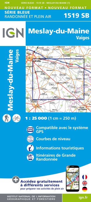
- Mesley-du-Maine - Vaiges IGN 25K Série Bleue Map 1519SB
- Topographic survey of France at 1:25,000 in IGN`s excellent TOP25 / Série Bleue series. All the maps are GPS compatible, with a 1km UTM grid plus latitude and longitude lines at 5’ intervals. Contours are at 5m intervals except for mountainous areas where the maps have contours at 10m intervals, vividly enhanced by hill shading and graphics for... Read more
- Also available from:
- De Zwerver, Netherlands
De Zwerver
Netherlands
Netherlands
- Wandelkaart - Topografische kaart 1519SB Meslay-du-Maine, Vaiges | IGN - Institut Géographique National
- Topographic survey of France at 1:25,000 in IGN's excellent TOP25 / S Read more

Stanfords
United Kingdom
United Kingdom
- Laval - Fougeres - PNR Normandie Maine IGN TOP100 116
- Discover the new double-sided laminated edition of TOP100 road maps of France from the Institut Géographique National (IGN); exceptionally detailed, contoured road maps which include the cycle paths and greenways of the AF3V (French Association for the Development of Cycle Paths and Greenways), ideal for exploring the French countryside by car,... Read more
- Also available from:
- De Zwerver, Netherlands


Stanfords
United Kingdom
United Kingdom
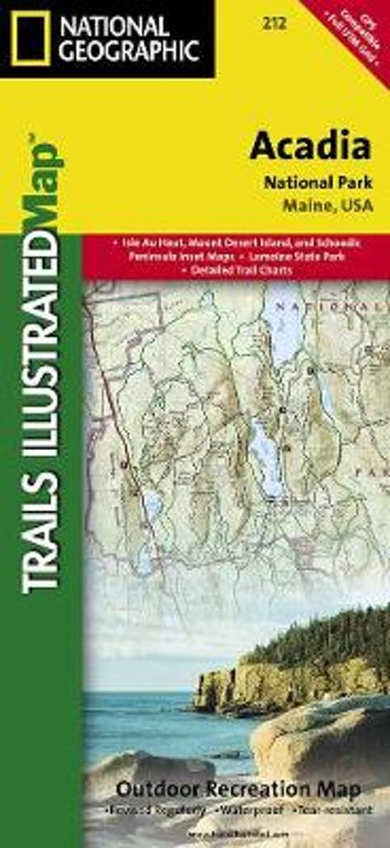
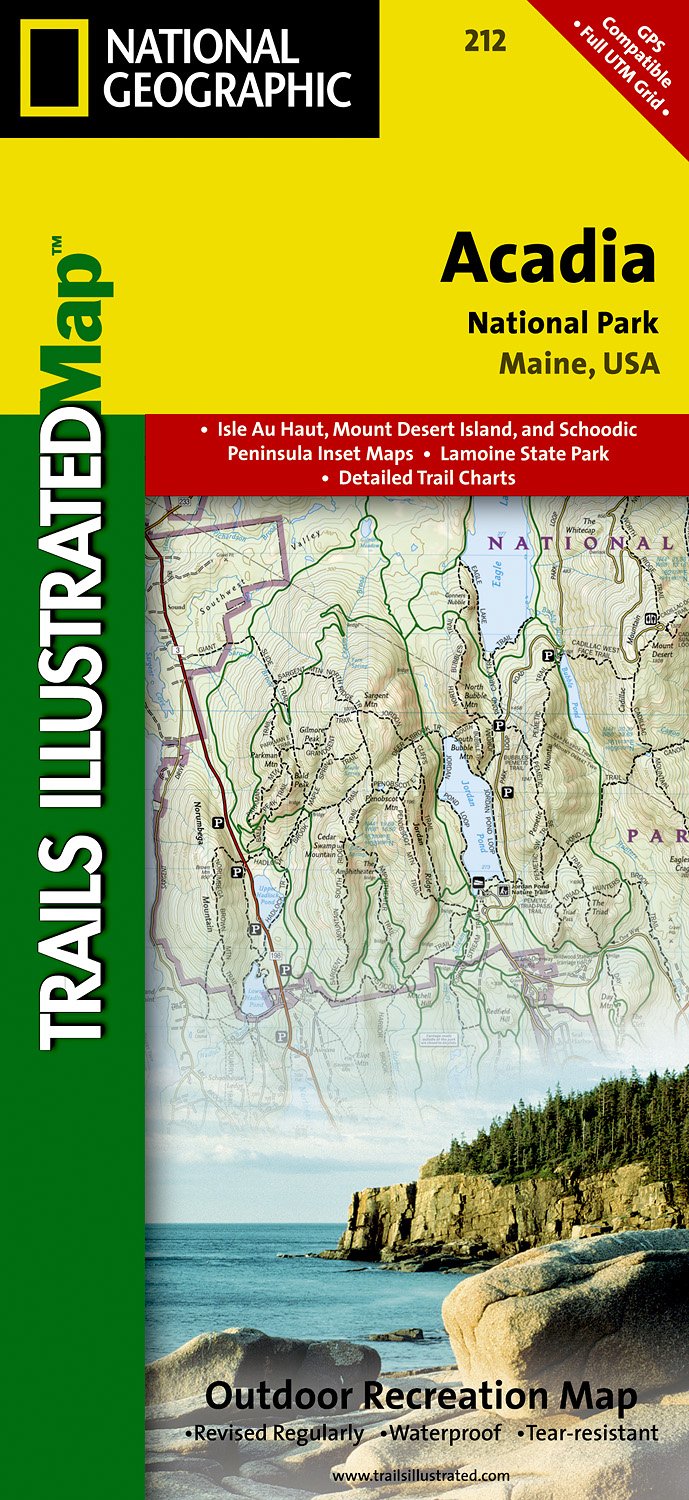
- Acadia National Park ME NGS Trails Illustrated Map 212
- Map No. 212, Acadia National Park, ME, in an extensive series of GPS compatible, contoured hiking maps of USA’s national and state parks or forests and other popular recreational areas. Cartography based on the national topographic survey, with additional tourist information.The maps, with most titles now printed on light, waterproof and... Read more
- Also available from:
- The Book Depository, United Kingdom
- Bol.com, Netherlands
- Bol.com, Belgium
- De Zwerver, Netherlands

Bol.com
Netherlands
Netherlands
- Acadia National Park
- Waterproof Tear-Resistant Topographic MapUpdated to reflect road closings, new trails, and campground relocation, and includes detailed trail information, points of interest, trailheads, picnic areas, facitlities, and more.Features Mount Desert Island, Sestern Mountain, Norwood Ridge, Freeman Ridge, Isle au Haut, Marshall Island, Swans... Read more
Bol.com
Belgium
Belgium
- Acadia National Park
- Waterproof Tear-Resistant Topographic MapUpdated to reflect road closings, new trails, and campground relocation, and includes detailed trail information, points of interest, trailheads, picnic areas, facitlities, and more.Features Mount Desert Island, Sestern Mountain, Norwood Ridge, Freeman Ridge, Isle au Haut, Marshall Island, Swans... Read more
De Zwerver
Netherlands
Netherlands
- Wandelkaart - Topografische kaart 212 Acadia National Park | National Geographic
- Prachtige geplastificeerde kaart van het nationaal park. Met alle recreatieve voorzieningen als campsites, maar ook met topografische details en wandelroutes ed. Door uitgekiend kleurgebruik zeer prettig in gebruik. Scheur en watervast! Trails Illustrated maps are the most trusted and popular recreation maps available. Continually setting the... Read more
More maps…