
Matterhorn
Description
- Height 4478.00 m
Links
Facts
Reports
Guides and maps
Lodging
Organisations
Tour operators
GPS
Other
Books

Stanfords
United Kingdom
United Kingdom
- DK Eyewitness Travel Guide Switzerland
- Marvel at the iconic Matterhorn, explore the fascinating art galleries and museums of Basel or stroll around the historic town of Lausanne on Lake Geneva. The DK Eyewitness Guide to Switzerland covers the must-see sights and the hidden backstreets, so you won`t miss a thing.- See Switzerland from a different angle - 14 pages of fresh ideas for... Read more

Stanfords
United Kingdom
2021
United Kingdom
2021
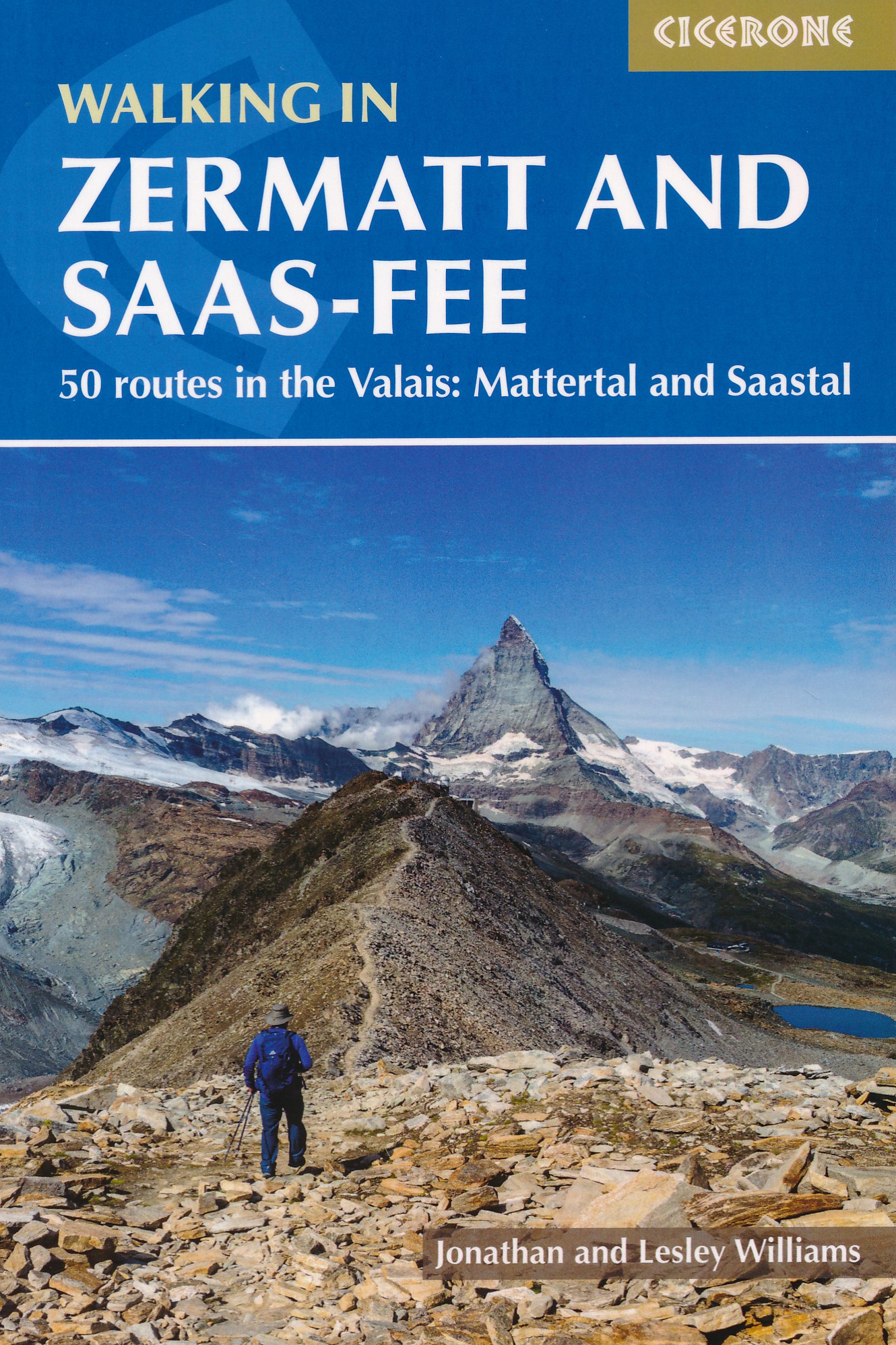
- Walking in Zermatt and Saas-Fee
- Guidebook describing 50 varied walks in the Valais region in the heart of the Swiss Alps. The graded day walks based around the popular resort towns of Zermatt and Saas-Fee explore the Mattertal and Saastal valleys and the surrounding mountains. Ranging from 4 to 18km, the easily accessible routes make use of the area`s extensive network of... Read more
- Also available from:
- The Book Depository, United Kingdom
- De Zwerver, Netherlands

The Book Depository
United Kingdom
2021
United Kingdom
2021
- Walking in Zermatt and Saas-Fee
- 50 routes in the Valais: Mattertal and Saastal Read more
De Zwerver
Netherlands
2021
Netherlands
2021
- Wandelgids Walking in Zermatt and Saas-Fee | Cicerone
- Guidebook describing 50 varied walks in the Valais region in the heart of the Swiss Alps. The graded day walks based around the popular resort towns of Zermatt and Saas-Fee explore the Mattertal and Saastal valleys and the surrounding mountains. Ranging from 4 to 18km, the easily accessible routes make use of the area`s extensive network of... Read more

The Book Depository
United Kingdom
2020
United Kingdom
2020
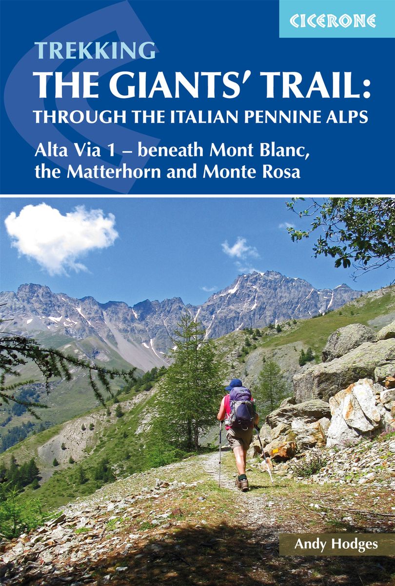
- Trekking the Giants' Trail: Alta Via 1 through the Italian Pennine Alps
- Beneath Mont Blanc, the Matterhorn and Monte Rosa Read more
- Also available from:
- De Zwerver, Netherlands
De Zwerver
Netherlands
2020
Netherlands
2020
- Wandelgids The Giants' Trail: Alta Via 1 Through the Italian Pennine Alps | Cicerone
- Beneath Mont Blanc, the Matterhorn and Monte Rosa Read more

Stanfords
United Kingdom
2022
United Kingdom
2022
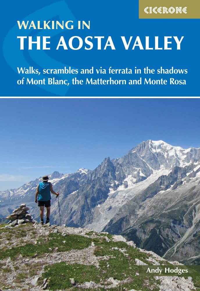
- Walking in the Aosta Valley: Walks and scrambles in the shadows of Mont Blanc, the Matterhorn and Monte Rosa
- A stunning, autonomous region in the Italian Alps, the Aosta valley is a walker`s paradise. This guidebook describes 32 varied and scenic routes both within the main valley and those to the north (including the Lys valley, Valpelline, Valtournenche and Grand St Bernard). The routes vary in difficulty and distance, offering something for walkers... Read more
- Also available from:
- The Book Depository, United Kingdom
- De Zwerver, Netherlands

The Book Depository
United Kingdom
2022
United Kingdom
2022
- Walking in the Aosta Valley
- Walks and scrambles in the shadows of Mont Blanc, the Matterhorn and Monte Rosa Read more
De Zwerver
Netherlands
2022
Netherlands
2022
- Wandelgids Walking in the Aosta Valley | Cicerone
- A stunning, autonomous region in the Italian Alps, the Aosta valley is a walker`s paradise. This guidebook describes 32 varied and scenic routes both within the main valley and those to the north (including the Lys valley, Valpelline, Valtournenche and Grand St Bernard). The routes vary in difficulty and distance, offering something for walkers... Read more

Stanfords
United Kingdom
2019
United Kingdom
2019
- Walkers`s Haute Route: Chamonix to Zermatt: The epic journey between Mont Blanc and the Matterhorn
- An incredible trek between the two most famous mountain towns in the Alps. Travelling from Chamonix in France to Zermatt in Switzerland, you will start at Mont Blanc and finish at the Matterhorn. On the way, pass the largest collection of snowy 4000m summits in the Alps: Mont Blanc, Grand Combin, the Weisshorn, the Zinalrothorn, the Dom, the... Read more
- Also available from:
- The Book Depository, United Kingdom
- De Zwerver, Netherlands

The Book Depository
United Kingdom
2019
United Kingdom
2019
- Walkers's Haute Route: Chamonix to Zermatt
- The epic journey between Mont Blanc and the Matterhorn Read more

De Zwerver
Netherlands
2019
Netherlands
2019
- Wandelgids Walker's Haute Route: Chamonix to Zermatt | Knife Edge Outdoor
- The epic journey between Mont Blanc and the Matterhorn Read more
De Zwerver
Netherlands
2012
Netherlands
2012
- Wandelgids Walliser Alpen Gebietsführer | Rother Bergverlag
- Wallis: »Land der weißen Riesen«, »Mekka des Bergsteigens«, der markigen Worthülsen und klingenden Attribute gibt es viele, namentlich im Sprachschatz einheimischer Tourismusmanager und alpenferner Werbeleute. Doch in der Tat, es steckt viel Wahres in den verbalen Superlativen für Landschaft und Natur des Viertausender-Kantons: Nirgendwo sonst... Read more
Bol.com
Netherlands
Netherlands
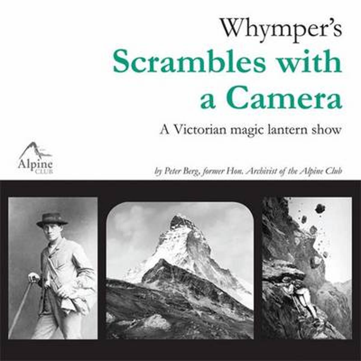
- Whymper's Scrambles with a Camera
- 2011 marks the centenary of the death of Edward Whymper, one of the most important figures in the history of mountaineering. His ascent of the Matterhorn in 1865, and the deaths of four members of his party on the way down, attracted attention throughout the world, bringing him praise and criticism in equal measure. In later years, he largely... Read more
- Also available from:
- Bol.com, Belgium
Bol.com
Belgium
Belgium
- Whymper's Scrambles with a Camera
- 2011 marks the centenary of the death of Edward Whymper, one of the most important figures in the history of mountaineering. His ascent of the Matterhorn in 1865, and the deaths of four members of his party on the way down, attracted attention throughout the world, bringing him praise and criticism in equal measure. In later years, he largely... Read more

Bol.com
Netherlands
Netherlands
- Marco Polo Reisgids Noord-Italie
- Ontdek Noord-ItaliëOlijven- en citrusbomen aan de voet van de besneeuwde Alpentoppen, een modern leven in 2000 jaar oude stadjes. Als het echt helder is, wat in de vochtige nevels van de Povlakte niet vaak gebeurt, kan men vanaf het dak van de Dom van Milaan de machtige bergketens van de Centrale Alpen in het noorden en de eerste hoge heuvels... Read more
- Also available from:
- Bol.com, Belgium
Bol.com
Belgium
Belgium
- Marco Polo Reisgids Noord-Italie
- Ontdek Noord-ItaliëOlijven- en citrusbomen aan de voet van de besneeuwde Alpentoppen, een modern leven in 2000 jaar oude stadjes. Als het echt helder is, wat in de vochtige nevels van de Povlakte niet vaak gebeurt, kan men vanaf het dak van de Dom van Milaan de machtige bergketens van de Centrale Alpen in het noorden en de eerste hoge heuvels... Read more
Bol.com
Netherlands
2004
Netherlands
2004
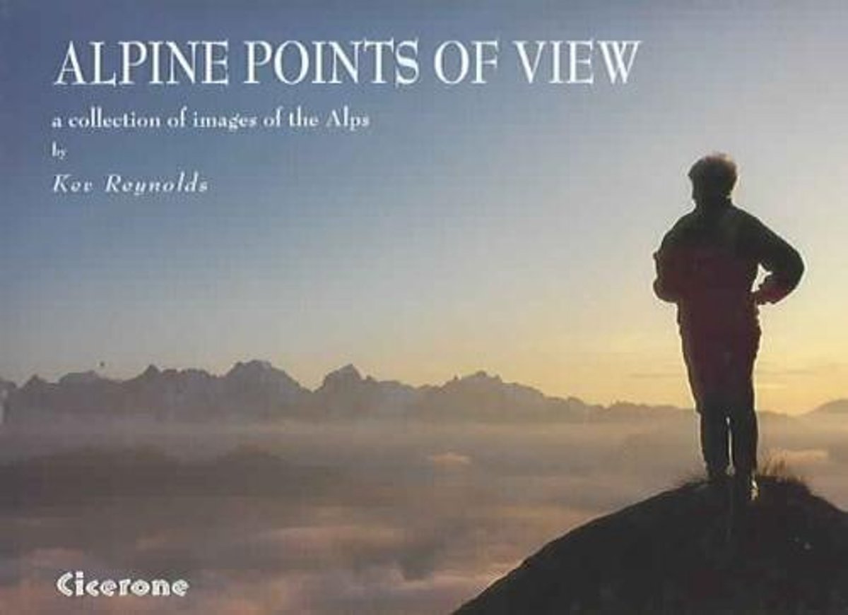
- Alpine Points Of View
- This photographic delight of 100 images will inspire a lifetime's worth of new dreams. Fall under the spell of the Alps and their amazine diversity of scenery.From the Maritime Alps behind Nice, to the sun-washed Julians of Slovenia, the Alpine chain is one of the most scenically diverse and exciting ranges on earth. With glacier and snowfield,... Read more
- Also available from:
- Bol.com, Belgium
Bol.com
Belgium
2004
Belgium
2004
- Alpine Points Of View
- This photographic delight of 100 images will inspire a lifetime's worth of new dreams. Fall under the spell of the Alps and their amazine diversity of scenery.From the Maritime Alps behind Nice, to the sun-washed Julians of Slovenia, the Alpine chain is one of the most scenically diverse and exciting ranges on earth. With glacier and snowfield,... Read more

Stanfords
United Kingdom
2011
United Kingdom
2011
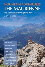
- Mountain Adventures in the Maurienne
- This new guide to a range of mountain adventures in the Haute Maurienne region of south east France, beside the Italian border in the French Alps is a collection of the finest day walks, scrambles, rock climbs, via ferratas, treks and mountain biking (MTBing) and road cycling routes, offering all the inspiration needed for a multi-activity or... Read more
- Also available from:
- Bol.com, Netherlands
- Bol.com, Belgium
- De Zwerver, Netherlands

Bol.com
Netherlands
2011
Netherlands
2011
- Mountain Adventures in the Maurienne
- A multi-activity guidebook to a range of mountain adventures in the Haute Maurienne region of south east France. The book offers a collection of the finest day walks, scrambles, rock climbs, via ferratas, treks and mountain biking and road cycling routes, offering all the inspiration needed for a multi-activity or family holiday. Routes vary... Read more
Bol.com
Belgium
2011
Belgium
2011
- Mountain Adventures in the Maurienne
- A multi-activity guidebook to a range of mountain adventures in the Haute Maurienne region of south east France. The book offers a collection of the finest day walks, scrambles, rock climbs, via ferratas, treks and mountain biking and road cycling routes, offering all the inspiration needed for a multi-activity or family holiday. Routes vary... Read more
De Zwerver
Netherlands
2011
Netherlands
2011
- Wandelgids Mountain Adventures in the Maurienne - The Vanoise and Dauphiné Alps | Cicerone
- This new guide to a range of mountain adventures in the Haute Maurienne region of south east France, beside the Italian border in the French Alps is a collection of the finest day walks, scrambles, rock climbs, via ferratas, treks and mountain biking (MTBing) and road cycling routes, offering all the inspiration needed for a multi-activity or... Read more

Stanfords
United Kingdom
2018
United Kingdom
2018
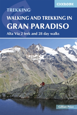
- Walking and Trekking in the Gran Paradiso: Alta Via 2 Trek and 28 Day Walks
- A guidebook to walking in the Gran Paradiso National Park in the Italian Alps, describing the 12-stage Alta Via 2 trek between Courmayeur and Chardonnay, and 28 walks ranging from 2 to 33km, as well as suggestions for combining routes into long-distance hikes. The Gran Paradiso sits in the Valle d`Aosta, in northwestern Italy, a region verging... Read more
- Also available from:
- The Book Depository, United Kingdom
- Bol.com, Netherlands
- Bol.com, Belgium

The Book Depository
United Kingdom
2018
United Kingdom
2018
- Walking and Trekking in the Gran Paradiso
- Alta Via 2 trek and 28 day walks Read more
Bol.com
Netherlands
2018
Netherlands
2018
- Walking and Trekking in the Gran Paradiso
- A guidebook to walking in the Gran Paradiso National Park in the Italian Alps, describing the 12-stage Alta Via 2 trek between Courmayeur and Chardonnay, and 28 walks ranging from 2 to 33km, as well as suggestions for combining routes into long-distance hikes. The Gran Paradiso sits in the Valle d'Aosta, in northwestern Italy, a region verging... Read more
Bol.com
Belgium
2018
Belgium
2018
- Walking and Trekking in the Gran Paradiso
- A guidebook to walking in the Gran Paradiso National Park in the Italian Alps, describing the 12-stage Alta Via 2 trek between Courmayeur and Chardonnay, and 28 walks ranging from 2 to 33km, as well as suggestions for combining routes into long-distance hikes. The Gran Paradiso sits in the Valle d'Aosta, in northwestern Italy, a region verging... Read more
Bol.com
Netherlands
Netherlands
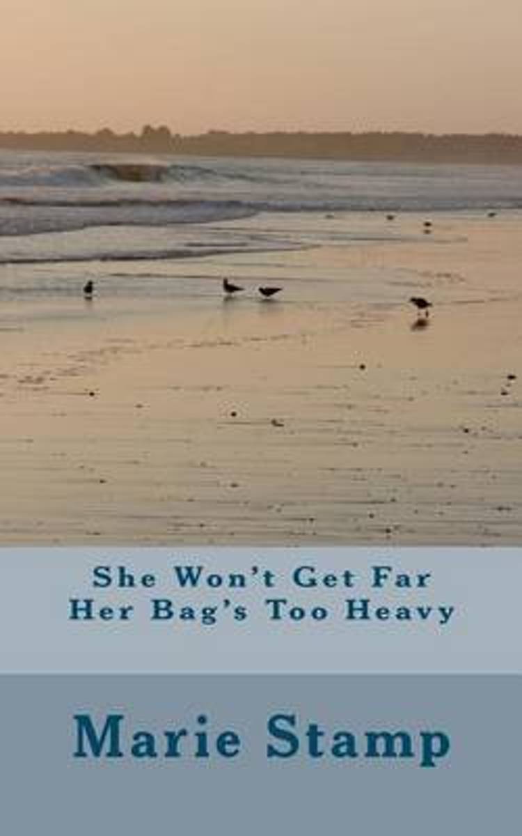
- She Won't Get Far Her Bag's Too Heavy
- SHE WON'T GET FAR HER BAG'S TOO HEAVYAuthor Marie StampA story about a woman and her dog starting out on a walk on the South West Coast Pathin 2010 with the intention of walking from Minehead to Land's End. Her dog carrying his ownbaggage and she carrying a huge rucksack full of things that give her self sufficiency. Sportingshin splints, she... Read more
- Also available from:
- Bol.com, Belgium
Bol.com
Belgium
Belgium
- She Won't Get Far Her Bag's Too Heavy
- SHE WON'T GET FAR HER BAG'S TOO HEAVYAuthor Marie StampA story about a woman and her dog starting out on a walk on the South West Coast Pathin 2010 with the intention of walking from Minehead to Land's End. Her dog carrying his ownbaggage and she carrying a huge rucksack full of things that give her self sufficiency. Sportingshin splints, she... Read more
Bol.com
Netherlands
Netherlands
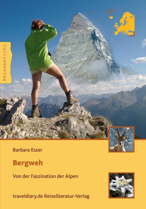
- Bergweh
- Gerade einmal zehn Minuten Gipfelglück sind der Lohn für die Mühen, die ich auf mich genommen habe, um ganz oben zu stehen. An einem hitzerekordverdächtigen Augusttag gehört das Matterhorn für einen einzigartigen Moment uns ganz alleine. Aus dem Inhalt: Das Bergweh begann ein paar Jahre zuvor. Vielleicht ergriff es Barbara Esser, als sie das... Read more
- Also available from:
- Bol.com, Belgium
Bol.com
Belgium
Belgium
- Bergweh
- Gerade einmal zehn Minuten Gipfelglück sind der Lohn für die Mühen, die ich auf mich genommen habe, um ganz oben zu stehen. An einem hitzerekordverdächtigen Augusttag gehört das Matterhorn für einen einzigartigen Moment uns ganz alleine. Aus dem Inhalt: Das Bergweh begann ein paar Jahre zuvor. Vielleicht ergriff es Barbara Esser, als sie das... Read more
Bol.com
Netherlands
Netherlands
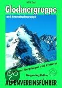
- Glockner- Und Granatspitzgruppe
- Der Großglockner, Primus inter pares im Land der Berge, übt seit jeher auf Alpinisten aller Herren Länder eine ungebrochen magische Anziehungskraft aus. Und in der Tat bieten seine Grate, Flanken und Wände immer noch Traumziele und Höhepunkte eines Bergsteigerlebens und brauchen einen Vergleich mit westalpinen Größen wie Jungfrau, Matterhorn... Read more
- Also available from:
- Bol.com, Belgium
Bol.com
Belgium
Belgium
- Glockner- Und Granatspitzgruppe
- Der Großglockner, Primus inter pares im Land der Berge, übt seit jeher auf Alpinisten aller Herren Länder eine ungebrochen magische Anziehungskraft aus. Und in der Tat bieten seine Grate, Flanken und Wände immer noch Traumziele und Höhepunkte eines Bergsteigerlebens und brauchen einen Vergleich mit westalpinen Größen wie Jungfrau, Matterhorn... Read more

Stanfords
United Kingdom
2014
United Kingdom
2014
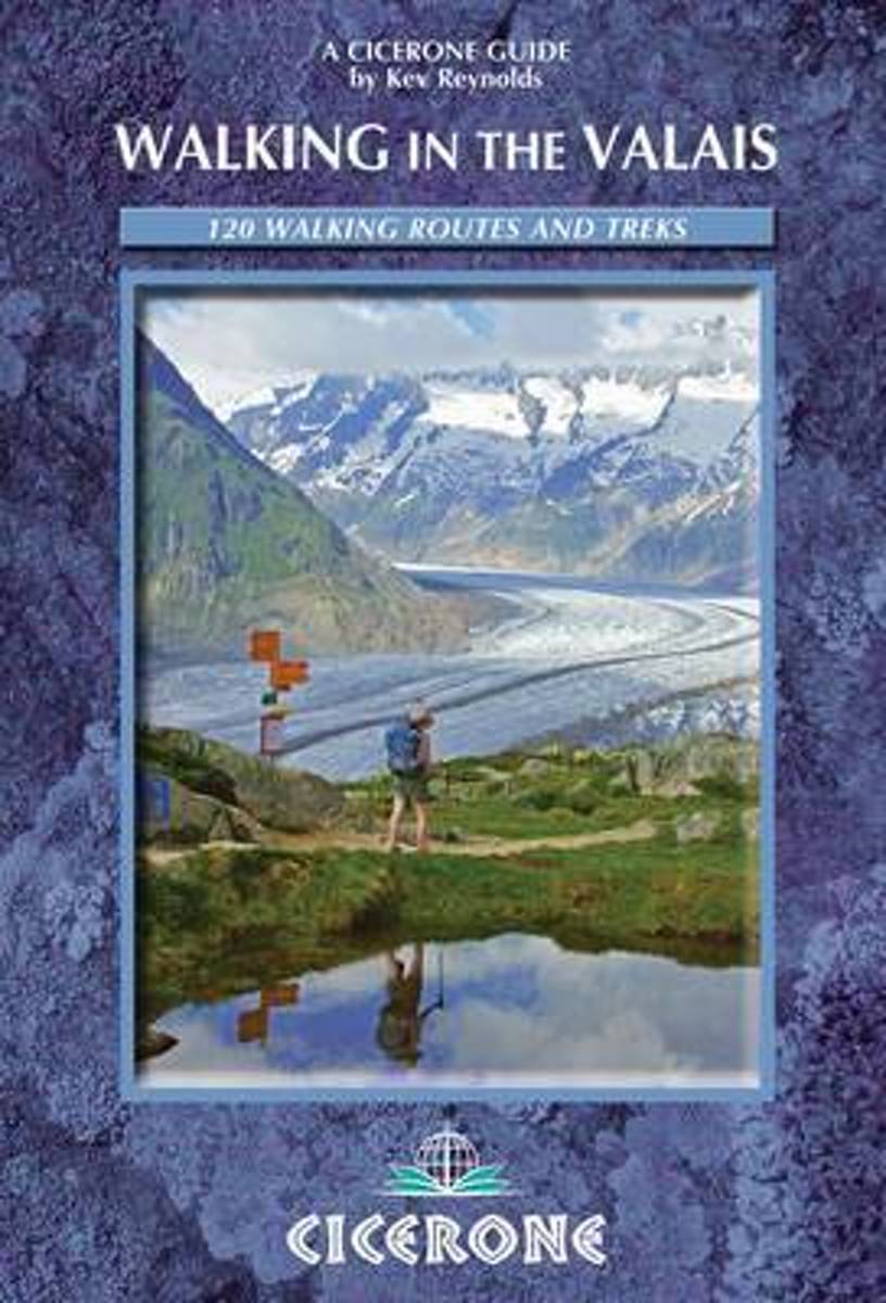
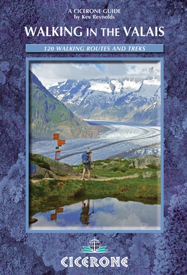
- Valais Walking Guide- 120 Walks and Treks
- The Pennine Alps in the Valais region of Switzerland contain more 4000m peaks than anywhere else in Western Europe and some of the greats: the Matterhorn, Monte Rosa, Dent Blanche and Grand Combin, all surrounded by idyllic valleys and hillsides dotted with chalets, hay barns and hardy little alpine flowers as well as pristine snowfields and... Read more
- Also available from:
- The Book Depository, United Kingdom
- Bol.com, Netherlands
- Bol.com, Belgium
- De Zwerver, Netherlands

Bol.com
Netherlands
2014
Netherlands
2014
- Walking in the Valais
- The Pennine Alps in the Valais region of Switzerland contain more 4000m peaks than anywhere else in Western Europe and some of the greats: the Matterhorn, Monte Rosa, Dent Blanche and Grand Combin, all surrounded by idyllic valleys and hillsides dotted with chalets, hay barns and hardy little alpine flowers as well as pristine snowfields and... Read more
Bol.com
Belgium
2014
Belgium
2014
- Walking in the Valais
- The Pennine Alps in the Valais region of Switzerland contain more 4000m peaks than anywhere else in Western Europe and some of the greats: the Matterhorn, Monte Rosa, Dent Blanche and Grand Combin, all surrounded by idyllic valleys and hillsides dotted with chalets, hay barns and hardy little alpine flowers as well as pristine snowfields and... Read more
De Zwerver
Netherlands
2014
Netherlands
2014
- Wandelgids Walks In The Valais | Cicerone
- Comprehensive guidebook to the Valais, Switzerland, describing 111 day walks and 10 multi-day tours. Some of Europe's most dramatic mountains are found here, including the Matterhorn, Monte Rosa, Dent Blanche and Grand Combin. From easy valley walks to harder treks across rugged passes - routes for all abilities. Read more
Maps
Stanfords
United Kingdom
United Kingdom
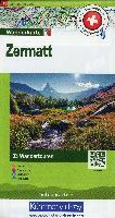
- Zermatt - Matterhorn K+F Hiking 13
- The Mattertal and the lower part of the Saastal valleys, the Mischabel group with Dom, and the upper part of the Val d`Anniviers presented at 1:50,000 on a waterproof and tear-resistant, contoured and GPS compatible map from the Hallwag/Kümmerly + Frey group, with route profiles, grading for the severity of the terrain and the degree of fitness... Read more

Stanfords
United Kingdom
United Kingdom
- Tour of the Matterhorn / Cervino L`Escursionista Editore Map-Guide
- Tour of the Matternhorn (Il Cervino) & Gran Balconata del Cervino long-distance hiking routes presented on a waterproof and tear-restant, double-sided, contoured and GPS compatible map published jointly by L’Escursionista Editore and Editrek, with a separate guide booklet for each route.On one side is a map at 1:50,000 showing the Tour of the... Read more

Stanfords
United Kingdom
United Kingdom
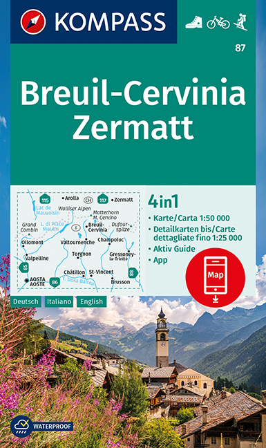
- Breuil-Cervinia - Zermatt Kompass 87
- Breuil-Cervinia - Matterhorn - Zermatt area straddling the border of Italy and Switzerland on a GPS compatible hiking and recreational map at 1:50,000 from Kompass, printed on durable, waterproof and tear-resistant synthetic paper. Coverage extends north to Arolla and east to Monte Rosa, with Aosta in the south-western corner of the map, and... Read more
- Also available from:
- De Zwerver, Netherlands
De Zwerver
Netherlands
Netherlands
- Wandelkaart 87 Breuil-Cervinia - Zermatt | Kompass
- Breuil-Cervinia - Matterhorn - Zermatt area straddling the border of Italy and Switzerland on a GPS compatible hiking and recreational map at 1:50,000 from Kompass, printed on durable, waterproof and tear-resistant synthetic paper. Coverage extends north to Arolla and east to Monte Rosa, with Aosta in the south-western corner of the map, and... Read more

Stanfords
United Kingdom
United Kingdom
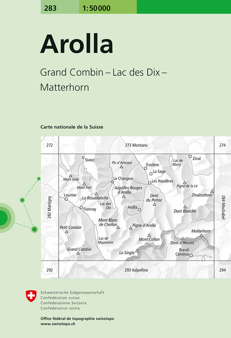
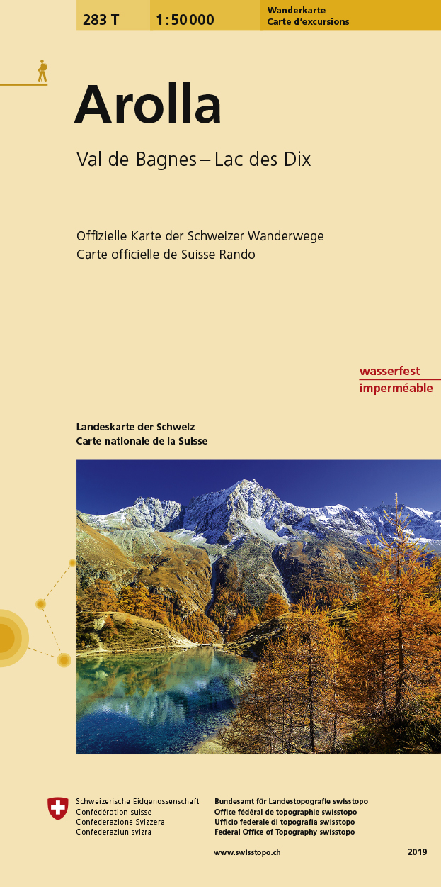
- Arolla Swisstopo 283
- Arolla, map No. 283, in the standard topographic survey of Switzerland at 1:50,000 from Swisstopo, i.e. without the special overprint highlighting walking trails, local bus stops, etc, presented in Swisstopo’s hiking editions of the 50K survey. The map covers the peaks from the Matterhorn to Grand Combin, and the southern part of Val d’Herens... Read more
- Also available from:
- De Zwerver, Netherlands
De Zwerver
Netherlands
Netherlands
- Wandelkaart - Topografische kaart 283 Arolla | Swisstopo
- Arolla, map No. 283, in the standard topographic survey of Switzerland at 1:50,000 from Swisstopo, i.e. without the special overprint highlighting walking trails, local bus stops, etc, presented in Swisstopo Read more

Stanfords
United Kingdom
United Kingdom
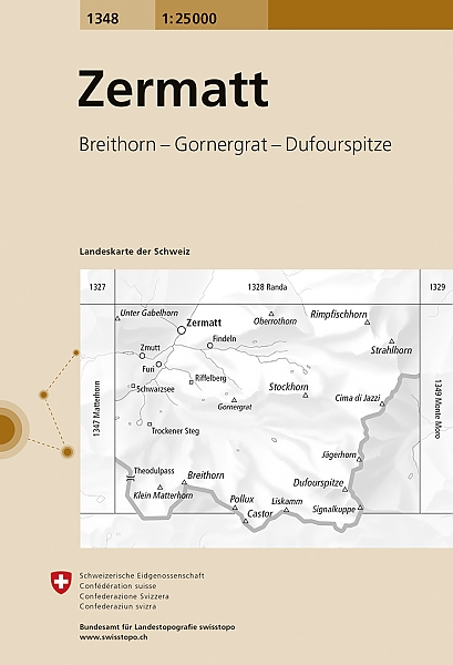
- Zermatt Swisstopo 1348
- Map No. 1348, Zermatt, in the topographic survey of Switzerland at 1:25,000 from Bundesamt für Landestopographie (swisstopo), covering the whole country on 247 small format sheets, with special larger maps published for popular regions including some titles now available in hiking versions.Highly regarded for their superb use of graphic relief... Read more
- Also available from:
- De Zwerver, Netherlands
De Zwerver
Netherlands
Netherlands
- Wandelkaart - Topografische kaart 1348 Zermatt | Swisstopo
- Map No. 1348, Zermatt, in the topographic survey of Switzerland at 1:25,000 from Bundesamt f Read more

Stanfords
United Kingdom
United Kingdom
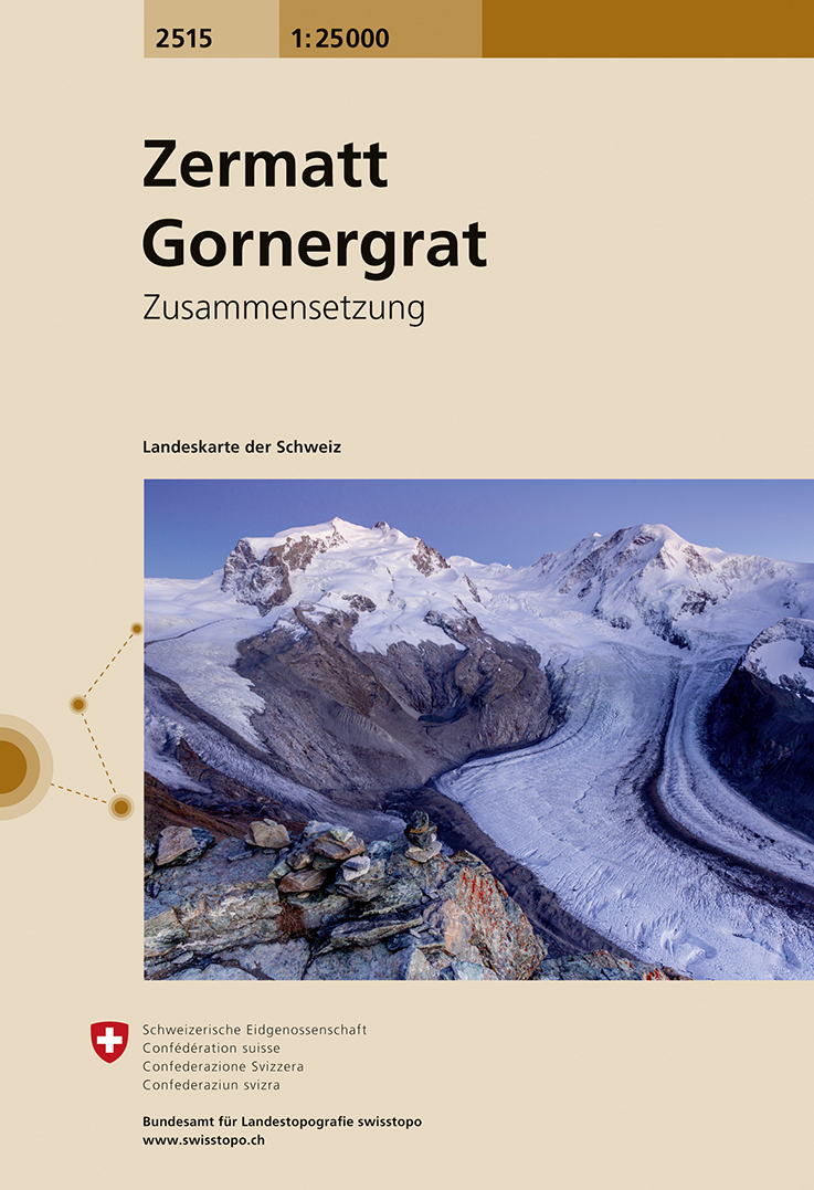
- Zermatt - Gornergrat Swisstopo 2515
- Map No. 2515, Zermatt - Gornergrat, in the topographic survey of Switzerland at 1:25,000 from Swisstopo, covering the upper part of the Mattertal with Täsch and Zermatt and extending south across the peaks (Monte Rosa/Dufourspitze, Breithorn, Theodulpass, Matterhorn and Dents d’Hérens) to Breuil-Cervinia in Italy. Peaks on both sides of the... Read more
- Also available from:
- De Zwerver, Netherlands
De Zwerver
Netherlands
Netherlands
- Wandelkaart - Topografische kaart 2515 Zermatt - Gornergrat | Swisstopo
- Map No. 2515, Zermatt - Gornergrat, in the topographic survey of Switzerland at 1:25,000 from Swisstopo, covering the upper part of the Mattertal with T Read more

Stanfords
United Kingdom
United Kingdom
- Arolla Swisstopo Hiking 283T
- Arolla area, map No. 283T, at 1:50,000 in a special hiking edition of the country’s topographic survey, published by Swisstopo in cooperation with the Swiss Hiking Federation. The map covers the peaks from the Matterhorn to Grand Combin, and the southern part of Val d’Herens with Evolène and La Forclaz.Cartography, identical to the standard... Read more
- Also available from:
- De Zwerver, Netherlands
De Zwerver
Netherlands
Netherlands
- Wandelkaart 283T Arolla | Swisstopo
- Arolla area, map No. 283T, at 1:50,000 in a special hiking edition of the country Read more

Stanfords
United Kingdom
United Kingdom
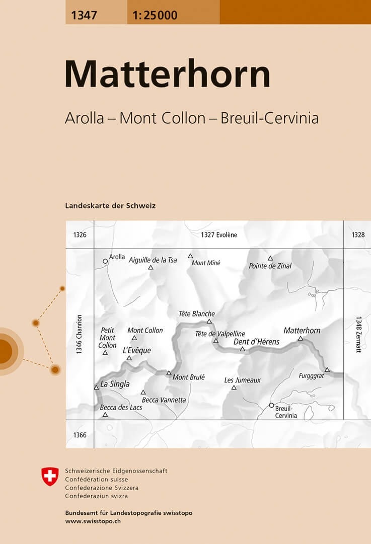
- Matterhorn Swisstopo 1347
- Map No. 1347, Matterhorn, in the topographic survey of Switzerland at 1:25,000 from Bundesamt für Landestopographie (swisstopo), covering the whole country on 247 small format sheets, with special larger maps published for popular regions including some titles now available in hiking versions.Highly regarded for their superb use of graphic... Read more
- Also available from:
- De Zwerver, Netherlands
De Zwerver
Netherlands
Netherlands
- Wandelkaart - Topografische kaart 1347 Matterhorn | Swisstopo
- Map No. 1347, Matterhorn, in the topographic survey of Switzerland at 1:25,000 from Bundesamt f Read more

Stanfords
United Kingdom
United Kingdom
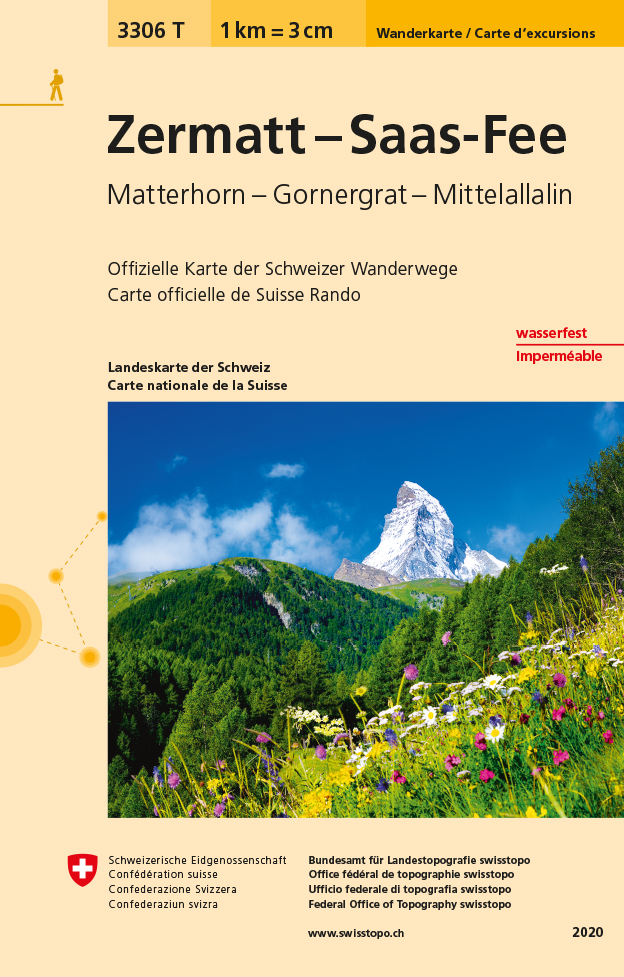
- Zermatt - Saas-Fee - Matterhorn - Gornergrat - Mittelallalin Swisstopo Hiking 3306T
- Zermatt - Saas Fee - Matterhorn - Gornergrat - Mischabel area at 1:33,333 on light, waterproof and tear-resistant map No. 3306T published by Swisstopo in cooperation with the Swiss Hiking Federation. Cartography is the same as in Swisstopo’s 50K hiking maps, simply enlarged to 1:33,333 for extra clarity but without additional information.... Read more
- Also available from:
- De Zwerver, Netherlands
De Zwerver
Netherlands
Netherlands
- Wandelkaart - Topografische kaart 3306T Zermatt - Saas - Fee | Swisstopo
- Een nieuwe serie van de Zwitserse topografische dienst: eindelijk goede wandelkaarten met ingetekende wandelroutes op scheur- en watervast papier. Vooralsnog zijn ze uitgebracht van de populaire wandelgebieden en niet landelijk dekkend (zie overzicht) Op een gedetailleerde schaal van 1:33.333 met als ondergrond de onovertroffen topografische... Read more

Stanfords
United Kingdom
United Kingdom
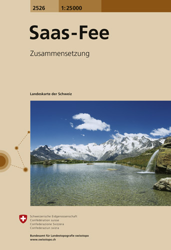
- Saas-Fee Swisstopo 2526
- Map No. 2526, Saas-Fee, in the topographic survey of Switzerland at 1:25,000 from Swisstopo, covering the central part of the Mischabel range and both sides of the two adjoining valleys: the Mattertal between Zermatt and St Niklaus and the Saastal from north of Saas-Balen to the Mattmark Reservoir. Please note: Zermatt is at the southern edge... Read more
- Also available from:
- De Zwerver, Netherlands
De Zwerver
Netherlands
Netherlands
- Wandelkaart - Topografische kaart 2526 Saas - Fee | Swisstopo
- Map No. 2526, Saas-Fee, in the topographic survey of Switzerland at 1:25,000 from Swisstopo, covering the central part of the Mischabel range and both sides of the two adjoining valleys: the Mattertal between Zermatt and St Niklaus and the Saastal from north of Saas-Balen to the Mattmark Reservoir. Please note: Zermatt is at the southern edge... Read more

Stanfords
United Kingdom
United Kingdom
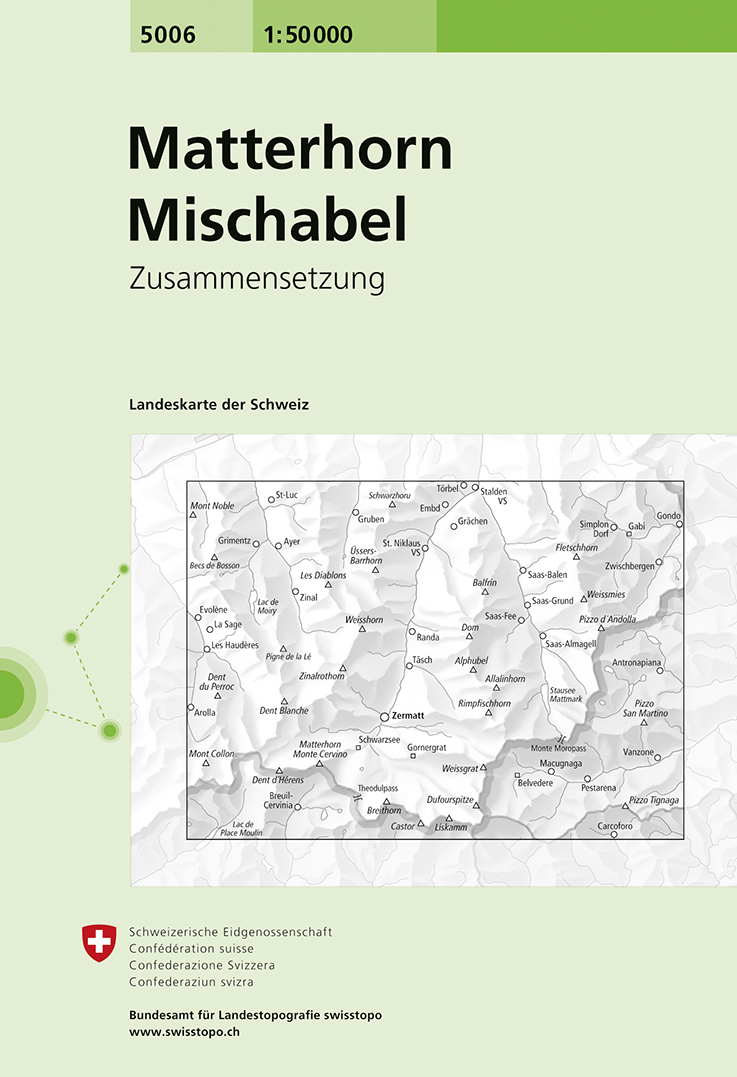
- Matterhorn - Mischabel Swisstopo 5006
- Matterhorn - Mischabel area, map No. 5006, in the standard topographic survey of Switzerland at 1:50,000 from Swisstopo, i.e. without the special overprint highlighting walking trails, local bus stops, etc, presented in Swisstopo’s hiking editions of the 50K survey. The map covers the whole of the Mattertal and Saastal valleys with Zermatt,... Read more
- Also available from:
- De Zwerver, Netherlands
De Zwerver
Netherlands
Netherlands
- Wandelkaart - Topografische kaart 5006 Matterhorn Mischabel | Swisstopo
- Matterhorn - Mischabel area, map No. 5006, in the standard topographic survey of Switzerland at 1:50,000 from Swisstopo, i.e. without the special overprint highlighting walking trails, local bus stops, etc, presented in Swisstopo Read more

Stanfords
United Kingdom
United Kingdom
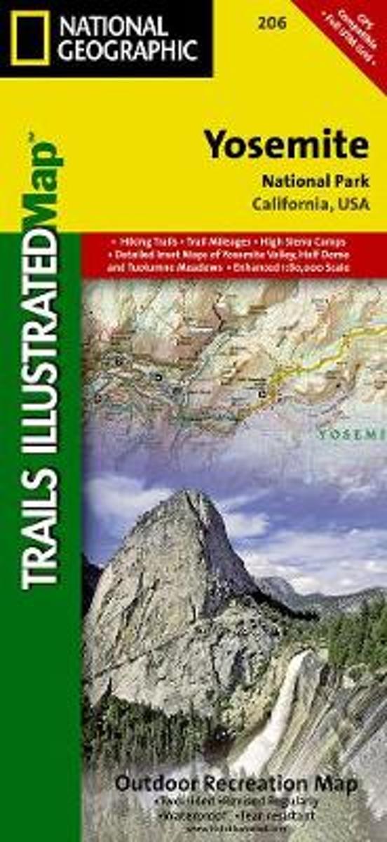
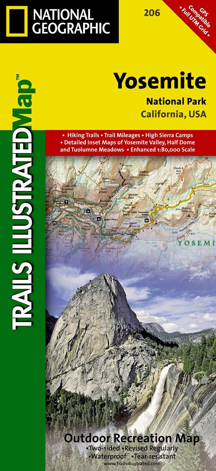
- Yosemite National Park CA NGS Trails Illustrated Map 206
- Map No. 206, Yosemite National Park, CA, in an extensive series of GPS compatible, contoured hiking maps of USA’s national and state parks or forests and other popular recreational areas. Cartography based on the national topographic survey, with additional tourist information.The maps, with most titles now printed on light, waterproof and... Read more
- Also available from:
- The Book Depository, United Kingdom
- Bol.com, Netherlands
- Bol.com, Belgium
- De Zwerver, Netherlands

Bol.com
Netherlands
Netherlands
- Yosemite National Park
- Waterproof Tear-Resistant Topographic MapExplore the majesty of Yosemite National Park with National Geographic's Trails Illustrated map. Loaded with helpful information on camping, hiking, lodging, transportation, regulations, and safety, this map is an invaluable tool for casual park visitors and avid adventurers alike. Expertly... Read more
Bol.com
Belgium
Belgium
- Yosemite National Park
- Waterproof Tear-Resistant Topographic MapExplore the majesty of Yosemite National Park with National Geographic's Trails Illustrated map. Loaded with helpful information on camping, hiking, lodging, transportation, regulations, and safety, this map is an invaluable tool for casual park visitors and avid adventurers alike. Expertly... Read more
De Zwerver
Netherlands
Netherlands
- Wandelkaart - Topografische kaart 206 Yosemite National Park | National Geographic
- Prachtige geplastificeerde kaart van het bekende nationaal park. Met alle recreatieve voorzieningen als campsites, maar ook met topografische details en wandelroutes ed. Door uitgekiend kleurgebruik zeer prettig in gebruik. Scheur en watervast! Coverage includes Stanislaus National Forest, Emigrant Wilderness, Carson Iceberg Wilderness, Toiyabe... Read more

Stanfords
United Kingdom
United Kingdom
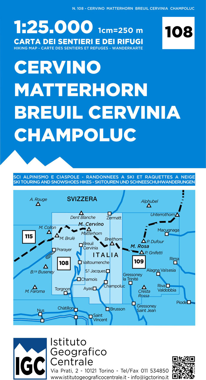
- Matterhorn / Cervino - Breuil Cervinia - Champoluc IGC 108
- Matterhorn/M. Cervino - Breuil-Cervinia - Champoluc area at 1:25,000 in a series of contoured, GPS compatible walking maps from the Turin based Istituto Geografico Centrale, highlighting hiking trails including long-distance routes, ski routes and alpine accommodation. Maps in this series have contours at 25m intervals, enhanced by shading and... Read more
- Also available from:
- De Zwerver, Netherlands

Stanfords
United Kingdom
United Kingdom
- Matterhorn / M. Cervino - Monte Rosa IGC 5
- The Italian side of the Matterhorn and Monte Rosa, with coverage extending from Zermatt to Aosta, in a series contoured hiking maps at 1:50,000 with local trails, long-distance footpaths, mountain accommodation, etc. from the Turin based Istituto Geografico Centrale. Maps in this series have contours at 50m intervals, enhanced by shading and... Read more
- Also available from:
- De Zwerver, Netherlands

De Zwerver
Netherlands
Netherlands
- Wandelkaart 05 Cervino Matterhorn e Monte Rosa | IGC - Istituto Geografico Centrale
- Matterhorn/M.Cervino and Monte Rosa, map no. 5, in a series contoured hiking maps at 1:50,000 with local trails, long-distance footpaths, mountain accommodation, etc. from the Turin based Istituto Geografico Centrale covering the Italian Alps and Piedmont, the lakes and northern Lombardy, and the Italian Riviera.The maps have contours at 50m... Read more