Stanfords
United Kingdom
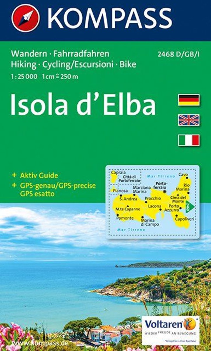
- Elba Kompass 2468
- Elba on a map at 1:25,000 from Kompass, with a street plan of Portoferraio and coverage of the nearby Capraia and Pianosa at 1:50,000. Contours are at 20m intervals, with relief shading and graphics/colouring to indicate different types of the terrain. An overprint highlights hiking trails, including the GTE – Grande Traversata Elbana,... Read more

Stanfords
United Kingdom
- Elba & the Tuscan Archipelago 25K Ed. Multigraphic Map No. 502
- Elba and the Tuscan Archipelago at 1:25,000 in a series of hiking maps from Edizioni Multigraphic covering Tuscany, parts of Umbria, and the adjoining areas. The cartography is rather old fashioned and sometimes not as clear as in the other map series but for many areas, especially for parts of Tuscany, these are the only hiking maps available.... Read more

Stanfords
United Kingdom
- IT2 Elba to Naples
- Passage ChartsC 1 Mallorca to Sicily 1:1,750,000C 2 Corsica Channel to Mt. Argentario 1:350,000C 3 Mt. Argentario to Capo Circeo 1:350,000C 4 Capo Circeo to Capri 1:350,000Coastal ChartsC 5 Tuscan Islands South 1:150,000C 6 Pta. Ala to Mt. Argentario 1:150,000C 7 Mt. Argentario to Capo Linaro 1:150,000C 8 Capo Linaro to Rome 1:150,000C 9 Rome... Read more

Stanfords
United Kingdom
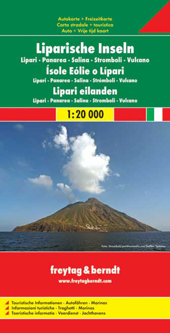
- Aeolian (Lipari) Islands and Southern Italy F&B
- Aeolian (Lipari) Islands at 1:20,000 from Freytag & Berndt on a double-sided map which presents on the reverse coverage of Italy south of Rome at 1:600,000 and shows ferry access to the islands from the mainland or Sicily.On one side the islands are shown in a series of panels, with the three largest: Salina, Lipari and Vulcano together, and... Read more
Bol.com
Netherlands
- Kompass WK2468 Elba
- Deze kaart is ideaal voor het uitstippelen van wandel- en fietsroutes en om onderweg te gebruiken • goed leesbare kaart met heel veel topografische details • duidelijke symbolen maken de kaart extra overzichtelijk • wandel- en fietsroutes zijn aangegeven • praktische informatie over de regio • bruikbaar met GPS • nuttige informatie voor... Read more
Bol.com
Belgium
- Kompass WK2468 Elba
- Deze kaart is ideaal voor het uitstippelen van wandel- en fietsroutes en om onderweg te gebruiken • goed leesbare kaart met heel veel topografische details • duidelijke symbolen maken de kaart extra overzichtelijk • wandel- en fietsroutes zijn aangegeven • praktische informatie over de regio • bruikbaar met GPS • nuttige informatie voor... Read more

Stanfords
United Kingdom
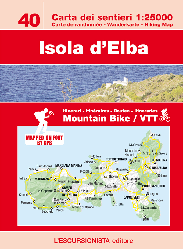
- Elba L`Escursionista Editore
- Elba at 1:25,000 on a contoured and GPS-compatible map from L’Escursionista Editore prominently highlighting local trails and longer routes, shown where appropriate with their waymaking symbols and/or official numbers, plus a 32-page English language booklet on the Grande Traversata Elbana including accommodation.Topography of the island is... Read more
De Zwerver
Netherlands
- Wandelkaart 40 Isola d'Elba | L'Escursionista editore
- Elba at 1:25,000 on a contoured and GPS-compatible map from L’Escursionista Editore prominently highlighting local trails and longer routes, shown where appropriate with their waymaking symbols and/or official numbers, plus a 32-page English language booklet on the Grande Traversata Elbana including accommodation.Topography of the island is... Read more
De Zwerver
Netherlands
De Zwerver
Netherlands