
Stanfords
United Kingdom
- London West 1920
- Map No. 176, London West 1920, in the Cassini Historical Series of old Ordnance Survey mapping of England and Wales at 1:50,000 in a format designed to offer a convenient comparison with the present day coverage from the OS, and most locations in three different editions. Old historical maps have been combined so that the sheet lines correspond... Read more
Stanfords
United Kingdom
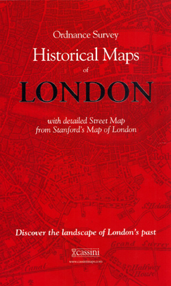
- London Historical Maps Box Set (5-map set)
- London Historical Set of five maps in the Cassini Historical Series reproducing old Ordnance Survey mapping of England and Wales at 1:50,000. The set consists of the four Cassini maps showing the capital between 1805 and 1948, and has as a bonus map a reproduction of Stanfords street plan London at six inches to one mile from 1891.The four... Read more

Stanfords
United Kingdom
- London High 5 Edition Street Plan
- The first water-resistant “Comfort Map“ with direct access to useful additional information from the InternetLondon in a scale of 1:20,000 including tourist destinations (Hampstead Heath, Olympic Park and Greenwich) presented on a practical map; inclusive of the High 5 Edition app technology for calling up additional travel information and many... Read more

Stanfords
United Kingdom
- London Greater London Street Finder PAPERBACK
- Detailed paperback street atlas covering the whole of Greater London at three different scales: 1:10,000 scale covers central London; 1:20,000 scale extends from Welwyn Garden City in the north to Gatwick Airport in the south and from Windsor in the west to Gravesend in the east; 1:63,360 scale extends from Highbury in the north to Clapham in... Read more
Stanfords
United Kingdom
- London East 1920-1921
- Map No. 177, London East 1920-1921, in the Cassini Historical Series of old Ordnance Survey mapping of England and Wales at 1:50,000 in a format designed to offer a convenient comparison with the present day coverage from the OS, and most locations in three different editions. Old historical maps have been combined so that the sheet lines... Read more

Stanfords
United Kingdom
- London
- London at 1:50,00 with mapping from the Ordnance Survey’s Landranger series published by Cassini to add to their extensive coverage of the city on historical maps reflecting different periods in its development. Unlike the Landranger series which splits the city east/west, the Cassini version is centred on Charing Cross and covers most of the... Read more

Stanfords
United Kingdom

Stanfords
United Kingdom
Stanfords
United Kingdom
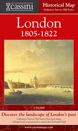
- London 1805-1822
- London in 1805-1822 in the Cassini Historical Series reproducing old Ordnance Survey mapping of England and Wales at 1:50,000. The four London maps cover roughly the area of the present day Greater London rather than following the format of rest of the series which is designed to correspond to the current Landranger maps. Mapping is identical... Read more
Stanfords
United Kingdom
- London West 1805-1920 (3-map set)
- Map No. 176, London West 1805-1920 (3-map set), in the Cassini Historical Series of old Ordnance Survey mapping of England and Wales at 1:50,000 in a format designed to offer a convenient comparison with the present day coverage from the OS, and most locations in three different editions. Old historical maps have been combined so that the sheet... Read more

Stanfords
United Kingdom
- Luxembourg North
- One of two topographic survey maps of Luxembourg at 1:50,000, with contours at 10-metres intervals and additional relief shading. An overprint highlights long-distance footpaths, including the GR5 (E-2), cycle routes, and various places of interest, including campsites. The map covers an area of approximately 53 x 43 km / 33 x 27 miles. Map... Read more
Stanfords
United Kingdom
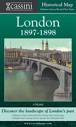
- London 1897-1898
- London in 1897-1898 in the Cassini Historical Series reproducing old Ordnance Survey mapping of England and Wales at 1:50,000. The four London maps cover roughly the area of the present day Greater London rather than following the format of rest of the series which is designed to correspond to the current Landranger maps. Mapping is identical... Read more
Stanfords
United Kingdom
- London East 1805-1922 (3-map set)
- Map No. 177, London East 1805-1922 (3-map set), in the Cassini Historical Series of old Ordnance Survey mapping of England and Wales at 1:50,000 in a format designed to offer a convenient comparison with the present day coverage from the OS, and most locations in three different editions. Old historical maps have been combined so that the sheet... Read more

Stanfords
United Kingdom
- Luxembourg South
- One of two topographic survey maps of Luxembourg at 1:50,000, with contours at 10-metres intervals and additional relief shading. An overprint highlights long-distance footpaths, including the GR5 (E-2), cycle routes, and various places of interest, including campsites. The map covers an area of approximately 53 x 43 km / 33 x 27 miles. Map... Read more
Stanfords
United Kingdom
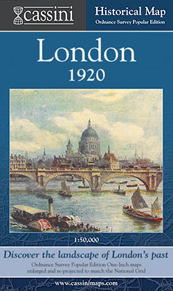
- London 1920
- London in 1920 in the Cassini Historical Series reproducing old Ordnance Survey mapping of England and Wales at 1:50,000. The four London maps cover roughly the area of the present day Greater London rather than following the format of rest of the series which is designed to correspond to the current Landranger maps. Mapping is identical to the... Read more