Stanfords
United Kingdom
- Dolomiti di Braies / Pragser Dolomiten - Marebbe / Ennberg Tabacco 031
- Dolomiti di Braies/Pragser Dolomiten - Marebbe/Ennberg area in a series of Tabacco maps at 1:25,000 covering the Dolomites and the mountains of north-eastern Italy - Stanfords’ most popular coverage for this region, with excellent cartography and extensive overprint for hiking routes and other recreational activities, local bus stops, etc.... Read more
Stanfords
United Kingdom
- Cortina d`Ampezzo - Dolomiti Ampezzane Kompass 617
- Map No. 617, Cortina d’Ampezzo and Dolomiti Ampezzane at 1:25,000 on a durable, waterproof and tear-resistant map from Kompass in their series of detailed maps of the Dolomites. The map is double-sided and includes sections of the ‘Alta Via’ high routes Nos. 1, 3, 4 and 5.CARTOGRAPHY: Kompass maps of the Dolomites at 1:25,000 have contours at... Read more

Stanfords
United Kingdom
- Cortina d`Ampezzo - Dolomiti Ampezzane Tabacco 03
- Cortina d`Ampezzo - Dolomiti Ampezzane area in a series of Tabacco maps at 1:25,000 covering the Dolomites and the mountains of north-eastern Italy - Stanfords’ most popular coverage for this region, with excellent cartography and extensive overprint for hiking routes and other recreational activities, local bus stops, etc. Additional overprint... Read more

Stanfords
United Kingdom
- Texelgruppe NP - Merano High Route Kompass 043
- Map No. 043, Texelgruppe NP - Merano High Route, from Kompass, printed on strudy waterproof and tear-resistant plastic paper in a series providing detailed coverage of the Dolomites and Lake Garda area and supplementing their main series of walking maps of Italy at 1:50,000. Maps in this series have a more detailed base and smaller contour... Read more

Stanfords
United Kingdom
- Lana - Etschtal / Val d`Adige Kompass 054
- Map No. 054, Lana - with a panorama map on the reverse, from Kompass in a series providing detailed coverage of the Dolomites and Lake Garda area and supplementing their main series of walking maps of Italy at 1:50,000. Maps in this series have a more detailed base and smaller contour interval than coverage at 1:50,000.*Cartography:* maps at... Read more

Stanfords
United Kingdom
- Val Venosta / Vinschgau Kompass 52
- Val Venosta/Vinschgau area of the Dolomites on a GPS compatible hiking and recreational map at 1:50,000 from Kompass, printed on durable, waterproof and tear-resistant synthetic paper. KOMPASS HIKING MAPS OF ITALY: this title is part of an extensive series of walking maps from Kompass covering selected areas of Italy at mainly 1:50,000, with a... Read more
Stanfords
United Kingdom
- Val Venosta / Vinschgau 3-Map Set Kompass 670
- Val Venosta / Vinschgau in the South Tyrol on a set of three contoured and GPS compatible maps at 1:25,000 from Kompass in their series of detailed maps of the Dolomites. Coverage extends from Merano westwards to the Rèsia lake and pass in the north-west and includes the Stelvio / Stilfser Joch National Par, with the Ortles/Ortler group and... Read more

Stanfords
United Kingdom
- Alpi Bellunesi Kompass 77
- Belluno and Alpi Bellunesi in the southern Dolomites on a GPS compatible hiking and recreational map at 1:50,000 from Kompass. KOMPASS HIKING MAPS OF ITALY: this title is part of an extensive series of walking maps from Kompass covering selected areas of Italy at mainly 1:50,000, with a GPS compatible, contoured topographic base, extensive... Read more

Stanfords
United Kingdom
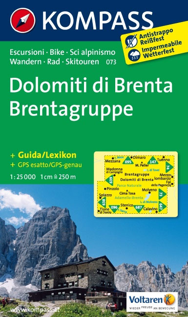
- Dolomiti di Brenta Kompass 073
- Map No. 073, Dolomiti di Brenta, from Kompass in a series providing detailed coverage of the Dolomites and Lake Garda area and supplementing their main series of walking maps of Italy at 1:50,000. Maps in this series have a more detailed base and smaller contour interval than coverage at 1:50,000.*Cartography:* maps at 1:25,000 have contours at... Read more

Stanfords
United Kingdom
- Alta Badia / Hochabtai Kompass 624
- Map No. 624, Alta Badia/Hochabtai, at 1:25,000 from Kompass, printed on sturdy, waterproof and tear-resistant synthetic paper in a series providing detailed coverage of the Dolomites and the Lake Garda area. Maps in this series supplement the publishers` main series of walking maps of Italy at 1:50,000 and have a more detailed base and smaller... Read more

Stanfords
United Kingdom
- Vipiteno / Sterzing Kompass 44
- Map No. 44, Vipiteno/Sterzing, from Kompass, printed on waterproof and tear-resistant synthetic paper in a series of walking maps of selected areas of Italy at 1:50,000, with hiking routes on a topographic base, various types of accommodation, recreational facilities, places of interest, etc. Kompass are Europe’s largest publishers of walking... Read more
Stanfords
United Kingdom
- Val d`Ultimo / Ultental Kompass 052
- Val d`Ultimo/Ultental area at 1:25,000 on a durable, waterproof and tear-resistant map from Kompass in their series of detailed maps of the Dolomites.CARTOGRAPHY: Kompass maps of the Dolomites at 1:25,000 have contours at 25-m intervals. An overprint shows local and long-distance footpaths, including all the high level routes (Alte Vie). The... Read more
Stanfords
United Kingdom
- Monti de Valle Aurina / Ahrntaler Berge Kompass 082
- Map No. 082, Monti de Valle Aurina/Ahrntaler Berge , from Kompass in a series providing detailed coverage of the Dolomites and Lake Garda area and supplementing their main series of walking maps of Italy at 1:50,000. Maps in this series have a more detailed base and smaller contour interval than coverage at 1:50,000.*Cartography:* maps at... Read more

Stanfords
United Kingdom
- Dolomiti di Sesto / Sextener Dolomiten Kompass 625
- Map No. 625, Dolomiti di Sesto/Sextener Dolomiten, at 1:25,000 from Kompass printed on sturdy, waterproof and tear-resistant synthetic paper in a series providing detailed coverage of the Dolomites and the Lake Garda area. Maps in this series supplement the publishers` main series of walking maps of Italy at 1:50,000 and have a more detailed... Read more

Stanfords
United Kingdom
- Val Gardena / Groden - Alpe di Siusi / Seiseralm Tabacco 05
- Val Gardena/Gröden - Alpe di Siusi/Seiseralm area in a series of Tabacco maps at 1:25,000 covering the Dolomites and the mountains of north-eastern Italy - Stanfords’ most popular coverage for this region, with excellent cartography and extensive overprint for hiking routes and other recreational activities, local bus stops, etc. Additional... Read more