
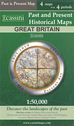
Stanfords
United Kingdom
- London West 1805-1822
- Map No. 176, London West 1805-1822, in the Cassini Historical Series of old Ordnance Survey mapping of England and Wales at 1:50,000 in a format designed to offer a convenient comparison with the present day coverage from the OS, and most locations in three different editions. Old historical maps have been combined so that the sheet lines... Read more
Stanfords
United Kingdom
- Lleyn Peninsula / Pen Llyn 1903
- Map No. 123, Lleyn Peninsula / Pen Llyn 1903, in the Cassini Historical Series of old Ordnance Survey mapping of England and Wales at 1:50,000 in a format designed to offer a convenient comparison with the present day coverage from the OS, and most locations in three different editions. Old historical maps have been combined so that the sheet... Read more
Stanfords
United Kingdom
- Scarborough 1924-1925
- Map No. 101, Scarborough 1924-1925, in the Cassini Historical Series of old Ordnance Survey mapping of England and Wales at 1:50,000 in a format designed to offer a convenient comparison with the present day coverage from the OS, and most locations in three different editions. Old historical maps have been combined so that the sheet lines... Read more
Stanfords
United Kingdom
- Grimsby 1824
- Map No. 113, Grimsby 1824, in the Cassini Historical Series of old Ordnance Survey mapping of England and Wales at 1:50,000 in a format designed to offer a convenient comparison with the present day coverage from the OS, and most locations in three different editions. Old historical maps have been combined so that the sheet lines correspond to... Read more
Stanfords
United Kingdom
- Richmond and Ealing Past and Present
- London boroughs of Richmond and Ealing in the Cassini Past and Present map series which covers town and cities of England and Wales and offers a unique way of tracing their history and expansion by showing four different periods of their development using Ordnance Survey mapping from the mid-19th century, the late 19th century, the 1920s and... Read more
Stanfords
United Kingdom
- Porthmadog and Dolgellau 1836-1922 (3-map set)
- Map No. 124, Porthmadog and Dolgellau 1836-1922 (3-map set), in the Cassini Historical Series of old Ordnance Survey mapping of England and Wales at 1:50,000 in a format designed to offer a convenient comparison with the present day coverage from the OS, and most locations in three different editions. Old historical maps have been combined so... Read more
Stanfords
United Kingdom
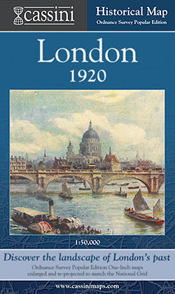
- London 1920
- London in 1920 in the Cassini Historical Series reproducing old Ordnance Survey mapping of England and Wales at 1:50,000. The four London maps cover roughly the area of the present day Greater London rather than following the format of rest of the series which is designed to correspond to the current Landranger maps. Mapping is identical to the... Read more
Stanfords
United Kingdom
- Chichester and the South Downs 1810-1813
- Map No. 197, Chichester and the South Downs 1810-1813, in the Cassini Historical Series of old Ordnance Survey mapping of England and Wales at 1:50,000 in a format designed to offer a convenient comparison with the present day coverage from the OS, and most locations in three different editions. Old historical maps have been combined so that... Read more
Stanfords
United Kingdom
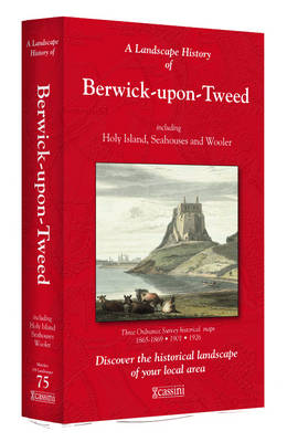
- Berwick-upon-Tweed 1865-1926 (3-map set)
- Map No. 75, Berwick-upon-Tweed 1865-1926 (3-map set), in the Cassini Historical Series of old Ordnance Survey mapping of England and Wales at 1:50,000 in a format designed to offer a convenient comparison with the present day coverage from the OS, and most locations in three different editions. Old historical maps have been combined so that the... Read more
Stanfords
United Kingdom
- Manchester 1923-1925
- Map No. 109, Manchester 1923-1925, in the Cassini Historical Series of old Ordnance Survey mapping of England and Wales at 1:50,000 in a format designed to offer a convenient comparison with the present day coverage from the OS, and most locations in three different editions. Old historical maps have been combined so that the sheet lines... Read more
Stanfords
United Kingdom
- West Cumbria 1864-1869
- Map No. 89, West Cumbria 1864-1869, in the Cassini Historical Series of old Ordnance Survey mapping of England and Wales at 1:50,000 in a format designed to offer a convenient comparison with the present day coverage from the OS, and most locations in three different editions. Old historical maps have been combined so that the sheet lines... Read more

Stanfords
United Kingdom
- Reading and Henley-on-Thames Past and Present
- Reading and Henley-on-Thames in the Cassini Past and Present map series which covers town and cities of England and Wales and offers a unique way of tracing their history and expansion by showing four different periods of their development using Ordnance Survey mapping from the mid-19th century, the late 19th century, the 1920s and the present... Read more
Stanfords
United Kingdom
- North West Norfolk 1824-1922 (3-map set)
- Map No. 132, North West Norfolk 1824-1922 (3-map set), in the Cassini Historical Series of old Ordnance Survey mapping of England and Wales at 1:50,000 in a format designed to offer a convenient comparison with the present day coverage from the OS, and most locations in three different editions. Old historical maps have been combined so that... Read more
Stanfords
United Kingdom
- London West 1897-1909
- Map No. 176, London West 1897-1909, in the Cassini Historical Series of old Ordnance Survey mapping of England and Wales at 1:50,000 in a format designed to offer a convenient comparison with the present day coverage from the OS, and most locations in three different editions. Old historical maps have been combined so that the sheet lines... Read more
Stanfords
United Kingdom
- Salisbury and the Plain 1811-1817
- Map No. 184, Salisbury and The Plain 1811-1817, in the Cassini Historical Series of old Ordnance Survey mapping of England and Wales at 1:50,000 in a format designed to offer a convenient comparison with the present day coverage from the OS, and most locations in three different editions. Old historical maps have been combined so that the sheet... Read more