Stanfords
United Kingdom
United Kingdom
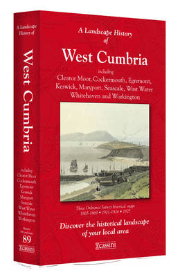
- West Cumbria 1864-1869
- Map No. 89, West Cumbria 1864-1869, in the Cassini Historical Series of old Ordnance Survey mapping of England and Wales at 1:50,000 in a format designed to offer a convenient comparison with the present day coverage from the OS, and most locations in three different editions. Old historical maps have been combined so that the sheet lines... Read more