Stanfords
United Kingdom
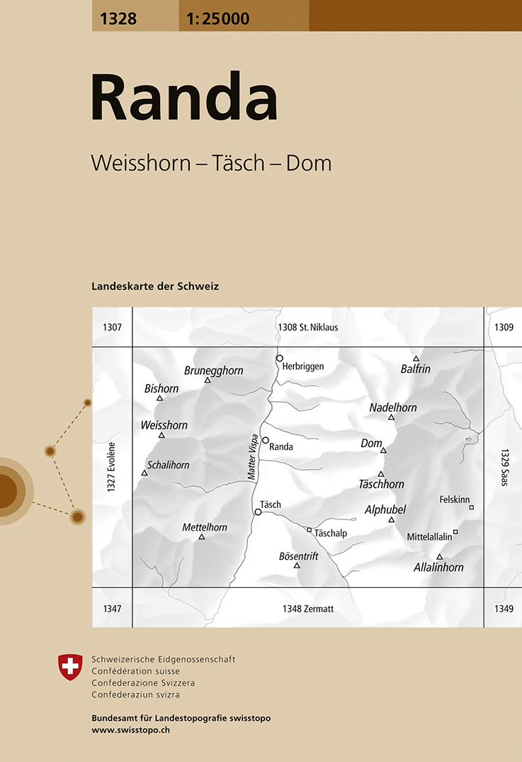
- Randa Swisstopo 1328
- Map No. 1328, Randa, in the topographic survey of Switzerland at 1:25,000 from Swisstopo. The map covers the central section of the Mattertal from just north of Zermatt to Herbriggen, and extends west to include Weisshorn and eastwards across the Mischabel range with Dom to outskirts of Saas Fee.Swiss topographic survey at 1:25,000 covers the... Read more
De Zwerver
Netherlands
- Wandelkaart - Topografische kaart 1328 Randa | Swisstopo
- Map No. 1328, Randa, in the topographic survey of Switzerland at 1:25,000 from Swisstopo. The map covers the central section of the Mattertal from just north of Zermatt to Herbriggen, and extends west to include Weisshorn and eastwards across the Mischabel range with Dom to outskirts of Saas Fee.Swiss topographic survey at 1:25,000 covers the... Read more

Stanfords
United Kingdom
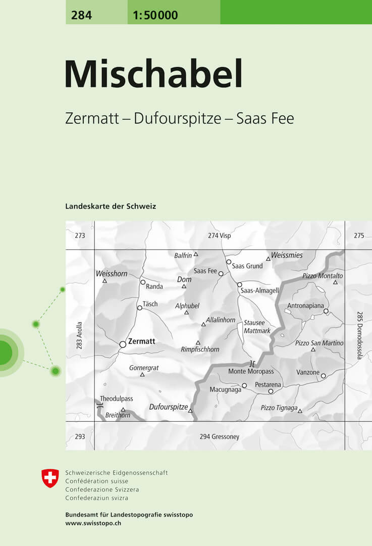
- Mischabel Swisstopo 284
- Mischabel, map No. 284, in the standard topographic survey of Switzerland at 1:50,000 from Swisstopo, i.e. without the special overprint highlighting walking trails, local bus stops, etc, presented in Swisstopo’s hiking editions of the 50K survey. The map covers the southern part of the Mattertal with Zermatt and Randa, the Saastal with Saas... Read more

Stanfords
United Kingdom
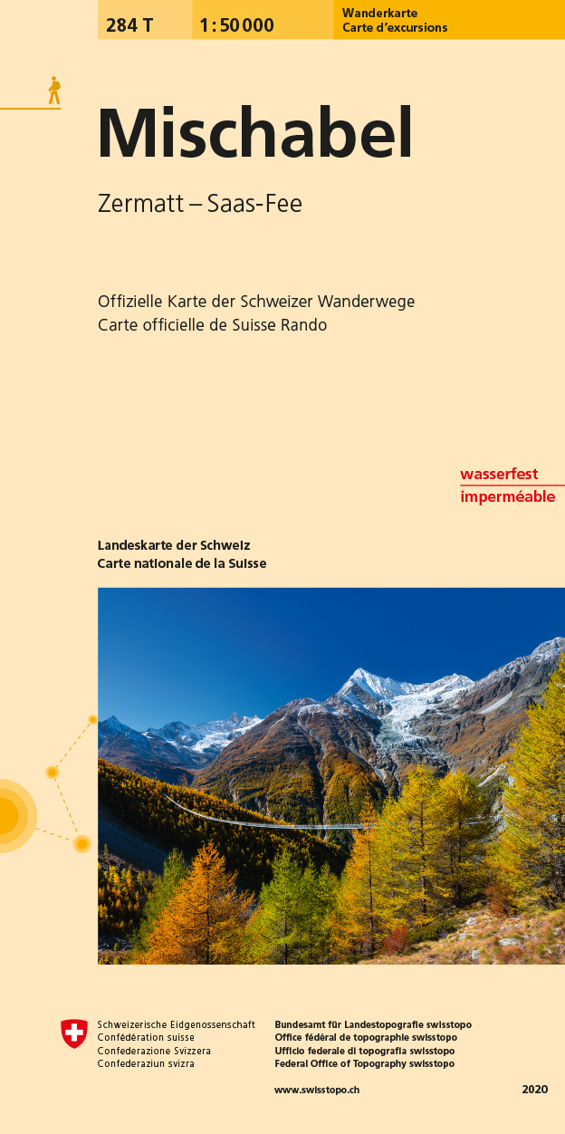
- Mischabel Swisstopo Hiking 284T
- The Michabel range, map No. 284T, at 1:50,000 in a special hiking edition of the country’s topographic survey, published by Swisstopo in cooperation with the Swiss Hiking Federation. The map covers most of the Mischabel range with the southern part of the Mattertal including Zermatt and Randa, the Saastal with Saas Fe, Theodul Pass, Monte Rosa... Read more

Stanfords
United Kingdom
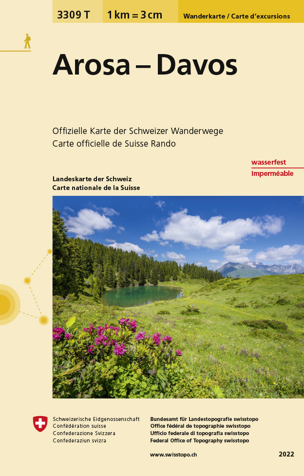
- Arosa - Davos Swisstopo Hiking 3309T
- Arosa - Davos area at 1:33,333 on light, waterproof and tear-resistant map No. 3309T published by Swisstopo in cooperation with the Swiss Hiking Federation. Cartography is the same as in Swisstopo’s 50K hiking maps, simply enlarged to 1:33,333 for extra clarity but without additional information. Coverage includes Klosters, Lenzerheide/Lei and... Read more
De Zwerver
Netherlands
- Wandelkaart - Topografische kaart 3309T Arosa - Davos | Swisstopo
- Een nieuwe serie van de Zwitserse topografische dienst: eindelijk goede wandelkaarten met ingetekende wandelroutes op scheur- en watervast papier. Vooralsnog zijn ze uitgebracht van de populaire wandelgebieden en niet landelijk dekkend (zie overzicht) Op een gedetailleerde schaal van 1:33.333 met als ondergrond de onovertroffen topografische... Read more

Stanfords
United Kingdom
- Montreux
- Montreux - Col du Pillon area at 1:50,000 in a series from Hallwag covering Switzerland’s popular hiking regions on light, waterproof and tear-resistant maps highlighting long-distance paths: the nine national routes plus special regional routes, as well as other local hiking trails.Cartography is similar to that used both in Hallwag’s hiking... Read more

Stanfords
United Kingdom
- Tour of the Matterhorn / Cervino L`Escursionista Editore Map-Guide
- Tour of the Matternhorn (Il Cervino) & Gran Balconata del Cervino long-distance hiking routes presented on a waterproof and tear-restant, double-sided, contoured and GPS compatible map published jointly by L’Escursionista Editore and Editrek, with a separate guide booklet for each route.On one side is a map at 1:50,000 showing the Tour of the... Read more