
Sardinia
Description
Second largest island in the Mediterranean.
Trails in this region
Links
Facts
Reports
Guides and maps
Lodging
Organisations
Tour operators
GPS
Other
Books

Stanfords
United Kingdom
United Kingdom
- Asinara (Sardinia)
- The island of Asinara of the north-western coast of Sardinia, a national park and a marine reserve, presented on a detailed, contoured and GPS compatible map at 1:25,000 from 4Land Cartography, with on reverse extracts highlighting 10 recommended walks. On one side is a map of the whole island, vividly presenting its topography by contours and... Read more

Stanfords
United Kingdom
United Kingdom
- DK Eyewitness Sardinia 14/5/20
- An atmospheric island bursting with history, culture and natural beauty.Whether you want to hike across rugged mountains, spot flamingoes near Cagliari or simply sip a glass of Cannonau overlooking the sparkling turquoise waters of the mediterranean, your DK Eyewitness travel guide makes sure you experience all that Sardinia has to offer.... Read more

Stanfords
United Kingdom
United Kingdom
- Sardinia North 4-Map Set Kompass 2497
- The northern part of Sardinia on a set of four double-sided, contoured and GPS compatible recreational maps at 1:50,000 from Kompass. Extensive overprint highlights hiking trails, cycle and selected mountain bike routes, and horse riding paths. Symbols indicate various types of accommodation including campsites, youth hostels, “Friends of... Read more

Stanfords
United Kingdom
2021
United Kingdom
2021
- Lonely Planet Best Day Walks Italy
- Lonely Planet`s Best Day Walks Italy is your passport to 60 easy escapes into nature. Stretch your legs outside the city by picking a hike that works for you, from just a couple of hours to a full day, from easy to hard. Hike the Dolomites, explore the Italian Lakes, and stroll Sardinia`s coast. Get to the heart of Italy and begin your journey... Read more
- Also available from:
- The Book Depository, United Kingdom
- De Zwerver, Netherlands


Bol.com
Netherlands
Netherlands
- NG Traveler
- Readers go on a drive along the Amalfi Coast; a boat trip to Capri and the islands; a walk through old Naples; and visit the Trulli houses of Puglia with author Tim Jepson, a renowned expert on Italian travel. Opening chapters give readers practical advice on planning your trip and explains the city and its surrounds in the context of its rich... Read more
- Also available from:
- Bol.com, Belgium
Bol.com
Belgium
Belgium
- NG Traveler
- Readers go on a drive along the Amalfi Coast; a boat trip to Capri and the islands; a walk through old Naples; and visit the Trulli houses of Puglia with author Tim Jepson, a renowned expert on Italian travel. Opening chapters give readers practical advice on planning your trip and explains the city and its surrounds in the context of its rich... Read more

Bol.com
Netherlands
Netherlands
- A Curious Horned Goat in a Mountain Pasture in Sardinia Italy Journal
- This journal with 150 ruled pages awaits your writing pleasure. You can use it to record your hopes and dreams, express your gratitude, to keep a bucket list, as a daily diary, or to jot down your To-Do lists. The possibilities are endless and the choice is all yours. Enjoy! Read more
- Also available from:
- Bol.com, Belgium
Bol.com
Belgium
Belgium
- A Curious Horned Goat in a Mountain Pasture in Sardinia Italy Journal
- This journal with 150 ruled pages awaits your writing pleasure. You can use it to record your hopes and dreams, express your gratitude, to keep a bucket list, as a daily diary, or to jot down your To-Do lists. The possibilities are endless and the choice is all yours. Enjoy! Read more
De Zwerver
Netherlands
2018
Netherlands
2018
- Reisgids Sardinia - Sardinië | Insight Guides
- Dé gids als het gaat om achtergrondinformatie en prachtige fotos. Door het formaat en gewicht niet zo zeer om mee te nemen, als wel om thuis voor en na de reis uitgebreid te lezen. Kwalitatief van een hoog niveau! Engels. Sardinia is known for its crystal-clear emerald seas, snow-white beaches and glitzy resorts, but those who venture inland... Read more
De Zwerver
Netherlands
2016
Netherlands
2016
- Wandelgids Hikeline Sardinië - Sardinien | Esterbauer
- 50 Wanderungen zwischen Stränden, Schluchten und Bergen, 50 Touren, 560 km. 1. Auflage. Read more
Bol.com
Netherlands
Netherlands
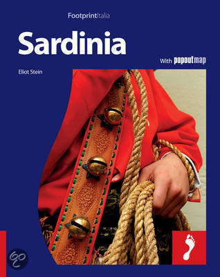
- Footprint Sardinia
- With its 7000 mysterious Bronze Age stone towers, Neolithic 'Giants Tombs' and hundreds of Spanish watchtowers, Sardinia is an outdoor museum where its tangled past meets its colourful present. The most isolated island in the Mediterranean, it basks in a seven-month summer and boasts jagged mountain ranges, beautiful flowering bougainvilleas,... Read more
- Also available from:
- Bol.com, Belgium
Bol.com
Belgium
Belgium
- Footprint Sardinia
- With its 7000 mysterious Bronze Age stone towers, Neolithic 'Giants Tombs' and hundreds of Spanish watchtowers, Sardinia is an outdoor museum where its tangled past meets its colourful present. The most isolated island in the Mediterranean, it basks in a seven-month summer and boasts jagged mountain ranges, beautiful flowering bougainvilleas,... Read more
Bol.com
Netherlands
Netherlands
- Sardinia Island Travel Guide
- Sardinia Island Travel Guide. Italy Vacation. Sardinia was love at first sight for me. No matter how often I return, I find new coastal trails to explore and mountains to climb, hidden bays to kayak to and little known agriturism tucked away in the silent hinterland. The island is deceptive it looks small on paper, but unravel it and it is... Read more
- Also available from:
- Bol.com, Belgium
Bol.com
Belgium
Belgium
- Sardinia Island Travel Guide
- Sardinia Island Travel Guide. Italy Vacation. Sardinia was love at first sight for me. No matter how often I return, I find new coastal trails to explore and mountains to climb, hidden bays to kayak to and little known agriturism tucked away in the silent hinterland. The island is deceptive it looks small on paper, but unravel it and it is... Read more
Bol.com
Netherlands
Netherlands
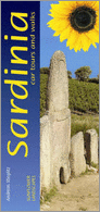
- Sunflower Landscapes Sardinia
- Pocket-sized and in full colour, this guide describes six long car tours (each spread over 2-3 days), highlighting places where you can stop for a walk or just a stroll to a lovely picnic setting. There is an accompanying fold-out touring map. But the major part of the book is devoted to 22 main walks and their many variations, all illustrated... Read more
- Also available from:
- Bol.com, Belgium
Bol.com
Belgium
Belgium
- Sunflower Landscapes Sardinia
- Pocket-sized and in full colour, this guide describes six long car tours (each spread over 2-3 days), highlighting places where you can stop for a walk or just a stroll to a lovely picnic setting. There is an accompanying fold-out touring map. But the major part of the book is devoted to 22 main walks and their many variations, all illustrated... Read more

Stanfords
United Kingdom
United Kingdom
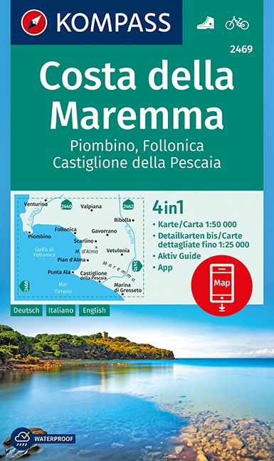
- Maremma Coast - Piombino - Follonica - Castiglione della Pascaia Kompass 2469
- The coast of Maremma at 1:50,000 from Kompass, on a map printed on durable, waterproof and tear-resistant synthetic paper. Coverage includes Piombino, Follonica, Castiglione della Pescaia, Marina di Grosseto, Wetulonia, Ribolla, Valpiana, Venturina, etc. Contours are at 40m intervals, with a 2-km UTM grid. Extensive overprint includes cycling... Read more
- Also available from:
- De Zwerver, Netherlands
De Zwerver
Netherlands
Netherlands
- Wandelkaart 2469 Costa della Maremma | Kompass
- Die GPS-genauen KOMPASS Karten sind ideal für Ihre nächste Tour! Der lesefreundliche Maßstab und nützliche Informationen über die Region erleichtern Ihre Planung.IT Read more
Bol.com
Netherlands
Netherlands
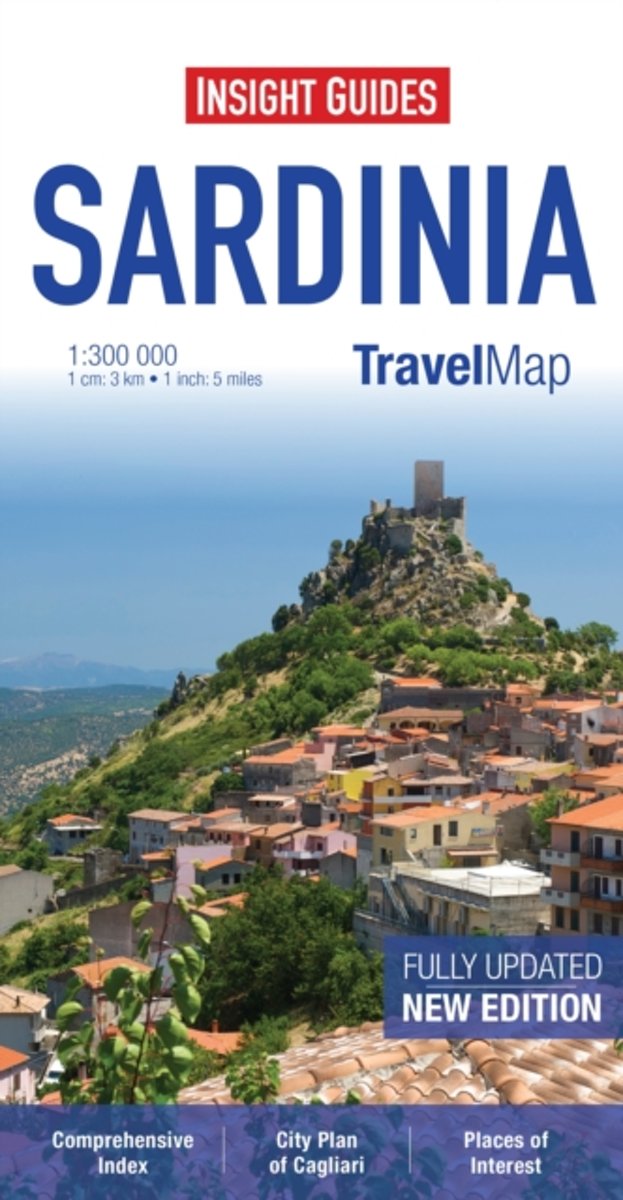
- Insight Guides Travel Map Sardinia
- Travel Map Sardinia is an indexed, road map at 1:300 000. It includes a detailed city plan of Cagliari, which has its own extensive index. Places of interest including nature reserves, national parks, museums, monuments and religious site are listed and depicted by a wide range of pictorial symbols for instant recognition, these symbols have... Read more
- Also available from:
- Bol.com, Belgium
Bol.com
Belgium
Belgium
- Insight Guides Travel Map Sardinia
- Travel Map Sardinia is an indexed, road map at 1:300 000. It includes a detailed city plan of Cagliari, which has its own extensive index. Places of interest including nature reserves, national parks, museums, monuments and religious site are listed and depicted by a wide range of pictorial symbols for instant recognition, these symbols have... Read more
Maps


Stanfords
United Kingdom
United Kingdom
- Eschenbach in der Oberpfalz E12
- Eschenbach i.d.OPf. in a series of GPS compatible recreational editions of the Bavarian topographic survey at 1:25,000, with waymarked hiking trails and cycling routes, campsites and youth hostels, etc. Coverage includes Creußen, Kirchenthumbach, Speichersdorf, Kemnath, Neustadt am Kulm, Grafenwöhr.Contours used in this map vary between 5 to... Read more

Stanfords
United Kingdom
United Kingdom
- Sardinia`s Trenino Verde Route 4-Map Set
- A set of four maps at 1:40,000 from the Edizioni Abies series covering Sardinia’s Trenino Verde tourist railway line, run with vintage diesel and steam engines. The maps in this set cover stages 1 to 4: Arbatax to Ussassai, Ussassai to Nurri, Nurri to Mandas plus Gesico to Nurallao, and Nurallao to Sorgono. Topography is shown by contours at... Read more

Stanfords
United Kingdom
United Kingdom
- Monti Sibillini National Park Kompass 2474
- Monti Sibillini National Park in Umbria and the Marches on a GPS compatible hiking and recreational map at 1:50,000 from Kompass, printed on durable, waterproof and tear-resistant synthetic paper. Contours are at 40m intervals, with a 2-km UTM grid. In addition to the region’s numerous local hiking trails and several long-distance routes,... Read more

Stanfords
United Kingdom
United Kingdom
- Sardinia South 4-Map Set Kompass 2499
- The southern part of Sardinia on a set of four double-sided, contoured and GPS compatible recreational maps at 1:50,000 from Kompass. Extensive overprint highlights hiking trails, cycle and selected mountain bike routes, and horse riding paths. Symbols indicate various types of accommodation including campsites, youth hostels, “Friends of... Read more

Stanfords
United Kingdom
United Kingdom
- Cinque Terre Kompass 2450
- Cinque Terra area of the Ligurian Coast on a double-sided, contoured and GPS compatible recreational map at 1:50,000 from Kompass, printed on durable, waterproof and tear-resistant synthetic paper. Coverage Montemarcello Magra Regional Park. In addition to numerous local hiking trails and long-distance routes such as the Alta Via dei Monti... Read more

Stanfords
United Kingdom
United Kingdom
- Arezzo - Casentino - Foreste Casentinesi NP - Monte Falterona Kompass 2459
- Arezzo - Casentino - Monte Falterona map at 1:50,000 from Kompass, printed on durable, waterproof and tear-resistant synthetic paper. Coverage includes Foreste Casentinesi National Park. Contours are at 40m intervals, with a 2-km UTM grid. Extensive overprint includes GEA - Grande Escursione Appenninica, Sentiero Italia, etc, plus cycling and... Read more

Stanfords
United Kingdom
United Kingdom
- Imray Chart M8: North Sardegna
- Plans included:Arcipelago di La Maddalena - Southern Group (1:65 000)Golfo di Cugnana (1:50 000)Golfo Spurlatta (1:60 000)Passaggio dei Fornelli (1:60 000)Porto Torres (1:15 000)Approaches to Alghero (1:50 000) Read more

Stanfords
United Kingdom
United Kingdom
- Lago di Bolsena - Acquapendente - Orvieto - Pitigliano - Sorano Kompass 2471
- Lago di Bolsena – Orvieto area at 1:50,000 from Kompass on a map printed on durable, waterproof and tear-resistant synthetic paper. Coverage includes Acquapendente, Ficulle, Santa Flora, Valentano, Montefiascone, Selva del Lamone, etc. Contours are at 40m intervals, with a 2-km UTM grid. Extensive overprint includes cycling and selected... Read more

Stanfords
United Kingdom
United Kingdom
- Lake Como - Lake Lugano Kompass 91
- Lake Como and Lake Lugano on a contoured and GPS compatible hiking and recreational map at 1:50,000 from Kompass. Coverage extends from Lugano in Switzerland to Lecco on the eastern spur of Lake Como and includes part of the Parco delle Grigne. KOMPASS HIKING MAPS OF ITALY – TO SEE THE OTHER TITLES IN THIS SERIES PLEASE CLICK ON THE SERIES... Read more

Stanfords
United Kingdom
United Kingdom
- Perugia - Assisi - Città di Castello - Gubbio Kompass 2464
- Perugia - Assisi - Città di Castello – Gubbio area in Umbria and the Marches on a double-sided, GPS compatible hiking and recreational map at 1:50,000 from Kompass on durable, waterproof and tear-resistant synthetic paper. Contours are at 40m intervals, with a 2-km UTM grid. In addition to the region’s numerous local hiking trails and several... Read more

Stanfords
United Kingdom
United Kingdom
- Lake Trasimeno - Val d`Orcia - Montepulciano - Monte Amiata Kompass 2463
- Lake Trasimeno - Val d`Orcia - Montepulciano - Monte Amiata area on a double-sided map at 1:50,000 from Kompass, printed on durable, waterproof and tear-resistant synthetic paper. Coverage includes Val di Chiana, Cortona, Montalcino, Asciano, Arcidosso, Fabro, Magione, etc. Contours are at 40m intervals, with a 2-km UTM grid. Extensive... Read more

Stanfords
United Kingdom
United Kingdom
- Gran Sasso and Monti della Laga National Park Kompass 2476
- Gran Sasso and Monti della Laga National Park in Umbria, the Marches, Lazio and Abruzzo on a double-sided, GPS compatible hiking and recreational map at 1:50,000 from Kompass, printed on durable, waterproof and tear-resistant synthetic paper. Contours are at 40m intervals, with a 2-km UTM grid. In addition to the region’s numerous local hiking... Read more

Stanfords
United Kingdom
United Kingdom
- Lake Maggiore - Lake Varese Kompass 90
- recreational map at 1:50,000 from Kompass. Coverage extends from Locarno to Arona on the southern tip of Lake Maggiore, and from Lago di Mergozzo in the west to Lugano in the east, and includes part of Parco Nazionale delle Val Grande. Accompanying booklet has 33 pages in English, providing descriptions of best sights, suggestions for three... Read more

Stanfords
United Kingdom
United Kingdom
- Sardinia South-West: The Mining Coast Hiking Trail Guide
- English language 63-page guide to a 60km / 5 day trail along Sardinia’s south-western coast between Portoscuso and Piscinas, with contoured maps, GPS coordinates for important points, route profiles for each stage, and numerous colour photos. The author, Lino Cianciotto, is an environmental hiking guide who organizes active holidays in... Read more