
Iztaccíhuatl
Description
- Height 5230.00 m
Links
Facts
Reports
Guides and maps
Lodging
Organisations
Tour operators
GPS
Other
Books

Stanfords
United Kingdom
2019
United Kingdom
2019
- Secret Provence
- Let `Secret Provence` guide you around the unusual and unfamiliar. Step off the beaten track with this fascinating Provence guide book and let our local experts show you the well-hidden treasures of an amazing region. Ideal for local inhabitants and curious travellers alike.The places included in our guides are unusual and unfamiliar, allowing... Read more

Stanfords
United Kingdom
2015
United Kingdom
2015
- La Palma GERMAN
- This Rother Walking Guide to La Palma (ALL TEXT IS IN GERMAN), presents the hiker with 64 varied and entertaining tour suggestions incorporating every region on the island - the guide includes 112 colour photos and colour hiking maps at 1:50.000 or 1:100,000 scale, and an overview map for general planning at 1:250,000. From physically demanding... Read more

The Book Depository
United Kingdom
2020
United Kingdom
2020
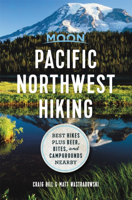
- Moon Pacific Northwest Hiking (First Edition)
- Best Hikes plus Beer, Bites, and Campgrounds Nearby Read more
- Also available from:
- De Zwerver, Netherlands
De Zwerver
Netherlands
2020
Netherlands
2020
- Wandelgids Pacific Northwest Hiking | Moon Travel Guides
- Best Hikes plus Beer, Bites, and Campgrounds Nearby Read more

Stanfords
United Kingdom
United Kingdom
- La Palma
- This Rother Walking Guide to La Palma presents the hiker with a wide variety of entertaining tour suggestions incorporating every region on the island - the guide includes 112 colour photos and colour hiking maps at 1:50.000 or 1:100,000 scale, and an overview map for general planning at 1:250,000. From physically demanding excursions to the... Read more
- Also available from:
- The Book Depository, United Kingdom

The Book Depository
United Kingdom
United Kingdom
- La Palma walking guide 71 walks 2020
- The Finest Valley and Mountain Walks - ROTH.E4808 Read more

Stanfords
United Kingdom
2021
United Kingdom
2021
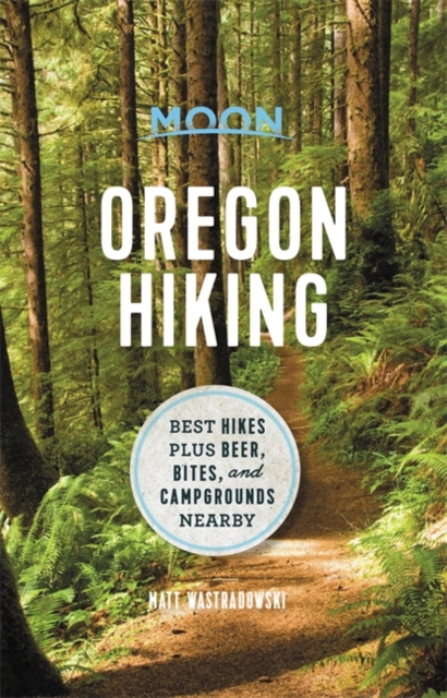
- Moon Oregon Hiking (First Edition): Best Hikes plus Beer, Bites, and Campgrounds Nearby
- Misty ancient forests, rugged high deserts, and black sand beaches: wherever you turn in Oregon, adventure awaits. Pack a lunch, lace up your boots, and hit the trails with Moon Oregon Hiking. Inside you`ll find:* Diverse Hiking Options: Whether you plan to take peaceful walks along the coast or challenging treks up Mount Hood, enjoy outdoor... Read more
- Also available from:
- The Book Depository, United Kingdom
- De Zwerver, Netherlands

The Book Depository
United Kingdom
2021
United Kingdom
2021
- Moon Oregon Hiking (First Edition)
- Best Hikes plus Beer, Bites, and Campgrounds Nearby Read more
De Zwerver
Netherlands
2021
Netherlands
2021
- Wandelgids Oregon Hiking | Moon Travel Guides
- Misty ancient forests, rugged high deserts, and black sand beaches: wherever you turn in Oregon, adventure awaits. Pack a lunch, lace up your boots, and hit the trails with Moon Oregon Hiking. Inside you`ll find:* Diverse Hiking Options: Whether you plan to take peaceful walks along the coast or challenging treks up Mount Hood, enjoy outdoor... Read more
Bol.com
Netherlands
Netherlands
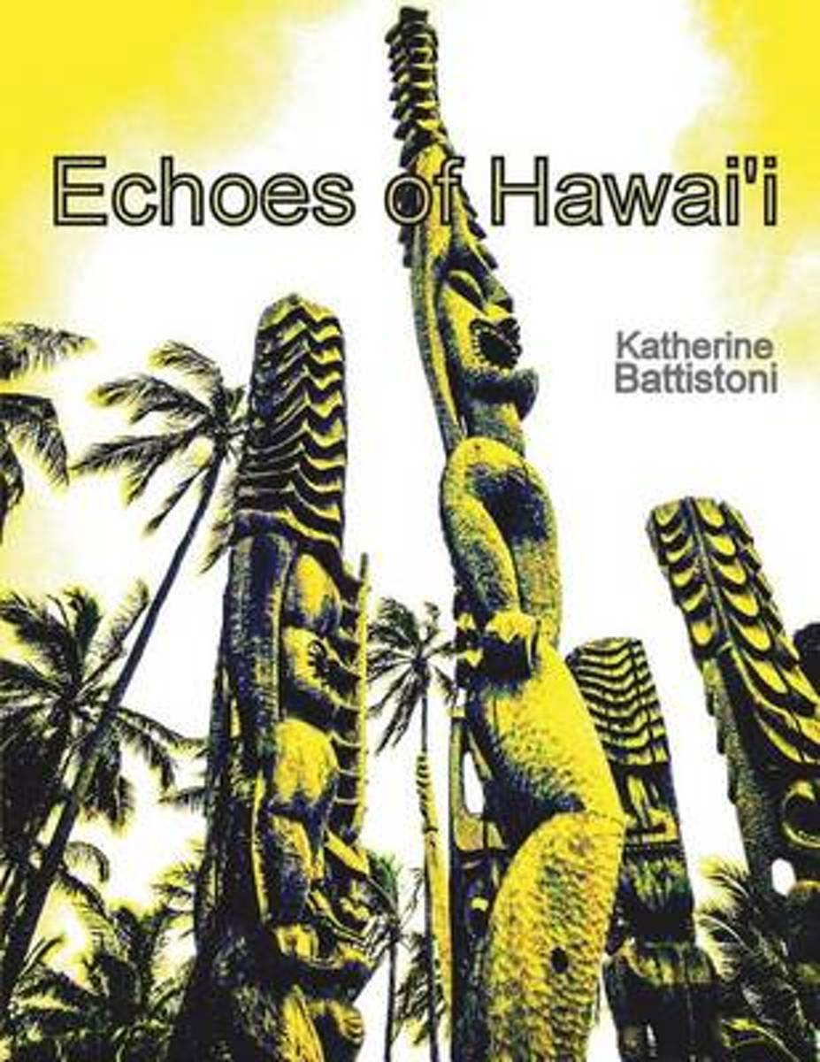
- Echoes of Hawaii
- The Big Island of Hawaii is shown at it's most splendid through photographs and the artist's drawings. Here a volcano billows out puffs daily. Enjoy views off the beaten path and majestic vistas. Ancient Hawaiian petroglyphs (usually underwater) are highlighted in white sand for you to admire. Exotic plants bloom on the pages. Also there are... Read more
- Also available from:
- Bol.com, Belgium
Bol.com
Belgium
Belgium
- Echoes of Hawaii
- The Big Island of Hawaii is shown at it's most splendid through photographs and the artist's drawings. Here a volcano billows out puffs daily. Enjoy views off the beaten path and majestic vistas. Ancient Hawaiian petroglyphs (usually underwater) are highlighted in white sand for you to admire. Exotic plants bloom on the pages. Also there are... Read more
Bol.com
Netherlands
2017
Netherlands
2017
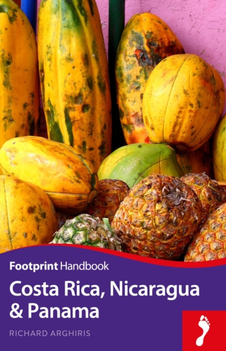
- Costa Rica, Nicaragua & Panama
- The shifting landscapes in these three southern-most countries in Central America reflect the diversity of each nation. Footprint's Costa Rica, Nicaragua & Panama will guide you through untouched Costa Rican rainforest, the tempestuous geography of Nicaragua and coral reefs off Panama's Caribbean coast. * Great coverage of the top activities... Read more
- Also available from:
- Bol.com, Belgium
Bol.com
Belgium
2017
Belgium
2017
- Costa Rica, Nicaragua & Panama
- The shifting landscapes in these three southern-most countries in Central America reflect the diversity of each nation. Footprint's Costa Rica, Nicaragua & Panama will guide you through untouched Costa Rican rainforest, the tempestuous geography of Nicaragua and coral reefs off Panama's Caribbean coast. * Great coverage of the top activities... Read more
Bol.com
Netherlands
Netherlands
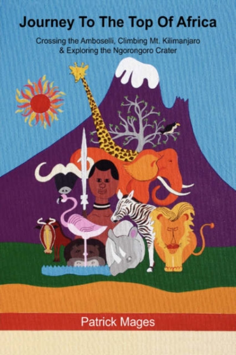
- Journey to the Top of Africa
- In Journey To The Top Of Africa, Patrick Mages tells a fascinating story of a night crossing of the Amboselli Game Reserve in Kenya, a five day climb of the fabled 19,300 foot Mt. Kilimanjaro and a four wheel drive descent into the Ngorongoro Crater, a long-extinct volcano and home to most species of African wildlife. If you've never climbed a... Read more
- Also available from:
- Bol.com, Belgium
Bol.com
Belgium
Belgium
- Journey to the Top of Africa
- In Journey To The Top Of Africa, Patrick Mages tells a fascinating story of a night crossing of the Amboselli Game Reserve in Kenya, a five day climb of the fabled 19,300 foot Mt. Kilimanjaro and a four wheel drive descent into the Ngorongoro Crater, a long-extinct volcano and home to most species of African wildlife. If you've never climbed a... Read more

Stanfords
United Kingdom
2017
United Kingdom
2017
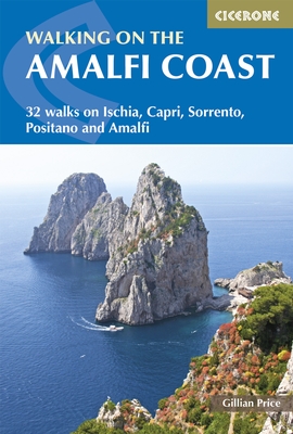
- Walking on the Amalfi Coast: Ischia, Capri, Sorrento, Positano and Amalfi
- Walking on the Amalfi Coast describes 32 day-walks, ranging from 3km to 11km in length. The walks explore the Sorrento Peninsula, Amalfi Coast and Monti Lattari, as well as the islands of Capri and Ischia in the Gulf of Naples. The whole area is crisscrossed by ancient mule tracks, pilgrim routes and goat tracks, offering a variety of walking... Read more
- Also available from:
- The Book Depository, United Kingdom
- Bol.com, Netherlands
- Bol.com, Belgium
- De Zwerver, Netherlands

The Book Depository
United Kingdom
2017
United Kingdom
2017
- Walking on the Amalfi Coast
- Ischia, Capri, Sorrento, Positano and Amalfi Read more

Bol.com
Netherlands
2017
Netherlands
2017
- Walking on the Amalfi Coast
- Walking on the Amalfi Coast describes 32 day-walks, ranging from 3km to 11km in length. The walks explore the Sorrento Peninsula, Amalfi Coast and Monti Lattari, as well as the islands of Capri and Ischia in the Gulf of Naples. The whole area is crisscrossed by ancient mule tracks, pilgrim routes and goat tracks, offering a variety of walking... Read more
Bol.com
Belgium
2017
Belgium
2017
- Walking on the Amalfi Coast
- Walking on the Amalfi Coast describes 32 day-walks, ranging from 3km to 11km in length. The walks explore the Sorrento Peninsula, Amalfi Coast and Monti Lattari, as well as the islands of Capri and Ischia in the Gulf of Naples. The whole area is crisscrossed by ancient mule tracks, pilgrim routes and goat tracks, offering a variety of walking... Read more
De Zwerver
Netherlands
2017
Netherlands
2017
- Wandelgids Walking on the Amalfi Coast | Cicerone
- Guidebook describing 32 day walks on Italy's beautiful Amalfi Coast. The areas covered include Amalfi, Sorrento, Positano and Monti Lattari, and the idyllic islands of Capri and Ischia. The region is criss-crossed by ancient mule tracks and pilgrim routes, offering a variety of walks from family strolls to strenuous treks. Read more
Bol.com
Netherlands
Netherlands
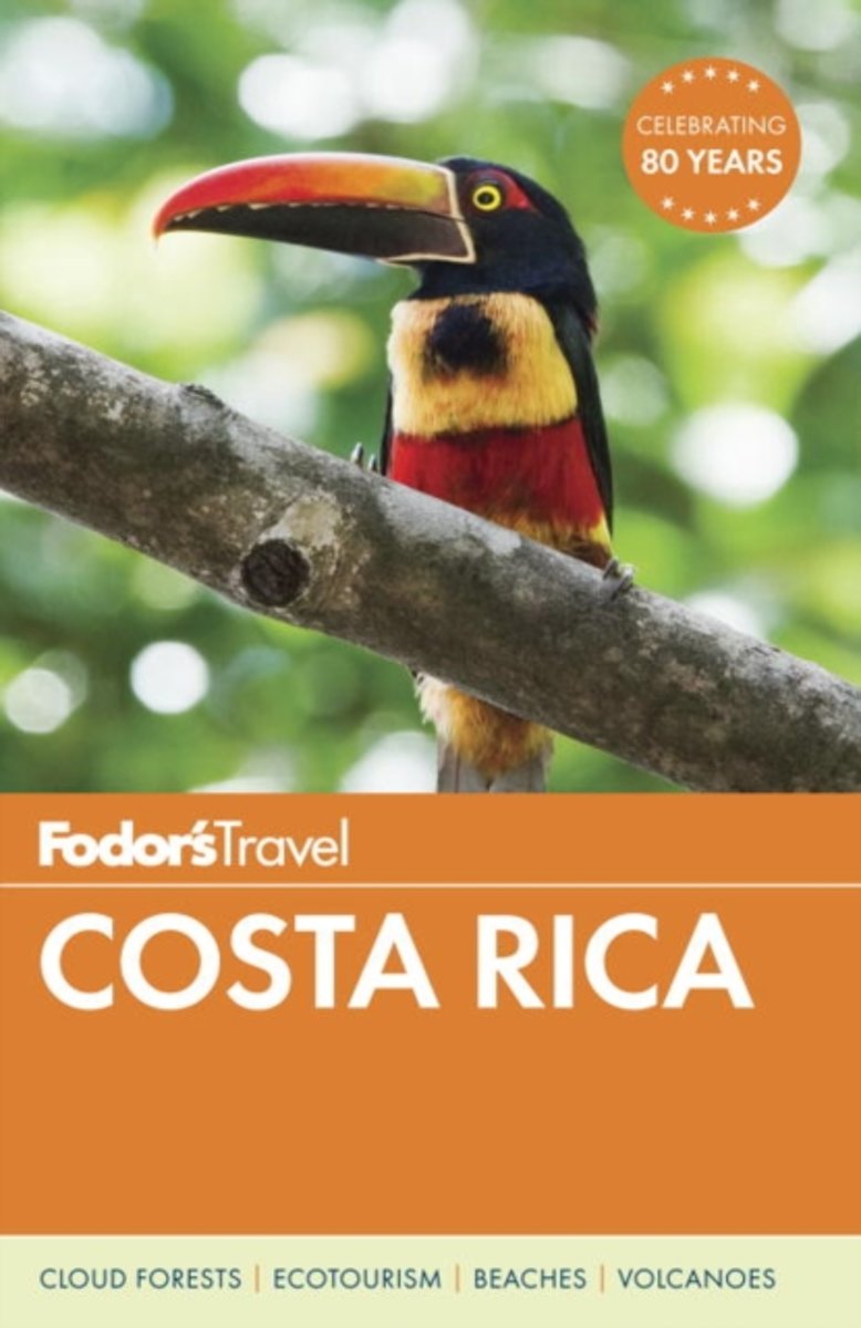
- Fodor's Costa Rica
- Written by locals, Fodor's travel guides have been offering expert advice for all tastes and budgets for 80 years. Costa Rica is one of the most popular destinations for travelers in search of natural beauty, outdoor adventure, and sun. In full-color and with helpful magazine-style illustrated features, Fodor's Costa Rica shows off the splendor... Read more
- Also available from:
- Bol.com, Belgium
Bol.com
Belgium
Belgium
- Fodor's Costa Rica
- Written by locals, Fodor's travel guides have been offering expert advice for all tastes and budgets for 80 years. Costa Rica is one of the most popular destinations for travelers in search of natural beauty, outdoor adventure, and sun. In full-color and with helpful magazine-style illustrated features, Fodor's Costa Rica shows off the splendor... Read more

Bol.com
Netherlands
Netherlands
- The Hawaiian Archipelago
- Isabella Bird visited the Sandwich Islands in 1871, when she was forty. Her letters home to her sister Henrietta have a remarkable freshness and spontaneity, and reveal the transformation of a Victorian invalid into a fearless horsewoman and enthusiastic mountain-climber, who thought nothing of riding for miles soaked with rain and fording... Read more
- Also available from:
- Bol.com, Belgium
Bol.com
Belgium
Belgium
- The Hawaiian Archipelago
- Isabella Bird visited the Sandwich Islands in 1871, when she was forty. Her letters home to her sister Henrietta have a remarkable freshness and spontaneity, and reveal the transformation of a Victorian invalid into a fearless horsewoman and enthusiastic mountain-climber, who thought nothing of riding for miles soaked with rain and fording... Read more
Bol.com
Netherlands
Netherlands
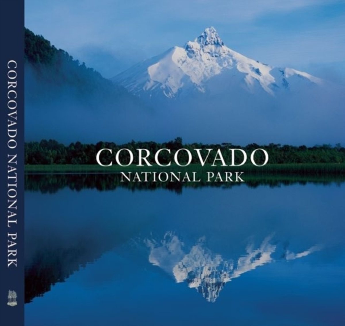
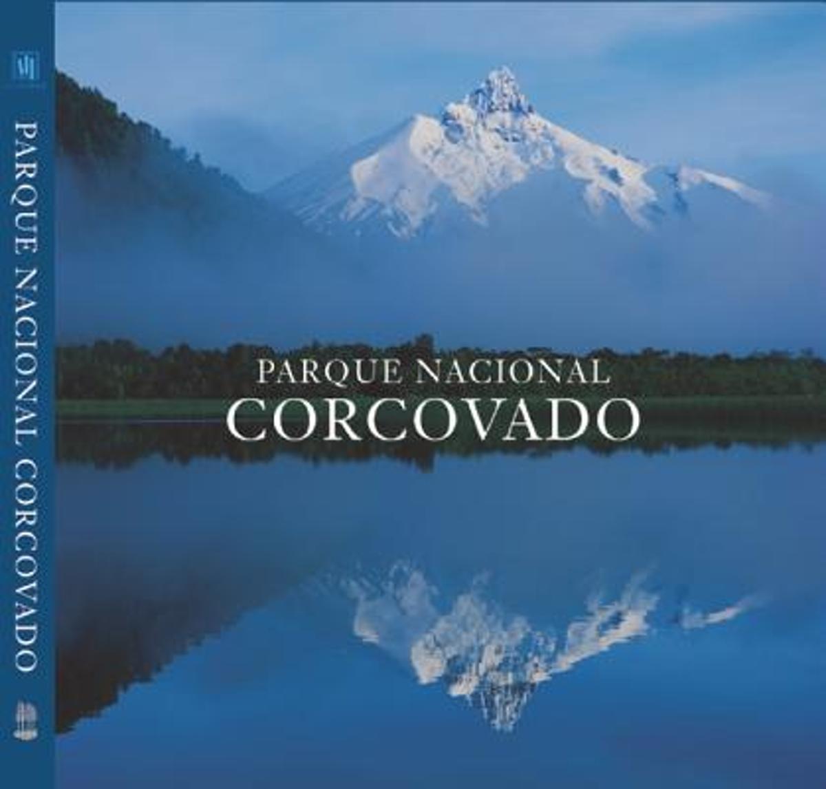
- Corcovado National Park
- Shimmering lakes. Snow-capped mountains. Primeval forest where pumas haunt the shadows. Free-flowing rivers that race to the sea. This is Chile's Corcovado National Park, one of the last great wilderness areas on Earth. Rising above it all is the Corcovado volcano, whose striking form has been a landmark for travellers along the Pacific... Read more
- Also available from:
- Bol.com, Belgium
Bol.com
Belgium
Belgium
- Corcovado National Park
- Shimmering lakes. Snow-capped mountains. Primeval forest where pumas haunt the shadows. Free-flowing rivers that race to the sea. This is Chile's Corcovado National Park, one of the last great wilderness areas on Earth. Rising above it all is the Corcovado volcano, whose striking form has been a landmark for travellers along the Pacific... Read more
Bol.com
Netherlands
2015
Netherlands
2015
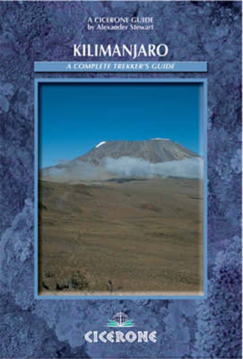
- Kilimanjaro
- Famous for its wildlife safaris and coastal resorts, East Africa is also an extraordinary destination for lovers of mountains, trekking and hiking. The mountains here stand as solitary peaks above surrounding plains. The most attractive is Mount Kilimanjaro in Tanzania, rising to 5895m. It is the highest mountain in Africa, the world's highest... Read more
- Also available from:
- Bol.com, Belgium
Bol.com
Belgium
2015
Belgium
2015
- Kilimanjaro
- Famous for its wildlife safaris and coastal resorts, East Africa is also an extraordinary destination for lovers of mountains, trekking and hiking. The mountains here stand as solitary peaks above surrounding plains. The most attractive is Mount Kilimanjaro in Tanzania, rising to 5895m. It is the highest mountain in Africa, the world's highest... Read more

Stanfords
United Kingdom
United Kingdom
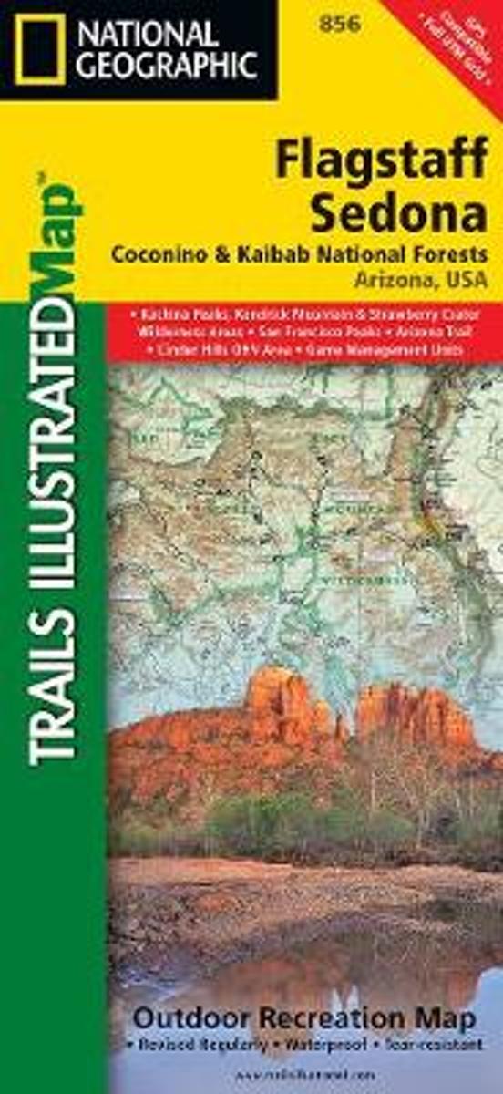
- Flagstaff - Sedona - Coconino and Kaibab National Forests AZ
- Map No. 856, Coconino National Forest: Flagstaff and Sedona, AZ, in an extensive series of GPS compatible, contoured hiking maps of USA’s national and state parks or forests and other popular recreational areas. Cartography based on the national topographic survey, with additional tourist information.The maps, with most titles now printed on... Read more
- Also available from:
- Bol.com, Netherlands
- Bol.com, Belgium
Bol.com
Netherlands
Netherlands
- Flagstaff/sedona, Coconino & Kaibab National Forests
- Waterproof Tear-Resistant Topographic MapNational Geographic's Flagstaff and Sedona Trails Illustrated topographic map is the most comprehensive available for outdoor enthusiasts of all types. Designed to be easy-to-read, yet highly detailed this map includes a comprehensive road and trail network distinguishing between major,... Read more
Bol.com
Belgium
Belgium
- Flagstaff/sedona, Coconino & Kaibab National Forests
- Waterproof Tear-Resistant Topographic MapNational Geographic's Flagstaff and Sedona Trails Illustrated topographic map is the most comprehensive available for outdoor enthusiasts of all types. Designed to be easy-to-read, yet highly detailed this map includes a comprehensive road and trail network distinguishing between major,... Read more
Bol.com
Netherlands
Netherlands
- Parque Nacional Corcovado
- Shimmering lakes. Snow-capped mountains. Primeval forest where pumas haunt the shadows. Free-flowing rivers that race to the sea. This is Chile's Corcovado National Park, one of the last great wilderness areas on Earth. Rising above it all is the Corcovado volcano, whose striking form has been a landmark for travellers along the Pacific... Read more
- Also available from:
- Bol.com, Belgium
Bol.com
Belgium
Belgium
- Parque Nacional Corcovado
- Shimmering lakes. Snow-capped mountains. Primeval forest where pumas haunt the shadows. Free-flowing rivers that race to the sea. This is Chile's Corcovado National Park, one of the last great wilderness areas on Earth. Rising above it all is the Corcovado volcano, whose striking form has been a landmark for travellers along the Pacific... Read more
Maps

Stanfords
United Kingdom
United Kingdom
- Huilo Huilo Biological Reserve Trekkingchile Map
- Huilo Huilo area around Neltume and Puerto Fuy near the Argentinian border at 1:75,000 on a waterproof and tear-resistant, contoured and GPS compatible map form Trekkingchile, with an enlargement at 1:20,000 and beautiful drawings of the local fauna and flora.On one side is a map at 1:75,000, centred on Neltune, Puerto Fuy, Lake Pirehueico and... Read more

Stanfords
United Kingdom
United Kingdom
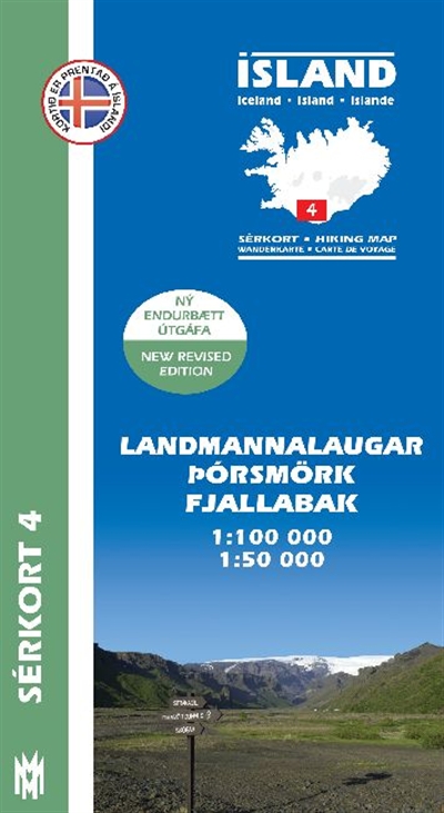
- Thorsmork - Landmannalaugar SUPERCEDED
- Þórsmörk - Landmannalaugar region at 1:100,000 in a series of special detailed hiking and touring maps based on the Icelandic topographic survey, covering an area east and south of the Hekla volcano, showing the lava fields annotated with dates of various eruptions. Contours are at 20-metre intervals, with several types of terrain and... Read more

Stanfords
United Kingdom
United Kingdom
- Goat Rocks - Norse Peak William O. Douglas Wilderness Area WA
- Map No. 823, Goat Rocks and Norse Peak Wilderness Area - Gifford-Pinchot and Okanogan-Wenatchee National Forests, WA, in an extensive series of GPS compatible, contoured hiking maps of USA’s national and state parks or forests and other popular recreational areas. Cartography based on the national topographic survey, with additional tourist... Read more
- Also available from:
- Bol.com, Netherlands
- Bol.com, Belgium

Bol.com
Netherlands
Netherlands
- Goat Rocks & Norse Peak Wilderness Area, Gifford-pinchot & Okanogan-wenatchee National Forests
- Waterproof Tear-Resistant Topographic MapGifford-Pinchot and Okanogan-Wenatchee National Forests Washington, USAOne of five new Trails Illustrated maps for the Washington Cascades region offers the most detailed and up-to-date map for the forest, carefully researched and developed in co-operation with local land managers and agencies.... Read more
Bol.com
Belgium
Belgium
- Goat Rocks & Norse Peak Wilderness Area, Gifford-pinchot & Okanogan-wenatchee National Forests
- Waterproof Tear-Resistant Topographic MapGifford-Pinchot and Okanogan-Wenatchee National Forests Washington, USAOne of five new Trails Illustrated maps for the Washington Cascades region offers the most detailed and up-to-date map for the forest, carefully researched and developed in co-operation with local land managers and agencies.... Read more

Stanfords
United Kingdom
United Kingdom
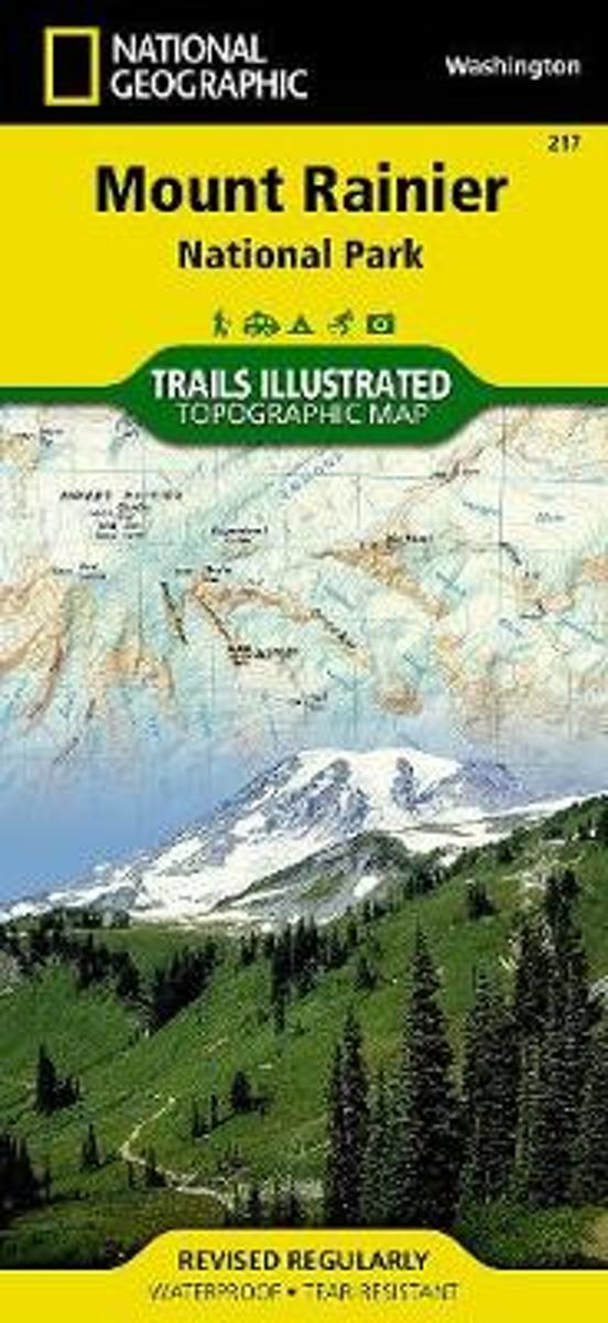
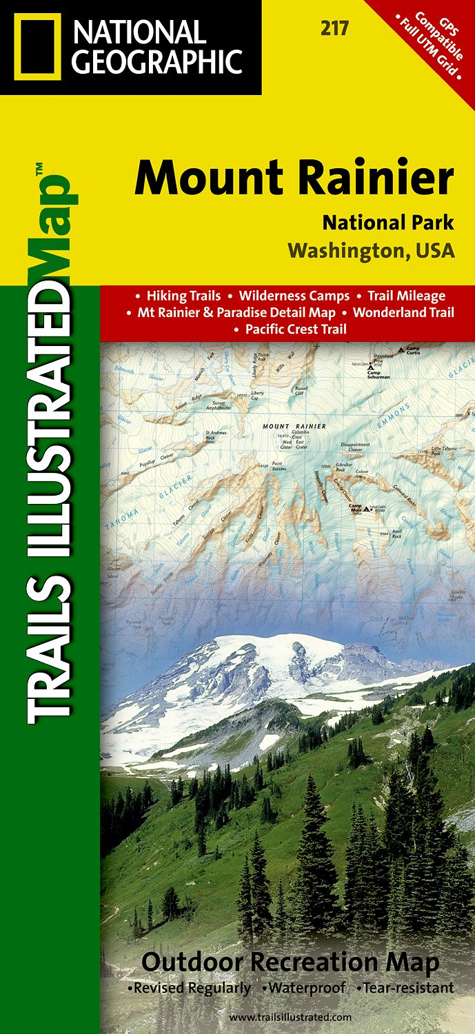
- Mount Rainier National Park WA
- Map No. 217, Mount Rainier National Park, WA, in an extensive series of GPS compatible, contoured hiking maps of USA’s national and state parks or forests and other popular recreational areas. Cartography based on the national topographic survey, with additional tourist information.The maps, with most titles now printed on light, waterproof and... Read more
- Also available from:
- The Book Depository, United Kingdom
- Bol.com, Netherlands
- Bol.com, Belgium
- De Zwerver, Netherlands

The Book Depository
United Kingdom
United Kingdom
- Mount Rainier National Park
- Trails Illustrated National Parks Read more
Bol.com
Netherlands
Netherlands
- Mount Rainier National Park
- Waterproof Tear-Resistant Topographic MapThe highest point in the Cascade Range, Mount Ranier is an icon of Washington state. It is an active volcano and the largest single-peak glacial system in the lower forty-eight states, spawning 6 major rivers. National Geographic's Trails Illustrated map of Mount Ranier National Park is designed to... Read more
Bol.com
Belgium
Belgium
- Mount Rainier National Park
- Waterproof Tear-Resistant Topographic MapThe highest point in the Cascade Range, Mount Ranier is an icon of Washington state. It is an active volcano and the largest single-peak glacial system in the lower forty-eight states, spawning 6 major rivers. National Geographic's Trails Illustrated map of Mount Ranier National Park is designed to... Read more
De Zwerver
Netherlands
Netherlands
- Wandelkaart - Topografische kaart 217 Mount Rainier National Park | National Geographic
- Prachtige geplastificeerde kaart van het bekende nationaal park. Met alle recreatieve voorzieningen als campsites, maar ook met topografische details en wandelroutes ed. Door uitgekiend kleurgebruik zeer prettig in gebruik. Scheur en watervast! Within the park, there is detailed coverage of Mount Rainier and its many glaciers, Eagles Roost,... Read more

Stanfords
United Kingdom
United Kingdom
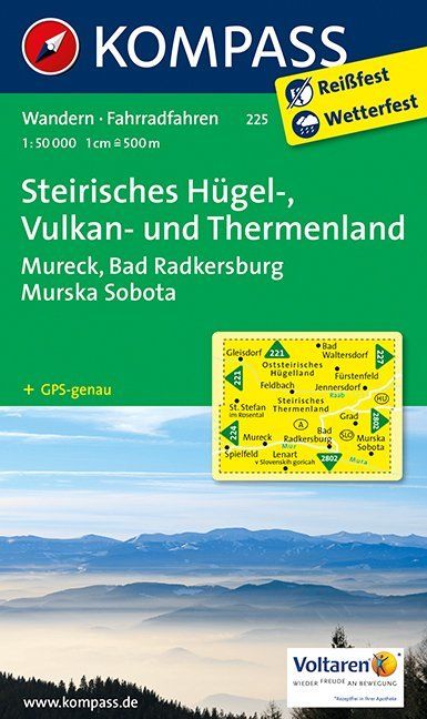
- Styria Hills, Volcano and Thermal Lands kompass 225
- Styria’s Volcanic Hills and Thermal Baths Land area of Austria on a detailed, GPS compatible map at 1:50,000 from Kompass with local and long-distance footpaths, cycling routes, accommodation, etc, printed on durable, waterproof and tear-resistant synthetic paper.KOMPASS HIKING & RECREATIONAL MAPS: this title is part of an extensive series... Read more
- Also available from:
- De Zwerver, Netherlands
De Zwerver
Netherlands
Netherlands
- Wandelkaart 225 Steirisches Hügel-, Vulkan- und Thermenland | Kompass
- Goede wandelkaart met vrijwel alle topografische details en ingetekende routes. Ook met symbolen voor toeristische bezienswaardigheden, register. Berghutten duidelijk weergegeven. Gevaarlijke wandelroutes zijn goed herkenbaar. GPS toepasbaar. Inclusief een Duitstalig boekje met informatie en routesuggesties. Destination: • Die Südoststeiermark... Read more

Stanfords
United Kingdom
United Kingdom
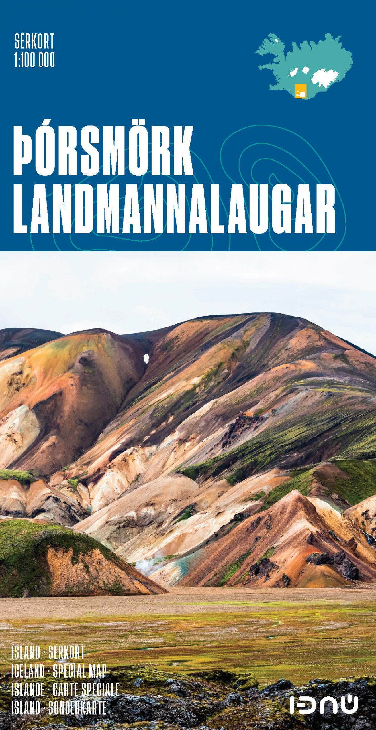
- Thorsmork - Landmannalaugar IDNU Map
- Þórsmörk - Landmannalaugar region at 1:100,000 in a series of special detailed hiking and touring maps based on the Icelandic topographic survey, covering an area east and south of the Hekla volcano, showing the lava fields annotated with dates of various eruptions. Contours are at 20-metre intervals, with several types of terrain and... Read more
- Also available from:
- De Zwerver, Netherlands

Stanfords
United Kingdom
United Kingdom
- Landmannalaugar - Þorsmork - Fjallabak - Eyjafjallajokull Volcano
- Landmannlaugar - Þórsmörk - Fjallabak area of Iceland at 1:100,000 in a series of detailed hiking and recreational topographic maps from Mál og menning - the country`s leading cartographic publishers, with beautiful drawings of local birds and tourist information. An enlargement shows the Þórsmörk area with paths between the Eyjafjallajökull... Read more
- Also available from:
- De Zwerver, Netherlands
De Zwerver
Netherlands
Netherlands
- Wandelkaart 04 Serkort Landmannalaugar - Þórsmörk - Fjallabak - Eyjafjallajökull Vulkaan - IJsland | Mal og Menning
- De wandelkaartenserie van Mal og Menning is bijzonder duidelijk en geschikt voor alle recreatieve doeleinden, ze zijn gebaseerd op de topografische kaarten van IJsland. De kaart laat een gedetailleerd beeld zien van de landschapskenmerken, hoogtelijnen op basis van 20 m. met hoogtepunten apart vermeld. Verschil in kleur en symbolen geven een... Read more