
Valencia
Description
Map

Trails in this region
Links
Facts
Reports
Guides and maps
Lodging
Organisations
Tour operators
GPS
Other
Books

Stanfords
United Kingdom
United Kingdom
- Les Monts du Beaujolais et du Lyonnais à pied FFRP Topo-guide No. P691
- Les Monts du Beaujolais et du Lyonnais à pied, FFRP topo-guide Ref. No. P691, with 34 day walks of varying length and difficulty in the region between Mâcon and St.Etienne, including a route along the GR7 and its variants. Each walk is presented on a separate colour extract from IGN’s topographic survey of France at 1:25,000, with its... Read more

Stanfords
United Kingdom
2020
United Kingdom
2020
- Les Abers - le Chemin de Phares GR34/GR34F
- Les Abers - le chemin de phares, FFRP topoguide Ref. no. 347, covering the coastal route in north-western Brittany between Morlaix, Brest, and le Fau, plus 4 walks on the Ile d`Ouessant. Current edition of this title was published in September 2017.Between Morlaix and Brest, where the sea has dug deep furrows in the land. More than 20 days of... Read more

Stanfords
United Kingdom
2018
United Kingdom
2018
- Val d`Azun à pied ST10
- Val d`Azun à pied, FFRP topo-guide Ref. No. ST10, with 18 day walks of varying length and difficulty in the French Pyrenees south-west of Argelès-Gazost, plus a tour which includes part of the GR10 long-distance footpaths. Each walk is presented on a separate colour extract from IGN’s topographic survey of France at 1:25,000 and/or 1:50,000,... Read more
Stanfords
United Kingdom
2020
United Kingdom
2020
- Tour du Larzac, Templier - Hospitalier - Entre causses et vallées GR71C/GR71D
- Tour du Larzac - Templier et Hospitalier, FFRP topoguide Ref. No. 710, covering the 195kms of hiking circuits along the GR71C and GR71D south of Millau in the Causse du Larzac, plus 13 local day walks. Current edition of this title was published in December 2015.ABOUT THE FFRP (Fédération française de la randonnée pédestre) TOPOGUIDES:... Read more

Stanfords
United Kingdom
United Kingdom
- GR3: Les Monts du Forez FFRP Topo-guide No. 334
- Les Monts du Forez, FFRP topoguide Ref. No. 334, covering in all 259kms along the GR3 and its variant, with additional descriptions of 21 day walks in the region. Current edition of this title was published in April 2016.ABOUT THE FFRP (Fédération française de la randonnée pédestre) TOPOGUIDES: published in a handy A5 paperback format, the... Read more

Stanfords
United Kingdom
2019
United Kingdom
2019
- La Traversée des Alpes de la Maurienne a l`Ubaye GR5/GR56
- 9 days from Modane to Larche by the GR5, as much for the tour of Ubaye.Grande Traversée des Alpes: de la Maurienne a l`Ubaye, FFRP topoguide Ref. No. 531, covering the third stage of the GR5 in the French Alps from Modane to Larche, plus the Tour de l`Ubaye at its southern end, in all 272km for hiking routes. Current edition of this title was... Read more

Stanfords
United Kingdom
2015
United Kingdom
2015
- GR654 Chemins de St-Jacques: Vézelay - Périgueux FFRP Topo-guide No. 6542
- Chemins de St-Jacques: Vézelay - Périgueux, FFRP topoguide Ref. no. 6542, covering the 744km route along the GR654 the Way of St. Jamezs from Vézelay via Limoges to Périgueux. Current edition of this title was published in March 2015.ABOUT THE FFRP (Fédération française de la randonnée pédestre) TOPOGUIDES: published in a handy A5 paperback... Read more
Stanfords
United Kingdom
2020
United Kingdom
2020
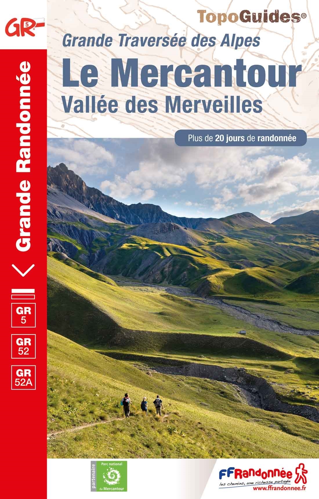
- Le Mercantour - Vallee des Merveilles GR5/GR52/52A
- Le Mercantour: Larche – Nice/Menton, Vallée des Merveilles, FFRP topoguide Ref. No. 507, covering 450km of long-distance routes: the last section of the GR5 in the French Alps from Larche to Nice, an alternative variant off GR5 along the GR52 leading via the Vallée des Merveilles to Menton, plus GR52A – Panoramique du Mecantour from Col du... Read more

Stanfords
United Kingdom
2011
United Kingdom
2011
- GRP: Monts et Lacs du Lévézou FFRP Topo-guide No. 1201
- Monts et Lacs du Lévézou, FFRP topo-guide ref. no. 1201, covering two hiking circuits in the Massif Central near Rodez and Millau; in all 214kms of routes. Current edition of this title was published in March 2011.ABOUT THE FFRP (Fédération française de la randonnée pédestre) TOPOGUIDES: published in a handy A5 paperback format, the guides are... Read more

Stanfords
United Kingdom
2015
United Kingdom
2015
- GRP: Tours et Ronde du Canigó FFRP Topo-guide No. 6600
- Tours et Ronde du Canigó, FFRP topoguide Ref. no. 6600, covering 395kms of routes in the eastern Pyrenees, including a tour of Canigou itself and sections of the GR10. Current edition of this title was published in June 2015.ABOUT THE FFRP (Fédération française de la randonnée pédestre) TOPOGUIDES: published in a handy A5 paperback format, the... Read more

Stanfords
United Kingdom
2012
United Kingdom
2012
- GR62B/GR36/GR46 Le Chemin de Conques à Toulouse FFRP Topo-guide No. 3646
- Le Chemin de Conques à Toulouse, FFRP topoguide Ref. no. 3646, covering 563kms of various GR routes in the region of Quercy and the Gorges of the Aveyron between Conques and Cahors in the north and Toulouse and Albi in the south: le Chemin de Conques à Toulouse along the GR62B, 36 and 46; GR 36 from Cahors to Albi; GR46 along the Gorges of the... Read more

Stanfords
United Kingdom
2012
United Kingdom
2012
- GR93/GR94 Tours dans les Hautes-Alpes FFRP Topo-guide No. 940
- Tours dans les Hautes-Alpes, FFRP topoguide Ref. no. 940, covering 691km of hiking routes along the GR93 and GR94 in the French Alps west of Gap. The routes can be combined, as required, into shorter or longer circuits. Current edition of this title was published in June 2012.ABOUT THE FFRP (Fédération française de la randonnée pédestre)... Read more

Stanfords
United Kingdom
2015
United Kingdom
2015
- GR2: La Seine à pied en Ile de France FFRP Topo-guide No. 203
- More than 10 days of hiking following the course of the Seine between Montereau (77) and Vernon (27).La Seine à pied en Ile de France, FFRP topoguide Ref. no. 203, covering a 262kms route along the GR2 from Monterau-Fault-Yonne to Vernon following the Seine, including in the suburbs of Paris and across the capital, with variants on both sides... Read more
Stanfords
United Kingdom
2020
United Kingdom
2020
- La Traversee der Alpes La Vanoise - PN de la Vanoise GR5/GR55
- 15 days in altitude from the Tarentaise to Modane, heart of the Maurienne. Description also of Via Alpina.La Vanoise (including Parc National de la Vanoise), FFRP topoguide Ref. no. 530, covering the second section of the GR5 in the French Alps between Landry and Modane, its lower variant on the GR5E along the river Arc, plus the traverse of... Read more

Stanfords
United Kingdom
2018
United Kingdom
2018
- Pyrénées Ariégeoises - La traversée des Pyrénées et tours du Val du Garbet et du Biros GR10
- Pyrénées Ariégeoises, FFRP topoguide, Ref. No. 1090, covering the third section of the GR10 along the Pyrenees from the Atlantic to the Mediterranean – a 335-km long walk from Bagnères-de-Luchon to Mérens-les-Vals. Given the mountainous terrain, the guide also provides a detailed route profile for this part of the GR10, annotated with timings... Read more
Maps

Stanfords
United Kingdom
United Kingdom
- Tour of the Canigó Hiking Circuit
- A 64-km long tour of Canigó (Canigou), the highest mountain in the eastern Pyrenees, presented by Editorial Alpina on a contoured, GPS compatible map at 1:25,000, with a booklet providing descriptions of its recommended stages.The map has contours at 20m intervals, enhanced by relief shading. The tour which follows sections of the GR10, the HRP... Read more

Stanfords
United Kingdom
United Kingdom
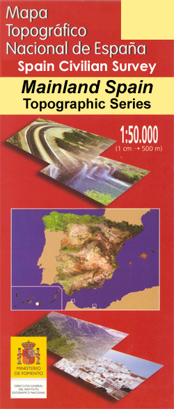
- Valencia de Alcantara CNIG Topo 701
- Topographic coverage of mainland Spain at 1:50,000 in the MTN50 (Mapa Topográfico Nacional) series from the Centro Nacional de Información Geografica, the country’s civilian survey organization. The maps have contours at 20m intervals, enhanced by relief shading, plus colouring and/or graphics to show different types of terrain, vegetation or... Read more

Stanfords
United Kingdom
United Kingdom
- Valencia - Alicante - Murcia 500K CNIG Regional Map No. 9
- The Mediterranean coast of Spain from north of Valencia to Costa Blanca and inland to include Sierras de Cazorla and Segura in north-eastern Andalucía, at 1:500,000 in a series of regional road maps from the country’s civilian survey organization IGN-CNIG (Instituto Geográfico Nacional - Centro Nacional de Información Geográfica), vividly... Read more
Stanfords
United Kingdom
United Kingdom
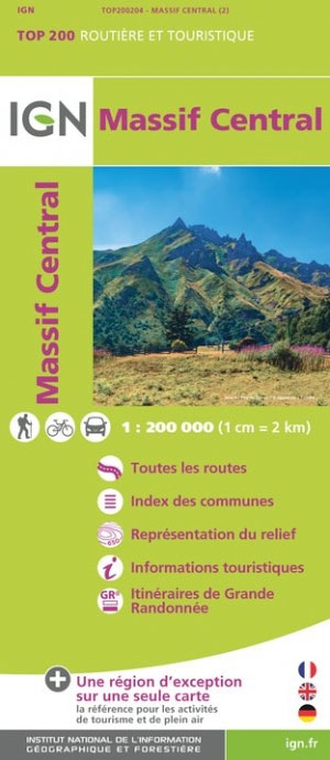
- Massif Central IGN Top200 204
- Pyrénées Ouest map from the IGN at 1:200,000, with excellent presentation of the terrain through contours and vivid relief shading, plenty of names of topographic features, long-distance GR hiking routes, places of interest, etc. The map is designed to provide convenient coverage of the western and central part of the Pyrenees, extending across... Read more

Stanfords
United Kingdom
United Kingdom
- M13 Denia to Barcelona and Ibiza
- Plans included: Denia (1:20,000) Valencia Harbour (1:30,000) Tarragona (1:25,000) Barcelona Harbour (1:65,000) San Antonio (Ibiza) (1:30,000) Read more

Stanfords
United Kingdom
United Kingdom
- Pays Basque West Rando Editions 1 SUPERCEDED
- The westernmost section of the French Pyrenees between the Atlantic coast and St-Jean-Pied-de-Port on a contoured and GPS compatible map at 1:50,000 from Rando Editions with topographic base provided by the IGN, highlighting local and long-distance hiking trails, cycle and mountain bike routes, etc. Coverage along the Atlantic coast starts at... Read more

Stanfords
United Kingdom
2017
United Kingdom
2017
- Le Chemin du Piemont Pyreneen - vers Saint-Jacques-de-Compostell
- Le Chemin du Piémont Pyrénéen, FFRP topoguide, Ref. No. 780, covering the GR78 - the Way of St. James along the northern side of the Pyrenees from Carcassonne to Roncesvalles on the Spanish side, with an alternative variant to cross the mountains along the Col du Somport. Current edition of this title was published in May 2017.The route, the... Read more
Stanfords
United Kingdom
2016
United Kingdom
2016
- Sur les Traces des Cathares GR107 FR et ES Plus de 10 Jours de Randonnee: FFR.1097: 2016
- Sur les traces des Cathares, Le Chemin des Bonshommes GR 10 Topo Guide FFRP ref 1097 Hiking guide for the French Pyrenees with description of a multi-day hike of 220 km for 10 days hiking through the Cathar country from Foix, Ariege along Andorra to Berga ( Pyrenees France and Spain).French-speaking hiking guide. Excellent description with... Read more
Stanfords
United Kingdom
2019
United Kingdom
2019
- Tours et Traversées du Vercors - du Diois et les Baronnies GR9/GR91
- Tours et Traversées dans Vercors, le Diois et les Baronnies, FFRP topo-guide Ref. No. 904, covering in all over 1000 km of routes and circuits along the GR9, GR91, GR93, GR95, GR429 and GRs de Pays between Grenoble, Die and Brantes in Provence north of Mt Ventoux. Topographic mapping from the IGN is accompanied by detailed route descriptions,... Read more
Stanfords
United Kingdom
United Kingdom
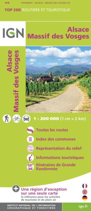
- Massif des Vosges - Plaine d`Alsace IGN Top200 201
- Pyrénées Ouest map from the IGN at 1:200,000, with excellent presentation of the terrain through contours and vivid relief shading, plenty of names of topographic features, long-distance GR hiking routes, places of interest, etc. The map is designed to provide convenient coverage of the western and central part of the Pyrenees, extending across... Read more

Stanfords
United Kingdom
2019
United Kingdom
2019
- Pyrénées Orientales et tours du Capcir, du Carlit et de Cerdagne GR10/GR36
- More than 30 days of hiking, including 12 to join Banyuls in Mérens-les-Vals.Pyrénées Orientales, FFRP topoguide, Ref. No. 1092, covering the fourth and last section of the GR10 along the Pyrenees from the Atlantic to the Mediterranean – a 196-km long walk from Mérens-les-Vals to Banyuls-sur-Mer. The guide also covers a 177-km trail along the... Read more

Stanfords
United Kingdom
United Kingdom
- 3220 Cabo de la Nao to the French border Chart Atlas - 2019 Edition
- A new chart atlas covering Mediterranean Spain from Cabo de la Nao to the French border. This appealing cruising area stretches from Jávea and Dénia in the south, past the low-lying Ebro delta to the charming towns along the rugged Costa Brava in the north. It includes the cities of Valencia, Tarragona and Barcelona. The 23 sheets in the atlas... Read more
Stanfords
United Kingdom
United Kingdom
- Valencia CNIG Topo 722
- Topographic coverage of mainland Spain at 1:50,000 in the MTN50 (Mapa Topográfico Nacional) series from the Centro Nacional de Información Geografica, the country’s civilian survey organization. The maps have contours at 20m intervals, enhanced by relief shading, plus colouring and/or graphics to show different types of terrain, vegetation or... Read more

Stanfords
United Kingdom
United Kingdom
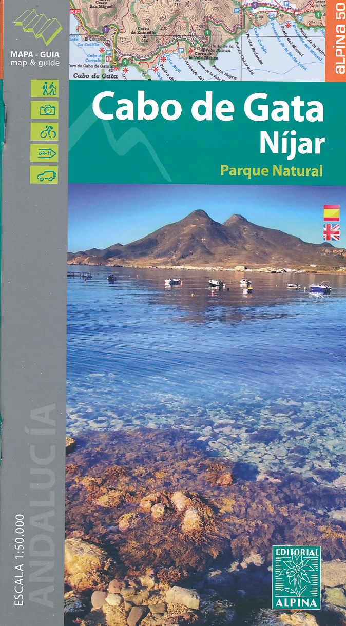
- Cabo de Gata-Níjar Natural Park Editorial Alpina
- Cabo da Gata area on the south-eastern tip of Andalucía on a contoured and GPS compatible map at 1:50,000 from Editorial Alpina highlighting hiking and cycling trails, plus a booklet with English language descriptions of recommended routes, accommodation lists, etc.Topography is shown by contours at 20m intervals, with relief shading and... Read more
- Also available from:
- The Book Depository, United Kingdom
- De Zwerver, Netherlands

The Book Depository
United Kingdom
United Kingdom
- Cabo de Gata / Nijar
- Gedetailleerde wandelkaart van een interessant wandelgebied. Uitstekend leesbaar, inhoudelijk een goede kaart met allerhande informatie op topografische basis waarbij wandelroutes, campings en hutten. Bij een aantal Alpina kaarten is een boekje bijgevoegd met routes. Door de toevoeging van gradengrid is deze kaart bruikbaar voor GPS. Cabo da... Read more
De Zwerver
Netherlands
Netherlands
- Wandelkaart Cabo de Gata - Nijar | Editorial Alpina
- Gedetailleerde wandelkaart van een interessant wandelgebied. Uitstekend leesbaar, inhoudelijk een goede kaart met allerhande informatie op topografische basis waarbij wandelroutes, campings en hutten. Bij een aantal Alpina kaarten is een boekje bijgevoegd met routes. Door de toevoeging van gradengrid is deze kaart bruikbaar voor GPS. Cabo da... Read more

Stanfords
United Kingdom
United Kingdom
- Southern Alps IGN Top200 203
- Pyrénées Ouest map from the IGN at 1:200,000, with excellent presentation of the terrain through contours and vivid relief shading, plenty of names of topographic features, long-distance GR hiking routes, places of interest, etc. The map is designed to provide convenient coverage of the western and central part of the Pyrenees, extending across... Read more
- Also available from:
- The Book Depository, United Kingdom

The Book Depository
United Kingdom
United Kingdom
- Alpes du Sud
- Pyrénées Ouest map from the IGN at 1:200,000, with excellent presentation of the terrain through contours and vivid relief shading, plenty of names of topographic features, long-distance GR hiking routes, places of interest, etc. The map is designed to provide convenient coverage of the western and central part of the Pyrenees, extending across... Read more