Lienzer Dolomiten
Description
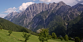
In fact, this impressive mountain range, popping out unexpectedly from less rugged mountain scenery around, has nothing to do with the Dolomites proper. Even the limestone is not dolomite. The classification of this compact and wild mountain group is difficult. Usually, they are grouped together with the Gailtaler Alps to the east.
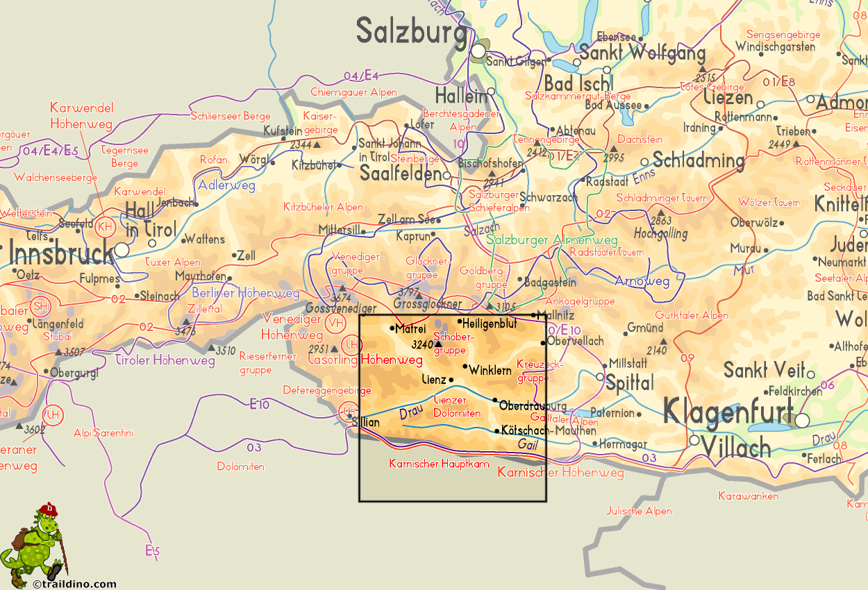
Anyway, what does it matter? For us hikers, the Lienzer Dolomites are a great area to explore. They only measure 40 by 15 km, but this is still a vast expanse of rocks and nature. In its lower parts, one can make hikes over the via ferrata in the narrow and deep crevasses. In its higher parts, a more comfortable tour is possible, combining the different huts into one long distance hike. The ascent of the peaks is more difficult. Highest is the Grosse Sandspitze, 2.772 m.
Map
Trails in this region
Links
Facts
Reports
Guides and maps
Lodging
Organisations
Tour operators
GPS
Other
Books
Netherlands
- Höhenwege & Gipfelziele - Bergwandern in Osttirol und Oberkärnten
- Dieses neue Bild-Wanderbuch pr sentiert die sch nsten H henwege und Gipfelziele der vielf ltigen Bergwelt Osttirols und Oberk rntens. Die reich bebilderten Tourenvorschl ge zu jeder Region werden dabei so pr sentiert, dass sie einen gr tm glichen Einblick in den Routenverlauf der vorgestellten Tour erlauben. Ideal also zum Vor- und... Read more
- Also available from:
- Bol.com, Belgium

Belgium
- Höhenwege & Gipfelziele - Bergwandern in Osttirol und Oberkärnten
- Dieses neue Bild-Wanderbuch pr sentiert die sch nsten H henwege und Gipfelziele der vielf ltigen Bergwelt Osttirols und Oberk rntens. Die reich bebilderten Tourenvorschl ge zu jeder Region werden dabei so pr sentiert, dass sie einen gr tm glichen Einblick in den Routenverlauf der vorgestellten Tour erlauben. Ideal also zum Vor- und... Read more
Netherlands
2016
- WF5620 Oost-Tirol Kompass
- De Kompass wandelgids + kaart geeft een overzicht van alle wandelroutes in het gebied met nauwkeurige routeaanwijzingen en hoogteaanduidingen, De extra grote kaart, schaal 1:35 000, is ideaal om van te voren uw route uit te stippelen en om onderweg te gebruiken • naast de bekende bestemmingen, worden ook de minder bekende vermeld • openbaar... Read more
- Also available from:
- Bol.com, Belgium

Belgium
2016
- WF5620 Oost-Tirol Kompass
- De Kompass wandelgids + kaart geeft een overzicht van alle wandelroutes in het gebied met nauwkeurige routeaanwijzingen en hoogteaanduidingen, De extra grote kaart, schaal 1:35 000, is ideaal om van te voren uw route uit te stippelen en om onderweg te gebruiken • naast de bekende bestemmingen, worden ook de minder bekende vermeld • openbaar... Read more
Netherlands
2022
- Wandelgids Osttirol Süd | Rother Bergverlag
- Uitstekende wandelgids met een groot aantal dagtochten in dal en hooggebergte. Met praktische informatie en beperkt kaartmateriaal! Wandelingen in verschillende zwaarte weergegeven in rood/blauw/zwart. Osttirol liegt südlich der Hohen Tauern, der höchsten Alpenkette Österreichs, die so manche Regenfront aus dem Norden abhält. Von Süden her tun... Read more
Maps

United Kingdom
- Lienz Dolomites - Lesachtal - Villgratner Berge F&B WK182
- Lienz Dolomites - Lesachtal area of Carinthia presented at 1:50,000 in a series of contoured and GPS compatible outdoor leisure map from Freytag & Berndt with hiking and cycling routes, mountain huts, campsites and youth hostels, local bus stops, plus other tourist information.To see the list of currently available titles in this series please... Read more
- Also available from:
- The Book Depository, United Kingdom

United Kingdom
- Lienz Dolomites - Lesachtal - Villgratner Mountains Hiking + Leisure Map 1:50 000
- Lienz Dolomites - Lesachtal area of Carinthia presented at 1:50,000 in a series of contoured and GPS compatible outdoor leisure map from Freytag & Berndt with hiking and cycling routes, mountain huts, campsites and youth hostels, local bus stops, plus other tourist information.To see the list of currently available titles in this series please... Read more

United Kingdom
- Carinthian Alps - Gailtal - Gitschtal - Nassfeld - Lesachtal - Weissensee - Upper Drautal F&B WK223
- Naturarena Kärnten - Gailtal - Gitschtal -Lesachtal - Weissensee - Oberes Drautal area of Carinthia presented at 1:50,000 in a series of contoured and GPS compatible outdoor leisure map from Freytag & Berndt with hiking and cycling routes, mountain huts, campsites and youth hostels, local bus stops, plus other tourist information.To see the... Read more
- Also available from:
- The Book Depository, United Kingdom
- Also available from:
- De Zwerver, Netherlands
Netherlands
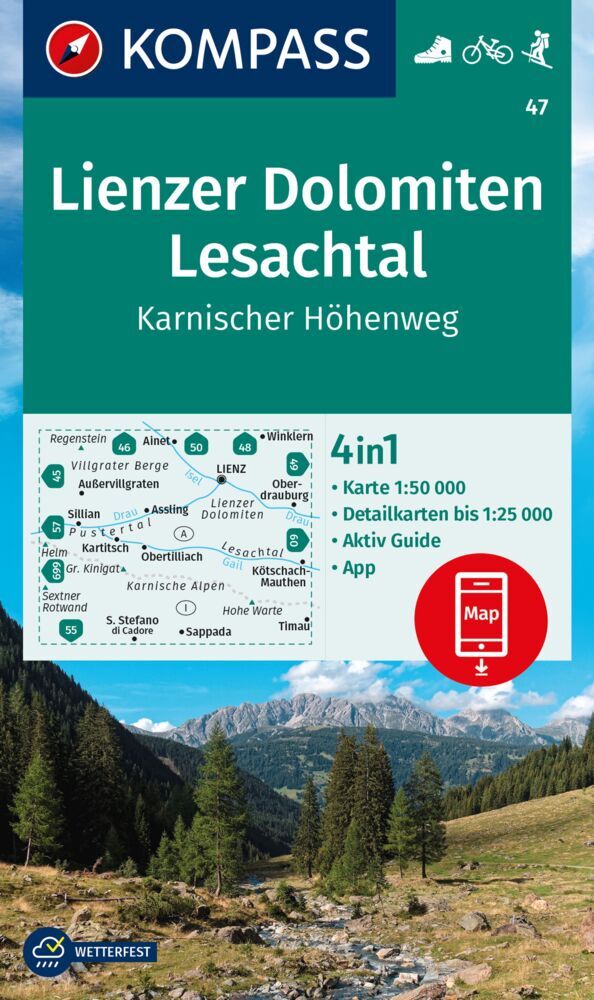
- Lienzer Dolomiten, Lesachtal WK47
- Die KOMPASS Wanderkarten überzeugen durch eine GPS-genaue und aktuelle Karte zur einfachen Orientierung den beigelegten Kurzführer zu Wissenswerten in der Region Herstellung auf robustem reiß- und wetterfesten PapierDeze Kompass wandelkaart, schaal 1:50 000, is ideaal om uw route uit te stippelen en om onderweg te gebruiken • naast de bekende... Read more
- Also available from:
- Bol.com, Belgium

Belgium
- Lienzer Dolomiten, Lesachtal WK47
- Die KOMPASS Wanderkarten überzeugen durch eine GPS-genaue und aktuelle Karte zur einfachen Orientierung den beigelegten Kurzführer zu Wissenswerten in der Region Herstellung auf robustem reiß- und wetterfesten PapierDeze Kompass wandelkaart, schaal 1:50 000, is ideaal om uw route uit te stippelen en om onderweg te gebruiken • naast de bekende... Read more

United Kingdom
- Kals - Heiligenblut - Matrei - Lienz F&B WK181
- Kals - Heiligenblut - Matrei - Lienz area of the Austrian Alps presented at 1:50,000 in a series of contoured and GPS compatible outdoor leisure map from Freytag & Berndt with hiking and cycling routes, mountain huts, campsites and youth hostels, local bus stops, plus other tourist information.To see the list of currently available titles in... Read more
- Also available from:
- The Book Depository, United Kingdom
- Bol.com, Netherlands
- Bol.com, Belgium

United Kingdom
- Kals - Heiligenblut - Matrei - Lienz Hiking + Leisure Map 1:50 000
- Kals - Heiligenblut - Matrei - Lienz area of the Austrian Alps presented at 1:50,000 in a series of contoured and GPS compatible outdoor leisure map from Freytag & Berndt with hiking and cycling routes, mountain huts, campsites and youth hostels, local bus stops, plus other tourist information.To see the list of currently available titles in... Read more
Netherlands
- FB WK181 Kals • Heiligenblut • Matrei • Lienz
- Fiets- en wandelkaart • schaal 1:50 000 • activiteiten gids • plaatsnamenregister met postcodes • fietspaden en mountainbikeroutes • vermelding GPS-punten • met ski- en langlaufroutes Read more

Belgium
- FB WK181 Kals • Heiligenblut • Matrei • Lienz
- Fiets- en wandelkaart • schaal 1:50 000 • activiteiten gids • plaatsnamenregister met postcodes • fietspaden en mountainbikeroutes • vermelding GPS-punten • met ski- en langlaufroutes Read more


