
Vorarlberg
Description
Bundesland in the westernmost corner of the country, bordering Switzerland, Germany and Liechtenstein.
Trails in this state
Links
Facts
Reports
Guides and maps
Lodging
Organisations
Tour operators
GPS
Other
Books

Stanfords
United Kingdom
United Kingdom
- Silvretta - Verwallgruppe Kompass 41
- Silvretta - Verwallgruppe area of the Austrian Alps on a detailed, GPS compatible map at 1:50,000 from Kompass with local and long-distance footpaths, cycling routes, accommodation, etc. KOMPASS HIKING & RECREATIONAL MAPS: this title is part of an extensive series covering Austria, much of Germany and the Slovenian Alps. Kompass are Europe’s... Read more

Bol.com
Netherlands
Netherlands
- Over the Top & Back Again
- Book of the Year Bronze Award 2010 (travel essays category), ForeWord Magazine After hiking some of the world's great trails, Brandon Wilson was excited to hear about the Via Alpina, paths running across eight countries on the backbone of the Alps. Besides promising immersion into Alpine life and wilderness, it was the ultimate adventure. It... Read more
- Also available from:
- Bol.com, Belgium
Bol.com
Belgium
Belgium
- Over the Top & Back Again
- Book of the Year Bronze Award 2010 (travel essays category), ForeWord Magazine After hiking some of the world's great trails, Brandon Wilson was excited to hear about the Via Alpina, paths running across eight countries on the backbone of the Alps. Besides promising immersion into Alpine life and wilderness, it was the ultimate adventure. It... Read more
De Zwerver
Netherlands
2021
Netherlands
2021
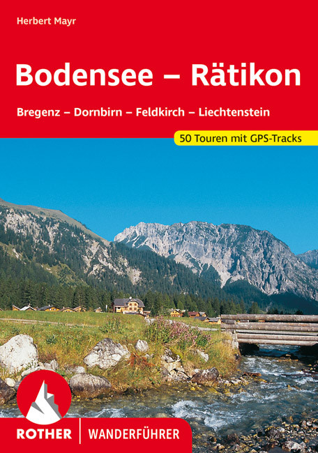
- Wandelgids Bodensee - Rätikon | Rother Bergverlag
- Uitstekende wandelgids met een groot aantal dagtochten in dal en hooggebergte. Met praktische informatie en beperkt kaartmateriaal! Wandelingen in verschillende zwaarte weergegeven in rood/blauw/zwart. Das Tourengebiet dieses Wanderführers reicht vom Bodensee fast bis zum Gletschereis der Schesaplana – es entspricht weitgehend der Vorarlberger... Read more

De Zwerver
Netherlands
2007
Netherlands
2007
- Wandelgids Across the eastern alps: E5 | Cicerone
- From Lake Constance in Germany, this guidebook describes walking the E5 trek that runs 600km through a remarkable kaleidoscope of landscapes and culture in Switzerland, Austria and Italy, to its destination at Verona. It traverses the Allgauer, Lechtaler and Ötztaler Alps. There is a good network of alpine refuges and guesthouses on the route. Read more
Bol.com
Netherlands
2021
Netherlands
2021
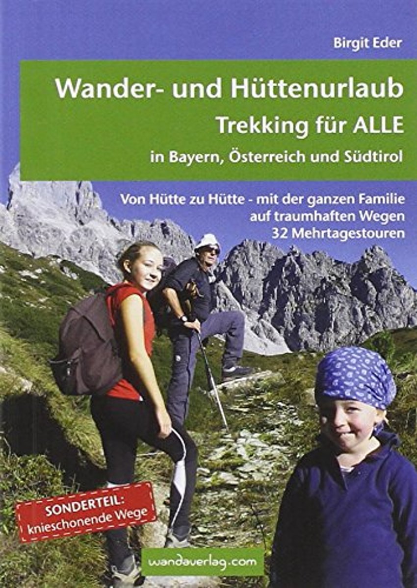
- Wander- und H ttenurlaub. Trekking f r ALLE in Bayern, Österreich und S dtirol
- Von H tte zu H tte mit leichtem Gep ck zu wandern, ist eine wunderbare Art, dem Alltag zu entfliehen. Die spannenden Mehrtagestouren sind in leicht zu bew ltigende Etappen unterteilt, die nach Kondition oder Laune zusammengefasst werden k nnen. Darum ist dieser Trekkingf hrer f r EinsteigerInnen wie f r Versierte gleicherma en eine Fundgrube.... Read more
- Also available from:
- Bol.com, Belgium
- De Zwerver, Netherlands
Bol.com
Belgium
2021
Belgium
2021
- Wander- und H ttenurlaub. Trekking f r ALLE in Bayern, Österreich und S dtirol
- Von H tte zu H tte mit leichtem Gep ck zu wandern, ist eine wunderbare Art, dem Alltag zu entfliehen. Die spannenden Mehrtagestouren sind in leicht zu bew ltigende Etappen unterteilt, die nach Kondition oder Laune zusammengefasst werden k nnen. Darum ist dieser Trekkingf hrer f r EinsteigerInnen wie f r Versierte gleicherma en eine Fundgrube.... Read more
De Zwerver
Netherlands
2021
Netherlands
2021
- Wandelgids Wander- und Hüttenurlaub. Trekking für alle in Bayern, Österreich und Südtirol | Wandaverlag
- Von Hütte zu Hütte mit leichtem Gepäck zu wandern, ist eine wunderbare Art, dem Alltag zu entfliehen. Die spannenden Mehrtagestouren sind in leicht zu bewältigende Etappen unterteilt, die nach Kondition oder Laune zusammengefasst werden können. Darum ist dieser Trekkingführer für EinsteigerInnen wie für Versierte gleichermaßen eine Fundgrube.... Read more

Bol.com
Netherlands
Netherlands
- Over the Top & Back Again
- Book of the Year Bronze Award 2010 (travel essays category), ForeWord Magazine After hiking some of the world's great trails, Brandon Wilson was excited to hear about the Via Alpina, paths running across eight countries on the backbone of the Alps. Besides promising immersion into Alpine life and wilderness, it was the ultimate adventure. It... Read more
- Also available from:
- Bol.com, Belgium
Bol.com
Belgium
Belgium
- Over the Top & Back Again
- Book of the Year Bronze Award 2010 (travel essays category), ForeWord Magazine After hiking some of the world's great trails, Brandon Wilson was excited to hear about the Via Alpina, paths running across eight countries on the backbone of the Alps. Besides promising immersion into Alpine life and wilderness, it was the ultimate adventure. It... Read more

De Zwerver
Netherlands
2022
Netherlands
2022

De Zwerver
Netherlands
2022
Netherlands
2022
- Klimgids - Klettersteiggids Bayern, Vorarlberg, Tirol, Salzburg | Rother Bergverlag
- 92 Klettersteige zwischen Rhein und Salzach Rother Wanderführer. 10., vollständig neu bearbeitete Auflage. Read more

The Book Depository
United Kingdom
2014
United Kingdom
2014
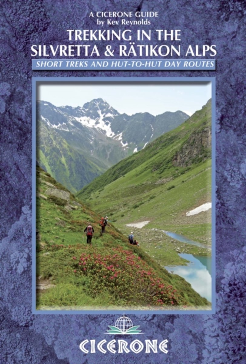
- Trekking in the Silvretta and Ratikon Alps
- Tour of the Silvretta, the Prattigauer Hohenweg and the Ratikon Hohenweg plus 12 day routes Read more
- Also available from:
- Bol.com, Netherlands
- Bol.com, Belgium
- De Zwerver, Netherlands
Bol.com
Netherlands
2014
Netherlands
2014
- Trekking in the Silvretta and Ratikon Alps
- This guidebook describes 3 Alpine treks, between 5 and 8 days long, as well as 12 full or half day hut-to-hut routes. The three treks suitable for moderately experienced trekkers, but requiring no specialist equipment, are the Tour of the Silvretta, the Prattigauer Hohenweg and the Ratikon Hohenweg, two of which can be combined to provide a... Read more
Bol.com
Belgium
2014
Belgium
2014
- Trekking in the Silvretta and Ratikon Alps
- This guidebook describes 3 Alpine treks, between 5 and 8 days long, as well as 12 full or half day hut-to-hut routes. The three treks suitable for moderately experienced trekkers, but requiring no specialist equipment, are the Tour of the Silvretta, the Prattigauer Hohenweg and the Ratikon Hohenweg, two of which can be combined to provide a... Read more
De Zwerver
Netherlands
2014
Netherlands
2014
- Wandelgids Trekking in the Silvretta and Ratikon Alps | Cicerone
- This guide describes three treks, between 5 and 8 days, in the Silvretta and Rätikon Alps starting near Klosters, and 12 half-day hut-to-hut routes. These contrasting ranges form a line on the borders of Switzerland, Austria and Liechtenstein. The Tour of the Silvretta, the Prättigauer Höhenweg and the Rätikon Höhenweg. Read more

Stanfords
United Kingdom
2017
United Kingdom
2017
- The Swiss Alpine Pass Route - via Alpina Route 1: Trekking East to West Across Switzerland
- This guidebook presents the stunning Alpine Pass Route, now fully waymarked as Via Alpina 1. The 360km trail traverses Switzerland from east to west, from Sargans near the Liechtenstein border to Montreux on Lac Leman (Lake Geneva). Crossing sixteen Alpine passes, it showcases some of the country`s most breathtaking mountain landscapes,... Read more
- Also available from:
- Bol.com, Netherlands
- Bol.com, Belgium

Bol.com
Netherlands
2017
Netherlands
2017
- The Swiss alpine pass route - Via Alpina route 1
- This guidebook presents the stunning Alpine Pass Route, now fully waymarked as Via Alpina 1. The 360km trail traverses Switzerland from east to west, from Sargans near the Liechtenstein border to Montreux on Lac Léman (Lake Geneva). Crossing sixteen Alpine passes, it showcases some of the country's most breathtaking mountain landscapes,... Read more
Bol.com
Belgium
2017
Belgium
2017
- The Swiss alpine pass route - Via Alpina route 1
- This guidebook presents the stunning Alpine Pass Route, now fully waymarked as Via Alpina 1. The 360km trail traverses Switzerland from east to west, from Sargans near the Liechtenstein border to Montreux on Lac Léman (Lake Geneva). Crossing sixteen Alpine passes, it showcases some of the country's most breathtaking mountain landscapes,... Read more

Bol.com
Netherlands
2017
Netherlands
2017
- Griechenland: Trans Kreta E4
- Kein Geheimtipp und dennoch etwas in Vergessenheit geraten ist das ber 500 km lange Teilst ck des europ ischen Fernwanderweges E4 auf Kreta. Bereits seit den 1970er-Jahren geh rt dieser Abschnitt zu einem der beliebtesten des l ngsten europ ischen Fernwanderweges und ist somit ein echter Trekkingklassiker.Wer gut markierte Pfade und verl... Read more
- Also available from:
- Bol.com, Belgium
- De Zwerver, Netherlands
Bol.com
Belgium
2017
Belgium
2017
- Griechenland: Trans Kreta E4
- Kein Geheimtipp und dennoch etwas in Vergessenheit geraten ist das ber 500 km lange Teilst ck des europ ischen Fernwanderweges E4 auf Kreta. Bereits seit den 1970er-Jahren geh rt dieser Abschnitt zu einem der beliebtesten des l ngsten europ ischen Fernwanderweges und ist somit ein echter Trekkingklassiker.Wer gut markierte Pfade und verl... Read more

De Zwerver
Netherlands
2017
Netherlands
2017
- Wandelgids E4 Kreta Lefka Ori und Lasithi | Conrad Stein Verlag
- OutdoorHandbuch. 3. Auflage. Read more
Bol.com
Netherlands
Netherlands
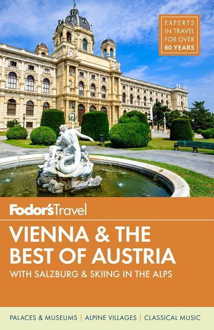
- Fodor's Vienna and the Best of Austria
- Written by local experts, Fodor's travel guides have been offering advice and professionally vetted recommendations for all tastes and budgets for 80 years.With its old-world charm, musical heritage, and alpine landscapes, Vienna and Austria offer choices for every traveler. Fodors Vienna and the Best of Austria captures the top experiences... Read more
- Also available from:
- Bol.com, Belgium
Bol.com
Belgium
Belgium
- Fodor's Vienna and the Best of Austria
- Written by local experts, Fodor's travel guides have been offering advice and professionally vetted recommendations for all tastes and budgets for 80 years.With its old-world charm, musical heritage, and alpine landscapes, Vienna and Austria offer choices for every traveler. Fodors Vienna and the Best of Austria captures the top experiences... Read more

De Zwerver
Netherlands
2022
Netherlands
2022
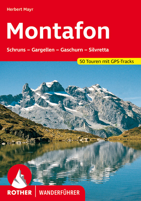
- Wandelgids Montafon, mit Bielerhöhe und Zeinisjoch-Gebiet | Rother Bergverlag
- Uitstekende wandelgids met een groot aantal dagtochten in dal en hooggebergte. Met praktische informatie en beperkt kaartmateriaal! Wandelingen in verschillende zwaarte weergegeven in rood/blauw/zwart. Die reizvoll gelegene Tallandschaft des Montafon ist von ganz unterschiedlichen, in ihrer Art unverwechselbaren Alpenregionen umgeben: Im Norden... Read more
Maps

Stanfords
United Kingdom
United Kingdom
- Bregenz F&B
- Indexed street plan of Bregenz extending north along the Bodensee coast to Lochau and Unter Hochsteg. Detail includes pedestrianised areas, railways, bus routes and cycle paths. Notable buildings are highlighted in red, and symbols indicate post offices, hostels, campsites and car parks.On the reverse is a 1:50,000 contoured map of the... Read more

Stanfords
United Kingdom
United Kingdom
- Transrhodopi - Long distance hiking and biking trail From Trigrad to Ivaylovgrad
- Western Rhodope Mountains at 1:100,000 on a contoured GPS compatible map from Domino extending from just west of the Pirin National Park to Asenovgrad in the north-east. The map is double-sided with a good overlap between the sides. Topography is shown by contours at 50m intervals with relief shading and spot heights, plus colouring for... Read more

Stanfords
United Kingdom
United Kingdom
- Cinque Terre - Golfo del Tigullio: La Spezia - Sestri Levante - Rapallo - Genoa 50K IGC Map No. 23
- Cinque Terre - Golfo del Tigullio area of the Italian Riviera from genoa to la Spezia including Sestri Levante and Rapallo in a series contoured hiking maps at 1:50,000 with local trails, long-distance footpaths, mountain accommodation, etc. from the Turin based Istituto Geografico Centrale.Maps in this series have contours at 50m intervals,... Read more

Stanfords
United Kingdom
United Kingdom
- Montreux
- Montreux - Col du Pillon area at 1:50,000 in a series from Hallwag covering Switzerland’s popular hiking regions on light, waterproof and tear-resistant maps highlighting long-distance paths: the nine national routes plus special regional routes, as well as other local hiking trails.Cartography is similar to that used both in Hallwag’s hiking... Read more

Stanfords
United Kingdom
United Kingdom
- Hungarian National Long-distance Blue Trail (E4): Visegrad to Irott-ko
- Hiking guide to the north-western section of Hungary’s National Blue Trail which forms part of the E4 European long-distance footpath. The guide covers the route from the historic town of Visegrád on the Danube, across the Buda Hills on the outskirts of Budapest and the Bakony Hills along the north-eastern shore of Lake Balaton, to Írott-ko in... Read more

Stanfords
United Kingdom
United Kingdom
- Vorarlberg Cycling Freytag & Berndt Map
- Vorarlberg on a detailed road map at 1:100,000 from Freytag & Berndt with numerous cycling routes, indicating unpaved paths, routes with heavy motorized traffic and gradient marking. Symbols mark various types of accommodation, including campsites and youth hostels, bike retail and repair facilities, viewpoints, places of interest, etc.... Read more

Stanfords
United Kingdom
United Kingdom
- Val Venosta / Vinschgau K+F Outdoor Map 1
- Val Venosta / Vinschgau area in the Dolomites at 1:50,000 in a series of waterproof and tear-resistant, GPS compatible and contoured recreational maps from Kümmerly + Frey with both local and long-distance hiking and cycling trails, ski routes, sites for other outdoor pursuits, accommodation, bus stops, etc. Coverage includes the Ortles/Ortler... Read more

Stanfords
United Kingdom
United Kingdom
- Grosses Walsertal - Feldkirch - Bludenz - Laterns - Liechtenstein F&B WK375
- Grosses Walsertal - Feldkirch - Bludenz - Laterns - Liechtenstein area of the Austrian Alps presented at 1:50,000 in a series of contoured and GPS compatible outdoor leisure map from Freytag & Berndt with hiking and cycling routes, mountain huts, campsites and youth hostels, local bus stops, plus other tourist information. Coverage inclused the... Read more

Stanfords
United Kingdom
United Kingdom
- Verwallgruppe Alpenverein Map 28
- Verwallgruppe area of the Alps in a hiking edition at 1:50,000 from a series of detailed, GPS compatible maps published by the DAV - Deutscher Alpenverein and produced by the German and Austrian Alpine Clubs using cartography from their respective survey organizations. Maps in this series have topography vividly presented by contours at 20... Read more

Stanfords
United Kingdom
United Kingdom
- Peloponnese Anavasi Road Atlas
- Road Atlas of the Peloponnese from Anavasi, in an A4 paperback format, with contoured, GPS compatible mapping at 1:50,000, very detailed road classification, hiking paths, and place names in both Greek and Latin alphabets.The main section of the atlas has 178 pages of detailed maps with contours at 100m intervals, altitude colouring and relief... Read more

Stanfords
United Kingdom
United Kingdom
- Lake Maggiore - Lake Orta - Lake Varese K+F Outdoor Map 8
- Lake Maggiore - Lake Orta - Lake Varese area at 1:50,000 in a series of waterproof and tear-resistant, GPS compatible and contoured recreational maps from Kümmerly + Frey with both local and long-distance hiking and cycling trails, ski routes, sites for other outdoor pursuits, accommodation, bus stops, etc. An inset provides a small road map of... Read more

Stanfords
United Kingdom
United Kingdom
- Taygetos - North Taygetos Anavasi 8.1
- The Taygetos range between Sparta and Kalamata at 1:50,000 on a contoured, GPS compatible map from Anavasi with on the reverse a special map highlighting the region’s numerous hiking trails, including the course of the E4 European long-distance path.On one side is the main map of the area with excellent presentation of its topography by... Read more

Stanfords
United Kingdom
United Kingdom
- Greece: Attika and Central Greece Road Atlas
- Road Atlas of Attika, the region around Athens, and Central Greece from Anavasi, in an A4 paperback format, with contoured mapping at 1:50,000, a 2km UTM grid for GPS users, very detailed road classification, hiking paths, and place names in both Greek and Latin alphabets.The main section of the atlas has 219 pages of detailed maps with... Read more

Stanfords
United Kingdom
United Kingdom
- Lake Como K+F Outdoor Map 9
- Lake Como area at 1:50,000 on a double-sided, waterproof and tear-resistant, GPS compatible and contoured recreational maps from Kümmerly + Frey with both local and long-distance hiking and cycling trails, ski routes, sites for other outdoor pursuits, accommodation, bus stops, etc. Coverage includes the northern part of Lake Lugano and extends... Read more

Stanfords
United Kingdom
United Kingdom
- Lechtal Alps - Parseierspitze Alpenverein Map 3/3
- Lechtaler Alps: Parseierspitze area of the Alps in a hiking edition at 1:25,000 from a series of detailed, GPS compatible maps published by the DAV - Deutscher Alpenverein and produced by the German and Austrian Alpine Clubs using cartography from their respective survey organizations. Maps in this series have topography vividly presented by... Read more