
Ardennes
Description
Map

Trails in this region
- Alzette PathGPX
- Attert PathGPX
- Charles Mathieu PathGPX
- Clervaux - Our
- E2GPX
- E3GPX
- Eisléck PathGPX
- Fred Welter Path
- GR122 - ScheldelandGPX
- GR125 - Tour de l'Entre-Sambre-et-MeuseGPX
- GR126 - Brussel-Namen-Membre sur SamoisGPX
- GR14 - Sentier de l'ArdenneGPX
- GR15 - AE - Ardennes-EifelGPX
- GR5GPX
- GR56 - Hautes Fagnes - EifelGPX
- GR57 - Vallée de l'OurtheGPX
- GR570 - Pays des Trois FrontièresGPX
- GR571 - Vallées des LégendesGPX
- GR575 - Tour du Condroz NamuroisGPX
- GR576 - Tour du Condroz LiégeoisGPX
- GR577 - Tour de la FamenneGPX
- GR579 - Brussels - LiègeGPX
- Little Switzerland PathGPX
- Lower-Sûre Path
- Mamer PathGPX
- Maurice Cosyn PathGPX
- Mëllerdall Path
- Müllerthal TrailGPX
- Moselle PathGPX
- North PathGPX
- Our PathGPX
- Panorama PathGPX
- Path of the MineworkersGPX
- Préizerdaul PathGPX
- Remerschen - HellangeGPX
- Rhine-Meuse Trail
- Schengen – Hellange
- South LuxembourgGPX
- South PathGPX
- Tour de la Vesdre
- Transardense Route
- Upper-Sûre Lake PathGPX
- Upper-Sûre PathGPX
- Valley of the 7 CastlesGPX
- Victor Hugo PathGPX
- Wiltz PathGPX
Links
Facts
Reports
Guides and maps
Lodging
Organisations
Tour operators
GPS
Other
Books

Stanfords
United Kingdom
United Kingdom
- Ribeauville Hike & Bike Map
- This new series of hiking and riding maps of various regions are characterized by a clear use of colour and ease of use. With miles of signed small and large loop-shaped walks.- relief and contour lines with an interval of 5 meters - multitude of interesting locations (restaurants, hotels, holiday homes, bakers, butchers, eateries, pharmacists,... Read more

Stanfords
United Kingdom
United Kingdom
- Cochem Hike & Bike Map
- This new series of hiking / riding maps of regions in the Ardennes, Flanders and various regions in the countries around Belgium are characterized by a clear use of colour and ease of use. With miles of signed small and large loop-shaped walks. - relief and contour lines with an interval of 5 meters - multitude of interesting locations... Read more

Stanfords
United Kingdom
United Kingdom
- Gerardmer Hike & Bike Map
- This new series of hiking and riding maps of various regions are characterized by a clear use of colour and ease of use. With miles of signed small and large loop-shaped walks.- relief and contour lines with an interval of 5 meters - multitude of interesting locations (restaurants, hotels, holiday homes, bakers, butchers, eateries, pharmacists,... Read more

Stanfords
United Kingdom
United Kingdom
- Louvain-la-Neuve Hike & Bike Map
- This new series of hiking / riding maps of regions in the Ardennes, Flanders and various regions in the countries around Belgium are characterized by a clear use of colour and ease of use. With miles of signed small and large loop-shaped walks. - relief and contour lines with an interval of 5 meters - multitude of interesting locations... Read more

Stanfords
United Kingdom
United Kingdom
- De Panne Hike & Bike Map
- This new series of hiking / riding maps of regions in the Ardennes, Flanders and various regions in the countries around Belgium are characterized by a clear use of colour and ease of use. With miles of signed small and large loop-shaped walks. - relief and contour lines with an interval of 5 meters - multitude of interesting locations... Read more

Stanfords
United Kingdom
United Kingdom
- Dinant Hike & Bike Map
- This new series of hiking / riding maps of regions in the Ardennes, Flanders and various regions in the countries around Belgium are characterized by a clear use of colour and ease of use. With miles of signed small and large loop-shaped walks. - relief and contour lines with an interval of 5 meters - multitude of interesting locations... Read more

Stanfords
United Kingdom
2017
United Kingdom
2017
- Les Ardennes à pied D008
- Les Ardennes à pied, FFRP topo-guide Ref. No. D008, with 47 day walks of varying length and difficulty in the Department of Ardennes, mainly in the area north of Charleville-Mézières around Rocroi, Fumay and Givet, and around Sedan. Each walk is presented on a separate colour extract from IGN’s topographic survey of France at 1:25,000 and/or... Read more

Stanfords
United Kingdom
United Kingdom
- Viroinval Hike & Bike Map
- This new series of hiking / riding maps of regions in the Ardennes, Flanders and various regions in the countries around Belgium are characterized by a clear use of colour and ease of use. With miles of signed small and large loop-shaped walks. - relief and contour lines with an interval of 5 meters - multitude of interesting locations... Read more

Stanfords
United Kingdom
United Kingdom
- Cap Gris Nez Hike & Bike Map
- This new series of hiking and riding maps of various regions are characterized by a clear use of colour and ease of use. With miles of signed small and large loop-shaped walks.- relief and contour lines with an interval of 5 meters - multitude of interesting locations (restaurants, hotels, holiday homes, bakers, butchers, eateries, pharmacists,... Read more

Stanfords
United Kingdom
United Kingdom
- Titisee Hike & Bike Map
- This new series of hiking / riding maps of regions in the Ardennes, Flanders and various regions in the countries around Belgium are characterized by a clear use of colour and ease of use. With miles of signed small and large loop-shaped walks. - relief and contour lines with an interval of 5 meters - multitude of interesting locations... Read more
Stanfords
United Kingdom
2020
United Kingdom
2020
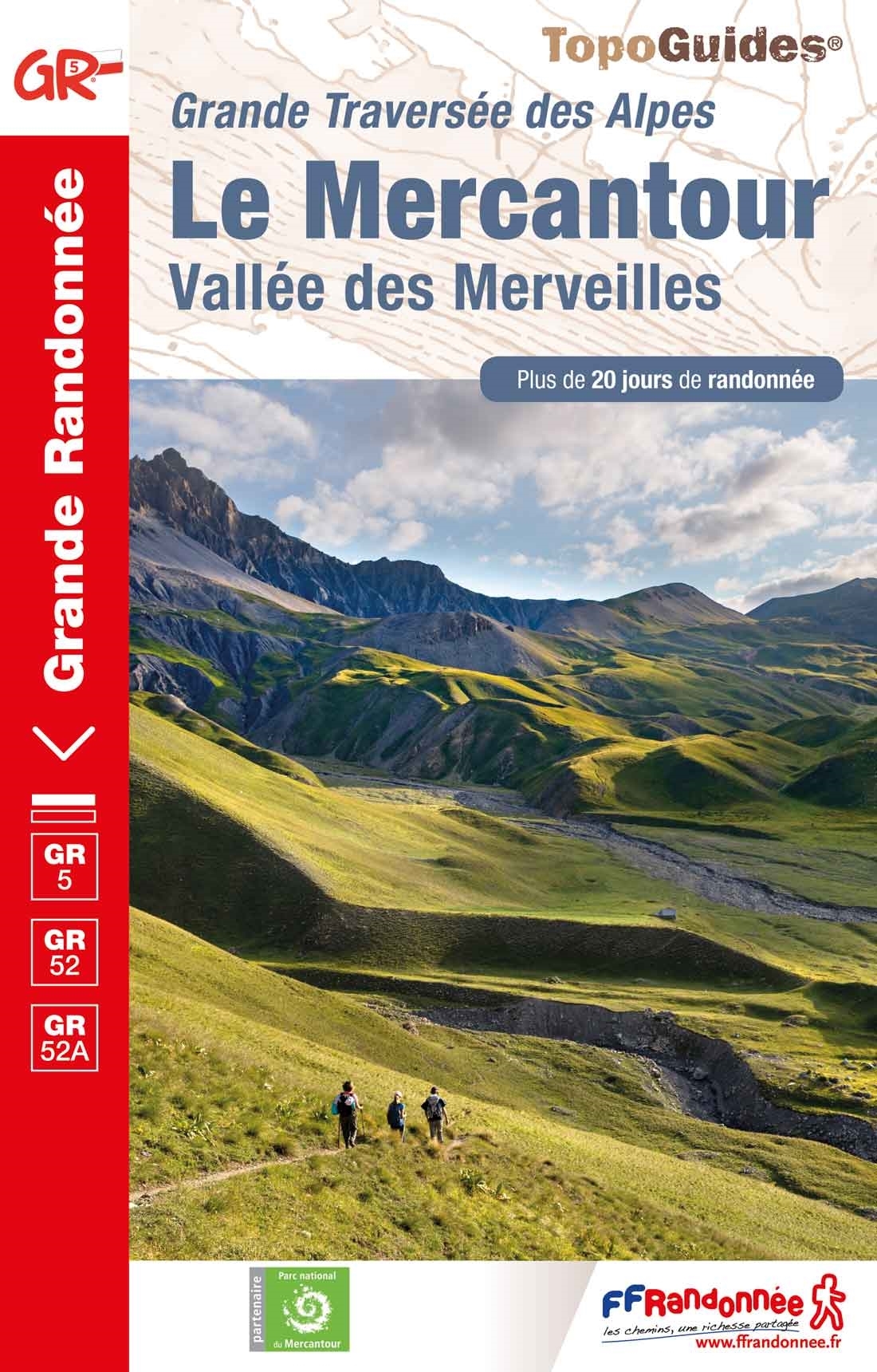
- Le Mercantour - Vallee des Merveilles GR5/GR52/52A
- Le Mercantour: Larche – Nice/Menton, Vallée des Merveilles, FFRP topoguide Ref. No. 507, covering 450km of long-distance routes: the last section of the GR5 in the French Alps from Larche to Nice, an alternative variant off GR5 along the GR52 leading via the Vallée des Merveilles to Menton, plus GR52A – Panoramique du Mecantour from Col du... Read more

Stanfords
United Kingdom
United Kingdom
- Stratford-upon-Avon, Warwick & Banbury OS Landranger Active Map 151 (waterproof)
- The area between Stratford-upon-Avon, Warwick and Banbury, including the northern part of the Cotswold Hills and part of the Cotswold Way / E2 European Long-distance Path, on a waterproof and tear-resistant OS Active version of map No. 151 from the Ordnance Survey’s Landranger series at 1:50,000, with contoured and GPS compatible topographic... Read more

Stanfords
United Kingdom
2020
United Kingdom
2020
- La Traversee der Alpes La Vanoise - PN de la Vanoise GR5/GR55
- 15 days in altitude from the Tarentaise to Modane, heart of the Maurienne. Description also of Via Alpina.La Vanoise (including Parc National de la Vanoise), FFRP topoguide Ref. no. 530, covering the second section of the GR5 in the French Alps between Landry and Modane, its lower variant on the GR5E along the river Arc, plus the traverse of... Read more

Stanfords
United Kingdom
United Kingdom
- Ipswich, The Naze & Clacton-on-Sea OS Landranger Active Map 169 (waterproof)
- Ipswich with Harwich and The Naze area, including part of the E2 European Long-distance Path, on a waterproof and tear-resistant OS Active version of map No. 169 from the Ordnance Survey’s Landranger series at 1:50,000, with contoured and GPS compatible topographic mapping plus tourist information.MOBILE DOWNLOADS: As well as the physical... Read more

Stanfords
United Kingdom
United Kingdom
- Cambridge, Newmarket & Saffron Walden OS Landranger Active Map 154 (waterproof)
- Parts of Cambridgeshire, Suffolk and Essex with Cambridge, Newmarket and Saffron Walden, including part of the E2 European Long-distance path, on a waterproof and tear-resistant OS Active version of map No. 154 from the Ordnance Survey’s Landranger series at 1:50,000, with contoured and GPS compatible topographic mapping plus tourist... Read more
Maps

Stanfords
United Kingdom
United Kingdom
- Mullerthal Hike & Bike Map
- This new series of hiking / riding maps of regions in the Ardennes, Flanders and various regions in the countries around Belgium are characterized by a clear use of colour and ease of use. With miles of signed small and large loop-shaped walks. - relief and contour lines with an interval of 5 meters - multitude of interesting locations... Read more

Stanfords
United Kingdom
United Kingdom
- Eupen Mini-Ardenne
- Ardennes Recreational Maps at a scale of 1:25,000 enable you to discover the Ardennes from junction to junction, each associated with a locality, through a network of hiking, cycling or riding paths. The network of mini walks consists of suggested routes with kilometre distance marked showing field boundaries and urbanised built up areas.... Read more

Stanfords
United Kingdom
United Kingdom
- Fleron - Verviers
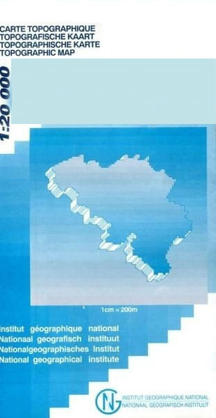
- Topographical survey of Belgium at 1:20,000 from Nationaal Geografisch Instituut / Institut Géographique National, the country’s national survey organization. Each 20K map covers one quarter of the corresponding 1:50,000 map (with adjustments in the border and coastal areas). The maps provide all the information expected of topographic mapping... Read more
Stanfords
United Kingdom
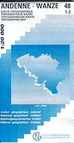
United Kingdom
- Andenne - Wanze
- Topographical survey of Belgium at 1:20,000 from Nationaal Geografisch Instituut / Institut Géographique National, the country’s national survey organization. Each 20K map covers one quarter of the corresponding 1:50,000 map (with adjustments in the border and coastal areas). The maps provide all the information expected of topographic mapping... Read more

Stanfords
United Kingdom
United Kingdom
- Luxembourg South
- One of two topographic survey maps of Luxembourg at 1:50,000, with contours at 10-metres intervals and additional relief shading. An overprint highlights long-distance footpaths, including the GR5 (E-2), cycle routes, and various places of interest, including campsites. The map covers an area of approximately 53 x 43 km / 33 x 27 miles. Map... Read more

Stanfords
United Kingdom
United Kingdom
- Hasselt NGI Topo 25
- Topographical survey of Belgium at 1:50,000 from the country’s national survey organization, Nationaal Geografisch Instituut / Institut Géographique National. Contour interval varies according to the terrain, from 2.5 metres in the coastal areas to 10 metres in the Ardennes. The maps provide all the information expected of topographic mapping... Read more

Stanfords
United Kingdom
United Kingdom
- Wavre NGI Topo 40
- Topographical survey of Belgium at 1:50,000 from the country’s national survey organization, Nationaal Geografisch Instituut / Institut Géographique National. Contour interval varies according to the terrain, from 2.5 metres in the coastal areas to 10 metres in the Ardennes. The maps provide all the information expected of topographic mapping... Read more
Stanfords
United Kingdom
United Kingdom
- Moulin-Manteau - Moulin-de-Chestion
- Topographical survey of Belgium at 1:20,000 from Nationaal Geografisch Instituut / Institut Géographique National, the country’s national survey organization. Each 20K map covers one quarter of the corresponding 1:50,000 map (with adjustments in the border and coastal areas). The maps provide all the information expected of topographic mapping... Read more

Stanfords
United Kingdom
United Kingdom
- Mechelen NGI Topo 23
- Topographical survey of Belgium at 1:50,000 from the country’s national survey organization, Nationaal Geografisch Instituut / Institut Géographique National. Contour interval varies according to the terrain, from 2.5 metres in the coastal areas to 10 metres in the Ardennes. The maps provide all the information expected of topographic mapping... Read more

Stanfords
United Kingdom
United Kingdom
- Jurbise - Obourg
- Topographical survey of Belgium at 1:20,000 from Nationaal Geografisch Instituut / Institut Géographique National, the country’s national survey organization. Each 20K map covers one quarter of the corresponding 1:50,000 map (with adjustments in the border and coastal areas). The maps provide all the information expected of topographic mapping... Read more

Stanfords
United Kingdom
United Kingdom
- Gesves - Ohey
- Topographical survey of Belgium at 1:20,000 from Nationaal Geografisch Instituut / Institut Géographique National, the country’s national survey organization. Each 20K map covers one quarter of the corresponding 1:50,000 map (with adjustments in the border and coastal areas). The maps provide all the information expected of topographic mapping... Read more
Stanfords
United Kingdom
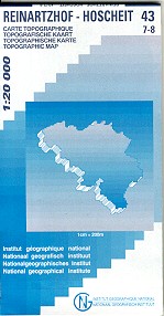
United Kingdom
- Reinartzhof - Hoscheit
- Topographical survey of Belgium at 1:20,000 from Nationaal Geografisch Instituut / Institut Géographique National, the country’s national survey organization. Each 20K map covers one quarter of the corresponding 1:50,000 map (with adjustments in the border and coastal areas). The maps provide all the information expected of topographic mapping... Read more

Stanfords
United Kingdom
United Kingdom
- Tongres NGI Topographic Map 34
- Topographical survey of Belgium at 1:50,000 from the country’s national survey organization, Nationaal Geografisch Instituut / Institut Géographique National. Contour interval varies according to the terrain, from 2.5 metres in the coastal areas to 10 metres in the Ardennes. The maps provide all the information expected of topographic mapping... Read more
Stanfords
United Kingdom
United Kingdom
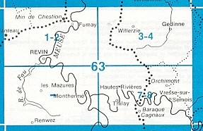
- Gedinne
- Topographical survey of Belgium at 1:20,000 from Nationaal Geografisch Instituut / Institut Géographique National, the country’s national survey organization. Each 20K map covers one quarter of the corresponding 1:50,000 map (with adjustments in the border and coastal areas). The maps provide all the information expected of topographic mapping... Read more
Stanfords
United Kingdom
United Kingdom
- Huy - Nandrin
- Topographical survey of Belgium at 1:20,000 from Nationaal Geografisch Instituut / Institut Géographique National, the country’s national survey organization. Each 20K map covers one quarter of the corresponding 1:50,000 map (with adjustments in the border and coastal areas). The maps provide all the information expected of topographic mapping... Read more