
Antwerpen
Description
Province in northern Belgium.
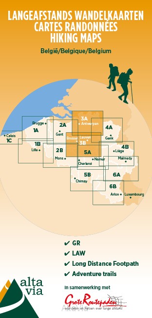
Map

Trails in this state
Links
Facts
Reports
Guides and maps
Lodging
Organisations
Tour operators
GPS
Other
Books

Stanfords
United Kingdom
United Kingdom
- Bruges, Ghent and Antwerp Insight City Guide OUT OF PRINT
- Bruges, Ghent and Antwerp in the City Guide series from Insight provides a detailed exploration of a range of destinations and includes extensive information on restaurants, hotels, shopping and sights as well as unique ‘editor’s tips’. Each heavily illustrated guide begins with ‘best of’ sections, giving a brief summary of the main highlights.... Read more

Stanfords
United Kingdom
2019
United Kingdom
2019
- Du Léman à la Vanoise - par le Mont Blanc et le Beaufortain GR5
- The first, 206-km long Alpine section of the GR5 from Lake Geneva, past Mont Blanc and across the Col de la Croix-du-Bonhomme, to Landry north of the Vanoise Massif, FFRP topo-guide ref. no. 504, with colour maps from the IGN TOP25 series at 1:25,000. Also included is a tour of the Dents du Midi. Current edition of this title was published in... Read more

Stanfords
United Kingdom
2021
United Kingdom
2021
- Tour de l`Oisans et des Ecrins - Parc National des Ecrins GR54/GR541
- Tour de l`Oisans et des Ecrins, FFRP topoguide, Ref. No. 508, covering the 11 to 13 days long tour of the Ecrins massif along the GR54, including the local section of the GR5. Variants along GRs 54A, 54B, 54C, and 541 offer less demanding circuits of two to three days. Current edition of this title was published in April 2014.To see other... Read more

Stanfords
United Kingdom
2019
United Kingdom
2019
- La Traversée des Alpes de la Maurienne a l`Ubaye GR5/GR56
- 9 days from Modane to Larche by the GR5, as much for the tour of Ubaye.Grande Traversée des Alpes: de la Maurienne a l`Ubaye, FFRP topoguide Ref. No. 531, covering the third stage of the GR5 in the French Alps from Modane to Larche, plus the Tour de l`Ubaye at its southern end, in all 272km for hiking routes. Current edition of this title was... Read more
Stanfords
United Kingdom
2019
United Kingdom
2019
- La Grande Traversee du Jura GR5/GR9/GTJ
- La Grande Travesée du Jura, FFRP topoguide Ref. no. 512, covering the GTJ along the Jura Mountains in France from Nommay to Culoz, plus several variants off the main route including parts of the GR5 and GR9 – in all 509kms of hiking trails. Current edition of this title was published in March 2017.The GR509 offers hikers a path punctuated by... Read more
Stanfords
United Kingdom
2020
United Kingdom
2020
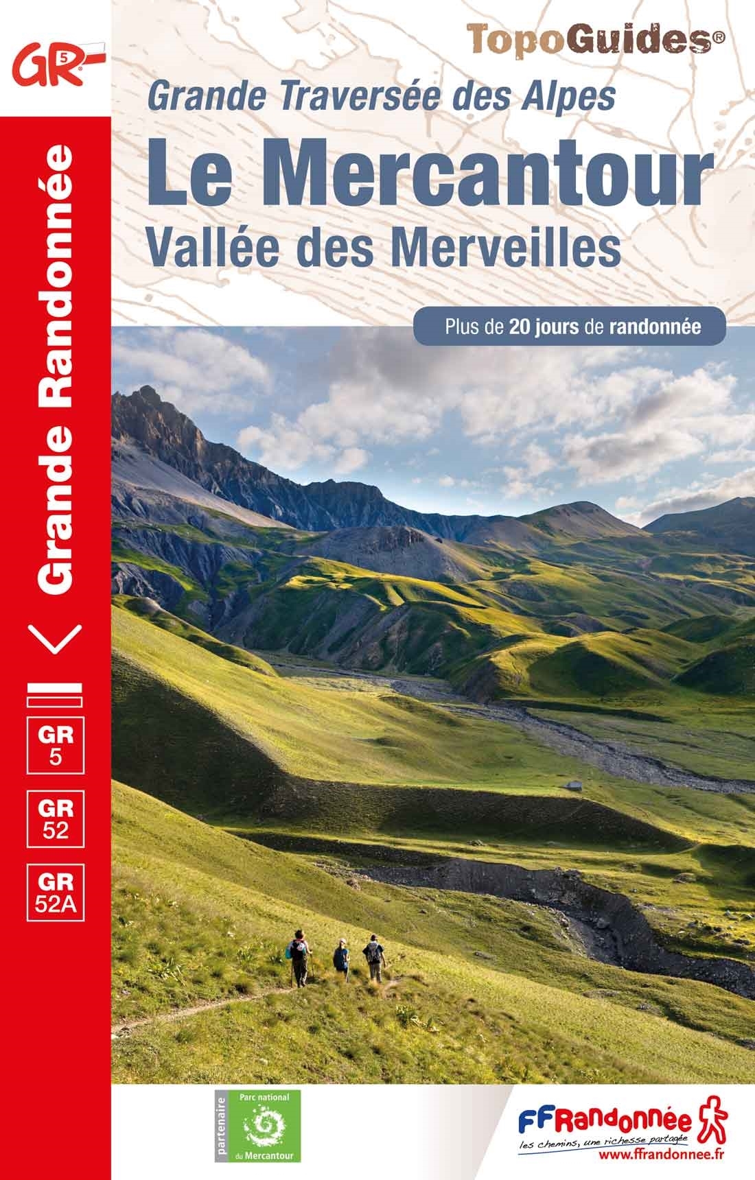
- Le Mercantour - Vallee des Merveilles GR5/GR52/52A
- Le Mercantour: Larche – Nice/Menton, Vallée des Merveilles, FFRP topoguide Ref. No. 507, covering 450km of long-distance routes: the last section of the GR5 in the French Alps from Larche to Nice, an alternative variant off GR5 along the GR52 leading via the Vallée des Merveilles to Menton, plus GR52A – Panoramique du Mecantour from Col du... Read more
Stanfords
United Kingdom
2020
United Kingdom
2020
- La Traversee der Alpes La Vanoise - PN de la Vanoise GR5/GR55
- 15 days in altitude from the Tarentaise to Modane, heart of the Maurienne. Description also of Via Alpina.La Vanoise (including Parc National de la Vanoise), FFRP topoguide Ref. no. 530, covering the second section of the GR5 in the French Alps between Landry and Modane, its lower variant on the GR5E along the river Arc, plus the traverse of... Read more

The Book Depository
United Kingdom
2018
United Kingdom
2018
- The GR5 Trail - Benelux and Lorraine
- The North Sea to Schirmeck in the Vosges mountains Read more
- Also available from:
- De Zwerver, Netherlands

De Zwerver
Netherlands
2018
Netherlands
2018
- Wandelgids The GR5 Trail Benelux and Lorraine | Cicerone
- Guidebook to walking the northern section of the GR5 - 1000km starting in Hoek van Holland and passing through the Netherlands, Belgium, Luxembourg and Lorraine to Schirmeck in France. A long-distance route covering a variety of cultures and landscapes. The full GR5 from the North Sea to the Mediterranean is one of the world's greatest trails. Read more


The Book Depository
United Kingdom
2022
United Kingdom
2022
- Also available from:
- De Zwerver, Netherlands

Bol.com
Netherlands
Netherlands
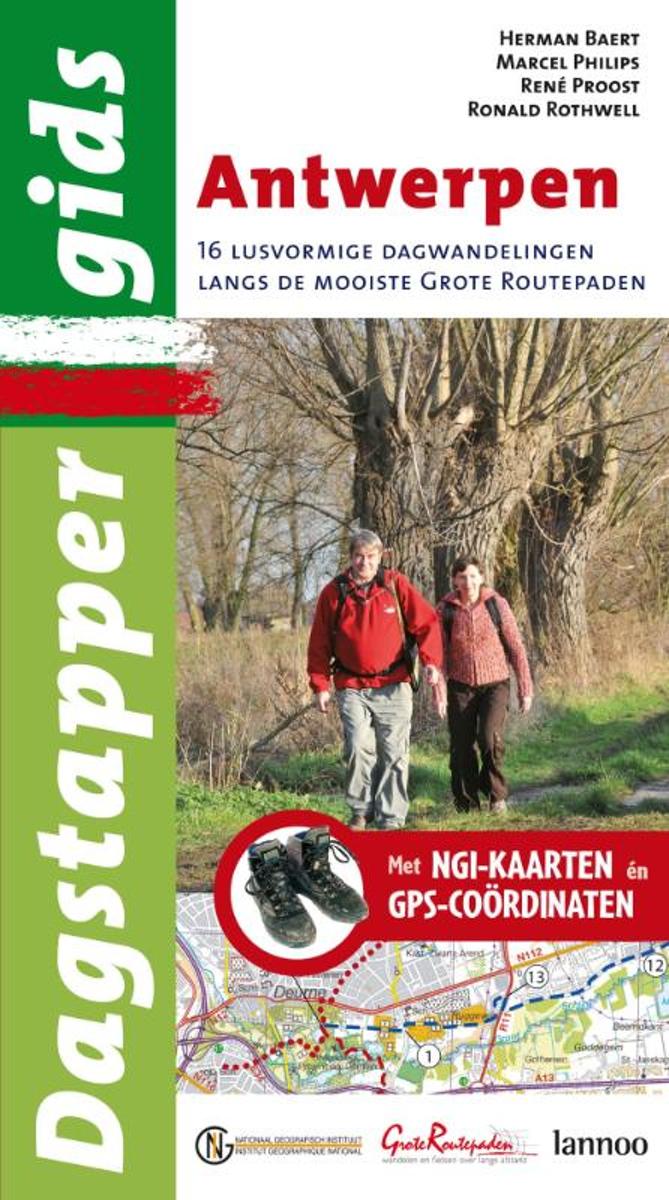
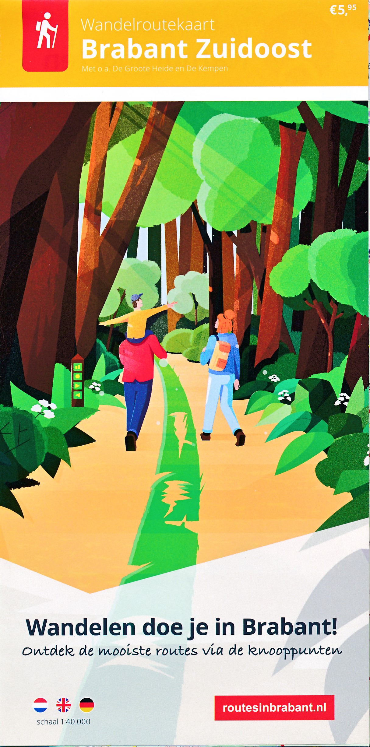
- Antwerpen
- Wie graag wandelt heeft op zijn tocht ongetwijfeld al eens de rood-witte bewegwijzering van de Grote-Routepaden opgemerkt. De organisatie Grote Routepaden Vlaanderen beheert en bewegwijzert in Vlaanderen 3000 km wandelpaden en 1200 km fietsroutes. De Vlaamse GR-paden zijn op uniforme wijze aangeduid met de bekende wit-rode of wit-gele strepen.... Read more
- Also available from:
- Bol.com, Belgium
Bol.com
Belgium
Belgium
- Antwerpen
- Wie graag wandelt heeft op zijn tocht ongetwijfeld al eens de rood-witte bewegwijzering van de Grote-Routepaden opgemerkt. De organisatie Grote Routepaden Vlaanderen beheert en bewegwijzert in Vlaanderen 3000 km wandelpaden en 1200 km fietsroutes. De Vlaamse GR-paden zijn op uniforme wijze aangeduid met de bekende wit-rode of wit-gele strepen.... Read more
De Zwerver
Netherlands
2019
Netherlands
2019
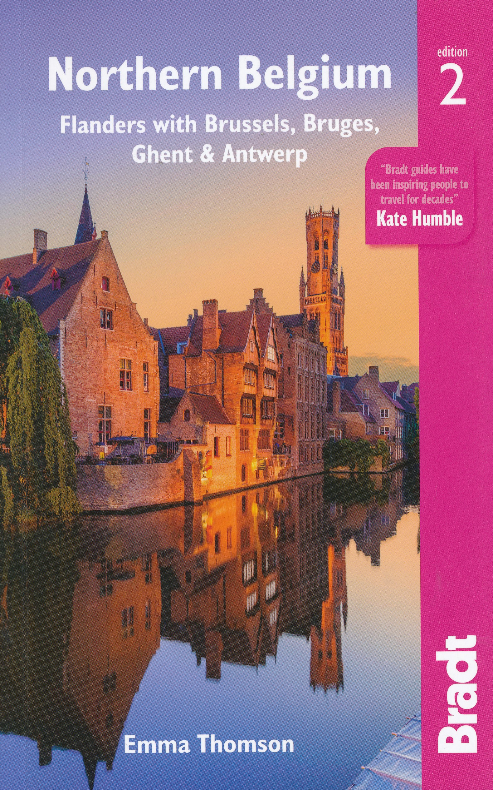
- Reisgids Travel guides Northern Belgium | Bradt Travel Guides
- Northern Belgium ab 17.49 EURO Flanders with Brussels, Bruges, Ghent and Antwerp The Bradt Travel Guide. 2nd Revised edition Read more

De Zwerver
Netherlands
2021
Netherlands
2021
Maps

Stanfords
United Kingdom
United Kingdom
- 2130 Westerschelde and Oosterschelde Chart Atlas - 2019 edition
- Part of Imray’s popular small format chart coverage for the Netherlands, this atlas is a convenient A2 format, wirobound along one edge. Includes extensive coverage of Westerschelde, Kanaal Gent-Terneuzen, Oosterschelde, Veerse Meer, Zoommeer, plus canal links and North Sea coastal approaches.This 2019 edition has been fully updated throughout... Read more

Stanfords
United Kingdom
United Kingdom
- Antwerp NGI Topo 15
- Topographical survey of Belgium at 1:50,000 from the country’s national survey organization, Nationaal Geografisch Instituut / Institut Géographique National. Contour interval varies according to the terrain, from 2.5 metres in the coastal areas to 10 metres in the Ardennes. The maps provide all the information expected of topographic mapping... Read more

Stanfords
United Kingdom
United Kingdom
- Luxembourg North
- One of two topographic survey maps of Luxembourg at 1:50,000, with contours at 10-metres intervals and additional relief shading. An overprint highlights long-distance footpaths, including the GR5 (E-2), cycle routes, and various places of interest, including campsites. The map covers an area of approximately 53 x 43 km / 33 x 27 miles. Map... Read more

Stanfords
United Kingdom
United Kingdom
- NL5 Ooster en Westerschelde
- Passage ChartsC1 Zuidelijke Noordzeekust · Zeeland 1:375.000RevierkartenC2 Westerschelde Monding 1:50.000 C3A Oosterschelde Monding 1:50.000 C3B Westerschelde · Vlissingen tot Braakman 1:50.000 C4 Westerschelde · Braakman tot Turfplaten 1:50.000 C5 Westerschelde · Turfplaten tot Antwerpen 1:30.000 C6 Antwerpen 1:30.000 C7A-C Kanaal Gent tot... Read more

Stanfords
United Kingdom
United Kingdom
- Luxembourg South
- One of two topographic survey maps of Luxembourg at 1:50,000, with contours at 10-metres intervals and additional relief shading. An overprint highlights long-distance footpaths, including the GR5 (E-2), cycle routes, and various places of interest, including campsites. The map covers an area of approximately 53 x 43 km / 33 x 27 miles. Map... Read more

Stanfords
United Kingdom
United Kingdom
- 2130 Westerschelde and Oosterschelde Chart Atlas - 2018 edition SUPERCEDED
- Part of Imray’s popular small format chart coverage for the Netherlands, this atlas is a convenient A2 format, wirobound along one edge. Includes download code for more than 140 digital charts covering all of the Netherlands on the Imray Navigator charts app.Includes extensive coverage of Westerschelde, Kanaal Gent-Terneuzen, Oosterschelde,... Read more

Stanfords
United Kingdom
2016
United Kingdom
2016
- Vanoise National Park - Beaufortain Didier Richard 04
- Vanoise National Park and the Beaufortain Massif in the French Alps at 1:60,000 on a contoured and GPS compatible map from Didier Richard with a base derived from IGN’s topographic survey, highlighting both local hiking routes and the GR network of long-distance paths, gîtes and mountain refuges, interesting natural and cultural sites, etc. The... Read more

Stanfords
United Kingdom
United Kingdom
- Autour du Thabor: Modane - Bardonecchia - Briançon
- Mont Thabor area at 1:50,000 on a contoured and GPS compatible map from Editions Didier Richard in their series of walking maps of French Alps and other popular hiking regions of south-eastern France. Coverage extends from Modane in the north to Briançon in the south-east, and west to Valloire.The base map with cartography from the IGN has... Read more

Stanfords
United Kingdom
United Kingdom
- Antwerp Kempen Falkplan Cycling Map 32
- The Antwerp province of Belgium at 1:50,000 in a series from Falk B.V. showing the network of signposted cycling routes on large, double-sided indexed maps with prominent highlighting of long-distance LF routes, symbols indicating accommodation and other tourist services, plus in each title two or more panels with recommended local circuits and... Read more

Stanfords
United Kingdom
United Kingdom
- Alsace - Mulhouse - Basel - Altkirch K+F Outdoor Map 2
- The southern part of Alsace around Mulhouse and Guebwiller on a GPS compatible, double-sided map at 1:50,000 from Kümmerly+Frey printed on sturdy, waterproof and tear-resistant synthetic paper; contoured, with hiking and cycling routes, sites for other recreational activities, various accommodation options, restaurants and ferme-auberge... Read more

- Also available from:
- De Zwerver, Netherlands

De Zwerver
Netherlands
Netherlands

Stanfords
United Kingdom
United Kingdom
- Alsace - Strasbourg - Saverne - Barr - Offenburg K+F Outdoor Map 7
- The central part of Alsace around Strasbourg and Saverne on a GPS compatible, double-sided map at 1:50,000 from Kümmerly+Frey printed on sturdy, waterproof and tear-resistant synthetic paper; contoured, with hiking and cycling routes, sites for other recreational activities, various accommodation options, restaurants and ferme-auberge... Read more
- Also available from:
- De Zwerver, Netherlands

De Zwerver
Netherlands
Netherlands
- Wandelkaart 07 Outdoorkarte FR Elsass, Vogesen - Alsace, Strasbourg Elzas - Vogezen | Kümmerly & Frey
- The central part of Alsace around Strasbourg and Saverne on a GPS compatible, double-sided map at 1:50,000 from K Read more

Stanfords
United Kingdom
United Kingdom
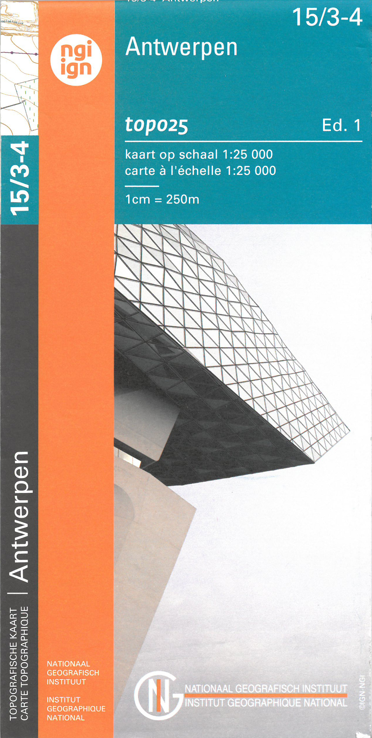
- Antwerpen NGI Topo 15/3-4
- Topographical survey of Belgium at 1:20,000 from Nationaal Geografisch Instituut / Institut Géographique National, the country’s national survey organization. Each 20K map covers one quarter of the corresponding 1:50,000 map (with adjustments in the border and coastal areas). The maps provide all the information expected of topographic mapping... Read more
- Also available from:
- De Zwerver, Netherlands
De Zwerver
Netherlands
Netherlands
- Wandelkaart - Topografische kaart 15/3-4 Topo25 Antwerpen - Schoten | NGI - Nationaal Geografisch Instituut
- Topographical survey of Belgium at 1:20,000 from Nationaal Geografisch Instituut / Institut Géographique National, the country’s national survey organization. Each 20K map covers one quarter of the corresponding 1:50,000 map (with adjustments in the border and coastal areas). The maps provide all the information expected of topographic mapping... Read more
De Zwerver
Netherlands
2021
Netherlands
2021