
Teutoburgerwald
Description
Low mountain area in Nordrhein-Westfalen and Niedersachsen.
Trails in this region
Links
Facts
Reports
Guides and maps
Lodging
Organisations
Tour operators
GPS
Other
Books

Stanfords
United Kingdom
United Kingdom
- Münsterland 3-Map Set Kompass 849
- The Münsterland region of North Rhine-Westphalia on a set of three detailed, GPS compatible maps at 1:50,000 from Kompass with local and long-distance footpaths, cycling routes, accommodation, etc. Coverage extends north to Osnabrück and Enschede in the Netherlands, and south to Hamm and Reckinghausen.KOMPASS HIKING & RECREATIONAL MAPS:This... Read more
- Also available from:
- De Zwerver, Netherlands

De Zwerver
Netherlands
2022
Netherlands
2022

De Zwerver
Netherlands
2022
Netherlands
2022


De Zwerver
Netherlands
2022
Netherlands
2022
De Zwerver
Netherlands
2022
Netherlands
2022
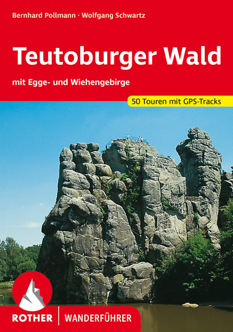
- Wandelgids Teutoburger Wald - Teutoburgerwoud | Rother Bergverlag
- Uitstekende wandelgids met een groot aantal dagtochten in dal en hooggebergte. Met praktische informatie en beperkt kaartmateriaal! Wandelingen in verschillende zwaarte weergegeven in rood/blauw/zwart. Im Einzugsbereich des Ruhrgebietes und der Großstädte Osnabrück, Bielefeld und Paderborn gelegen, zählen der Teutoburger Wald sowie das Egge-... Read more
De Zwerver
Netherlands
2014
Netherlands
2014
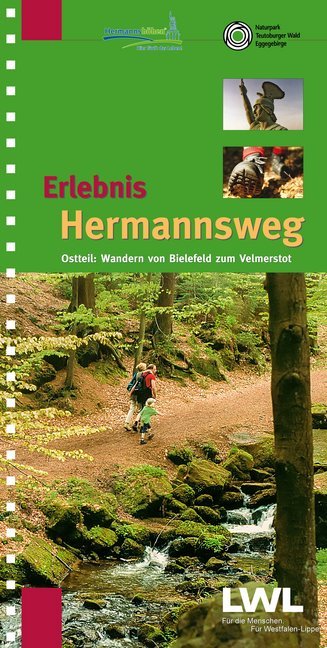
- Wandelgids Erlebnis Hermannsweg - Ostteil | TPK Kiper
- Zeer goede wandelgids met een prima beschrijving, zeer duidelijke kaarten en veel informatie. Bovendien in een ringband, dus uitermate handig in gebruik! Route van Bielefeld naar Horn - Bad Meinberg Östlicher Teil des zweibändigen Wanderführers "Erlebnis Hermannsweg" - Der Hermannsweg im Teutoburger Wald gilt als einer der schönsten... Read more
De Zwerver
Netherlands
2023
Netherlands
2023

De Zwerver
Netherlands
2017
Netherlands
2017
- Wandelgids 411 Kautokeino - Nordkap E1 | Conrad Stein Verlag
- Handzaam boekje met de routebeschrijving inclusief een heleboel praktische informatie. De beschrijving is uitstekend, maar kaarten zijn wat beperkt. Duits. Die 330 km lange Wanderung auf dem E1 von Kautokeino zum Nordkap ist ein unvergessliches Wanderabenteuer. In 15 Etappen laufen Sie durch die Wildnis Nordnorwegens und überqueren die... Read more
Maps

Stanfords
United Kingdom
United Kingdom
- Riviera Cesenate - San Marino
- Map No. 128, Riviera Cesenate - San Marino, in a series of GPS compatible hiking maps at 1:50,000 from the Istituto Geografico Adriatico, covering parts of central Italy: eastern Tuscany, with northern Umbria and the Marches, plus the south-eastern of part of Emilia-Romagna.The maps have contours at 50m intervals with additional shading and... Read more
Stanfords
United Kingdom
United Kingdom
- Alta Val Marecchia
- Map No. 126, Alta Val Marecchia, in a series of GPS compatible hiking maps at 1:50,000 from the Istituto Geografico Adriatico, covering parts of central Italy: eastern Tuscany, with northern Umbria and the Marches, plus the south-eastern of part of Emilia-Romagna.The maps have contours at 50m intervals with additional shading and numerous spot... Read more

Stanfords
United Kingdom
United Kingdom
- Foreste Casentinesi NP Monti Editore 20
- Map No. 20, Foreste Casentinesi: Campigna, Camaldoli, Chiusi dell Verna, in series of contoured, GPS compatible hiking maps at 1:25,000 from the Istituto Geografico Adriatico, covering mainly the spine of the Apennines along the borders of Tuscany, Emilia-Romagna, Umbria and the Marches.Map in this series have contours at 25m intervals with... Read more

Stanfords
United Kingdom
United Kingdom
- Monti Sibillini National Park Edizioni Multigraphic 60/61
- Monti Sibillini National Park at 1:25,000 on a double-sided contoured map from Edizioni Multigraphic highlighting local waymarked hiking routes including the GAS – Grand Anello dei Sibilini, the circular tour around the mountains.The map has contours at 25m intervals with colouring for woodlands. Waymarked routes are highlighted and annotated... Read more
Stanfords
United Kingdom
United Kingdom
- Alta Valle del Metauro: Valle del Candigliano, Monte Nerone, Monte Catria
- Map No. 122, Alta Valle del Metauro: Valle del Candigliano, Monte Nerone, Monte Catria, in a series of GPS compatible hiking maps at 1:50,000 from the Istituto Geografico Adriatico, covering parts of central Italy: eastern Tuscany, with northern Umbria and the Marches, plus the south-eastern of part of Emilia-Romagna.The maps have contours at... Read more

Stanfords
United Kingdom
United Kingdom
- Munsterland Regional Cycling Map
- Munsterland on a waterproof, tear-resistant, GPS compatible cycling map at 1:75,000 from the ADFC (Allgemeiner Deutscher Fahrrad-Club - the official German cycling federation), in a series of maps with extensive overprint for long-distance and local cycling routes. GPS waypoints, route profiles, details of online links for information about... Read more

Stanfords
United Kingdom
United Kingdom
- Pegnitz E11
- Pegnitz in a series of GPS compatible recreational editions of the Bavarian topographic survey at 1:25,000, with waymarked hiking trails and cycling routes, campsites and youth hostels, etc. Coverage includes Creußen, Ahorntal, Pottenstein, Glashütten, Hummeltal, Schnabelwaid.Contours used in this map vary between 5 to 20m according to the... Read more

Stanfords
United Kingdom
United Kingdom
- Hermannsweg und Eggeweg - die Hermannshohen Kompass Long-distance Trail Map 2504
- Hermannsweg plus Eggeweg, a combined 218km long-distance hiking trail in north-western Germany between Rheine and Marsberg along the Teutoburger Wald and hills of the Eggegebirge. The route is presented on 18 panels, accompanied by street plans of Rheine, Bielefeld, Horn-Bad Mainberg and Marsberg.Maps in this new series from Kompass, begun in... Read more

Stanfords
United Kingdom
United Kingdom
- Alpe della Luna 17
- Map No. 16, Monte Carpegna - Sasso di Simone, in series of contoured, GPS compatible hiking maps at 1:25,000 from the Istituto Geografico Adriatico, covering mainly the spine of the Apennines along the borders of Tuscany, Emilia-Romagna, Umbria and the Marches.Map in this series have contours at 25m intervals with additional shading and... Read more
Stanfords
United Kingdom
United Kingdom
- Alta Valle del Santerno 23
- Map No. 22, Alta Valle del Lamone: Alto Appennino Faentino – Anello di Marradi, in series of contoured, GPS compatible hiking maps at 1:25,000 from the Istituto Geografico Adriatico, covering mainly the spine of the Apennines along the borders of Tuscany, Emilia-Romagna, Umbria and the Marches.Map in this series have contours at 25m intervals... Read more
Stanfords
United Kingdom
United Kingdom
- Colline di Rimini
- Map No. 124, Colline di Rimini, in a series of GPS compatible hiking maps at 1:50,000 from the Istituto Geografico Adriatico, covering parts of central Italy: eastern Tuscany, with northern Umbria and the Marches, plus the south-eastern of part of Emilia-Romagna. This title covers the holiday resorts on the Adriatic coast around Rimini,... Read more

Stanfords
United Kingdom
United Kingdom
- Alpe di San Benedetto 21
- Map No. 21, Alpe di San Benedetto: Passo del Muraglione – San Godenzo – Dicomano, in series of contoured, GPS compatible hiking maps at 1:25,000 from the Istituto Geografico Adriatico, covering mainly the spine of the Apennines along the borders of Tuscany, Emilia-Romagna, Umbria and the Marches.Map in this series have contours at 25m intervals... Read more
Stanfords
United Kingdom
United Kingdom
- Colline di Forlí
- Map No. 127, Colline di Forlí, in a series of GPS compatible hiking maps at 1:50,000 from the Istituto Geografico Adriatico, covering parts of central Italy: eastern Tuscany, with northern Umbria and the Marches, plus the south-eastern of part of Emilia-Romagna.The maps have contours at 50m intervals with additional shading and numerous spot... Read more

Stanfords
United Kingdom
United Kingdom
- Roman Cycle Route along the Lippe - Teutoburg Forest to the Rhine Bikeline Map-Guide
- The Roman Cycle Route along the Lippe presented by Verlag Esterbauer in a guide with maps at 1:50,000. This new version of the old Roman Cycle Route, significantly revised and officially opened in April 2013, starts at Detmold, passes by the Hermann Monument in the Teutoburger Wald and continues to the old Roman town of Xanten on the left bank... Read more

Stanfords
United Kingdom
United Kingdom
- Alta Valle del Lamone 22
- Map No. 22, Alta Valle del Lamone: Alto Appennino Faentino – Anello di Marradi, in series of contoured, GPS compatible hiking maps at 1:25,000 from the Istituto Geografico Adriatico, covering mainly the spine of the Apennines along the borders of Tuscany, Emilia-Romagna, Umbria and the Marches.Map in this series have contours at 25m intervals... Read more