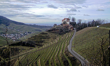
Renchtalsteig
Description
- Name Renchtalsteig
- Length of trail 98 km, 61 miles
- Length in days 5 days
- Start of trail Bottenau
- End of trail Bergruine Schauenburg
- Traildino grading MW, Moderate walk, backpacking trail
- Hut tour grading T1, Walk
Renchtalsteig, Oberkirch / Bottenau - Bergruine Schauenburg, 98 km, 5 days
The Renchtalsteig a new path in the Black Forest, created in accordance with the quality standards of Wanderbares Deutschland. The path describes a semi-circle. You start and end in the town of Oberkirch and describe a wide arc around the valley of the river Rench. The path stays high up in the mountains. At the lake Glaswaldsee it reaches almost 1000 meters and beyond in the north it climbs the Schliffkopf, 1055 meters high.
The Renchtalsteig runs through the densely forested Naturpark Schwarzwald Mitte / Nord, and thus through a century old tourist area with long traditions of hospitality.
Select some tracks
☐Renchtalsteig, 98km


