Galway
Description
Trails in this state
Links
Facts
Reports
Guides and maps
Lodging
Organisations
Tour operators
GPS
Other
Books

Stanfords
United Kingdom
2021
United Kingdom
2021
- DK Eyewitness Road Trips Ireland
- With its unspoiled coastline, dramatic ruins and picturesque villages, Ireland is the perfect destination for a leisurely road trip. It`s yours to explore with Road Trips Ireland, which contains 24 amazing drives across the country, from the majestic Ring of Kerry to the extraordinary Giant`s Causeway.Packed with insider tips and information,... Read more

Stanfords
United Kingdom
2020
United Kingdom
2020
- Insight Guides Explore Ireland (Travel Guide with Free eBook)
- Insight Guides Explore IrelandTravel made easy. Ask local experts. Focused travel guide featuring the very best routes and itineraries, now with free eBook.Discover the best of Ireland with this unique travel guide, packed full of insider information and stunning images. From making sure you don`t miss out on must-see, top attractions like... Read more

Stanfords
United Kingdom
United Kingdom
- Ireland The Best: The insider`s guide to Ireland
- The true Irish insider`s guide to the very best Ireland has to offer. This fully comprehensive and independent guide to Ireland gives you only the very best recommendations, whatever your budget. Brought to you by the McKennas, who have over 30 years` experience writing and talking about Ireland`s amazing food, drink and hospitality.... Read more

Stanfords
United Kingdom
United Kingdom
- Moon Ireland (Third Edition): Castles, Cliffs, and Lively Local Spots
- From its stirring legends to its stunning landscapes, Ireland is a living, breathing fairy-tale. Ignite your imagination with Moon Ireland. Inside you`ll find:*Flexible itineraries from a two-week ”Best of Ireland” adventure or a weekend in Dublin to 3-day tours of southern, northern, and coastal Ireland that can be combined into a longer... Read more
- Also available from:
- The Book Depository, United Kingdom

The Book Depository
United Kingdom
United Kingdom
- Moon Ireland (Third Edition)
- Castles, Cliffs, and Lively Local Spots Read more
Bol.com
Netherlands
Netherlands
- Ireland - Its Scenery, Character And History - Vol VI
- IRELAND, ITS HISTORY, SCENERY AND CHARACTER - CONTENTS - PAGE LONGFORD . . . . . . . . . . . 1 LEITRIM . . . . . . . . . . . . 2 0 SLIGO . . . . . . . . . . . . 4 1 ROSCOMM . ON . . . . . . . . . . 6 5 MAYO . . . . . . . . . . . . 11 0 CLARE . . . . . . . . . . . . l7 8 GALWAY . . . . . . . . . . . . 2 19 LIST OF ILLUSTRATIONS Achill See page... Read more
- Also available from:
- Bol.com, Belgium

Bol.com
Belgium
Belgium
- Ireland - Its Scenery, Character And History - Vol VI
- IRELAND, ITS HISTORY, SCENERY AND CHARACTER - CONTENTS - PAGE LONGFORD . . . . . . . . . . . 1 LEITRIM . . . . . . . . . . . . 2 0 SLIGO . . . . . . . . . . . . 4 1 ROSCOMM . ON . . . . . . . . . . 6 5 MAYO . . . . . . . . . . . . 11 0 CLARE . . . . . . . . . . . . l7 8 GALWAY . . . . . . . . . . . . 2 19 LIST OF ILLUSTRATIONS Achill See page... Read more
Bol.com
Netherlands
Netherlands
- National Geographic Traveler Ireland
- Author Christopher Somerville is the perfect guide to this picturesque country. He begins with Dublin, Ireland's cosmopolitan capital city, where reminders of the country's stirring history and rich culture adorn nearly every street corner. From there we head south, with highlights including County Kildare, capital of Irish horse racing; the... Read more
- Also available from:
- Bol.com, Belgium

Bol.com
Belgium
Belgium
- National Geographic Traveler Ireland
- Author Christopher Somerville is the perfect guide to this picturesque country. He begins with Dublin, Ireland's cosmopolitan capital city, where reminders of the country's stirring history and rich culture adorn nearly every street corner. From there we head south, with highlights including County Kildare, capital of Irish horse racing; the... Read more

Bol.com
Netherlands
Netherlands
- Fodor's Essential Ireland
- Written by locals, Fodor's travel guides have been offering expert advice for all tastes and budgets for 80 years. With an array of dazzling photographs, this book deftly guides the traveler through all the sights and experiences--from Connemara to Georgian Dublin to pub culture to Irish dance--that make the Emerald Isle one of Europe's most... Read more
- Also available from:
- Bol.com, Belgium

Bol.com
Belgium
Belgium
- Fodor's Essential Ireland
- Written by locals, Fodor's travel guides have been offering expert advice for all tastes and budgets for 80 years. With an array of dazzling photographs, this book deftly guides the traveler through all the sights and experiences--from Connemara to Georgian Dublin to pub culture to Irish dance--that make the Emerald Isle one of Europe's most... Read more
Bol.com
Netherlands
Netherlands
- Stones of Aran
- The Aran Islands, in Galway Bay off the west coast of Ireland, are a unique geological and cultural landscape, and for centuries their stark beauty and their inhabitants traditional way of life have attracted pilgrims from abroad. The Aran Islands, in Galway Bay off the west coast of Ireland, are a unique geological and cultural landscape, and... Read more
- Also available from:
- Bol.com, Belgium

Bol.com
Belgium
Belgium
- Stones of Aran
- The Aran Islands, in Galway Bay off the west coast of Ireland, are a unique geological and cultural landscape, and for centuries their stark beauty and their inhabitants traditional way of life have attracted pilgrims from abroad. The Aran Islands, in Galway Bay off the west coast of Ireland, are a unique geological and cultural landscape, and... Read more
De Zwerver
Netherlands
2020
Netherlands
2020
- Reisgids Reiseführer Irland - Ierland | Trescher Verlag
- Reiseführer Irland ab 18.95 EURO Mit Dublin, Belfast, Cork, Galway und Nordirland Trescher-Reihe Reisen. 1. Auflage Read more
Bol.com
Netherlands
2012
Netherlands
2012
- West of Ireland Walks
- New edition of this ever-popular walking guide Explore the counties of Clare, Galway and Mayo in the company of a wildlife expert. The West of Ireland offers a huge choice of landscape to the walker - mountain peaks, woodland, bogs and lakes, sandy beaches and the strange limestone plateaux of the Burren. The Walks Clare: The Cliffs of Moher -... Read more
- Also available from:
- Bol.com, Belgium

Bol.com
Belgium
2012
Belgium
2012
- West of Ireland Walks
- New edition of this ever-popular walking guide Explore the counties of Clare, Galway and Mayo in the company of a wildlife expert. The West of Ireland offers a huge choice of landscape to the walker - mountain peaks, woodland, bogs and lakes, sandy beaches and the strange limestone plateaux of the Burren. The Walks Clare: The Cliffs of Moher -... Read more
Bol.com
Netherlands
Netherlands
- Preliminary Surficial Geologic Map of the Newberry Springs 30' X 60' Quadrangle, California
- The Newberry Springs 30 x 60 quadrangle in the central and eastern Mojave Desert of Southern California (fig. 1) contains several mountain ranges including, from east to west, the Bristol, Cady, Bullion, Lava Bed, Rodman, Fry, Newberry, Calico, and Ord Mountains (fig. 2). The ephemeral Mojave River flows through the northwestern part of the map... Read more
- Also available from:
- Bol.com, Belgium

Bol.com
Belgium
Belgium
- Preliminary Surficial Geologic Map of the Newberry Springs 30' X 60' Quadrangle, California
- The Newberry Springs 30 x 60 quadrangle in the central and eastern Mojave Desert of Southern California (fig. 1) contains several mountain ranges including, from east to west, the Bristol, Cady, Bullion, Lava Bed, Rodman, Fry, Newberry, Calico, and Ord Mountains (fig. 2). The ephemeral Mojave River flows through the northwestern part of the map... Read more
Maps

Stanfords
United Kingdom
United Kingdom
- Mayo SW - Galway NW OSI Discover 37
- Map No. 37, Mayo South-West - Galway North-West, in the Discovery series from the OSI, the Ordnance Survey of Ireland, which presents the country on detailed topographic maps at 1:50,000, with additional overprint highlighting campsites and caravan parks, youth hostels, etc. Current 5th edition of this title was published in summer 2015.Maps in... Read more

Stanfords
United Kingdom
United Kingdom
- Clare - Galway OSI Discovery 51
- Map No. 51, Clare North - Aran Islands in the Discovery series from the OSI, the Ordnance Survey of Ireland, which presents the country on detailed topographic maps at 1:50,000, with additional overprint highlighting campsites and caravan parks, youth hostels, etc. Current 5th edition of this map was published in 2015.Maps in the Discovery... Read more

Stanfords
United Kingdom
United Kingdom
- C55 Dingle Bay to Galway Bay
- Plans included: Cashla Bay (1:30 000) Galway Bay (1:40 000) Galway Harbour (1:15 000) Kilronan (Aran Is.) (1:45 000) River Shannon to Limerick (1:110 000) Kilrush (1:30 000) Foynes Harbour (1:17 500) Fenit Island (1:35 000) Dingle Harbour (1:25 000) On this 2015 edition revised depths are shown throughout, in particular at Cashla Bay, Galway... Read more

Stanfords
United Kingdom
United Kingdom
- Galway County
- Galway County at 1:100,000 in a series of double-sided, GPS-compatible maps from Xploreit Maps, with contours, altitude colouring, hiking trails and cycling routes, and printed on light, waterproof and tear-resistant plastic paper.Topography is shown by altitude colouring with contours (interval varies) and plenty of names of geographical... Read more

Stanfords
United Kingdom
United Kingdom
- Galway - Longford - Roscommon - Westmeath OSI Discovery 40
- Map No. 40, Roscommon Central - Longford West in the Discovery series from the OSI, the Ordnance Survey of Ireland, which presents the country on detailed topographic maps at 1:50,000, with additional overprint highlighting campsites and caravan parks, youth hostels, etc. Current 3rd edition of this title was published in March 2011.Maps in the... Read more
De Zwerver
Netherlands
Netherlands
- Topografische kaart - Wandelkaart 47 Discovery Galway, Offaly, Roscommon, Westmeath | Ordnance Survey Ireland
- Zeer gedetailleerde topografische kaart met een aantal toegevoegde toeristische symbolen voor bijv. bezienswaardigheden, campings en jeugdherbergen. Met hoogtelijnen, mooi kleurgebruik en ingetekende lange-afstands-wandelroutes. Op deze kaart zijn de nationale parken en de 'national reserves ' uitstekend te vinden. De kaart is dus zowel voor de... Read more

Stanfords
United Kingdom
United Kingdom
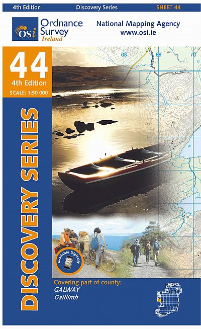
- Galway W OSI Discovery 44
- Map No. 44, Galway West in the Discovery series from the OSI, the Ordnance Survey of Ireland, which presents the country on detailed topographic maps at 1:50,000, with additional overprint highlighting campsites and caravan parks, youth hostels, etc. Current 4th edition of this map was published in January 2013.Maps in the Discovery series have... Read more
- Also available from:
- De Zwerver, Netherlands
De Zwerver
Netherlands
Netherlands
- Topografische kaart - Wandelkaart 44 Discovery Galway | Ordnance Survey Ireland
- Map No. 44, Galway West in the Discovery series from the OSI, the Ordnance Survey of Ireland, which presents the country on detailed topographic maps at 1:50,000, with additional overprint highlighting campsites and caravan parks, youth hostels, etc. Current 4th edition of this map was published in January 2013.Maps in the Discovery series have... Read more
De Zwerver
Netherlands
Netherlands
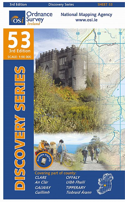
- Topografische kaart - Wandelkaart 53 Discovery Clare, Galway, Offaly, Tipperary | Ordnance Survey Ireland
- Map No. 53, Galway South-East - Offaly West - Tipperary North in the Discovery series from the OSI, the Ordnance Survey of Ireland, which presents the country on detailed topographic maps at 1:50,000, with additional overprint highlighting campsites and caravan parks, youth hostels, etc. Current 3rd edition of this map was published in October... Read more


