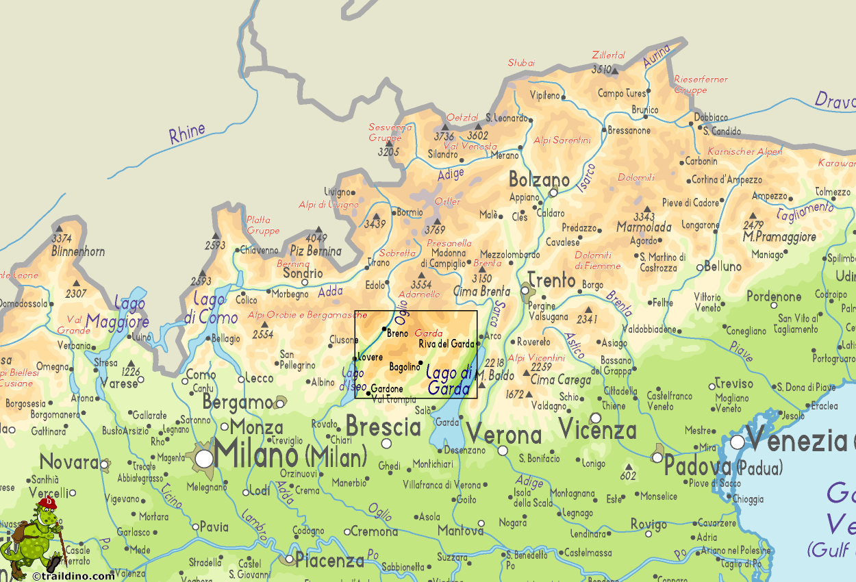
Garda
Description
Map
Trails in this region
Links
Facts
Reports
Guides and maps
Lodging
Organisations
Tour operators
GPS
Other
Books

Stanfords
United Kingdom
United Kingdom
- Insight Guides Explore Italian Lakes (Travel Guide with Free eBook)
- Discover the best of the Italian Lakes with this unique travel guide, packed full of insider information and stunning images. From making sure you don`t miss out on must-see, top attractions like Lake Garda, Lake Como and Lake Maggiore, to discovering cultural gems, including the imposing Rocca Borromeo in Angera, spectacular food and wine at... Read more

Stanfords
United Kingdom
2015
United Kingdom
2015
- Italian Lakes Walking: Garda, Maggiore, Como and Iseo
- This guidebook describes 50 walks around Lakes Como, Iseo, Garda and Maggiore in Northern Italy. The picturesque routes are accessible by public transport from popular centres including Bellagio, Riva, Stresa and Cannero, and range from 2 to 14km in length. There are gentle lakeside strolls, and numerous ridge routes and traverses as well as... Read more

Stanfords
United Kingdom
United Kingdom
- DK Eyewitness Venice and the Veneto
- Welcome to this enchanting corner of ItalyWhether you want to wander around a magical maze of canals, sample delicious cuisine, ramble through majestic mountains or relive fascinating history, your DK Eyewitness travel guide makes sure you experience all that Venice and the Veneto have to offer.The jewel of the Veneto, Venice is a dreamlike... Read more

Stanfords
United Kingdom
2018
United Kingdom
2018
- Italian Sunflower Landscape Guide
- This new 3rd edition of Italian Lakes has been carefully revised just a few months prior to publication. The topo maps now show waypoints, and free downloadable GPS tracks are available for all the walks. Colour coding on the Contents page enables you to see at a glance the grading of various walks. These great expanses of water, bound to the... Read more

Stanfords
United Kingdom
United Kingdom
- Dolomiti di Braies - Pragser Dolomiten Kompass 145
- Map No. 145, Dolomiti di Braies - Pragser Dolomiten at 1:25,000 printed on sturdy waterproof and tear-resistant plastic paper. The map is part of Kompass series providing detailed coverage of the Dolomites and Lake Garda area and supplementing their main series of walking maps of Italy at 1:50,000. Maps in this series have a more detailed base... Read more

Stanfords
United Kingdom
United Kingdom
- Naturno / Naturns - Laces / Latsch - Val Senales / Schnalstal Kompass 051
- Map No. 051, Naturno/Naturns - Laces/Latsch, from Kompass, printed on waterproof and tear-resistant synthetic paper in a series providing detailed coverage of the Dolomites and Lake Garda area and supplementing their main series of walking maps of Italy at 1:50,000. Maps in this series have a more detailed base and smaller contour interval than... Read more

The Book Depository
United Kingdom
United Kingdom
- Alla scoperta delle Prealpi Venete
- 30 escursioni a piedi dal lago di Garda alla diga del Vajont Read more

Stanfords
United Kingdom
2019
United Kingdom
2019
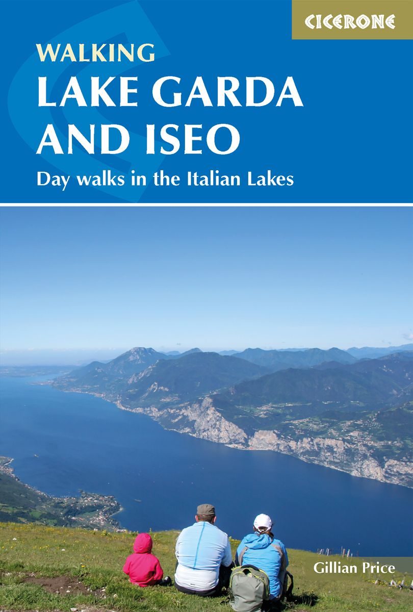
- Walking Lake Garda & Iseo
- This guidebook describes 20 walks around Lakes Garda and Iseo in Northern Italy. The routes range from 4 to 13km in length and are graded 1 to 3. There is something for everyone, from easy leisurely strolls for first-time walkers to strenuous climbs up panoramic peaks.The clear maps, inspirational photographs and information about accommodation... Read more
- Also available from:
- The Book Depository, United Kingdom
- De Zwerver, Netherlands

The Book Depository
United Kingdom
2019
United Kingdom
2019
- Walking Lake Garda and Iseo
- Day walks in the Italian Lakes Read more
De Zwerver
Netherlands
2019
Netherlands
2019
- Wandelgids Walking Lake Garda and Iseo | Cicerone
- Guidebook to 20 day walks around the majestic Italian lakes of Garda and Iseo. The routes, which range from leisurely strolls to more strenuous routes up panoramic peaks, offer something to suit all walkers. Invaluable practical information about public transport, accommodation and walking kit is included, together with a handy Italian glossary. Read more
Bol.com
Netherlands
Netherlands
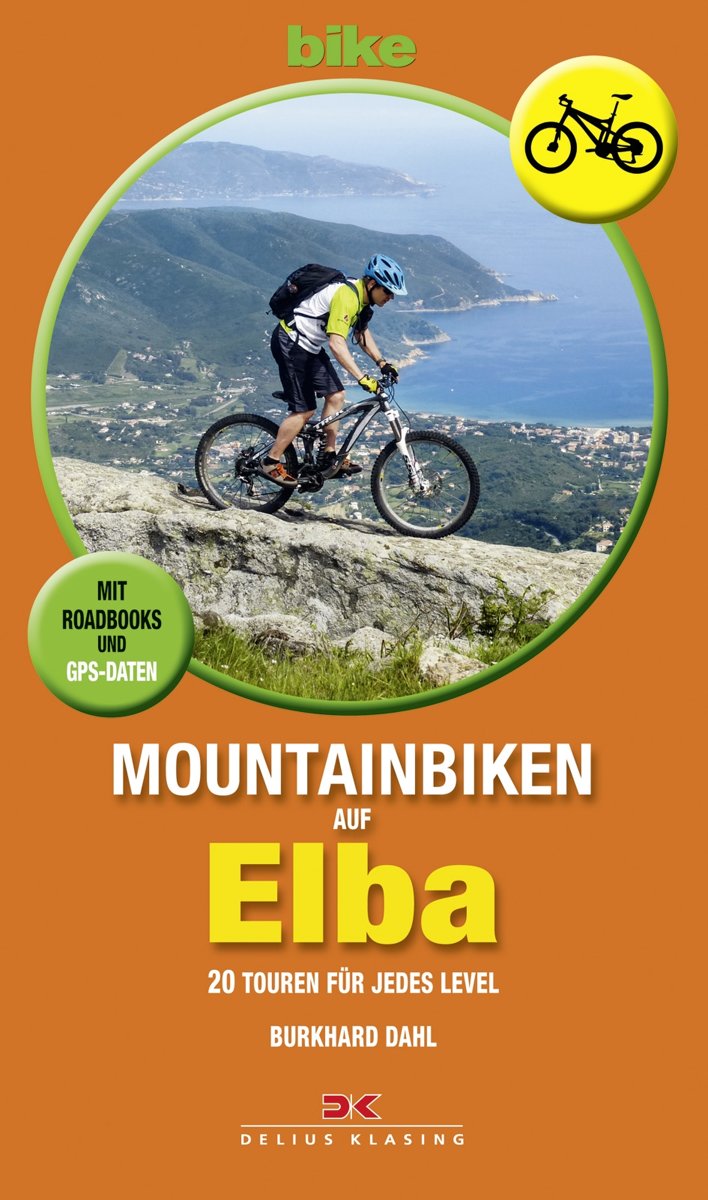
- Mountainbiken auf Elba
- Die italienische Insel Elba ist ein Traumrevier f r abenteuerlustige Mountainbiker und entwickelt sich gerade zu einem neuen Hotspot der Szene. Schroffe Berge, tolle Trails und das milde Klima locken viele, die den Gardasee und auch Finale Ligure schon gut kennen, in die noch nicht berlaufenen Quartiere auf Elba. Hier gibt es unendliche Fahrm... Read more
- Also available from:
- Bol.com, Belgium

Bol.com
Belgium
Belgium
- Mountainbiken auf Elba
- Die italienische Insel Elba ist ein Traumrevier f r abenteuerlustige Mountainbiker und entwickelt sich gerade zu einem neuen Hotspot der Szene. Schroffe Berge, tolle Trails und das milde Klima locken viele, die den Gardasee und auch Finale Ligure schon gut kennen, in die noch nicht berlaufenen Quartiere auf Elba. Hier gibt es unendliche Fahrm... Read more

Bol.com
Netherlands
Netherlands
- Etschradweg RF6701 Kompass
- . Von den Alpengletschern bis zum Mittelmeerklima, von den Tiroler Bergbauern bis zu den Relikten der Römer: der Etschradweg ist wohl Europas schönste Nord-Süd-Transversale, die man im Radsattel erleben kann.. Rund 350 Kilometer hat die Strecke vom Nordtiroler Inntal bis nach Verona. Unterwegs gibt es viel zu entdecken! Kirchen und mächtige... Read more
- Also available from:
- Bol.com, Belgium

Bol.com
Belgium
Belgium
- Etschradweg RF6701 Kompass
- . Von den Alpengletschern bis zum Mittelmeerklima, von den Tiroler Bergbauern bis zu den Relikten der Römer: der Etschradweg ist wohl Europas schönste Nord-Süd-Transversale, die man im Radsattel erleben kann.. Rund 350 Kilometer hat die Strecke vom Nordtiroler Inntal bis nach Verona. Unterwegs gibt es viel zu entdecken! Kirchen und mächtige... Read more
De Zwerver
Netherlands
2011
Netherlands
2011
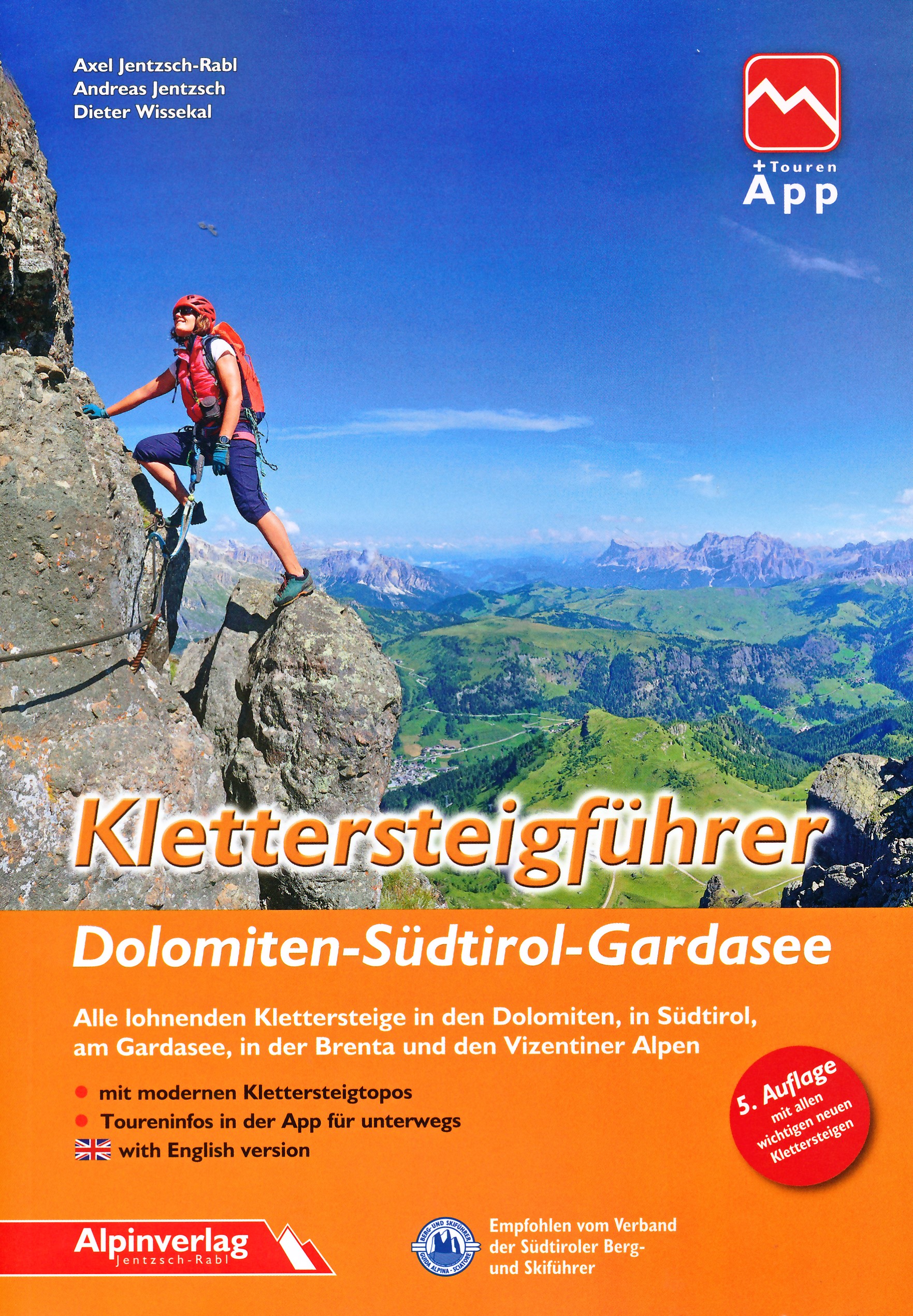
- Reisgids Kunstreiseführer Gardasee: Verona - Mantua - Trentino | Dumont
- Bis vor wenigen Jahrzehnten genossen der Lago Maggiore und der Comer See mit ihren Villen, Palästen und Gärten die ´´Kulturhoheit´´ unter den oberitalienischen Seen. Der Gardasee dagegen galt schon seit Goethes ´´Italienischer Reise´´ vorwiegend als beeindruckendes Landschaftserlebnis, als ´´Anblick der Südsee mitten im Gebirge´´. Der... Read more
Bol.com
Netherlands
Netherlands
- ANWB Actief / Gardameer
- Wandelingen, Fietstochten en Autoroutes. Op een actieve manier de leukste plekjes ontdekken kan met deze ANWB Actief gids.ANWB Actief is d reisgids voor actieve vakantiegangers. De gids is bedoeld voor reizigers die naar het Gardameer op vakantie gaan en ter plekke een aantal dagtochten willen maken om de omgeving te verkennen. Dat kan met... Read more
- Also available from:
- Bol.com, Belgium

Bol.com
Belgium
Belgium
- ANWB Actief / Gardameer
- Wandelingen, Fietstochten en Autoroutes. Op een actieve manier de leukste plekjes ontdekken kan met deze ANWB Actief gids.ANWB Actief is d reisgids voor actieve vakantiegangers. De gids is bedoeld voor reizigers die naar het Gardameer op vakantie gaan en ter plekke een aantal dagtochten willen maken om de omgeving te verkennen. Dat kan met... Read more

Bol.com
Netherlands
Netherlands
- Mr. Radley Drives to Vienna
- This unique book shows an album of photos taken in May & June 1913 when James Radley drove from London to Vienna via Paris, Mont Cenis Pass, Brescia, Riva del Garda, Dolomites, & Loibl Pass. His car was entered in the famous sterreichische Alpenfahrt, a gruelling 2650 kil ometre route with 19 mountain passes to drive across in seven days. On... Read more
- Also available from:
- Bol.com, Belgium

Bol.com
Belgium
Belgium
- Mr. Radley Drives to Vienna
- This unique book shows an album of photos taken in May & June 1913 when James Radley drove from London to Vienna via Paris, Mont Cenis Pass, Brescia, Riva del Garda, Dolomites, & Loibl Pass. His car was entered in the famous sterreichische Alpenfahrt, a gruelling 2650 kil ometre route with 19 mountain passes to drive across in seven days. On... Read more
Maps

Stanfords
United Kingdom
United Kingdom
- Lana - Etschtal / Val d`Adige Kompass 054
- Map No. 054, Lana - with a panorama map on the reverse, from Kompass in a series providing detailed coverage of the Dolomites and Lake Garda area and supplementing their main series of walking maps of Italy at 1:50,000. Maps in this series have a more detailed base and smaller contour interval than coverage at 1:50,000.*Cartography:* maps at... Read more

Stanfords
United Kingdom
United Kingdom
- Monte Baldo - Altipiano di Brentonico - Malcesine Kompass 129
- Map No. 129, Monte Baldo, at 1:25,000 on a double-sided map from Kompass, printed on sturdy waterproof and tear-resistant synthetic paper and covering an area to the east of the northern part of Lake Garda.This title is part of a series of Kompass maps providing detailed coverage of the Dolomites and Lake Garda area, supplementing their main... Read more

Stanfords
United Kingdom
United Kingdom
- Valle del Sacra – Arco – Riva del Garda Tabacco 055
- Valle del Sacra – Arco – Riva del Garda area in a series of Tabacco maps at 1:25,000 covering the Dolomites and the mountains of north-eastern Italy - Stanfords’ most popular coverage for this region, with excellent cartography and extensive overprint for hiking routes and other recreational activities, local bus stops, etc. Additional... Read more

Stanfords
United Kingdom
United Kingdom
- Vipiteno / Sterzing and Environs Kompass 058
- Map No. 058, Vipiteno/Sterzing and the Surrounding Area, from Kompass in a series providing detailed coverage of the Dolomites and Lake Garda area and supplementing their main series of walking maps of Italy at 1:50,000. Maps in this series have a more detailed base and smaller contour interval than coverage at 1:50,000.*Cartography:* maps at... Read more

Stanfords
United Kingdom
United Kingdom
- Lake Garda: Trento - Brescia - Verona 35K Kompass Hiking Atlas No. 2752
- Lake Garda and the surrounding area presented by Kompass in an A5 paperback atlas at 1:35,000 with contoured and GPS compatible mapping at 1:35,000 with extensive overprint for hiking trails, including special nature trails and long-distance routes, accommodation (campsites, youth hostels, huts, etc), sport and recreational facilities, local... Read more

Stanfords
United Kingdom
United Kingdom
- Dolomiti di Brenta Kompass 073
- Map No. 073, Dolomiti di Brenta, from Kompass in a series providing detailed coverage of the Dolomites and Lake Garda area and supplementing their main series of walking maps of Italy at 1:50,000. Maps in this series have a more detailed base and smaller contour interval than coverage at 1:50,000.*Cartography:* maps at 1:25,000 have contours at... Read more

Stanfords
United Kingdom
United Kingdom
- Monti Sarentino / Sarntal Alps Kompass 056
- Map No. 056, Val Sarentino/Sarntal, from Kompass in a series providing detailed coverage of the Dolomites and Lake Garda area and supplementing their main series of walking maps of Italy at 1:50,000. Maps in this series have a more detailed base and smaller contour interval than coverage at 1:50,000.*Cartography:* maps at 1:25,000 have contours... Read more

Stanfords
United Kingdom
United Kingdom
- Monti de Valle Aurina / Ahrntaler Berge Kompass 082
- Map No. 082, Monti de Valle Aurina/Ahrntaler Berge , from Kompass in a series providing detailed coverage of the Dolomites and Lake Garda area and supplementing their main series of walking maps of Italy at 1:50,000. Maps in this series have a more detailed base and smaller contour interval than coverage at 1:50,000.*Cartography:* maps at... Read more

Stanfords
United Kingdom
United Kingdom
- Lake Garda North Supertrail Map
- The new Supertrail Maps show the best singletrails in Europe’s hottest mountain bike spots. These unique topographic maps make the knowledge of locals available to other mountain bikers. Consistent difficulty rating and useful additional information prevent the user from critical situations on the trails. The best singletrails in the best... Read more

Stanfords
United Kingdom
United Kingdom
- Texelgruppe NP - Merano High Route Kompass 043
- Map No. 043, Texelgruppe NP - Merano High Route, from Kompass, printed on strudy waterproof and tear-resistant plastic paper in a series providing detailed coverage of the Dolomites and Lake Garda area and supplementing their main series of walking maps of Italy at 1:50,000. Maps in this series have a more detailed base and smaller contour... Read more

Stanfords
United Kingdom
United Kingdom
- Lake Garda South Supertrail Map
- The new Supertrail Maps show the best singletrails in Europe’s hottest mountain bike spots. These unique topographic maps make the knowledge of locals available to other mountain bikers. Consistent difficulty rating and useful additional information prevent the user from critical situations on the trails. The best singletrails in the best... Read more

Stanfords
United Kingdom
United Kingdom
- Bressanone / Brixen and Environs Kompass 050
- Map No. 050, Bressanone/Brixen and Environs - with a panorama map on the reverse, from Kompass in a series providing detailed coverage of the Dolomites and Lake Garda area and supplementing their main series of walking maps of Italy at 1:50,000. Maps in this series have a more detailed base and smaller contour interval than coverage at... Read more

Stanfords
United Kingdom
United Kingdom
- Alta Val Venosta / Obervinschgau Kompass 041
- Map No. 041, Alta Val Venosta/Obervinschgau, from Kompass, printed on waterproof and tear-resistant synthetic paperin a series providing detailed coverage of the Dolomites and Lake Garda area and supplementing their main series of walking maps of Italy at 1:50,000. Maps in this series have a more detailed base and smaller contour interval than... Read more

Stanfords
United Kingdom
United Kingdom
- Monti Lessini - Gruppo della Carega - Recoaro Terme Kompass 100
- Map No. 100, Monti Lessini - Gruppo della Carega - Recoaro Terme, from Kompass in a series of walking maps of selected areas of Italy at 1:50,000, with hiking routes on a topographic base, various types of accommodation, recreational facilities, places of interest, etc. Kompass are Europe’s largest publishers of walking maps, with extensive... Read more

Stanfords
United Kingdom
United Kingdom
- Alto Garda and Ledro - Riva del Garda - Malcesine - Torbole - Limone sul Garda Kompass 690
- The area around the northern part of Lake Garda, including the Ledro Valley and Lago di Ledro, on a contoured and GPS compatible map at 1:25,000 from Kompass. Contour interval is 25m, with extensive overprint for hiking trails, cycle routes (including a selection of mountain bike trails), accommodation and recreational facilities, etc.OTHER... Read more


