
Brecon Beacons
Description
Mountain range in the south of Wales. Also, the name is used to refer to the Brecon Beacons National Park, which comprises a larger area and other hill ranges as well. Popular for hiking. Pen y Fan, south Wales highest mountain, is one of the popular destinations.
Trails in this region
Links
Facts
Reports
Guides and maps
Lodging
Organisations
Tour operators
GPS
Other
Books

Stanfords
United Kingdom
2021
United Kingdom
2021
- DK Eyewitness Road Trips Great Britain
- With its idyllic market towns, romantic castle ruins and stunning natural landscapes, Great Britain is the perfect destination for a leisurely road trip. It`s yours to explore with Road Trips Great Britain, which contains 25 drives across the country, from the sweeping sandy beaches of Cornwall to the dramatic peaks of the Scottish... Read more

Stanfords
United Kingdom
United Kingdom
- Brecon Beacons Eastern OS Explorer Map OL13 (paper)
- The eastern part of the Brecon Beacons National Park on a detailed topographic and GPS compatible map OL13, paper version, from the Ordnance Survey’s 1:25,000 Explorer series. Coverage includes Tredegar, Ebbw Vale, Abergavenny, Hay-on-Wye, the Black Mountains, Llangorse Lake, Sugar Loaf, Black Hill, Hay Bluff, sections of the Offa’s Dyke... Read more
- Also available from:
- The Book Depository, United Kingdom
- De Zwerver, Netherlands


The Book Depository
United Kingdom
2018
United Kingdom
2018
- Fastpacking
- Multi-day running adventures: tips, stories and route ideas Read more
Stanfords
United Kingdom
2016
United Kingdom
2016
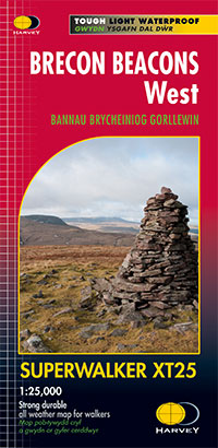
- Brecon Beacons West Harvey Superwalker XT25
- The western part of the Brecon Beacons at 1:25,000 on a light, waterproof and tear-resistant, contoured and GPS compatible map from Harvey Map Services in their Superwalker series.Maps in Harvey’s Superwalker series have contours at 15m intervals, with additional graphics for various types of terrain (crags, large boulders, scattered rocks) and... Read more
- Also available from:
- The Book Depository, United Kingdom
- De Zwerver, Netherlands


Stanfords
United Kingdom
United Kingdom
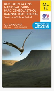
- Brecon Beacons Western & Central OS Explorer Map OL12 (paper)
- The Western and central areas of the Brecon Beacons National Park on a detailed topographic and GPS compatible map OL12, paper version, from the Ordnance Survey’s 1:25,000 Explorer series. Coverage extends from Merthyr Tydfil in the south-east to Llandovery in the north-west and highlights include the Black Mountain, Fforest Fawr, the Beacons... Read more
- Also available from:
- The Book Depository, United Kingdom
- De Zwerver, Netherlands


Stanfords
United Kingdom
2019
United Kingdom
2019
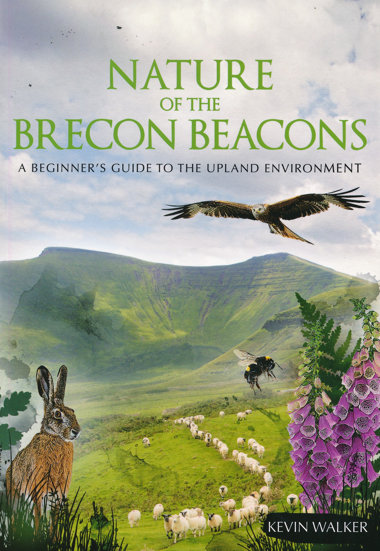
- Nature of the Brecon Beacons: A Beginners Guide to the Upland Environment
- For most people wandering through the beautiful landscape of the Brecon Beacons is pleasure enough, but sooner or later you may ask yourself, what is that little bird or flower that you see on most of your walks?The problem with most guides is that many of the animals, insects, rocks or plants in them are rarities, and therefore probably not... Read more
- Also available from:
- The Book Depository, United Kingdom
- De Zwerver, Netherlands

The Book Depository
United Kingdom
2019
United Kingdom
2019
- Nature of the Brecon Beacons
- A Beginners Guide to the Upland Environment Read more
De Zwerver
Netherlands
2019
Netherlands
2019
- Natuurgids Nature of the Brecon Beacons | Pesda Press
- A Beginners Guide to the Upland Environment Read more

Stanfords
United Kingdom
2016
United Kingdom
2016
- Brecon Beacons East Harvey Superwalker XT25
- The eastern part of the Brecon Beacons at 1:25,000 on a light, waterproof and tear-resistant, contoured and GPS compatible map from Harvey Map Services in their Superwalker series.Maps in Harvey’s Superwalker series have contours at 15m intervals, with additional graphics for various types of terrain (crags, large boulders, scattered rocks) and... Read more
- Also available from:
- The Book Depository, United Kingdom
Stanfords
United Kingdom
2017
United Kingdom
2017
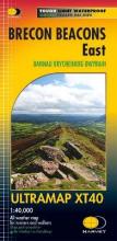
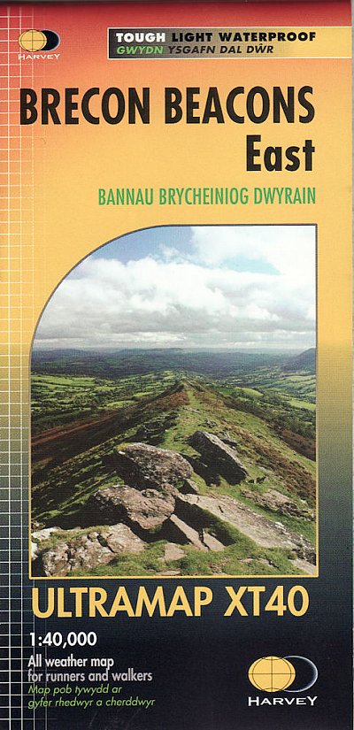
- Brecon Beacons East Harvey Ultramap XT40
- Covers a large area yet is handily compact. Pocket perfect!Detailed map for runners and walkers of the eastern part of the Brecon Beacons National Park and the Black Mountains at the magic scale of 1:40,000.Includes Pen y Fan and the Black Mountains.Welsh-English text.Has the advantages of its bigger brothers:Fully detailed genuine HARVEY... Read more
- Also available from:
- The Book Depository, United Kingdom
- De Zwerver, Netherlands


- Also available from:
- The Book Depository, United Kingdom

The Book Depository
United Kingdom
United Kingdom

Stanfords
United Kingdom
United Kingdom
- Brecon Beacons Eastern OS Explorer Active Map OL13 (waterproof)
- The eastern part of the Brecon Beacons National Park on a detailed topographic and GPS compatible map OL13, waterproof version, from the Ordnance Survey’s 1:25,000 Explorer series. Coverage includes Tredegar, Ebbw Vale, Abergavenny, Hay-on-Wye, the Black Mountains, Llangorse Lake, Sugar Loaf, Black Hill, Hay Bluff, sections of the Offa’s Dyke... Read more
- Also available from:
- The Book Depository, United Kingdom

The Book Depository
United Kingdom
United Kingdom

Stanfords
United Kingdom
2019
United Kingdom
2019
- Offa`s Dyke Path: Prestatyn To Chepstow
- The Offa`s Dyke Path is a magnificent National Trail that runs from the North Wales coast to the Severn Estuary following the line of Offa`s Dyke, an impressive 8th century earthwork along the English/Welsh border. The ever-changing landscape - the Wye Valley, the Black Mountains, the Shropshire Hills and the Clwydian Hills - is steeped in... Read more
- Also available from:
- The Book Depository, United Kingdom

The Book Depository
United Kingdom
2019
United Kingdom
2019
- Offa's Dyke Path (Trailblazer British Walking Guides) 2019
- Chepstow To Prestatyn & Prestatyn To Chepstow, Planning, Places to Stay, Places to Eat, 98 large-scale maps & guides to 52 towns and villages (Trailblazer British Walking Guides) Read more

- Also available from:
- De Zwerver, Netherlands


The Book Depository
United Kingdom
United Kingdom
- Walks to South Wales' Lakes and Waterfalls
- Black Mountain, Brecon Beacons, the Black Mountains & the Vale of Neath Read more
Maps

Stanfords
United Kingdom
United Kingdom
- Swansea and Gower / Abertawe a Gwyr 1923
- Map No. 159, Swansea and Gower / Abertawe a Gwyr 1923, in the Cassini Historical Series of old Ordnance Survey mapping of England and Wales at 1:50,000 in a format designed to offer a convenient comparison with the present day coverage from the OS, and most locations in three different editions. Old historical maps have been combined so that... Read more
Stanfords
United Kingdom
United Kingdom
- Presteigne and Hay-on-Wye / Llanandras a’r Gelli Gandryll 1831-1920 (3-map set)
- Map No. 148, Presteigne and Hay-on-Wye / Llanandras a’r Gelli Gandryll 1831-1920 (3-map set), in the Cassini Historical Series of old Ordnance Survey mapping of England and Wales at 1:50,000 in a format designed to offer a convenient comparison with the present day coverage from the OS, and most locations in three different editions. Old... Read more
Stanfords
United Kingdom
United Kingdom
- Brecon Beacons / Bannau Brycheiniog 1919-1923
- Map No. 160, Brecon Beacons / Bannau Brycheiniog 1919-1923, in the Cassini Historical Series of old Ordnance Survey mapping of England and Wales at 1:50,000 in a format designed to offer a convenient comparison with the present day coverage from the OS, and most locations in three different editions. Old historical maps have been combined so... Read more
Stanfords
United Kingdom
United Kingdom
- The Black Mountains / Y Mynyddoedd Duon 1830-1920 (3-map set)
- Map No. 161, The Black Mountains / Y Mynyddoedd Duon 1830-1920 (3-map set), in the Cassini Historical Series of old Ordnance Survey mapping of England and Wales at 1:50,000 in a format designed to offer a convenient comparison with the present day coverage from the OS, and most locations in three different editions. Old historical maps have... Read more
Stanfords
United Kingdom
United Kingdom
- Lampeter and Llandovery / Llanbedr Pont Steffan a Llanymddyfri 1901-1902
- Map No. 146, Lampeter and Llandovery / Llanbedr Pont Steffan a Llanymddyfri 1901-1902, in the Cassini Historical Series of old Ordnance Survey mapping of England and Wales at 1:50,000 in a format designed to offer a convenient comparison with the present day coverage from the OS, and most locations in three different editions. Old historical... Read more
Stanfords
United Kingdom
United Kingdom
- Presteigne and Hay-on-Wye / Llanandras a’r Gelli Gandryll 1831-1833
- Map No. 148, Presteigne and Hay-on-Wye / Llanandras a’r Gelli Gandryll 1831-1833, in the Cassini Historical Series of old Ordnance Survey mapping of England and Wales at 1:50,000 in a format designed to offer a convenient comparison with the present day coverage from the OS, and most locations in three different editions. Old historical maps... Read more

Stanfords
United Kingdom
United Kingdom
- Brecon Beacons East A-Z Adventure Atlas
- The eastern part of the Brecon Beacons at 1:25,000 in a series of handy A5 size Adventure Atlases from Geographers` A-Z Map Company with cartography from the Ordnance Survey’s Explorer series. Coverage includes Brecon, Hay-on-Wye, Pandy, Abergavenny, Pontypool, Merther Tydfil, Llangynidr, Llanfrynach, Llangorse and Talgarth.To see other titles... Read more
Stanfords
United Kingdom
United Kingdom
- Swansea and Gower / Abertawe a Gwyr 1901
- Map No. 159, Swansea and Gower / Abertawe a Gwyr 1901, in the Cassini Historical Series of old Ordnance Survey mapping of England and Wales at 1:50,000 in a format designed to offer a convenient comparison with the present day coverage from the OS, and most locations in three different editions. Old historical maps have been combined so that... Read more
Stanfords
United Kingdom
United Kingdom
- The Black Mountains / Y Mynyddoedd Duon 1830-1833
- Map No. 161, The Black Mountains / Y Mynyddoedd Duon 1830-1833, in the Cassini Historical Series of old Ordnance Survey mapping of England and Wales at 1:50,000 in a format designed to offer a convenient comparison with the present day coverage from the OS, and most locations in three different editions. Old historical maps have been combined... Read more

Stanfords
United Kingdom
United Kingdom
- Cycling Lon Las Cymru: 250 miles through the heart of Wales on traffic-free paths and quiet roads
- Guidebook to cycling Lon Las Cymru, a 255 mile (410km) route from Cardiff, or 242 mile (390km) from Chepstow to Holyhead, showcasing Wales`s beautiful rural heartland. Passing through the Brecon Beacons National Park, Snowdonia National Park, and over the Black Mountains, the Brecon Beacons and the Cambrian Mountains, the route is as scenic as... Read more
Stanfords
United Kingdom
United Kingdom
- Lampeter and Llandovery / Llanbedr Pont Steffan a Llanymddyfri 1831-1834
- Map No. 146, Lampeter and Llandovery / Llanbedr Pont Steffan a Llanymddyfri 1831-1834, in the Cassini Historical Series of old Ordnance Survey mapping of England and Wales at 1:50,000 in a format designed to offer a convenient comparison with the present day coverage from the OS, and most locations in three different editions. Old historical... Read more
Stanfords
United Kingdom
United Kingdom
- Brecon Beacons / Bannau Brycheiniog 1901-1902
- Map No. 160, Brecon Beacons / Bannau Brycheiniog 1901-1902, in the Cassini Historical Series of old Ordnance Survey mapping of England and Wales at 1:50,000 in a format designed to offer a convenient comparison with the present day coverage from the OS, and most locations in three different editions. Old historical maps have been combined so... Read more
Stanfords
United Kingdom
United Kingdom
- Presteigne and Hay-on-Wye / Llanandras a’r Gelli Gandryll 1919-1920
- Map No. 148, Presteigne and Hay-on-Wye / Llanandras a’r Gelli Gandryll 1819-1920, in the Cassini Historical Series of old Ordnance Survey mapping of England and Wales at 1:50,000 in a format designed to offer a convenient comparison with the present day coverage from the OS, and most locations in three different editions. Old historical maps... Read more
Stanfords
United Kingdom
United Kingdom
- Swansea and Gower / Abertawe a Gwyr 1830-1831
- Map No. 159, Swansea and Gower / Abertawe a Gwyr 1830-1831, in the Cassini Historical Series of old Ordnance Survey mapping of England and Wales at 1:50,000 in a format designed to offer a convenient comparison with the present day coverage from the OS, and most locations in three different editions. Old historical maps have been combined so... Read more
Stanfords
United Kingdom
United Kingdom
- Lampeter and Llandovery / Llanbedr Pont Steffan a Llanymddyfri 1831-1923 (3-map set)
- Map No. 146, Lampeter and Llandovery / Llanbedr Pont Steffan a Llanymddyfri 1831-1923 (3-map set), in the Cassini Historical Series of old Ordnance Survey mapping of England and Wales at 1:50,000 in a format designed to offer a convenient comparison with the present day coverage from the OS, and most locations in three different editions. Old... Read more