
Pennine Way
Description
- Name Pennine Way
- Length of trail 412 km, 256 miles
- Length in days 21 days
- Start of trail Edale
- End of trail Kirk Yetholm
- Traildino grading SW, Strenuous walk, mountain trail
- Hut tour grading T2, Mountain walk

Pennine Way, Edale to Kirk Yetholm, 256 miles, 412 km, 21 days
National Trail
"A long green trail from the Peak to the Cheviots.", Tom Stephenson envisioned in 1935. The Pennine Way became the first National Trail to be opened, some fifty years ago, and it's still a major landmark on Britain's hiking map. Many people have enjoyed the hike, and the many reports on the web do bear witness of the beauty of the trail.
After the South West Coast Path, the Pennine Way is the longest path in the UK. It is part of the European E2. This is not an easy walk. The route runs through the highest and most desolate parts of the Pennines. In order to walk this trail, you must have a good physical condition, a healthy amount of perseverance, good rain gear and waterproof shoes.
The path picks the wildest and most beautiful parts of northern England, to the border with Scotland: the Pennines including the Peak District, the colourful Yorkshire Dales, the cheery Cheviots. Despite its popularity, hikers marvel the solitude encountered in this upland part of northern England. At night, in the pub, you will be sharing your pains and pleasures with other hikers and forget about your despair during daytime crossing another fell in rain and storm.
Do not underestimate this trail. The legs are long and often exposed. Be prepared for strong winds, rain and cold. Many people start, few finish. The bogs are reputed for by some and cursed by most, but the worst parts have now been slabbed to stop erosion. Older guidebooks point to the Peak District as a very greasy walk but that is no more. Accommodation options are diminishing. In Kirk Yetholm your Pennine Way Certificate and Free Half Pint is waiting for you in the Border Hotel.
Map

Links
Facts
Reports
Guides and maps
Lodging
Organisations
Tour operators
GPS
Other
Books

United Kingdom
2019
- Pennine Way: Edale to Kirk Yetholm
- Britain`s best-known National Trail winds for 256 miles through three National Parks - the Peak District, Yorkshire Dales and Northumberland. This is the 5th edition. This superb footpath showcases Britain`s finest upland scenery, while touching the literary landscape of the Bronte family and Roman history along Hadrian`s Wall. *138 large-scale... Read more

United Kingdom
2017
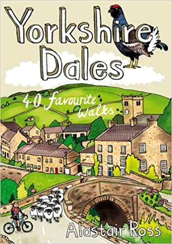
- Yorkshire Dales: 40 Favourite Walks
- The Yorkshire Dales combine a wild limestone landscape of high rolling moorland gouged by dramatic caves and cascading waterfalls with peaceful farmland carpeted in wildflowers and dotted with ruined abbeys, ancient stone walls and barns, and timeless villages waiting to be discovered.The 40 moderate walks in this collection from award winning... Read more
- Also available from:
- The Book Depository, United Kingdom
- De Zwerver, Netherlands

Netherlands
2017
- Wandelgids Yorkshire Dales | Pocket Mountains
- The Yorkshire Dales combine a wild limestone landscape of high rolling moorland gouged by dramatic caves and cascading waterfalls with peaceful farmland carpeted in wildflowers and dotted with ruined abbeys, ancient stone walls and barns, and timeless villages waiting to be discovered.The 40 moderate walks in this collection from award winning... Read more


United Kingdom
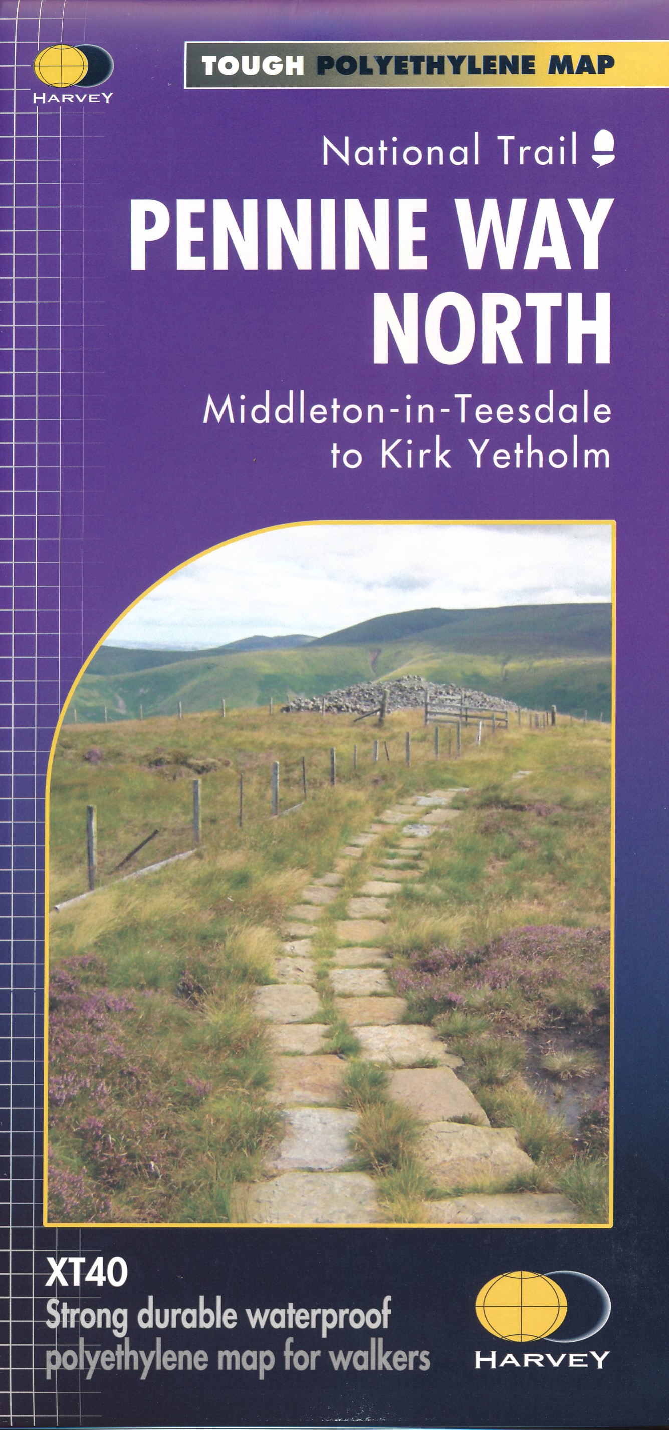
- North Pennines: Teesdale & Weardale OS Explorer Active Map OL31 (waterproof)
- The northern part of the Pennines including Teesdale and Weardale on a detailed topographic and GPS compatible map OL31, waterproof version, from the Ordnance Survey’s 1:25,000 Explorer series. Coverage include Barnard Castle, Middleton-in-Teesdale, Stanhope, Blagill, Gilderdale Forest, Milburn Forest, Hamsterley Forest, Middleton Common, the... Read more
- Also available from:
- The Book Depository, United Kingdom


United Kingdom
- Cheviot Hills - Jedburgh & Wooler OS Explorer Map OL16 (paper)
- The Cheviot Hills on a detailed topographic and GPS compatible map OL16, paper version, from the Ordnance Survey’s 1:25,000 Explorer series. Coverage includes Jedburgh, Woolmer, part of the Northumberland National Park, the peaks of The Cheviot, Corby Pike, Cold Law, Scrathy Holes and Windy Gyle, Catcleugh Reservoir, sections of the Pennine Way... Read more
- Also available from:
- The Book Depository, United Kingdom
- De Zwerver, Netherlands


Netherlands

United Kingdom
- Kielder Water & Forest - Bellingham & Simonside Hills OS Explorer Active Map OL42 (waterproof)
- Kielder Water and Kielder Forest on a detailed topographic and GPS compatible map OL42, waterproof version, from the Ordnance Survey’s 1:25,000 Explorer series. Coverage includes Simonside Hills, Kershope Forest, Liddesdale, Sweethope Loughs, the peaks of The Dodd, Muckle Knowe, Mid Fell, the lakeside circuit around the Kielder Water, a section... Read more
- Also available from:
- The Book Depository, United Kingdom


United Kingdom
2015
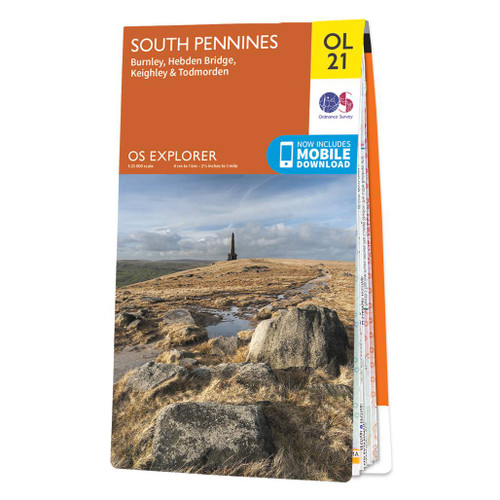
- South Pennines: Burnley, Hebden Bridge, Keighley & Todmorden OS Explorer Map OL21 (paper)
- The southern part of the Pennines on a detailed topographic and GPS compatible map OL21, paper version, from the Ordnance Survey’s 1:25,000 Explorer series. The map covers an area between Burney and Halifax, extending north to Skipton and Horton. Coverage includes Littleborough, Sowerby Bridge, Todmorden, Haworth, Nelson, Bernoldswick, the peak... Read more
- Also available from:
- The Book Depository, United Kingdom
- De Zwerver, Netherlands


- Also available from:
- De Zwerver, Netherlands
United Kingdom
2016
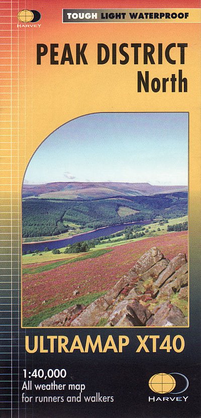
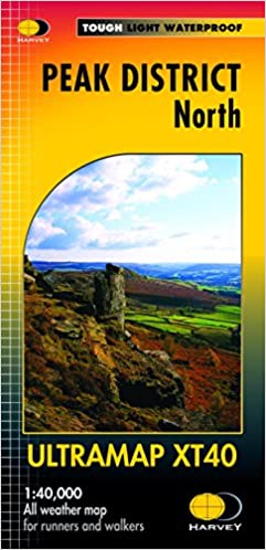
- Peak District North Harvey Ultramap XT40
- The northern part of the Peak District at 1:40,000 on a waterproof and tear-resistant, pocket-size Ultramap from Harvey Map Services with the same cartography as their Superwalker map of this area. Coverage extends from Marsden and Holmbridge in the north to beyond Glossop in the south, and includes the Bottoms / Valehouse / Rhodeswood /... Read more
- Also available from:
- The Book Depository, United Kingdom
- De Zwerver, Netherlands

United Kingdom
2016
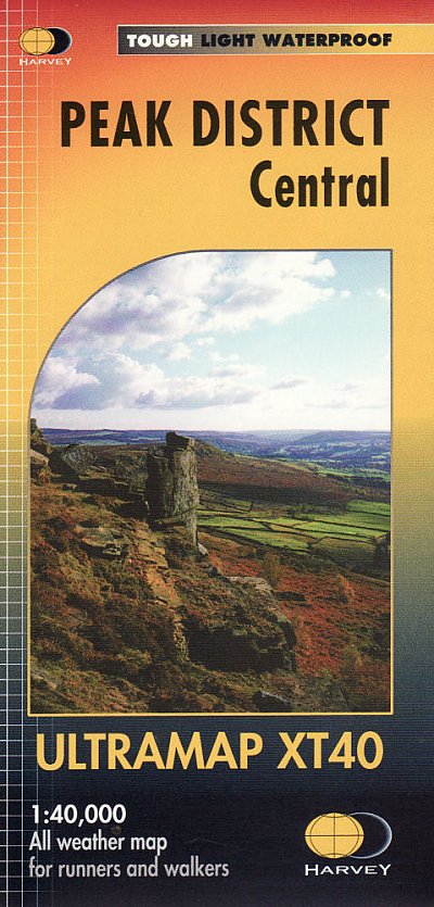
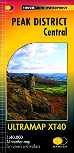
- Peak District Central Harvey Ultramap XT40
- The central part of the Peak District at 1:40,000 on a waterproof and tear-resistant, pocket-size Ultramap from Harvey Map Services with the same cartography as their Superwalker map of this area. Coverage extends from west of New Mills and Whaley Bridge in the west to Sheffield, and from the Derwent Reservoir in the north to Buxton, and... Read more
- Also available from:
- The Book Depository, United Kingdom
- De Zwerver, Netherlands


United Kingdom
2016
- The Pennine Way: The Path, the People, the Journey
- This book presents a portrait of the Pennine Way, Britain`s oldest and best known long-distance footpath, tracing its remarkable history through the experiences of walkers past and present. As Andrew McCloy walks the 268-mile route from the Derbyshire Peak District to the Scottish borders, he discovers how the Pennine Way set a benchmark for... Read more
- Also available from:
- The Book Depository, United Kingdom

United Kingdom
2016
- The Pennine Way - the Path, the People, the Journey
- A portrait of the The Pennine Way, Britain's oldest and best known long-distance footpath, stretching for 268 miles from the Derbyshire Peak District to the Scottish Borders. It charts the path's remarkable history, and walkers past and present relate their experiences of this commanding, exhilarating and complex path. Read more

United Kingdom
- Cheviot Hills - Jedburgh & Wooler OS Explorer Active Map OL16 (waterproof)
- The Cheviot Hills on a detailed topographic and GPS compatible map OL16, waterproof version, from the Ordnance Survey’s 1:25,000 Explorer series. Coverage includes Jedburgh, Woolmer, part of the Northumberland National Park, the peaks of The Cheviot, Corby Pike, Cold Law, Scrathy Holes and Windy Gyle, Catcleugh Reservoir, sections of the... Read more
- Also available from:
- The Book Depository, United Kingdom


United Kingdom
- South Pennines: Burnley, Hebden Bridge, Keighley & Todmorden OS Explorer Active Map OL21 (waterproof)
- The southern part of the Pennines on a detailed topographic and GPS compatible map OL21, waterproof version, from the Ordnance Survey’s 1:25,000 Explorer series. The map covers an area between Burney and Halifax, extending north to Skipton and Horton. Coverage includes Littleborough, Sowerby Bridge, Todmorden, Haworth, Nelson, Bernoldswick, the... Read more
- Also available from:
- The Book Depository, United Kingdom

United Kingdom
Netherlands
- Actually, I'm English
- Forty years is a long time to be away. Travelling on foot and by motorbike, Nick Adams discovers that while many things have changed, the things he loved; the hills, the pubs, the back roads and yes, even the weather, are undiminished. Join Nick as he hikes the length of Wales, hitting all the high spots. Then follow him up the spine of England... Read more
- Also available from:
- Bol.com, Belgium
Belgium
- Actually, I'm English
- Forty years is a long time to be away. Travelling on foot and by motorbike, Nick Adams discovers that while many things have changed, the things he loved; the hills, the pubs, the back roads and yes, even the weather, are undiminished. Join Nick as he hikes the length of Wales, hitting all the high spots. Then follow him up the spine of England... Read more

United Kingdom
2017
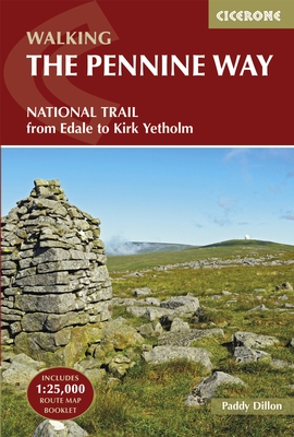
- The Pennine Way: From Edale to Kirk Yetholm
- The Pennine Way is Britain`s oldest, toughest long-distance footpath - and arguably its most iconic. Now a National Trail, the 427km (2651/2 mile) route from Edale in Derbyshire to Kirk Yetholm in the Scottish Borders offers wayfarers the opportunity to immerse themselves in wild beauty of the North. The Pennines boast rolling hills, sweeping... Read more
- Also available from:
- The Book Depository, United Kingdom
- Bol.com, Netherlands
- Bol.com, Belgium
- De Zwerver, Netherlands


Netherlands
2017
- The Pennine Way
- The Pennine Way is Britain's oldest, toughest long-distance footpath - and arguably its most iconic. Now a National Trail, the 427km (2651/2 mile) route from Edale in Derbyshire to Kirk Yetholm in the Scottish Borders offers wayfarers the opportunity to immerse themselves in wild beauty of the North. The Pennines boast rolling hills, sweeping... Read more
Belgium
2017
- The Pennine Way
- The Pennine Way is Britain's oldest, toughest long-distance footpath - and arguably its most iconic. Now a National Trail, the 427km (2651/2 mile) route from Edale in Derbyshire to Kirk Yetholm in the Scottish Borders offers wayfarers the opportunity to immerse themselves in wild beauty of the North. The Pennines boast rolling hills, sweeping... Read more
Netherlands
2022
- Wandelgids The Pennine Way | Cicerone
- Guidebook to the Pennine Way National Trail with OS map booklet. The 270-mile route from Edale to Kirk Yetholm takes three weeks to walk and is suitable for fit and experienced long distance walkers. The route crosses the Peak District, Yorkshire Dales and North Pennines National Parks. Includes separate OS 1:25,000 map booklet of the route. Read more
Maps

United Kingdom
- Sheffield and Huddersfield 1903
- Map No. 110, Sheffield and Huddersfield 1903, in the Cassini Historical Series of old Ordnance Survey mapping of England and Wales at 1:50,000 in a format designed to offer a convenient comparison with the present day coverage from the OS, and most locations in three different editions. Old historical maps have been combined so that the sheet... Read more
United Kingdom
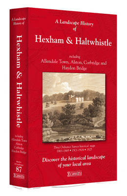
- Hexham and Haltwhistle 1863-1925 (3-map set)
- Map No. 87, Hexham and Haltwhistle 1983-1925 (3-map set), in the Cassini Historical Series of old Ordnance Survey mapping of England and Wales at 1:50,000 in a format designed to offer a convenient comparison with the present day coverage from the OS, and most locations in three different editions. Old historical maps have been combined so that... Read more
United Kingdom
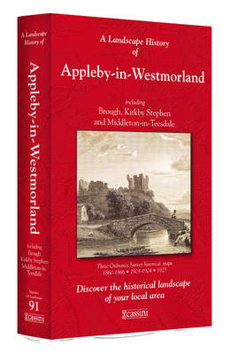
- Appleby-in-Westmorland 1860-1925 (3-map set)
- Map No. 91, Appleby-in-Westmorland 1860-1925 (3-map set), in the Cassini Historical Series of old Ordnance Survey mapping of England and Wales at 1:50,000 in a format designed to offer a convenient comparison with the present day coverage from the OS, and most locations in three different editions. Old historical maps have been combined so that... Read more
United Kingdom
- Sheffield and Huddersfield 1840-1841
- Map No. 110, Sheffield and Huddersfield 1840-1841, in the Cassini Historical Series of old Ordnance Survey mapping of England and Wales at 1:50,000 in a format designed to offer a convenient comparison with the present day coverage from the OS, and most locations in three different editions. Old historical maps have been combined so that the... Read more
United Kingdom
- Sheffield and Huddersfield 1923-1925
- Map No. 110, Sheffield and Huddersfield 1923-1925, in the Cassini Historical Series of old Ordnance Survey mapping of England and Wales at 1:50,000 in a format designed to offer a convenient comparison with the present day coverage from the OS, and most locations in three different editions. Old historical maps have been combined so that the... Read more
United Kingdom
- Berwick-upon-Tweed 1901
- Map No. 75, Berwick-upon-Tweed 1901, in the Cassini Historical Series of old Ordnance Survey mapping of England and Wales at 1:50,000 in a format designed to offer a convenient comparison with the present day coverage from the OS, and most locations in three different editions. Old historical maps have been combined so that the sheet lines... Read more
United Kingdom
- Wensleydale and Upper Wharfedale 1852-1925 (3-map set)
- Map No. 98, Wensleydale and Upper Wharfedale 1852-1925 (3-map set), in the Cassini Historical Series of old Ordnance Survey mapping of England and Wales at 1:50,000 in a format designed to offer a convenient comparison with the present day coverage from the OS, and most locations in three different editions. Old historical maps have been... Read more

United Kingdom
- Peak District - Dark Peak A-Z Adventure Atlas
- Peak District: Dark Peak Adventure Atlas at 1:25,000 in a series of handy A5 size Adventure Atlases from Geographers` A-Z Map Company with cartography from the Ordnance Survey’s Explorer series. Coverage includes Glossop, Hadfield, Stocksbridge, Chapel-en-le-Frith, Hope, Bamford, New Mills, Castleton, Bradwell, Hayfield, Tintwistle, Greenfield,... Read more
United Kingdom
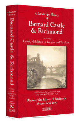
- Barnard Castle and Richmond 1860-1925 (3-map set)
- Map No. 92, Barnard Castle and Richmond 1860-1925 (3-map set), in the Cassini Historical Series of old Ordnance Survey mapping of England and Wales at 1:50,000 in a format designed to offer a convenient comparison with the present day coverage from the OS, and most locations in three different editions. Old historical maps have been combined so... Read more
United Kingdom
- Berwick-upon-Tweed 1865-1869
- Map No. 75, Berwick-upon-Tweed 1865-1869, in the Cassini Historical Series of old Ordnance Survey mapping of England and Wales at 1:50,000 in a format designed to offer a convenient comparison with the present day coverage from the OS, and most locations in three different editions. Old historical maps have been combined so that the sheet lines... Read more
United Kingdom
- Berwick-upon-Tweed 1926
- Map No. 75, Berwick-upon-Tweed 1926, in the Cassini Historical Series of old Ordnance Survey mapping of England and Wales at 1:50,000 in a format designed to offer a convenient comparison with the present day coverage from the OS, and most locations in three different editions. Old historical maps have been combined so that the sheet lines... Read more
United Kingdom
- Cheviot Hills and Kielder Water 1901
- Map No. 80, Cheviot Hills and Kielder Water 1901, in the Cassini Historical Series of old Ordnance Survey mapping of England and Wales at 1:50,000 in a format designed to offer a convenient comparison with the present day coverage from the OS, and most locations in three different editions. Old historical maps have been combined so that the... Read more
United Kingdom
- Blackburn and Burnley 1843-1925 (3-map set)
- Map No. 103, Blackburn and Burnley 1843-1925 (3-map set), in the Cassini Historical Series of old Ordnance Survey mapping of England and Wales at 1:50,000 in a format designed to offer a convenient comparison with the present day coverage from the OS, and most locations in three different editions. Old historical maps have been combined so that... Read more
United Kingdom
- Appleby-in-Westmorland 1860-1866
- Map No. 91, Appleby-in-Westmorland 1860-1866, in the Cassini Historical Series of old Ordnance Survey mapping of England and Wales at 1:50,000 in a format designed to offer a convenient comparison with the present day coverage from the OS, and most locations in three different editions. Old historical maps have been combined so that the sheet... Read more
United Kingdom
- Cheviot Hills and Kielder Water 1868-1869
- Map No. 80, Cheviot Hills and Kielder Water 1868-1869, in the Cassini Historical Series of old Ordnance Survey mapping of England and Wales at 1:50,000 in a format designed to offer a convenient comparison with the present day coverage from the OS, and most locations in three different editions. Old historical maps have been combined so that... Read more