
North York Moors
Description
The North York Morks is a national park, located in northeastern England, along the Northsea coast. It is one of the largest expances of open heather moorland in the UK. There are a great many footpaths and rights of way in the park. The well known Coast to Coast walk goes through the heart of the moors. The Cleveland way touches the northern edge of the area.
A popular challenge is the Lyke Wake Walk, a complete crossing of the North Yorkshire moors over a length of 40 miles in less than 24 hours.
Trails in this region
Links
Facts
Reports
Guides and maps
Lodging
Organisations
Tour operators
GPS
Other
Books

Stanfords
United Kingdom
United Kingdom
- Yorkshire Coast Path: A guide to walking 120 miles of magnificent coastline from Redcar to the Humber
- The Yorkshire coastline is the second most visited tourist destination in England - so why no walking guide to its entire length? The Trail Guides published by, for example, Aurum, and other walking publishers like Cicerone, sell steady numbers of guides to the Northumberland Coast Path, let alone National Trails like the South-West Coast Path.... Read more

Stanfords
United Kingdom
United Kingdom
- Wild Pub Walks
- Join the author on 30 walks in beautiful remote or mountain landscapes, each with a great pub - often with historical significance - at journey`s end. The book is aimed at the large market of hill walkers who enjoy long days out followed by a great pint in a great pub.The areas covered are: Peak District; Lake District; Highlands/Islands;... Read more

Stanfords
United Kingdom
United Kingdom
- Ely, Wisbech & Downham Market OS Landranger Active Map 143 (waterproof)
- Cambridgeshire around Ely, Wisbech and Downham Market, including part of the E2 European Long-distance Path, on a waterproof and tear-resistant OS Active version of map No. 143 from the Ordnance Survey’s Landranger series at 1:50,000, with contoured and GPS compatible topographic mapping plus tourist information.MOBILE DOWNLOADS: As well as the... Read more

Stanfords
United Kingdom
United Kingdom
- Oxford, Chipping Norton & Bicester OS Landranger Active Map 164 (waterproof)
- Oxford area, including sections of the Thames Path and the E2 European Long-distance Path, on a waterproof and tear-resistant OS Active version of map No. 164 from the Ordnance Survey’s Landranger series at 1:50,000, with contoured and GPS compatible topographic mapping plus tourist information.MOBILE DOWNLOADS: As well as the physical edition... Read more

Stanfords
United Kingdom
United Kingdom
- North York Moors Western OS Explorer Active Map OL26 (waterproof)
- The western part of the North York Moors National Park on a detailed topographic and GPS compatible map OL26, waterproof version, from the Ordnance Survey’s 1:25,000 Explorer series. Coverage extends from Ampleforth in the south northwards to Saltburn-by-the-Sea, and from Ingleby Arncliffe to Danby, Castleton and Hutton-le-Hole, and includes... Read more

Stanfords
United Kingdom
United Kingdom
- Stratford-upon-Avon, Warwick & Banbury OS Landranger Active Map 151 (waterproof)
- The area between Stratford-upon-Avon, Warwick and Banbury, including the northern part of the Cotswold Hills and part of the Cotswold Way / E2 European Long-distance Path, on a waterproof and tear-resistant OS Active version of map No. 151 from the Ordnance Survey’s Landranger series at 1:50,000, with contoured and GPS compatible topographic... Read more

Stanfords
United Kingdom
United Kingdom
- Ipswich, The Naze & Clacton-on-Sea OS Landranger Active Map 169 (waterproof)
- Ipswich with Harwich and The Naze area, including part of the E2 European Long-distance Path, on a waterproof and tear-resistant OS Active version of map No. 169 from the Ordnance Survey’s Landranger series at 1:50,000, with contoured and GPS compatible topographic mapping plus tourist information.MOBILE DOWNLOADS: As well as the physical... Read more

Stanfords
United Kingdom
United Kingdom
- Cambridge, Newmarket & Saffron Walden OS Landranger Active Map 154 (waterproof)
- Parts of Cambridgeshire, Suffolk and Essex with Cambridge, Newmarket and Saffron Walden, including part of the E2 European Long-distance path, on a waterproof and tear-resistant OS Active version of map No. 154 from the Ordnance Survey’s Landranger series at 1:50,000, with contoured and GPS compatible topographic mapping plus tourist... Read more

Stanfords
United Kingdom
United Kingdom
- Bury St Edmunds, Sudbury & Stowmarket OS Landranger Active Map 155 (waterproof)
- Suffolk around Bury St Edmunds, Sudbury and Stowmarket, including part of the E2 European Long-distance path, on a waterproof and tear-resistant OS Active version of map No. 155 from the Ordnance Survey’s Landranger series at 1:50,000, with contoured and GPS compatible topographic mapping plus tourist information.MOBILE DOWNLOADS: As well as... Read more

Stanfords
United Kingdom
United Kingdom
- Maidstone, Royal Tunbridge Wells, Sevenoaks & Tonbridge OS Landranger Active Map 188 (waterproof)
- Maidstone, Tunbridge Wells and the High Weald area, including a section of the North Downs Way / E2 European Long-distance Path, on a waterproof and tear-resistant OS Active version of map No. 188 from the Ordnance Survey’s Landranger series at 1:50,000, with contoured and GPS compatible topographic mapping plus tourist information.MOBILE... Read more

Stanfords
United Kingdom
United Kingdom
- Cheltenham, Cirencester & Stow-on-the-Wold OS Landranger Active Map 163 (waterproof)
- Cheltenham and Cirencester area, including sections of the Thames Path, the Cotswold Way and the E2 European Long-distance Path, on a waterproof and tear-resistant OS Active version of map No. 163 from the Ordnance Survey’s Landranger series at 1:50,000, with contoured and GPS compatible topographic mapping plus tourist information.MOBILE... Read more

Stanfords
United Kingdom
2016
United Kingdom
2016
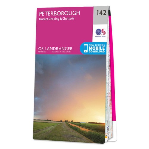
- Peterborough, Market Deeping & Chatteris OS Landranger Map 142 (paper)
- The area around Peterborough, Market Deeping and Chatteris, including the Fens of the North and Middle Levels with part of the E2 European Long-distance Path, on a paper version of map No. 142 from the Ordnance Survey’s Landranger series at 1:50,000, with contoured and GPS compatible topographic mapping plus tourist information.MOBILE... Read more
- Also available from:
- The Book Depository, United Kingdom
- De Zwerver, Netherlands

De Zwerver
Netherlands
2016
Netherlands
2016

The Book Depository
United Kingdom
United Kingdom
- Cleveland Way National Trail Official Map
- With Ordnance Survey Mapping Read more

Stanfords
United Kingdom
2016
United Kingdom
2016
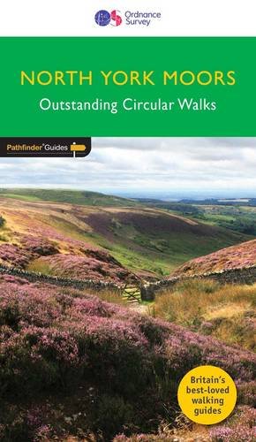
- North York Moors - Outstanding Circular Walks
- Pathfinder(R) North York Moors covering parts of the Pickering, Whitby and Ingleby Moor. This selection offers interest, regional variety and balance of routes in the North York Moors providing the best walks in the area. From an easy stroll through Robin Hood`s Bay to the much more challenging walks on Westerdale Moor this volume contains... Read more
- Also available from:
- The Book Depository, United Kingdom
- De Zwerver, Netherlands

De Zwerver
Netherlands
2016
Netherlands
2016

Stanfords
United Kingdom
2016
United Kingdom
2016
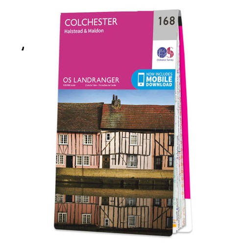
- Colchester, Halstead & Maldon OS Landranger Map 168 (paper)
- Colchester, Halstead and Maldon area, including part of the E2 European Long-distance Path, on a paper version of map No. 168 from the Ordnance Survey’s Landranger series at 1:50,000, with contoured and GPS compatible topographic mapping plus tourist information.MOBILE DOWNLOADS: As well as the physical edition of the map, each Landranger title... Read more
- Also available from:
- The Book Depository, United Kingdom
- De Zwerver, Netherlands

De Zwerver
Netherlands
2016
Netherlands
2016
Maps

Stanfords
United Kingdom
United Kingdom
- Luxembourg North
- One of two topographic survey maps of Luxembourg at 1:50,000, with contours at 10-metres intervals and additional relief shading. An overprint highlights long-distance footpaths, including the GR5 (E-2), cycle routes, and various places of interest, including campsites. The map covers an area of approximately 53 x 43 km / 33 x 27 miles. Map... Read more

Stanfords
United Kingdom
United Kingdom
- North York Moors East A-Z Adventure Atlas
- The eastern part of the North Yorkshire Moors at 1:25,000 in a series of handy A5 size Adventure Atlases from Geographers` A-Z Map Company with cartography from the Ordnance Survey’s Explorer series. Coverage includes Whitby, Scarborough, Thornton-le-Dale, Pickering, Kirkbymoorside, Castleton and Loftus.To see other titles in this series please... Read more

Stanfords
United Kingdom
United Kingdom
- Malton & Pickering 1924-1925
- Map No. 100, Malton and Pickering 1924-1925, in the Cassini Historical Series of old Ordnance Survey mapping of England and Wales at 1:50,000 in a format designed to offer a convenient comparison with the present day coverage from the OS, and most locations in three different editions.Old historical maps have been combined so that the sheet... Read more

Stanfords
United Kingdom
United Kingdom
- Luxembourg South
- One of two topographic survey maps of Luxembourg at 1:50,000, with contours at 10-metres intervals and additional relief shading. An overprint highlights long-distance footpaths, including the GR5 (E-2), cycle routes, and various places of interest, including campsites. The map covers an area of approximately 53 x 43 km / 33 x 27 miles. Map... Read more
Stanfords
United Kingdom
United Kingdom
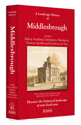
- Middlesbrough 1860-1863
- Map No. 93, Middlesbrough 1860-1863, in the Cassini Historical Series of old Ordnance Survey mapping of England and Wales at 1:50,000 in a format designed to offer a convenient comparison with the present day coverage from the OS, and most locations in three different editions. Old historical maps have been combined so that the sheet lines... Read more
Stanfords
United Kingdom
United Kingdom
- Whitby and Esk Dale 1925
- Map No. 94, Whitby and Esk Dale 1925, in the Cassini Historical Series of old Ordnance Survey mapping of England and Wales at 1:50,000 in a format designed to offer a convenient comparison with the present day coverage from the OS, and most locations in three different editions. Old historical maps have been combined so that the sheet lines... Read more
Stanfords
United Kingdom
United Kingdom
- Middlesbrough 1925
- Map No. 93, Middlesbrough 1925, in the Cassini Historical Series of old Ordnance Survey mapping of England and Wales at 1:50,000 in a format designed to offer a convenient comparison with the present day coverage from the OS, and most locations in three different editions. Old historical maps have been combined so that the sheet lines... Read more
Stanfords
United Kingdom
United Kingdom
- Malton and Pickering 1903-1904
- Map No. 100, Malton and Pickering 1903-1904, in the Cassini Historical Series of old Ordnance Survey mapping of England and Wales at 1:50,000 in a format designed to offer a convenient comparison with the present day coverage from the OS, and most locations in three different editions. Old historical maps have been combined so that the sheet... Read more
Stanfords
United Kingdom
United Kingdom
- Middlesbrough 1903-1904
- Map No. 93, Middlesbrough 1903-1904, in the Cassini Historical Series of old Ordnance Survey mapping of England and Wales at 1:50,000 in a format designed to offer a convenient comparison with the present day coverage from the OS, and most locations in three different editions. Old historical maps have been combined so that the sheet lines... Read more
Stanfords
United Kingdom
United Kingdom
- Whitby and Esk Dale 1903-1904
- Map No. 94, Whitby and Esk Dale 1903-1904, in the Cassini Historical Series of old Ordnance Survey mapping of England and Wales at 1:50,000 in a format designed to offer a convenient comparison with the present day coverage from the OS, and most locations in three different editions. Old historical maps have been combined so that the sheet... Read more
Stanfords
United Kingdom
United Kingdom
- Middlesbrough 1860-1925 (3-map set)
- Map No. 93, Middlesbrough 1860-1925 (3-map set), in the Cassini Historical Series of old Ordnance Survey mapping of England and Wales at 1:50,000 in a format designed to offer a convenient comparison with the present day coverage from the OS, and most locations in three different editions. Old historical maps have been combined so that the... Read more
Stanfords
United Kingdom
United Kingdom
- Whitby and Esk Dale 1857-1925 (3-map set)
- Map No. 94, Whitby and Esk Dale 1925, in the Cassini Historical Series of old Ordnance Survey mapping of England and Wales at 1:50,000 in a format designed to offer a convenient comparison with the present day coverage from the OS, and most locations in three different editions. Old historical maps have been combined so that the sheet lines... Read more
Stanfords
United Kingdom
United Kingdom
- Malton and Pickering 1857-1925 (3-map set)
- Map No. 100, Malton and Pickering 1857-1925 (3-map set), in the Cassini Historical Series of old Ordnance Survey mapping of England and Wales at 1:50,000 in a format designed to offer a convenient comparison with the present day coverage from the OS, and most locations in three different editions. Old historical maps have been combined so that... Read more
Stanfords
United Kingdom
United Kingdom
- Malton and Pickering 1857-1861
- Map No. 100, Malton and Pickering 1857-1861, in the Cassini Historical Series of old Ordnance Survey mapping of England and Wales at 1:50,000 in a format designed to offer a convenient comparison with the present day coverage from the OS, and most locations in three different editions. Old historical maps have been combined so that the sheet... Read more

Stanfords
United Kingdom
United Kingdom
- North York Moors West AA Walker`s Map 19
- The western part of the North York Moors at 1:25,000 in a series of Walker’s Maps published by the AA with the cartography from the Ordnance Survey’s Explorer series. The map is double-sided and coverage includes North York Moors National Park, Middlesbrough, Salturn-by-the-Sea, Guisboroughm Stokesley, Castleton, Seave Green, Hutton-le-Hole,... Read more