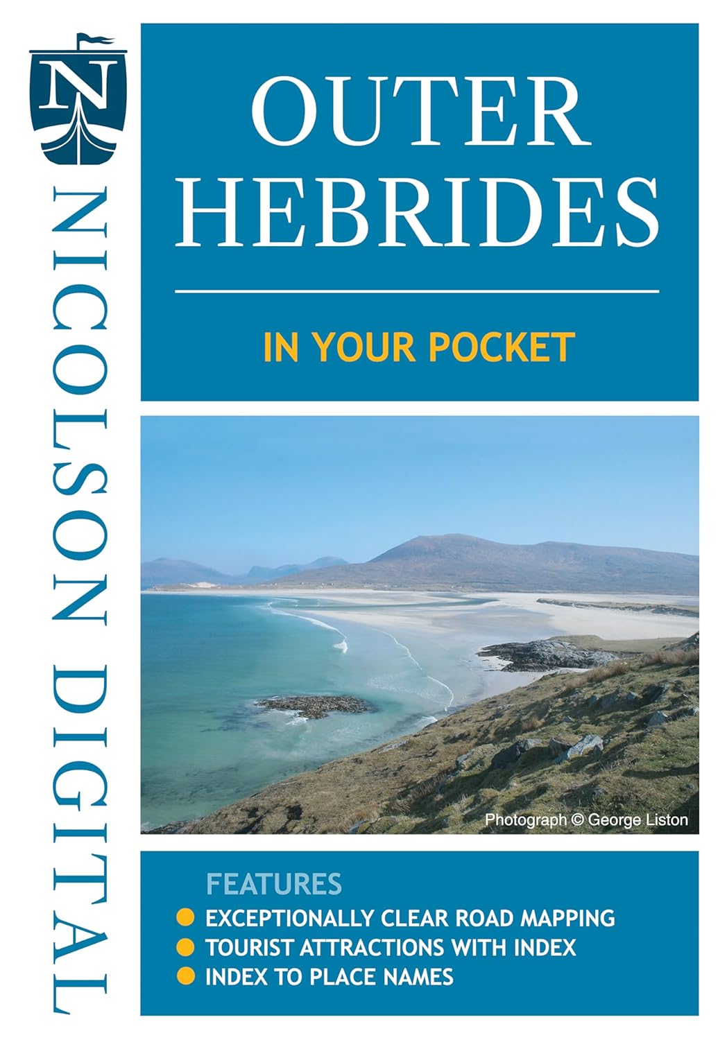
Outer Hebrides
Description
Island group in the Norht Atlantic, off the west coast of Scotland: Lewis and Harris, South Uist, North Uist, Benbecula, Barra, Scalpay, Great Bernera, Grimsay, Berneray, Eriskay, Vatersay.
The islands are very diverse in character. Lewis is flat, Harris is mountainous, Uist is flat again. It's a birders paradise. Long continuous trails are missing. But on the other hand the islands are relatively isolated to the main car driven tourist industry. Backpacking and hopping from one island to the other is a good idea.
Links
Facts
Reports
Guides and maps
Lodging
Organisations
Tour operators
GPS
Other
Books

Stanfords
United Kingdom
United Kingdom
- Isles at the Edge of the Sea
- Rising off the western seaboard of mainland Scotland are hundreds of islands; hidden worlds. Beginning on Arran, Jonny Muir sets out to explore these places with a single ambition: to reach the faraway St Kilda archipelago; the islands at the edge of the world. On the way he attempts to find his inner peace on Holy Island, takes part in a... Read more

Stanfords
United Kingdom
2011
United Kingdom
2011
- Skye & The Western Isles
- Skye & the Western Isles is a fully revised new edition of the only comprehensive guide to Scotland`s Western Isles, which include Skye, Lewis, Harris, Uist, Iona, Jura, Islay and Arran. These enchanting islands reward the visitor with a rich variety of terrain and wildlife from the stark beauty of the Cuillin mountains of Skye to the raging... Read more

Stanfords
United Kingdom
United Kingdom
- Poacher`s Pilgrimage: An Island Journey
- The islands of the Outer Hebrides are home to some of the most remote and spectacular scenery in the world. They host an astonishing range of mysterious structures - stone circles, beehive dwellings, holy wells and `temples` from the Celtic era. Over a twelve-day pilgrimage, often in appalling conditions, Alastair McIntosh returns to the... Read more

Stanfords
United Kingdom
United Kingdom
- Explore Macau
- Walking is the best way to get to know any city, and Macau - the former Portuguese colony returned to China in 1999 - is made for walking. Only seven miles square, one can easily walk from the Border Gate to Barra Point at the tip of Macau in a day. This guide describes eight walks around peninsular Macau and its outlying islands, sufficient to... Read more

Stanfords
United Kingdom
United Kingdom
- West Lewis & North Harris OS Landranger Active Map 13 (waterproof)
- Waterproof and tear-resistant OS Active version of map No. 13 from the Ordnance Survey’s Landranger series at 1:50,000, with contoured and GPS compatible topographic mapping plus tourist information.MOBILE DOWNLOADS: As well as the physical edition of the map, each Landranger title now includes a code for downloading after purchase its digital... Read more

Stanfords
United Kingdom
United Kingdom
- Central Lewis & Stornoway - Eye Peninsula & Callanish OS Explorer Active Map 459 (waterproof)
- Central Lewis with Stornoway, Eye Peninsula and Callanish on a detailed topographic and GPS compatible map No. 459, waterproof version, from the Ordnance Survey’s 1:25,000 Explorer series. MOBILE DOWNLOADS: this title and all the other OS Explorer maps include a code for downloading after purchase the digital version onto your smartphone or... Read more
- Also available from:
- The Book Depository, United Kingdom

The Book Depository
United Kingdom
United Kingdom

Stanfords
United Kingdom
2015
United Kingdom
2015
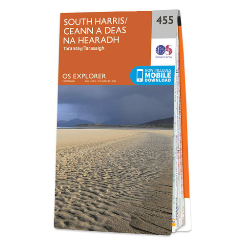
- South Harris - Taransay OS Explorer Map 455 (paper)
- South Harris, Taransay and the surrounding smaller islands on a detailed topographic and GPS compatible map No. 455, paper version, from the Ordnance Survey’s 1:25,000 Explorer series.MOBILE DOWNLOADS: this title and all the other OS Explorer maps include a code for downloading after purchase the digital version onto your smartphone or tablet... Read more
- Also available from:
- The Book Depository, United Kingdom
- De Zwerver, Netherlands

De Zwerver
Netherlands
2015
Netherlands
2015

Stanfords
United Kingdom
2016
United Kingdom
2016
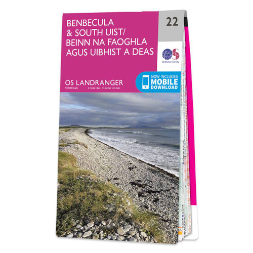
- Benbecula & South Uist OS Landranger Map 22 (paper)
- Paper version of map No. 22 from the Ordnance Survey’s Landranger series at 1:50,000, with contoured and GPS compatible topographic mapping plus tourist information.MOBILE DOWNLOADS: As well as the physical edition of the map, each Landranger title now includes a code for downloading after purchase its digital version onto your smartphone or... Read more
- Also available from:
- The Book Depository, United Kingdom
- De Zwerver, Netherlands

De Zwerver
Netherlands
2016
Netherlands
2016

Stanfords
United Kingdom
United Kingdom
- North Harris & Loch Seaforth OS Explorer Active Map 456 (waterproof)
- North Harris with Loch Seaforth and the surrounding smaller islands on a detailed topographic and GPS compatible map No. 456, waterproof version, from the Ordnance Survey’s 1:25,000 Explorer series. MOBILE DOWNLOADS: this title and all the other OS Explorer maps include a code for downloading after purchase the digital version onto your... Read more
- Also available from:
- The Book Depository, United Kingdom

The Book Depository
United Kingdom
United Kingdom

Stanfords
United Kingdom
United Kingdom
- South Harris - Taransay OS Explorer Active Map 455 (waterproof)
- South Harris, Taransay and the surrounding smaller islands on a detailed topographic and GPS compatible map No. 455, waterproof version, from the Ordnance Survey’s 1:25,000 Explorer series. MOBILE DOWNLOADS: this title and all the other OS Explorer maps include a code for downloading after purchase the digital version onto your smartphone or... Read more
- Also available from:
- The Book Depository, United Kingdom


Stanfords
United Kingdom
2016
United Kingdom
2016
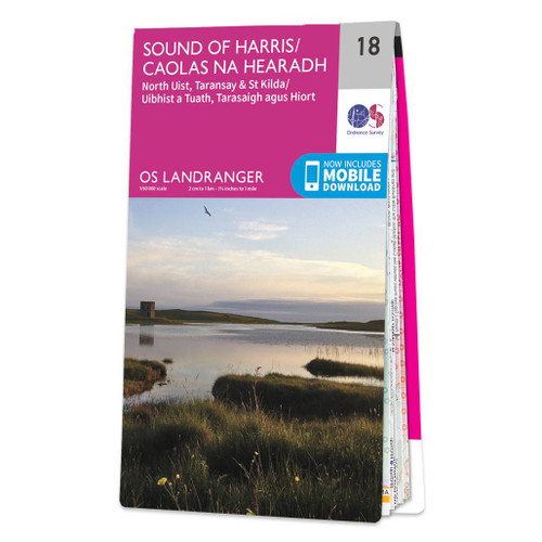
- Sound of Harris, North Uist, Taransay & St Kilda OS Landranger Map 18 (paper)
- Paper version of map No. 18 from the Ordnance Survey’s Landranger series at 1:50,000, with contoured and GPS compatible topographic mapping plus tourist information.MOBILE DOWNLOADS: As well as the physical edition of the map, each Landranger title now includes a code for downloading after purchase its digital version onto your smartphone or... Read more
- Also available from:
- The Book Depository, United Kingdom
- De Zwerver, Netherlands

De Zwerver
Netherlands
2016
Netherlands
2016

Stanfords
United Kingdom
2017
United Kingdom
2017
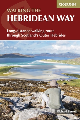
- The Hebridean Way: Long-Distance Walking Route Through Scotland`s Outer Hebrides
- Officially launched in 2017, the Hebridean Way offers walkers the opportunity to experience the magic of Scotland`s Outer Hebrides in one inspirational journey. The waymarked route stretches 247km (155 miles) from Vatersay to Stornaway, linking ten major islands of the archipelago by means of causeways and two ferry crossings: Vatersay, Barra,... Read more
- Also available from:
- The Book Depository, United Kingdom
- De Zwerver, Netherlands

The Book Depository
United Kingdom
2017
United Kingdom
2017
- The Hebridean Way
- Long-distance walking route through Scotland's Outer Hebrides Read more
De Zwerver
Netherlands
2017
Netherlands
2017
- Wandelgids The Hebridean Way | Cicerone
- Guidebook to walking the Hebridean Way, a 154 mile (247km) walking route along the length of the Outer Hebrides. From the island of Vatersay to Stornoway on Lewis, the waymarked route can be walked in 8-13 days and crosses a variety of terrain including shell beaches, rugged hills and wild moor. Also includes an extension to the Butt of Lewis. Read more

Stanfords
United Kingdom
2015
United Kingdom
2015
- Uist and Barra Walking
- Walking on Uist and Barra hiking guide from Cicerone Press with a variety of day walks on North and South Uist, Benbecula, Barra, Eriskay, Mingulay and Vatersay, all highlighted on extracts from the Ordnance Survey Landranger series.Recommended walks range from 3km to 17km and cover all kinds of the terrain from machair and sandy coast to more... Read more
- Also available from:
- The Book Depository, United Kingdom

The Book Depository
United Kingdom
2015
United Kingdom
2015
- Walking on Uist and Barra
- 40 coast, moorland and mountain walks on all the isles of Uist and Barra Read more

Stanfords
United Kingdom
United Kingdom
- North Uist & Berneray OS Explorer Active Map 454 (waterproof)
- North Uist, Berneray and the surrounding smaller islands on a detailed topographic and GPS compatible map No. 454, waterproof version, from the Ordnance Survey’s 1:25,000 Explorer series. MOBILE DOWNLOADS: this title and all the other OS Explorer maps include a code for downloading after purchase the digital version onto your smartphone or... Read more
- Also available from:
- The Book Depository, United Kingdom


Stanfords
United Kingdom
United Kingdom
- South East Lewis - Loch Eireasort & Shiant Islands OS Explorer Active Map 457 (waterproof)
- South East Lewis with Loch Eireasort and the Shiant Islands on a detailed topographic and GPS compatible map No. 457, waterproof version, from the Ordnance Survey’s 1:25,000 Explorer series. MOBILE DOWNLOADS: this title and all the other OS Explorer maps include a code for downloading after purchase the digital version onto your smartphone or... Read more
- Also available from:
- The Book Depository, United Kingdom

Maps

Stanfords
United Kingdom
United Kingdom
- C65 Crinan To Mallaig & Barra
- Plans included: Castle Bay (Barra) (1:25,000) Mallaig (1:10,000) Tobermory (Mull) (1:22,500) Caledonian Canal Entrance (1:40,000) Lynn of Lorn (1:40,000) Dunstaffnage Bay (1:20,000) Oban (1:15,000) Loch Feochan Entrance (1:25,000) Sound of Luing (1:30,000) On the 2013 edition of this chart, depths from the latest known surveys have been... Read more

Stanfords
United Kingdom
United Kingdom
- C67 North Minch & Isle of Lewis
- Plans included:Loch Inchard (Kinlochbervie) (1:12 500)Loch Inver (1:15 000)Ullapool (1:10 000)Stornoway Harbour (1:15 000)Loch Carloway (1:20 000)On this 2017 edition the latest depth surveys have been included. The chart specification has been improved to show coloured light flashes. There has been general updating throughout. Read more

Stanfords
United Kingdom
United Kingdom
- C48 A Coruna to Porto
- Plans included: A Coruna (1:50 000) Ria de Corme e Laxe (1:75 000) Ria de Camarinas (1:50 000) Ria de Muros (1:75 000) Approaches to Ria de Arousa (1:150 000) Ria de Arousa (1:150 000) Cabo de Cruz (1:40 000) Vilagarcia (1:35 000) Illa de Arousa to Cambados (1:40 000) Ria de Pontevedra (1:150 000) Ria de Vigo (1:150 000) Baiona (1:85 000)... Read more

Stanfords
United Kingdom
United Kingdom
- Yellowstone National Park WY/MT NGS Trails Illustrated Map 201
- Map No. 201, Yellowstone National Park, WY/MT, in an extensive series of GPS compatible, contoured hiking maps of USA’s national and state parks or forests and other popular recreational areas. Cartography based on the national topographic survey, with additional tourist information.The maps, with most titles now printed on light, waterproof... Read more
- Also available from:
- The Book Depository, United Kingdom
- Bol.com, Netherlands
- Bol.com, Belgium
- De Zwerver, Netherlands

The Book Depository
United Kingdom
United Kingdom
- Yellowstone National Park
- Trails Illustrated National Parks Read more

Bol.com
Netherlands
Netherlands
- Yellowstone National Park
- Waterproof Tear-Resistant Topographic MapNational Geographic's Trails Illustrated map of Yellowstone National Park is designed to meet the needs of outdoor enthusiasts by combining valuable information with unmatched detail of America's first national park. Expertly researched and created in partnership with local land management... Read more
Bol.com
Belgium
Belgium
- Yellowstone National Park
- Waterproof Tear-Resistant Topographic MapNational Geographic's Trails Illustrated map of Yellowstone National Park is designed to meet the needs of outdoor enthusiasts by combining valuable information with unmatched detail of America's first national park. Expertly researched and created in partnership with local land management... Read more

De Zwerver
Netherlands
Netherlands
- Wandelkaart - Topografische kaart 201 Trails Illustrated Yellowstone National Park | National Geographic
- Prachtige geplastificeerde kaart van het bekende nationaal park. Met alle recreatieve voorzieningen als campsites, maar ook met topografische details en wandelroutes ed. Door uitgekiend kleurgebruik zeer prettig in gebruik. Scheur en watervast! Detailed and accurate coverage for Yellowstone National Park. Includes a detailed road network and... Read more

Stanfords
United Kingdom
United Kingdom
- Mount Rogers High Country VA
- Map No. 318 - Mount Rogers High Country in Virginia in an extensive series of GPS compatible, contoured hiking maps of USA’s national and state parks or forests and other popular recreational areas. Cartography based on the national topographic survey, with additional tourist information.The maps, with most titles now printed on light,... Read more
- Also available from:
- The Book Depository, United Kingdom
- Bol.com, Netherlands
- Bol.com, Belgium
- De Zwerver, Netherlands

The Book Depository
United Kingdom
United Kingdom
- Mount Rogers High Country
- Trails Illustrated Other Rec. Areas Read more

Bol.com
Netherlands
Netherlands
- Mount Rogers High Country
- Waterproof Tear-Resistant Topographic MapNational Geographic's Trails Illustrated map of Mount Rogers High Country and Grayson Highlands State Park, Southwest Virginia, is a two-sided, waterproof, topographic trail map designed to meet the needs of outdoor enthusiasts with unmatched durability and detail. This map was created in... Read more
Bol.com
Belgium
Belgium
- Mount Rogers High Country
- Waterproof Tear-Resistant Topographic MapNational Geographic's Trails Illustrated map of Mount Rogers High Country and Grayson Highlands State Park, Southwest Virginia, is a two-sided, waterproof, topographic trail map designed to meet the needs of outdoor enthusiasts with unmatched durability and detail. This map was created in... Read more

De Zwerver
Netherlands
Netherlands
- Wandelkaart - Topografische kaart 318 Mount Rogers High Country - Grayson Highlands State Park | National Geographic
- Prachtige geplastificeerde kaart van het bekende nationaal park. Met alle recreatieve voorzieningen als campsites, maar ook met topografische details en wandelroutes ed. Door uitgekiend kleurgebruik zeer prettig in gebruik. Scheur en watervast! National Geographic's Trails Illustrated map of Mount Rogers High Country and Grayson Highlands... Read more

Stanfords
United Kingdom
United Kingdom
- Glacier - Waterton Lakes National Park MT
- Map No. 215, Glacier/Waterton Lakes National Park, MT, in an extensive series of GPS compatible, contoured hiking maps of USA’s national and state parks or forests and other popular recreational areas. Cartography based on the national topographic survey, with additional tourist information.The maps, with most titles now printed on light,... Read more
- Also available from:
- Bol.com, Netherlands
- Bol.com, Belgium
- De Zwerver, Netherlands

Bol.com
Netherlands
Netherlands
- Glacier/waterton Lakes National Parks
- Waterproof Tear-Resistant Topographic MapNational Geographic's Trails Illustrated map of Glacier and Waterton Lakes National Parks offers unparalleled detail for outdoor enthusiasts exploring the pristine landscape of forests, mountains, lakes, and meadows within these two spectacular parks. Created in partnership with local land... Read more
Bol.com
Belgium
Belgium
- Glacier/waterton Lakes National Parks
- Waterproof Tear-Resistant Topographic MapNational Geographic's Trails Illustrated map of Glacier and Waterton Lakes National Parks offers unparalleled detail for outdoor enthusiasts exploring the pristine landscape of forests, mountains, lakes, and meadows within these two spectacular parks. Created in partnership with local land... Read more

De Zwerver
Netherlands
Netherlands
- Wandelkaart - Topografische kaart 215 Glacier - Waterton Lakes National Park | National Geographic
- Prachtige geplastificeerde kaart van het bekende nationaal park. Met alle recreatieve voorzieningen als campsites, maar ook met topografische details en wandelroutes ed. Door uitgekiend kleurgebruik zeer prettig in gebruik. Scheur en watervast! Waterton Lakes National Park, Canada includes Waterton Park, Upper and Middle Waterton Lakes, The... Read more
More maps…