Two Moors Way
Description
- Name Two Moors Way
- Length of trail 164 km, 102 miles
- Length in days 8 days
- Traildino grading EW, Easy walk, nature trail
102 miles, 166 km, 8 days
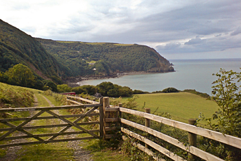
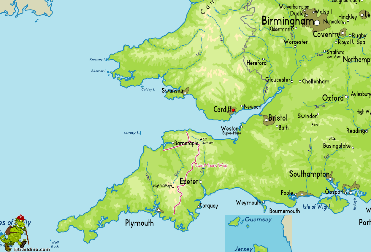
The two moors referred to are Dartmoor and Exmoor, Devon, southwest England. Both moors are important nature reserves. In between the two moors the trail winds through a forlorn rural area.
Expect a hilly terrain, which means a lot of climbing and going down. Apart from open moorland, there is much wood, especially in river valleys, and of course agricultural land and surrounded by typical robust Devon hedges. Unfortunately, England has fallen prey to the intensification of agriculture as elsewhere in Europe, and hedges are being removed.
The path is not much frequented by hikers. Perhaps the reason is the vicinity of popular venues like the South West Coast Path. A pity: the Two Moors Way shows a unique piece of England.
Map
Links
Facts
Reports
Guides and maps
Lodging
Organisations
Tour operators
GPS
Other
Books

United Kingdom
2019
- Two Moors Way Cicerone Map Booklet
- All the mapping you need to complete the Two Moors Way, Devon`s coast to coast route between Wembury Bay and Lynmouth, including a section of the Erme-Plym Trail. NOTE: An accompanying Cicerone guidebook - The Two Moors Way - describes the route south to north, with summary directions for walking north to south. It includes lots of other... Read more

United Kingdom
- South Devon - Brixham to Newton Ferrers OS Explorer Active Map OL20 (waterproof)
- The coast of South Devon on a detailed topographic and GPS compatible map OL20, waterproof version, from the Ordnance Survey’s 1:25,000 Explorer series. The map extends westwards beyond Newton Ferrers to Plymouth, eastwards beyond Brixham to Torquay, and inland to include part of the Dartmoor National Park. Coverage includes Paignton, Totness,... Read more

United Kingdom
- A Trail Guide to Walking The Two Moors Way
- from Lynmouth to Ivybridge Read more

United Kingdom
2019
- The Two Moors Way: Devon`s Coast to Coast: Wembury Bay to Lynmouth
- This guidebook to walking Coast to Coast across Devon, presents a 117 mile route incorporating the Two Moors Way and a section of the Erme-Plym Trail. Beginning at Wembury Bay on the south coast and finishing at Lynmouth, the 11-stage walk passes through the beautiful Devon countryside and across two of southwest England`s magnificent... Read more
- Also available from:
- The Book Depository, United Kingdom
- De Zwerver, Netherlands

United Kingdom
2019
- The Two Moors Way
- Devon's Coast to Coast: Wembury Bay to Lynmouth Read more
Netherlands
2019
- Wandelgids The Two Moors Way | Cicerone
- Guidebook to walking Devon's Coast to Coast, a 117 mile route incorporating the Two Moors Way and a section of the Erme-Plym Trail. Beginning at Wembury Bay on the south coast and finishing at Lynmouth, the walk passes through the beautiful countryside of Dartmoor and Exmoor. A map booklet of the full route on OS 1:25K maps is included. Read more

United Kingdom
- Exmoor - Barnstaple, Lynton, Minehead & Dulverton OS Explorer Map OL9 (paper)
- The Exmoor National Park on a detailed topographic and GPS compatible map OL9, paper version, from the Ordnance Survey’s 1:25,000 Explorer series. Coverage extends westwards to Ilfracombe and Barnstaple and includes Minehead – the start of the South West Coast Path National Rrail, Lynton, Dulverton, sections of the Two Moors Way, Tarka Way,... Read more
- Also available from:
- The Book Depository, United Kingdom
- De Zwerver, Netherlands

United Kingdom
2015
- South Devon - Brixham to Newton Ferrers OS Explorer Map OL20 (paper)
- The coast of South Devon on a detailed topographic and GPS compatible map OL20, paper version, from the Ordnance Survey’s 1:25,000 Explorer series. The map extends westwards beyond Newton Ferrers to Plymouth, eastwards beyond Brixham to Torquay, and inland to include part of the Dartmoor National Park. Coverage includes Paignton, Totness,... Read more
- Also available from:
- The Book Depository, United Kingdom
- De Zwerver, Netherlands

United Kingdom
- Exmoor - Barnstaple, Lynton, Minehead & Dulverton OS Explorer Active Map OL9 (waterproof)
- The Exmoor National Park on a detailed topographic and GPS compatible map OL9, waterproof version, from the Ordnance Survey’s 1:25,000 Explorer series. Coverage extends westwards to Ilfracombe and Barnstaple and includes Minehead – the start of the South West Coast Path National Rrail, Lynton, Dulverton, sections of the Two Moors Way, Tarka... Read more
- Also available from:
- The Book Depository, United Kingdom
- De Zwerver, Netherlands
Netherlands
2015
- The Two Moors Way
- This guidebook describes the 187km (116 mile) Devon Coast-to-Coast Path, or Two Moors Way. The route travels south to north, from Wembury on the south coast, up through Dartmoor and mid-Devon, through Exmoor to Lynmouth on the Bristol Channel. The walk can be adjusted to suit each walker, and can take between a week to 10 days depending on... Read more
- Also available from:
- Bol.com, Belgium

Belgium
2015
- The Two Moors Way
- This guidebook describes the 187km (116 mile) Devon Coast-to-Coast Path, or Two Moors Way. The route travels south to north, from Wembury on the south coast, up through Dartmoor and mid-Devon, through Exmoor to Lynmouth on the Bristol Channel. The walk can be adjusted to suit each walker, and can take between a week to 10 days depending on... Read more

United Kingdom
2017
- North and Mid Devon
- Are you planning a visit or holiday to North or Mid Devon? Do you enjoy a walk in the country or a leisurely afternoon stroll? Inside Pathfinder(R) Guide to North and Mid Devon are 28 fantastic country walks designed for walkers of all abilities. Ranging from 3 to 11 1/ 2 miles in length, each circular walk takes in some of the many delights of... Read more
- Also available from:
- Bol.com, Netherlands
- Bol.com, Belgium
- De Zwerver, Netherlands

Netherlands
2017
- NORTH AND MID DEVON
- Are you planning a visit or holiday to North or Mid Devon? Do you enjoy a walk in the country or a leisurely afternoon stroll? Inside Pathfinder(R) Guide to North and Mid Devon are 28 fantastic country walks designed for walkers of all abilities. Ranging from 3 to 11 1/ 2 miles in length, each circular walk takes in some of the many delights of... Read more

Belgium
2017
- NORTH AND MID DEVON
- Are you planning a visit or holiday to North or Mid Devon? Do you enjoy a walk in the country or a leisurely afternoon stroll? Inside Pathfinder(R) Guide to North and Mid Devon are 28 fantastic country walks designed for walkers of all abilities. Ranging from 3 to 11 1/ 2 miles in length, each circular walk takes in some of the many delights of... Read more
Netherlands
2017
- Wandelgids 68 Pathfinder Guides North and Mid Devon | Ordnance Survey
- Are you planning a visit or holiday to North or Mid Devon? Do you enjoy a walk in the country or a leisurely afternoon stroll? Inside Pathfinder(R) Guide to North and Mid Devon are 28 fantastic country walks designed for walkers of all abilities. Ranging from 3 to 11 1/ 2 miles in length, each circular walk takes in some of the many delights of... Read more
Maps

United Kingdom
- Two Moors Way Harvey National Trail XT40
- Two Moors Way, a 150km / 93 mile long-distance trail between Lynmouth on the north coast of Devon and Ivybridge near Plymouth, crossing Exmoor and Dartmoor National Parks, presented at 1:40,000 on a light, waterproof and tear-resistant map from Harvey Map Services. The route is shown on six panels.Maps in the Harvey’s series covering Great... Read more

United Kingdom
- Exmoor A-Z Adventure Atlas
- Exmoor at 1:25,000 in a series of handy A5 size Adventure Atlases from Geographers` A-Z Map Company with cartography from the Ordnance Survey’s Explorer series. Coverage includes the South West Coast path between Minehead and Combe Martin Bay, Two Moors Way, Tarka Train, Dulverton, Brendon Hills, etc.To see other titles in this series please... Read more


