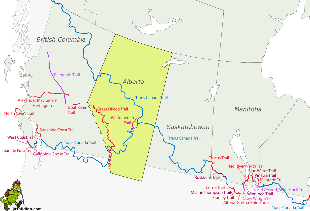
Alberta
Description
Map
Trails in this state
Links
Facts
Reports
Guides and maps
Lodging
Organisations
Tour operators
GPS
Other
Books

The Book Depository
United Kingdom
United Kingdom
- The Best of The Great Trail -- Volume 1
- Newfoundland to Southern Ontario on the Trans Canada Trail Read more

The Book Depository
United Kingdom
United Kingdom
- The Best of The Great Trail
- British Columbia to Northern Ontario on the Trans Canada Trail Read more
Bol.com
Netherlands
Netherlands
- The David Thompson Highway Hiking Guide
- Another of RMB s bestselling hiking books, The David Thompson Highway Hiking Guide has been completely revised, updated and redesigned for outdoors enthusiasts interested in experiencing a wide variety of easily accessible trails through stunning landscapes in west-central Alberta between the rolling foothills of the Nordegg area and the... Read more
- Also available from:
- Bol.com, Belgium

Bol.com
Belgium
Belgium
- The David Thompson Highway Hiking Guide
- Another of RMB s bestselling hiking books, The David Thompson Highway Hiking Guide has been completely revised, updated and redesigned for outdoors enthusiasts interested in experiencing a wide variety of easily accessible trails through stunning landscapes in west-central Alberta between the rolling foothills of the Nordegg area and the... Read more
Bol.com
Netherlands
Netherlands
- Camps And Cruises Of An Ornithologist
- CAMPS AND CRUISES OF AN ORNITHOLOGIST BY FRANK M. CHAPMAN CURATOR OF ORNITHOLOGY, AMERICAN MUSEUM OF NATURAL HISTORY FELLOW OF THE AMERICAN ORNITHOLOGISTS UNION AUTHOR OF HANDBOOK OF BIRDS OF EASTERN NORTH AMERICA BIRD-LIFE BIRD STUDIES WITH A CAMERA, ETC. WITH 250 PHOTOGRAPHS FROM NATURE BY THE AUTHOR, 1908, - PREFACE with the assistance of... Read more
- Also available from:
- Bol.com, Belgium

Bol.com
Belgium
Belgium
- Camps And Cruises Of An Ornithologist
- CAMPS AND CRUISES OF AN ORNITHOLOGIST BY FRANK M. CHAPMAN CURATOR OF ORNITHOLOGY, AMERICAN MUSEUM OF NATURAL HISTORY FELLOW OF THE AMERICAN ORNITHOLOGISTS UNION AUTHOR OF HANDBOOK OF BIRDS OF EASTERN NORTH AMERICA BIRD-LIFE BIRD STUDIES WITH A CAMERA, ETC. WITH 250 PHOTOGRAPHS FROM NATURE BY THE AUTHOR, 1908, - PREFACE with the assistance of... Read more
Bol.com
Netherlands
Netherlands
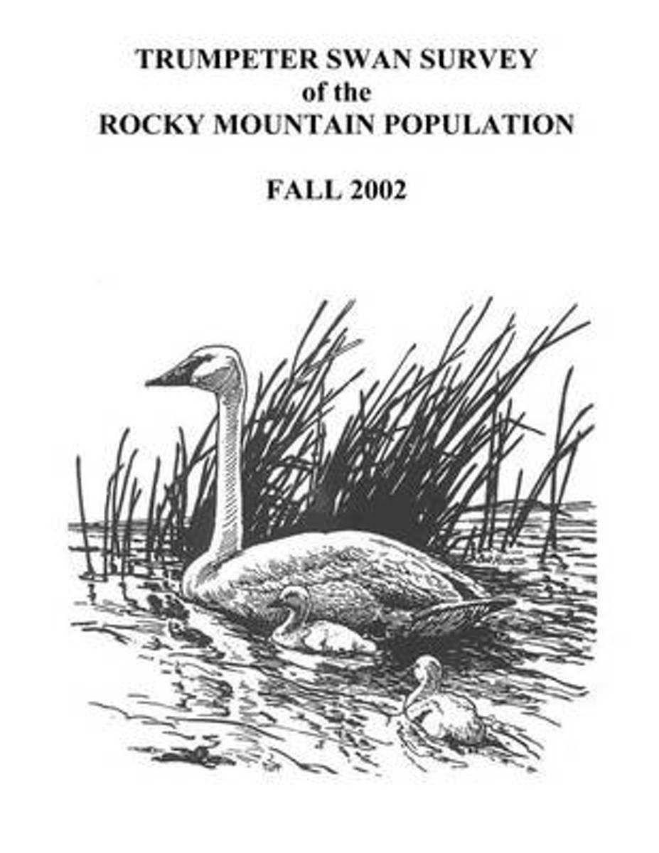
- Trumpeter Swan Survey of the Rocky Mountain Population
- The Rocky Mountain Population (RMP) of trumpeter swans (Cygnus buccinator) consists of birds that nest primarily from western Canada southward to Nevada and Wyoming. The population is comprised of several flocks that nest in different portions of the overall range. The RMP/Canadian Flocks consist of birds that summer primarily in southeastern... Read more
- Also available from:
- Bol.com, Belgium

Bol.com
Belgium
Belgium
- Trumpeter Swan Survey of the Rocky Mountain Population
- The Rocky Mountain Population (RMP) of trumpeter swans (Cygnus buccinator) consists of birds that nest primarily from western Canada southward to Nevada and Wyoming. The population is comprised of several flocks that nest in different portions of the overall range. The RMP/Canadian Flocks consist of birds that summer primarily in southeastern... Read more
Bol.com
Netherlands
Netherlands
- Canada West
- Waterproof Tear-Resistant Travel MapNational Geographic's Canada West AdventureMap is designed to meet the needs of adventure travelers with its durability and detailed, accurate information. The map includes the locations of cities and towns with a user-friendly index, a clearly marked road network complete with distances and... Read more
- Also available from:
- Bol.com, Belgium
- De Zwerver, Netherlands

Bol.com
Belgium
Belgium
- Canada West
- Waterproof Tear-Resistant Travel MapNational Geographic's Canada West AdventureMap is designed to meet the needs of adventure travelers with its durability and detailed, accurate information. The map includes the locations of cities and towns with a user-friendly index, a clearly marked road network complete with distances and... Read more
De Zwerver
Netherlands
Netherlands
- Wegenkaart - landkaart 3113 Adventure Map Canada West | National Geographic
- Waterproof Tear-Resistant Travel MapNational Geographic's Canada West AdventureMap is designed to meet the needs of adventure travelers with its durability and detailed, accurate information. The map includes the locations of cities and towns with a user-friendly index, a clearly marked road network complete with distances and... Read more
Bol.com
Netherlands
Netherlands
- Pack 'em Up, Ride 'em Out
- When Tania Millen began doing horse pack trips in western Canada, she had trouble deciding where to go - not because there were so many options, but because information was so hard to come by. Riding the trails was the only way she could gain information about particular routes, and she is now sharing her knowledge with readers and riders.... Read more
- Also available from:
- Bol.com, Belgium

Bol.com
Belgium
Belgium
- Pack 'em Up, Ride 'em Out
- When Tania Millen began doing horse pack trips in western Canada, she had trouble deciding where to go - not because there were so many options, but because information was so hard to come by. Riding the trails was the only way she could gain information about particular routes, and she is now sharing her knowledge with readers and riders.... Read more

Bol.com
Netherlands
Netherlands
- The Grizzly Manifesto
- Provocative, passionate and populist, RMB Manifestos are short and concise non-fiction books of literary, critical, and cultural studies. The grizzly bear, once the archetype for all that is wild, is quickly becoming a symbol of nature's fierce but flagging resilience in the face of human greed and ignorance and the difficulty a wealth-addicted... Read more
- Also available from:
- Bol.com, Belgium

Bol.com
Belgium
Belgium
- The Grizzly Manifesto
- Provocative, passionate and populist, RMB Manifestos are short and concise non-fiction books of literary, critical, and cultural studies. The grizzly bear, once the archetype for all that is wild, is quickly becoming a symbol of nature's fierce but flagging resilience in the face of human greed and ignorance and the difficulty a wealth-addicted... Read more
Bol.com
Netherlands
Netherlands
- Alberta Backcountry Equestrian One-Day Trail Guide
- Everything you need to know to explore on horseback. Packed with interpretive notes on wildlife, plants, geology, local history and horse language, this book tells you where to go, how to get there and what to do to have a successful one-day ride. Read more
- Also available from:
- Bol.com, Belgium

Bol.com
Belgium
Belgium
- Alberta Backcountry Equestrian One-Day Trail Guide
- Everything you need to know to explore on horseback. Packed with interpretive notes on wildlife, plants, geology, local history and horse language, this book tells you where to go, how to get there and what to do to have a successful one-day ride. Read more
Bol.com
Netherlands
Netherlands
- Badlands
- Foreword by Ross King, New York Times bestselling author and winner of the Governor General's Award. There can be few places in the world where the visual impact of the landscape is as hauntingly captivating as the Badlands of the Northern Great Plains. Encompassing Alberta, Saskatchewan, North Dakota and Montana, these amazing regions... Read more
- Also available from:
- Bol.com, Belgium

Bol.com
Belgium
Belgium
- Badlands
- Foreword by Ross King, New York Times bestselling author and winner of the Governor General's Award. There can be few places in the world where the visual impact of the landscape is as hauntingly captivating as the Badlands of the Northern Great Plains. Encompassing Alberta, Saskatchewan, North Dakota and Montana, these amazing regions... Read more

Bol.com
Netherlands
Netherlands
- Kanada: Rocky Mountains Rundtour
- In den zwei kanadischen Provinzen British Columbia und Alberta l sst sich noch unber hrte Natur hautnah erleben, wenn man auf Wanderungen, Kanu- und Wildwasserfahrten, beim Jagen und Angeln der faszinierenden Flora und Fauna begegnet. Das Buch gibt eine genaue Darstellung der Provinzen, gegliedert in Geschichte, Geografie und Wirtschaft. In... Read more
- Also available from:
- Bol.com, Belgium

Bol.com
Belgium
Belgium
- Kanada: Rocky Mountains Rundtour
- In den zwei kanadischen Provinzen British Columbia und Alberta l sst sich noch unber hrte Natur hautnah erleben, wenn man auf Wanderungen, Kanu- und Wildwasserfahrten, beim Jagen und Angeln der faszinierenden Flora und Fauna begegnet. Das Buch gibt eine genaue Darstellung der Provinzen, gegliedert in Geschichte, Geografie und Wirtschaft. In... Read more
Bol.com
Netherlands
Netherlands
- Cycling The Great Divide
- The only guidebook to one of the world's premier long-distance mountain bike trails * Mountain bikers from around the world test their mettle on this 2,745-mile route each year * Ultra cycling, including this route through the Rockies, are increasing in popularity * 245 miles have been added to the route since the first edition was published... Read more
- Also available from:
- Bol.com, Belgium

Bol.com
Belgium
Belgium
- Cycling The Great Divide
- The only guidebook to one of the world's premier long-distance mountain bike trails * Mountain bikers from around the world test their mettle on this 2,745-mile route each year * Ultra cycling, including this route through the Rockies, are increasing in popularity * 245 miles have been added to the route since the first edition was published... Read more
Bol.com
Netherlands
Netherlands
- Trans Canada Trail
- A spectacular journey through the heart of British Columbia. The Trans Canada Trail in southern British Columbia runs from Vancouver Island to the Rockies, weaving more than 1,000 miles through seven mountain ranges. In northern British Columbia, the trail follows the Alaska Highway for 650 miles, from Watson Lake, Yukon, to the British... Read more
- Also available from:
- Bol.com, Belgium

Bol.com
Belgium
Belgium
- Trans Canada Trail
- A spectacular journey through the heart of British Columbia. The Trans Canada Trail in southern British Columbia runs from Vancouver Island to the Rockies, weaving more than 1,000 miles through seven mountain ranges. In northern British Columbia, the trail follows the Alaska Highway for 650 miles, from Watson Lake, Yukon, to the British... Read more
Bol.com
Netherlands
Netherlands
- Northern Alberta
- This backroad mapbook is a complete road and recreation atlas for the northern half of Alberta, from just north of Edmonton to the Alberta/Northwest Territories border, an area of the province with extensive wilderness for outdoor recreation. It includes 77 detailed colour recreational GPS-compatible topographical relief maps that include... Read more
- Also available from:
- Bol.com, Belgium

Bol.com
Belgium
Belgium
- Northern Alberta
- This backroad mapbook is a complete road and recreation atlas for the northern half of Alberta, from just north of Edmonton to the Alberta/Northwest Territories border, an area of the province with extensive wilderness for outdoor recreation. It includes 77 detailed colour recreational GPS-compatible topographical relief maps that include... Read more
Bol.com
Netherlands
Netherlands
- Camps And Cruises Of An Ornithologist
- CAMPS AND CRUISES OF AN ORNITHOLOGIST BY FRANK M. CHAPMAN CURATOR OF ORNITHOLOGY, AMERICAN MUSEUM OF NATURAL HISTORY FELLOW OF THE AMERICAN ORNITHOLOGISTS UNION AUTHOR OF HANDBOOK OF BIRDS OF EASTERN NORTH AMERICA BIRD-LIFE BIRD STUDIES WITH A CAMERA, ETC. WITH 250 PHOTOGRAPHS FROM NATURE BY THE AUTHOR, 1908, - PREFACE with the assistance of... Read more
- Also available from:
- Bol.com, Belgium

Bol.com
Belgium
Belgium
- Camps And Cruises Of An Ornithologist
- CAMPS AND CRUISES OF AN ORNITHOLOGIST BY FRANK M. CHAPMAN CURATOR OF ORNITHOLOGY, AMERICAN MUSEUM OF NATURAL HISTORY FELLOW OF THE AMERICAN ORNITHOLOGISTS UNION AUTHOR OF HANDBOOK OF BIRDS OF EASTERN NORTH AMERICA BIRD-LIFE BIRD STUDIES WITH A CAMERA, ETC. WITH 250 PHOTOGRAPHS FROM NATURE BY THE AUTHOR, 1908, - PREFACE with the assistance of... Read more
Maps

Stanfords
United Kingdom
United Kingdom
- Alberta & Saskatchewan
- Alberta, including the Banff and Jasper National Parks, and Saskatchewan on an indexed road map presenting both provinces at 1:1,850,000, each accompanied by several street maps of their main cities, including detailed plans of downtown Calgary, Edmonton, Regina and Saskatoon.On one side is a road map of Alberta with coverage extending within... Read more

Stanfords
United Kingdom
United Kingdom
- Jasper & Maligne Lake Gem Trek
- Jasper - Maligne Lake area of the Jasper National Park at 1:100,000 on a GPS compatible, waterproof and tear-resistant map from Gem Trek, with very extensive tourist information including recommendations for day or longer hikes, mountain biking trails, notes on camping permits, more detailed enlargements, etc.The map covers the most popular... Read more

Stanfords
United Kingdom
United Kingdom
- Alberta MapArt
- Alberta, including the Banff and Jasper National Parks, on an indexed road map at 1:1,500,000 accompanied by several street maps of its main cities, including plans of Calgary, Edmonton and the holiday resorts of Banff, Jasper and Canmore.The road map shows Alberta at 1:1,500,000 prominently highlighting its numerous national and provincial... Read more

Stanfords
United Kingdom
United Kingdom
- Alberta Pocket Road Atlas
- Pocket road atlas of Alberta presenting the whole province at 1:1,325,000, with numerous enlargement showing in more detail most visited areas, including Banff, Jasper, Canmore, Calgary, Edmonton, etc. The index includes a listing of the province’s national and provincial parks.Road network indicates loose surface and unimproved roads, showing... Read more

Stanfords
United Kingdom
United Kingdom
- Edmonton - Jasper & Environs FastTrack
- Waterproof and tear-resistant FastTrack map presenting in a handy-size format a street plan of Edmonton and a road map of most of the Jasper National Park, both at 1:250,000, plus a more detailed street plan of downtown Edmonton.On one side a street plan at 1:250,000 covers Edmonton with its outer suburbs, highlighting various facilities and... Read more

Stanfords
United Kingdom
United Kingdom
- Manning Park - Skagit River ITMB
- Manning Park - Skagit River at 1:50,000 in a series of topographic survey maps of selected areas of British Columbia and the Canadian Rockies from ITMB with cartography from Canada’s national survey organization. Most sheets are printed on light, waterproof and tear- resistant plastic paper.Whilst the Canadian Department of Natural Resources... Read more

Stanfords
United Kingdom
United Kingdom
- Kootenay Rockies - Calgary and Northern Montana Back Road Atlas
- South-eastern British Columbia with the adjoining regions of Alberta including the Banff and Jasper NP plus the border area of Montana with the Glacier NP presented at 1:250,000 in an A4 paperback road atlas with additional street plans, a listing of local events, etc.Mapping at 1:250,000 covers the areas indicated on our coverage image.... Read more

Stanfords
United Kingdom
United Kingdom
- Fort McMurray & Towns of Central and Northern Alberta
- Double-sided map presenting on separate panels indexed street plans of the towns in central and northern Alberta: Fort McMurray, Barrhead, Beaumont, Bonnyville, Cold Lake North & South with Medley, Devon, Edson, Gibbons, Grande Prairie, High Level Hinton, Jasper, Leduc, Morinville, Peace River, Redwater, Slave Lake, St. Paul, Spruce Grove... Read more

Stanfords
United Kingdom
United Kingdom
- Vancouver to Calgary MapArt Back Road Atlas
- The main Trans-Canada Highway from Vancouver to Calgary, including the adjoining Okanagan and Crowsnest Highways and the Seattle area of north-west Washington State, presented at 1:250,000 in an A4 paperback road atlas with additional street plans, listing of local events and wineries, etc.Mapping at 1:250,000 covers the areas indicated on our... Read more

Stanfords
United Kingdom
United Kingdom
- Calgary & Southern Alberta Street Atlas
- Street atlas of Calgary and Southern Alberta, Aidrie, Banff, Beiseker, Black Diamond, Bragg Creek, Brooks, Canmore, Chestermere, Coaldale, Cochrane, Crowsnest Pass, Crossfield, Drumheller, High River, Innisfail, Irricana, Lake Louise, Medicin Hat, Okotoks, Olds, Red Deer, Redwood Meadows, Strathmore, Taber and Turner Valley. The atlas is part... Read more

Stanfords
United Kingdom
United Kingdom
- British Columbia - Alberta FastTrack
- British Columbia and Alberta, including the Banff and Jasper National Parks, on an indexed, double-sided road map presenting both provinces together at 1:2,000,000, plus more detailed mapping of the region’s main urban areas including Vancouver, Victoria, Calgary, etc.On one side both provinces are shown together at 1:2m with their road network... Read more

Stanfords
United Kingdom
United Kingdom
- Edmonton & Northern Alberta Street Atlas
- Street atlas of Edmonton and northern Alberta, including Beaumont, Bonnyville, Camrose, Cold Lake, Devon, Drayton Valley, Edson, Fort McMurray, Fort Saskatchewan, Grande Prairie, Hinton, Jasper, Lacombe, Leduc, Lloydminster, Morinville, Nisku, Peace River, Ponoka, Red Deer, Rocky Mountain House, St. Albert, St. Paul, Sherwood Park, Slave Lake,... Read more

Stanfords
United Kingdom
United Kingdom
- Calgary Pocket Street Atlas
- Pocket size street atlas of Calgary area at 1:25,000 with an enlargement showing the downtown Area in greater detail at 1:15,000, plus road maps of the environs of Calgary at 1:333,333 and of southern Alberta at 1:2,500,000Street plans and pocket atlases from the MapArt / Canadian Cartographics Corporation / JDM Géo publishing group are usually... Read more

Stanfords
United Kingdom
United Kingdom
- British Columbia - Alberta MapArt
- British Columbia and Alberta, including the Banff and Jasper National Parks, on an indexed, double-sided road map presenting both provinces together at 1:2,000,000, plus more detailed mapping of the region’s main urban areas including Vancouver, Victoria, Calgary, etc.On one side both provinces are shown together at 1:2m with their road network... Read more
De Zwerver
Netherlands
Netherlands
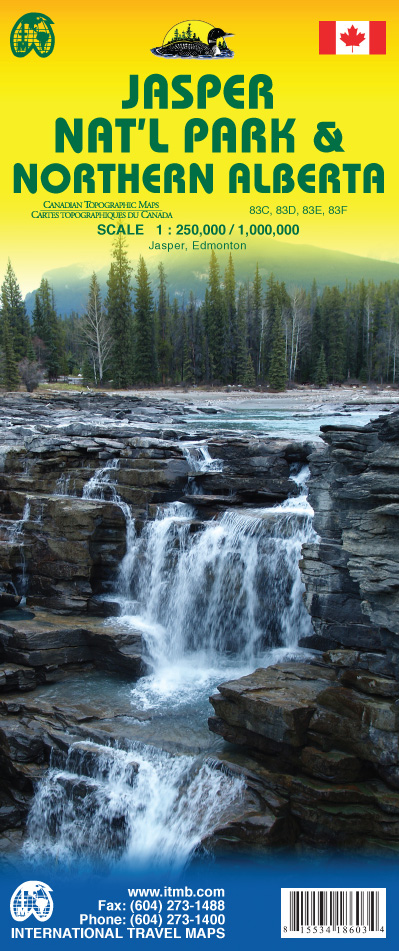
- Wegenkaart - landkaart Jasper National Park & Northern Alberta | ITMB
- Jasper National Park & Northern Alberta 1 : 250 000 / 1 : 1 000 000 ab 10.5 EURO Jasper, Edmonton International Travel Map ITM. 2nd edition Read more


