
Tirol
Description
Tirol comprises the Western part of Austria (Nordtirol) and the bordering region in Italy (Osttirol, Südtirol and Trentino).
Trails in this region
Links
Facts
Reports
Guides and maps
Lodging
Organisations
Tour operators
GPS
Other
Books

Stanfords
United Kingdom
United Kingdom
- Tannheimer Tal F&B WK5352
- Tannheimer Tal - Füssen - Forchach area of the Austrian and Bavarian Alps presented at 1:35,000 in a series of contoured and GPS compatible outdoor leisure map from Freytag & Berndt with hiking and cycling routes, mountain huts, campsites and youth hostels, local bus stops, plus other tourist information. Cartography is an enlargement of the... Read more
Stanfords
United Kingdom
United Kingdom
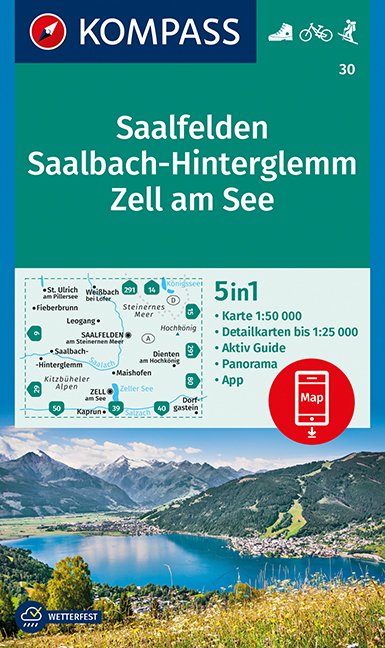
- Saalfelden - Saalbach-Hinterglemm - Zell am See Kompass 30
- Saalfelden - Saalbach - Zell am See (No. 30), a detailed, GPS compatible map at 1:50,000 from Kompass with local and long-distance footpaths, cycling routes, accommodation, etc, printed on durable, waterproof and tear-resistant synthetic paper. This title has on the reverse an additional panorama map of the region.KOMPASS HIKING & RECREATIONAL... Read more

Stanfords
United Kingdom
United Kingdom
- Radstadt - Schladming - Flachau Kompass 31
- Radstadt - Schladming - Flachau area of the Austrian Alps on a detailed, GPS compatible map at 1:50,000 from Kompass with local and long-distance footpaths, cycling routes, accommodation, etc, printed on durable, waterproof and tear-resistant synthetic paper. KOMPASS HIKING & RECREATIONAL MAPS: this title is part of an extensive series covering... Read more

Stanfords
United Kingdom
United Kingdom
- Landeck - Nauders - Samnaungruppe Kompass 42
- Landeck - Nauders - Samnaungruppe (No. 42), a detailed, GPS compatible map at 1:50,000 from Kompass with local and long-distance footpaths, cycling routes, accommodation, etc, printed on durable, waterproof and tear-resistant synthetic paper. KOMPASS HIKING & RECREATIONAL MAPS:This title is part of an extensive series covering Austria, much of... Read more

Stanfords
United Kingdom
United Kingdom
- Tyrol Mountain Bike Trail (1000km) Bikeline Atlas
- A 1000-km long mountain bike trail in the very heart of the Austrian Alps in a 172-page German language guide from Verlag Esterbauer. The route, which can be divided into shorter circuits, takes in many of the region’s top tourist destinations including Innsbruck, Kitzbühel, Mayrhofen, Kufstein, Landeck, Ischgl, St. Anton, etc. IMPORTANT -... Read more

Stanfords
United Kingdom
2018
United Kingdom
2018
- Innsbruck Mountain Adventures: Summer routes for a multi-activity holiday around the capital of Austria`s Tirol
- This guidebook presents 60 routes covering some of the best day walks, scrambles, hut-to-hut walks, alpine mountaineering, sport climbing, via ferratas, mountain-biking routes, road rides, city and trail runs and family activities the Innsbruck area has to offer. Ideal for a multi-activity holiday or for the keen amateur seeking a summary of... Read more
- Also available from:
- The Book Depository, United Kingdom
- De Zwerver, Netherlands

The Book Depository
United Kingdom
2018
United Kingdom
2018
- Innsbruck Mountain Adventures
- Summer routes for a multi-activity holiday around the capital of Austria's Tirol Read more

De Zwerver
Netherlands
2018
Netherlands
2018
- Klimgids - Klettersteiggids Innsbruck Mountain Adventures | Cicerone
- Summer routes for a multi-activity holiday around the capital of Austria's Tirol Read more
Bol.com
Netherlands
2015
Netherlands
2015
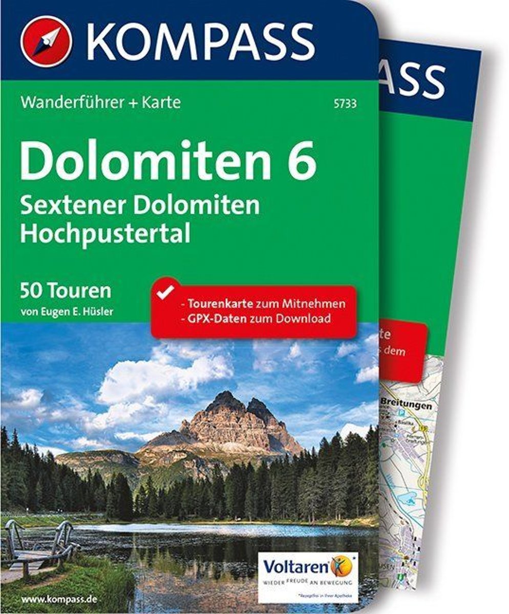
- WF5733 Dolomiten blad 6 Sextner • Hochpustertal Kompass
- Destination:. Die ''Sextener'' erheben sich im Nordosten der Dolomiten zwischen Sextental und Val d'Ansiei; sie grenzen nördlich an den Karnischen Hauptkamm, östlich an die Karnischen Alpen, südlich an die Marmarole und westlich an die Pragser Dolomiten und das Cristallomassiv.. Ihre berühmtesten Gipfel kennt jeder: die Drei Zinnen. Den... Read more
- Also available from:
- Bol.com, Belgium
Bol.com
Belgium
2015
Belgium
2015
- WF5733 Dolomiten blad 6 Sextner • Hochpustertal Kompass
- Destination:. Die ''Sextener'' erheben sich im Nordosten der Dolomiten zwischen Sextental und Val d'Ansiei; sie grenzen nördlich an den Karnischen Hauptkamm, östlich an die Karnischen Alpen, südlich an die Marmarole und westlich an die Pragser Dolomiten und das Cristallomassiv.. Ihre berühmtesten Gipfel kennt jeder: die Drei Zinnen. Den... Read more
De Zwerver
Netherlands
2011
Netherlands
2011
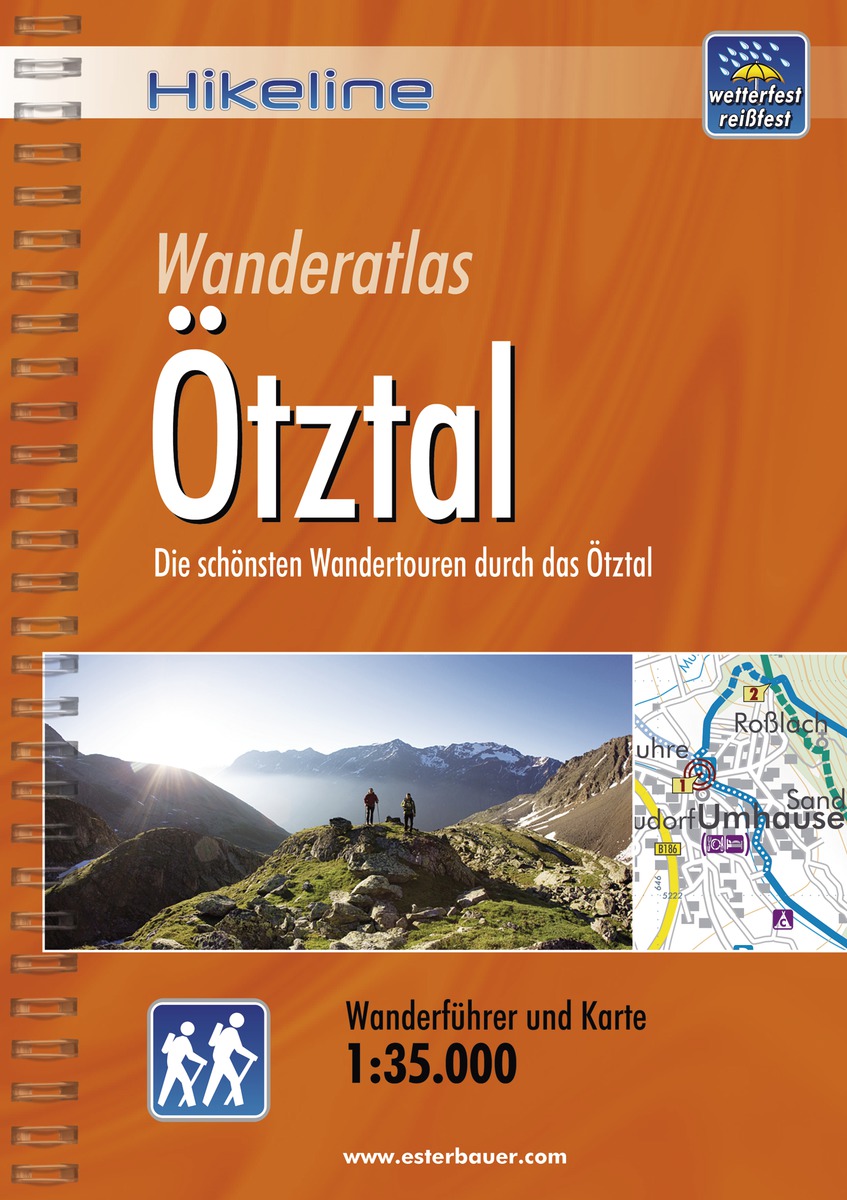
- Wandelgids Hikeline Ötztal | Esterbauer
- Goede handzame wandelgids met duidelijke kaarten en informatieve tekst. / Gedetailleerde wandelgidsen met ingetekende lange afstandsroute. Goede omschrijving van de route met tevens praktische informatie voor onderweg. Länge, Höhenmeter und Anforderungen Die fünfzig Touren dieses Buches decken eine große Bandbreite von kurzen Spaziergängen über... Read more
Bol.com
Netherlands
Netherlands
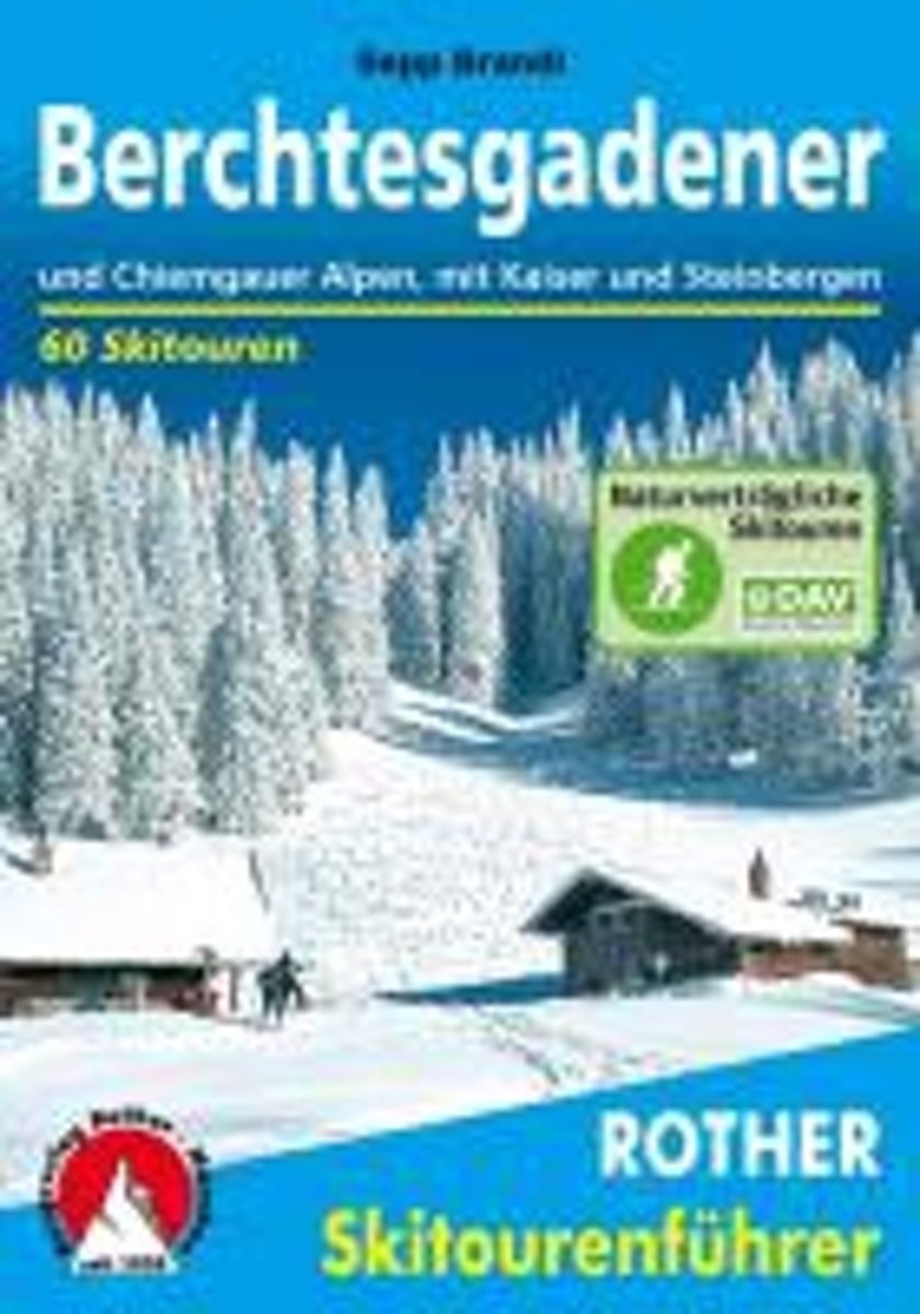
- Berchtesgadender und Chiemgauer Alpen
- Die Berge um das Dreil ndereck von Bayern, Salzburg und Tirol, bieten Skitouren f r jeden Geschmack: Hier locken die Chiemgauer und Dientner Berge mit reizvollem Almgl nde, w hrend das Kaisergebirge, die Loferer und Leoganger Steinberge sowie das Steinerne Meer die Skibergsteiger mit Fr hjahrsfirn unter grandioser Felskulisse bezaubern. In den... Read more
- Also available from:
- Bol.com, Belgium
Bol.com
Belgium
Belgium
- Berchtesgadender und Chiemgauer Alpen
- Die Berge um das Dreil ndereck von Bayern, Salzburg und Tirol, bieten Skitouren f r jeden Geschmack: Hier locken die Chiemgauer und Dientner Berge mit reizvollem Almgl nde, w hrend das Kaisergebirge, die Loferer und Leoganger Steinberge sowie das Steinerne Meer die Skibergsteiger mit Fr hjahrsfirn unter grandioser Felskulisse bezaubern. In den... Read more
De Zwerver
Netherlands
2012
Netherlands
2012
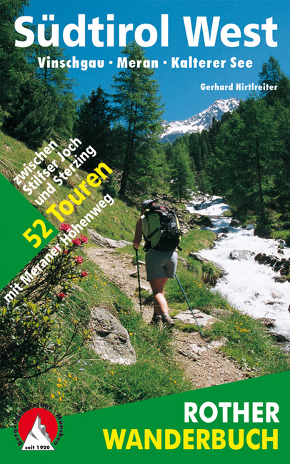
- Wandelgids Südtirol West - zuid tirol | Rother Bergverlag
- De ‘Rother Wanderbücher’ behandelen telkens de 50 mooiste wandelingen, die variëren van eenvoudige kindvriendelijke wandelingen tot routes die aanzienlijk meer ervaring vereisen. Uitvoerige routebeschrijvingen, een aantrekkelijke lay-out met vele kleurenfoto’s, niets aan duidelijkheid te wensen gelaten hoogteprofielen, kaartjes met de... Read more
- Also available from:
- Bol.com, Belgium
- De Zwerver, Netherlands

De Zwerver
Netherlands
2011
Netherlands
2011
- Wandelgids Hikeline Rund um die Zugspitze | Esterbauer
- Handzame gids met een goede beschrijving van een groot aantal dagtochten in dit gebied. De gids is in spiraalbinding en elke pagina is op scheur- en watervast papier gedrukt. Daar is echt over nagedacht! Streckencharakteristik Länge, Höhenmeter und Etappen Die insgesamt 50 Touren dieses Buches decken eine große Bandbreite von kurzen... Read more

Bol.com
Netherlands
Netherlands
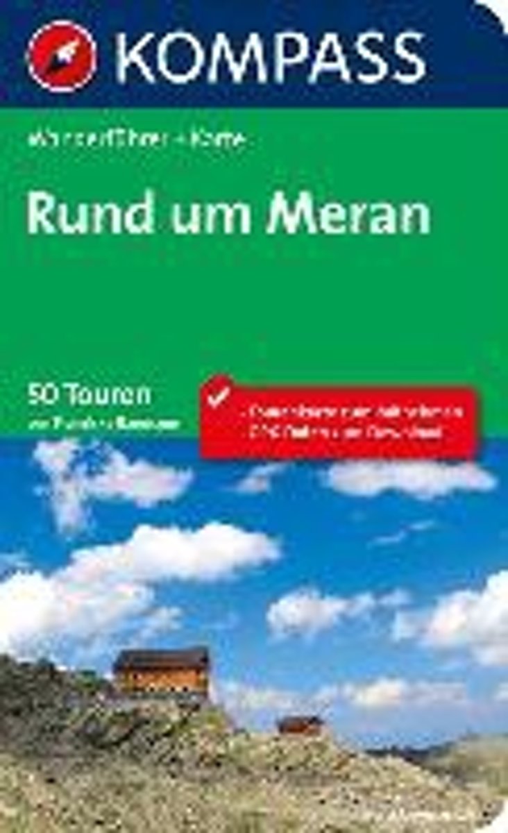
- WF5701 Rund um Meran Kompass
- . Praktische Tourenkarte im Maßstab 1:35000 zum Mitnehmen mit allen eingezeichneten Touren aus dem Wanderführer.. Icons im Farbbalken informieren über Schwierigkeitsgrad, Einkehrmöglichkeit, Kinderfreundlichkeit usw.. Informationen zu Ausgangspunkt, Charakter, Einkehr und Karte sind gleich zu Beginn jeder Tour übersichtlich zusammengefasst..... Read more
- Also available from:
- Bol.com, Belgium
Bol.com
Belgium
Belgium
- WF5701 Rund um Meran Kompass
- . Praktische Tourenkarte im Maßstab 1:35000 zum Mitnehmen mit allen eingezeichneten Touren aus dem Wanderführer.. Icons im Farbbalken informieren über Schwierigkeitsgrad, Einkehrmöglichkeit, Kinderfreundlichkeit usw.. Informationen zu Ausgangspunkt, Charakter, Einkehr und Karte sind gleich zu Beginn jeder Tour übersichtlich zusammengefasst..... Read more
Maps

Stanfords
United Kingdom
United Kingdom
- Grossglockner - Sonnblick - Kaprun - Zell am See F&B WK120
- Grossglockner - Sonnblick - Kaprun - Zell am See area of the Austrian Alps presented at 1:50,000 in a series of contoured and GPS compatible outdoor leisure map from Freytag & Berndt with hiking and cycling routes, mountain huts, campsites and youth hostels, local bus stops, plus other tourist information.To see the list of currently available... Read more

Stanfords
United Kingdom
United Kingdom
- Zell am See - Kaprun - Saalbach F&B WK382
- Zell-am-See - Kaprun - Saalbach area of the Austrian Alps presented at 1:50,000 in a series of contoured and GPS compatible outdoor leisure map from Freytag & Berndt with hiking and cycling routes, mountain huts, campsites and youth hostels, local bus stops, plus other tourist information. To see the list of currently available titles in this... Read more

Stanfords
United Kingdom
United Kingdom
- Mölltal - Kreuzeckgruppe - Drautal F&B WK225
- Mölltal - Kreuzeckgruppe - Drautal area of Carinthia presented at 1:50,000 in a series of contoured and GPS compatible outdoor leisure map from Freytag & Berndt with hiking and cycling routes, mountain huts, campsites and youth hostels, local bus stops, plus other tourist information.To see the list of currently available titles in this series... Read more

Stanfords
United Kingdom
United Kingdom
- Mayrhofen - Zillertal Alps - Gerlos - Krimml - Tuxertal - Zell im Zillertal F&B WK152
- Mayrhofen - Zillertal Alps - Gerlos - Krimml - Tuxertal - Zell im Zillertal area of the Austrian Alps presented at 1:50,000 in a series of contoured and GPS compatible outdoor leisure map from Freytag & Berndt with hiking and cycling routes, mountain huts, campsites and youth hostels, local bus stops, plus other tourist information.To see the... Read more

Stanfords
United Kingdom
United Kingdom
- Achensee - Rofan - Unterinntal F&B WK321
- Achensee - Rofan - Unterinntal area of the Austrian Alps north-east of Innsbruck presented at 1:50,000 in a series of contoured and GPS compatible outdoor leisure map from Freytag & Berndt with hiking and cycling routes, mountain huts, campsites and youth hostels, local bus stops, plus other tourist information. To see the list of currently... Read more

Stanfords
United Kingdom
United Kingdom
- Lienz - Schobergruppe - Hohe Tauern NP Kompass 48
- Lienz - Schobbergruppe - Hohe Tauern NP area of the Austrian Alps on a detailed, GPS compatible map at 1:50,000 from Kompass with local and long-distance footpaths, cycling routes, accommodation, etc, printed on durable, waterproof and tear-resistant synthetic paper. KOMPASS HIKING & RECREATIONAL MAPS: this title is part of an extensive series... Read more
Stanfords
United Kingdom
United Kingdom
- Zillertal Alps - Tux Alps Kompass 37
- Zillertal Alps - Mayrhofen - Zell am Ziller - Tuxer Voralpen (No. 37), a detailed, GPS compatible map at 1:50,000 from Kompass with local and long-distance footpaths, cycling routes, accommodation, etc, printed on durable, waterproof and tear-resistant synthetic paper. KOMPASS HIKING & RECREATIONAL MAPS:This title is part of an extensive series... Read more

Stanfords
United Kingdom
United Kingdom
- Zillertal Alps West Alpenverein Map 35/1
- Zillertal Alps West area of the Alps in a hiking edition at 1:25,000 from a series of detailed, GPS compatible maps published by the DAV - Deutscher Alpenverein and produced by the German and Austrian Alpine Clubs using cartography from their respective survey organizations. Maps in this series have topography vividly presented by contours at... Read more

Stanfords
United Kingdom
United Kingdom
- Wetterstein - Mieminger Gebirge East Alpenverein Map 4/3
- Wetterstein - Mieminger Gebirge East area of the Alps in a hiking edition at 1:25,000 from a series of detailed, GPS compatible maps published by the DAV - Deutscher Alpenverein and produced by the German and Austrian Alpine Clubs using cartography from their respective survey organizations. Maps in this series have topography vividly presented... Read more

Stanfords
United Kingdom
United Kingdom
- East Tyrol Cycling Atlas
- Cycling routes in the East Tyrol region of Austria presented at 1:75,000 by Verlag Esterbauer with essential information on accommodation, repair facilities, etc. All the text is in GERMAN only but extensive map legend includes English, as shown on our sample image.Esterbauer’s Bikeline guides in this series can be used without any knowledge of... Read more
Stanfords
United Kingdom
United Kingdom
- Kufstein - Walchsee - St. Johann in Tirol Kompass 09
- Kufstein - Walchsee - St.Johann in Tirol area in a detailed, GPS compatible map at 1:25,000 from Kompass with local and long-distance footpaths, cycling routes, accommodation, etc, printed on durable, waterproof and tear-resistant synthetic paper. KOMPASS HIKING & RECREATIONAL MAPS:This title is part of an extensive series covering Austria,... Read more
Stanfords
United Kingdom
United Kingdom
- Defereggental - Villgratental Kompass 45
- Defereggental - Lasörlinggruppe (No. 45), a detailed, GPS compatible map at 1:50,000 from Kompass with local and long-distance footpaths, cycling routes, accommodation, etc, printed on durable, waterproof and tear-resistant synthetic paper. This title has on the reverse an additional panorama map of the region.KOMPASS HIKING & RECREATIONAL... Read more

Stanfords
United Kingdom
United Kingdom
- Vorderes Zillertal - Achensee - Alpbachtal - Wildschonau Kompass 28
- Vorderes Zillertal - Alpbach - Rofan - Wildschönau (No. 28), a detailed, GPS compatible map at 1:50,000 from Kompass with local and long-distance footpaths, cycling routes, accommodation, etc, printed on durable, waterproof and tear-resistant synthetic paper. This title has on the reverse an additional panorama map of the region. KOMPASS HIKING... Read more
Stanfords
United Kingdom
United Kingdom
- Karwendel Range Kompass 26
- Karwendelgebirge area of the German Alps on a detailed, GPS compatible map at 1:50,000 from Kompass with local and long-distance footpaths, cycling routes, accommodation, etc, printed on durable, waterproof and tear-resistant synthetic paper. KOMPASS HIKING & RECREATIONAL MAPS: this title is part of an extensive series covering Austria, much of... Read more

Stanfords
United Kingdom
United Kingdom
- Granatspitzgruppe Alpenverein KOMBI Map 39
- Granatspitzgruppe area of the Alps in a combined hiking and ski edition at 1:25,000 from a series of detailed, GPS compatible maps published by the DAV - Deutscher Alpenverein and produced by the German and Austrian Alpine Clubs using cartography from their respective survey organizations. Maps in this series have topography vividly presented... Read more