
Rolwaling
Description
This region is not far from the Everest region, or Kbumbu Himal. The trek from this valley to Solo Khumbu region is possible, but difficult.
Links
Facts
Reports
Guides and maps
Lodging
Organisations
Tour operators
GPS
Other
Books


The Book Depository
United Kingdom
United Kingdom
- The Great Himalaya Trail N3
- The Rara, Jumla & Mugu Section Read more


- Also available from:
- Bol.com, Belgium
Bol.com
Netherlands
Netherlands
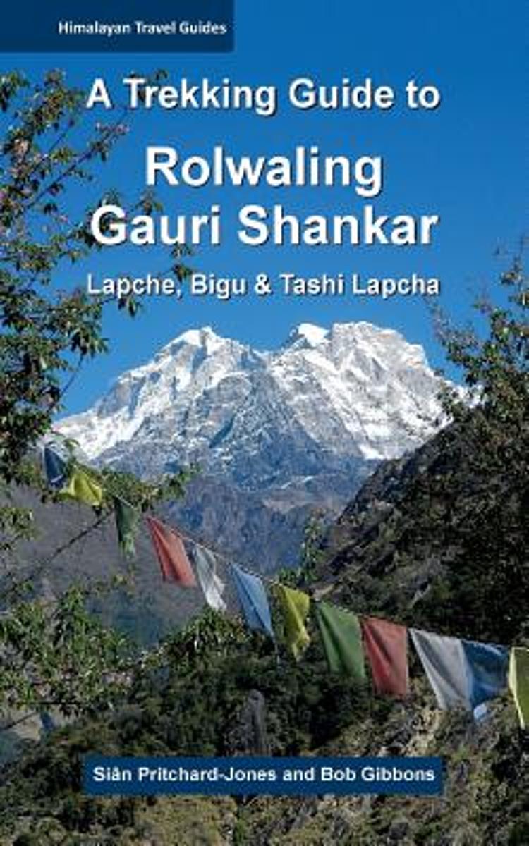
- A Trekking Guide to Rolwaling & Gauri Shankar
- Secretive and serene, the Gauri Shankar/Rolwaling trekking area offers an unspoilt, less visited, more authentic Himalayan experience. An inspirational array of climbing peaks lures ever more mountaineers. For some, crossing the Tashi Lapcha pass adds to the magic. The long-forgotten Lapche Valley is a fairytale wonderland, barely accessible on... Read more
- Also available from:
- Bol.com, Belgium
Bol.com
Belgium
Belgium
- A Trekking Guide to Rolwaling & Gauri Shankar
- Secretive and serene, the Gauri Shankar/Rolwaling trekking area offers an unspoilt, less visited, more authentic Himalayan experience. An inspirational array of climbing peaks lures ever more mountaineers. For some, crossing the Tashi Lapcha pass adds to the magic. The long-forgotten Lapche Valley is a fairytale wonderland, barely accessible on... Read more
Bol.com
Netherlands
2015
Netherlands
2015
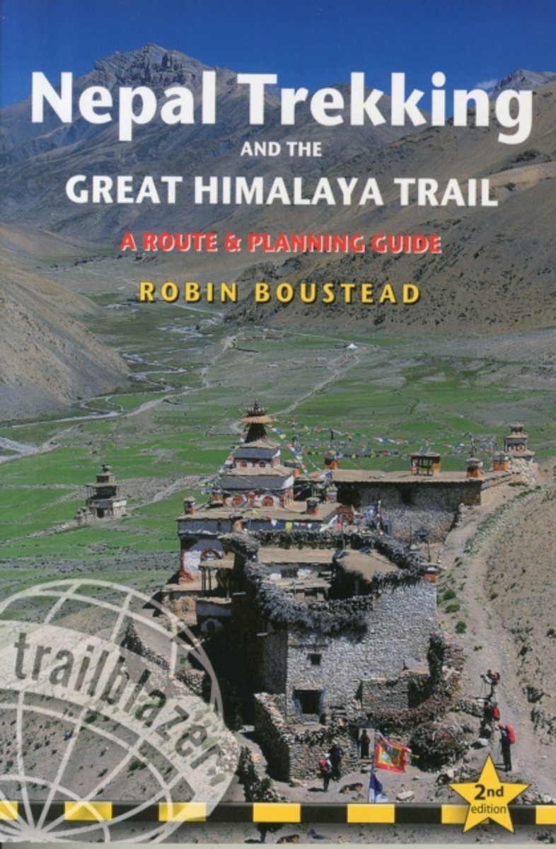
- Nepal Trekking & the Great Himalaya Trail
- With extensive sections to help choose a trekking region, this is a route and planning guide for anyone organising a trekking holiday in Nepal. It includes the most popular routes as well as the newest trekking areas plus the most extreme route of all, the 160-day Great Himalaya Trail. There are route guides to the following regions:... Read more
- Also available from:
- Bol.com, Belgium
Bol.com
Belgium
2015
Belgium
2015
- Nepal Trekking & the Great Himalaya Trail
- With extensive sections to help choose a trekking region, this is a route and planning guide for anyone organising a trekking holiday in Nepal. It includes the most popular routes as well as the newest trekking areas plus the most extreme route of all, the 160-day Great Himalaya Trail. There are route guides to the following regions:... Read more
Bol.com
Netherlands
Netherlands
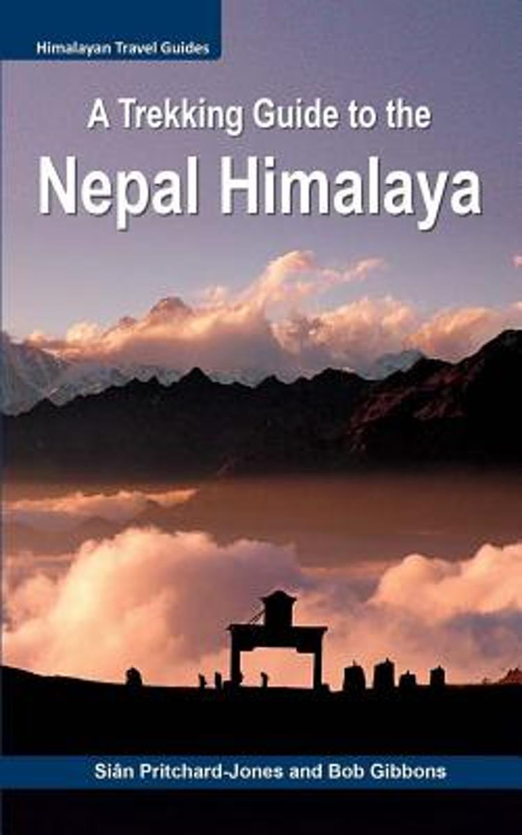
- A Trekking Guide to the Nepal Himalaya
- For centuries the inspirational spires of the Himalaya have been a magical draw for mystics, sages, hermits and pilgrims. Today the fascination with these highest mountains continues for trekkers, climbers, naturalists, explorers and the curious, all seeking a new experience. Secretive and serene, the Nepal Himalaya are a fairytale wonderland... Read more
- Also available from:
- Bol.com, Belgium
Bol.com
Belgium
Belgium
- A Trekking Guide to the Nepal Himalaya
- For centuries the inspirational spires of the Himalaya have been a magical draw for mystics, sages, hermits and pilgrims. Today the fascination with these highest mountains continues for trekkers, climbers, naturalists, explorers and the curious, all seeking a new experience. Secretive and serene, the Nepal Himalaya are a fairytale wonderland... Read more

The Book Depository
United Kingdom
2018
United Kingdom
2018
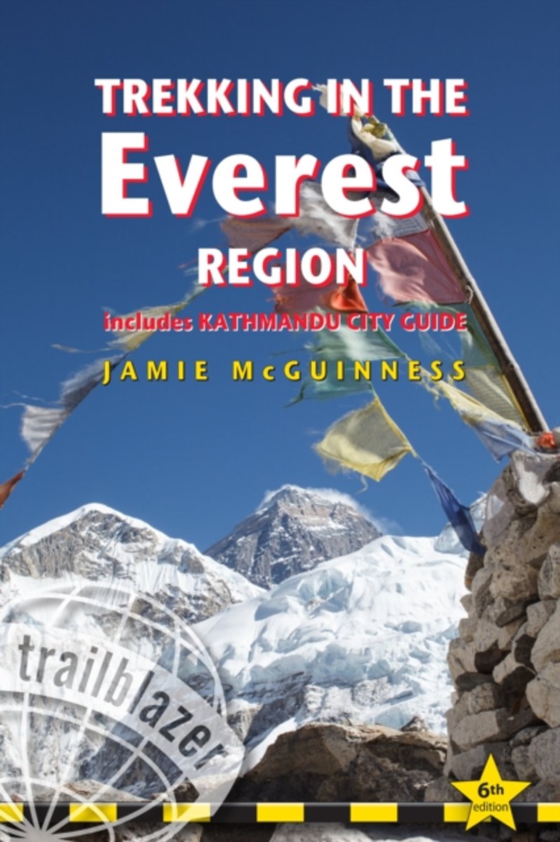
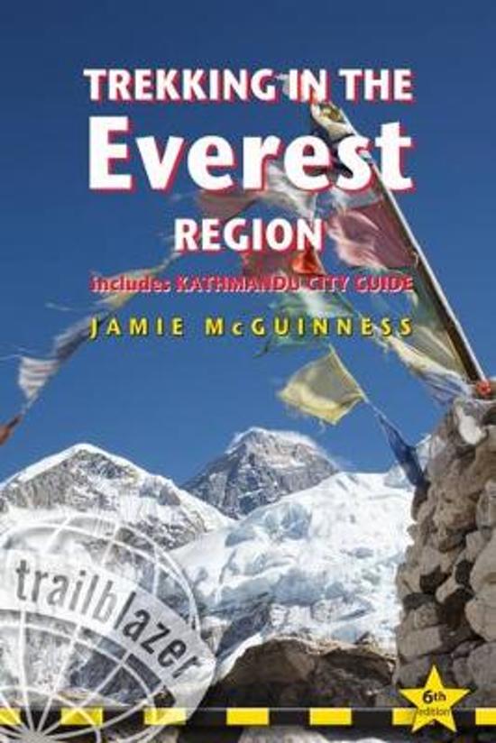
- Trekking in the Everest Region
- Practical Guide with 27 Detailed Route Maps & 52 Village Plans, Includes Kathmandu City Guide Read more
- Also available from:
- Bol.com, Netherlands
- Bol.com, Belgium
- De Zwerver, Netherlands
Bol.com
Netherlands
2018
Netherlands
2018
- Trekking in the Everest Region
- Fully revised fifth edition of this practical guide with 27 detailed route maps covering not only the classic treks but also the wild routes: Everest expedition route, Rolwaling, trekking from Lukla Salpa-Arun, the Gokyo trek, High passes, trekking peaks including Mera and Island Peak. Information for all budgets and trekking styles. Ranging... Read more
Bol.com
Belgium
2018
Belgium
2018
- Trekking in the Everest Region
- Fully revised fifth edition of this practical guide with 27 detailed route maps covering not only the classic treks but also the wild routes: Everest expedition route, Rolwaling, trekking from Lukla Salpa-Arun, the Gokyo trek, High passes, trekking peaks including Mera and Island Peak. Information for all budgets and trekking styles. Ranging... Read more
De Zwerver
Netherlands
2018
Netherlands
2018
- Wandelgids Trekking in the Everest Region | Trailblazer Guides
- Fully revised fifth edition of this practical guide with 27 detailed route maps covering not only the classic treks but also the wild routes: Everest expedition route, Rolwaling, trekking from Lukla Salpa-Arun, the Gokyo trek, High passes, trekking peaks including Mera and Island Peak. Information for all budgets and trekking styles. Ranging... Read more
Maps

Stanfords
United Kingdom
United Kingdom
- Khumbu - Jiri to Everest Nepa Maps Trekking Map
- Trekking route from Juri to Lukla and Namche Bazaar, and then on to the Everest Base Camp presented on a map at 1:100,000 from Nepa Maps. In addition to the main trekking route from Jiri to Mt Everest the map also highlights several other routes in the Khumbu region including treks to Gokyo Lakes, Island Peak (Imja Tse), Mera Peak, Amphu Labsta... Read more

Stanfords
United Kingdom
United Kingdom
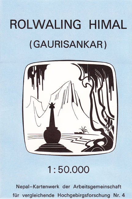
- Rolwaling Himal (Gaurisankar)
- Rolwaling Himal (Gaurisankar) region at 1:50,000 in a series of detailed topographic maps of selected trekking areas of Nepal originally prepared by E. Schneider and now edited by the German Scientific Association of Comparative High-Mountain Research (Arbeitsgemeinschaft für vergleichende Hochgebirgsforschung).Traditionally referred to as “the... Read more

Stanfords
United Kingdom
United Kingdom
- Rolwaling Region Great Himalaya Trail Map SUPERCEDED
- The Rolwaling, map no. 104, at 1:100,000 on a waterproof and tear-resistant trekking map from the Himalayan MapHouse in their series covering the whole of northern Nepal. The map highlights main trekking routes from Jiri, both north and south of the town, including the first sections of the Jiri/Everest and Jiri/Pikey Peak trails, the Numbur... Read more
Stanfords
United Kingdom
United Kingdom
- Tamba Kosi - Likhu Khola
- Tamba Kosi - Likhu Khola region at 1:50,000 in a series of detailed topographic maps of selected trekking areas of Nepal originally prepared by E. Schneider and now edited by the German Scientific Association of Comparative High-Mountain Research (Arbeitsgemeinschaft für vergleichende Hochgebirgsforschung). The map covers the area south of the... Read more

Stanfords
United Kingdom
United Kingdom
- Numbur Cheese Circuit
- Numbur Cheese Circuit at 1:100,000 in the Nepa Maps series which provides extensive coverage of trekking areas of Nepal on detailed contoured maps with trekking routes and hiking trails, huts and camp sites, local places of interest and other tourist information.The map covers the same area as the publishers’ “Jiri to Everest” title and has... Read more

Stanfords
United Kingdom
United Kingdom
- Rolwaling Region Great Himalaya Trail Map
- The Rolwaling, map no. 104, at 1:100,000 on a waterproof and tear-resistant trekking map from the Himalayan MapHouse in their series covering the whole of northern Nepal. The map highlights main trekking routes from Jiri, both north and south of the town, including the first sections of the Jiri/Everest and Jiri/Pikey Peak trails, the Numbur... Read more

De Zwerver
Netherlands
Netherlands
- Wandelkaart The Great Himalaya Trail | GHT
- Prachtige kaartenserie van één van 'swerelds mooiste wandeltochten. The Far West is one of the least explored areas of Nepal. Its area is bounded to the east by mighty, turquoise Karnali river which flows from Tibet’s sacred Mount Kailash. Myth and superstition remain part of the fabric of life here. Though the Nepali language originated... Read more
De Zwerver
Netherlands
Netherlands