
Southern Uplands
Description
The sparsely populated southern part of Scotland is located south of the line Edinburgh - Prestwick and north of the English border. In this empty space, quite a few long distance trails are laid out. The most important of them is the Southern Upland Way, traversing the entire distance from coast to coast. The mountains may be not as high as in the Highlands, they are wild and remote nevertheless.
Trails in this region
Links
Facts
Reports
Guides and maps
Lodging
Organisations
Tour operators
GPS
Other
Books

Stanfords
United Kingdom
United Kingdom
- Pilgrimage: The Great Pilgrim Routes of Britain and Europe
- Shortlisted for a 2018 Edward Stanford Travel Writing Award.Ten historic pilgrim routes of Western Europe, inspiration for today`s long distance walker. Pilgrimage in Europe is thriving on a massive scale. In 1990 the cathedral at Santiago de Compostela recorded less than 5000 pilgrims: today that figure is at least 200,000 a year. Author Derry... Read more

- Also available from:
- De Zwerver, Netherlands


- Also available from:
- De Zwerver, Netherlands


- Also available from:
- De Zwerver, Netherlands


- Also available from:
- De Zwerver, Netherlands


Stanfords
United Kingdom
United Kingdom
- Cheviot Hills - Jedburgh & Wooler OS Explorer Map OL16 (paper)
- The Cheviot Hills on a detailed topographic and GPS compatible map OL16, paper version, from the Ordnance Survey’s 1:25,000 Explorer series. Coverage includes Jedburgh, Woolmer, part of the Northumberland National Park, the peaks of The Cheviot, Corby Pike, Cold Law, Scrathy Holes and Windy Gyle, Catcleugh Reservoir, sections of the Pennine Way... Read more
- Also available from:
- The Book Depository, United Kingdom
- De Zwerver, Netherlands


De Zwerver
Netherlands
Netherlands

- Also available from:
- De Zwerver, Netherlands


- Also available from:
- De Zwerver, Netherlands


Stanfords
United Kingdom
2016
United Kingdom
2016
- North York Moors Western OS Explorer Map OL26 (paper)
- The western part of the North York Moors National Park on a detailed topographic and GPS compatible map OL26, paper version, from the Ordnance Survey’s 1:25,000 Explorer series. Coverage extends from Ampleforth in the south northwards to Saltburn-by-the-Sea, and from Ingleby Arncliffe to Danby, Castleton and Hutton-le-Hole, and includes... Read more
- Also available from:
- The Book Depository, United Kingdom
- De Zwerver, Netherlands


De Zwerver
Netherlands
2016
Netherlands
2016

- Also available from:
- De Zwerver, Netherlands


- Also available from:
- De Zwerver, Netherlands

Maps

Stanfords
United Kingdom
United Kingdom
- Luxembourg North
- One of two topographic survey maps of Luxembourg at 1:50,000, with contours at 10-metres intervals and additional relief shading. An overprint highlights long-distance footpaths, including the GR5 (E-2), cycle routes, and various places of interest, including campsites. The map covers an area of approximately 53 x 43 km / 33 x 27 miles. Map... Read more

Stanfords
United Kingdom
United Kingdom
- Luxembourg South
- One of two topographic survey maps of Luxembourg at 1:50,000, with contours at 10-metres intervals and additional relief shading. An overprint highlights long-distance footpaths, including the GR5 (E-2), cycle routes, and various places of interest, including campsites. The map covers an area of approximately 53 x 43 km / 33 x 27 miles. Map... Read more

Bol.com
Netherlands
2010
Netherlands
2010
- St Cuthbert's Way
- Follow the footsteps of St Cuthbert in this easy-going walk of 62 miles (100 km) from Melrose Abbey in the Scottish borders to the Holy Island of Lindisfarne in the North Sea. The route passes many fine abbeys, hill forts and castles, includes a section of Roman road and finishes with the barefoot Pilgrims' Path across tidal sands. The walk can... Read more
- Also available from:
- Bol.com, Belgium
Bol.com
Belgium
2010
Belgium
2010
- St Cuthbert's Way
- Follow the footsteps of St Cuthbert in this easy-going walk of 62 miles (100 km) from Melrose Abbey in the Scottish borders to the Holy Island of Lindisfarne in the North Sea. The route passes many fine abbeys, hill forts and castles, includes a section of Roman road and finishes with the barefoot Pilgrims' Path across tidal sands. The walk can... Read more
De Zwerver
Netherlands
Netherlands
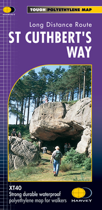
- Wandelkaart St Cuthbert's Way | Harvey Maps
- St. Cuthbert's Way, a 100km / 62.5 mile route from Melrose in the Scottish Borders through the Northumberland National Park to the Holly Island of Lindisfarne, presented at 1:40,000 on a GPS compatible, light, waterproof and tear-resistant map from Harvey Map Services. The route is shown on six panels, with additional small street plans of... Read more

The Book Depository
United Kingdom
United Kingdom
- La Palma Hiking + Leisure Map 1:30 000
- Uitstekende wandelkaart van La Palma, tweezijdig, met ingetekende routes, hoogtelijnen en andere belangrijke informatie. Ook met fietsroutes, bovendien GPS geschikt! Read more
- Also available from:
- Bol.com, Netherlands
- Bol.com, Belgium
- De Zwerver, Netherlands

Bol.com
Netherlands
Netherlands
- FB WKE2 La Palma
- Dubbelzijdige wandel- en vrijetijdskaart • toeristische tips • stadsplattegronden • fietspaden en mountainbikeroutes • GPS-punten • ski- en langlaufroutes Read more
Bol.com
Belgium
Belgium
- FB WKE2 La Palma
- Dubbelzijdige wandel- en vrijetijdskaart • toeristische tips • stadsplattegronden • fietspaden en mountainbikeroutes • GPS-punten • ski- en langlaufroutes Read more

De Zwerver
Netherlands
Netherlands
- Wandelkaart WKE2 La Palma | Freytag & Berndt
- Uitstekende wandelkaart van La Palma, tweezijdig, met ingetekende routes, hoogtelijnen en andere belangrijke informatie. Ook met fietsroutes, bovendien GPS geschikt! Read more