
Solent Way
Description
- Name Solent Way
- Length of trail 97 km, 60 miles
- Length in days 5 days
- Traildino grading EW, Easy walk, nature trail
 60 miles. 97 km.
The Solent Way is a coast path on Englands south coast, passing Southampton, in view of the Isle of Man. “Solent” is the name of the sea streat between this island and mainland England. It forms part of the European Long Distance Path E9, from Portugal to Estonia.
The trail is pretty flat, but the pleasures one encounters are manyfold: the funny English beach resorts, industry, cities, harbours, old villages, new villages, the busy boat traffic, and also nature.
Select some tracks
☐Solent Way, 104km
Map

Links
Facts
Reports
Guides and maps
Lodging
Organisations
Tour operators
GPS
Other
Books

Stanfords
United Kingdom
United Kingdom
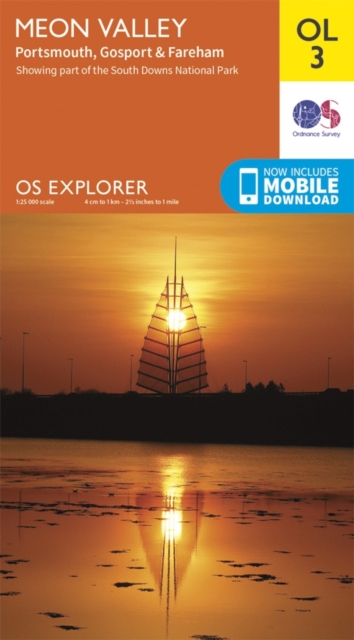
- Meon Valley, Portsmouth, Gosport & Fareham OS Explorer Active Map OL3 (waterproof)
- Meon Valley, Portsmouth, Gosport and Fareham area of south Hampshire on a detailed topographic and GPS compatible map OL3, waterproof version, from the Ordnance Survey’s 1:25,000 Explorer series. Coverage extends from the coast to Owslebury and East Meon, and includes part of the South Downs National Park, a section of the South Downs Way... Read more

Stanfords
United Kingdom
United Kingdom
- New Forest - Southampton, Ringwood, Ferndown, Lymington, Christchurch & Bournemouth OS Explorer Active Map OL22 (waterproof)
- The New Forest on a detailed topographic and GPS compatible map OL22, waterproof version, from the Ordnance Survey’s 1:25,000 Explorer series. Coverage along the coast extends from Southampton with Southampton Water to Bournemouth, and includes Eastleigh, Totton, Lymington with the ferry link to the Isle of Wight, Christchurch, Ringwood, the... Read more

Stanfords
United Kingdom
United Kingdom
- Meon Valley, Portsmouth, Gosport & Fareham OS Explorer Map OL3 (paper)
- Meon Valley, Portsmouth, Gosport and Fareham area of south Hampshire on a detailed topographic and GPS compatible map OL3, paper version, from the Ordnance Survey’s 1:25,000 Explorer series. Coverage extends from the coast to Owslebury and East Meon, and includes part of the South Downs National Park, a section of the South Downs Way National... Read more
- Also available from:
- The Book Depository, United Kingdom
- De Zwerver, Netherlands

De Zwerver
Netherlands
Netherlands

Stanfords
United Kingdom
United Kingdom
- Purbeck & South Dorset - Poole, Dorchester - Weymouth & Swanage OS Explorer Active Map OL15 (waterproof)
- Purbeck and the southern part of Dorset on a detailed topographic and GPS compatible map OL15, waterproof version, from the Ordnance Survey’s 1:25,000 Explorer series. Coverage extends from Poole and Swanage in the east to Bridport in the west, and includes Dorchester, Tolpuddle, Bere Regis, Wareham, Weymouth, Chesil Beach, Portland Bill, the... Read more
- Also available from:
- The Book Depository, United Kingdom

The Book Depository
United Kingdom
United Kingdom

Stanfords
United Kingdom
United Kingdom
- Purbeck & South Dorset - Poole, Dorchester - Weymouth & Swanage OS Explorer Map OL15 (paper)
- Purbeck and the southern part of Dorset on a detailed topographic and GPS compatible map OL15, paper version, from the Ordnance Survey’s 1:25,000 Explorer series. Coverage extends from Poole and Swanage in the east to Bridport in the west, and includes Dorchester, Tolpuddle, Bere Regis, Wareham, Weymouth, Chesil Beach, Portland Bill, the final... Read more
- Also available from:
- The Book Depository, United Kingdom
- Bol.com, Netherlands
- Bol.com, Belgium
- De Zwerver, Netherlands

The Book Depository
United Kingdom
United Kingdom

Bol.com
Netherlands
Netherlands
- Purbeck & South Dorset, Poole, Dorchester, Weymouth & Swanage
- OS Explorer is the Ordnance Survey's most detailed map and is recommended for anyone enjoying outdoor activities like walking, horse riding and off-road cycling. The OS Explorer range of OL maps now includes a digital version of the paper map, accessed through the OS smartphone app, OS Maps. Providing complete GB coverage the series details... Read more
Bol.com
Belgium
Belgium
- Purbeck & South Dorset, Poole, Dorchester, Weymouth & Swanage
- OS Explorer is the Ordnance Survey's most detailed map and is recommended for anyone enjoying outdoor activities like walking, horse riding and off-road cycling. The OS Explorer range of OL maps now includes a digital version of the paper map, accessed through the OS smartphone app, OS Maps. Providing complete GB coverage the series details... Read more

De Zwerver
Netherlands
Netherlands