
Loire
Description
France's longest river.
Links
Facts
Reports
Guides and maps
Lodging
Organisations
Tour operators
GPS
Other
Books

Stanfords
United Kingdom
2011
United Kingdom
2011
- Le Parc de Millevaches en Limousin à pied FFRP Topo-guide No. PN17
- Le Parc de Millevaches en Limousin à pied, topo-guide Ref. No. PN017, with 18 day walks of varying length and difficulty, plus 270kms of hiking circuits in the department of Creuse. Current edition of this title was published in March 2011.To see the list of other FFRP guides with day walks please click on the series link.ABOUT THE FFRP... Read more

Stanfords
United Kingdom
United Kingdom
- Le Pays de Charlieu-Belmont à pied P423
- Le Pays de Belmont-de-la-Loire à pied, FFRP topo-guide ref. no. P423, with 16 day walks of varying length and difficult near Belmont-de-la-Loire . Current edition of this title was published in May 2008.To see the list of other FFRP guides with day walks please click on the series link.ABOUT THE FFRP (Fédération française de la randonnée... Read more
Stanfords
United Kingdom
2019
United Kingdom
2019
- La Loire à pied
- La Loire à pied, FFRP topo-guide ref. no. D042, one of the titles in an extensive series of light, A5-size, high quality paperback guides published by the Fédération Française de la Randonnée Pédestre in association with local authorities, ramblers’ clubs, etc. The guides have *colour extracts from the French topographic survey at 1:25,000 or... Read more
Stanfords
United Kingdom
2019
United Kingdom
2019
- Mézenc - meygal et haute vallee de le Loire
- Le Pays de la Loire Sauvage et du Mézenc à pied, FFRP topo-guide Ref. No.P435, with 26 day walks of varying length and difficulty in the region south-east of Le Puy-en-Velay. Each walk is presented on a separate colour extract from IGN’s topographic survey of France at 1:25,000, with its description cross-referenced to the map. Current edition... Read more

Stanfords
United Kingdom
United Kingdom
- Rick Steves Best of France (Third Edition)
- Hit France`s can`t-miss art, sights, and bites in two weeks or less with Rick Steves Best of France! Inside you`ll find:Strategic advice from Rick Steves on what`s worth your time and moneyShort itineraries covering the best of Paris, Normandy, the Loire, Dordogne, Provence, the French Riviera, and Burgundy, including Versailles, Nice, the... Read more

Stanfords
United Kingdom
United Kingdom
- Les Marches du Velay à pied FFRP Topo-guide No. P43D
- Les Marches du Velay à pied, FFRP topo-guide Ref. No. P43D, with 21 day walks of varying length and difficulty near Monistril-sur-Loire. Each walk is presented on a separate colour extract from IGN’s topographic survey of France at 1:25,000, with its description cross-referenced to the map. Current edition of this title was published in May... Read more

Stanfords
United Kingdom
2007
United Kingdom
2007
- Le Centre: Val de Loire à pied FFRP Topo-guide No. RE11
- Le Centre: Val de Loire à pied, FFRP topo-guide ref. no. RE08, one of the titles in an extensive series of light, A5-size, high quality paperback guides published by the Fédération Française de la Randonnée Pédestre in association with local authorities, ramblers’ clubs, etc. The guides have *colour extracts from the French topographic survey... Read more
Stanfords
United Kingdom
2018
United Kingdom
2018
- Les Gorges de la Loire à pied
- Les Gorges de la Loire à pied, FFRP topo-guide Ref. No.P425, with 15 day walks of varying length and difficulty east of St-Etienne. The guide also includes a 28km long circuit along both banks of the river. Each walk is presented on a separate colour extract from IGN’s topographic survey of France at 1:25,000, with its description... Read more

Stanfords
United Kingdom
United Kingdom
- Amboise - Montlouis-sur-Loire IGN 1922SB
- Topographic survey of France at 1:25,000 in IGN`s excellent TOP25 / Série Bleue series. All the maps are GPS compatible, with a 1km UTM grid plus latitude and longitude lines at 5’ intervals. Contours are at 5m intervals except for mountainous areas where the maps have contours at 10m intervals, vividly enhanced by hill shading and graphics for... Read more

Stanfords
United Kingdom
United Kingdom
- Chemins de St.Jacques: Cluny/Lyon - Le Puy à pied
- Chemins de St.Jacques: Cluny/Lyon-Le Puy à pied from Chamina presents the route overprinted on IGN’s 1:50,000 topographic survey with details of accommodation, local services and other tourist information.Each stage is shown on extracts from IGN`s 1:50,000 topographic survey cross-referenced to the descriptions of the route. Symbols indicate... Read more

The Book Depository
United Kingdom
2021
United Kingdom
2021
- Also available from:
- De Zwerver, Netherlands

Stanfords
United Kingdom
United Kingdom
- Thouars - Airvault IGN 25K Série Bleue Map 1625SB
- Topographic survey of France at 1:25,000 in IGN`s excellent TOP25 / Série Bleue series. All the maps are GPS compatible, with a 1km UTM grid plus latitude and longitude lines at 5’ intervals. Contours are at 5m intervals except for mountainous areas where the maps have contours at 10m intervals, vividly enhanced by hill shading and graphics for... Read more
- Also available from:
- De Zwerver, Netherlands
De Zwerver
Netherlands
Netherlands
- Topografische kaart - Wandelkaart 1625SB Thouars | IGN - Institut Géographique National
- L'indispensable carte de randonnée IGN. A conserver dans son sac à dos Read more
Bol.com
Netherlands
Netherlands
- Fodor's Essential France
- Written by locals, Fodor's travel guides have been offering expert advice for all tastes and budgets for 80 years. Unforgettable artwork, heavenly villages, and dream cities--there are so many reasons to visit France that deciding where to go and what to do can be a bit overwhelming. Fodor's Essential France takes the guesswork out of choosing... Read more
- Also available from:
- Bol.com, Belgium
Bol.com
Belgium
Belgium
- Fodor's Essential France
- Written by locals, Fodor's travel guides have been offering expert advice for all tastes and budgets for 80 years. Unforgettable artwork, heavenly villages, and dream cities--there are so many reasons to visit France that deciding where to go and what to do can be a bit overwhelming. Fodor's Essential France takes the guesswork out of choosing... Read more
Stanfords
United Kingdom
2018
United Kingdom
2018
- Le Pays des Sucs et del la Loire au Meygal à pied P438
- Le Pays des Sucs et du Meygal à pied, FFRP topo-guide Ref. No. P438, with 26 day walks of varying length and difficulty in the area west and north-west of Le-Puy-en-Velay. Each walk is presented on a separate colour extract from IGN’s topographic survey of France at 1:25,000 or 1:50,000, with its description cross-referenced to the map. Current... Read more
- Also available from:
- De Zwerver, Netherlands
De Zwerver
Netherlands
2018
Netherlands
2018
- Wandelgids P438 Le Pays des Sucs, de la Loire au Meygal à pied | FFRP
- Le Pays des Sucs et du Meygal à pied, FFRP topo-guide Ref. No. P438, with 26 day walks of varying length and difficulty in the area west and north-west of Le-Puy-en-Velay. Each walk is presented on a separate colour extract from IGN’s topographic survey of France at 1:25,000 or 1:50,000, with its description cross-referenced to the map. Current... Read more

Stanfords
United Kingdom
United Kingdom
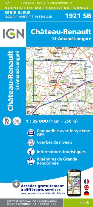
- Chateau-Renault - St-Amand-Longpre IGN 25K Série Bleue Map 1921SB
- Topographic survey of France at 1:25,000 in IGN`s excellent TOP25 / Série Bleue series. All the maps are GPS compatible, with a 1km UTM grid plus latitude and longitude lines at 5’ intervals. Contours are at 5m intervals except for mountainous areas where the maps have contours at 10m intervals, vividly enhanced by hill shading and graphics for... Read more
- Also available from:
- De Zwerver, Netherlands
De Zwerver
Netherlands
Netherlands
- Wandelkaart - Topografische kaart 1921SB Château-Renault, St-Amand-Longpré | IGN - Institut Géographique National
- L'indispensable carte de randonnée IGN aux alentours de Château-Renault - St-Amand-Longpré. A conserver dans son sac à dos. Read more
Maps

Stanfords
United Kingdom
United Kingdom
- Saint-Etienne-de-Montluc - la Bernerie-en-Retz IGN 25K Série Bleue Map 1124SB
- Topographic survey of France at 1:25,000 in IGN`s excellent TOP25 / Série Bleue series. All the maps are GPS compatible, with a 1km UTM grid plus latitude and longitude lines at 5’ intervals. Contours are at 5m intervals except for mountainous areas where the maps have contours at 10m intervals, vividly enhanced by hill shading and graphics for... Read more

Stanfords
United Kingdom
United Kingdom
- La Loupe - Remalard IGN 1916SB
- Topographic survey of France at 1:25,000 in IGN`s excellent TOP25 / Série Bleue series. All the maps are GPS compatible, with a 1km UTM grid plus latitude and longitude lines at 5’ intervals. Contours are at 5m intervals except for mountainous areas where the maps have contours at 10m intervals, vividly enhanced by hill shading and graphics for... Read more

Stanfords
United Kingdom
United Kingdom
- France Chamina Edition Greenways and Cycle Routes Atlas
- Guarantee of quality and reliability, the Atlas France of greenways & cycle routes Chamina is enriched this year by more than 1,000 km of cycle route: 2 new cycle routes (The Flow Vélo and the EuroVelo 4 - Tour de Manche) , as well as the updating of the extensive routes such as the ViaRhôna, the Vélo Francette, the EuroVelo 6 and the... Read more

Stanfords
United Kingdom
United Kingdom
- Forêt de Fontainebleau - Forêt des Trois Pignons IGN WATERPROOF 2417OTR
- Topographic survey of France at 1:25,000 in IGN`s excellent TOP25 / Série Bleue series. All the maps are GPS compatible, with a 1km UTM grid plus latitude and longitude lines at 5’ intervals. Contours are at 5m intervals except for mountainous areas where the maps have contours at 10m intervals, vividly enhanced by hill shading and graphics for... Read more

Stanfords
United Kingdom
United Kingdom
- Chatillon-sur-Indre - Ecueille IGN 2024SB
- Topographic survey of France at 1:25,000 in IGN`s excellent TOP25 / Série Bleue series. All the maps are GPS compatible, with a 1km UTM grid plus latitude and longitude lines at 5’ intervals. Contours are at 5m intervals except for mountainous areas where the maps have contours at 10m intervals, vividly enhanced by hill shading and graphics for... Read more

Stanfords
United Kingdom
United Kingdom
- Illiers-Combray - Bailleau-le-Pin IGN 25K Série Bleue Map 2017SB
- Topographic survey of France at 1:25,000 in IGN`s excellent TOP25 / Série Bleue series. All the maps are GPS compatible, with a 1km UTM grid plus latitude and longitude lines at 5’ intervals. Contours are at 5m intervals except for mountainous areas where the maps have contours at 10m intervals, vividly enhanced by hill shading and graphics for... Read more

Stanfords
United Kingdom
United Kingdom
- Châteauroux - Levroux - Villedieu-sur-Indre IGN 25K Série Bleue Map 2125SB
- Topographic survey of France at 1:25,000 in IGN`s excellent TOP25 / Série Bleue series. All the maps are GPS compatible, with a 1km UTM grid plus latitude and longitude lines at 5’ intervals. Contours are at 5m intervals except for mountainous areas where the maps have contours at 10m intervals, vividly enhanced by hill shading and graphics for... Read more

Stanfords
United Kingdom
United Kingdom
- Montrichard - St-Aignan IGN 2023SB
- Topographic survey of France at 1:25,000 in IGN`s excellent TOP25 / Série Bleue series. All the maps are GPS compatible, with a 1km UTM grid plus latitude and longitude lines at 5’ intervals. Contours are at 5m intervals except for mountainous areas where the maps have contours at 10m intervals, vividly enhanced by hill shading and graphics for... Read more

Stanfords
United Kingdom
United Kingdom
- Forêt de Fontainebleau - Forêt des Trois Pignons IGN 2417OT
- Topographic survey of France at 1:25,000 in IGN`s excellent TOP25 / Série Bleue series. All the maps are GPS compatible, with a 1km UTM grid plus latitude and longitude lines at 5’ intervals. Contours are at 5m intervals except for mountainous areas where the maps have contours at 10m intervals, vividly enhanced by hill shading and graphics for... Read more

Stanfords
United Kingdom
United Kingdom
- Pays de la Loire IGN Regional NR07
- IGN publishes its new collection of regional maps including the official division of the 13 new regions. The largest regions are well represented on a single map. These maps are double sided and in 6 languages. Read more


Stanfords
United Kingdom
United Kingdom
- Romorantin-Lanthenay - Cour-Cheverny IGN 2122SB
- Topographic survey of France at 1:25,000 in IGN`s excellent TOP25 / Série Bleue series. All the maps are GPS compatible, with a 1km UTM grid plus latitude and longitude lines at 5’ intervals. Contours are at 5m intervals except for mountainous areas where the maps have contours at 10m intervals, vividly enhanced by hill shading and graphics for... Read more

Stanfords
United Kingdom
United Kingdom
- Centre - Val de Loire IGN Regional NR08
- IGN publishes its new collection of regional maps including the official division of the 13 new regions. The largest regions are well represented on a single map. These maps are double sided and in 6 languages. Read more

Stanfords
United Kingdom
United Kingdom
- La ViaRhôna à vélo - from Lake Geneva to the Mediterranean FRENCH
- PLEASE NOTE ALL TEXT IS IN FRENCHAmong the major cycling routes, the ViaRhôna is the one that arouses the most expectation because of the exceptional appeal of its route. Heading south, from Léman to Camargue and Sète, in 36 stages and 780 km of a course fully marked by the authors, you will travel with a guide with more than 300 good... Read more

Stanfords
United Kingdom
United Kingdom
- Loire Cycle Route: Nevers to the Atlantic (690km) Bikeline Map/Guide
- Loire Cycle Route, a 690-km long stretch of the EuroVelo6 route along the Loire from Nevers in Burgundy to the Atlantic, presented by the Verlag Esterbauer in a guide with maps at 1:50,000 showing the route and its variants. Extensive information is conveyed by symbols, indicating road surface, campsites and other accommodation, repair... Read more