
France
Description

France, country of contrasts, home to the inventors of the Topoguide, is a great walking destination all year round. An intricate network of long distance footpaths, the so-called Grands Randonnées, reaches out to the farthest corners of the country. At least 80 long distance trails and their countless variants are meticulously documented and waymarked. Mastering a bit of French will help you find your way, and a bottle of wine at that.
It may be difficult to find information or topo guides for many trails. The exact route - not only the name "GR" - of any hiking trail in France is copyrighted by the FFRP and cannot be published by others without their consent. The maps of IGN usually show all regional PR's and national GR's.
The French themselves are mad about walking, often in groups of about 20, recognisable by their non-stop rather loud conversations lasting from dawn till dusk and snacking on hard boiled eggs en route. So join the crowd and turn bon vivant. Walk the Provence in spring, pass through the wine regions coloured all red in late autumn. Enjoy the Atlantic coast and its birds in May, and the shimmering sun on the glaciers in summer. Explore the Loire in autumn, and the dark forests of the Morvan in winter. Or take a walk all the way from the Atlantic to the Mediterranean right across the Pyrenees along the GR10. Another popular trail is the GR5, from Luxembourg to Nice through the Vosges, the Elzas and the Alps. For those fearless and bursting with energy, the GR20 is a fine challenge. This trail following the highest ridges of the island of Corsica is for the surefooted only.
Another popular walk of course is the TMB, the Tour du Mont Blanc: eight days with views on the highest mountain of Europe, weather permitting. Drawback: crazy busy. Less known, but just as fine, is the Tour du Queyras (GR58), also in the Alps. Other best hikes in the Alps are the Tour de la Vanoise (GR55) or the Tour de l'Oisans (GR54). You can walk the Vallée des Merveilles (GR52). And a bit on the outside of the Alps is the Vercors (GR91 - GR95) and Mt Lubéron (GR97). There you are, now you know what the French themselves like most.
Along most GR's you will find huts or Gites d'Etappe at regular intervals. These are mostly just simple shelters, so bring food to prepare your own meals. Outside the main summer season, with most French back in Paris, the Gites are often closed. In such cases, bring your own tent. Most GR's can be tough but not dangerous, except the GR20.
Map


Trails
- Camino de BaztanGPX
- Chemin du Roi Dagobert
- E10GPX
- E12GPX
- E2GPX
- E3GPX
- E4GPX
- E5GPX
- E7GPX
- E9GPX
- GR1 - Tour de ParisGPX
- GR10 - Traversée des PyrénéesGPX
- GR101GPX
- GR107 - El Camí dels Bons HomesGPX
- GR11 - Grand Tour de ParisGPX
- GR111 - Sentier de l’EssonneGPX
- GR12 - Amsterdam - ParisGPX
- GR120 - Parc Régional BoulonnaisGPX
- GR121 - Wavre - BoulogneGPX
- GR122 - ScheldelandGPX
- GR123 - À travers la PicardieGPX
- GR124GPX
- GR125GPX
- GR126 (France)GPX
- GR127GPX
- GR128 - VlaanderenrouteGPX
- GR13 - Traversée du MorvanGPX
- GR130 - IJzerGPX
- GR131GPX
- GR137
- GR14 - Sentier de l'ArdenneGPX
- GR14a - Vallée de la MarneGPX
- GR16 - Sentier de la SemoisGPX
- GR2 - Vallée de la SeineGPX
- GR20 - La montagne CorseGPX
- GR21 - Côtes NormandesGPX
- GR211GPX
- GR212GPX
- GR22 - Sentier du Mont Saint-MichelGPX
- GR221GPX
- GR222GPX
- GR223GPX
- GR224GPX
- GR23GPX
- GR25
- GR26GPX
- GR3 - Vallée de la LoireGPX
- GR30 - Volcans et lacs d'AuvergneGPX
- GR300 - Voie du BourbonnaisGPX
- GR31GPX
- GR32GPX
- GR34 - Sentier des DoaniersGPX
- GR340 - Tour de Belle-Île-en-MerGPX
- GR341GPX
- GR347GPX
- GR34AGPX
- GR35GPX
- GR36 - Traversée du PérigordGPX
- GR360 - Tour de la SaintongeGPX
- GR364GPX
- GR37 - Sentier de l'ArgoatGPX
- GR38GPX
- GR380 - Monts d'ArréeGPX
- GR39GPX
- GR4GPX
- GR40 - Tour du VelayGPX
- GR400 - Volcans du CantalGPX
- GR41GPX
- GR412 - Gorges de l’AllierGPX
- GR42GPX
- GR420GPX
- GR427GPX
- GR43GPX
- GR430 - Chemin de Saint Régis
- GR44GPX
- GR440 - Grand tour du Limousin
- GR440B - Petit tour du Limousin
- GR441 - Chaîne des PuysGPX
- GR444
- GR46GPX
- GR461
- GR463GPX
- GR48GPX
- GR49GPX
- GR5GPX
- GR50 - Tour des ÉcrinsGPX
- GR51 - Balcons de la MéditerranéeGPX
- GR510 - Sentier des huit valléesGPX
- GR52 - Vallée des MerveillesGPX
- GR52A - Panoramique du MercantourGPX
- GR53 - Crête des VosgesGPX
- GR533GPX
- GR534GPX
- GR54 - Tour de l'Oisans et des ÉcrinsGPX
- GR541
- GR549
- GR55 - Tour de la VanoiseGPX
- GR559GPX
- GR56 - Tour de l'UbayeGPX
- GR570 - Pays des Trois FrontièresGPX
- GR58 - Tour du QueyrasGPX
- GR59 - Des Vosges au JuraGPX
- GR590
- GR595
- GR6GPX
- GR60 - Monts d'AubracGPX
- GR61GPX
- GR62GPX
- GR63GPX
- GR636
- GR64GPX
- GR646GPX
- GR646 - Traversée du PérigordGPX
- GR65 - Via PodiensisGPX
- GR651GPX
- GR652GPX
- GR653 - Via TolosanaGPX
- GR653A - Via AureliaGPX
- GR653D - Voie d’ArlesGPX
- GR654 - Via LemovicensisGPX
- GR655 - Via TuronensisGPX
- GR66 - Tour du Mont AigoualGPX
- GR67 - Tour du Pays CévenolGPX
- GR68 - Tour du Mont Lozère
- GR7GPX
- GR70 - Chemin de StevensonGPX
- GR700 - Chemin de RégordaneGPX
- GR703 - Sentier de Jeanne d'Arc
- GR71 - Traversée du Haute LanguedocGPX
- GR71CD - Tour du Larzac templier et hospitalier
- GR72GPX
- GR73
- GR74GPX
- GR76
- GR77GPX
- GR78 - Sentier de PiémontGPX
- GR8GPX
- GR83 - Camí del Nord o del CanigóGPX
- GR86GPX
- GR9GPX
- GR90GPX
- GR91 - Traversée du VercorsGPX
- GR92GPX
- GR93GPX
- GR94 - Tour des Hautes-AlpesGPX
- GR946
- GR95GPX
- GR96 - Traversée des BaugesGPX
- GR97 - Tour du LuberonGPX
- GR98 - Les CalanquesGPX
- GR99 - Gorges du VerdonGPX
- GR99AGPX
- GTJ - Grande Traversée du JuraGPX
- GTPA - Grande Traversée des PréalpesGPX
- GTV - Grande Traversée du VercorsGPX
- Haute Route Chamonix-ZermattGPX
- HeuvellandGPX
- HRP - Haute Randonnée PyrénéenneGPX
- Jakobsweg Breisach - Cluny
- Jakobsweg im Elsass
- Jakobsweg Waldshut-Vézelay
- Mare a Mare CentreGPX
- Mare a Mare NordGPX
- Mare a Mare SudGPX
- Mare e Monti SudGPX
- Rhine-Meuse Trail
- Route du Temps
- Santiago de Compostela Pilgrims WayGPX
- SeealpentourGPX
- Sentier CathareGPX
- Templar Trail
- TMB - Tour du Mont BlancGPX
- Tour des monts d'AubracGPX
- Tour du BeaufortainGPX
- Tour du LarzacGPX
- Tour du MorvanGPX
- Tour du Parc du Pilat
- Tra Mare e MontiGPX
- Via AlpinaGPX
- Via ArverniaGPX
- Via BrugensisGPX
- Via FrancigenaGPX
- Via Gallia BelgicaGPX
- Via GebennensisGPX
- Via Thiérache
- Voie Catalane - Roussillon
- Voie de Lourdes
- Voie des PlantagenêtsGPX
- Voie du PiémontGPX
- Voie LittoraleGPX
Regions
- Alps
- Alsace
- Ardèche
- Auvergne
- Écrins
- Bauges
- Bourgogne
- Bretagne
- Cévennes
- Côte d'Azur
- Chablais
- Champagne-Ardenne
- Charente-Maritime
- Chartreuse
- Corsica
- Dauphiné
- Dordogne
- Drôme
- Giffre
- Gorges du Tarn
- Haute Savoie
- Ile-de-France
- Jura
- Lac Léman
- Languedoc
- Les Landes
- Limousin
- Loire
- Luberon
- Massif Central
- Mercantour
- Mont Blanc
- Morvan
- Normandie
- Paris
- Pays Catalan
- Picardie
- Provence
- Pyrenees
- Queyras
- Seine
- Tarn
- Ubaye
- Vanoise
- Vendée
- Vercors
- Verdon
- Vosges


Links
Facts
Reports
Guides and maps
Lodging
Organisations
Tour operators
GPS
Other
Books

United Kingdom
2015
- Marais du Cotentin et du Bessin PNR à pied FFRP Topo-guide No. PN20
- Marais du Cotentin et du Bessin Parc Naturel Régional à pied, FFRP topo-guide Ref. No. PN20, with 33 day walks of varying length and difficulty in the southern part of the Cotentin Peninsula, including a walk along the Utah Beach of the 1944 D-Day Landings. Each day walk is presented on a separate colour extract from IGN’s topographic survey... Read more

United Kingdom
2018
- La Charente à pied
- La Charente à pied, FFRP topo-guide Ref. No. D016, with 43 day walks in the department. Each day walk is presented on a separate colour extract from IGN’s topographic survey of France at 1:25,000, with its description cross-referenced to the map. Current edition of this title was published in August 2011.To see the list of other FFRP guides... Read more
United Kingdom
2019
- Le Parc Naturel Regional du Pilat à pied
- Le Parc du Pilat à pied, FFRP topo-guide Ref. No. PN05, with 22 day walks of varying length and difficulty in the regional park between St. Etienne and the Rhone. Each walk is presented on a separate colour extract from IGN’s topographic survey of France at 1:25,000 and/or 1:50,000, with its description cross-referenced to the map. Current... Read more

United Kingdom
2015
- La Côte Picarde à pied FFRP Topo-guide No. P804
- La Côte Picarde à pied, FFRP topo-guide Ref. No.P804, with 26 day walks of varying length and difficulty in the area around Amiens and the estuary of the Somme. Each walk is presented on a separate colour extract from IGN’s topographic survey of France at 1:25,000, with its description cross-referenced to the map. Current edition of this title... Read more

United Kingdom
2015
- Le Pays du Haut-Lignon à pied FFRP Topo-guide No. P432
- Le Pays du Haut-Lignon à pied, FFRP topo-guide Ref. No. P432, with 19 day walks of varying length and difficulty in the hills between Yssingeaux and Chambon-sur-Lignon. Each walk is presented on a separate colour extract from IGN’s topographic survey of France at 1:25,000, with its description cross-referenced to the map. Current edition of... Read more

United Kingdom
2016
- Le Parc d`Armorique à pied FFRP Topo-guide No. PN12
- Le Parc d`Armorique à pied, FFRP topo-guide Ref. No. PN12, with 43 day walks of varying length and difficulty in western Brittany. Current edition of this title was published in March 2016.To see the list of other FFRP guides with day walks please click on the series link.ABOUT THE FFRP (Fédération française de la randonnée pédestre)... Read more

United Kingdom
- Lille For Pleasure
- Lille is City of Culture 2004 and has created a spectacularly innovative programme of events as part of the year-long celebrations. But it is also an ancient town with a fascinating history, poised as it is on the border of France and Dutch-speaking Flanders. A beautiful old city, spectacular fortifications, intriguing Art Nouveau architecture,... Read more
United Kingdom
- Les environs de Lyon a pied
- Environs de Lyon à pied, FFRP Topo-guide No. RE20, with 41 day walks of varying length and difficulty all accessible within a 60min journey from Lyon on the regional train network (TER). Current edition of this title was published in March 2016.To see the list of other FFRP guides with day walks please click on the series link.ABOUT THE FFRP... Read more

United Kingdom
2015
- Les Monts de Vaucluse à pied FFRP Topo-guide No. P842
- Les Monts de Vaucluse à pied, FFRP topo-guide Ref. No. P842, with 38 day walks of varying length and difficulty in the mountains of Vaucluse between Carpentras and Apt. Each walk is presented on a separate colour extract from IGN’s topographic survey of France at 1:25,000, with its description cross-referenced to the map. Current edition of... Read more
United Kingdom
2020
- La Vienne à pied
- La Vienne à pied, FFRP topo-guide Ref. No. D086, with 36 day walks of varying length and difficulty in the department of Vienne around Poitiers. Current edition of this title was published in August 2008.To see the list of other FFRP guides with day walks please click on the series link.ABOUT THE FFRP (Fédération française de la randonnée... Read more

United Kingdom
- Randonnées dans les vignes de l’Ile de France
- Randonnées dans les vignes de l’Ile de France from Rando Editions offers 30 walks in the region, with three routes in the capital itself: in Montmartre, Père-Lachaise - Belleville area, and from Jardins des Plantes to Bercy. Most are in the outer suburbs, easily accessible by metro or RER.All the routes, between one and five hours long, start... Read more
United Kingdom
- Lyon à pied VI08
- Lyon à pied, FFRP topo-guide Ref. No. VI08, with six thematic walks within the city centre and across the suburbs, all marked on detailed street plans cross-referenced to the descriptions. Current edition of this title was published in November 2013.ABOUT THE FFRP (Fédération française de la randonée pédestre) TOPOGUIDES: published in a handy... Read more

United Kingdom
2021
- DK Eyewitness France
- Discover France`s special je ne sais quoiWhether you want to visit fairytale chateaux, stroll amid rolling fields of blossoming lavender or learn what makes a noble vintage, your DK Eyewitness travel guide makes sure you experience all that France has to offer.Few countries capture the imagination quite like France. The world-famous cuisine is... Read more

United Kingdom
2012
- Lot-et-Garonne à pied FFRP Topo-guide No. D047
- Lot-et-Garonne à pied, FFRP topo-guide Ref. No.D047, with 36 day walks of varying length and difficulty in the department of Lot-et-Garonne, near Agen and the confluence of the two rivers, the Lot and the Garonne. Each walk is presented on a separate colour extract from IGN’s topographic survey of France at 1:25,000, with its description... Read more
United Kingdom
2019
- L`Aude et Pays Cathare à pied
- L`Aude et Pays Cathare à pied, FFRP topo-guide Ref. No. D011, with 47 day walks of varying length and difficulty in the department of Aude, near Carcassonne, Narbonne and Limoux . Each walk is presented on a separate colour extract from IGN’s topographic survey of France at 1:25,000, with its description cross-referenced to the map. Current... Read more
Maps

United Kingdom
- Le Perche Parc Naturel Régional à pied FFRP Topo-guide No. PN16
- Le Perche Parc Naturel Régional à pied, FFRP topo-guide Ref. No. PN16, with 20 day walks of varying length and difficulty in the park. Each walk is presented on a separate colour extract from IGN’s topographic survey of France at 1:25,000, with its description cross-referenced to the map. Current edition of this title was published in May... Read more

United Kingdom
- La Brenne Parc Naturel Régional IGN 83309
- Parc Naturel Régional de la Brenne east of Poitiers on a detailed map at 1:60,000 prepared by the IGN in collaboration with the park authorities, the FFRP and various tourist organizations. Current edition of this map was published in summer 2014.The map highlights numerous local and long-distance hiking trails, including specially selected... Read more

United Kingdom
- Chateaulin - Douarnenez IGN 0518OT
- Topographic survey of France at 1:25,000 in IGN`s excellent TOP25 / Série Bleue series. All the maps are GPS compatible, with a 1km UTM grid plus latitude and longitude lines at 5’ intervals. Contours are at 5m intervals except for mountainous areas where the maps have contours at 10m intervals, vividly enhanced by hill shading and graphics for... Read more

United Kingdom
- Largentiere - Aubenas - Villeneuve-de-Berg IGN 2938SB
- Topographic survey of France at 1:25,000 in IGN`s excellent TOP25 / Série Bleue series. All the maps are GPS compatible, with a 1km UTM grid plus latitude and longitude lines at 5’ intervals. Contours are at 5m intervals except for mountainous areas where the maps have contours at 10m intervals, vividly enhanced by hill shading and graphics for... Read more

United Kingdom
- France: Insight Guides Road Atlas OUT OF PRINT
- France Road Atlas from Insight, indexed and to a scale of 1:300,000 features, in addition to the main country wide road mapping, 24 city street plans to a scale of 1:15,000 and 5 overview maps of the surrounding area to a scale of 1:100,000.Distance indicators and motorway junction numbers are given for major routes through the country, with... Read more

United Kingdom
- World War I Macedonian Front: Lake Dorjan
- Lake Dorjan, one of two maps covering the site of the Battle of Doiran between British and Greek troops against Bulgarian forces on the Macedonian Front during World War I. Both maps are reproductions by G.H. Smith & Son of the original British Army trench maps at approximately 7/10th of the original scale quoted against each title.This title,... Read more

United Kingdom
- Bonneville - Cluses - Le Faucigny IGN 3429ET
- Topographic survey of France at 1:25,000 in IGN`s excellent TOP25 / Série Bleue series. All the maps are GPS compatible, with a 1km UTM grid plus latitude and longitude lines at 5’ intervals. Contours are at 5m intervals except for mountainous areas where the maps have contours at 10m intervals, vividly enhanced by hill shading and graphics for... Read more

United Kingdom
- Saar Cycle Route - French Canals to Trier Bikeline Map-Guide
- The Saar Cycle Route: a 191-km long cycle route from Sarrebourg in France along the Sarre/Saar river to the old Roman town of Trier on the Moselle, presented by the Verlag Esterbauer in a guide with maps at 1:50,000 showing the route and its variants. Extensive information is conveyed by symbols, indicating road surface, campsites and other... Read more

United Kingdom
- Greoux-les-Bains - PNR du Verdon IGN 3343OT
- Topographic survey of France at 1:25,000 in IGN`s excellent TOP25 / Série Bleue series. All the maps are GPS compatible, with a 1km UTM grid plus latitude and longitude lines at 5’ intervals. Contours are at 5m intervals except for mountainous areas where the maps have contours at 10m intervals, vividly enhanced by hill shading and graphics for... Read more

United Kingdom
- Serres - Veynes - Haut Buech - Bochaine IGN 3338OT
- Topographic survey of France at 1:25,000 in IGN`s excellent TOP25 / Série Bleue series. All the maps are GPS compatible, with a 1km UTM grid plus latitude and longitude lines at 5’ intervals. Contours are at 5m intervals except for mountainous areas where the maps have contours at 10m intervals, vividly enhanced by hill shading and graphics for... Read more

United Kingdom
- Spain - Portugal IGN ESP01
- Topographic survey of France at 1:25,000 in IGN`s excellent TOP25 / Série Bleue series. All the maps are GPS compatible, with a 1km UTM grid plus latitude and longitude lines at 5’ intervals. Contours are at 5m intervals except for mountainous areas where the maps have contours at 10m intervals, vividly enhanced by hill shading and graphics for... Read more

United Kingdom
- Lac d`Annecy IGN 3431OT
- Topographic survey of France at 1:25,000 in IGN`s excellent TOP25 / Série Bleue series. All the maps are GPS compatible, with a 1km UTM grid plus latitude and longitude lines at 5’ intervals. Contours are at 5m intervals except for mountainous areas where the maps have contours at 10m intervals, vividly enhanced by hill shading and graphics for... Read more

United Kingdom
- Fecamp - Saint-Valery-en-Caux - Cote d`Albatre IGN 1809OT
- Topographic survey of France at 1:25,000 in IGN`s excellent TOP25 / Série Bleue series. All the maps are GPS compatible, with a 1km UTM grid plus latitude and longitude lines at 5’ intervals. Contours are at 5m intervals except for mountainous areas where the maps have contours at 10m intervals, vividly enhanced by hill shading and graphics for... Read more

United Kingdom
- Poitiers - Chauvigny IGN 1827SB
- Topographic survey of France at 1:25,000 in IGN`s excellent TOP25 / Série Bleue series. All the maps are GPS compatible, with a 1km UTM grid plus latitude and longitude lines at 5’ intervals. Contours are at 5m intervals except for mountainous areas where the maps have contours at 10m intervals, vividly enhanced by hill shading and graphics for... Read more
United Kingdom
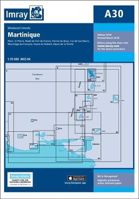
- A30 Martinique
- Plans included:St Pierre (1:20 000)Rade de Fort de France (1:15 000)Pointe du Bout (1:35 000)Cul-de-Sac Marin (1:35 000)Mouillage du François (1:50 000)Havre du Robert (1:45 000)Havre de la Trinité (1:30 000)On this 2018 edition the chart specification has been improved to show coloured light flashes. The plan of Rade de Fort de France has been... Read more