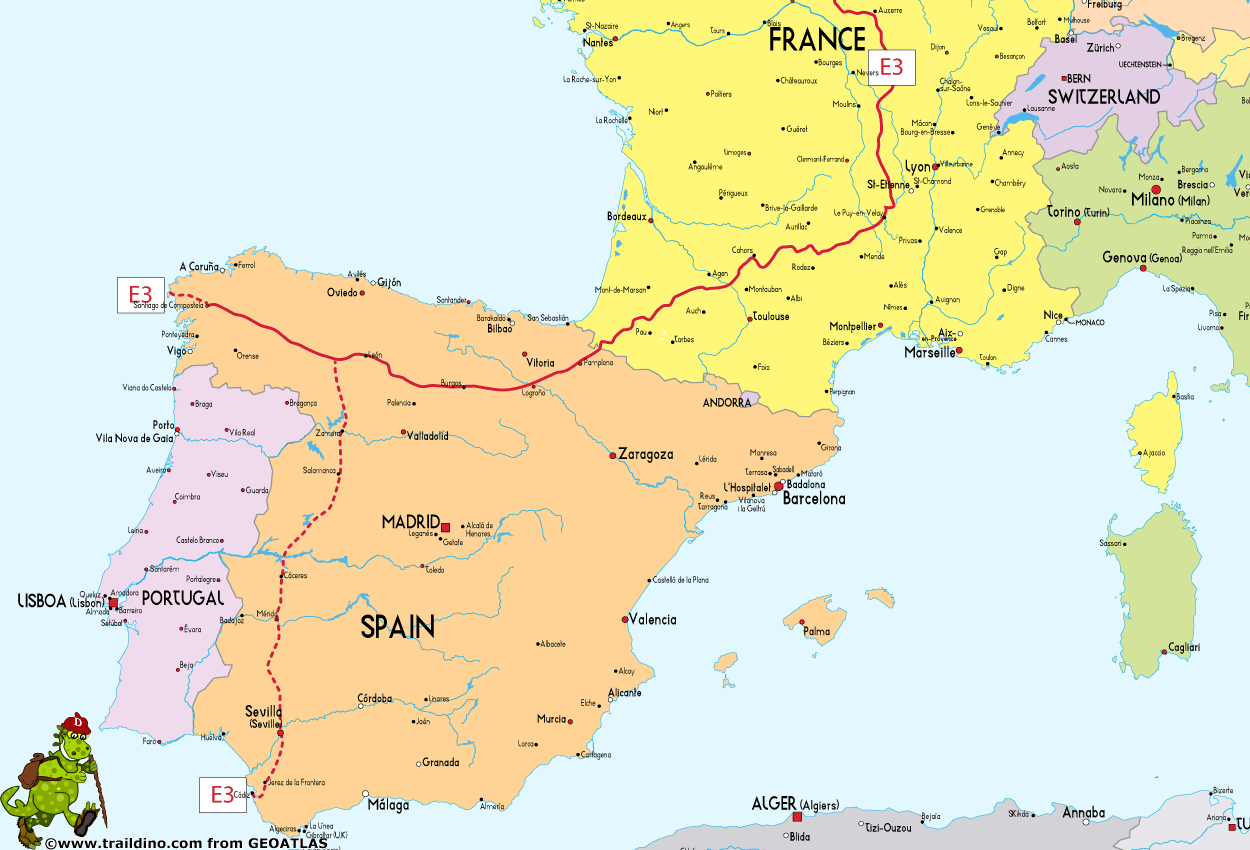
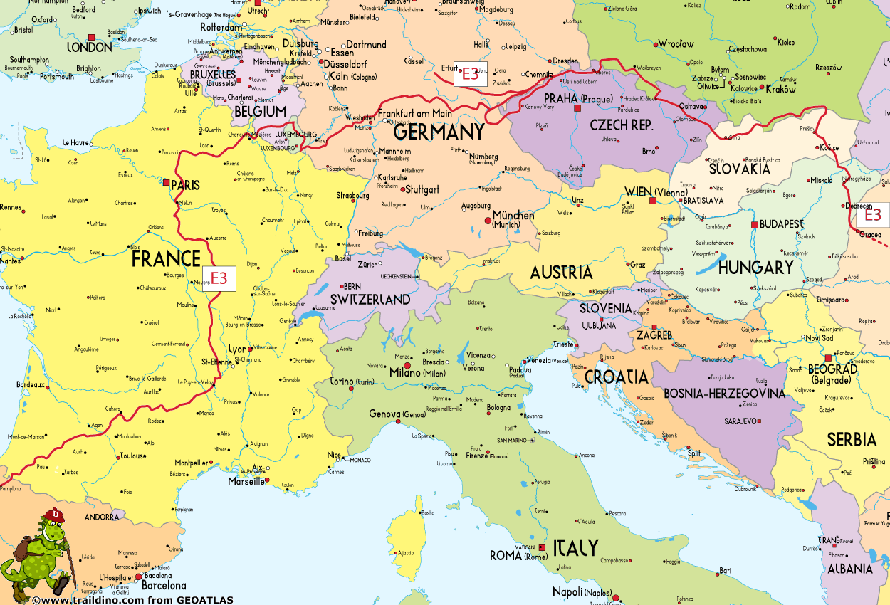
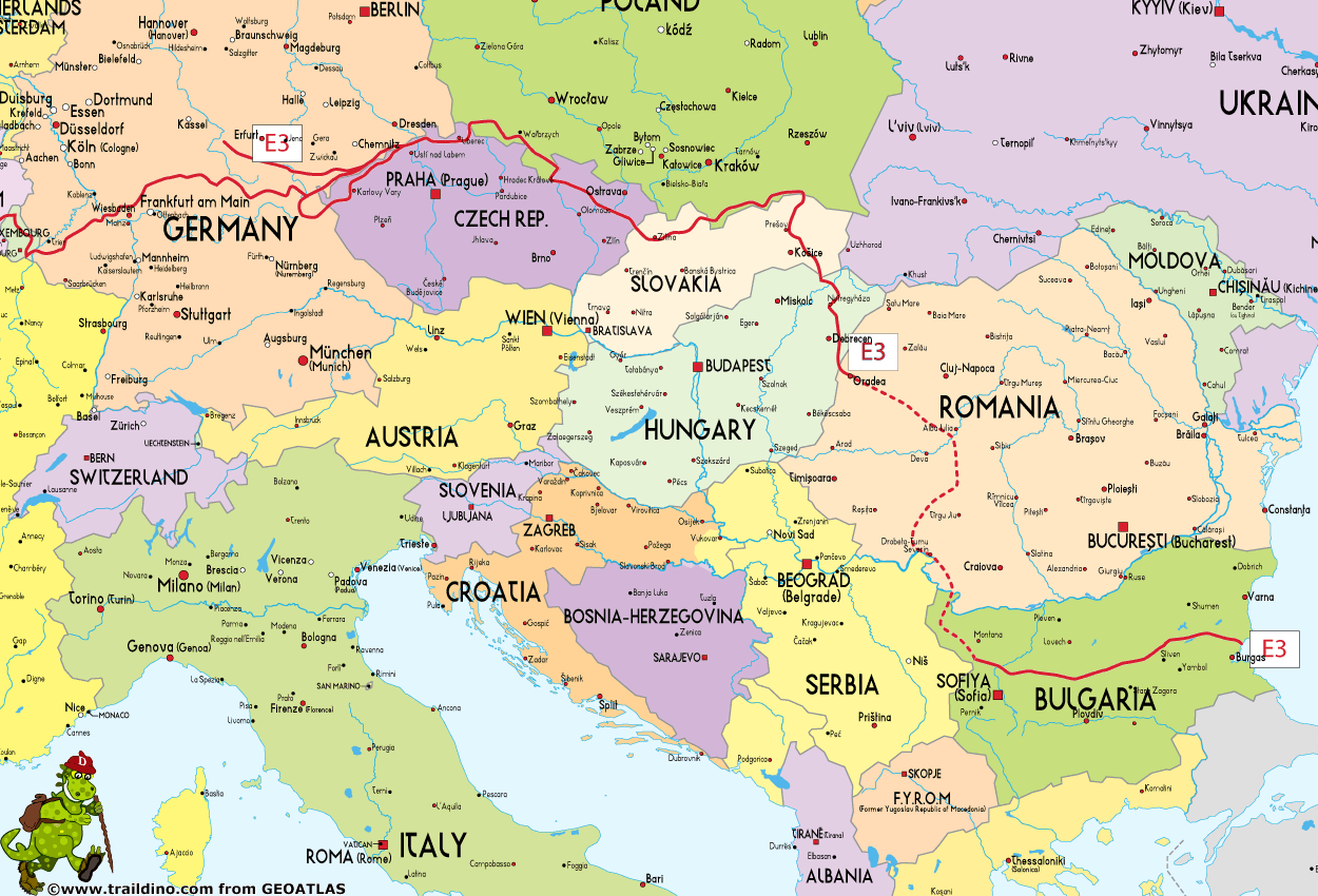
E3
Description
- Name E3 (E3)
- Length of trail 6,950 km, 4,319 miles
- Length in days 350 days
- Start of trail Santiago de Compostela (Es)
- End of trail Emine (Bg)
- Traildino grading MW, Moderate walk, backpacking trail
- Hut tour grading T1, Walk

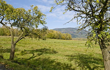 E3: Santiago de Compostela (Es) - Emine (Bg), 6950 km
Atlantic – Ardennen – Erzgebirge – Karpaten – Black Sea
Its 6950 km make it the second longest European trail, leading all the way from Bulgaria's Black Sea coast, through Hungary, Slovakia, Poland, the Czech Republic, Germany, Luxembourg, Belgium and France to Santiago the Compostela in Spain.
Bulgaria: 700 km, Mount Kom to cape Emine on the Black Sea.
The E3 strings together the following national trails:
Spain
- GR100 - Ruta de la Plata, South branch starting in Cádiz
- GR65 - Camino de Santiago, West Branch, starting in Santiago de Compostela:
France
- GR65 - Via Podiensis
- GR3 - Vallée de la Loire
- GR13 - Traversée du Morvan
- GR1 - Tour de Paris
- GR12 - Amsterdam - Paris
- GR16 - Sentier de la Semois
Belgium
- First village is Corbion
- GR16 - Sentier de la Semois, Corbion - Barrage de la Vierre
- GR15 - GR151 - AE, Barrage de la Vierre - Martelange
- Last village is Martelange
Luxembourg (235 km)
- First village is Martelange
- Sentier Ardennes - Eifel, Martelange - Echternach
- This could be broken down to the following trails:
- Upper-Sûre Path, Martelange - Esch sur Sûre
- Charles Mathieu Path, Esch sur Sûre - Clervaux
- Sentier Ardennes - Eifel, Clervaux - Hosingen. Here, the E2 / GR5, coming from the north, joins the E3
- Our Path, Hosingen - Diekirch
- Maurice Cosyn Path, Diekirch - Echternach
- Lower-Sûre Path, Echternach - Wasserbillig
- Moselle Path, Wasserbillig - Schengen. One hour walk before schengen, in Remerschen, the E3 and E2 / GR5 separate again
- Last village is Schengen
Germany
- First village is Perl
- From Perl local trails, marked
- Saarland Rundwanderweg (partly)
- Local trails, marked
- Ausoniusweg
- Local trails, marked
- Taunus Höhenweg
- Local trails to border with Czech Republic, marked
- Last village of south leg in Germany is Schirnding
Czech Republic (452 km)
South leg, 300 km
- First village in Czech Republic is Pomezí nad Ohří
- Pomezí n.O. (border crossing) - Horní Hraničná - Cheb (square) - Lipová (railway station) , 22,5 km, KCT map no. 1
- Dolní Žandov - Vysoké sedlo - Hvězda (crossroads) - Bílá hájenka , 31,5 km, KCT map no. 2
- Loket, Monument of Goethe , 20 km, KCT map no. 3
- Svatošské Rocks - Karlovy Vary, Hot Spring - Karlovy Vary, Post office - Sadov - Vlčinec (lodge) - Plešivec - Jáchymov, townhall - Boží Dar - Klínovec (watchtower) - Měděnec (railway station) , 78 km, KCT map no. 4
- Mountain of St. Sebastian - Svahová - Nová Ves v H. - Český Jiřetín (border crossing) , 58,5 km, KCT map no. 5
- Fláje (former village) - Cínovec (border crossing) - Komáří vížka - Adolfov - Tisá - mountain walls - Děčínský Sněžník , 60,5 km, KCT map no. 6
- Děčín, Tyršův most - Děčín, Nové město - Labská stráň - Hřensko, town , 29,5 km, KCT map no. 12-13
- Border crossing at Hřensko, joins E3 North leg coming from Germany
Central leg, 152 km
- First village in this leg is Hřensko, border with Germany
- Hřensko (border crossing) - Hřensko, town - Pravčická brána - Mezní louka - Jetřichovice - Studenec - Jedlová (railway station) - U Ranče - Jedlová, peak - return to U Ranče - Luž, peak - Dolní Světlá (railway station), 60,5 km, KCT map no. 12-13
- Hvozd, peak - Horní sedlo - Ještěd, peak, 39,5 km, KCT map no. 14
- Liberec, Horní Hanychov - transfer by public transport to Liberec, Lid.sady - Liberec, Lidové sady - Nová louka - Klečové louky - Jizera, peak - return to Klečové louky - Smědava - Jizerka , 37 km, KCT map no. 20-21
- Harachov (railway station) - Nový Svět - Harachov (border crossing) , 15 km, KCT map no. 22
- Last village in Czech Republic is Nový Svet / Harrachov
Maps
- South leg: KCT maps 1, 2, 3, 4, 5, 6, 12, 13, 14, 20, 21, 22
- Central leg: KCT maps 53, 55, 56, 59, 60, 96
Poland (300 km)
- First village in Poland is Jakuszyce, border crossing
- Jakuszyce - Boboszów, local trails, marked blue (mainly), 300 km
- Last village in Poland is Boboszów (border crossing)
Czech Republic (291 km)
- First village in Czech Republic is Dolní Lipka / Dolní Boříkovice
- Dolní Lipka (border crossing) - Dolní Boříkovice, crossroads - Králíky (square) - Prostřední Lipka (railway station) - Králický Sněžník, crossroads - Paprsek (tourist hut), 44,5 km, KCT map no. 53
- Ramzová (railway station) - Červenohorské sedlo (tourist hut) - Švýcárna (tourist hut) - Praděd, peak - Jelení studánka - Rýmařov (square), 56 km, KCT map no. 55
- Stráské (bus) - Rýžoviště (square) - Dětřichov n. Bystřicí (railway st.) - Dvorce - Budišov nad Budišovkou (square) - Kružberská přehrada (bus) , 57 km, KCT map no. 56
- Podhradí, camp - Hradec n. Moravicí (castle) - Leskovec (bus) , 43 km, KCT map no. 59
- Fulnek (bus) - Kletné (dam) - Suchdol n. Odrou (railway station) - Starý Jičín, edge, 31,5 km, KCT map no. 60
- Svinec, peak - Hodslavice, museum - Malý Javorník (crossroads) - Radhošť, chapel - Pustevny, huts - Martiňák, monument - Hlavatá (bus) - Třeštík (tourist hut) - Nad Bumbálkou - Bumbálka (border crossing), 59 km, KCT map no. 96
- Last village in Czech Republic is Horní Bečva
Slovakia (170 km)
- Start at Border Czech Republic / Slovakia, Bumbálka, hut
- Bumbálka - Veľký Javorník (1071 m) (22 km), path to Kasárne, cottages (2 km)
- Veľký Javorník – Bytča – Súľovské – Súľov, village and hut (17 km)
- Súľov – Rajec, town (15 km), path to Rajecká Lesná, village (2 km)
- Rajec - Veľká lúka (1475 m) (25 km), path to Martinské hole, chalets
- Veľká lúka - Veľký Kriváň (1708 m) (25 km), path to Vrátna hut
- Veľký Kriváň - Veľký Rozsutec (1609 m) – Zázrivá, village (18 km)
- Zázrivá - Minčol (1393 m) – Orava dam, recreation area (35 km)
- Orava – Border Slovakia / Poland, Trstená/Chyżne (13 km)
VKÚ maps:
109 Javorníky-Čadca
108 Javorníky-Púchov
157 Súľovské vrchy
120 Malá Fatra-Martinské hole
110 Malá Fatra-Vrátna
111 Chočské vrchy-vodná nádrž Liptovská Mara
102 Oravské Beskydy-vodná nádrž Orava
Poland (160 km)
- Local trails, marked
- First village in Poland is Chyżne
- Chyżne - Barwinek, 160 km, marked
(Probably this is part of the Beskids Trail) - Last village in Poland is Barwinek
Slovakia (274 km)
- Start in Dukliansky (502 m)
- Dukliansky - Nižnej Polianky (590 m) (24 km), path to motel (3 km)
- Nižnej Polianky - Staviská pass (650 m) (24 km), path to Vyšného Tvarožca (hut)
- Staviská pass – Kurovské pass (683 m) (22 km)
- Kurovské pass – Obručné, village (16 km)
- Obručné - Čergov pass (917 m), hut (29 km)
- Čergov pass – Prešov (34 km)
- Prešov – Dubnik (874 m) (27 km)
- Dubnik – Herľany (19 km)
- Herľany – Slanec, village (34 km)
- Slanec – Byšta, village (20 km)
- Byšta - Slovenské Nové Mesto, border Slovakia / Hungary (25 km)
VKÚ maps:
106 Laborecká vrchovina-Dukla
105 Ondavská vrchovina-Bardejov
104 Čergov
115 Šarišská vrchovina-Branisko
116 Slanské vrchy-Veľká Domaša
117 Slanské vrchy-Dargov
148 Zemplínske vrchy-Latorická rovina
Hungary (266 km)
- First village is Sátoraljaújhely, border with Slovakia
- Great Plain Blue Trail, Sátoraljaújhely – Nagykereki, 260 km
- Own track, Nagykereki – Ártánd, 6 km
- Last village in Hungary is Ártánd, border with Romania
Romania
-
Recently, the first 150 km have been marked, and maps and guides will be available soon
Bulgaria
Map
Links
Facts
Reports
Guides and maps
Lodging
Organisations
Tour operators
GPS
Other
Books
Netherlands
2016
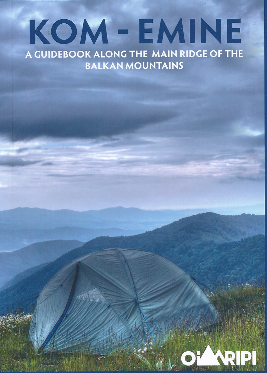
- Wandelgids Kom-Emine Bulgarije E3 | Oilaripi
- Een uitstekende wandelgids van een beroemd lange-afstands-wandelpad in Bulgarije, onderdeel van de E3 route. Goede beschrijving, mooie kaarten en praktische informatie. Onverwacht hoog nivo van de gids voor een land waar tot voor kort weinig beschikbaar was. Kom-Emine is a long distance path in Bulgaria, part of the E3 European Long Distance... Read more
Maps

United Kingdom
- E3 Arquipelago de Madeira
- Plans included:Porto Santo (1:25 000)Porto de Recreio da Calheta (1:6250)Funchal (1:10 000)Água de Pena (1:5000)Porto de Machico (1:7500)Quinta do Lorde (1:5000)Ponta de São Lourenço (1:30 000)Enseada da Doca (Isla Deserta Grande) (1:25 000)Selvagem Grande (1:30 000)Selvagem Pequena (1:30 000)On this edition the chart specification has been... Read more

United Kingdom
- Czechia Shocart 50K Tourist Atlas
- Czech Republic Tourist Atlas from Shocart with over 600 pages of contoured mapping at an exceptionally detailed scale of 1:50,000 with hiking and cycling trails, presented in an A4 ring-binder with a hard slipcase. Each page is removable so coverage can be easily assembled for just selected parts of the country, or individual pages used on... Read more

United Kingdom
- Transrhodopi - Long distance hiking and biking trail From Trigrad to Ivaylovgrad
- Western Rhodope Mountains at 1:100,000 on a contoured GPS compatible map from Domino extending from just west of the Pirin National Park to Asenovgrad in the north-east. The map is double-sided with a good overlap between the sides. Topography is shown by contours at 50m intervals with relief shading and spot heights, plus colouring for... Read more

Netherlands
2020
- Wandelatlas - Pelgrimsroute (kaart) 161 Chemins de Compostelle GR65 | Michelin
- Véritable petit atlas détaillant chaque étape avec indications précises concernant les villes de départ et d'arrivée ainsi que pour les localités traversées (auberges, refuges, restaurants, pharmacies, gare, épiceries, Km parcourus, Km restants....).Ce petit atlas suit le chemin du... Read more

United Kingdom
- Rila Mountains Domino
- Rila Mountains at 1:50,000 on a large, double-sided, contoured map with GPS waypoints for shelters and chalets, peaks, etc. and highlighting hiking routes. Topography is shown by contours at 50m intervals with additional relief shading and graphics and colouring for scree, single rocks over 5m high, marshlands and pine scrub and forests. An... Read more
- Also available from:
- De Zwerver, Netherlands

Netherlands
- Wandelkaart 5 Rila gebergte | Domino
- Rila Mountains at 1:50,000 on a large, double-sided, contoured map with GPS waypoints for shelters and chalets, peaks, etc. and highlighting hiking routes. Topography is shown by contours at 50m intervals with additional relief shading and graphics and colouring for scree, single rocks over 5m high, marshlands and pine scrub and forests. An... Read more

United Kingdom
- Pirin Mountains Domino
- Pirin Mountains at 1:50,000 on a large, double-sided, contoured map with GPS waypoints for shelters and chalets, peaks, etc. and highlighting hiking routes. Topography is shown by contours at 40m intervals with additional relief shading and graphics and colouring for sandstone stacks, single rocks over 5m high, marshlands and different types of... Read more
- Also available from:
- De Zwerver, Netherlands

Netherlands
- Wandelkaart 6 Pirin gebergte | Domino
- Pirin Mountains at 1:50,000 on a large, double-sided, contoured map with GPS waypoints for shelters and chalets, peaks, etc. and highlighting hiking routes. Topography is shown by contours at 40m intervals with additional relief shading and graphics and colouring for sandstone stacks, single rocks over 5m high, marshlands and different types of... Read more

United Kingdom
- Western Rhodope Mountains Domino Map
- Western Rhodope Mountains at 1:100,000 on a contoured GPS compatible map from Domino extending from just west of the Pirin National Park to Asenovgrad in the north-east. The map is double-sided with a good overlap between the sides. Topography is shown by contours at 50m intervals with relief shading and spot heights, plus colouring for... Read more
- Also available from:
- De Zwerver, Netherlands

Netherlands
- Wandelkaart - Wegenkaart - landkaart 7 Westelijke Rhodopen - Western Rhodopes | Domino
- Western Rhodope Mountains at 1:100,000 on a contoured GPS compatible map from Domino extending from just west of the Pirin National Park to Asenovgrad in the north-east. The map is double-sided with a good overlap between the sides. Topography is shown by contours at 50m intervals with relief shading and spot heights, plus colouring for... Read more

United Kingdom
- Stara Planina Central: Zlatitsa to Kalofer Domino Map
- Stara Planina Central: Zlatitsa to Kalofer map at 1:50,000 from Bulgarian publishers Domino, contoured and GPS compatible, with hiking trails, accommodation options including a list of local mountain refuges, etc. The map is double-sided and covers the mountains from just west of Ribaritsa and Zlatitsa eastwards beyond Kalofer to the peak of... Read more
- Also available from:
- De Zwerver, Netherlands

Netherlands
- Wandelkaart 1 Stara Planina gebergte | Domino
- Stara Planina Central: Zlatitsa to Kalofer map at 1:50,000 from Bulgarian publishers Domino, contoured and GPS compatible, with hiking trails, accommodation options including a list of local mountain refuges, etc. The map is double-sided and covers the mountains from just west of Ribaritsa and Zlatitsa eastwards beyond Kalofer to the peak of... Read more

United Kingdom
- Strandzha Mountains: Burgas to the Turkish Border Domino Map
- Strandzha Mountains in the south-eastern corner of Bulgaria between Burgas to the Turkish border on a contoured and GPS compatible map from Domino showing local hiking trails and highlighting various interesting sites, with three more detailed enlargements at 1:25,000. Most place names are in both Latin and Cyrillic alphabet; map legend... Read more
- Also available from:
- De Zwerver, Netherlands

Netherlands
- Wandelkaart Strandzha - Bulgarije | Domino
- Strandzha Mountains in the south-eastern corner of Bulgaria between Burgas to the Turkish border on a contoured and GPS compatible map from Domino showing local hiking trails and highlighting various interesting sites, with three more detailed enlargements at 1:25,000. Most place names are in both Latin and Cyrillic alphabet; map legend... Read more

United Kingdom
- Stara Planina Central: Uzana to Vratnik Domino Map
- Stara Planina Central: Uzana to Vratnik map at 1:50,000 from Bulgarian publishers Domino, contoured and GPS compatible, with hiking trails, accommodation options including a list of local mountain refuges, etc. The map is double-sided and covers the mountains from just west of the Uzana massif, the geographical centre of Bulgaria, eastwards to... Read more
- Also available from:
- De Zwerver, Netherlands

Netherlands
- Wandelkaart 2 Stara Planina gebergte | Domino
- Stara Planina Central: Uzana to Vratnik map at 1:50,000 from Bulgarian publishers Domino, contoured and GPS compatible, with hiking trails, accommodation options including a list of local mountain refuges, etc. The map is double-sided and covers the mountains from just west of the Uzana massif, the geographical centre of Bulgaria, eastwards to... Read more
Netherlands
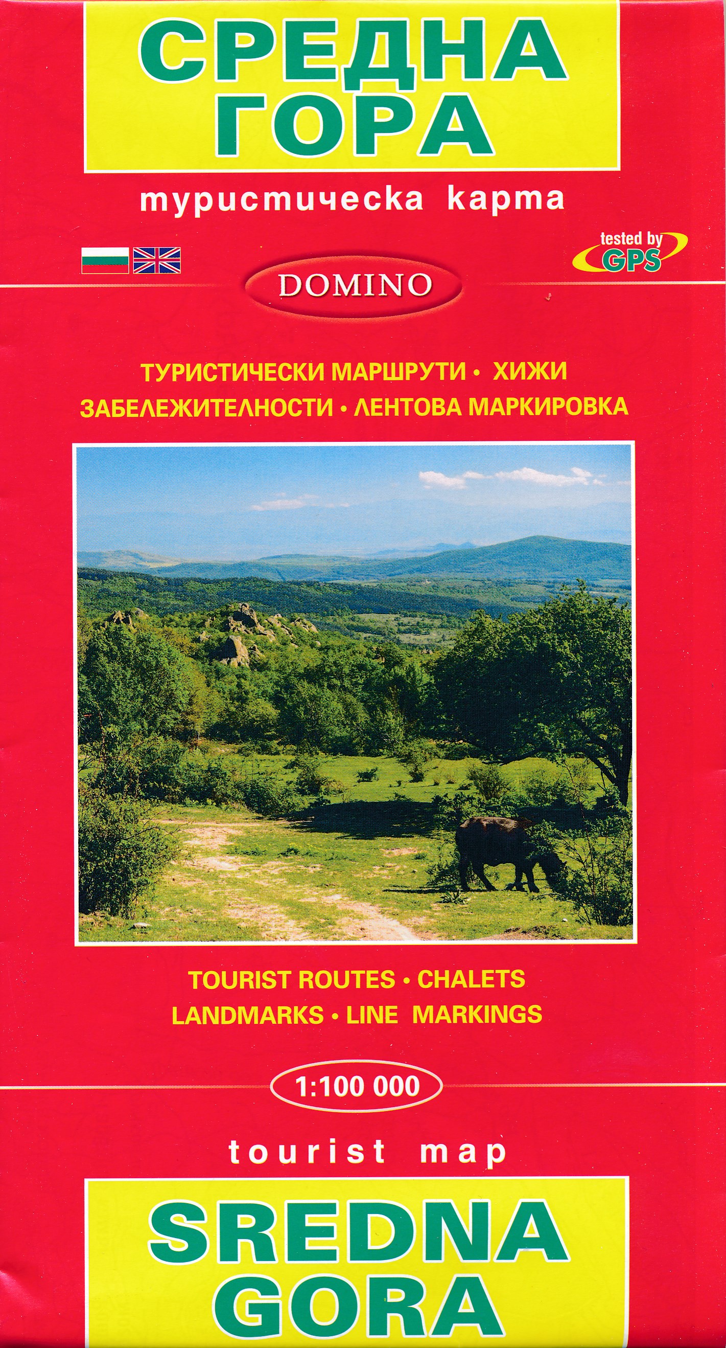
- Wandelkaart Sredna Gora - Bulgarije | Domino
- Pirin Mountains at 1:50,000 on a large, double-sided, contoured map with GPS waypoints for shelters and chalets, peaks, etc. and highlighting hiking routes. Topography is shown by contours at 40m intervals with additional relief shading and graphics and colouring for sandstone stacks, single rocks over 5m high, marshlands and different types of... Read more

United Kingdom
- Stara Planina Western: Belogradchik to Berkovita Domino Map
- Stara Planina Western: Belogradchik to Berkovita map at 1:50,000 from Bulgarian publishers Domino, contoured and GPS compatible, with hiking trails, accommodation options including a list of local mountain refuges, etc. The map is double-sided and covers the mountains from the peak of Byala Voda near Belogradchik eastwards to just beyond... Read more
- Also available from:
- De Zwerver, Netherlands

Netherlands
- Wandelkaart 3 Stara Planina gebergte | Domino
- Stara Planina Western: Belogradchik to Berkovita map at 1:50,000 from Bulgarian publishers Domino, contoured and GPS compatible, with hiking trails, accommodation options including a list of local mountain refuges, etc. The map is double-sided and covers the mountains from the peak of Byala Voda near Belogradchik eastwards to just beyond... Read more

United Kingdom
- Stara Planina Western: Berkovita to Zlatitsa Domino Map
- Stara Planina Western: Berkovita to Zlatitsa map at 1:50,000 from Bulgarian publishers Domino, contoured and GPS compatible, with hiking trails, accommodation options including a list of local mountain refuges, etc. The map is double-sided and covers the mountains from Varshets (directly north of Sofia) to just beyond Etrepole.Maps in the... Read more
- Also available from:
- De Zwerver, Netherlands

Netherlands
- Wandelkaart 4 Stara Planina gebergte | Domino
- Stara Planina Western: Berkovita to Zlatitsa map at 1:50,000 from Bulgarian publishers Domino, contoured and GPS compatible, with hiking trails, accommodation options including a list of local mountain refuges, etc. The map is double-sided and covers the mountains from Varshets (directly north of Sofia) to just beyond Etrepole.Maps in the... Read more


