
Costa Blanca
Description
The "White Coast", a popular holiday and beach destination in the South of Spain, Province of Alicante.
Trails in this region
Links
Facts
Reports
Guides and maps
Lodging
Organisations
Tour operators
GPS
Other
Books

The Book Depository
United Kingdom
2022
United Kingdom
2022
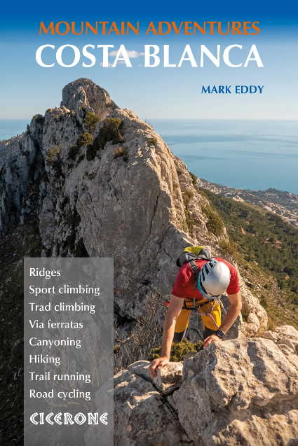
- Costa Blanca Mountain Adventures
- The Bernia Ridge and other multi-activity adventures Read more
- Also available from:
- De Zwerver, Netherlands
De Zwerver
Netherlands
2022
Netherlands
2022
- Wandelgids - Klimgids - Klettersteiggids Costa Blanca Mountain Adventures | Cicerone
- The Bernia Ridge and other multi-activity adventures Read more

The Book Depository
United Kingdom
2014
United Kingdom
2014
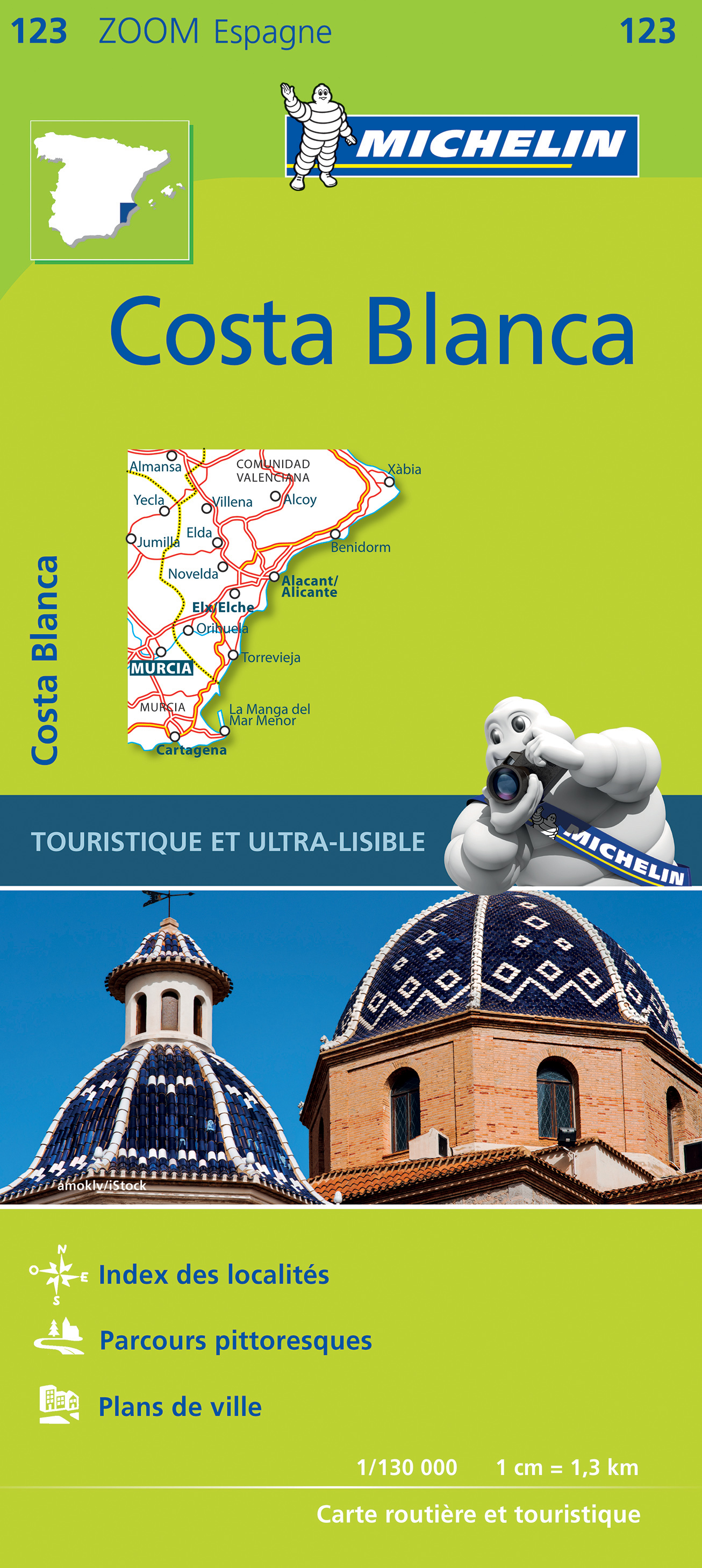
- Costa Blanca (wf) 53T Denia - Calpe - Benidorm - Alicante
- Uitstekende wandelgids met een groot aantal dagtochten in dal en hooggebergte. Met praktische informatie en beperkt kaartmateriaal! Wandelingen in verschillende zwaarte weergegeven in rood/blauw/zwart. Die Costa Blanca steht seit langem im Ruf, die Region mit der meisten Wintersonne, den billigsten Flügen und den günstigsten Unterkünften in... Read more
- Also available from:
- De Zwerver, Netherlands

De Zwerver
Netherlands
2019
Netherlands
2019
- Wandelgids 269 Rother Wandefuhrer Spanje Costa Blanca | Rother Bergverlag
- Uitstekende wandelgids met een groot aantal dagtochten in dal en hooggebergte. Met praktische informatie en beperkt kaartmateriaal! Wandelingen in verschillende zwaarte weergegeven in rood/blauw/zwart. Die Costa Blanca steht seit langem im Ruf, die Region mit der meisten Wintersonne, den billigsten Flügen und den günstigsten Unterkünften in... Read more
Bol.com
Netherlands
Netherlands
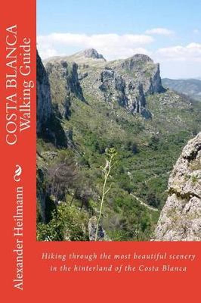
- Costa Blanca Walking Guide
- Hiking and restaurant guide of the hinterland of the Costa Blanca Read more
- Also available from:
- Bol.com, Belgium
Bol.com
Belgium
Belgium
- Costa Blanca Walking Guide
- Hiking and restaurant guide of the hinterland of the Costa Blanca Read more
De Zwerver
Netherlands
Netherlands

Stanfords
United Kingdom
2017
United Kingdom
2017
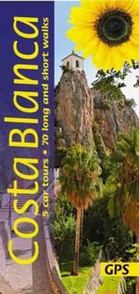
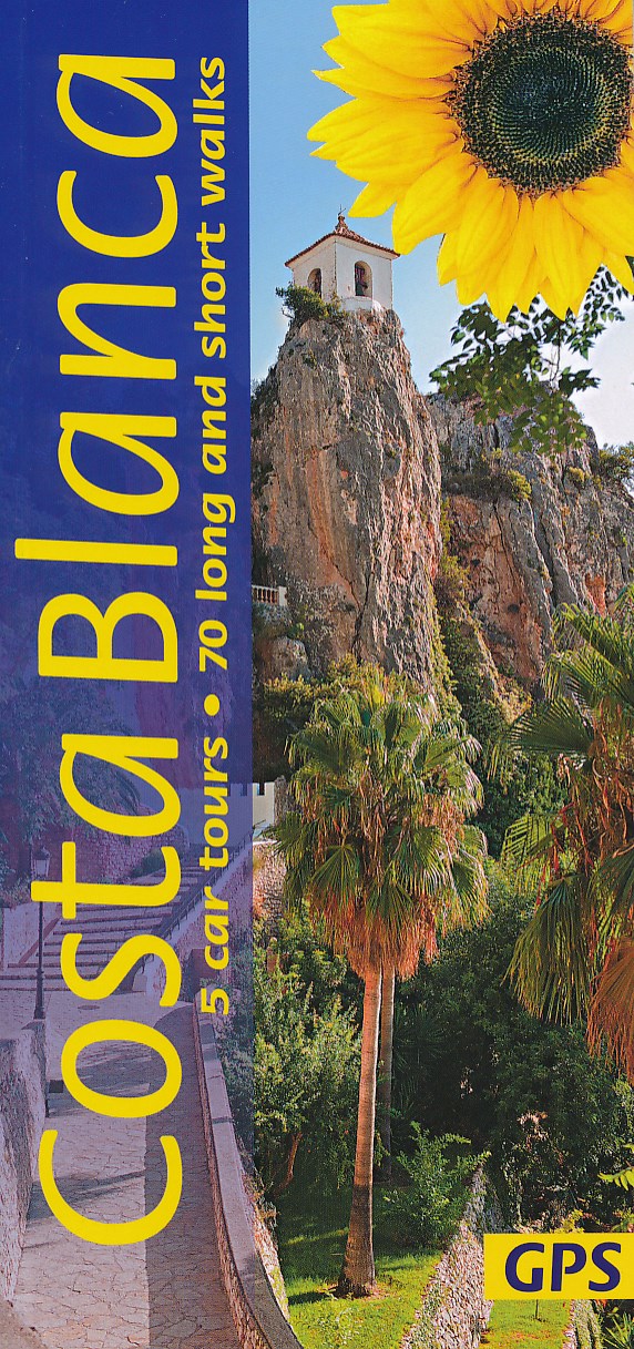
- Costa Blanca Sunflower Landscape Guide
- Costa Blanca in the Sunflower Landscapes guide series; exploring the best walking and touring possibilities in the region or area. Detailed information about touring by hired car or public transport, as well as on foot, is provided, helping walkers to navigate and plan day-trips. Shorter strolls are also included as an alternative for each main... Read more
- Also available from:
- Bol.com, Netherlands
- Bol.com, Belgium
- De Zwerver, Netherlands
Bol.com
Netherlands
2017
Netherlands
2017
- Landscapes of the Costa Blanca
- The Costa Blanca is ideal for countryside exploration all year round. Travel only a short distance inland, and the bustle of the resorts is left far behind. You find yourself surrounded by market gardens, orchards and orange groves, while the dark rugged silhouettes of the sierras beckon you close. Wild flowers — from the humble daisy to the... Read more
Bol.com
Belgium
2017
Belgium
2017
- Landscapes of the Costa Blanca
- The Costa Blanca is ideal for countryside exploration all year round. Travel only a short distance inland, and the bustle of the resorts is left far behind. You find yourself surrounded by market gardens, orchards and orange groves, while the dark rugged silhouettes of the sierras beckon you close. Wild flowers — from the humble daisy to the... Read more

Stanfords
United Kingdom
United Kingdom
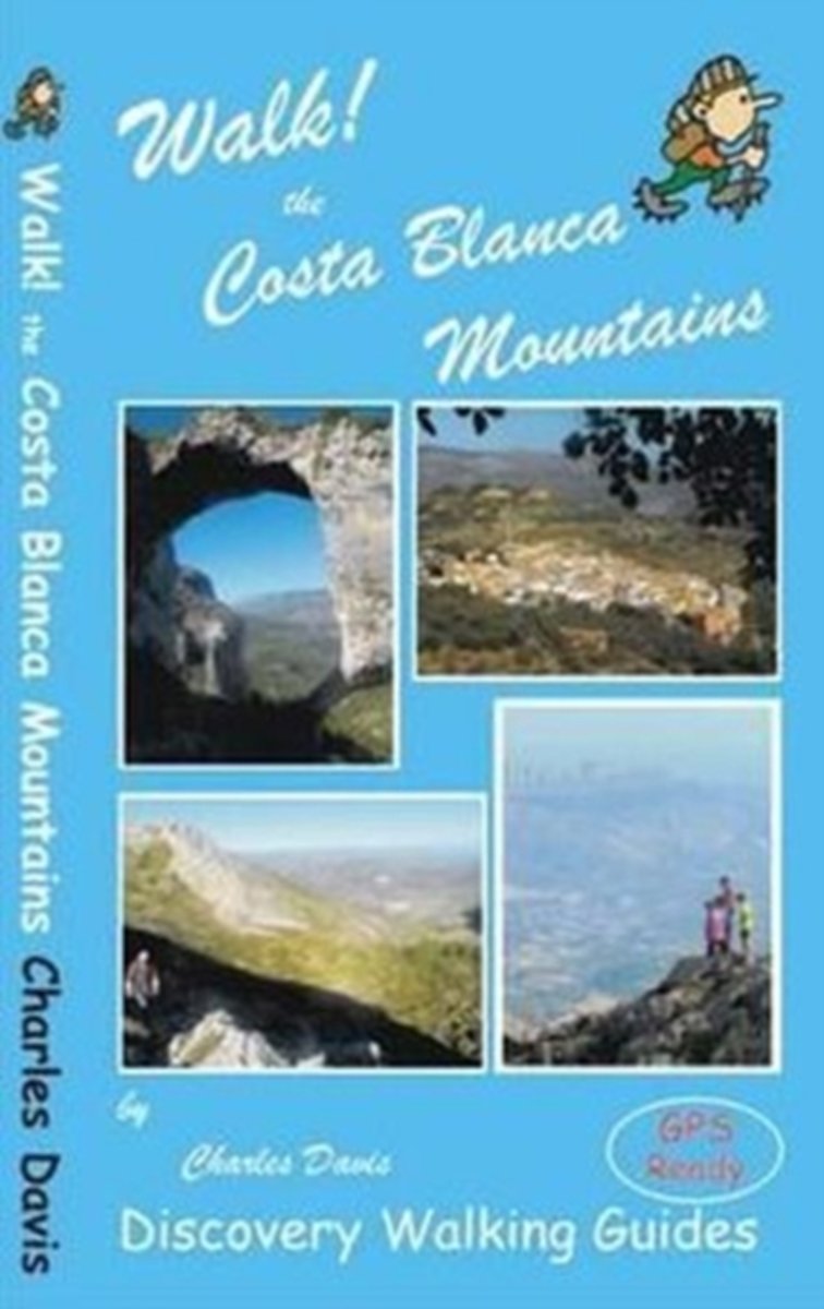
- Walk! Costa Blanca Mountains
- Walk! Costa Blanca Mountains guide from Discovery Walking Guides providing descriptions of 37 hiking trails in the mountains north-west of Altea and Benidorm, with extracts from the publishers’ map of the region and general tourist advice.The guide covers an area centred on Guadalest with mountain rages both north and south of the CV-70 road... Read more
- Also available from:
- The Book Depository, United Kingdom
- Bol.com, Netherlands
- Bol.com, Belgium

The Book Depository
United Kingdom
United Kingdom
- Walk! the Costa Blanca Mountains
- Walk! Costa Blanca Mountains guide from Discovery Walking Guides providing descriptions of 37 hiking trails in the mountains north-west of Altea and Benidorm, with extracts from the publishers Read more
Bol.com
Netherlands
Netherlands
- Walk! the Costa Blanca Mountains
- Walk! Costa Blanca Mountains includes 37 fully detailed walking route itineraries. Each walking route itinerary includes:- - walking route summary - ratings for Effort, Time, Distance, Ascents/Descents, Refreshments and Vertigo risk - fully detailed walk description, including frequent timings to aid navigation and check your progress - GPS... Read more
Bol.com
Belgium
Belgium
- Walk! the Costa Blanca Mountains
- Walk! Costa Blanca Mountains includes 37 fully detailed walking route itineraries. Each walking route itinerary includes:- - walking route summary - ratings for Effort, Time, Distance, Ascents/Descents, Refreshments and Vertigo risk - fully detailed walk description, including frequent timings to aid navigation and check your progress - GPS... Read more
Bol.com
Netherlands
Netherlands
- Costa Blanca II Walking Guide
- Hiking Through the Most Beautiful Scenery in the Hinterland of the Costa Blanca Read more
- Also available from:
- Bol.com, Belgium
Bol.com
Belgium
Belgium
- Costa Blanca II Walking Guide
- Hiking Through the Most Beautiful Scenery in the Hinterland of the Costa Blanca Read more

Stanfords
United Kingdom
2014
United Kingdom
2014
- Costa Blanca Rother Guide
- The Rother Walking Guide to Costa Blanca introduces 51 particularly interesting routes like walks onto Montgó, the Sierra de Aitana, Sierra de Bèrnia, Sierra Helada and Sierra de Orihuela and a selection of treks to explore and enjoy the cultural history and reveal culinary delights of this region. Every walk contains a fact-file of all the... Read more
- Also available from:
- The Book Depository, United Kingdom
- Bol.com, Netherlands
- Bol.com, Belgium
- De Zwerver, Netherlands

The Book Depository
United Kingdom
2014
United Kingdom
2014
- Costa Blanca walking guide Denia/Calpe/Benidorm/Alcoy 2019
- The Rother Walking Guide to Costa Blanca introduces 51 particularly interesting routes like walks onto Montg Read more
Bol.com
Netherlands
2014
Netherlands
2014
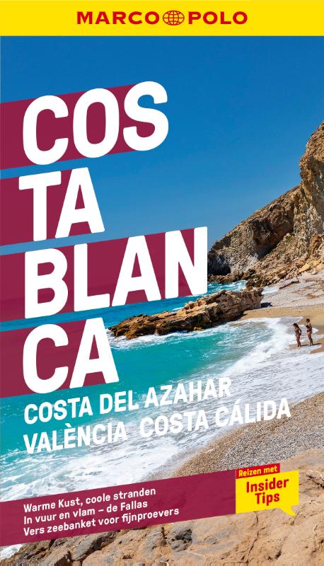
- Costa Blanca
- For a long time the Costa Blanca has had a reputation for having the best chance of winter sun, the cheapest flights and the most reasonably priced accommodation. However, the 'white coast' has a lot more to offer than the simple beach holidays enjoyed by thousands of tourists every year. Not only the spectacular and varied mountains close to... Read more
Bol.com
Belgium
2014
Belgium
2014
- Costa Blanca
- For a long time the Costa Blanca has had a reputation for having the best chance of winter sun, the cheapest flights and the most reasonably priced accommodation. However, the 'white coast' has a lot more to offer than the simple beach holidays enjoyed by thousands of tourists every year. Not only the spectacular and varied mountains close to... Read more
De Zwerver
Netherlands
2019
Netherlands
2019
- Wandelgids Rother Wandefuhrer Spanje Costa Blanca | Rother Bergverlag
- The Rother Walking Guide to Costa Blanca introduces 51 particularly interesting routes like walks onto Montg Read more
Bol.com
Netherlands
Netherlands
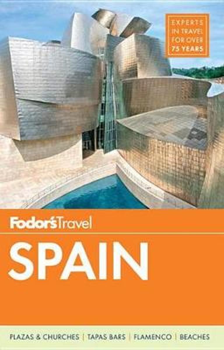
- Fodor's Essential Spain
- Written by locals, Fodor's travel guides have been offering expert advice for all tastes and budgets for 80 years. Spain remains one of the world's most popular tourist destinations for its cutting-edge cuisine and superior wine, festivals like the running of the bulls in Pamplona, world-class museums like the Museo del Prado, amazing... Read more
- Also available from:
- Bol.com, Belgium
Bol.com
Belgium
Belgium
- Fodor's Essential Spain
- Written by locals, Fodor's travel guides have been offering expert advice for all tastes and budgets for 80 years. Spain remains one of the world's most popular tourist destinations for its cutting-edge cuisine and superior wine, festivals like the running of the bulls in Pamplona, world-class museums like the Museo del Prado, amazing... Read more
Bol.com
Netherlands
Netherlands
- Fodor's Spain 2015
- Written by locals, Fodor's travel guides have been offering expert advice for all tastes and budgets for 80 years. Spain remains one of the world's most popular tourist destinations for its cutting-edge cuisine and superior wine, festivals like the running of the bulls in Pamplona, world-class museums like the Museo del Prado, amazing... Read more
- Also available from:
- Bol.com, Belgium
Bol.com
Belgium
Belgium
- Fodor's Spain 2015
- Written by locals, Fodor's travel guides have been offering expert advice for all tastes and budgets for 80 years. Spain remains one of the world's most popular tourist destinations for its cutting-edge cuisine and superior wine, festivals like the running of the bulls in Pamplona, world-class museums like the Museo del Prado, amazing... Read more

Stanfords
United Kingdom
2015
United Kingdom
2015
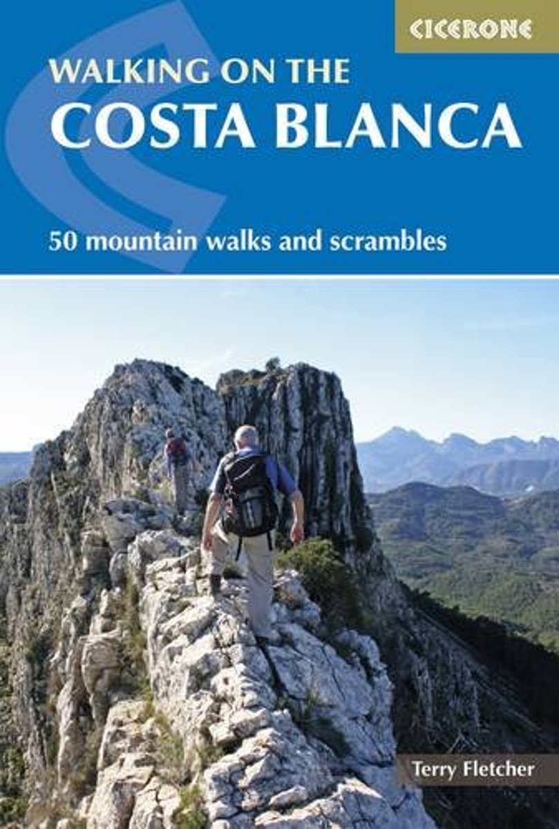
- Walking on the Costa Blanca
- This guidebook describes 50 circular walks and scrambles exploring the Costa Blanca mountains, around the resorts of Alicante, Benidorm and Calp. These routes range from gentle strolls to demanding days with steep climbs, and from 3-20km in distance. The Mediterranean coast is one of Europe`s most popular winter sun adventure destinations. In... Read more
- Also available from:
- The Book Depository, United Kingdom
- Bol.com, Netherlands
- Bol.com, Belgium
- De Zwerver, Netherlands

The Book Depository
United Kingdom
2015
United Kingdom
2015
- Walking on the Costa Blanca
- 50 mountain walks and scrambles Read more
Bol.com
Netherlands
2015
Netherlands
2015
- Walking on the Costa Blanca
- This guidebook describes 50 circular walks and scrambles exploring the Costa Blanca mountains, around the resorts of Alicante, Benidorm and Calp. These routes range from gentle strolls to demanding days with steep climbs, and from 3-20km in distance. The Mediterranean coast is one of Europe's most popular winter sun adventure destinations. In... Read more
Bol.com
Belgium
2015
Belgium
2015
- Walking on the Costa Blanca
- This guidebook describes 50 circular walks and scrambles exploring the Costa Blanca mountains, around the resorts of Alicante, Benidorm and Calp. These routes range from gentle strolls to demanding days with steep climbs, and from 3-20km in distance. The Mediterranean coast is one of Europe's most popular winter sun adventure destinations. In... Read more
De Zwerver
Netherlands
2015
Netherlands
2015
- Wandelgids Walking on the Costa Blanca Walks | Cicerone
- A collection of 50 circular walks and scrambles that explore the Costa Blanca mountains, around the resorts of Alicante, Benidorm and Calp, a popular European winter sun adventure destination. From 1,500m peaks and knife edge ridges to deep gorges, the walks range from gentle strolls to demanding days with steep climbs, and from 3-20km in distance. Read more
Maps

Stanfords
United Kingdom
United Kingdom
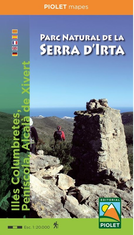
- Serra d`Irta Natural Park - Columbretes Islands Editorial Piolet Hiking Map
- Serra d`Irta Natural Park and the Columbretes Islands on the Mediterranean coast of Spain north of Castelló de la Plana on a contoured and GPS compatible map at 1:20,000 from Editorial Piolet. Coverage of the mainland extends along the coast from Alcosserbe in the south to beyond Peníscola, and inland across the Serra d’ Irta to Alcalà de... Read more

Stanfords
United Kingdom
United Kingdom
- Murcia Province 200K CNIG Map No. 32
- Contoured, GPS-compatible, indexed road map at 1:200,000 from CNIG - Spain’s civilian survey organization, with exceptionally informative presentation of the landscape and highlighting for facilities and places of interest including campsites and paradors.Maps in CNIG’s 200K Provincial Series provide an excellent picture the topography through... Read more

Stanfords
United Kingdom
United Kingdom
- Valencia - Alicante - Murcia 500K CNIG Regional Map No. 9
- The Mediterranean coast of Spain from north of Valencia to Costa Blanca and inland to include Sierras de Cazorla and Segura in north-eastern Andalucía, at 1:500,000 in a series of regional road maps from the country’s civilian survey organization IGN-CNIG (Instituto Geográfico Nacional - Centro Nacional de Información Geográfica), vividly... Read more

Stanfords
United Kingdom
United Kingdom
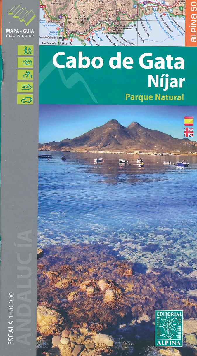
- Cabo de Gata-Níjar Natural Park Editorial Alpina
- Cabo da Gata area on the south-eastern tip of Andalucía on a contoured and GPS compatible map at 1:50,000 from Editorial Alpina highlighting hiking and cycling trails, plus a booklet with English language descriptions of recommended routes, accommodation lists, etc.Topography is shown by contours at 20m intervals, with relief shading and... Read more
- Also available from:
- The Book Depository, United Kingdom
- De Zwerver, Netherlands

The Book Depository
United Kingdom
United Kingdom
- Cabo de Gata / Nijar
- Gedetailleerde wandelkaart van een interessant wandelgebied. Uitstekend leesbaar, inhoudelijk een goede kaart met allerhande informatie op topografische basis waarbij wandelroutes, campings en hutten. Bij een aantal Alpina kaarten is een boekje bijgevoegd met routes. Door de toevoeging van gradengrid is deze kaart bruikbaar voor GPS. Cabo da... Read more
De Zwerver
Netherlands
Netherlands
- Wandelkaart Cabo de Gata - Nijar | Editorial Alpina
- Gedetailleerde wandelkaart van een interessant wandelgebied. Uitstekend leesbaar, inhoudelijk een goede kaart met allerhande informatie op topografische basis waarbij wandelroutes, campings en hutten. Bij een aantal Alpina kaarten is een boekje bijgevoegd met routes. Door de toevoeging van gradengrid is deze kaart bruikbaar voor GPS. Cabo da... Read more

- Also available from:
- De Zwerver, Netherlands

Stanfords
United Kingdom
United Kingdom
- Garraf - la Morella - Eramprunya Editorial Alpina
- Massíf de Garraf in an extensive and very popular series of walking maps from Editorial Alpina covering the Pyrenees, Catalonia and other selected hiking areas in Spain, including Picos de Europa, Sierra Nevada and parts of Andalucía, Majorca, etc. Scales vary from 1:50,000 to 1:10,000, with the majority of the titles at 1:25,000. The maps have... Read more
- Also available from:
- The Book Depository, United Kingdom
- De Zwerver, Netherlands

The Book Depository
United Kingdom
United Kingdom
- Garraf - La Morella - Eramprunya - Parc Natural del Garraf
- Zeer gedetailleerde wandelkaart van dit mooie natuurgebied in Noord Oost Spanje. Met ingetekende wandelroutes en andere informatie. Spaans en deel in het engels, maar uitstekende kaart. Met symbolen voor campings, hutten. Read more

De Zwerver
Netherlands
Netherlands
- Wandelkaart 62 Parc Naturel del Garraf | Editorial Alpina
- Zeer gedetailleerde wandelkaart van dit mooie natuurgebied in Noord Oost Spanje. Met ingetekende wandelroutes en andere informatie. Spaans en deel in het engels, maar uitstekende kaart. Met symbolen voor campings, hutten. Read more
De Zwerver
Netherlands
Netherlands
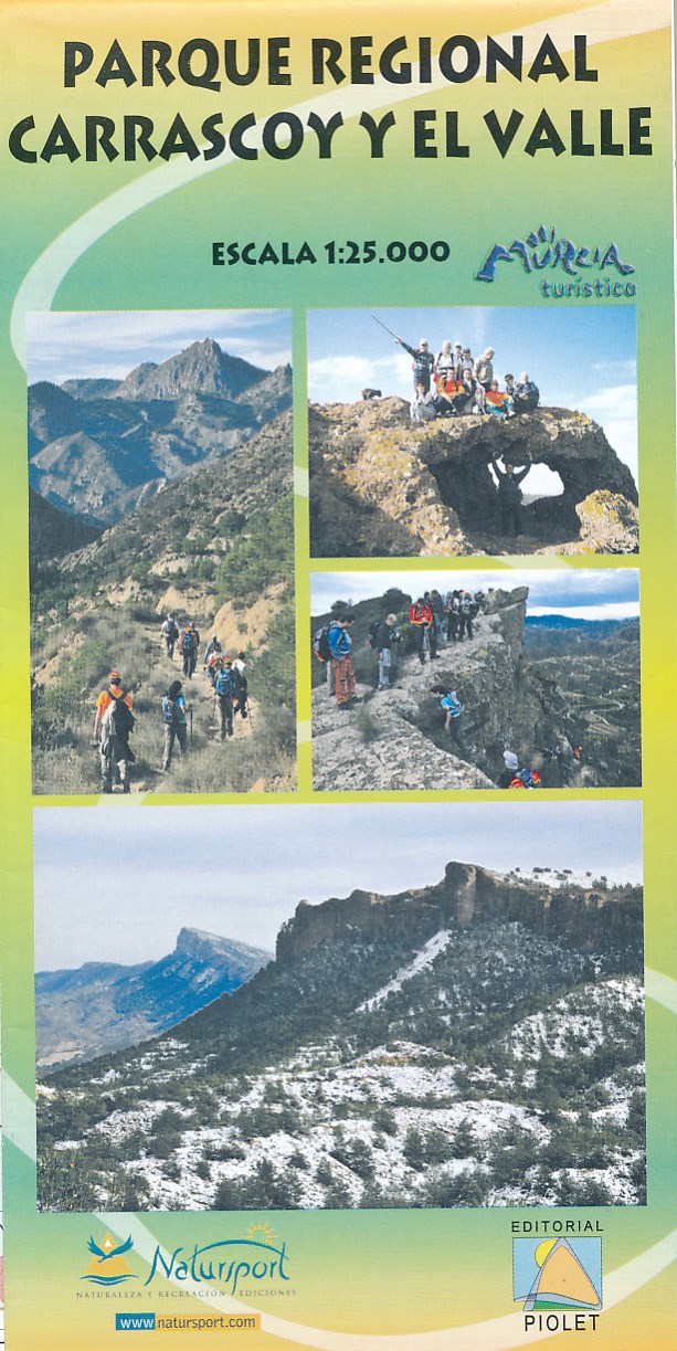
- Wandelkaart Parque Regional Carrascoy y el Valle | Editorial Piolet
- Uitstekende wandelkaart van een klein gebied. Met ingetekende wandelroutes en hoogtelijnen. Excellent 1:20.000 scale map of the area of Regional Park Carrascoy y el Valle in Murcia. Includes local signaling pathways, GR, PR, Nordik Walking tour and most characteristic areas of diving. Equidistance between contours 10 m. Read more
De Zwerver
Netherlands
Netherlands
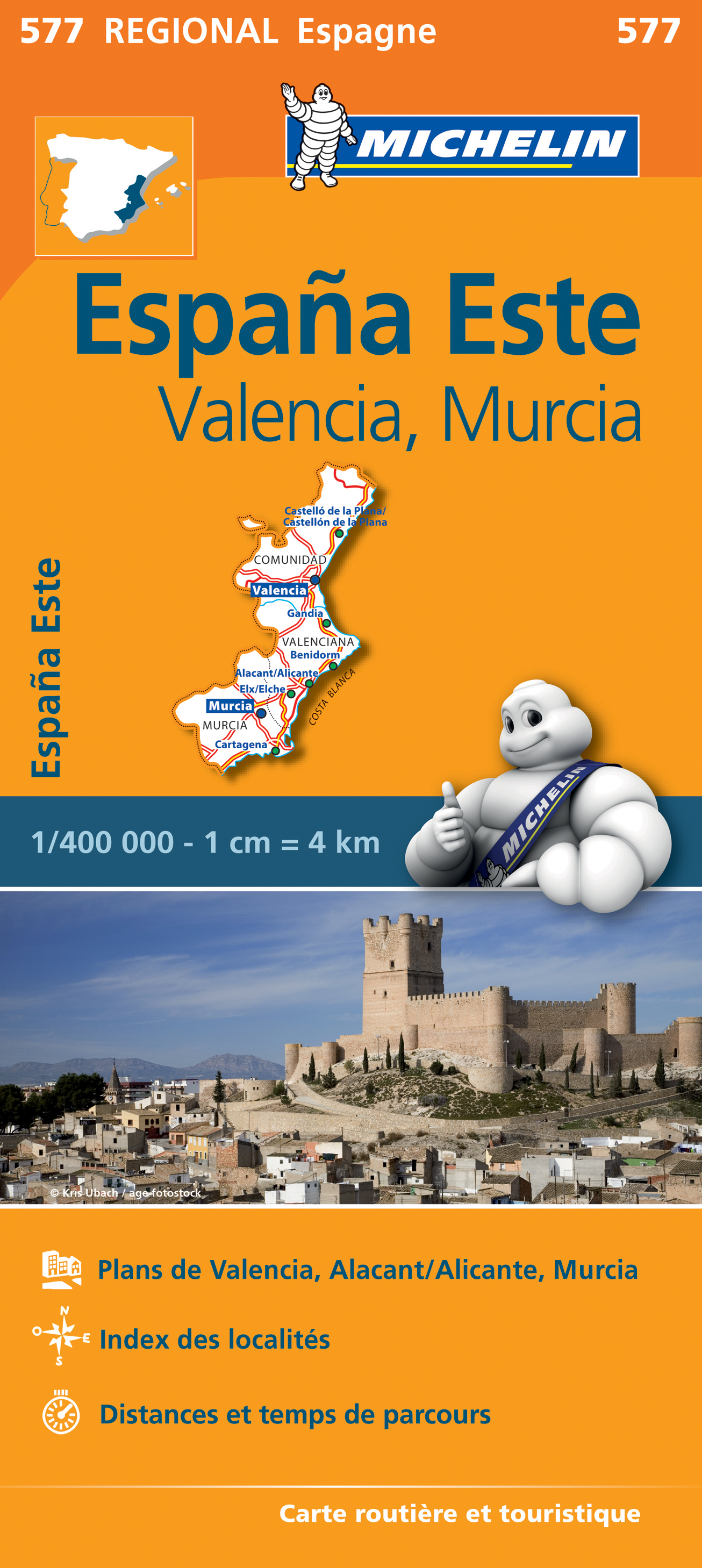
- Wegenkaart - landkaart 577 Comunidad Valenciana - Murcia - Alicante - Benidorm | Michelin
- une carte fiable pour parcourir les régions d'Europe Read more

Stanfords
United Kingdom
United Kingdom
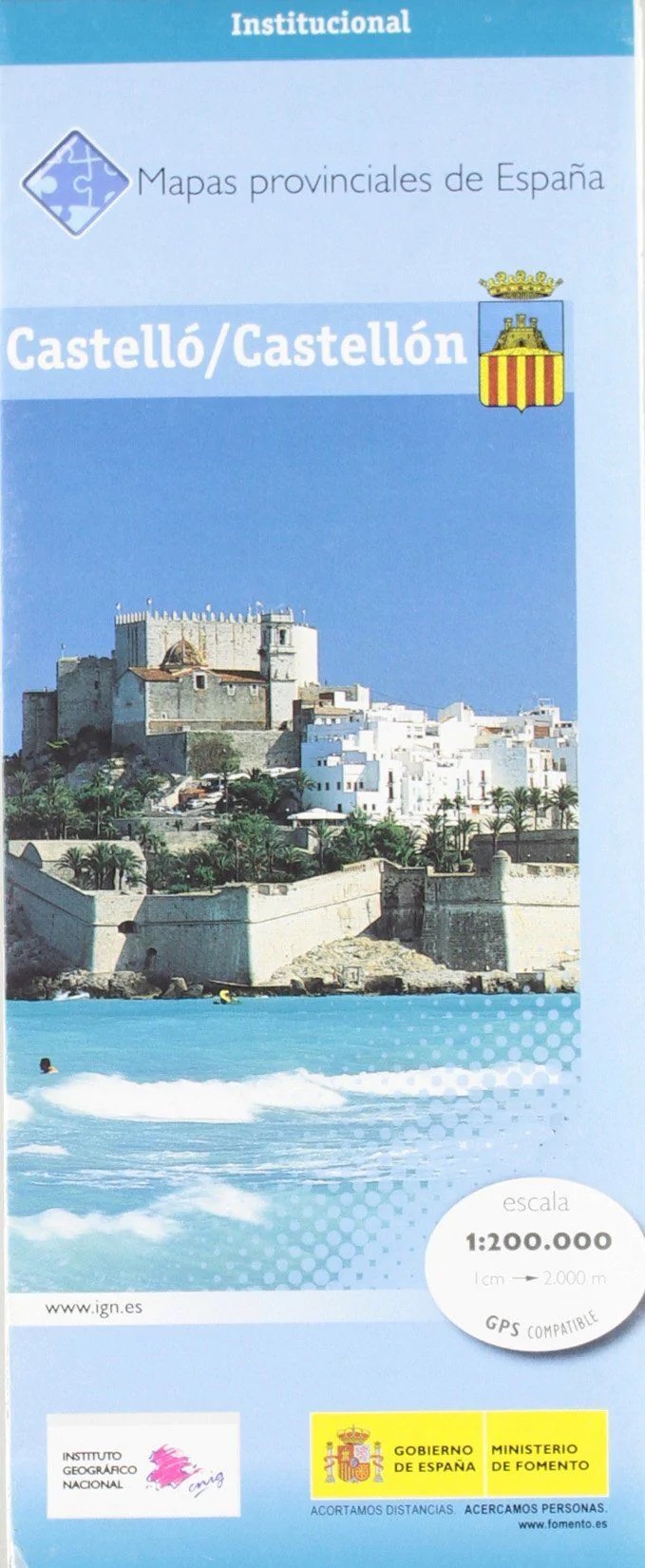
- Castellón / Castello Province 200K CNIG Map 14
- Contoured, GPS-compatible, indexed road map at 1:200,000 from CNIG - Spain’s civilian survey organization, with exceptionally informative presentation of the landscape and highlighting for facilities and places of interest including campsites and paradors.Maps in CNIG’s 200K Provincial Series provide an excellent picture the topography through... Read more
- Also available from:
- De Zwerver, Netherlands


Stanfords
United Kingdom
United Kingdom
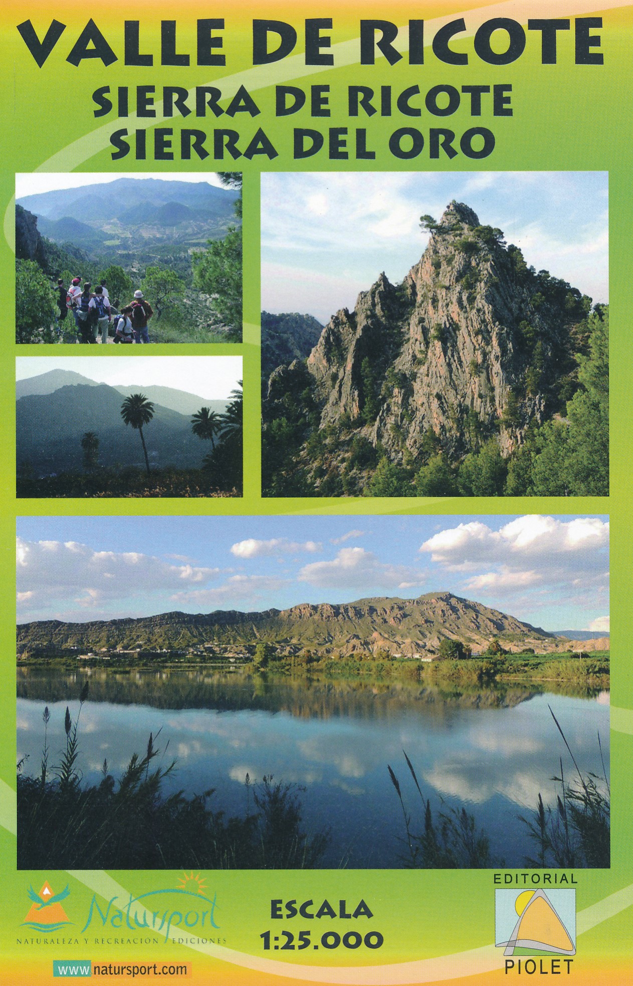
- Valle de Ricote - Sierra de Ricote - Sierra del Oro
- Valle de Ricote, Sierra de Ricote and Sierra del Oro north-west of Murcia on a contoured and GPS compatible map at 1:25,000 from Editorial Piolet. Coverage extends westwards from Archena, north to Abarán, and south to the RM-530 road.Topography is presented by contours at 10m intervals with plenty of additional spot heights. An overprint shows... Read more
- Also available from:
- De Zwerver, Netherlands
De Zwerver
Netherlands
Netherlands
- Wandelkaart Valle de Ricote - Sierra de Ricote - Sierra del Oro | Editorial Piolet
- Valle de Ricote, Sierra de Ricote and Sierra del Oro north-west of Murcia on a contoured and GPS compatible map at 1:25,000 from Editorial Piolet. Coverage extends westwards from Archena, north to Abarán, and south to the RM-530 road.Topography is presented by contours at 10m intervals with plenty of additional spot heights. An overprint shows... Read more
De Zwerver
Netherlands
Netherlands
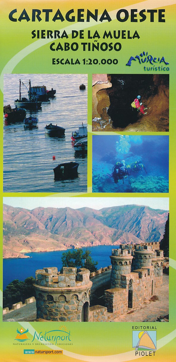
- Wandelkaart Cartagena Oeste - Sierra de la Muela | Editorial Piolet
- Uitstekende wandelkaart van een klein gebied. Met ingetekende wandelroutes en hoogtelijnen. Excellent 1:20.000 scale map of the area of West Cartagena (Murcia). Includes local signaling pathways, GR, PR, Nordik Walking tour and most characteristic areas of diving. Equidistance between contours 10 m. Read more