Spain
Description
A land of marvellous nature and astounding contrasts, Spain has made remarkable progress over the past decades in developing hiking trails and facilities. All thanks to the efforts of the Federación Española de Alpinismo (Spanish Mountain Federation) and its many regional branches.
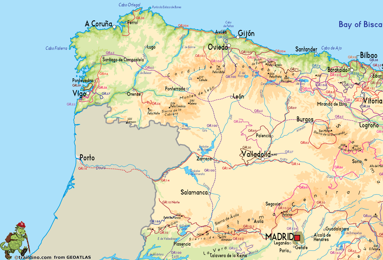
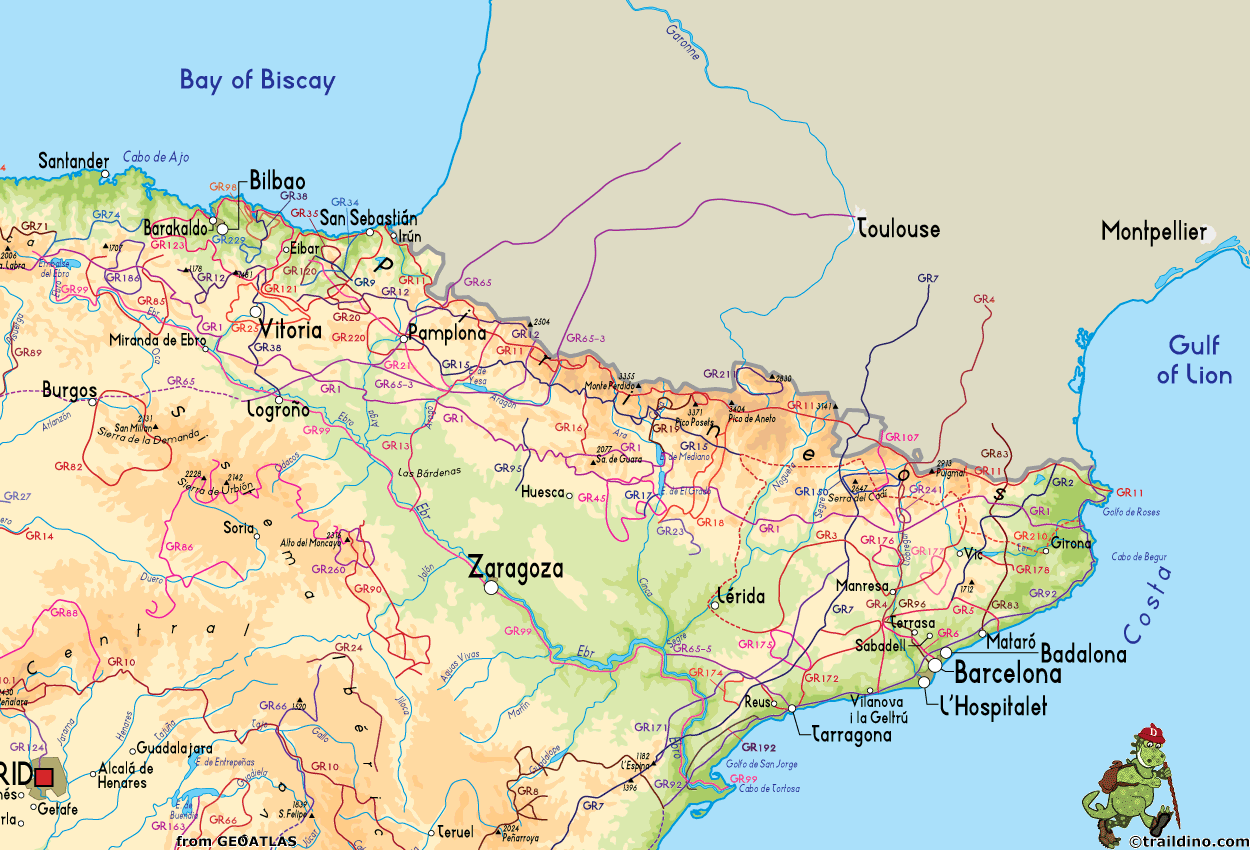
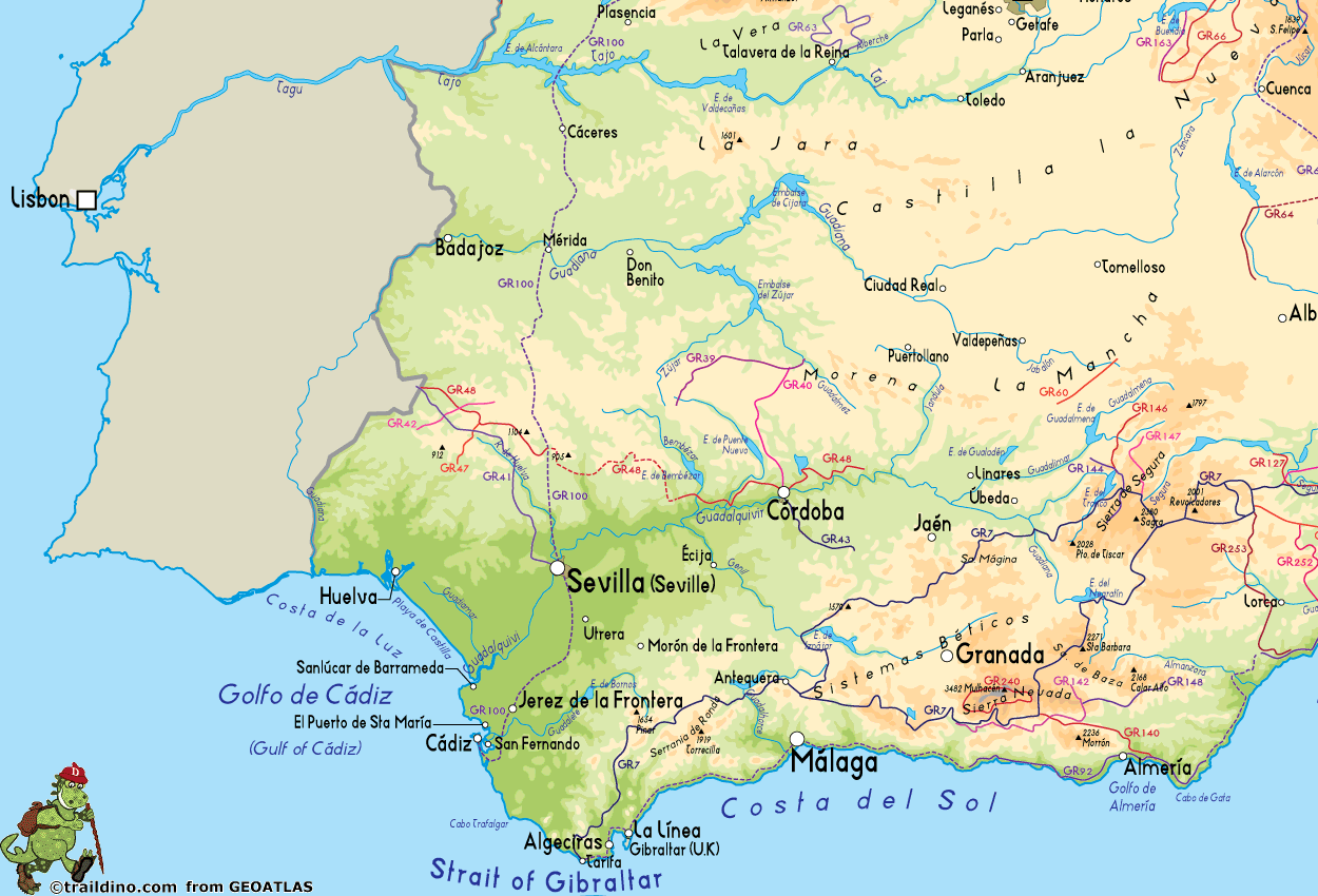
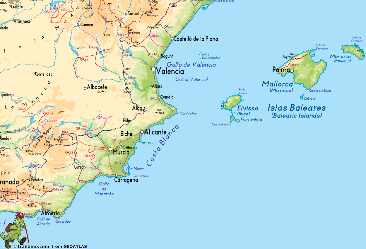
The Spanish Pyrenees are probably the best known hiking area, with the GR11 running all the way across from west to east, parallel to the French GR10. The most beautiful parts of the Pyrenees are protected, like Aigüestortes and Ordesa, and these can get very busy in summer. Another popular hiking area are the Picos de Europa, a limestone massif west of the Pyrenees. The rest of the Cantabrian mountain range, which runs al the way to the northwestern tip of Spain, is much less known. It is a relatively green area and a popular holiday destination for the Spanish themselves. Other mountain ranges, such as the Sierra Nevada, are hiking areas of old. Recent hiking tourism has resulted in the opening up of extraordinary landscapes, like the Extremadura on the border with Portugal which is well-known for its vultures and birds of prey, and of course Andalucia in the south.
Who hasn't heard of Camino de Santiago, the pilgrims' trail to Santiago de Compostela, which exerts an inexplicable attraction on hordes of people?! But there is much more and better too. Nowadays there are more than one hundred long distance trails in Spain. Like in France, these are called GR (Sendero de Gran Recorrido) and marked in red and white. Not surprisingly the "Topoguias" look the same as those of their northern neighbours.
Shorter hiking trails are marked in green and white (Sendero Local) or yellow and white (Sendero de Pequeño Recorrido).
Lastly there are several islands that deserve attention: the Balearic Islands and the Canary Islands offer fantastic hiking opportunities. Some long distance footpaths have been established here.
Opinions

- Elon Bartov June 2016
- Rate 8
- Positive the landscape, the accomodations and the people attidude.

- Miguel
- Rate 9
- Positive Great landscapes all around, never too far from towns if necessary. Slightly off the beaten path, Sanabria is quite nice.

- pc22
- Rate 9
- Positive I have walked across Spain twice now and also walked in the Picos mountains, the Cannary islands and across the mountains of Mallorca. The weather seems to be mostly amazing, great diversity of wildlife....in the main the people are friendly and usually relaxed....The Picos mountains in particular were sublime

- Tanja Laitila
- Rate 8
- Positive Good weather all year round, small rural roads and tracks all over to choose and build your own hike with a bit of imagination and liking to adventure.
- Negative Angry dogs loose around rural areas.
Map
Trails
- Camí Català per HuescaGPX
- Camí Català per LleidaGPX
- Camino a Finisterre - MuxíaGPX
- Camino AragonésGPX
- Camino de BaztanGPX
- Camino de GironaGPX
- Camino de la CostaGPX
- Camino de LevanteGPX
- Camino de Santiago de MadridGPX
- Camino de Santiago de TenerifeGPX
- Camino de Tarragona
- Camino del EbroGPX
- Camino del InviernoGPX
- Camino del NorteGPX
- Camino del SalvadorGPX
- Camino del Sur
- Camino FrancésGPX
- Camino InglésGPX
- Camino MozárabeGPX
- Camino Natural de la Cordillera Cantábrica
- Camino PortuguésGPX
- Camino PrimitivoGPX
- Camino SanabrésGPX
- Camino Vasco del InteriorGPX
- Carros de FocGPX
- E10GPX
- E12GPX
- E3GPX
- E4GPX
- E7GPX
- GR1 Sendero Histórico, Senda TransversalGPX
- GR10 Senderos de la MielGPX
- GR100 Ruta de la PlataGPX
- GR101 Camino Real de la MesaGPX
- GR102 Camino Real de Sellón
- GR105 Ruta de las PeregrinacionesGPX
- GR106 Ruta de San MelchorGPX
- GR107 - El Camí dels Bons HomesGPX
- GR108 Travesía AndariegaGPX
- GR11 Sendero PirenaicoGPX
- GR12 Sendero de Euskal HerriaGPX
- GR120 Ruta de los Tres TemplosGPX
- GR121 Vuelta a GipuzcoaGPX
- GR123 Vuelta a BizkaiaGPX
- GR124 Senda RealGPX
- GR125 La Senda del PoetaGPX
- GR127 Río SeguraGPX
- GR13 Cañada Real de los RoncalesesGPX
- GR130 Camino Real de la CostaGPX
- GR131 Camino de la VirgenGPX
- GR131 Camino Natural Anaga-ChasnaGPX
- GR131 Camino Natural Cumbres de La GomeraGPX
- GR131 Camino Natural de FuerteventuraGPX
- GR131 El BastónGPX
- GR132 La GomeraGPX
- GR14 Sendero del DueroGPX
- GR140 Puerto de la Ragua - Cabo de GataGPX
- GR142 Sendero de la AlpujarraGPX
- GR143 Sendero de Almeria
- GR144 Ruta de la TrashumanciaGPX
- GR146 Ruta Monte y Olivo
- GR147 Sierra ProfundaGPX
- GR148 Tahal - Abrucena
- GR15 Sendero PrepirenaicoGPX
- GR150 Alrededor de la Sierra de CadíGPX
- GR16 Sendero del SerrabloGPX
- GR163 Ruta del Cristal de HispaniaGPX
- GR17 Sendero MarianoGPX
- GR170 L'Estany - VidràGPX
- GR171 Pinós - PaülsGPX
- GR172 Bellprat - Montserrat - La MussaraGPX
- GR173 Vallès NaturalGPX
- GR174 Sender del PrioratGPX
- GR175 Ruta del CisterGPX
- GR176 Ruta de les Vint ErmitesGPX
- GR177 Ruta del MoianésGPX
- GR178 Ruta d'en SerrallongaGPX
- GR179 Sender del MaquisGPX
- GR18 Senderos de la RibagorzaGPX
- GR186 Caminos de MedinaGPX
- GR188 Ruta Ciudad Rodrigo el Payo
- GR19 Senderos de SobrabeGPX
- GR192 Cambrils - AmpostaGPX
- GR2 La Jonquera - AiguafredaGPX
- GR20 Vuelta a Aralar, Aralarko BiraGPX
- GR200 Ruta de los Palacios
- GR201 Senda del ArcedianoGPX
- GR202 Ruta La ReconquistaGPX
- GR204 Senda CosteraGPX
- GR21 Camino Ignaciano, Ruta IgnacianaGPX
- GR210 Camí vora TerGPX
- GR211 Circular del Vall d'AranGPX
- GR220 Vuelta a la Cuenca de PamplonaGPX
- GR221 Ruta de la Pedra en SecGPX
- GR222 Ruta Artà-LlucGPX
- GR223 Camí de CavallsGPX
- GR229 Ruta MikeldiGPX
- GR23 Senderos por la LiteraGPX
- GR24 Senderos de Calatayud, Darroca y GallocantaGPX
- GR240 Sendero SulayrGPX
- GR241 Sender Circular de BorredàGPX
- GR25 Vuelta a la Llanada Alavesa a Pie de MonteGPX
- GR250 Ruta del ApóstolGPX
- GR251 Camino del AltiplanoGPX
- GR252 Camino del Bajo GuadalentínGPX
- GR253 Camino de la Cruz del Alto GuadalentínGPX
- GR26 Senda de Tierra de CamposGPX
- GR260 Vuelta al Moncayo-Calcenada
- GR27 Sendero del Valle Esgueva
- GR28 Sendero de Tierra de PinaresGPX
- GR29 Sendero del río Pisuerga
- GR3 Sendero Central de CatalunyaGPX
- GR30 Sendero de los Montes de TorozosGPX
- GR33 Sender de la Lluna PlenaGPX
- GR34 Donostia - ArantzazuGPX
- GR35 Camino de la TrashumanciaGPX
- GR36 Sierra de EspadánGPX
- GR37 La Serranía - Vías PecuariesGPX
- GR38 Ruta del Vino y del PescadoGPX
- GR39 Cañada de la MestaGPX
- GR4 Puigcerdà - MontserratGPX
- GR40 Cañada Real SorianaGPX
- GR41 Cordel de las Buervas
- GR42 Cañada Real Leonesa OccidentalGPX
- GR43 Cordel de la CampiñaGPX
- GR44 Sender de SaragossaGPX
- GR45 Sendero del SomontanoGPX
- GR47 Camino de las Minas
- GR48 Sierra MorenaGPX
- GR5 Sendero de los Parques Naturales, Sender dels MiradorsGPX
- GR50 Ruta do MedievoGPX
- GR52 Ruta dos Ríos
- GR53 Sendero Panorámico de VigoGPX
- GR56 TransourensanoGPX
- GR57 Camí da FranqueiraGPX
- GR58 Sendero As GreasGPX
- GR59 Sender Roteiro Ecolóxico do MorrazoGPX
- GR6 Barcelona - MontserratGPX
- GR60 Sender d'AnibalGPX
- GR63 Sendero Senda de ViriatoGPX
- GR64 Mira - Límite provincialGPX
- GR65 Camino de SantiagoGPX
- GR66 Sendero de Castillano-ManchegoGPX
- GR67 Alcaraz - HellínGPX
- GR68 Circular sierra de Segura
- GR69 Circular de Huete
- GR7 Andorra - TarifaGPX
- GR71 Sendero de la Reserva de SajaGPX
- GR72 Ruta de los Campurrianos
- GR73 Calzada de los Blendios
- GR74 Corredor Oriental de Cantabria
- GR75 Senda de los Valles de Cantabria
- GR8 Puertos de Beceite - JavalambreGPX
- GR82 Sierra de la DemandaGPX
- GR83 - Camí del Nord o del CanigóGPX
- GR84 Canal del DueroGPX
- GR85 Ruta de los SentidosGPX
- GR86 Sendero Ibérico Soriano
- GR88 Sendero SegovianoGPX
- GR89 Canales de CastillaGPX
- GR9 Navarra y EuskadiGPX
- GR90 Tierras del MontcayoGPX
- GR92 Sender MediterraneoGPX
- GR93 Sierras de la RiojaGPX
- GR94 Sendero Rural de GaliciaGPX
- GR95 Calzada Romana de Zaragoza a FranciaGPX
- GR96 Cami Romeu a MontserratGPX
- GR97 Sendero de la Tordera al LlobregatGPX
- GR98 Vuelta a la Reserva de la Biosfera de Urdaibai
- GR99 Sendero del EbroGPX
- HRP - Haute Randonnée PyrénéenneGPX
- Ruta de la LanaGPX
- Ruta desde Almería
- Ruta desde Málaga
- Ruta por Toledo
- Santiago de Compostela Pilgrims WayGPX
- Sendero Circular del Hierro
- TR1 Route of PeaceGPX
- TR3 Verdaguer Route
- TR5 Ruta Matagalls-Montserrat
- TR6 Ruta del Meridia Verd
- Vía de la PlataGPX
- Via Augusta de Cádiz a Sevilla
- Via Portugués de la Via de la Plata
Regions
- Aigües Tortes
- Andalucía
- Aragón
- Asturias
- Cantabria
- Castilla y León
- Castilla-La Mancha
- Catalunya
- Cordillera Cantabrica
- Costa Blanca
- Costa Brava
- Costa Daurada
- Costa del Azahar
- Costa del Sol
- Eivissa, Baleares
- El Hierro, Canarias
- Euskadi
- Extremadura
- Formentera, Baleares
- Fuerteventura, Canarias
- Galicia
- Gran Canaria, Canarias
- Islas Baleares
- Islas Canarias
- La Gomera, Canarias
- La Graciosa, Canarias
- La Palma, Canarias
- La Rioja
- Lanzarote, Canarias
- Madrid
- Majorca, Baleares
- Menorca, Baleares
- Murcia
- Navarra
- Picos de Europa
- Pyrenees
- Sierra de Grazalema
- Sierra de Gredos
- Sierra de Guadarrama
- Sierra Nevada
- Tenerife, Canarias
- Valencia
States
Mountains
Links
Facts
- Caminos naturales - Caminos naturales - Desarrollo Rural (Spanish)
The Spanish government has developped a series of trails exploring the more natural areas of Spain.
- GR footpath - Wikipedia, the free encyclopedia
The concept of the "Grand Randonnée", or GR, was invented in France, and then spread to Belgium, Spain and the Netherlands. In the Netherlands the term was redubbed LAW. This wikipage lists the main trails.
- FEEC / Federació d'Entitats Excursionistes de Catalunya (Catalan)
All the GR's that pass through Catalunya are listed here. Many trails are described in detail.
- GRAN CANARIA WALKING FESTIVAL 2012
Gran Canaria Walking Festival 2012 is an annual event where walkers from all over the world will enjoy Gran Canaria through walking tours along the rural areas of the Island. September 15-22, 2012.
- Hiking in Spain Guides
Main page is overview of hiking in Spain. Additional pages contain overview maps, GPX tracks, list of accommodation and links to trip reports (from outside TrailDino) for the GR7, G8 and GR10 trails.
- Walking Spain - Walking guide
Good introductory page on walking in Spain.
Reports
- Viajar a pie (Spanish)
Website by Inaki Diaz de Etura. His meticulously composed opinions will help others choosing the right trail and equipment. A large part of his website is in English too.
Guides and maps
Lodging
Organisations
- FEDME - Federación Española de Deportes de Montaña y Escalada (Spanish)
The FEDME is the Spanish hiking and mountaineering organisation, realising and maintaining - together with the regional hiking organisations - the Senderos de Gran Recorrido, or the GRs, long distance trails. You will find a database of all the GR's here. Often, it's wise to visit one of the regional organisations' webpage for more information. The FEDME is member of the European Ramblers' Organisation and looks after the 5 European Long Distance Paths crossing the countrY: E3, E4, E7, E10, E12.
- FEEC / Federació d'Entitats Excursionistes de Catalunya (Catalan)
Hiking and climbing association of Catalunya.
- Piedra Sobre Piedra, Senderismo y naturaleza (Spanish)
Website on mountain activities in Spain, giving nice suggestions for short and long hikes.
Tour operators
GPS
Other
Books
- Also available from:
- Stanfords, United Kingdom
- De Zwerver, Netherlands

United Kingdom
2017
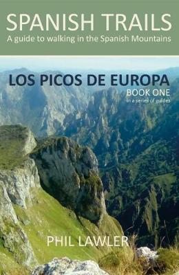
- Spanish Trails - A Guide to Walking the Spanish Mountains: Book one: Picos De Europa
- In this book Phil Lawler offers a wide selection of walks across the Picos de Europa in the majestic Cordillera Cantabrica, the Cantabrian Mountains, which run parallel with the Atlantic coastline in northern Spain. Phil has an intimate knowledge of this beautiful mountain range, as well as mountains in other parts of Spain. Many of the walks... Read more

United Kingdom
- Ordesa y Monte Perdido Parc Natural map and hiking guide 2018
- Ordesa and Monte Perdido National Park at 1:40,000 on a GPS compatible recreational map in an extensive and very popular series from Editorial Alpina, including a booklet with English language descriptions of several walks, climbs, etc.Contours are at 20m intervals, with relief shading and altitude colouring. An overprint highlights waymarked... Read more
- Also available from:
- Stanfords, United Kingdom

United Kingdom
- Ordesa and Monte Perdido National Park Editorial Alpina
- Ordesa and Monte Perdido National Park at 1:40,000 on a GPS compatible recreational map in an extensive and very popular series from Editorial Alpina, including a booklet with English language descriptions of several walks, climbs, etc.Contours are at 20m intervals, with relief shading and altitude colouring. An overprint highlights waymarked... Read more

United Kingdom
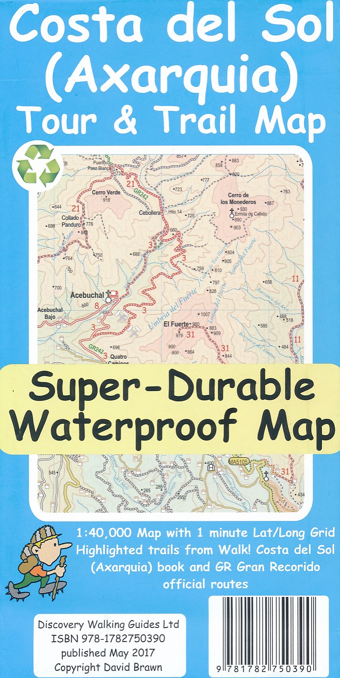
- Costa del Sol (Axarquia) Tour and Trail Super-Durable Map
- Costa del Sol (Axarquia) Tour & Trail Super-Durable Map comes with a 2 year adventurous use wear and tear guarantee against splitting or falling apart, see Discovery Walking Guides website for details. Our large 1:40,000 scale, combined with splitting the region into West and East sections with a generous overlap, produces double sided map... Read more
- Also available from:
- De Zwerver, Netherlands

Netherlands
- Wandelkaart Tour & Trail Costa de Sol - Axarquia | Discovery Walking
- Costa del Sol (Axarquia) Tour & Trail Super-Durable Map comes with a 2 year adventurous use wear and tear guarantee against splitting or falling apart, see Discovery Walking Guides website for details. Our large 1:40,000 scale, combined with splitting the region into West and East sections with a generous overlap, produces double sided map... Read more

United Kingdom
- Cycle Touring in Spain
- 8 multi-day routes throughout Spain Read more

United Kingdom
2013
- The Way of St James - Spain
- Pyrenees-Santiago-Finisterre Read more

United Kingdom
- The Camino Way
- Lessons in Leadership from a Walk Across Spain Read more

United Kingdom
2015
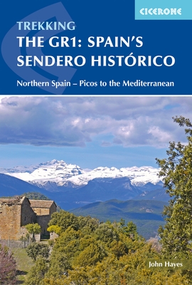
- Spain's Sendero Historico: The GR1
- Northern Spain - Picos to the Mediterranean Read more
- Also available from:
- Stanfords, United Kingdom
- De Zwerver, Netherlands

United Kingdom
2015
- Spain`s Sendero Historico: The GR1: Northern Spain - Picos to the Mediterranean
- The Sendero Historico (the GR1) is a 1,250km long-distance path that takes you from Puerto de Tarna, on the border of Asturias and Castilla y León, east along the southern flank of the Cantabrian Mountains and the foothills of the Pyrenees before finishing on the Mediterranean coast near L`Escala.This walking guide splits the route that... Read more

Netherlands
2015
- Wandelgids Spain's Sendero Historico: the GR1 | Cicerone
- Guidebook to the 1250km of Spain's Sendero Historico (GR1), traversing northern Spain from Puerto de Tarna in the province of Leon in the west to the Mediterranean near L'Escala in Catalonia, through fascinating, varied landscapes and the foothills of the Pyrenees. Described in 53 stages, about 25km each in length, with detailed mapping. Read more

United Kingdom
- Monte Perdido Macizo de / Valle de Ordesa / Pineta 2019
- Ordesa and Monte Perdido National Park at 1:25,000 in a set of two GPS compatible recreational maps in an extensive and very popular series from Editorial Alpina, providing more detailed coverage of this popular hiking area.Contours are at 10m intervals, with relief shading and vegetation colouring. An overprint highlights waymarked PR hiking... Read more
- Also available from:
- Stanfords, United Kingdom
- De Zwerver, Netherlands

United Kingdom
- Macizo de Monte Perdido - Valle de Ordesa - Pineta Editorial Alpina
- Ordesa and Monte Perdido National Park at 1:25,000 in a set of two GPS compatible recreational maps in an extensive and very popular series from Editorial Alpina, providing more detailed coverage of this popular hiking area.Contours are at 10m intervals, with relief shading and vegetation colouring. An overprint highlights waymarked PR hiking... Read more

Netherlands
- Wandelkaart 08 Macizo de Monte Perdido - Valle de Ordesa - Pineta | Editorial Alpina
- Ordesa and Monte Perdido National Park at 1:25,000 in a set of two GPS compatible recreational maps in an extensive and very popular series from Editorial Alpina, providing more detailed coverage of this popular hiking area.Contours are at 10m intervals, with relief shading and vegetation colouring. An overprint highlights waymarked PR hiking... Read more

United Kingdom
2014
- The Mountains of Nerja
- Sierras Tejeda, Almijara Y Alhama Read more
- Also available from:
- Stanfords, United Kingdom
- De Zwerver, Netherlands

United Kingdom
2014
- The Mountains of Nerja: Sierras de Tejeda, Almijara Y Alhama
- Guide to walking in the compact but action-packed mountain ranges just north of the seaside town of Nerja on the Costa del Sol, in southern Spain, less than an hour`s drive from Malaga airport. The ranges that make up the Sierras Tejeda, Almijara and Alhama National Park contain 50 summits of Munros status, as well as lots of wilderness areas... Read more

Netherlands
2017
- Wandelgids The Mountains of Nerja | Cicerone
- Guidebook to the Sierras de Tejeda, Almijara Y Alhama mountains in the Spanish region of Axarquía. The 24 day walks are accessible from the holiday towns of Nerja and Vélez-Málaga on the Costa del Sol. Routes range from easy strolls to strenuous climbs. The mountains are largely limestone, with some summits reaching over 2000m. Read more

United Kingdom
- Taga - Serra Cavallera - Sant Amand - Puig Sestela 2019
- Taga – Serra Cavalara area in the eastern part of the Spanish Pyrenees on a contoured and GPS compatible map at 1:25,000 from Editorial Alpina, highlighting local and long-distance hiking trails, accommodation facilities, etc.The map has contour lines at 10m intervals enhanced by relief shading, plus colouring to indicate different types of... Read more
- Also available from:
- Stanfords, United Kingdom
- De Zwerver, Netherlands

United Kingdom
- Taga - Serra Cavallera Editorial Alpina
- Taga – Serra Cavalara area in the eastern part of the Spanish Pyrenees on a contoured and GPS compatible map at 1:25,000 from Editorial Alpina, highlighting local and long-distance hiking trails, accommodation facilities, etc.The map has contour lines at 10m intervals enhanced by relief shading, plus colouring to indicate different types of... Read more

Netherlands
- Wandelkaart 43 Taga - Serra Cavallera | Editorial Alpina
- Taga – Serra Cavalara area in the eastern part of the Spanish Pyrenees on a contoured and GPS compatible map at 1:25,000 from Editorial Alpina, highlighting local and long-distance hiking trails, accommodation facilities, etc.The map has contour lines at 10m intervals enhanced by relief shading, plus colouring to indicate different types of... Read more

United Kingdom
- Alta Garrotxa - Comanegra - Bassegoda - el Mont 2018
- Alta Garrotxa area in the eastern part of the Spanish Pyrenees on a contoured and GPS compatible map at 1:25,000 from Editorial Alpina, highlighting local and long-distance hiking trails, accommodation facilities, etc.The map has contour lines at 10m intervals enhanced by relief shading, plus colouring to indicate different types of terrain or... Read more
- Also available from:
- Stanfords, United Kingdom
- De Zwerver, Netherlands

United Kingdom
- Alta Garrotxa - Comanegra - Bassegoda - el Mont Editorial Alpina
- Alta Garrotxa area in the eastern part of the Spanish Pyrenees on a contoured and GPS compatible map at 1:25,000 from Editorial Alpina, highlighting local and long-distance hiking trails, accommodation facilities, etc.The map has contour lines at 10m intervals enhanced by relief shading, plus colouring to indicate different types of terrain or... Read more

Netherlands
- Wandelkaart 48 Alta Garrotxa | Editorial Alpina
- Alta Garrotxa area in the eastern part of the Spanish Pyrenees on a contoured and GPS compatible map at 1:25,000 from Editorial Alpina, highlighting local and long-distance hiking trails, accommodation facilities, etc.The map has contour lines at 10m intervals enhanced by relief shading, plus colouring to indicate different types of terrain or... Read more
Maps

United Kingdom
- Sant Maurici / Els Encantats map&hiking guide 2019
- Zeer gedetailleerde wandelkaart van een klein deel van de Spaanse Pyreneeen. Met ingetekende wandelroutes en andere informatie. Spaanstalig / Engelstalig, maar uitstekende kaart. Met symbolen voor campings, hutten. Read more
- Also available from:
- Stanfords, United Kingdom
- De Zwerver, Netherlands

United Kingdom
- Sant Maurici Editorial Alpina
- Sant Maurici area of the Spanish Pyrenees, including the eastern half of the Aigüestortes i Estany de Sant Maurici National Park, presented on a contoured and GPS compatible map at 1:25,000 from Editorial Alpina. The map has contours at 10m intervals, enhanced by relief shading with plenty of spot heights, plus colouring for different types of... Read more

Netherlands
- Wandelkaart 22 Sant Maurici, Els Encantats | Editorial Alpina
- Zeer gedetailleerde wandelkaart van een klein deel van de Spaanse Pyreneeen. Met ingetekende wandelroutes en andere informatie. Spaanstalig / Engelstalig, maar uitstekende kaart. Met symbolen voor campings, hutten. Read more

United Kingdom
- Ramat de l'Est hiking map and guide 2018
- Trekking through the Pallars following in the footsteps of Camilo Jose Cela and Josep M. Espinas. This Editorial Alpina map and guide at 1:50,000 scale is in English, French, Spanish and Catalan.Covers: La Pobla de Segur, Peramea, Gerri de la Sal, Baro, Tornafort, Sort, Llessui, Rialp, Llavorsi, Tirvia, Areu. Read more
- Also available from:
- De Zwerver, Netherlands
Netherlands
- Wandelkaart Ramat de l'Est - trekking pel Pallars | Editorial Alpina
- Trekking through the Pallars following in the footsteps of Camilo Jose Cela and Josep M. Espinas. This Editorial Alpina map and guide at 1:50,000 scale is in English, French, Spanish and Catalan.Covers: La Pobla de Segur, Peramea, Gerri de la Sal, Baro, Tornafort, Sort, Llessui, Rialp, Llavorsi, Tirvia, Areu. Read more

United Kingdom
- Irati y Aezkoa valles de - Valle de Salazar-Sierra de Abodi 2018
- Valles de Irati & Aezkoa in an extensive and very popular series of walking maps from Editorial Alpina covering the Pyrenees, Catalonia and other selected hiking areas in Spain, including Picos de Europa, Sierra Nevada and parts of Andalucía, Majorca, etc. Scales vary from 1:50,000 to 1:10,000, with the majority of the titles at 1:25,000. The... Read more
- Also available from:
- Stanfords, United Kingdom
- De Zwerver, Netherlands

United Kingdom
- Valles de Irati y Aezkoa Editorial Alpina
- Valles de Irati & Aezkoa in an extensive and very popular series of walking maps from Editorial Alpina covering the Pyrenees, Catalonia and other selected hiking areas in Spain, including Picos de Europa, Sierra Nevada and parts of Andalucía, Majorca, etc. Scales vary from 1:50,000 to 1:10,000, with the majority of the titles at 1:25,000. The... Read more

Netherlands
- Wandelkaart 01 Mapa de los Valles de Irati - Aezkoa (Roncesvalles) | Editorial Alpina
- Valles de Irati & Aezkoa in an extensive and very popular series of walking maps from Editorial Alpina covering the Pyrenees, Catalonia and other selected hiking areas in Spain, including Picos de Europa, Sierra Nevada and parts of Andalucía, Majorca, etc. Scales vary from 1:50,000 to 1:10,000, with the majority of the titles at 1:25,000. The... Read more
- Also available from:
- Stanfords, United Kingdom

United Kingdom
- Cap de Creus Park Natural Editorial Alpina
- Cap de Creus Natural Park on the Costa Brava at 1:25,000 on a contoured and GPS compatible map from Editorial Alpina, plus a booklet which includes English language descriptions several recommended hiking trails, accommodation details, etc.Topography is presented by contours at10m intervals with relief shading and plenty of spot heights, plus... Read more

United Kingdom
- Pica d'Estats - Mont-Roig french 2016
- Zeer gedetailleerde wandelkaart van deel van de Spaanse Pyreneeen. Met ingetekende wandelroutes en andere informatie. Spaans en deel in het engels, maar uitstekende kaart. Met symbolen voor campings, hutten. A topographic tourist map and hiking guide with details of tourist attractions, hiking & sporting activities as well as transport... Read more
- Also available from:
- Stanfords, United Kingdom
- De Zwerver, Netherlands

United Kingdom
- Pica d`Estats - Mont-roig Editorial Alpina
- Pica d`Estats - Mont-roig area of the Catalan Pyrenees just west of Andorra on a contoured and GPS-compatible map at 1:25,000 from Editorial Alpina, highlighting local and long-distance hiking trails, tourist accommodation, etc. Coverage extends from the Andorran border westwards beyond the peak of Mont-roig and from the French border south to... Read more

Netherlands
- Wandelkaart 26 Pica d`Estats - Mont-roig E25 | Editorial Alpina
- Zeer gedetailleerde wandelkaart van deel van de Spaanse Pyreneeen. Met ingetekende wandelroutes en andere informatie. Spaans en deel in het engels, maar uitstekende kaart. Met symbolen voor campings, hutten. A topographic tourist map and hiking guide with details of tourist attractions, hiking & sporting activities as well as transport... Read more

United Kingdom
- 3Mils.Cat - Guide + Hiking and MTB Map 2016
- The “3mils.cat” route - a 125km / 10 day traverse across 10 over 3000m high peaks in the Catalan Pyrenees - on a contoured and GPS compatible map at 1:40,000 from Editorial Alpina with a booklet providing accommodation details, stage descriptions, etc.The route - from Tuc de Molières o Mulleres (3,010m), just south-east of Pic d’ Aneto, past... Read more
- Also available from:
- Stanfords, United Kingdom
- De Zwerver, Netherlands

United Kingdom
- 3mils.cat: Traverse of Ten 3000m Peaks in the Catalan Pyreness
- The “3mils.cat” route - a 125km / 10 day traverse across 10 over 3000m high peaks in the Catalan Pyrenees - on a contoured and GPS compatible map at 1:40,000 from Editorial Alpina with a booklet providing accommodation details, stage descriptions, etc.The route - from Tuc de Molières o Mulleres (3,010m), just south-east of Pic d’ Aneto, past... Read more

Netherlands
- Wandelkaart 3mils.cat | Editorial Alpina
- The “3mils.cat” route - a 125km / 10 day traverse across 10 over 3000m high peaks in the Catalan Pyrenees - on a contoured and GPS compatible map at 1:40,000 from Editorial Alpina with a booklet providing accommodation details, stage descriptions, etc.The route - from Tuc de Molières o Mulleres (3,010m), just south-east of Pic d’ Aneto, past... Read more

United Kingdom
- Sierra de Guara Parc Natural 2017
- Zeer gedetailleerde wandelkaart van de Sierra y Canones de Guara, Canyons National Park. Met ingetekende wandelroutes en andere informatie. uitstekende kaart. Met symbolen voor campings, hutten. Let op: deze uitgever is traag met het vernieuwen van kaarten; het kan zo maar zijn dat een bepaalde kaart gedurende langere tijd niet beschikbaar is.... Read more
- Also available from:
- Stanfords, United Kingdom
- De Zwerver, Netherlands

United Kingdom
- Sierra y Canones de Guara Editorial Alpina
- Topographic hiking map of Sierra y Canones de Guara by Editorial Alpina at 1:40,000 scale. Includes mountain huts, campsites and highlights, signposted hiking trails and the GR paths (long distance walkways). The map also includes a Spanish / French / English booklet with additional information about existing facilities and some routes. Read more

Netherlands
- Wandelkaart 11 Sierra y Cañones de Guara, Canyons National Park | Editorial Alpina
- Zeer gedetailleerde wandelkaart van de Sierra y Canones de Guara, Canyons National Park. Met ingetekende wandelroutes en andere informatie. uitstekende kaart. Met symbolen voor campings, hutten. Let op: deze uitgever is traag met het vernieuwen van kaarten; het kan zo maar zijn dat een bepaalde kaart gedurende langere tijd niet beschikbaar is.... Read more

United Kingdom
- Valles de Belagua y Roncal - Macizo de Larra 2018
- Zeer gedetailleerde wandelkaart van deel van de Spaanse Pyreneeen. Met ingetekende wandelroutes en andere informatie. Spaans maar uitstekende kaart. Met symbolen voor campings, hutten. A topographic tourist map and hiking guide with details of tourist attractions, hiking & sporting activities as well as transport information. An excellent... Read more
- Also available from:
- Stanfords, United Kingdom
- De Zwerver, Netherlands

United Kingdom
- Valles de Belagua y Roncal Editorial Alpina
- Valles de Belagua & Roncal in an extensive and very popular series of walking maps from Editorial Alpina covering the Pyrenees, Catalonia and other selected hiking areas in Spain, including Picos de Europa, Sierra Nevada and parts of Andalucía, Majorca, etc. Scales vary from 1:50,000 to 1:10,000, with the majority of the titles at 1:25,000. The... Read more

Netherlands
- Wandelkaart 02 Valles de Belagua y Roncal | Editorial Alpina
- Zeer gedetailleerde wandelkaart van deel van de Spaanse Pyreneeen. Met ingetekende wandelroutes en andere informatie. Spaans maar uitstekende kaart. Met symbolen voor campings, hutten. A topographic tourist map and hiking guide with details of tourist attractions, hiking & sporting activities as well as transport information. An excellent... Read more

United Kingdom
- Cotiella - Pena Montanesa 2019
- Zeer gedetailleerde wandelkaart van deel van de spaanse pyreneeen. Met ingetekende wandelroutes, GPS compatible enveel nuttige informatie over MTB, rotsklimmen, wandelroute. Spaans en deel in het engels, maar uitstekende kaart. Met symbolen voor campings, hutten. A topographic tourist map and hiking guide with details of tourist attractions,... Read more
- Also available from:
- De Zwerver, Netherlands
Netherlands
- Wandelkaart 13 Cotiella - Pena Montanesa | Editorial Alpina
- Zeer gedetailleerde wandelkaart van deel van de spaanse pyreneeen. Met ingetekende wandelroutes, GPS compatible enveel nuttige informatie over MTB, rotsklimmen, wandelroute. Spaans en deel in het engels, maar uitstekende kaart. Met symbolen voor campings, hutten. A topographic tourist map and hiking guide with details of tourist attractions,... Read more

United Kingdom
- Montnegre Corredor Parc Natural E25 2016
- The Montnegre - Corredor Natural Park on the Costa Brava presented by Editorial Alpina at 1:25,000 on a contoured and GPS compatible map with an overprint highlighting hiking trails, various accommodation options, etc.Topography is shown by contours at 10m intervals, relief shading and vegetation colouring. In addition to footpaths, the... Read more
- Also available from:
- Stanfords, United Kingdom
- De Zwerver, Netherlands

United Kingdom
- Montnegre - Corredor Editorial Alpina
- The Montnegre - Corredor Natural Park on the Costa Brava presented by Editorial Alpina at 1:25,000 on a contoured and GPS compatible map with an overprint highlighting hiking trails, various accommodation options, etc.Topography is shown by contours at 10m intervals, relief shading and vegetation colouring. In addition to footpaths, the... Read more

Netherlands
- Wandelkaart 59 Montnegre Corredor | Editorial Alpina
- The Montnegre - Corredor Natural Park on the Costa Brava presented by Editorial Alpina at 1:25,000 on a contoured and GPS compatible map with an overprint highlighting hiking trails, various accommodation options, etc.Topography is shown by contours at 10m intervals, relief shading and vegetation colouring. In addition to footpaths, the... Read more

United Kingdom
- Muntanyes de Llibertat guide + map Alt Pirineu 2015
- Muntanyes de Llibertat Hiking Circuit, a 62km-long cross-border hiking trail in the central Pyrenees covering the routes of Republican refuges from Spain into France after the Civil War and of Jewish refuges from France during World War II, presented by Editorial Alpina at 1:25,000 on a contoured and GPS compatible map. Staring from the... Read more
- Also available from:
- Stanfords, United Kingdom
- De Zwerver, Netherlands

United Kingdom
- Muntanyes de Llibertat Hiking Circuit
- Muntanyes de Llibertat Hiking Circuit, a 62km-long cross-border hiking trail in the central Pyrenees covering the routes of Republican refuges from Spain into France after the Civil War and of Jewish refuges from France during World War II, presented by Editorial Alpina at 1:25,000 on a contoured and GPS compatible map. Staring from the... Read more

Netherlands
- Wandelkaart Muntanyes de Llibertat - Alt Pirineu | Editorial Alpina
- Muntanyes de Llibertat Hiking Circuit, a 62km-long cross-border hiking trail in the central Pyrenees covering the routes of Republican refuges from Spain into France after the Civil War and of Jewish refuges from France during World War II, presented by Editorial Alpina at 1:25,000 on a contoured and GPS compatible map. Staring from the... Read more

United Kingdom
- Valle de Benasque / Aneto / Maladeta / Posets / Perdiguero 2017
- Zeer gedetailleerde wandelkaart van een klein deel van de Spaanse Pyreneeen. Met ingetekende wandelroutes en andere informatie. Spaanstalig, maar uitstekende kaart. Met symbolen voor campings, hutten. Book Language: Catalan •Hiking map and guidebook •Scale 1:30.000 •Equidistance contours: 10 m distance •Master contours: at 50 m •Shady relief... Read more
- Also available from:
- De Zwerver, Netherlands

Netherlands
- Wandelkaart 18 Valle de Benasque | Editorial Alpina
- Zeer gedetailleerde wandelkaart van een klein deel van de Spaanse Pyreneeen. Met ingetekende wandelroutes en andere informatie. Spaanstalig, maar uitstekende kaart. Met symbolen voor campings, hutten. Book Language: Catalan •Hiking map and guidebook •Scale 1:30.000 •Equidistance contours: 10 m distance •Master contours: at 50 m •Shady relief... Read more

United Kingdom
- Puigpedros - Tossa Plana de Lles - Cerdanya carte&guide 2019
- Zeer gedetailleerde wandelkaart van een klein deel van de Spaanse Pyreneeen. Met ingetekende wandelroutes en andere informatie. Spaanstalig, maar uitstekende kaart. Met symbolen voor campings, hutten. • Mapa excursionista i guia • Escala: 1:25.000 • Equidistància: 10 m • Corbes mestres: a 50 m • Ombrejat • Usos del sòl representats a 3 nivells... Read more
- Also available from:
- De Zwerver, Netherlands

Netherlands
- Wandelkaart 29 Puigpedros | Editorial Alpina
- Zeer gedetailleerde wandelkaart van een klein deel van de Spaanse Pyreneeen. Met ingetekende wandelroutes en andere informatie. Spaanstalig, maar uitstekende kaart. Met symbolen voor campings, hutten. • Mapa excursionista i guia • Escala: 1:25.000 • Equidistància: 10 m • Corbes mestres: a 50 m • Ombrejat • Usos del sòl representats a 3 nivells... Read more

United Kingdom
- Senda de Camille circular trek 2018
- Een topografische wandelkaart van de Senda de Camille, een meerdaagse tocht in het centrale deel van de Spaanse Pyreneeen met een deel in Frankrijk. Parque Natural de los Valles Occidentales - Huesca Pargue Nacional de los Pireneos Francia Op de topografische wandelkaart worden o.a. berghutten, campings aangeduid en hoogtelijnen, ingetekende... Read more
- Also available from:
- Stanfords, United Kingdom
- De Zwerver, Netherlands

United Kingdom
- La Senda de Camille Editorial Alpina
- La Senda de Camille, the Pyrenean Bear Trail, a 104-km circuit in the central Pyrenees, on a contoured GPS compatible map at 1:25,000 from Editorial Alpina, plus a booklet providing information on mountain refuges. The route, which crosses over from the Spanish side to the Parc National des Pyrénées in France and incorporates part of the... Read more

Netherlands
- Wandelkaart La Senda de Camille | Editorial Alpina
- Een topografische wandelkaart van de Senda de Camille, een meerdaagse tocht in het centrale deel van de Spaanse Pyreneeen met een deel in Frankrijk. Parque Natural de los Valles Occidentales - Huesca Pargue Nacional de los Pireneos Francia Op de topografische wandelkaart worden o.a. berghutten, campings aangeduid en hoogtelijnen, ingetekende... Read more

United Kingdom
- Ruta dels Estanys Amagats map and guide 2018
- The Hidden Lakes (Ruta dels Estanys Amagats) Hiking Circuit, a 97km route across the Cerdanya region of the Spanish Pyrenees and Andorra, presented at 1:40,000 on a contoured and GPS compatible map from Editorial Alpina, with contact details of mountain refuges.The map has contours at 20m intervals, enhanced by relief shading. The Hidden Lakes... Read more
- Also available from:
- Stanfords, United Kingdom
- De Zwerver, Netherlands

United Kingdom
- Ruta dels Estanys Amagats
- The Hidden Lakes (Ruta dels Estanys Amagats) Hiking Circuit, a 97km route across the Cerdanya region of the Spanish Pyrenees and Andorra, presented at 1:40,000 on a contoured and GPS compatible map from Editorial Alpina, with contact details of mountain refuges.The map has contours at 20m intervals, enhanced by relief shading. The Hidden Lakes... Read more

Netherlands
- Wandelkaart Ruta dels Estanys Amagats | Editorial Alpina
- The Hidden Lakes (Ruta dels Estanys Amagats) Hiking Circuit, a 97km route across the Cerdanya region of the Spanish Pyrenees and Andorra, presented at 1:40,000 on a contoured and GPS compatible map from Editorial Alpina, with contact details of mountain refuges.The map has contours at 20m intervals, enhanced by relief shading. The Hidden Lakes... Read more
Walking holidays

United Kingdom
- Camino Stage 2 - Logrono to Burgos Self Guided Walking Holiday
- Stage 2 Camino - Logrono to Burgos 7 day and 6 night self guided walking holiday. Walk from Logrono, in the region of Rioja to the medieval city of Burgos on the second stage of the Camino. The first part of this stage is relatively easy and the landscape is dominated by vineyards, as you head towards Santa Domingo country roads dominate and... Read more

United Kingdom
- Camino Portugués: Final Stage - Tui to Santiago Self Guided Walking Holiday
- The final 110km of the Camino Portugués from Tui to Santiago. Walk the last 100km of the Camino Portugués from Tui to Santiago de Compostela. This final section of the walk takes you from Tui through the friendly region of Galicia in Northern Spain. Following country roads and woodland paths, you pass through wooded valleys, follow gentle... Read more

United Kingdom
- Camino Portugués: Stage 2: Santarém to Coimbra Self Guided Walking Holiday
- Walk from the gothic city of Santarém through to the beautiful University town of Coimbra. The second stage of the Camino Portugués starts off with a day of relatively flat walking, but you are soon out amongst the rolling hills as the week progresses. This section has three of the most amazing cities on the trip, the gothic Santarém, the... Read more

United Kingdom
- Camino Stage 5 - O'Cebreiro to Santiago Self Guided Walking Holiday
- Stage 5 of the Camino, O'Cebreiro to Santiago 9 day and 8 night self guided walking holiday. Walk the last section of the Camino through rural Spain ending up in the fabulous city of Santiago de Compostela. A wonderful section of the walk and just enough mileage to gain your Compostela Certificate. This final stage passes through the sierra of... Read more

United Kingdom
- Stage 1 - St Jean-Pied-de-Port to Logrono Self Guided Walking Holiday
- Walk the first stage of the Camino de Santiago from St-Jean-Pied-de-Port to Logrono. Walk the first stage of the Camino de Santiago, from St Jean which straddles the French and Spanish border, to Logrono in the famous wine growing region of Rioja. Undoubtedly the toughest stage of the whole Camino de Santiago, but one filled with rewards.... Read more

United Kingdom
- Camino Stage 3 - Burgos to Leon Self Guided Walking Tour
- This section runs from Burgos to the wonderful city of Leon. Walk from the medieval city of Burgos to the beautiful city of Leon on the third stage of the Camino. Crop field dominate the landscape on the first part of this stage and there are not many trees in view. The river Pisuerga brings you in to Palencia and into the Tierra de Campos... Read more

United Kingdom
- Camino Portugués: Stage 4: Porto to Tui Self Guided Walking Holiday
- This stage crosses the border from Portugal to Spain across the Minho river. On this trip you cross the border from Portugal into Spain when crossing the international bridge over the Minho river. During the course of the trip you will pass through a variety of landscapes, from the urban sprawl of Porto to rolling green hills and stretches of... Read more

United Kingdom
- Camino Portugués: Full Walk: Lisbon to Santiago Self Guided Walking Holiday
- The full 611km of the Camino Portugués pilgrimage. Walk the full Camino Portugués from Lisbon to Santiago de Compostela, and enjoy a less travelled side of Portugal, but one which is no less inspiring and rich in cultural and architectural heritage. From the smells of cooking from the Churrascaria, the swell of emotion from your first sight of... Read more

United Kingdom
- Camino Stage 4 - Leon to O'Cebreiro Self Guided Walking Holiday
- Stage 4 of the Camino de Santiago takes you from the wonderful city of Leon to the quaint village of O'Cebriero. Walk from the beautiful city of Leon to O'Cebreiro on the Camino Frances. As you leave the plateau of Leon you will see the mountains up ahead as you head to Astorga. This part of the countryside is characterised by broom, heather,... Read more

United Kingdom
- Camino Last 100km - Sarria to Santiago - 8 Days
- Walk the last 100km of the Camino Frances to Santiago de Compostela over 6 walking days. Walk the classic final stage of the Camino de Santiago, covering the last 100km of the Camino de Santiago over six walking days. This breaks up the longest day (usually 28km) between Palas de Rei and Arzua. By adding an extra night you will have more... Read more

United Kingdom
- Camino Stage 1 & 2 - St Jean-Pied-de-Port to Burgos
- A 14 day & 13 night stage 1 & 2 St Jean-Pied-de-Port to Burgos self guided walking holiday. Walk the first two stages of the Camino from St Jean Pied de Port, which straddles the French and Spanish border, to the medieval city of Burgos. Crossing the Pyrenees your first day will undoubtably be the toughest day of the whole Camino. The steep... Read more

United Kingdom
- Full Camino - St Jean Pied de Port to Santiago Self-Guided Walking Tour
- Walk the full Camino Frances from St Jean Pied de Port to Santiago de Compostela. Walk the full Camino Frances (Way of St James) - a journey for the spirit and soul that millions of travellers complete year after year. Setting off from St Jean Pied de Port in the foothills of the Pyrenees, and finishing in Santiago de Compostela, you will enjoy... Read more
Netherlands
- Frankrijk - Les Pyrénées Cathares
- Avontuurlijke (ezel)tocht door de fraaie voetheuvels van de oostelijke Pyreneeën, met zicht op de hoogste, besneeuwde bergtoppen bij Andorra. Je overnacht in een gastvrije chambres d'hôtes en een refuge (berghut) op 1600m hoogte, waar heerlijke maaltijden worden verzorgd. Afwisselend door stille bossen en over kleurrijke bloemenweides wandel je... Read more
Netherlands
- Spanje - Pyreneeën GR11 etappe 1 Aragón - Ordesa
- De GR11 voert door de hoogste, ruigste en mooiste stukken van de Spaanse Pyreneeën. Met SNP kun je in twee etappes van Jaca in Aragón naar Catalonië wandelen, individueel en ‘self-guided', maar wel met ondersteuning van een lokale gids. Van hem krijg je elke avond een briefing waarbij de weersverwachting, condities van de paden en eventuele... Read more
Netherlands
- Spanje - Andalusië
- Bezoek Granada, Córdoba en Sevilla en leer alles over het Moorse, christelijke en Joodse erfgoed uit de hoogtijdagen van Andalusië. Tussendoor is het genieten in twee comfortabele, landelijke accommodaties, met zwembad en tuin, van waaruit je wandelingen maakt in verrassende natuurgebieden. Read more
Forum

- vincent1919 2020-11-25 16:28:56
We have High Quality 100% Undetectable Grade AA+ Counterfeit Banknotes For Sale [+16614123859 ]Our Website:https://counterfeitsuppliers.com
- Buy high quality undetectable grade AA+ counterfeit banknotes, we have available USD, CAD, GBP, EU just to name a few.
Our Website:https://counterfeitsuppliers.com
E-Mail Address:……..((( counterfeitsuppliers2011@gmail.com)))
Buy High Quality Fake//Real Express UK/USA Passport//ID Cards//Counterfeit Banknotes//IELTS//TOEFL [ Whats App: +16614123859}
We also deal and specialize in helping you to get high quality Biometric documents, registered PASSPORT, DRIVING LICENSE, ID CARD, VISA, SSN TOEFL, IELTS, IDP, ESOL, GMAT CELTA/DELTA, DEGREE, DIPLOMAS & other English Language Certificates[ Whats App:+16614123859]

- vincent1919 2020-11-25 16:28:47
We have High Quality 100% Undetectable Grade AA+ Counterfeit Banknotes For Sale [+16614123859 ]Our Website:https://counterfeitsuppliers.com
- Buy high quality undetectable grade AA+ counterfeit banknotes, we have available USD, CAD, GBP, EU just to name a few.
Our Website:https://counterfeitsuppliers.com
E-Mail Address:……..((( counterfeitsuppliers2011@gmail.com)))
Buy High Quality Fake//Real Express UK/USA Passport//ID Cards//Counterfeit Banknotes//IELTS//TOEFL [ Whats App: +16614123859}
We also deal and specialize in helping you to get high quality Biometric documents, registered PASSPORT, DRIVING LICENSE, ID CARD, VISA, SSN TOEFL, IELTS, IDP, ESOL, GMAT CELTA/DELTA, DEGREE, DIPLOMAS & other English Language Certificates[ Whats App:+16614123859]

- Chel 2020-03-10 13:19:32
Traverser l'Espagne de Granada a Biaritz....
- Hi,
si vous avez des infos pour ce procurer des cartes GR ou autres pour mon projet merci de me faire passer l'info ...
merci :-)

- sophie j 2017-01-17 13:00:23
hebergement sur le GR240 Sierra Nevada Espagne
- bonjour, je cherche des gites sur le GR240 sierra nevada et ce n'est pas simple!
Si quelqu'un a des idées, je suis preneuse!
Merci d'avance!
Sophiej.

- Pete Mathers 2016-04-23 22:20:08
Walking the coast from Gibraltar to France
- Hi. I'm planning to walk the coast of Spain from Gibraltar up into France. It's actually part of a larger project to walk the whole north coast of the Mediterranean. I hope to set off around Easter next year. I'm in the very early stages of planning my route at the moment and would be very grateful for any advice or suggestions for paths to take.
At the start, for example, I'm thinking of heading up from Gibraltar to the GR7 and following that east for a bit then dropping down to Malaga. Or following the Great Malaga Path (GR249 - which doesn't seem to be no this site) and the GR92. Does anyone know if the Great Malaga Path is actually finished yet? And what it's like? Basically I'd love to hear from anyone who has walked the coast of Spain or part of it, who can recommend paths to take. - Andy King 2017-09-17 08:49:50
- Would be interested to know how you got on with this. I am not a hiker at present but looking to take a sabbatical in 2019 and walk something similiar. Would be interested in hearing your story or blog