
Costa Brava
Description
The "Wild Coast", popular holiday destination, extending some 200 km South starting from the French border.
Trails in this region
Links
Facts
Reports
Guides and maps
Lodging
Organisations
Tour operators
GPS
Other
Books

Stanfords
United Kingdom
2019
United Kingdom
2019
- The Pyrenean Haute Route
- There are three main trekking routes across the Pyrenees from coast to coast: of these, the Pyrenean Haute Route (or HRP for Haute Route Pyreneenne) is the most challenging - and arguably, the most spectacular. Unlike the GR10 and GR11, it is not waymarked and borders on mountaineering at times, sticking as closely as possible to the main... Read more
- Also available from:
- The Book Depository, United Kingdom
- De Zwerver, Netherlands


De Zwerver
Netherlands
2022
Netherlands
2022
- Wandelgids Pyrenean Haute Route - a high level trail, Pyreneeën HRP | Cicerone
- Guidebook to trekking the Pyrenean Haute Route, which zigzags across the Franco-Spanish border, staying close to the main ridge in the highest and most spectacular central Pyrenees. It covers 750km with over 40km of ascent, so is suitable for experienced mountain walkers only. The largely unwaymarked route is presented in 45 stages. Read more

- Also available from:
- De Zwerver, Netherlands


The Book Depository
United Kingdom
2017
United Kingdom
2017
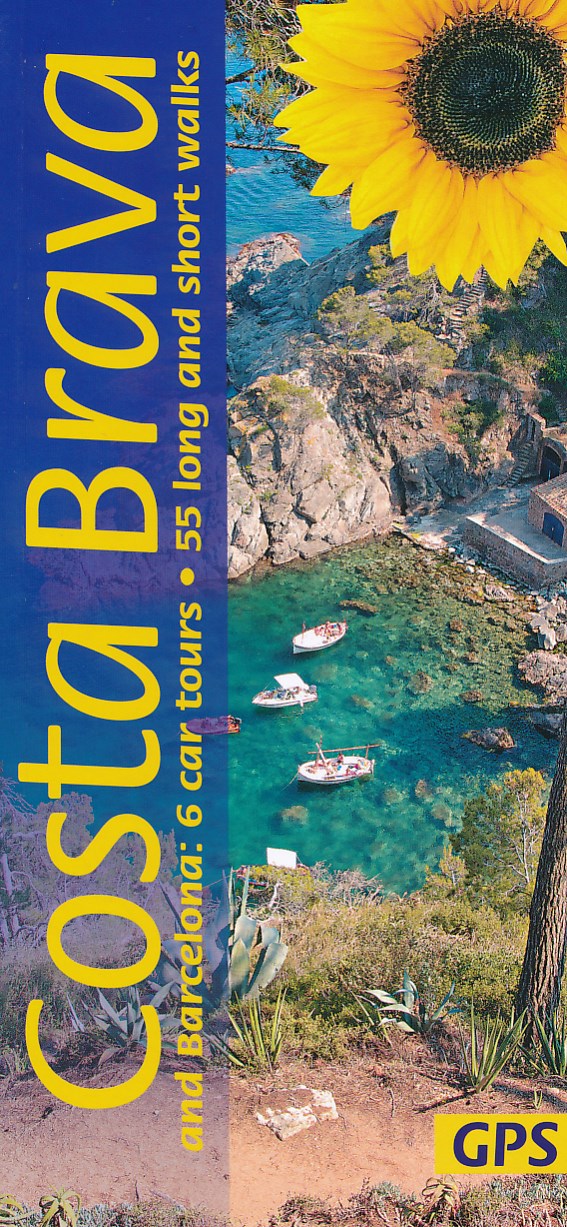
- Costa Brava and Barcelona
- 6 car tours, 55 long and short walks with GPS Read more
- Also available from:
- De Zwerver, Netherlands

The Book Depository
United Kingdom
2019
United Kingdom
2019
- Shorter Treks in the Pyrenees
- 7 great one and two week circular treks Read more
- Also available from:
- De Zwerver, Netherlands

De Zwerver
Netherlands
2019
Netherlands
2019
- Wandelgids Shorter Treks in the Pyrenees | Cicerone
- Guidebook detailing seven circular treks of 4-12 days in the beautiful Pyrenees. The varied routes cover both sides of the French-Spanish border and include both the High Pyrenees and the lower, more gentle mountains of the Basque Country and Catalonia. Variants are suggested for those wishing to shorten or extend the treks. Read more


- Also available from:
- De Zwerver, Netherlands


Stanfords
United Kingdom
United Kingdom
- Vignemale - Valle de Bujaruelo Editorial Alpina
- Cross-border area of the Pyrenees at 1:25,000 on a contoured and GPS compatible map covering on the Spanish side the valleys of Bujaruelo and Ara with the western section of the Ordesa National Park and the Ordesa Valley, and within France extending from the Vignemale Massif to Gavarnie, plus a Spanish/French booklet with recommendations for... Read more
- Also available from:
- The Book Depository, United Kingdom
- De Zwerver, Netherlands

The Book Depository
United Kingdom
United Kingdom
- Vignemale - Valle de Bujaruelo
- Cross-border area of the Pyrenees at 1:25,000 on a contoured and GPS compatible map covering on the Spanish side the valleys of Bujaruelo and Ara with the western section of the Ordesa National Park and the Ordesa Valley, and within France extending from the Vignemale Massif to Gavarnie, plus a Spanish/French booklet with recommendations for... Read more

De Zwerver
Netherlands
Netherlands
- Wandelkaart 06 Vignemale - Valle de Bujaruelo | Editorial Alpina
- Cross-border area of the Pyrenees at 1:25,000 on a contoured and GPS compatible map covering on the Spanish side the valleys of Bujaruelo and Ara with the western section of the Ordesa National Park and the Ordesa Valley, and within France extending from the Vignemale Massif to Gavarnie, plus a Spanish/French booklet with recommendations for... Read more


- Also available from:
- De Zwerver, Netherlands

The Book Depository
United Kingdom
United Kingdom

Stanfords
United Kingdom
United Kingdom
- Macizo de Monte Perdido - Valle de Ordesa - Pineta Editorial Alpina
- Ordesa and Monte Perdido National Park at 1:25,000 in a set of two GPS compatible recreational maps in an extensive and very popular series from Editorial Alpina, providing more detailed coverage of this popular hiking area.Contours are at 10m intervals, with relief shading and vegetation colouring. An overprint highlights waymarked PR hiking... Read more
- Also available from:
- The Book Depository, United Kingdom

The Book Depository
United Kingdom
United Kingdom
- Monte Perdido Macizo de / Valle de Ordesa / Pineta
- Ordesa and Monte Perdido National Park at 1:25,000 in a set of two GPS compatible recreational maps in an extensive and very popular series from Editorial Alpina, providing more detailed coverage of this popular hiking area.Contours are at 10m intervals, with relief shading and vegetation colouring. An overprint highlights waymarked PR hiking... Read more

Bol.com
Netherlands
Netherlands
- BARCELONA CITYGUIDE 4E ING
- Barcelona is, of course, singular in its architecture and art - from the intricately carved edifices of its Gothic quarter; Gaudi's moderniste structures; and, the seminal surrealist works of Picasso and Miro that pegged Barcelona as an important birthplace for 20th-century art. An informative narrative points out interesting facts and explains... Read more
- Also available from:
- Bol.com, Belgium
Bol.com
Belgium
Belgium
- BARCELONA CITYGUIDE 4E ING
- Barcelona is, of course, singular in its architecture and art - from the intricately carved edifices of its Gothic quarter; Gaudi's moderniste structures; and, the seminal surrealist works of Picasso and Miro that pegged Barcelona as an important birthplace for 20th-century art. An informative narrative points out interesting facts and explains... Read more
De Zwerver
Netherlands
2024
Netherlands
2024

Stanfords
United Kingdom
2010
United Kingdom
2010
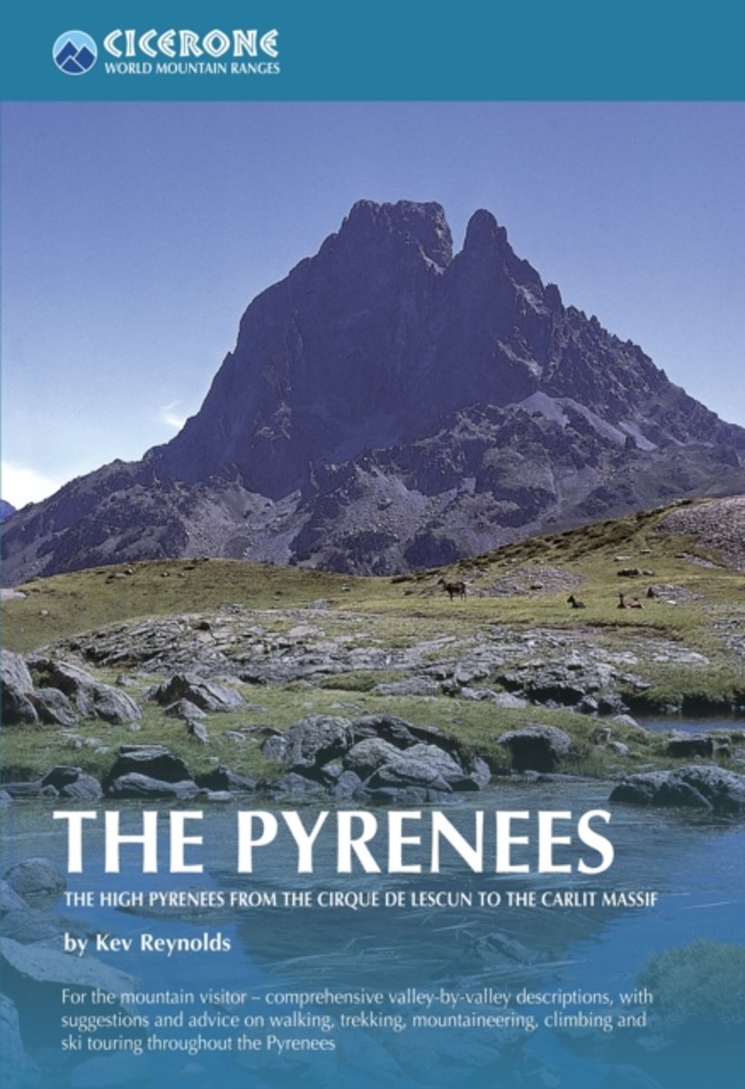
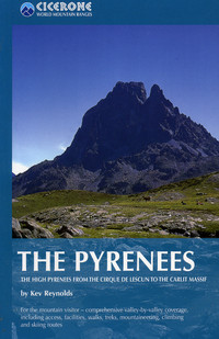
- The Pyrenees: The High Pyrenees from the Cirque de Lescun to the Carlit Massif
- The Pyrenees is accomplished walker Kev Reynolds’ large-format Cicerone guide to one of Europe’s most famous and impressive mountain ranges. The guide gives a valley-by-valley description of the High Pyrenees from west to east and is a very useful reference to help identify the best locations for walking, mountaineering, skiing and climbing.... Read more
- Also available from:
- The Book Depository, United Kingdom
- Bol.com, Netherlands
- Bol.com, Belgium
- De Zwerver, Netherlands

The Book Depository
United Kingdom
2010
United Kingdom
2010
- The Pyrenees
- The High Pyrenees from the Cirque de Lescun to the Carlit Massif Read more
Bol.com
Netherlands
2010
Netherlands
2010
- The Pyrenees
- A resource book covering the finest walks, treks and climbs in the High Pyrenees for 400km between France and Spain, from the Cirque de Lescun, on the edge of the Basque country in the west, to the Carlit massif and the Cerdagne to the east of Andorra. The book is divided into five regional chapters: the Western Valleys; Cirques and Canyons;... Read more
Bol.com
Belgium
2010
Belgium
2010
- The Pyrenees
- A resource book covering the finest walks, treks and climbs in the High Pyrenees for 400km between France and Spain, from the Cirque de Lescun, on the edge of the Basque country in the west, to the Carlit massif and the Cerdagne to the east of Andorra. The book is divided into five regional chapters: the Western Valleys; Cirques and Canyons;... Read more
De Zwerver
Netherlands
2010
Netherlands
2010
- Wandelgids - Klimgids - Klettersteiggids The Pyrenees | Cicerone
- A resource book covering the finest walks, treks and climbs in the High Pyrenees for 400km between France and Spain, from the Cirque de Lescun, on the edge of the Basque country in the west, to the Carlit massif and the Cerdagne to the east of Andorra. It is the first in our World Mountain Ranges series. Read more
Maps

Stanfords
United Kingdom
United Kingdom
- Cap de Creus Park Natural Editorial Alpina
- Cap de Creus Natural Park on the Costa Brava at 1:25,000 on a contoured and GPS compatible map from Editorial Alpina, plus a booklet which includes English language descriptions several recommended hiking trails, accommodation details, etc.Topography is presented by contours at10m intervals with relief shading and plenty of spot heights, plus... Read more

Stanfords
United Kingdom
United Kingdom
- Serra de Montsant Editorial Piolet Hiking Map
- Serra de Montsant area at 1:20,000 in a series of GPS compatible maps from Editorial Piolet with cartography based on Spain’s civilian topographic survey overprinted with hiking routes and other tourist information. The overprint includes 11 recommended itinerates in the park, plus eight special walks exploring local flora.Hiking maps in the... Read more
Stanfords
United Kingdom
United Kingdom
- Ordesa - Monte Perdido National Park Editorial Alpina 2-Map Set
- Ordesa and Monte Perdido National Park at 1:25,000 in a set of two GPS compatible recreational maps in an extensive and very popular series from Editorial Alpina, providing more detailed coverage of this popular hiking area.Contours are at 10m intervals, with relief shading and vegetation colouring. An overprint highlights waymarked PR hiking... Read more

Stanfords
United Kingdom
United Kingdom
- Pyrenees East - Barcelona - Costa Brava 500K CNIG Regional Map No. 4
- The eastern part of Spanish Pyrenees, with coverage extending along the Mediterranean coast beyond Barcelona to Tarragona, at 1:500,000 in a series of regional road maps from the country’s civilian survey organization IGN-CNIG (Instituto Geográfico Nacional - Centro Nacional de Información Geográfica), vividly presenting the topography by... Read more
Stanfords
United Kingdom
United Kingdom
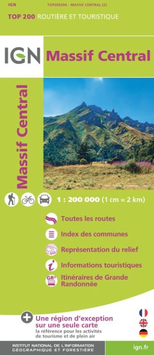
- Massif Central IGN Top200 204
- Pyrénées Ouest map from the IGN at 1:200,000, with excellent presentation of the terrain through contours and vivid relief shading, plenty of names of topographic features, long-distance GR hiking routes, places of interest, etc. The map is designed to provide convenient coverage of the western and central part of the Pyrenees, extending across... Read more

Stanfords
United Kingdom
United Kingdom
- GR 11: La Senda
- GR11 long-distance footpaths along the Spanish side of the Pyrenees in a French language guide from Rando Editions, with extracts from the publisher’s topographic series at 1:50,000 highlighting the route and mountain refuges.The guide divides the route into 40 sections and covers it from the Mediterranean, starting at Cap de Creus on the Costa... Read more

Stanfords
United Kingdom
United Kingdom
- Terres de l`Ebre
- Terres de l`Ebre map at 1:100,000 in the topographic survey of Catalonia published by the Institut Cartogràfic de Catalunya, with very detailed coverage of a large area and an excellent representation of the region’s topography. Maps in this series have relief presented by contours at 40m intervals, enhanced by additional hill-shading and spot... Read more

Stanfords
United Kingdom
United Kingdom
- 3220 Cabo de la Nao to the French border Chart Atlas - 2019 Edition
- A new chart atlas covering Mediterranean Spain from Cabo de la Nao to the French border. This appealing cruising area stretches from Jávea and Dénia in the south, past the low-lying Ebro delta to the charming towns along the rugged Costa Brava in the north. It includes the cities of Valencia, Tarragona and Barcelona. The 23 sheets in the atlas... Read more
Stanfords
United Kingdom
United Kingdom
- Pla de Lleida
- Pla de Lleida map at 1:100,000 in the topographic survey of Catalonia published by the Institut Cartogràfic de Catalunya, with very detailed coverage of a large area and an excellent representation of the region’s topography. Maps in this series have relief presented by contours at 40m intervals, enhanced by additional hill-shading and spot... Read more
Stanfords
United Kingdom
United Kingdom
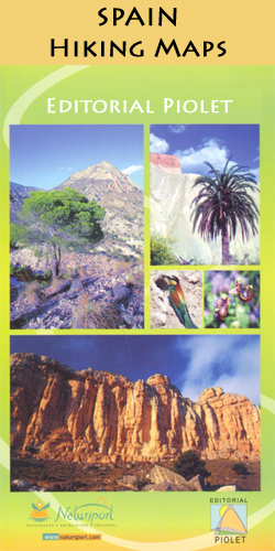
- Costa Brava - l’Emporda 1 - PN Aiguamolls - l`Escala Editorial Piolet
- Costa Brava: L’Empordà, map No.1 covering PN Aiguamolls - l`Escala area, at 1:25,000 in a series of GPS compatible maps from Editorial Piolet with cartography based on Spain’s civilian topographic survey overprinted with hiking routes and other tourist information. The map covers the southern part of the publishers’ coverage of the L’Empordà... Read more
Stanfords
United Kingdom
United Kingdom
- Pirineu Occidental
- Pirineu Occidental, the western part of the Catalan Pyrenees, at 1:100,000 in the topographic survey of Catalonia published by the Institut Cartogràfic de Catalunya, with very detailed coverage of a large area and an excellent representation of the region’s topography.Maps in this series have relief presented by contours at 40m intervals,... Read more
Stanfords
United Kingdom
United Kingdom
- Costa Brava - l’Emporda 2 - l`Escala - Pals Editorial Piolet
- Costa Brava: L’Empordà, map No.2 covering l`Escala – Pals area, at 1:25,000 in a series of GPS compatible maps from Editorial Piolet with cartography based on Spain’s civilian topographic survey overprinted with hiking routes and other tourist information. The map covers the central part of the publishers’ coverage of the L’Empordà area of... Read more

Stanfords
United Kingdom
United Kingdom
- Pirineu Oriental - Girona - Costa Brava
- Pirineu Oriental - Girona - Costa Brava map, covering the eastern part of the Catalan Pyrenees and the coast southwards to Pineda de Mar at 1:100,000 in the topographic survey of Catalonia published by the Institut Cartogràfic de Catalunya, with very detailed coverage of a large area and an excellent representation of the region’s topography.... Read more
Stanfords
United Kingdom
United Kingdom
- Camp de Tarragona
- Camp de Tarragona map at 1:100,000 in the topographic survey of Catalonia published by the Institut Cartogràfic de Catalunya, with very detailed coverage of a large area and an excellent representation of the region’s topography. Maps in this series have relief presented by contours at 40m intervals, enhanced by additional hill-shading and spot... Read more
Stanfords
United Kingdom
United Kingdom
- Costa Brava - l’Emporda 3 - Begur - Palamos Editorial Piolet
- Costa Brava: L’Empordà, map No.3 covering Begur – Palamós area, at 1:25,000 in a series of GPS compatible maps from Editorial Piolet with cartography based on Spain’s civilian topographic survey overprinted with hiking routes and other tourist information. The map covers the southern part of the publishers’ coverage of the L’Empordà area of... Read more