Eivissa, Baleares
Description
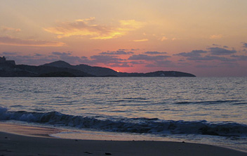
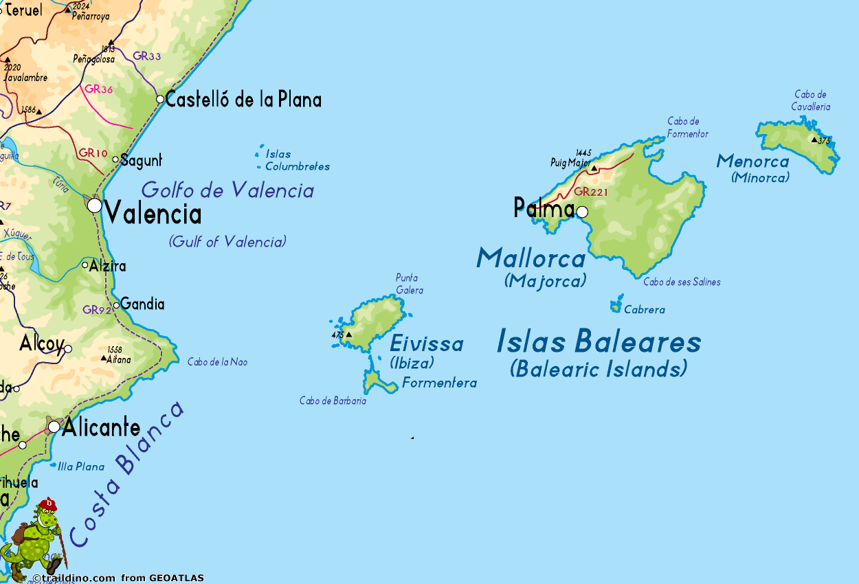
Ibiza - or Eivissa - is one of the Balearic Islands. With its friendly coastline and many beaches, it is a major tourist destination. The interior is made up of arid farmland and round hills with secondary forest and shrubs. No long distance hikes. But you may find nice coastal walks in the northwest, or attractive rural scenery in the interior.
Check the list of Balearic Islands.
Map
Links
Facts
Reports
Guides and maps
Lodging
Organisations
Tour operators
GPS
Other
Books

Stanfords
United Kingdom
2017
United Kingdom
2017
- Ibiza and Formentera Sunflower Landscape Guide
- Until the sixties, Ibiza belonged to the Ibizans, and only a few artists, poets and writers lived in this paradise. Then the flower-children arrived, the hippies and drop-outs. In the last decades however, mass tourism has taken over and unfortunately destroyed much of the charm of Ibiza and Formentera. But not everything on the islands has... Read more

Stanfords
United Kingdom
2016
United Kingdom
2016
- Menorca Sunflower Landscape Guide
- This new 6th edition of Sunflower`s popular guide to Menorca has been reformatted to feature many new walks and to include a section on the Cami de Cavalls a walking/cycling/riding trail circling the island alongside or near the coast.Menorca is a peaceful island, much more low-key than the neighbouring Balearic Islands of Mallorca and Ibiza.... Read more

Stanfords
United Kingdom
2014
United Kingdom
2014
- Ibiza and Formentera: Car Tours, Cycle Tours and Walks
- Ibiza & Formentera in the Sunflower Landscapes guide series; exploring the best walking and touring possibilities in the region or area. Detailed information about touring by hired car or public transport, as well as on foot, is provided, helping walkers to navigate and plan day-trips. Shorter strolls are also included as an alternative for... Read more

Stanfords
United Kingdom
United Kingdom
- DK Eyewitness Road Trips Spain
- With its idyllic hilltop villages, historic cities, coastal towns, and stunning natural landscapes, Spain is the perfect destination for a leisurely road trip. It`s yours to explore with Road Trips Spain, our redesigned and newly updated guide containing 25 drives across the country, from the spectacular rocky coastline of Mallorca to the... Read more

The Book Depository
United Kingdom
2022
United Kingdom
2022
- Wild Guide Balearic Islands
- Secret coves, mountains, caves and adventure in Mallorca, Menorca, Ibiza & Formentera Read more
- Also available from:
- De Zwerver, Netherlands
De Zwerver
Netherlands
2022
Netherlands
2022
- Reisgids Wild Guide Balearic Islands | Wild Things Publishing
- Secret coves, mountains, caves and adventure in Mallorca, Menorca, Ibiza & Formentera Read more

Bol.com
Netherlands
2012
Netherlands
2012
- ANWB extra - Ibiza
- ANWB Extra reisgids Ibiza - Spanje Ontdek Ibiza met de compacte reisgids ANWB Extra Ibiza!Is Ibiza nou een eiland voor hippies? Voor feestgangers? Of toch voor de jetset? Eigenlijk is het voor iedereen geschikt. De Spanjaarden zelf gaan er ook graag heen, al zullen zij de drukke stranden mijden. Wat voor vakantieganger je ook bent, op Ibiza... Read more
- Also available from:
- Bol.com, Belgium

Bol.com
Belgium
2012
Belgium
2012
- ANWB extra - Ibiza
- ANWB Extra reisgids Ibiza - Spanje Ontdek Ibiza met de compacte reisgids ANWB Extra Ibiza!Is Ibiza nou een eiland voor hippies? Voor feestgangers? Of toch voor de jetset? Eigenlijk is het voor iedereen geschikt. De Spanjaarden zelf gaan er ook graag heen, al zullen zij de drukke stranden mijden. Wat voor vakantieganger je ook bent, op Ibiza... Read more

De Zwerver
Netherlands
2018
Netherlands
2018
- Reisgids Ibiza & Formentera | Edicola
- Al decennialang zijn vooral Ibiza, maar ook haar kleinere zusje Formentera, beroemd en berucht als een van dé bestemmingen voor feestvierders, jetsetters en supersterren. Door het feestgedruis zijn de unieke schoonheid en de rijke historie van deze Balearische eilanden ietwat op de achtergrond verdwenen. In deze gids neemt auteur en fotografe... Read more
De Zwerver
Netherlands
2016
Netherlands
2016
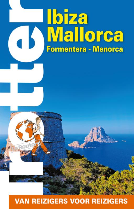
- Reisgids Trotter Ibiza - Mallorca - Formentera - Menorca | Lannoo
- De onmisbare gids voor echte trotters - Het echte verhaal achter de klassieke trekpleisters - Tips om de verborgen parels buiten de platgetreden paden te verkennen - Verrassende anekdotes en topervaringen van Trotter - Honderden budgetvriendelijke en uitgeteste horeca-adressen - Kaarten en plattegronden waarop je al onze adressen terug vindt Read more

De Zwerver
Netherlands
2018
Netherlands
2018
- Reisgids Rough Guide Pocket Ibiza and Formentera | Rough Guides
- Een kleinere versie in zakformaat van de grotere versies van de Rough Guides. Als altijd weer vol met goede informatie over cultuur en praktische zaken. Pocket Rough Guide Tenerife & LaGomera Discover these exciting volcanic islands with themost incisive and entertaining travel guide on the market. You can take thishandy, pocket-sized book out... Read more

De Zwerver
Netherlands
2016
Netherlands
2016
- Wandelkaart Tour & Trail Formentera | Discovery Walking Guides
- Water-proof, split-proof, tear-proof, adventure-proof. Formentera Tour & Trail Super-Durable Map is simply the toughest, most accurate, easy to read, easy to use map of the island you can buy at any price. David & Ros Brawn surveyed this beautiful island in October 2015 carrying out their `gps ground survey` pinpointing all the details needed... Read more
Maps

Stanfords
United Kingdom
United Kingdom
- Sant Miguel de Balansat 25K Ibiza CNIG Topographic Survey Map No. 772-IV
- Topographic coverage of the Balearic Islands at 1:25,000 published by the Instituto Geográfico Nacional – Centro Nacional de Información Geografica, the country’s civilian survey organization. The maps have contours at 10m intervals and colouring and/or graphics to show different types of vegetation or land use. Boundaries of national parks and... Read more

Stanfords
United Kingdom
United Kingdom
- M13 Denia to Barcelona and Ibiza
- Plans included: Denia (1:20,000) Valencia Harbour (1:30,000) Tarragona (1:25,000) Barcelona Harbour (1:65,000) San Antonio (Ibiza) (1:30,000) Read more

Stanfords
United Kingdom
United Kingdom
- San Antoni de Portmany 25K Ibiza CNIG Topographic Survey Map No. 798-I
- Topographic coverage of the Balearic Islands at 1:25,000 published by the Instituto Geográfico Nacional – Centro Nacional de Información Geografica, the country’s civilian survey organization. The maps have contours at 10m intervals and colouring and/or graphics to show different types of vegetation or land use. Boundaries of national parks and... Read more

Stanfords
United Kingdom
United Kingdom
- Sant Rafel 25K Ibiza CNIG Topographic Survey Map No. 798-II
- Topographic coverage of the Balearic Islands at 1:25,000 published by the Instituto Geográfico Nacional – Centro Nacional de Información Geografica, the country’s civilian survey organization. The maps have contours at 10m intervals and colouring and/or graphics to show different types of vegetation or land use. Boundaries of national parks and... Read more

Stanfords
United Kingdom
United Kingdom
- Sant Joan de Labritja CNIG Topo 773
- Topographic coverage of the Balearic Islands at 1:50,000 in the MTN50 (Mapa Topográfico Nacional) series from the Instituto Geográfico Nacional – Centro Nacional de Información Geografica, the country’s civilian survey organization. The maps have contours at 20m intervals, enhanced by relief shading, plus colouring and/or graphics to show... Read more

Stanfords
United Kingdom
United Kingdom
- Es Cubells 25K Ibiza CNIG Topographic Survey Map No. 798-III
- Topographic coverage of the Balearic Islands at 1:25,000 published by the Instituto Geográfico Nacional – Centro Nacional de Información Geografica, the country’s civilian survey organization. The maps have contours at 10m intervals and colouring and/or graphics to show different types of vegetation or land use. Boundaries of national parks and... Read more

Stanfords
United Kingdom
United Kingdom
- Santa Eularia des Riu CNIG Topo 799
- Topographic coverage of the Balearic Islands at 1:50,000 in the MTN50 (Mapa Topográfico Nacional) series from the Instituto Geográfico Nacional – Centro Nacional de Información Geografica, the country’s civilian survey organization. The maps have contours at 20m intervals, enhanced by relief shading, plus colouring and/or graphics to show... Read more

Stanfords
United Kingdom
United Kingdom
- Santa Eulalia del Rio CNIG Topographic Map 799-1
- Topographic coverage of the Balearic Islands at 1:25,000 published by the Instituto Geográfico Nacional – Centro Nacional de Información Geografica, the country’s civilian survey organization. The maps have contours at 10m intervals and colouring and/or graphics to show different types of vegetation or land use. Boundaries of national parks and... Read more

Stanfords
United Kingdom
United Kingdom
- Eivissa CNIG Topo 798
- Topographic coverage of the Balearic Islands at 1:50,000 in the MTN50 (Mapa Topográfico Nacional) series from the Instituto Geográfico Nacional – Centro Nacional de Información Geografica, the country’s civilian survey organization. The maps have contours at 20m intervals, enhanced by relief shading, plus colouring and/or graphics to show... Read more

Stanfords
United Kingdom
United Kingdom
- Cala de Portinatx CNIG Topographic Map 773-1
- Topographic coverage of the Balearic Islands at 1:25,000 published by the Instituto Geográfico Nacional – Centro Nacional de Información Geografica, the country’s civilian survey organization. The maps have contours at 10m intervals and colouring and/or graphics to show different types of vegetation or land use. Boundaries of national parks and... Read more

Stanfords
United Kingdom
United Kingdom
- Sant Miguel de Balansat CNIG Topo 722
- Topographic coverage of the Balearic Islands at 1:50,000 in the MTN50 (Mapa Topográfico Nacional) series from the Instituto Geográfico Nacional – Centro Nacional de Información Geografica, the country’s civilian survey organization. The maps have contours at 20m intervals, enhanced by relief shading, plus colouring and/or graphics to show... Read more

Stanfords
United Kingdom
United Kingdom
- Eivissa 25K Ibiza CNIG Topographic Survey Map No. 798-IV
- Topographic coverage of the Balearic Islands at 1:25,000 published by the Instituto Geográfico Nacional – Centro Nacional de Información Geografica, the country’s civilian survey organization. The maps have contours at 10m intervals and colouring and/or graphics to show different types of vegetation or land use. Boundaries of national parks and... Read more

Stanfords
United Kingdom
United Kingdom
- Sant Joan de Labritja 25K Ibiza CNIG Topographic Survey Map No. 773-III
- Topographic coverage of the Balearic Islands at 1:25,000 published by the Instituto Geográfico Nacional – Centro Nacional de Información Geografica, the country’s civilian survey organization. The maps have contours at 10m intervals and colouring and/or graphics to show different types of vegetation or land use. Boundaries of national parks and... Read more

Stanfords
United Kingdom
United Kingdom
- 3200 Islas Baleares Chart Atlas - 2018 edition
- Chart atlas covering the Islas Baleares - Ibiza, Formentera, Mallorca, Cabrera and Menorca. 25 sheets provide all of the necessary information for passage planning and detailed approaches to the harbours and anchorages of this appealing cruising ground. In loose-leaf A2 format in a tough plastic wallet.A voucher code to download the relevant... Read more

Stanfords
United Kingdom
United Kingdom
- Port de Benirras 25K Ibiza CNIG Topographic Survey Map No. 772-II
- Topographic coverage of the Balearic Islands at 1:25,000 published by the Instituto Geográfico Nacional – Centro Nacional de Información Geografica, the country’s civilian survey organization. The maps have contours at 10m intervals and colouring and/or graphics to show different types of vegetation or land use. Boundaries of national parks and... Read more


